Text by Narayan Krishnamoorthy, photos by Chris Heg and Keith Moore
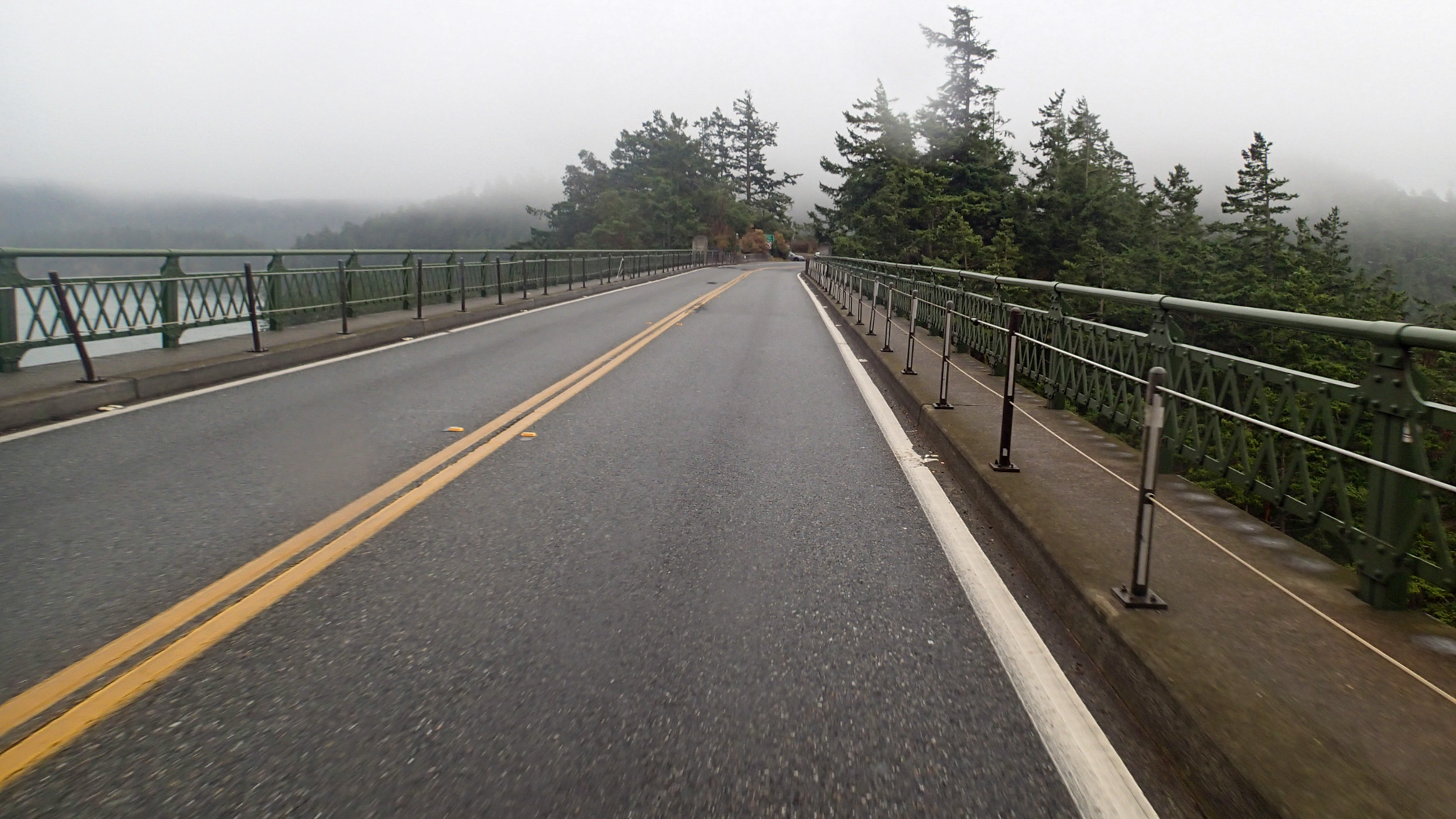
Crossing the Deception Pass Bridge onto Whidbey Island — photo by Chris Heg
La Belle Dame Sans Merci
We have long believed that the raison d’etre of randonneuring is “anything worth doing, is worth doing to excess”. The definitive proof of that is the wonderful, pretty, and cruel Fever Dream 400K course, lovingly conceived and initiated by my evil twin Keith Moore. In his defense, he came up with it in a fugue, and he certainly didn’t force me to pre-ride it. Besides, if you know anything of my randonneuring history, a seeker of big challenges I am not. But the other credo of randonneuring is also “friends don’t let friends do dumb things… alone”. However, I just had to test myself against it, to see if I could arrive at the finish in the time allotted.
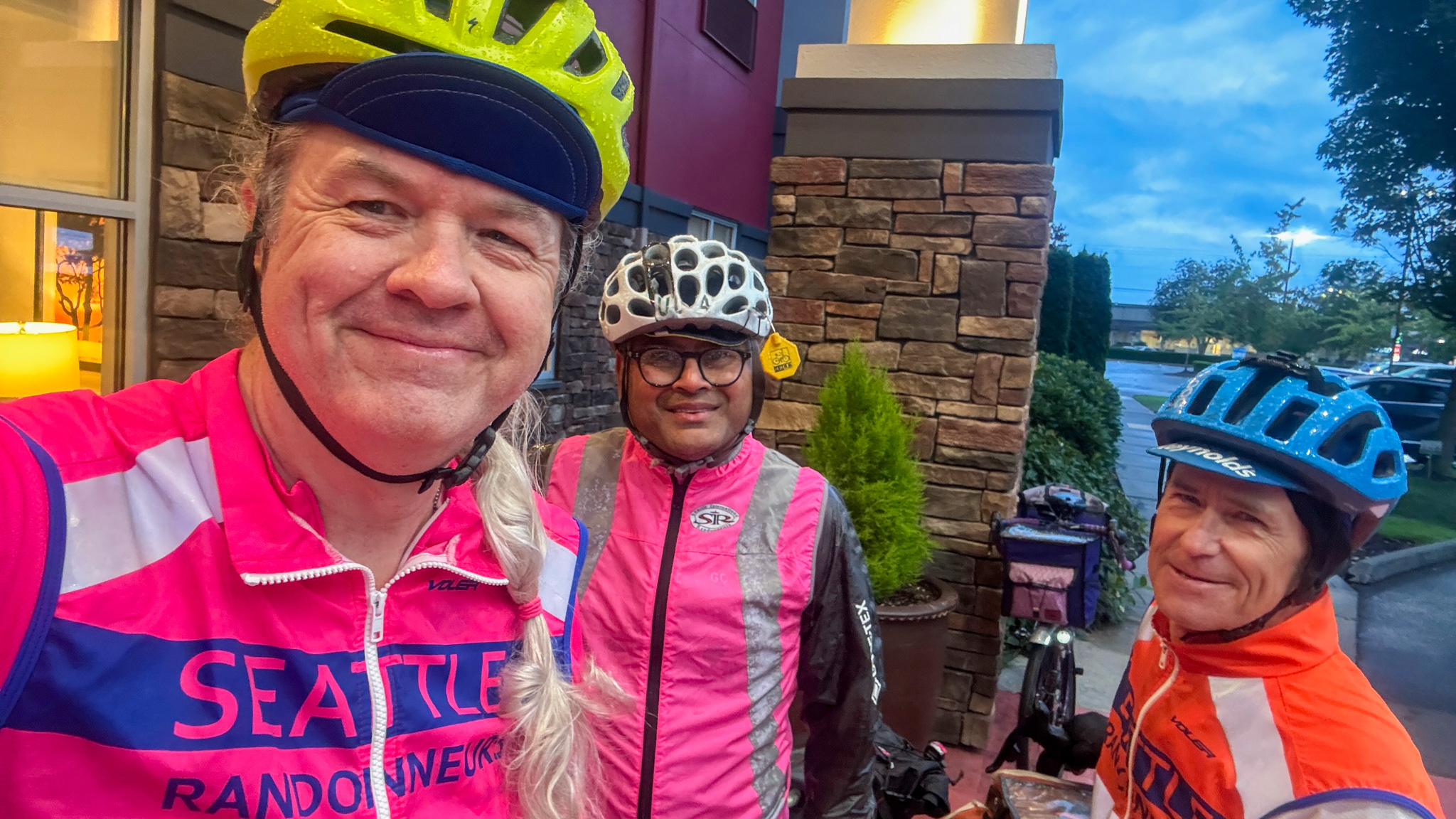
We met at the Starbucks a bit after 5.30 AM, delayed only slightly by our vastly more talented fellow pre-rider Chris Heg’s “inability” to locate his helmet. My first reaction was that he had finally come to his senses about pre-riding the course, but alas, he had just left it in his car, and willingly announced that he was prepared and able. Onward and upward, we would go.
We left at 6:00 AM. A few almost traffic-free kilometers found us on the Centennial trail, at which point the skies started dousing us with the occasional rain drop, which then turned into something a bit persistent, so we pulled over at the Nakashima Barn and donned our rain gear. We had been hoping to avoid that until about 9:00 AM, but sadly the rain would be an off and on companion through to the end of the ride. The ethos of the ride was “thou shalt not faff”, so we made quick work of the first kilometers until we got to La Conner, where a welcome potty break gave us a good excuse to stretch our legs, lose some ballast, and prepare ourselves for the rigors ahead.
Riders would be best served to follow our exact principle and not faff around until at least La Conner in the interest of banking the most time possible on what is the easiest part of the course. Mr Moore, you see, is a hard task master, but he at least gives you a head start. Carry food and water to last you awhile: I carried around 1400 calories on me.
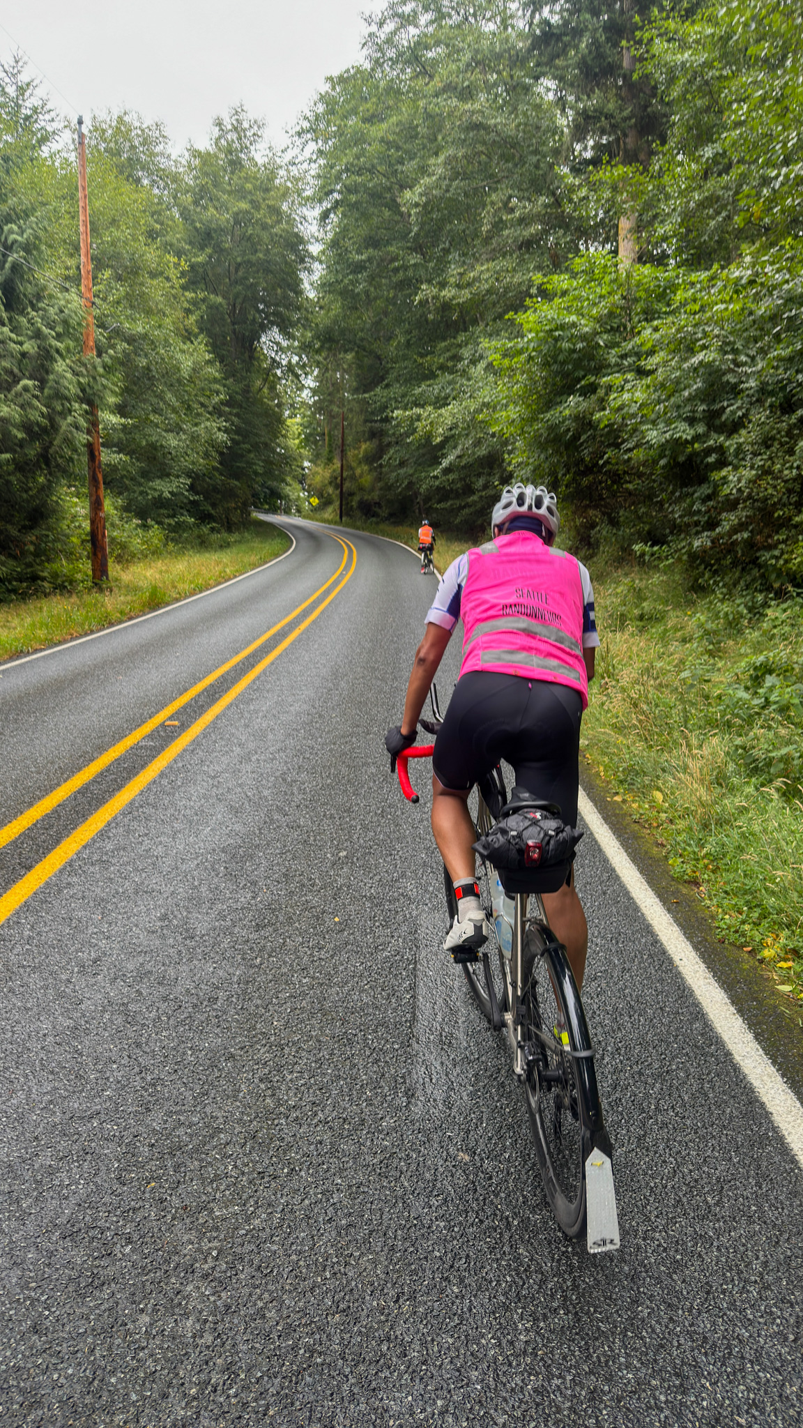
The descent on Reservation Road is your final moment of respite, and you should savor it; the hills start with a vengeance at this point. The climb to SR 20 is a real doozy. A gentleman doing yard work told us “it gets worse” as we were huffing and puffing on the lower slopes of Deception Road. Care should be exercised from this left turn onwards until you clear Deception Pass Bridge, because the shoulders are narrow and debris-filled and traffic may be high. Keep moving and survive Whidbey. That is all there is to be said. I brought up the rear of the train on many a hill and my compatriots were patient and soft-pedaled and waited on many a hilltop. I remember walking one, which is a good way to stretch one’s legs.
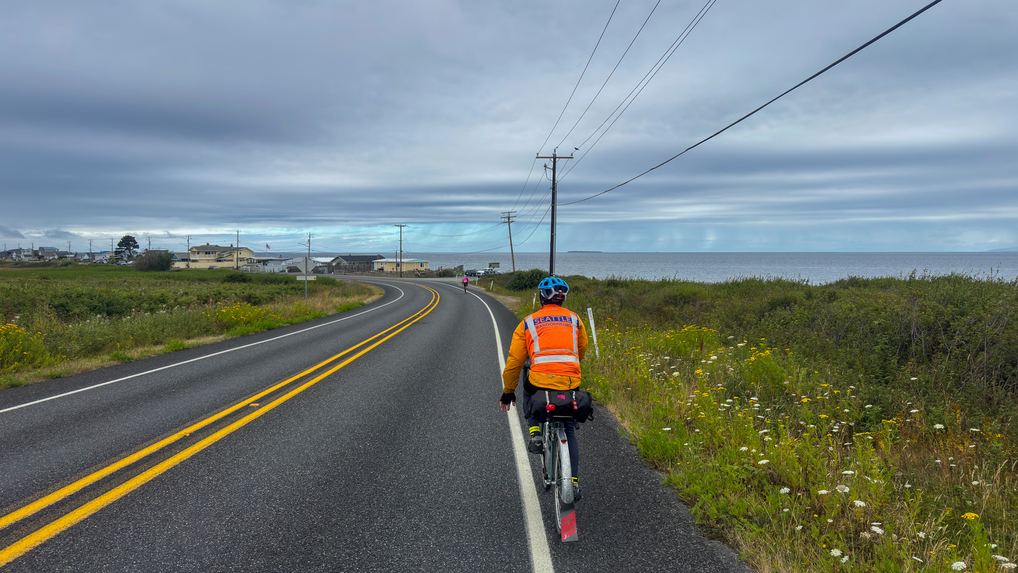
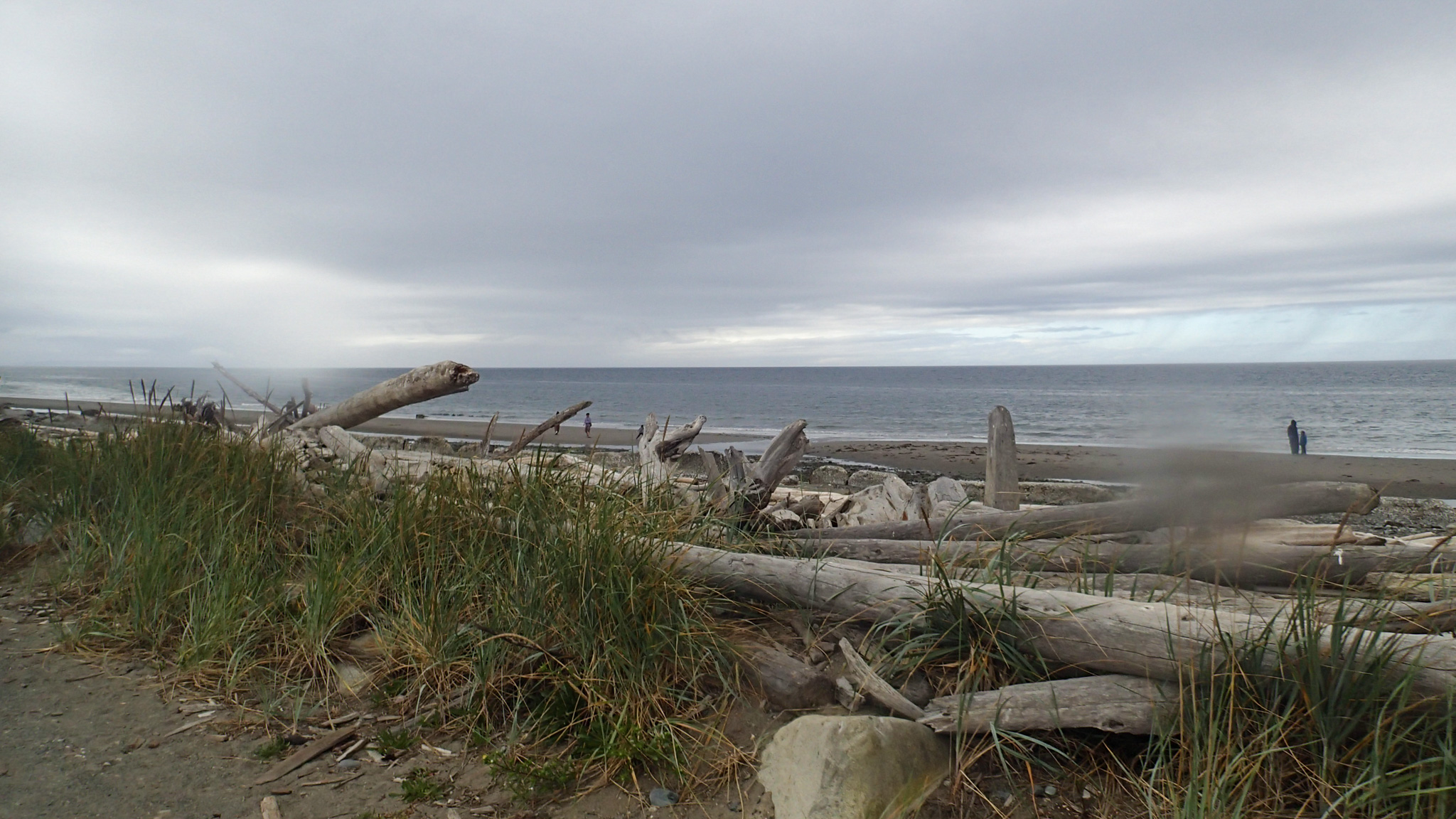
Approaching the beach near Joseph Whidbey State Park — photo by Keith MooreWest Beach on Whidbey Island — photo by Chris Heg
On Whidbey, we stopped every 40-50K for a few minutes to refuel, rest up, or deal with minor mechanicals. Chris had a loose crank – no pun intended – and Keith had the right tool to fix it until Chris bought a new set at our Langley stop. Speaking of mechanicals, start this ride with a well maintained bicycle. The route is tough as is, banking time in any abundance is going to be hard and you don’t want to hurt your chances even more by riding something that is going to be less than reliable.
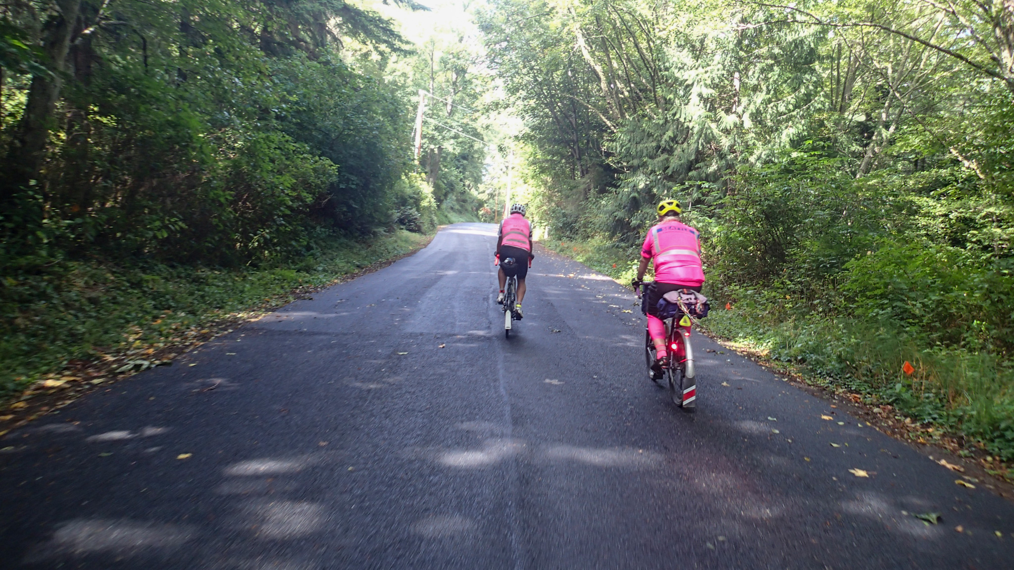
Photo by Chris HegNarayan powering up Lancaster Road on South Whidbey Island — photo by Keith Moore
Our grand goal was to get off Whidbey by sunset, a goal we missed by a small margin of an hour and 15 minutes. The route goes around the hard direction around the Island but you are blessed with some fantastic views of the water, the mountains, and farms. Traffic is calm on all of the side roads except on SR 20 and SR 525, so please take care on those. It will likely be dark when you head north across the bridge to get off the island. Also, do not be shy to ask to ride with your fellow starters near dusk and into the night. It is safer than riding alone and company at night makes the miles melt away faster.
Once you cross Deception Pass Bridge to exit Whidbey, take care for the next few kilometers as you come to the right turn onto Deception Road. Take this descent carefully. The hills don’t end until after crossing the bridge into La Conner, but we had rain to deal with, which hopefully you lot don’t have to. You will probably ride into the Stanwood Arco in the wee hours of the night. But believe me, it will be the second most wonderful sight on the ride. We got ourselves some coffee, more food and set off to conquer Camano.
Trust me when I say Camano will feel easier after the rigours of Whidbey. You will have had some flat sections getting there and so may have had a chance to recover, a touch. The first few kilometers are easy, with the first climb after the right turn onto E North Camano Road. We saw not a single car until the left turn onto Eiger Bay Road, which was a first for us. Keep an eye out for traffic at all times, however. You may not have the same fortune as us. We had some loose chipseal to deal with and hopefully it’ll be fixed by the time you get there.
Sorry about the hill on Russell Road, but hey it’s low traffic and is one of the last few climbs. A few short climbs later you should be off Camano, watch that descent however. We were set for food and water and so skipped the Arco stop on the way back. The skies had started to lighten up for us at this time. We had a bit more rain on Pioneer Highway, which was cruel and there was some traffic. Take care on this road as it is curvy and you could go off the road as a friend of mine did on a 400K several years ago. You will cross the 400K mark a short while after the turn onto Smokey Point (which I always think of as Smoked Bacon Road, for some reason) and when you see the Little Caesar’s on your left it is time to turn left and you should see the most glorious sight in the world, and that is the finish.
Congratulations and resist the urge to call Mr Moore any unflattering names. You have now finished one of the hardest 400s in the Pacific Northwest.
At the finish 23:49 later, looking much fresher than we felt — photo by Keith Moore
This ride celebrates Seattle’s extraordinary natural setting and urban culture, so there are plenty of distractions and urban trails combined with a fair bit of climbing: no time for much dawdling, but please don’t rush either; enjoy our amazing city, and be especially careful on the pathways we’re sharing with pedestrians.
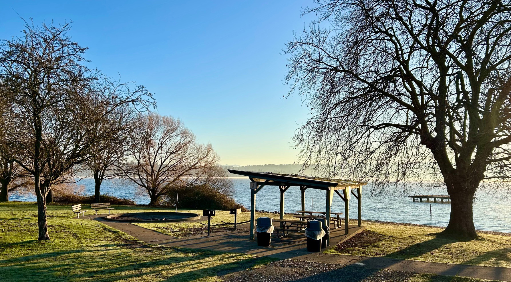
From Magnuson Park Beach, we head east to the Burke-Gilman, then south to UW and Montlake Bridge. At 7.4km, slow down for the narrow easy-to-miss turn off the Burke-Gilman up to Rainier Vista. At 7.9km, the Montlake Bridge has narrow clearances – slow down for oncoming pedestrians and cyclists. After winding over the new 520 pedestrian/bike overpass to Lake Washington Blvd, you take a nice jaunt through the Olmsted-designed Washington Park Arboretum along tree-lined Arboretum Drive East (closed to traffic) and the Arboretum Loop Trail.
Arboretum Drive
As you’re leaving Arboretum Trail, take care at km 11.3 rejoining Lake Washington Blvd. If the intersection is busy, dismount and use the crosswalks, then head south on Lake Washington Boulevard.
(Did you know, from Olmsted Parks.Org: “The longest and most significant boulevard in Seattle’s Olmsted park system, Lake Washington Boulevard links nine of the Olmsted parks, extending six miles from Montlake Boulevard at the north end, through Washington Park Arboretum and along the lake to Seward Park at the south end…. first proposed in the Olmsted Brothers’ 1903 report, their recommendation included routing the boulevard beyond the city limits at that time so that it might extend all the way to Seward Park (then known as Bailey Peninsula)”. President Taft described the Lake Washington string of parks soon after completion in 1909 as follows: “One of the most magnificent combinations of modern city and medieval forest, of formal gardening and Nature’s handiwork with the most beautiful views of lake, sea and snow-capped mountain peak, that has ever delighted the eye of man in this or any other country.”)
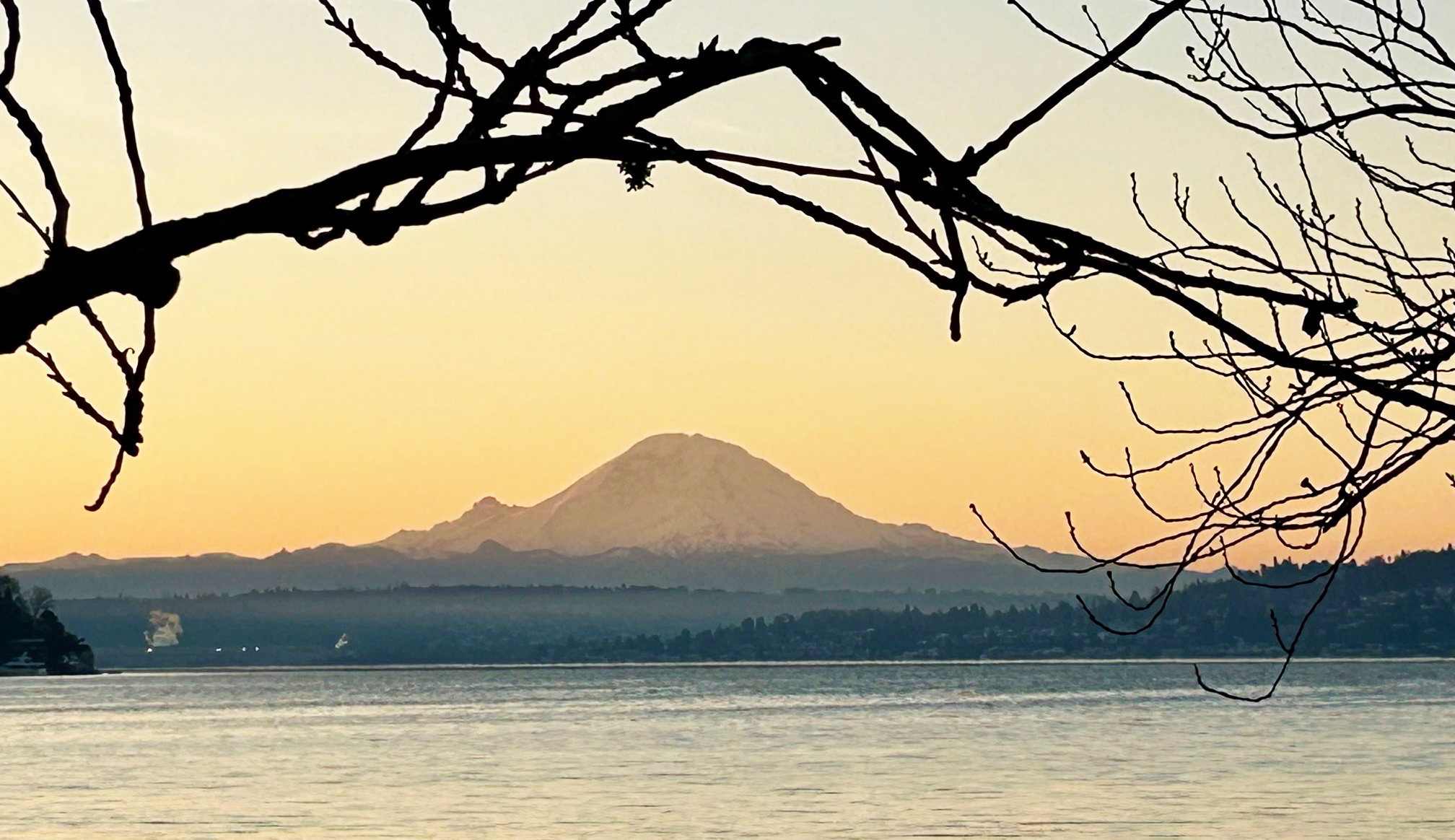
At km 21.8, we enter Seward Park and Shore Loop Road, closed to traffic – and one of the key stretches we need to ride slowly and give pedestrians and other cyclists ample room – take your time and enjoy the filtered views of Mt Baker (visible on a clear day from Control 2 at Seward Park North Beach km 23.5), and Mt Rainier from Seward Park’s south beach.
Mt Rainier from Seward Park
Leaving Seward Park, we climb Seward Park Ave and head west through Othello, then navigate the north end of Boeing Field and South Park. At km 31.4, coming down South Albro Place, take care shifting to the left lane to move over to the new bike lane after Ruby Chow Park. This newly completed bike lane from km 31.9 to 33.5 along the south side of Albro Place and east side of East Marginal Way is a great recent addition to our bike infrastructure, avoiding the need to ride along thse busy roads. At km 33.5, use the crosswalk to cross East Marginal to the 16 th Ave S Bridge over the Duwamish, then weave your way through South Park’s quiet back streets to the Duwamish Trail, passing Control 3 Gears at km 35.4. At km 39.2, you’ll ride through a nice grove of madrones with filtered views of Harbor Island and downtown Seattle. At km 41.0, take care crossing West Marginal Way to a recently finished bike path which avoids the climb up and under the W Seattle Bridge. If traffic is busy here, use the pedestrian button at the crosswalk to stop traffic. The curb cut to the bike path is narrow so take it easy here. At km 42.3, we turn north to continue on the Alki Trail, then shifting to Harbor Avenue SW. There are plenty of public restrooms and eateries along Alki Beach, but don’t linger as there are plenty more distractions and climbs ahead! After Alki Point Lighthouse, Control 4 at 48.6, continue south to Lincoln Park. At km 53.7, you enter a relatively narrow gravel path along the beach which can sometimes be crowded with pedestrians and kids riding bikes: another key stretch to be ridden very slowly when passing pedestrians. Take time to compliment that cute dog or little kid riding her bike.
Lincoln Park Beach Path looking SouthBruun Idun – The Way of the Bird King
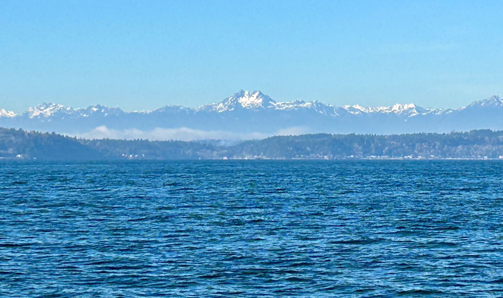
After a visit with Bruun Idun – the Way of the Bird King, we return north, enjoying views west to the Olympics.
View from Lincoln Park Beach
Leaving Lincoln Park, you climb up via Erskine Avenue to downtown West Seattle, passing Bakery Nouveau on California Ave at km 58, then continuing east and north along SW Alaska St and SW Avalon Way. Take care along SW Avalon Way’s protected bike lane which is relatively narrow. At km 60.3, be cautious crossing SW Spokane St to rejoin the Alki Trail, and continue around Harbor Island and north to Seattle on the newly completed Portside Trail to downtown. At km 66.1, shift to the Waterfront Bike Trail through the downtown waterfront: take your time and obey the stop signals at the many pedestrian crossings.
A short climb around the new Aquarium takes you to the finally complete Alaskan Way Cycletrack leading to the Olympic Sculpture Park. Be careful entering the park at km 86.6, passing the Bourgeois Fountain to Elliott Bay Trail. In Myrtle Edwards Park, at km 70.2, a portion of the separated pedestrian path is closed, so we again share the road with walkers. Continuing north along the railyards, you then turn south for a gentle climb up Thorndyke Avenue and Magnolia Boulevard West, past Magnolia Viewpoint, with views to downtown and Mt Rainier.
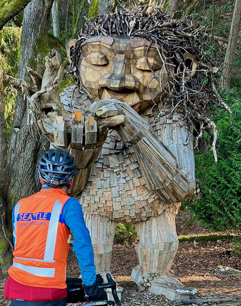
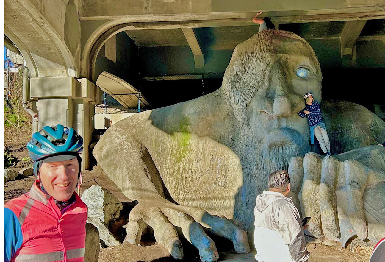
At km 78.6, you enter Discovery Park (formerly Fort Lawton Army Base), crossing open fields, with views to the Olympics to your left and officer quarters / FAA Radar Site to your fight. You then head east for a nice downhill forested stretch on Discovery Park Boulevard to Gilman Avenue West: at km 81.4, slow down to shift over to the Cycletrack at 29 th Ave West. At the traffic light – km 82.3, be careful at the turning left onto the West Emerson Place Cycletrack. After a brief downhill, akm 82.5, slow down to shift over via a tight curbcut onto the ‘Ship Canal Trail’: the next stretch of sidewalk has some root heave issues, and there are some tight turns at km 83.2. After passing under the bridge at km 85.6, miss the immediate turn slight right up the trail to the path adjoining Westlake Ave, then turn north over Freemont Bridge and up another short climb to visit the Freemont Troll (synopsis from Wikipedia: “built in 1990 by artist/architect Steve Badanes, inspired by Norwegian folklore, the 18 feet tall Troll constructed with 13,000 lbs of concrete, is clutching an actual Volkswagen Beetle, as if it had just swiped it from the Aurora Bridge above. Originally, the car held a time capsule, including a plaster bust of Elvis Presley, which was stolen when the sculpture was vandalized.”)
Freemont Troll
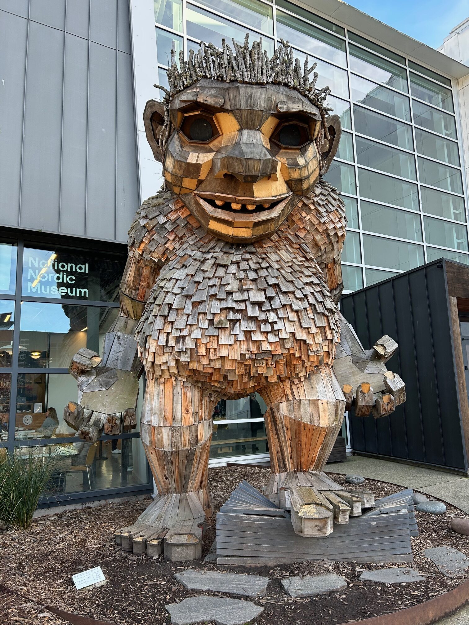
A short steep few blocks down Troll Avenue takes you to the Burke Gilman Trail, where you head west to Ballard. At km 91.0, take care navigating the intersection at 24 th Ave NW and Market Street: the intersection is likely to be crowded. Dismount and cross the crosswalk at the light to the bike path. Two blocks west of here, you pass the National Nordic Museum and a visit with Frankie Feetsplinter
Frankie Feetsplinter @ Nordic Heritage Museum
Proceeding north on the last stretch of the Burke Gilman, be careful navigating the end of the trail and entry to Golden Gardens at km 94.6 – lots of cars and pedestrians headed to the beach. The Golden Gardens Bathhouse and Kite Café at km 95.1 offers a good spot to catch your breath and gear up for the big climb of the ride.
Returning south briefly to the park entry gate, you turn left for a winding climb up Seaview Place Northwest – be careful as there is very little shoulder and a fair bit of traffic, but drivers are typically respectful. Moving east and north through relatively quiet residential streets, you arrive at the Interurban Trail at km 103.4, then north to Echo Lake, and east to Perkins Lane at km 112.9. After a brief climb to the crest, you’re on a delightful winding descent through the woods to Lake Forest Park. After crossing Lake City Way to the Burke Gilman, you head south – keep an eye out for the turn left at km 124.1 to Inverness Drive NE, then be careful on the short run on Sand Point Way with no shoulders. At km 124.8, you turn left for an easy-to-miss turn off Sand Point Way over gravel to a break in the hedge: watch out for the quick left on the gravel path, and take it slow as the path twists down to Magnuson Café and Brewery, where much deserved refreshments await.
Comments Off on 2026 Winter Rouleur 125K-149K Pre-Ride Report
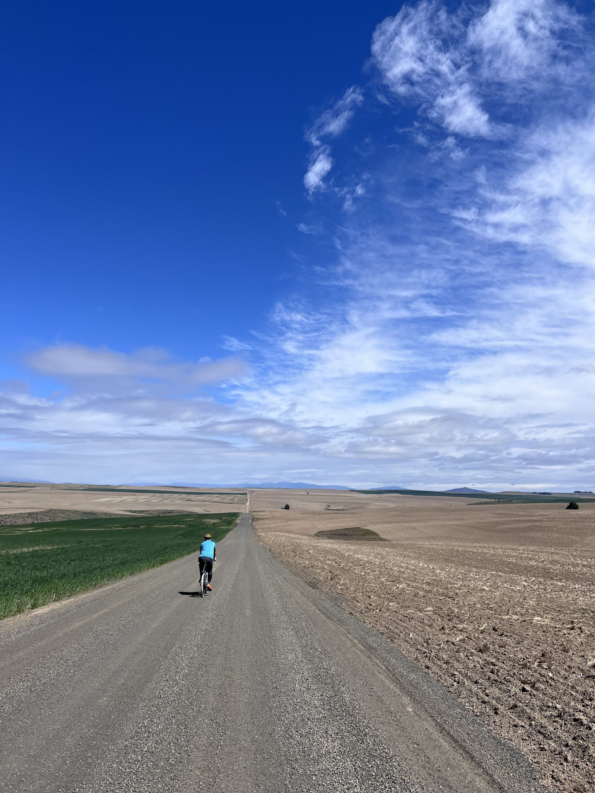
On June 7th, SIR returns to the Waterville plateau for our Summer Gravel Populaire. If you rode any events here last year, this is an all-new route once again crafted by local rando Don “shiggy” Person. I previewed the course with shiggy last week. After heading west from town, we made our way up to the northernmost corner at Fletcher Cemetery. Then turned south skirting Lamoine and Supplee, passing through Alstown and Douglas before returning to Waterville.
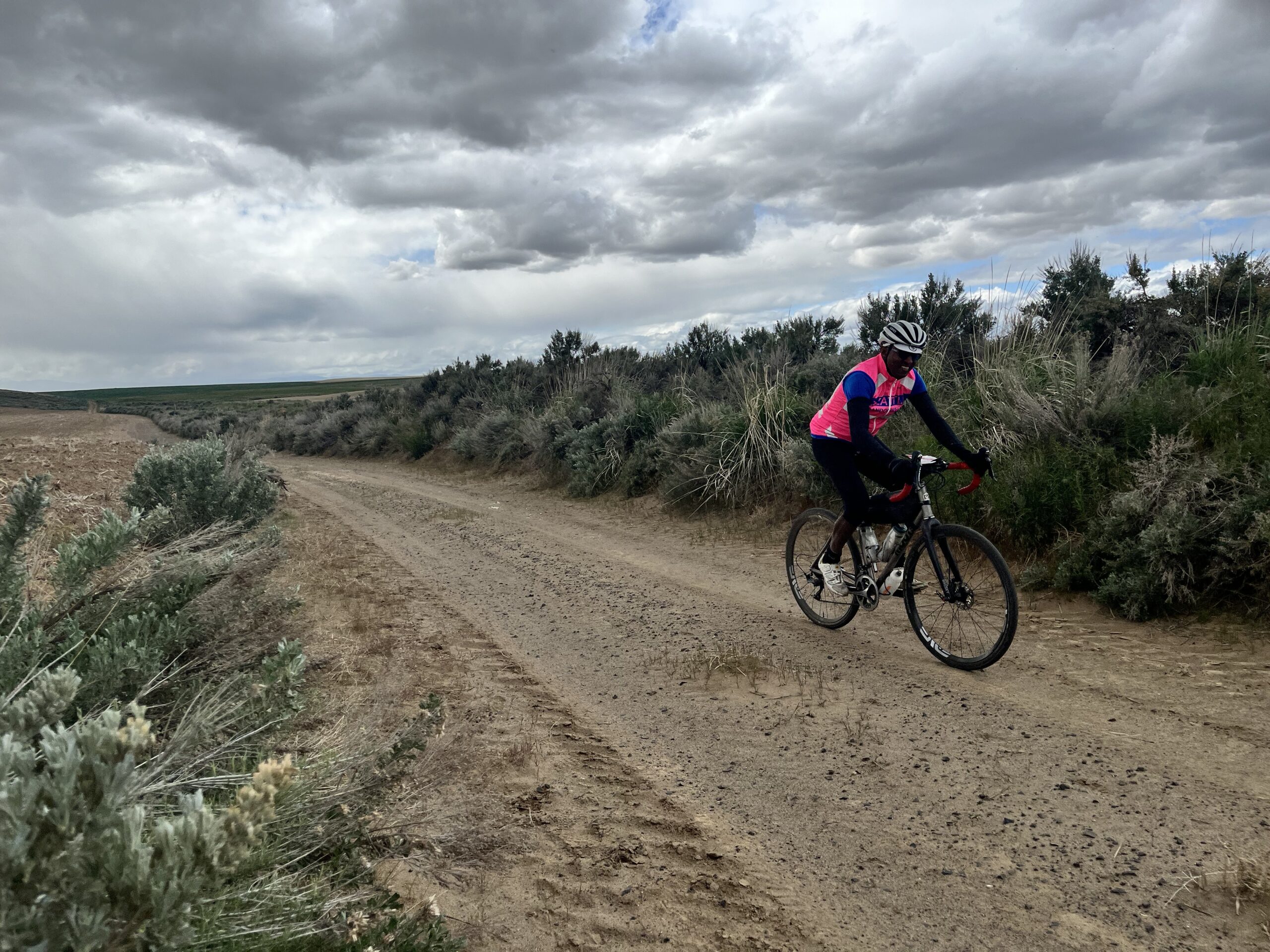
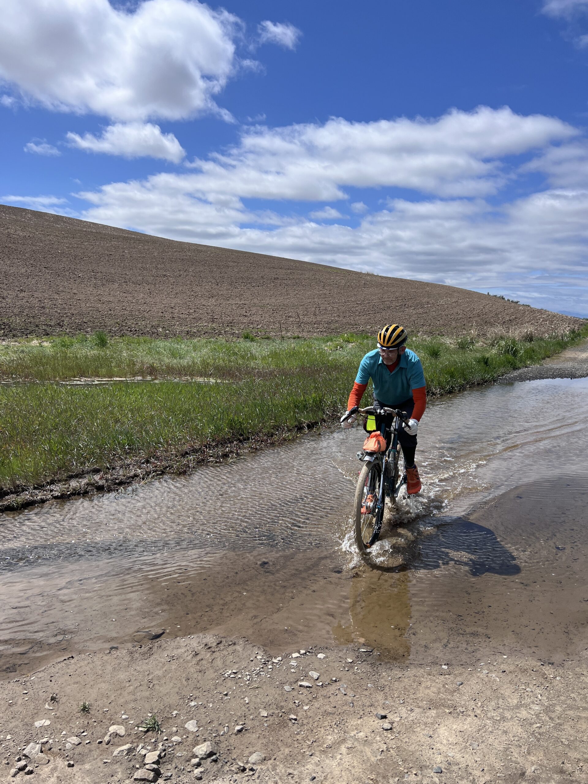
Of the 100K distance, just 9K is paved with the rest (91K) a diverse mix of gravel across a patchwork of interconnected, rolling farm roads. Elevation gain on RWGPS (https://ridewithgps.com/routes/49950178) shows 3590’/1094m, but we recorded 4514’/1376m. Expect surface conditions to vary from hard packed dirt to soft sand to chunky loose rocks – creating an intermediately challenging ride where bike handling skills will be tested. But nothing too extreme. I rode 42mm tires. Shiggy was on 55mm. Recommend minimum 38mm. Slicks are ok if you’re experienced. Many of the roads will NOT have markings, but we’ve verified accuracy of the turns (and also updated the cue-sheet with “Unsigned” designation). We do suggest bringing a printed copy to aid with your navigation.
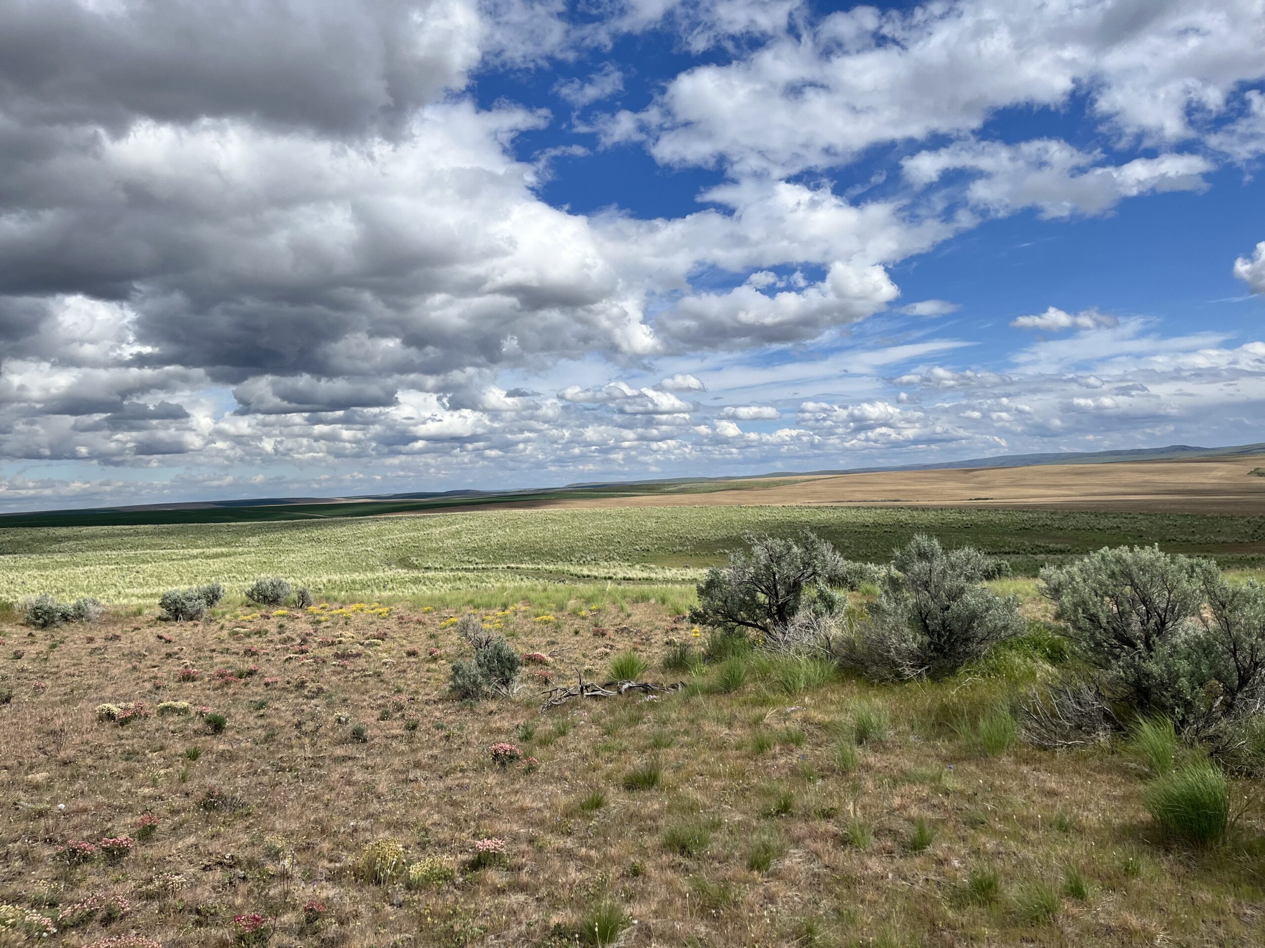
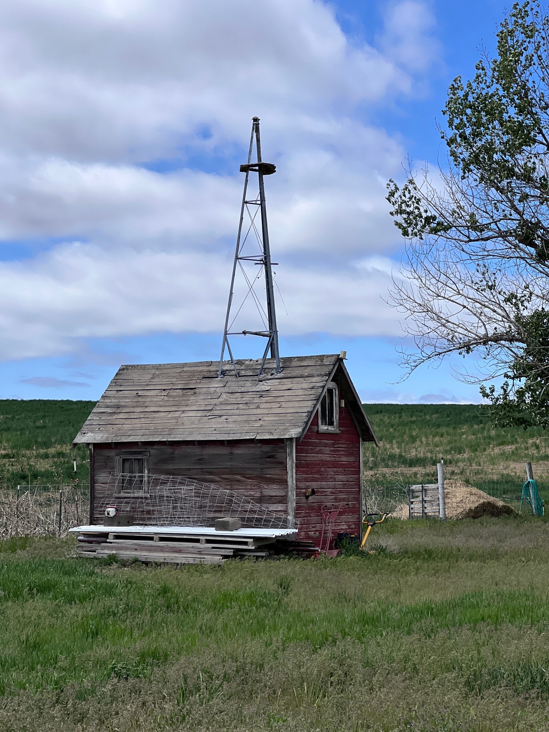
You’ll spend the day soaking up open skies, admiring acres of thriving wheat, punctuated by the occasional “alley” of deeply aromatic Sagebrush. These fields extend as far as the eye can see and were carved by glacial activity, floods and wind over millennia. The fertile soil, winter snow, spring rain, and dry summers create ideal growing conditions in these rugged lands. Expect to see no one and little auto traffic during your ride. We were passed by just 3 vehicles (a road grader, a gravel hauler, and a pickup) – all very bike friendly. Please remember, farm equipment ALWAYS have the right of way. It also gets hot in June, and there’s no real shade on the route. So come well prepared – carry extra tubes, check/top off sealant (if riding tubeless), bring ample food and no less than 2 water bottles. We’ll have a staffed SIR control at 53.9km (33.5mi) where you can refill them, but there’s no services or resupply points elsewhere. Cell service is spotty.
A few noteworthy items:
TURN at 13.7k (8.5mi): Right uphill onto 4 Rd NW [unsigned]. This turn comes immediately after passing some concrete barriers. Do not continue straight downhill!
TURN at 16.7k (10.3mi): Hidden Right onto Rd P NW [unsigned]. On road right before turn, there are buildings with farm equipment.
BAIL-OUT OPTION at 22.2km (13.8mi). At intersection of Rd N NW and 4 Rd NW, continue straight on Rd N NW. Turn right on Rd 3 NW and then left to Rd O NW/N Chelan Ave to Waterville.
You will encounter “Bike Detour” signs at several locations on the route. Ignore all of them. They appear to be for the questionable benefit of unfortunate cyclists riding on I-90, directing them around the construction zones and back to I-90. Ignore all BIKE DETOUR signs.
The Route
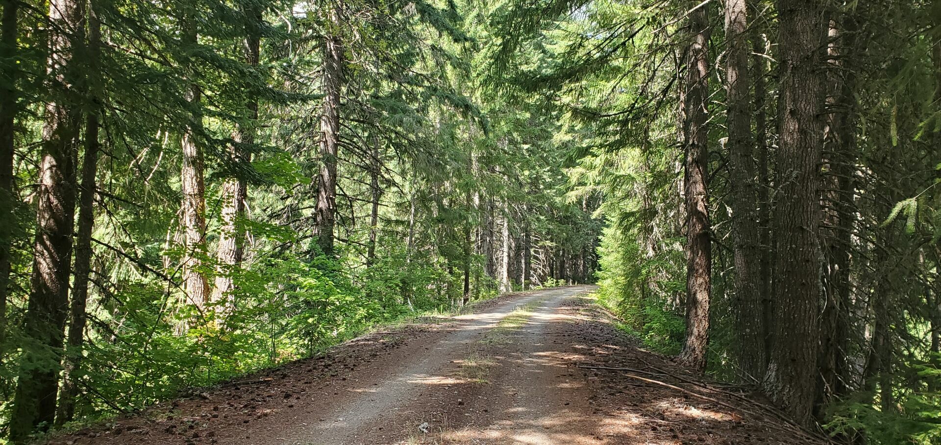
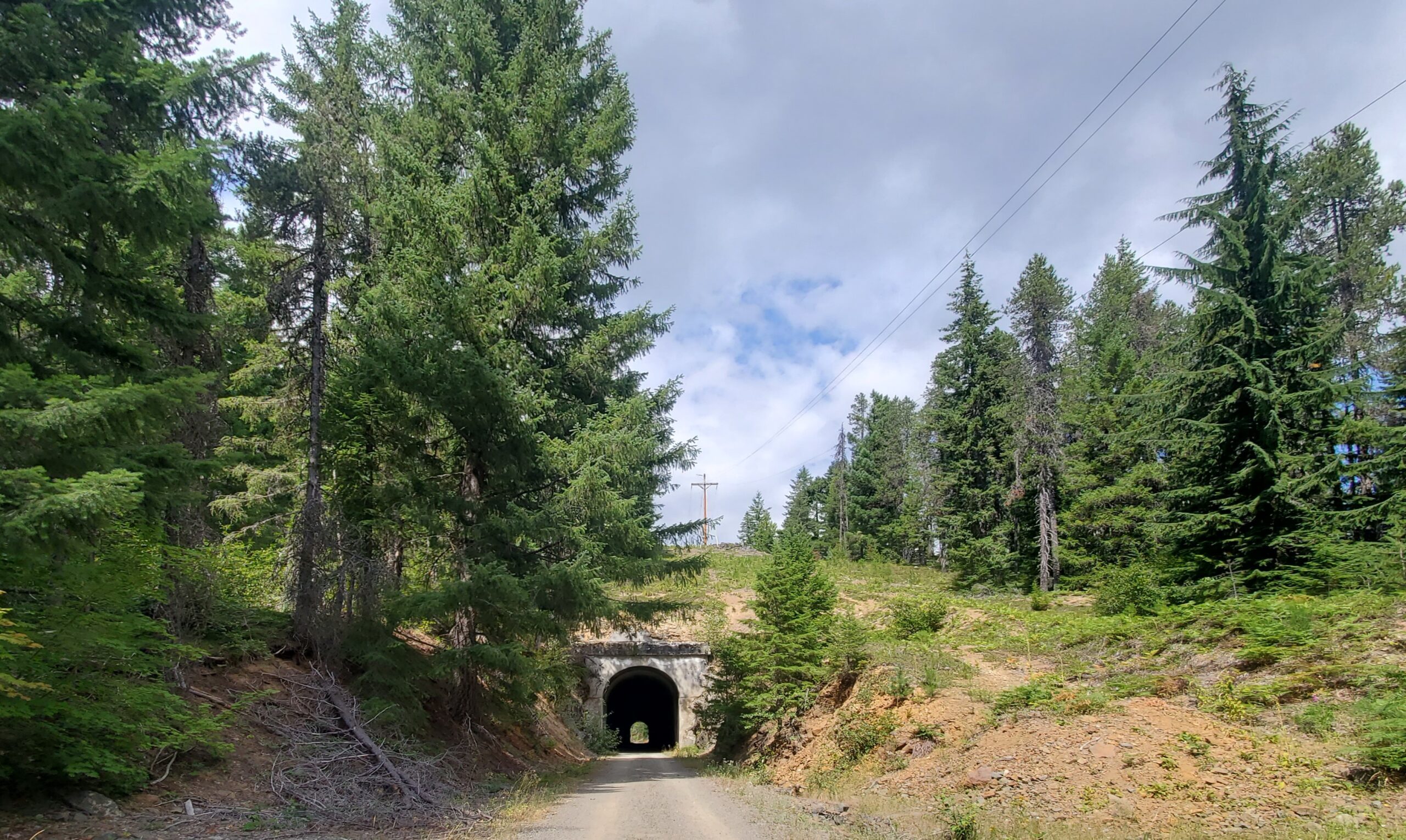
From Pioneer Coffee the route reaches the Palouse to Cascades Trail in about 1.4 miles. From there it follows the trail directly to Hyak almost entirely on gravel. This part of the P2C is more exposed than the trail on the west side of the Snoqualmie Tunnel. Be prepared for sunny conditions.
Do not be dismayed if your speed seems impaired. Gravel is slow, the route climbs almost the entire way at a railroad grade, much of it too shallow for a GPS to detect, and you may be heading into the Snoqualmie Scirocco. (Cliff Maas explains the wind.) Enjoy the often quiet setting, the absence of cars, the open fields, the forests, the river views, and your fellow riders. Carry more water than you think you should need. Keep in mind the gravel time allowance gives you an hour and a half more time than the same distance entirely on pavement. Think about the return trip: How often do our routes finish downhill with a tailwind?
There are two tunnels on the way to Hyak. Both are short enough that lights are not needed. In fact, you will exit them before your eyes can adjust. The surface in the tunnels is rougher than the trail out in the open. There are no serious potholes but be prepared to absorb surprise roller coaster bumps and dips.
At several bridges the bridge deck sits an inch or two above the dirt trail. Be careful at these transitions not to flat or dent a rim.
No services are available on the way to Hyak. There are a few pit toilets at irregular intervals.
There are numerous gates to go around. They are all well marked with reflective material. One gate in particular, at the site of a double railroad crossing at 12.8 miles, has some loose gravel in the path around the gate.
The first info control is at Hyak. Hyak has nice restrooms and a water station on the north side of the building. From Hyak you head back to Cle Elum.
On the way back the route turns off the P2C into Lake Easton State Park on a pleasant trail through forest. Take it easy as there may be families with small children. At the info control you can enjoy scenic views of the lake. A little farther there is a nice Park restroom and water just off the route, noted in the cues.
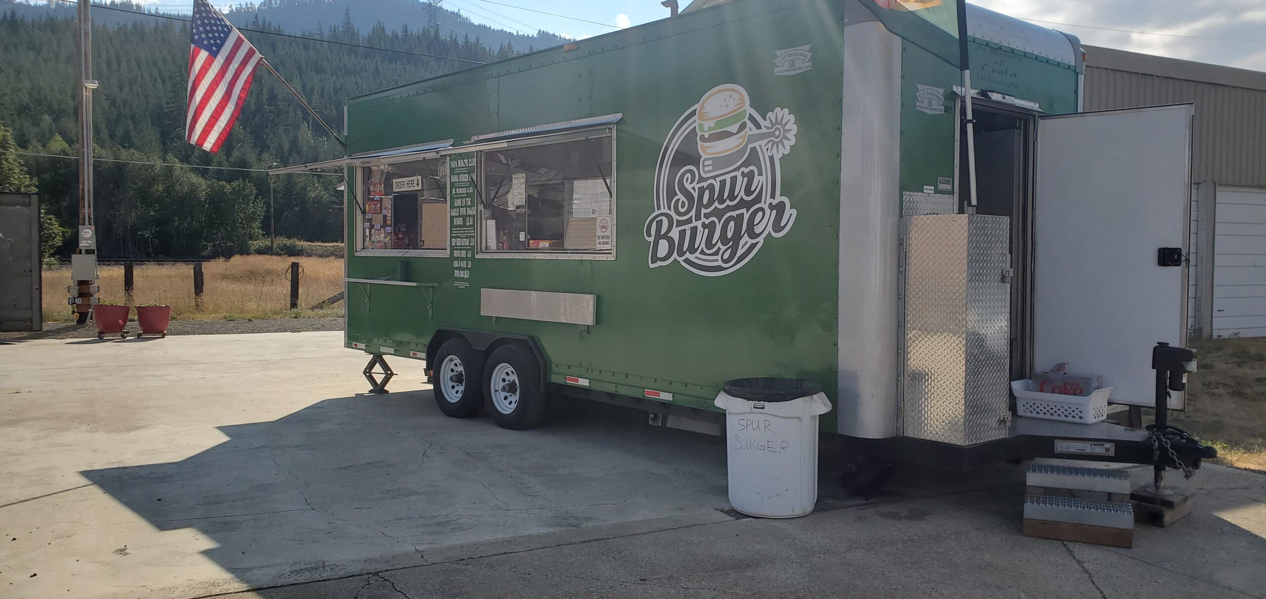
After the Park the route goes through the small town of Easton. You might want to grab a bite at Spur Burger (the only option for resupply that I could see).
Leaving Easton the route rejoins the P2C trail. Now downhill, and possibly with a sprightly tailwind, you should make good time back to Cle Elum. The old Cle Elum train depot heralds the turn off the trail and arrival in Cle Elum.
The Finish
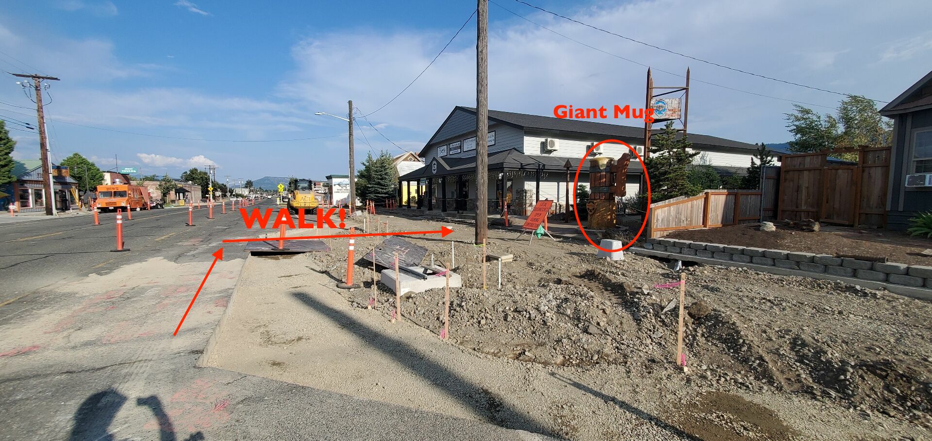
The finish at Mule & Elk is in a construction disaster zone. Look for the large wooden beer mug on the right. Walk your bike over the steel plate, or whatever pathway leads across the construction zone that day, and make your way to the brewpub.
Comments Off on 2024 Summer Gravel Populaire Pre-ride Report
The Spider was a permanent route created in 2011 for PBP training. A few of us in Olympia resurrected it into the new RUSA permanent program, and now we’re introducing it as a populaire.
There are 9 sets of hills on this ride, and there are a lot of downhills to make up the time from the climbing, Take advantage of these descents and minimize stop time at the stores. The 5 most notable climbs are:
Shaker Church/Hwy8: longest climb of the day, 546 ft gain in 5 miles.
Summit Lake: 633 ft gain, 631 loss in 10.5 miles.
Cedar Flats: misleading, as this is NOT flat, with steepest grade of the day (9.4%), 332 ft gain in 2.4 miles.
Delphi: 222 ft gain in 1.4 miles.
Alpine/Brown: 321 ft gain in 2.5 miles.
There are two stores early on at miles 14.5 and 23.7, so stock at either Steamboat or Summit Lake stores, so you don’t have to cross the 4-lane highway while descending Highway 8. Summit Lake store is on the climb up Hwy 8, and nothing at Summit Lake. Warning: there was a lot of glass on the shoulder along US101 and Hwy 8, so come with tubeless or extra tubes. After Summit Lake, take extra caution while crossing Highway 8, with 4 lanes of high speed traffic. Take advantage of the descent on highway 8 to catch up for all the hills.
The final 3 big hills are to come with steep pitches. If the road is wet take caution on the downhills. Cedar Flats and Alpine/Brown are out and backs, so these hills do have a reward on the return.
If needed, there is a store at Black Lake, about 58 miles. The final 100 ft climb over Sapp Rd, is nicer way to come into Olympia, compared to the busy roads in West Olympia. Check out the view of the Puget Sound/Budd Inlet in the distance when descending down Lakeridge into Capitol Lake!
The finish at the Oly Taproom has a great selection of brew and pizza. Park either in street parking or in parking lot across the street from Bayview Thriftway, but don’t park in Bayview Thriftway parking lot. There is also free parking across from the Oly Taproom if you prefer.
Thanks to all who pre-rode including: Ricky Blacker, Matthew Sponseller, Andy Speier, and Renee Lewis.
Have a great ride!
Comments Off on 2024 Olympia Populaire Pre-Ride Report
A small change has been made at the start due to changing traffic patterns in North Bend. The ride now accesses the trail via Ballarat Ave. (The same change has been made to the Permanent.)
The start and finish will be run differently for this ride. Late starts will not be accommodated. The organizer intends to join the ride. The start will close whenever he gets all the start materials put away.
Proof of finishing and proof of passage will be entirely by electronic means. The finish will not be staffed. When you finish, or if you DNF, text the organizer (me) with your name. This provides the confirmation RUSA wants that you are off the course. If you do not text within a reasonable period after the time limit, I will call your emergency contact. We don’t want that, do we?
Proof of passage will be by providing a gps track in Ride with GPS. Upload your ride to RwGPS, then report the link to the ride on a Google Form that will be made available on the SIR ride page and on an informational card you will get at the start.
Comments Off on 2023 Summer Populaire — Iron Horse Trail
The Seattle International Randonneurs headed to the eastern Washington city of Wenatchee to host brevet week of 2023. My name is Kiel Safstrom, or some in the club like to call me, Hand Grenade. Surprisingly, there was no self-implosion completing all four of these bombastically designed routes by Don “Shiggy” Person. Let’s pull the pin and recount the routes for those aspiring to ride amongst the tumbleweeds.
Saturday May 20th – Lake Wenatchee 200K
15 registered riders gathered before the 6 am. start at the Hilton Garden Inn, the main base of this entire week’s operations. We roll out on the hour north on the Apple Capitol Trail and very soon we are headed west on Easy St. in the Wenatchee hillsides. We jump onto Highway 2 around Monitor for about 4 miles of shoulder riding before we make a right on Dryden St. We ride next to the Ollala Canyon which offers great views of the Wenatchee River. The river was the highest some riders have ever seen, engulfing trees and shorelines normally seen. We pass over the river, skirt under the BNSF Railway through Peshastin and up Chumstick Hwy. Our direction heads northwest to our further point on an out and back to the Napeequa River on the White River Rd.
We turn back, wave and ring our bells at other members proceeding to the turnaround point. The 14.5 miles has us cycling parallel to the Wenatchee Lake, it’s cool near the water and a relief from the high heat the day has brought. Within the State Park, I found a spigot for water prior to the camp store. The store offered sound bits of ‘Free Bird’. The clerk mentioned her spin coach would have them sprint during the four and a quarter minute solo of the song, she loathed it. An iced espresso with coconut milk and Milano’s were enjoyed. Mint Ice cream and a Root beer for the tandem duo, Greg and Rose was their treat of choice for the heat.
Onward to Leavenworth, the Bavarian tourist trap, which I made a costly stop for a schnitzel at the Sausage Garten compared to individuals who had stopped at Starbucks. There were 15 different condiment bottles to squeeze onto the brat, sauerkraut, jalapeños and grilled onions. I can’t forget the misting fans that offered small relief from the heat. A smart rando knows, how to maximize efficiency off the bike. I bit it and doubled my normal allowed time off the bike. Back on, we loop south of the town out toward Icicle Rd. The Temple, Edward Peak, Cannon Mountain makes up some of those mountains in the distance. For good measure on liquids, I stop at the 76 where some other randos are using to resupply.
Out of Leavenworth we return from which we came and eventually are back HYW 2 turning right on Deadman Hill Rd, which turns into Pine Flats Loop. The Wenatchee Valley roads south of HWY 2 are extremely quiet and by then the heat was at its’ highest of the day. We were met with a short sun shower that cooled us off only moderately.
We roll through Cashmere, Monitor and re-cross the Wenatchee River to rejoin with the Apple Capital Trail.
Post the 200K finish, I enjoyed dinner with randouneering legends Vinny and Yonnel, building camaraderie as we filled our stomachs for the 300K the next day.
Sunday May 21 – Ancient Ice Age Floods 300K
12 registered riders took to the road, this time heading south and over the Columbia River per the Old Wenatchee bridge. We cut through East Wenatchee and past Pangborn Memorial Airport before a pleasant descent on Batterman Rd. to join with HYW 28. We ride the highway shoulder for 4 miles, on this Sunday morning it is not heavily populated with vehicles. We make a left turn on Sunrise Ln. and sneak over to the Palisades Rd. taking our adventure northeast through a valley with mountainous hills on both sides. We encountered some cross winds in this section as I watched tumbleweeds get blown up mountain cliff sides.
This section is paved for 15.5 miles until the first gravel section of the day begins. It’s an easy section until the 3 Devils Grade which has a max of 9.8% with some heavily pitted sections. With a planted seat the punchy section is swiftly taken care of. You’ll know you’re done with the climbing and halfway through the gravel when you cross a Cattle Guard, more dangerous than any railroad crossing I’ve needed to make thus far in my cycling tenure. We make a left on B SE Rd after the Mayer Farms which turns into Coulee Meadows Rd and eventually onto HWY 2, where we make a right turn.
It’s 20.5 miles until the Dry Falls Visitor Center, once there a water bottle refill station, bathrooms, the scenic Sun Lakes-Dry Falls State Park and Stacy’s Top Chef Concessions services are here. Highly recommend a scoop of ice cream or Blue Star espresso from the food truck. I don’t stay longer than a yo-yo mindbender trick can be performed and head out towards Coluee City for the out and back along the Banks Lake.
Along 155, Coluee Blvd., I see Yonnel and Clayton returning from the northern stretch about 22 kilometers ahead of me. The turnaround point is called the Million Dollar North Public Access to the left and on the right is the Lower Lewis Creek Waterfall. Looking back don’t be deflated to have to climb back from that descent, it’s only 6.2% and less then 200 ft.
On the return to Coluee City, around the same section I saw the leaders, I pass the tandem of Greg and Rose, behind them is Mitch and John all looking strong. At the Coulee City Campground, I make a left and dip into the Banks Lake Brew & Bistro for blueberry pastry and Sunrise breakfast sandwich. They were pleasant and accommodating there.
Back on to HWY2 before turning right on 17. It is about 6 miles until a left-hand turn is made on 6 Rd NE / St. Edwards West Rd., the second gravel section. Which, had I been listening more intently at the start, was completely optional! The 9 miles of gravel north seemed to roll on for eternity but was extremely grateful for the intermittent cloud coverage being provided as this was a 30-mile stretch with 1,470 ft. of climbing to Mansfield against a growing headwind.
As I was about to turn left onto 172, I see this BMW turn down the gravel road and chuckle given there isn’t anything in the direction I just came from that would interest anyone. The driver was Mark a randonueer using the extra days for rest for the upcoming 600K. He offered some beverages but politely denied as I wasn’t expecting for anyone out here. I scoot on into Mansfield just in time to be in ear shot of a gun salute for a former service member. Mansfield Mercantile is only open until 5 pm. on Sundays and the Golden Grain next door offers restrooms. All stocked up, I press on through the next 34-mile section where we all battled 25 mph headwinds into Waterville. There were momentary reliefs when we would turn left to head south for a few miles. Never had I been at such an angle while attempting to ride straight.
The Waterville Family Foods provided the last services needed before inching my way, stilling furiously punching through the wind, to the top of the Orando grade on Sunset HWY. It seriously felt like I was on the slowest lift hill of a rollercoaster before the 6-mile descent. Crosswinds during this section were the most dangerous as speed maxed out at 40 mph. there was a small bridge section that was exposed and felt the winds blows from all directions. Back at 740 ft. the 18-mile slugged on. Tree branches were blown down along the back roads of NW Cascade Ave. and dust storms littered the air. The last fight with the wind was across the Richard Odabashian Bridge as road debris was blown up and pelted into our faces. With our heads positioned down we pierced through and finished the soul cleansing route.
Tuesday May 23 – Electric City 600K
16 registered riders huddled around Rose, the SIR RBA, as she gave the pre-ride speech reminding riders to be safe and to ensure communication if having to DNF on the ride. These statements are a must at such lengthy course attempts, best thought through plans are usually discarded as fatigue or discomfort sets in. We roll out a few moments around 6 am. and head north on the Apple Capitol trail across the Columbia River.
Following HWY 2, what goes down must always go up and thus we begin the roughly 6.5-mile ascent up Orando grade. From 785 ft. climbing 1,995 ft. reaching Waterville and rolling through the plains of Lamonie and north of Mansfield. Seeing forever in each direction atop of the plateau, if The Who’s, ‘I Can See For Miles’ isn’t playing in your head yet. The twangy guitar was the chorus was ringing in mine along the 70 miles to Grand Coulee.
A quick hydration stop at the Chevron on the corner was required before proceeding down to the gravity dam producing hydroelectric for four different power houses and irrigation water to Banks Lake.
In another 17 miles, I make a second stop at the Nespelem Trading Post for more liquids as it’s going to be a 45-mile stretch without services along the Columbia River Rd. If you are to stop here, there is a restroom in the far back left corner of the store past the produce and frozen food section. On this Tuesday, there was one cashier working and the line was 6 deep. I quickly ate all my food in line and paid to limit any waste of time.
These next sections of roads are the most scenic of the entire route, riding parallel to the Columbia River until we follow the road to continue heading north west up to Omak Lake, the 3,244 acre lake will be in view on your right as the road provides steady rolling elevation. Soon after Beer Can Beach Rd. your descent will take you into Omak which if you were seeking services, you’ll be out of luck as the dismal looking Omak Market on Jackson is closed.
Proceeding to Okanagon, aka as O-town, if you can’t pronounce it. A 76 on the right of 2nd Ave and Oak St. provided rehydration and a bag of TGIF Potato Skin chips. There is no Subway currently in the store do not be deceived as I was. Some used the IGA Market three blocks on the right off 2nd Ave.
I refilled again about 25 miles down HWY 97 at the Chevorn, McDonalds, similarly designed like the one out in Granite Falls. Major déjà vu vibes in there. After filling up it was time to proceed yet another 25 miles to Chelan Lake.
The Alt 97 climb after having a double century in the legs was humbling. With the sun setting over the lake, the quick descent into town as rewarding. The Port for the Lady of the Lake had an open and extremely clean restroom right on the dock. With dusk and night setting in, lights on from here on out.
With 36 miles remaining until we returned into Wenatchee, the only grade encountered was the climb out of Chelan. Be sure to have your lights on for the Knapp’s Hill Tunnel! On Alt 97 south of Entiat, our visiting Oregon randonueers, Todd and Stuart (John) caught on and we battled 18 mph headwinds before taking a short rest to tackle the remaining 200K.
Having got in around 10:55 pm., I slept until 4:15 am. and was back riding before 5 am., as I rode out a rider was just coming in from the trail. I needed to stop for a moment as my Garmin was having difficulties acquiring satellites. Later found out that changing the GPS mode from GLONASS to GALILEO should resolve that issue immediately without a computer restart, which I needed to perform twice.
Once resolved, I rode south of Wenatchee for a second time, after the climbing near the Rock Island grade, I noticed a highlighter looking individual and arrived just in time, to hold Mark’s bike as he pumped air into his tubeless that had snagged a stable. He had rolled out about 20 minutes earlier then I had and as he mentioned, I had perfect timing.
Traffic was immensely noticeable this Wednesday morning. We stuck to the highway shoulder until the right turn off Rd 10 NW, near the Quincy Valley Rest Stop, we take these back roads on through to Quincy and planned for a stop at Starbucks in Ephrata. We made our way onto Martin Rd. for the 13-mile stretch through the orchards and spun along until four dogs gave chase and attacked. Mark was caught up in a crash, he suffered no injuries but the shifters on the bike had suffered insurmountable damage. He stayed behind to sort out the claim.
I rode on and stopped at the Starbucks as originally planned. The staff was overly nice as I was not in any mood for pleasantries having a few hours of sleep and had been road ridden 300 miles in the last 26 hours. The next 44 mile stretch from Ephrata to Waterville about 2,640 ft. of gain. proved to be the hardest part of this ride. With fatigue taking hold, distant storm clouds and rain showers ensured I didn’t lollygag too much and pressed on along HWY 2 heading west.
I stopped at the Waterville Family Grocery where I was greeted by Jan who was riding some unpleasant gravel in the area. After a pose for a photo and downing the remaining Gatorade. I proceeded up to and down Sunset HWY for the second time and third time being on the road that week. With no headwinds to battle this time around, it seemed I had caught the road all to myself midday on this Wednesday utilizing the full lane through the windy descent.
In no time was I off HWY 2, through Cascade Ave and still on the east side of the Columbia River for the 4.5 miles of trail before crossing on the Old Wenatchee bridge and sprinting to the Hilton, ecstatic to be finished with the 600K.
Friday May 27 – 400K Eastern Washington Loop
On the last event of the week, only 6 riders including myself were present and hungry for the road. Our morning ride out to Quincy via HWY 28 was wet as a storm cloud paraded the first 35 miles. It did make for a refreshingly cool climb up HWY 28 for the second time that week.
The early morning sun was not far behind the clouds and began drying out as I made my way through George and onto Frenchmen Hills Rd. to begin the 73 mile stretch out east to Ralston. On this road, some dogs gave chase longer than usual and out of caution I sent a message to have the RBA warn others.
Pothole General Store was the first stop of the day to rehydrate, carb up just to get stuck behind a gentlemen proceeding to buy what must be the last pack of Marlboro Silvers the store has. May it be the last ride of the week but the inquisitive looks from the local clientele was strong on this day amongst the eastern Washington loop.
Out of the store and back on the road, the road takes us next to the Potholes Reservoir on the left. On the right is Corral Lake. Warden is a potato town; one can tell by the orphaned potatoes scattered on the street. In town, at the Astro Express Mart, I ran into two WXA rider filling up. Jose from Ellensburg was looking strong, and I bide them both a safe journey to Idaho!
20 miles down the road my next services stop was in Lind, desolate little thing. Along the way, I see three horseback riders on my right. The route proceeds with climbs, on the Lind-Warden Rd. on the left at the street of Hoffman is a field that had 6 dust devils before coming into Lind. The tattooed gal running, Jim’s Market was kind to fill the water bottles, whip up a lotus energy drink from my random dice roll and wish me good luck finishing the series.
With a snapshot of the bike near the mural, I’m a sucker for a historic mural, I pedal on through the countryside. Along the way to Ralston, three deer run parallel to the road with me for over a minute. One crosses the road first, the second peels off and the third keeps running for another 20 seconds before crossing in front of me.
I turn north, and proceed the 9 miles to Ritzville for a stop at the Circle K. I waste no time here as I feel as the main attraction for the mass’s eyes. We cut through historic Ritzville and out onto the long straight of Rosenoff Rd. for the 40 miles of headwinds, rolling climbs and chasing a storm cloud off to our right. Even through the route is perceived to be descending over time, this stretch of road felt to be the hardest part of the ride.
I by past the right turn on Rd L NE, to retrieve services at the One Stop Mart. The drink fountains do not have water here, luckily the lady behind the counter fills them up in the kitchen and then back on course through Moses Lake.
We are nearing the end and I’m beginning to sense the accomplishment as I ride on HWY 17 to 282. The afternoon glow makes Ephrata very rustic, and I dip into the 76 for the last stop of the day after the last 23 miles of headwinds.
With 50 miles remaining and it mostly a descent, the only thing that had me worried was having to cycle back on Martin Rd/ Rd 12 NW through those orchard fields that we encountered the dog chase two days before. Sure enough, as I approached those pesks were sitting in the road. Luckily, the dark gray aggressive one was nowhere in sight, and I scooted through unscathed.
By now dusk was here and I was on HWY 28 for what felt like a blitz of 28 miles, yet a minor slog through the 10-mile Rock Island and Eastern Wenatchee stretch. One last time, totaling four crosses of the Old Wenatchee bridge and the sprint up Worhten St. to the Hilton. When I arrive at 10:22 pm. it marks a result of 953.67 miles covered with 42,820 ft. of elevation climbed, having spent 60:41:17 in moving time on the bike. I considered this a resounding success.
400 kilometers is a long ways, and you can see a lot. This ride will keep you interested as it hits many highlights on local roads. With 12,500 ft of climbing, this 400K has a little more elevation per mile than PBP, but the sawtooth profile is similar with endless short climbs and descents.
Parking
Parking is pretty restricted in Mukilteo- most on-street parking is at most 4hrs with no parking 2-4am. Nobody wants to find their car towed after finishing the ride. Be sure to allow time to find parking and ride down to the ferry.
By far the most convenient parking is at the pay lot across the street from Silver Cloud Hotel. There are plenty of spots and it’s a couple minutes from the ferry. It’s not cheap at $28 for 24 hours. If you’re staying at the Silver Cloud, parking there will be just as easy- check with the hotel. I did see on-street parking 4 miles up the hill by the YMCA (10601 47th Pl W, Mukilteo, WA 98275).
Rider checkin
We’ll check riders in beginning 05:15am at the Mukilteo ferry terminal, after the toll booth. Get your brevet card from a volunteer and get a sticker from another volunteer after passing the safety check (front and rear lights, reflective vest and ankle bands).
The ferry leaves at 06:00am. Once we arrive at Clinton, ride up the hill 1 kilometer to the P&R on the left at Deer Lake Rd behind the Post Office. We’ll finish checking in riders there, and start shortly afterwards for a 0630± start. The start will be open for an hour, in case you miss the 06:00 ferry.
The Route
We’ll start out on the leg- tenderizing hills of Whidbey Island with many water views. The Deception Pass bridge marks a change to the quiet roads of Swinomish Island to La Conner. It’s too early for the tulips on the Skagit Flats but there may be tailwinds to push you towards Chuckanut Drive on the way to Bellingham, the northern- most point of the route.
Riding south along Lake Whatcom on our way past Sedro Wooley, we’ll turn on to S Skagit Hwy for an 80K out-and-back to Concrete (wave to your fellow randonneurs going the other way!). We make our way to the Nakashima Barn and the Centennial Trail. Note: the gate at the Nakashima trailhead will be closed when most riders get there- you will need to go around it to access the trail. Exit the Centennial Trail on 60th St NE, 17km after the penultimate control in Arlington. The route through Ebey Slough beginning at km 388 can be confusing for riders who have not ridden it before- see this post for additional information. There’s one more hill on E Mukilteo Blvd before the finish at the Silver Cloud Hotel near the waterfront in Mukilteo.
Services
The route passes through many towns, and finding food should not be a problem. The last two controls at Concrete (278K) and Arlington (359K) are 24hr convenience stores.
The 2023 Spring 400K starts on Whidbey Island and finishes in Mukilteo. All riders will be riding the last 20K at night, many will be doing it well after midnight. There will be very little traffic because of this, but randonneurs navigating this for the first time can be confused with all the turns, one way streets, and road furniture. Becoming familiar with this beforehand will hopefully ease your way to the finish.
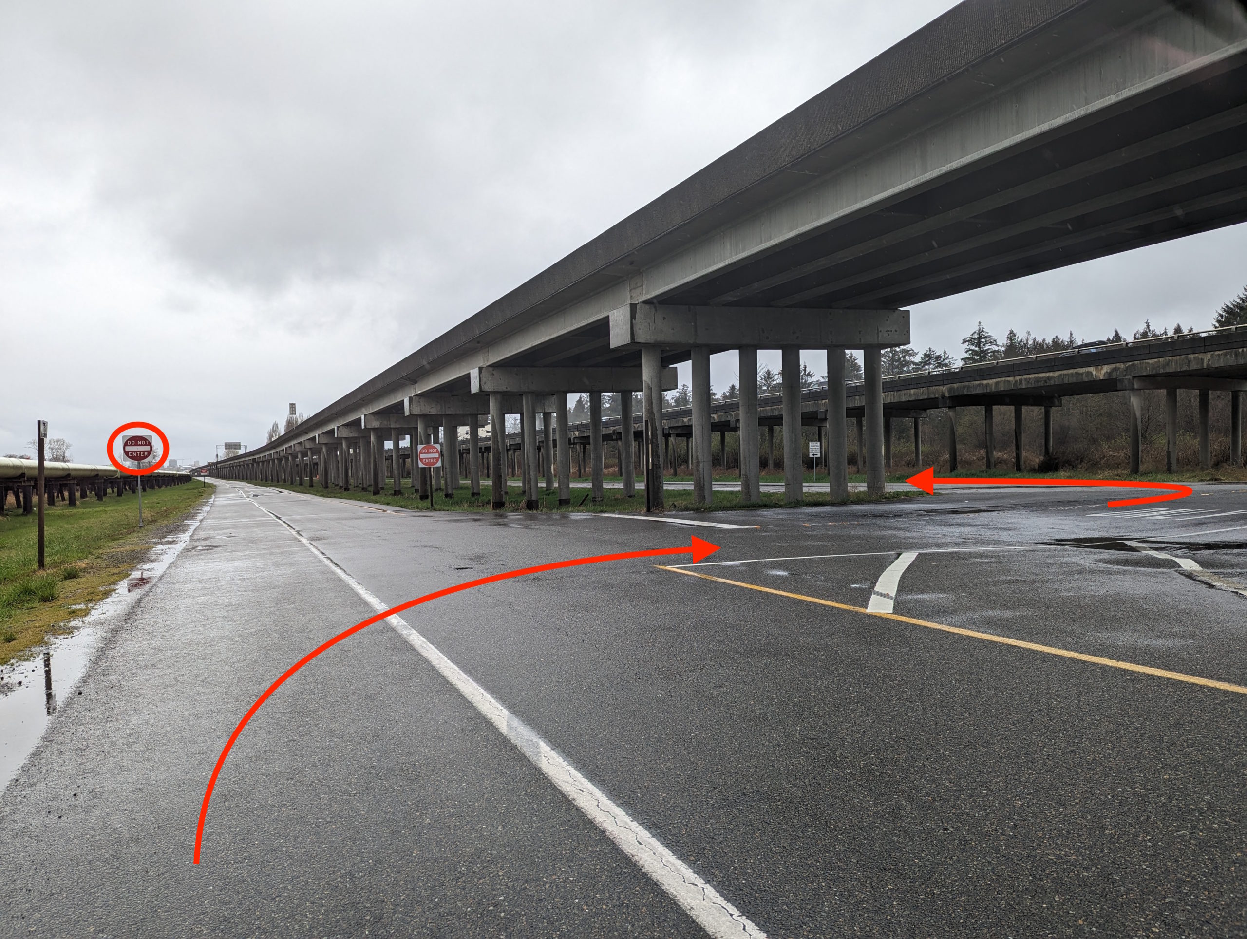
17K after the control in Arlington, leave the Centennial Trail by making a right on 60th St NE, one of the many cross streets on the trail. There is a sign on the trail calling out the 60th St intersection as well as a stop sign.
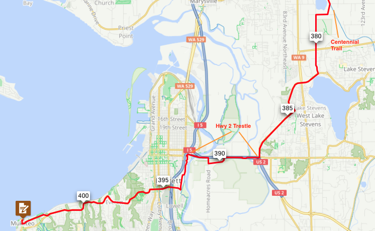
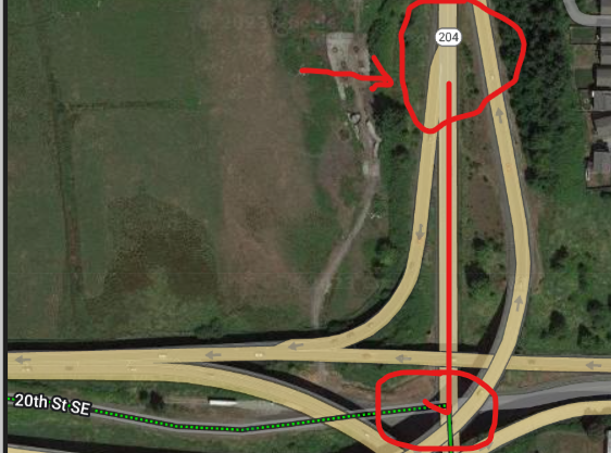
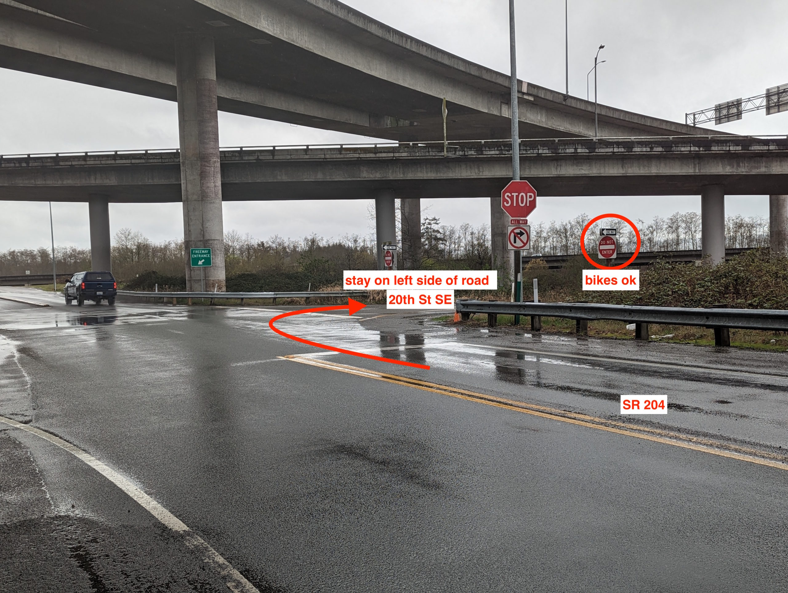
Quiet roads will take you through Lake Stevens, where you will turn right on SR-204 at km 384.5 and go down the hill to US-2. Stay on SR-204 past the onramp to US-2 continuing to the stop sign at 20th St SE. You will turn right on to 20th St SE- there is a bike lane on the left side of 20th St and it will look like you’re going the wrong way on this one-way street.
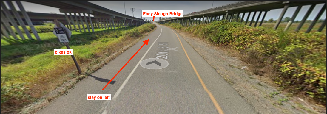
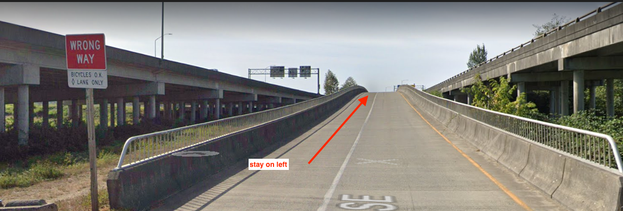
Stay in the bike lane to the left as it crosses a bridge over Ebey Slough
After the bridge at km 388.4, stay to the left as the road passes underneath the trestle.
At the next intersection (km 388.6) turn right then left to go under the trestle and get on the ‘right’ side of 20th St.
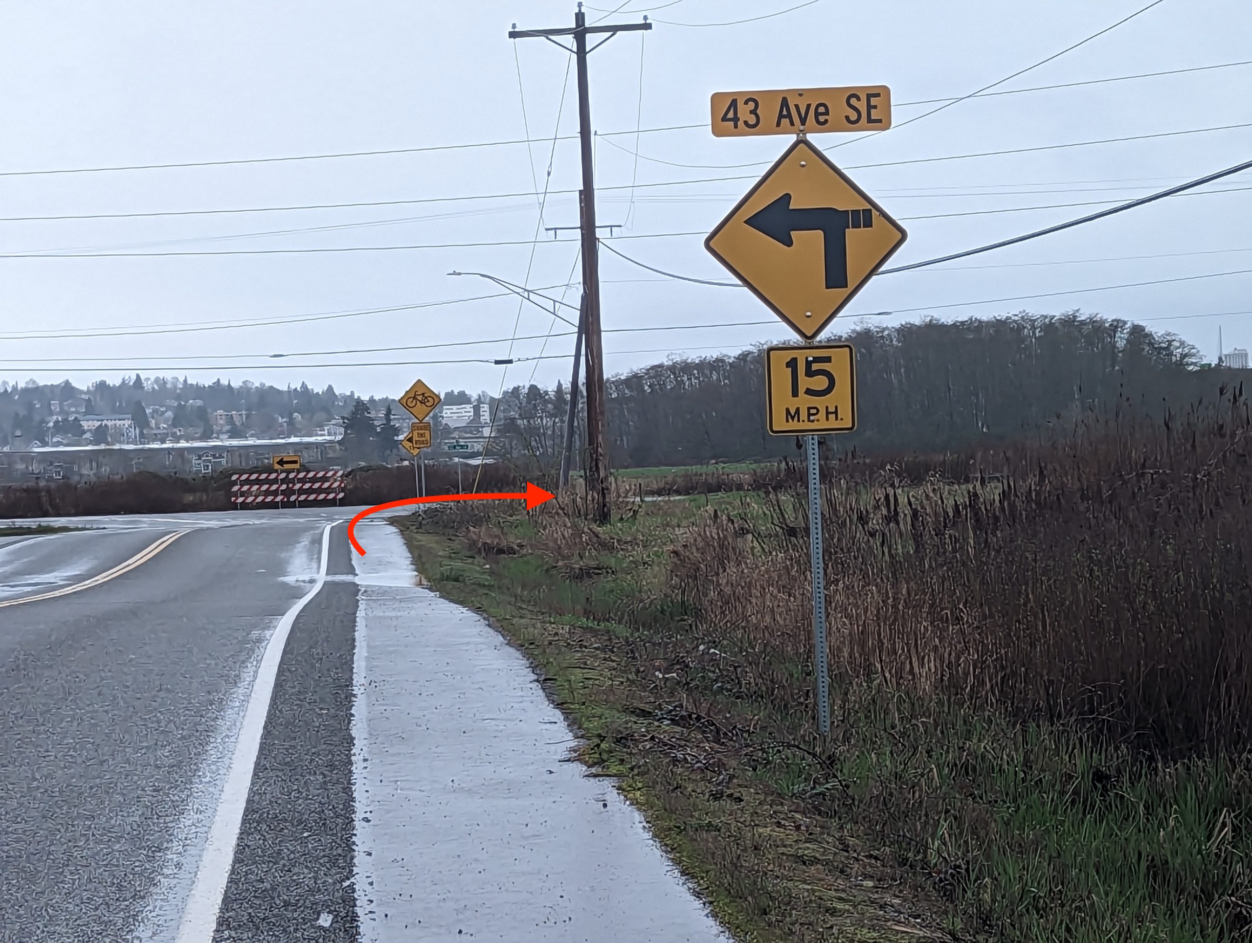
After a kilometer at the stop sign, turn left on Homeacres Rd
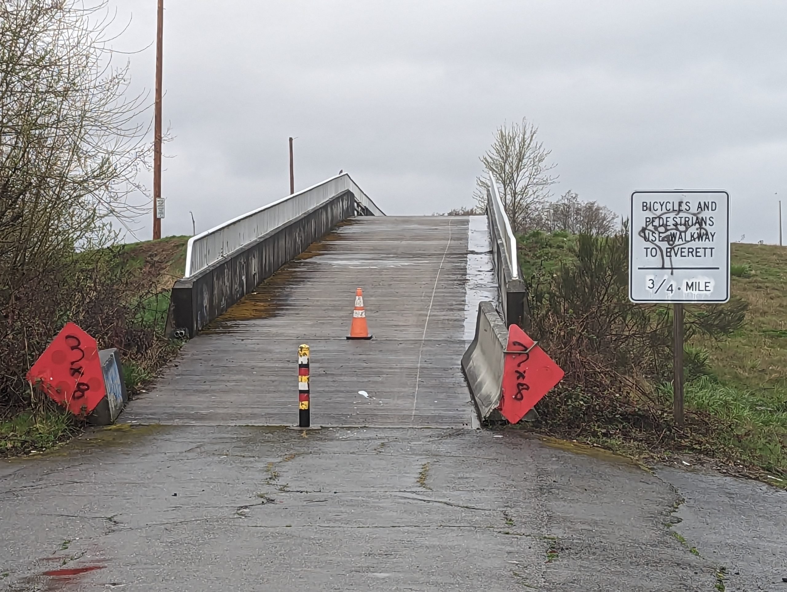
At the T intersection at km 390.6 turn right on 43rd Ave SE and the trail over the Snohomish River.
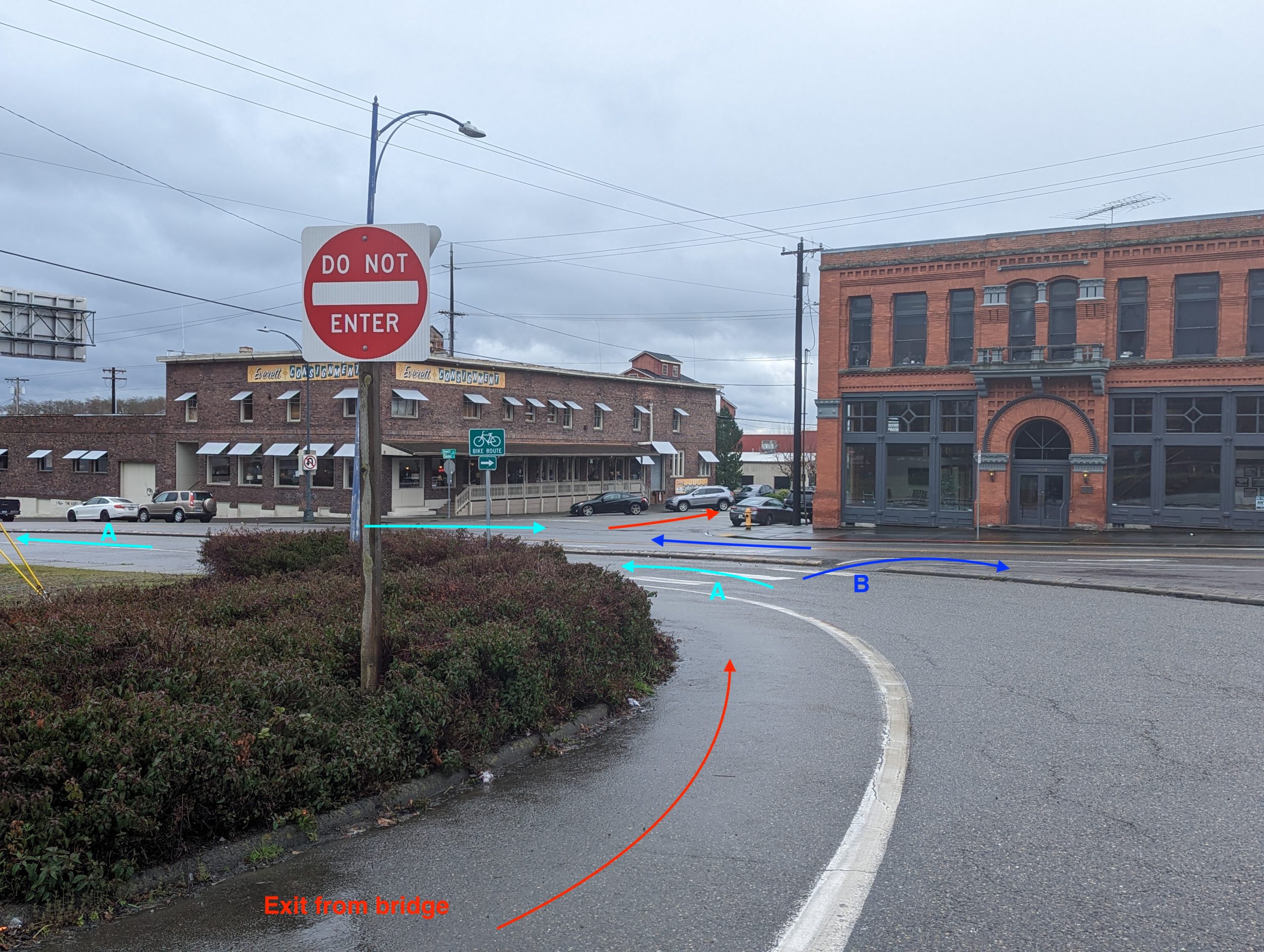
The trail ends at km 392.1 at Hewitt Ave. The route crosses Hewitt Ave to get on Chestnut St. The raised lane divider blocks direct access to Chestnut St. Your choices are to (A) continue on Hewitt Ave past the lane divider to turn on to Hewitt Ave or (B) use crosswalk to access Hewitt Ave past raised divider.
The route to Mukilteo is straightforward from here, passing through Everett to E Mukilteo Blvd and one last climb before the descent to the finish by the ferry terminal. You’re done!
The Populaire starts at Tacoma’s War Memorial Park. There is ample parking at the park and adjacent Park & Ride lot. The park does not have restrooms. A number of fast food restaurants and a gas station are nearby.
The ride starts with the spectacular crossing of the Tacoma Narrows Bridge. The projected cold weather should discourage tourists, but as always, be careful around pedestrians and other cyclists. The descent to the bridge, climb to its middle, descent and then final climb on the west side set the tone for the route: Up, down, up and down, up and down…. Easily adjustable clothing for temperature regulation is highly recommended. For the most part the route is on relatively quiet roads with pleasant scenery.
After a short cruise on the Cushman Trail the route descends into Gig Harbor, where the traffic circle that was under construction all summer at Stinson Ave is finished. Expect slow traffic and oblivious pedestrians in the downtown area.
A long ascent ensues culminating in a thrilling plunge to Olalla. The store here is closed but does have a chemical toilet available.
Climbing out of Olalla we take the longer route through a little neighborhood while the cars go up the shorter way. This bit has the steepest climbing on the route. There is a scenic spot near the top where you can pretend to take in the view while catching your breath. Once you’ve winched your way to the top you’ve got the ride in the bag. Now about the remaining 100 kms….
Seriously, if you decide to walk the climb on Banner Rd, do use the left side where you will not be hemmed in by a guard rail.
Banner Rd continues north arrow straight. Eventually it begins a “climbing descent” where you can make up some time. Approaching Southworth we weave through a little neighborhood to stay away from any ferry traffic.
The Southworth info control is at the Southworth Grocery. From there the route offers water views as it continues through Manchester and around the point to the next info control at the Waterman Pier. This is a pleasant, speedy section of the route.
Port Orchard comes next where the cue sheet points out a 7-Eleven for resupply. There are numerous cafes and coffee shops if you need a higher-class calorie and caffeine boost. The steady climb on Port Orchard Blvd returns us to the undulating highlands of the Kitsap Peninsula.
After the Fire Station 15 info control comes a fast downhill on Pine Rd where you must be ready to get on your brakes for the turn to Spruce Rd. Warning cues have been added for this and several other turns that are easy to miss.
At Wauna we turn left onto Hwy 302. Traffic may be heavy, be patient with the left turn.
After crossing the little bridge on 302 turn into the 76 gas station. What looks like a parking lot is actually Tyee Dr.
Tyee Dr shortly merges with Purdy Dr. At this point Purdy Dr is functionally a shoulderless onramp for WA-16. At least there are two lanes and most drivers should give you room. Relief comes in a kilometer with the turn onto Burnham Dr.
The route wanders south and west to the last info control at Kopachuck State Park, which has restrooms. Next we swing by the Arletta store on our way back to the Narrows Bridge.
The entrance to the Narrows Bridge trail is via a left turn on a blind right hand curve. Please be cautious.
The finish is at the Starbucks on 6th Ave in Tacoma, a few blocks past War Memorial Park.
Comments Off on 2022 Turkey Populaire Pre-Ride Report