Category Archives: Pre Rides

2022 February 5 Winter 200 km Pre-Ride Report

Pre-riders: Mitch Ishihara, John Nguyen

RUSA Brevet #2134 Redmond, Lakes, Falls, and Trails – features Peet’s Coffee, Granite Falls (multiple bakery, food, and coffee options), Postdoc Brewing Company

The route features low elevation (below 240 meters/790 feet) on rural roads. 

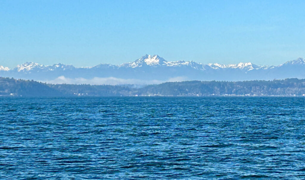
From the start in Redmond, make a gradual climb up to Echo Lake passing through a short gravel/dirt trail. Descend down to Tualco Valley and Monroe. Climb up rolling hills to Lake Chaplain. Follow it up with a rolling climb up to Lake Roesiger. Continue with a rolling descent down to Granite Falls with multiple food options (roughly the half-way point). Make a net descent across additional rolling hills out to Arlington. Take a short out and back to Bryant followed by the gradual railroad trail grades on the Centennial Trail to Snohomish. Make one more lumpy climb before finishing on the Sammamish River Trail back to Postdoc Brewing Company in Redmond. All of this packed in against a few scenic peeks of mountains in the distance.

The Route

Ride with GPS: https://ridewithgps.com/routes/22218260 

Plenty of lumpy rolling hills before gradual 1-2% railroad grades on the Centennial Trail and flat Sammamish River Trail.

Parking

There’s parking near the finish at Postdoc Brewing Company on NE 65th Street in Redmond.

And parking near the start at Peet’s Coffee at Lake Sammamish Trail Parking off of NE 70th Street in Redmond.

Start location @ Peet’s Coffee

We’ll gather in front of Peet’s Coffee.

Compact Gravel/Dirt Trail to Echo Lake

Entrance to trail – do not go through the arch on the left.

Fresh composting foliage covers the trail.

We removed the small fallen tree.

But that’s about all we would do…

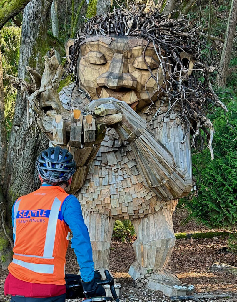
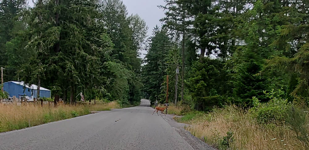
Hello Mr. Ed

Oh deer!

Info Control – Echo Lake and Aspen Way

11.4 miles / 18.3 km

Monroe

23.2 miles / 36.5 km 

Water and restroom at Lewis Street Park on right. 7-11 on Main Street.

Lake Chaplain Service Road

During a temperature inversion, go higher to get out of the cold lowland fog!

Info Control – Lake Chaplain

34.9 miles / 56.1 km

Fog billows over mountain peaks

Our last glimpse of warm sunshine for the day

Back down into the fog

Info Control – Lake Roesiger Park

48.9 miles / 78.6 km

The fog cleared briefly as we climbed up to the park.

Lake Roesiger Store

50.0 miles / 80.4 km

Last services until Granite Falls.

Granite Falls

58.1 miles / 93.5 km – almost half-way!

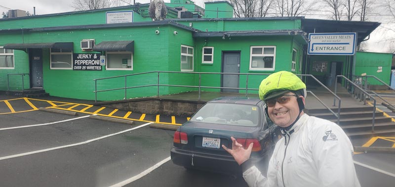
The place formerly known as Hanky Pies

First course…

Second course…

Centennial Trail to Bryant

Info Control – Bryant

75.7 miles / 121.8 km

“Uhm. John, we’re going to need a new info control.” Talked to the friendly new owners.

Arlington

79.4 miles / 127.8 km

Legion Memorial Park

Water and Restrooms on right

Who’s idea was this to ride in the fog?🥶

Machias Station Park

96.3 miles / 155.0 km

Water and Restrooms (dusk to dawn)

…on Broadway

They say there’s always magic in the air

Finish – Postdoc Brewing Company

125.0 miles / 201 km

Hazy IPA for a hazy day!

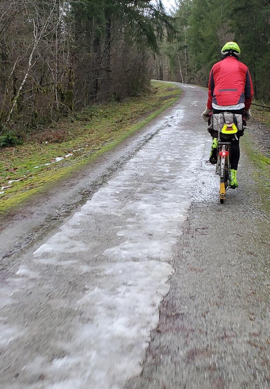
Was bone chilling!

Your weather forecast

In Redmond

Epic Ride Weather

Comments Off on 2022 February 5 Winter 200 km Pre-Ride Report

Filed under Brevets, Pre Rides, SIR Rides

2022 January 22 Rouleur 125-149 km Pre-Ride Report

Pre-riders: Mitch Ishihara and John Nguyen

Distance: 130K (0.1 km gravel), 81 miles
[The finishing time of 8h 40m is based on the official distance of 130 km. Detours may make the actual route longer. You will still have to finish in 8h 40m.]

Elevation (max / accumulative): 173 m / 1090 m, 567 feet / 3576 feet

Brevet #: 2876 

Name: Sultan Bakery Sandy Coffee Sumerian Beer

Route: https://ridewithgps.com/routes/38225020
[The route may be updated Thursday night/Friday morning depending on the status of flooded roads.]

Features: Sultan Bakery, Sandy’s Espresso, Sumerian Brewing Company

SIR Event Listing

There is a perpetually flooded road through a wetland. Detour required.

These people did not make it through.

Tualco Valley had barns and farm stubble.

There were water-over-roadway signs (but not closed).

Automobiles successfully crossed.

So did we. Too much fun.

Snow decorated the mountain backdrops.

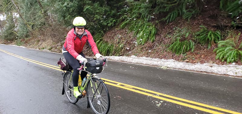
Snow decorated the side of the road too… but melting.

We ate lunch at a bakery.

There were a enough tough hills.

More roads were closed. Detours required.

Rivers ran full.

Sandy’s Espresso was open.

We climbed up Tolt Hill Road above the flooded River Road.

There were nice views from up high.

We rode through a fancy neighborhood.

We saw blue skies and sunsets.

We drank beer.

Good times!

The weather forecast for January 22nd looks promising.

For Woodinville, WA

And for the route…

Aerial view of the route with some photos on Relive.

Comments Off on 2022 January 22 Rouleur 125-149 km Pre-Ride Report

Filed under Brevets, Pre Rides, SIR Rides, Uncategorized

January 15 Rouleur 100-125k Pre-Ride Report

Preriders: Bill Gobie and Bradley Hawkins

SIR Event Listing

There was a landslide.

There were flooded roads. Curiously there were more flooded roads the higher we went.

There was snow. The route is “low elevation (below 300 meters/1000 feet)” they said.

We had a good time.

Conditions should be much better on the 15th.

It will be fun!

Comments Off on January 15 Rouleur 100-125k Pre-Ride Report

Filed under Brevets, Pre Rides, SIR Rides

Summer 300k Brevet Pre-ride Report

Mysterious Mountain

310 km, 9000 ft climbing

Pre-riders: Adam Glass, Bill Gobie

The camera doesn’t do justice to my sunscreen

The ride begins and ends in the Renton Village shopping center, 601 S Grady Way, Renton. The start is at the Starbucks. Recommended parking is north across Grady Way at the South Renton Park & Ride. The finish will be at the Applebee’s until it closes at midnight, then at the volunteers’ cars in the parking lot. Fast riders (you know who you are) please text the organizers from Enumclaw so we know when to staff the finish.

This ride will have no on-course support. Carrying adequate water for the climb to Cayuse Pass is essential. Devise a way to carry more water than you normally do.

The forecast is for warm and clear conditions. Be prepared with plenty of sunscreen and perhaps protective clothing.

The descent from Cayuse Pass may be cold, particularly for tired and dehydrated riders. Bring a wind jacket and some warm clothing.


The preride started in early morning sunshine. Clouds soon moved in and conditions remained unexpectedly cool, verging on cold, all the way to Elbe. This was the first time I have been in Eatonville when it was not stinking hot. It’s not all that bad a place.

No rabbits in sight – full speed ahead! Four water bottles!

The route begins with a long roll on the Interurban Trail with its numerous railroad crossings. Many of the rubber tiles at the crossings were recently renewed. Not all, however! Most of the crossings are oblique to some degree, so exercise caution at the crossings.

Stay alert for suicide rabbits. The rabbits look well-fed this year. Hitting one could take you down.

If the weather is clear you should get the first views of Mt Rainier, awakening from its overnight slumber, unaware yet of your approach.

After taking surface streets in Pacific the route transitions to the Sumner Link trail with pleasant views of the White River. The trail has some surprisingly sharp turns so heed the warnings in the route file.

In Sumner you ride the aptly named Traffic Ave, then turn onto Shaw Rd. Shaw begins with a bridge that is steeper than it looks. The extra-wide sidewalk is recommended for the climb.

The next long segment is on the Foothills Trail to Orting. A public restroom with water is located close to the start of the trail. Like the Sumner Link, this trail has surprisingly sharp turns, generally when approaching rail crossings. Expect pedestrian and casual bike traffic to increase as you approach Orting, although it may be relatively light due to the early hour riders should reach Orting. Keep in mind the local drivers expect to have their right of way at intersections.

The route does not follow our traditional way through Orting! The aim is to avoid the busy intersections and pedestrian traffic on the trail in central Orting. Be alert for the right turn onto Whitehawk Blvd. A “landmark” instruction at the school track is intended to wake you up. If you need supplies there is a cue to head off-route at Whitsell.

Next we head south past Lake Kapowsin and Ohop Lake to Eatonville. These roads were unexpectedly quiet on the pre-ride, possibly because we were on them several hours earlier than has been the case with routes that start in Seattle. Turning onto WA-161 expect impatient loud traffic on the climb into Eatonville.

From Eatonville the route follows the less busy option to Alder Lake, highways 161 and 7. Shoulders were good except for a few tight spots. Pretty forest appears. Be alert for deer (and elk) (on the entire route).

Oh deer!

Turning alongside Alder lake on WA-7, Mt Rainier suddenly looms, challenging, “Who approaches?”

“Who enters my domain?”

Running toward Elbe at up to 25 mph we enjoyed a great tailwind. The temperature rose abruptly into the 70s. We walked the evil track crossing just before town.

This crossing is not a peach

In Elbe we found packaged sandwiches (expiration date in August!) at the Elbe Junction, opposite the decaying Heisler logging locomotive. There are several other options for food.

Steel is real

Leaving Elbe we walked the second abominable track crossing. The run to Ashford is generally a false flat. Don’t knock yourself out trying to make speed here. Ashford offers a couple of stores for final supplies before climbing to Skate Creek.

The climb to Skate Creek was well shaded and quiet with good road surfaces. At one point you may feel you are being watched – what, is it Sasquatch? No, the Mountain is surveilling you through the trees. The trees part and the stern, silent Mountain assesses you, then slips back behind the trees. What does the Mountain plan for you?

You persist, mortal?”

The Skate Creek summit transitions gradually to downhill, and then becomes seriously downhill. The road is in much better condition than I have seen it at times, but hazards still abound. Most potholes have been circled with paint, but not all. The dappled light under the trees demands full attention. Be satisfied with listening to the cascading waterfalls. Don’t look at them! Finally the right-hand hairpin turn heralds arrival in Packwood.

Skate Creek

In Packwood we ate at the convenience store at the intersection with US-12. It is now a 76 gas station. The outdoor portable toilets were out of paper; you might want to bring your own supply. There are other food options in Packwood if you go off-route right on US-12. Leave with a full load of water and food.

Heading east on US-12 the climb to Cayuse Pass begins with ascending rollers. They seem fun despite the lack of shade. The temperature rapidly rose into the 90s. Then the Mountain flicks the grade up to 5% and enlists the sun to torment the unworthy. My gps recorded 102 degrees alongside a basalt wall. When you find the rare spot where a tree’s shadow stretches across the road, stop in it and cool down.

Pass the gantlet, and the Mountain grants reprieve on shady WA-123. As a National Park road, commercial truck traffic is banned and most of the car drivers seemed mellow. After about three miles you pass Ohanapecosh Campground. I had drunk so much water in the ten miles from Packwood that I opted to get more water here. It was a good idea. Notes for finding water here and later at Silver Springs Campground have been added to the RwGPS file’s description. These are not in the cue sheet!

Shade on hwy 123

I cannot overemphasize how important hydration on this climb is, and how necessary to carry a great deal of water particularly if you are slow climber. I drank five bottles on this climb plus most of a bottle of liquid food. Don’t be tempted to pour water over your head. With a limited supply it is much wiser to drink your water.

Eventually the tree cover becomes sparse and you are again exposed to the sun. Fortunately the air becomes cooler at higher altitudes. Unfortunately, the air becomes thinner while the grade increases to 4-6%. If you’ve had as little altitude exposure this year as me, you will notice.

Getting high

The only truly unpleasant part of WA-123 is the tunnel at 190 miles. Be absolutely certain to turn your lights on!

Keep plugging along and eventually the Mountain will acknowledge your spirit, permitting your arrival at Cayuse Pass. Don’t fret if you are behind the clock, you’re about to become a gravity bomb. The upper five miles of 410 descend at 7%. Some braking is needed to hang on to the corners and the road surface is a bit rough in places. Drivers may be afflicted with must pass bicycle syndrome despite you perhaps reaching 45 mph or more. I confess it was gratifying seeing how desperately the drivers braked when they realized how hot they were coming into the next curve.

After an info control at Crystal Mountain Blvd you may want to stop at Silver Springs Campground to fill a bottle. Instructions for finding the water are in the RwGPS description.

In Greenwater only Naches Tavern was open when we arrived. Being Sunday night, and being Naches Tavern, they were out of food. Perhaps they will be better stocked on Saturday. The water we got from the bar was vaguely tainted with cherry soda.

We finished the descent to Enumclaw in the dark. This was not fun. I recommend trying to get to Enumclaw in daylight. Enumclaw has numerous food options. We opted for the traditional randonneur repas en plein air, namely chips and soda on a convenience store sidewalk.

From Enumclaw the route courses north across the plain toward Green Valley. We hit surprising pockets of cold air. After dropping into Green Valley the route hits you with a final steep test heading toward Lake Sawyer.

The last fifteen miles are an easy roll down the Maple Valley trail. In the dark don’t miss the turn to the trail from Maxwell Rd. Maxwell becomes steeper downhill just after, so be mindful here. On the trail be careful of the posts at road crossings. At the Renton end of the trail ride slowly and be respectful of pedestrians.

Renton’s one-way streets send us on the usual indirect wander through downtown. There is extensive road construction. Skinny-tire folks should be wary of pinch flatting.

Comments Off on Summer 300k Brevet Pre-ride Report

Filed under Brevets, Pre Rides, SIR Rides, Uncategorized

Brevet Week 600k Pre-ride Report

by John Pearch

The Brevet Week 600k follows almost the same route as the 400k with the exception that the 600k goes to Lake Samish, where the 400k goes to Lake Whatcom.  See Mark Thomas 400k preride report with additional details. One additional small difference is that the 600k takes the Redmond Central Connector trail into Redmond, which goes by the McDonalds and Chevron. Most restaurants close at midnight (as of May 1st), but you need to check on this as closing hours have varied a lot lately. Redmond Inn is not serving breakfast, and only has coffee in the lobby.  When in doubt have some food either in your car or in your hotel room at the Redmond Inn if you are staying there as the overnight.

I prerode the last 215k of this route (after Redmond overnight) on April 24th, on a long rainy day (without credit). 😆 Keep in mind that the last 215k is quite hilly, about 6,000 accumulated feet of climbing. After the overnight you will climb up Union Hill up and over to Carnation, where you can get some awesome coffee at Sandies. From there you will have a steady climb up the Snoqualmie gravel trail, to the tunnel.

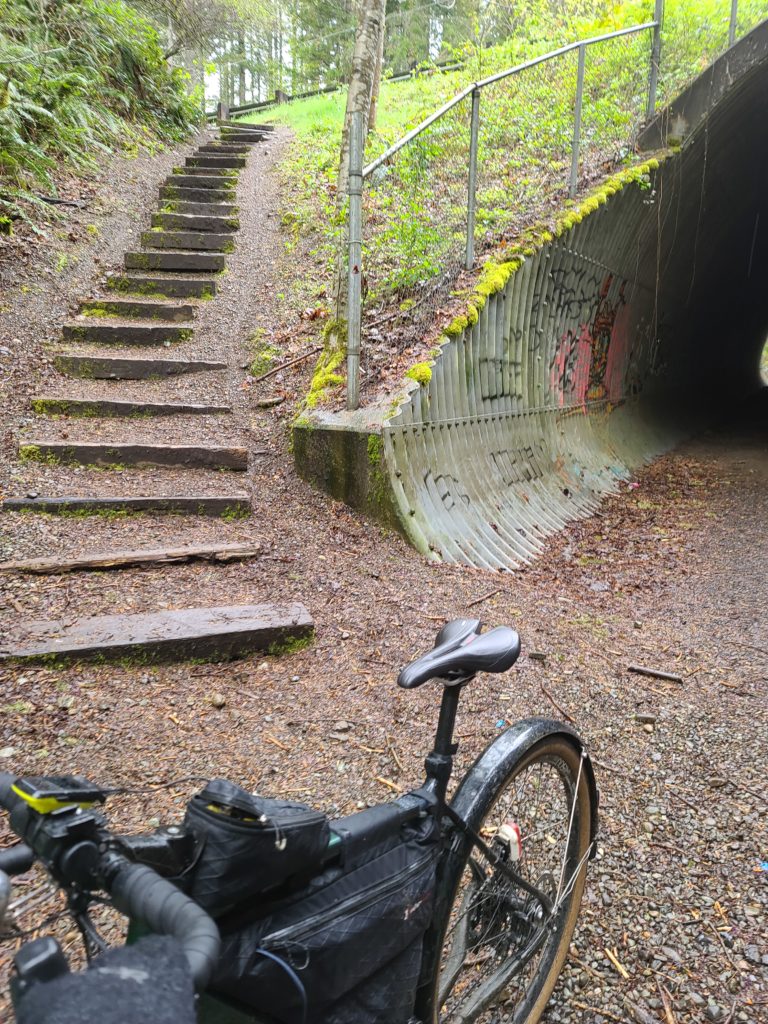
The route directs you through the tunnel then takes the stairs up (best option), then left on Tokul Rd.

The route goes through Snoqualmie then North Bend, so stock up where necessary as there are no services for 30 miles after North Bend.  Just after North Bend there is construction on North Bend Way where the shoulder is closed. If you are from the area and know what you are doing, the alternative route is to take the Snoqualmie Trail by taking a left on Thrasher at the Forest Service office and then a right onto the Snoqualmie Trail (gravel), then a left back on North Bend Way.

The climb up to Middle Fork is spectacular. Hopefully the sun comes out for you all on this stretch as this has some of the best views on the entire route! Take caution as there are a couple steel grates about 4 km before the turnaround and also on the return. The info is at the Garfield Ledges trailhead, just past the bridge over the Middle Fork Snoqualmie River.

When returning to North Bend, you could take the Snoqualmie Valley Trail back into North Bend. The bakery in North Bend is the best bakery around!!

When you leave North Bend, the route goes on the Snoqualmie Valley Trail until the golf course and comes into the town of the Snoqualmie the back way. After Snoqualmie, you will climb up Snoqualmie Ridge (along the Snoqualmie Ridge trail-parallels Snoqualmie Ridge Parkway). The info at the Chevron is where all the Alps permanents climb up Lake Alice Rd, where on this 600, you will get to descend down this…but not all the way down!! You will need to take a sharp left turn onto the Preston-Snoqualmie Trail.

The Preston-Snoqualmie trail has some steep gravel switchbacks that is highly recommended to walk your bike down…at least I didJ

Take special caution crossing Preston-Falls City Road at the crosswalk, a very busy road! If you need services, you might want to stop in Preston, as the route avoids all services in Issaquah.  After Preston you will follow the Preston-Issaquah Trail, paralleling I-90 then descend into Issaquah.

Issaquah-Hobart Rd becomes other road names south to Ravensdale and to Black Diamond. About 4k after the Black Diamond control, you will take the Green to Cedar (gravel) trail all the way down to the Cedar River Trail, which will take you all the way into Renton. We took the most direct route through Renton then will be on the East Rail Trail for about 2k, but once you get to the Seahawks training building, the East Rail Trail is still under construction and the route goes on Lake Washington Blvd and trail. You will then take the I-90 trail that will go over the brand new Factoria bike bridge.

After the bridge, you will go down underneath this same bike bridge and also I-90 to go through Bellevue and avoids the 36th. This is the final climb up and over into Redmond.

Please text me when you depart the 2nd day and also when you arrive in Black Diamond so I know approximately when you will be finishing.  For those that finish in the normal hours, PostDoc Brewery is right nearby Redmond Inn that has food truck until about 7pm and still serves beer until 10pm. When Vinny and I prerode the 300k (on May 1st), everything was closed after midnight in Redmond, but found the IHOP in Bellevue open 24 hours. But keep an eye on the services hours as closing hours may change.

Note: All controls are info controls!

These are the changes we made from the 2019 Chuckacamano Middle Fork version:

·         Starts up Paradise Lake Rd

·         Deleted Chuckanut trail option,

·         Goes to Lake Samish and not to Lake Whatcom where the 400k goes,

·         Turns off SR9 onto N Fruitdale into Sedro Woolley and goes through less busy roads in Burlington and Mount Vernon instead of staying on SR9,

·         Returns down into Woodinville and takes the Sammamish River trail into Redmond for the overnight

·         Rerouted the more direct way through Renton

·         Rerouted onto Lake Washington Trail since the East Rail Trail since it is under construction (north of the Seahawks training building)

·         Takes the new bike bridge over Factoria and also goes under I-90 to avoid 36th

Comments Off on Brevet Week 600k Pre-ride Report

Filed under Brevets, Pre Rides, SIR Rides

Mossyrock 200K Pre-Ride Report

[Pre-ride report by John Pearch and Josh Morse]

While everyone else was battling headwinds or flooded roads up north, John Pearch and Josh Morse prerode the Mossyrock 200k with very little rain and no flooded roads.
This route differs slightly from the permanent route (#801) — the brevet takes a more direct route back to Centralia, turning north on Jackson Hwy at 135K. This brevet route was last ridden in 2010 and has about 4600 feet of climbing.

This brevet starts at Olympia Coffee Roasters in downtown Olympia, taking Capitol Blvd/Old Hwy 99 to Tenino.

We chose a great place for control in Centralia — The Station: Coffee Bar and Bistro. Best French Toast Mochas!

Stock up in Centrailia because there is nothing but hills (no services) until you arrive in Mossyrock. Centrailia to Mossyrock is about 55K with 2200 feet of gain. Centrailia-Alpha Road never stops giving.

There are great views of the Mayfield Reservoir while crossing the Tilton River and Cowlitz River bridges.

After Mossyrock there are rollers along Spencer and Jackson Hwy. Enjoy the great views of the Cowlitz River! It’s about 40K from Mossyrock to Mary’s Corner. Services include an on-route Chevron. If you’re trying to avoid gas station services, Avenue Espresso has great breakfast burritos.

Once you get back to Centralia it’s the traditional flat stretch taking you back home to Olympia.

Areas to be extra attentive:

  • Caution in the railroad tunnel on Hwy 99 at 17.9K and crossing railroad tracks at 18.5K.
  • Heading south out of Centrailia watch for traffic as you make your way from Hwy 507 to the control and then across the RR tracks.
  • On Gold St in both directions there are seams in the road that could catch a tire.
  • Mossyrock to Salkum is on Hwy 12 with fast moving traffic but mostly a very nice shoulder for a highway.
  • There is the bridge crossing Mayfield Lake with no shoulder so check behind you before entering and use caution.
  • Northbound as you leave downtown Chehalis on National (becomes Kresky) there is a brief section of road with no shoulder — there is a concrete curb and then a wall. We rode through here at dusk and traffic was not bad but this area and the old pavement deserve some extra attention.
  • The transition from Kresky to Gold in Centralia requires you to take the left lane to follow the turn to Gold.
  • Northbound on our ride it was just after sunset and dark with a fair amount of traffic on Main St and then Harrison.
  • There are good bike lane through the busiest part of town but there can be a lot of traffic so stay visible and alert.
  • It was very dark on the side of the road from Centralia up to Grand Mound with a fair number of cars.
  • Good lighting will be very helpful if you are here after dark.
  • From Grand Mound north to Olympia we saw only a handful of cars to the finish.

Fingers crossed for tailwinds!

Comments Off on Mossyrock 200K Pre-Ride Report

Filed under Brevets, Pre Rides, SIR Rides

Factoria 100K Pre-ride Report

[Pre-ride report by Mark Thomas]

Yesterday, Jan, Rick, Vinny, and I scouted out the route for Saturday’s 100k. I’d like to say that we took the rain bullet for the ride, but it seems that mother nature has more ammunition.

We made a couple changes from the route previously posted on RideWithGPS. Those are now reflected at the same link (https://ridewithgps.com/routes/31749069). Here are a few notes.

  • Early in the route, there is some construction work along the trail, but we had no trouble getting through. I think I saw a post warning of some work on the trail at around 5km that may cause short delays, but we were able to just ride around the vehicles parked in the trail.
  • At km 13, there is an info control. The referenced sign is on the north-east corner of the intersection of Shattuck Ave and Airport Way at the stop light.
  • From km 31-32, we made a route change to eliminate the walk up a muddy trail covered with blackberry vines leading to a cafe that no longer exists (at least not under the name in the old route). Some quick instructions: As you head down toward Maple Valley, stay on the trail under SR-18 overpasses, pass through a tunnel, and ride to a bridge over the Cedar River. The information control question is at the beginning of the bridge. This is also the turnaround point. After the U-turn, proceed back through the tunnel and under the freeway again. Just past the freeway, there is a gravel parking lot on the left side of the trail. About even with the north end of that parking lot, you’ll see some posts on the right. Go through those to get to Maxwell Road.
  • There are a couple of options to re-stock at the mid-point of the ride. At about 41.1km, just after the left turn onto Issaquah-Hobart Road, there is a convenience store end an espresso stand on the left side. Or at km 49.1, just after crossing busy Front Street, there is a convenience store on the right. Note that all of the controls on the ride are information controls, so if you need to restock, you’ll need to do it outside of a control.
  • Just past that, you need to turn from Gilman Road to the East Lake Sammamish Trail. You either need to hop over the curb at the start of the trail or turn onto the sidewalk at the driveway right before the trail (as on cue sheet). If you reach the crosswalk traffic light, you’ve missed it.
  • Recent rains resulted in a mudslide on the trail somewhere around km 56. The trail is closed. There is a trail closed sign just after where the trail crosses SE33rd St. The revised route turns right on SE 33rd to get up to East Lake Sammamish Parkway. This is a bit awkward, because you go up a short pitch and then need to stop and cross the busy parkway to turn left. Be careful. More information is available here: https://content.govdelivery.com/accounts/WAKING/bulletins/273c9fe
  • Once past the detour, the easiest navigation is to continue on East Lake Sammamish Parkway to the light at NE 65th and go into Marymoor that way. But if you feel comfortable finding your way back to the trail after the closure, that’s ok too. Just be aware that on at least part of the trail, they have just dumped a bunch of new gravel and it’s deep and loose. Ugh.
  • At the end of the route, around km105, there is a lot of construction. It’s work on a new flyover for bikes to get past the awful factoria intersection, so they’re doing it for us! We were able to get around on the right side even without a shoulder, but at some point after the Honda dealership, we crossed over and used the sidewalk on the south side.

Have fun,
Mark Thomas

Comments Off on Factoria 100K Pre-ride Report

Filed under Brevets, Pre Rides, SIR Rides, Uncategorized

Iron Horse Unpopulaire Pre-ride Report


By Bill Gobie

Pre-riders: Bill Gobie, Jason Hansen, Keith Moore


Bright morning sun and a half hour spent inside a warm bakery mislead yours truly into underdressing at the start. After a quick stop to add clothing the pre-ride got underway in earnest. The air was very cold, and continued to be cold all the way to the tunnel. While the Iron Horse Trail’s location on the shady north-facing side of the valley makes the trail very pleasant on a hot summer day, on a cold fall day the trail is cold, period.

At the start the course follows paved streets in North Bend for a few blocks, then turns on to gravel and remains on gravel for more than 50 km, all the way to Hyak. The return is on pavement, very hard dirt, and gravel. In all there is 76 km of gravel, 10 km of hard dirt, and the balance pavement.

We rolled up the trail without mishap, this dog with his prize stick notwithstanding.

The trail is used by horseback riders. If you encounter a horse, do not ring your bell! Bells can startle horses. Call out, ask the rider for permission to pass. Some riders will want to turn their horses to face you.

There were a fair number of people using the trail. If the weather is nice on the day of the ride, expect to encounter a goodly number of hikers taking advantage of the nice conditions. There may also be families with small children on bikes.

We got some welcome sunshine crossing the big trestles. The climbing areas near the trestles were lightly populated. Be aware people belaying climbers are paying full attention to their friends up on the rock. Give them lots of warning and pass slowly.

The portable toilets had been removed from the climbing areas. Three pit toilets are available on the trail, at Alice Creek Campground, Carter Creek Campground, and at the west end of the tunnel. On the east side of the tunnel Hyak has heated restrooms. These are all noted on the route sheet.

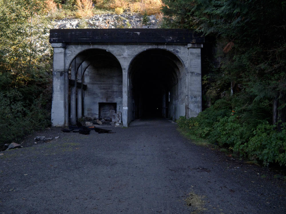
If you’ve not been to the Snoqualmie tunnel, it is a surprisingly long way up the trail. But eventually you arrive. Since the day was cold, we did not find the interior of the tunnel significantly colder. There were a few spots dripping water from the ceiling with small puddles beneath. The surface was generally very hard, although bumpy in a few places.

The tunnel is close to the parking area at Hyak. You will almost certainly encounter pedestrians in the tunnel. Most have lights, although somehow some people are able to make their way through without any lights. Virtually none wear reflective clothing nor do any have tail lights. Distance can be hard to judge, so approach pedestrians cautiously.

When we popped out of the tunnel on the Hyak side the air was significantly warmer and we had lots of nice sunshine. Hyak has a restroom building with heated restrooms. There is a water spigot on the west side of the building (nearest the tunnel).

Continuing on the trail we saw lots of foliage putting on its fall colors. Will the show last until the ride day? You will have to ride to find out!

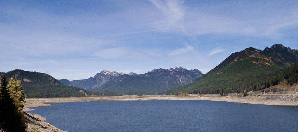
The turnaround point is at a large interpretive sign. The views are great from here (see picture at the top). We had a second look at the fall colors on the way back to Hyak.

From Hyak the route takes the frontage road alongside I-90, passing the ski areas. The second-steepest climbing on the route occurs here. The control at the Summit Deli/Chevron marks the high point of the route. Since this control comes after nearly 60 km of unbroken climbing, it is untimed – you are not required to reach this point within four hours elapsed time. However, if you are over four hours, don’t dally here. You will be able to make up time on the descent, but you don’t want to have to be a daredevil.

A little way from the control the route turns left onto the original pass road, Forest Service Road 58, and begins a splendid descent. On a nice day the day-use areas along Road 58 will be busy. Be aware there may be uphill car traffic around every bend and curve. Around one hairpin I encountered a car making a three-point turn, entirely blocking the road. There are a few metal plates in the road. If it has rained within the last several days the shady portions of the road may still be wet. In some places we could see moss was beginning to regrow on the road.

The fast plunge through the forest eventually ends. The route crosses I-90 and turns onto Tinkham Rd. There is an enormous hole at this turn, 43.7 mi/70.1 km!

As usual, Tinkham Rd has numerous potholes. It will be a good idea for groups to spread out on Tinkham so everyone has a clear view of the pothole fields.

Tinkham has two fixed hazards, a wooden bridge with a gap down the center at 46.6 mi/75.0 km, and a large grate resembling a diagonal cattle guard spanning the entire road at 48.6 mi /78.2 km. These are noted on the route sheet.

After Tinkham there is a 2.4 mile noisy downhill run on I-90 to the next exit. The shoulder is wide but covered with debris. Ride carefully.

Exiting onto Homestead Valley Rd you will regain peace and quiet. From Homestead the route rejoins the Iron Horse Trail, but you have to work to do so! The steepest climbing on the route occurs on this short pitch. From there the rest of the ride is all downhill and then nearly level into North Bend.

To find the exit from the trail look for a building with a chain link fence topped with barbed wire. At the start of the ride the cue sheet prompts you to look at this fence as you pass it. From there it’s a minute or two to the ride finish at The Pour House.

Comments Off on Iron Horse Unpopulaire Pre-ride Report

Filed under Pre Rides, SIR Rides

R5000 1000K Pre-ride Report – September 14, 2019

by John Pearch


No 1000k is easy, regardless of the accumulative elevation gain. The SIR 2019 Fall 1000k has about 17,300 ft of climbing (according to Strava), but the hard part is really about navigation! Even if you are from Seattle, ask yourself, have you ever rode the Snohomish Interurban or other trails in the dark? Even if you are familiar with all the trails and turns in the dark, it is still highly suggested you have a GPS. But if you plan just using a cuesheet, reviewing the RWGPS links is essential before the ride!

Thanks to Geoff Swarts, a new route was created and approved by RUSA. Vinny and I pre-rode this past weekend and found many changes to the cuesheet.  We made many changes to the route immediately after the pre-ride. We decided to take out on the 3rd day the Green River Trail and also the control in South Park. The alternative is to go up to Kapowsin before Orting. We also modified the course to go over Montlake Blvd Bridge instead of 24th, that will be closed this weekend; this is on the 1st and 3rd days.
The Redmond Inn is very generous and a bike friendly atmosphere. They have a great breakfast during normal business hours and dry breakfast food after hours (before 6am).
The 1st Day is 407k that goes north of Redmond to essentially Bellingham and back. The route follows familiar back roads to Paradise Lake climb, however the route descends down the Snohomish a different way instead of Broadway, so watch for the right turn on Downs Rd! After getting to Snohomish you’ll take the Centennial Trail to Lake McMurray store for the first control. Then descend to Conway and follow the I5 corridor through Mt Vernon. Then eventually Chuckanut Dr to Fairhaven/ Bellingham for a control. After returning on Chuckanut you’ll go to LaConner open control…we chose Stompin Grounds Coffee, they have the best latte milkshakes!! You’ll then go back over the Skagit on Fir Island then further south to Stanwood. After getting through a few busy intersections, the route then goes through Marysville that has some quiet city streets. After turning right off Sunnyside onto WA-204, be cautious of crossing the on ramp for US-2! Immediately after this you’ll make a right on 20th (under the US-2 bridge) and get in the left shoulder. Bikes are OK in the left shoulder so ignore the Do Not Enter signs—just don’t ride on the right side of the the road as this is an off ramp!! You’ll be down under and between both US-2 bridges still staying in this left shoulder until the there is another Do Not Enter sign. Caution taking a right turn, as exiting traffic does not stop!
After you take a left on Home Acres Rd, you’ll go right on 43rd and go up the bike path ramp onto a the US-2 bridge and cross over the Snohomish River into Everett. There is an INFO control at McDonald’s in Everett at the Colby/41st intersection. Kitty-corner to the McDonald’s is the Interurban Trail where you will continue on for the next 18 miles. The Snohomish Interurban Trail is full of adjoining feeder trails and also follow along city streets. We did our best to get as many details or landmarks as possible. But if your using a cuesheet and get off course, I would try and pull up Google Maps and find your way to Lake Ballinger station (info control).
After the info you’ll make a left a left on 76th and go over the I-5 pedestrian bridge and eventually descend to Lake Forest Park, where you will then get on the Burke Gilman Trail. This is a lot more straight forward trail that takes you all the way into Seattle and UW. I  didn’t want to waste time in U Village so I went to the 76/Circle K on 25th. You’ll need to go over the Montlake Blvd pedestrian bridge at Husky Stadium then take the sidewalk along Montlake until you cross over 520, as the 24th Ave bridge will be closed starting this weekend!
You’ll start finding some climbing gears through the next few miles through the Montlake and Madrona ‘hoods. This has a lot of quiet city street turns that will keep you awake, watching for the signs or diligently following your GPS track for the next turn! After a short cruise on Lake Washington Blvd, you’ll climb up 50th Ave hill into the Seward Park neighborhood and  eventually to Renton. There are services in Renton, so it is advised to stock up here as there may not be anything open in until Issaquah. The Shell was closed for me in Maple Valley when I got there long past midnight. The Cedar River Trail is a nice grade up to the Info at Maxwell Rd.  A few rollers on Maxwell and you’ll be descending all the way back to Issaquah.  In Issaquah, you’ll get on the East Lake Sammamish Trail that has a compact gravel section for a few miles then turns back to pavement. The ELST goes straight to the Redmond Inn.
Day 2 is 352k and the most scenic day.  This has some rolling hills after Snohomish, including the DuBuque Rd (aka 2 Pukes Rd;), on the way to Granite Falls. Granite Falls is an open control (you can choose any location to get your card signed), but we always go to the McDonalds/Chevron on the far side of town as it’s a traditional control on Cascade 1200. If you are lucky you might get a tailwind on Hwy 530 to Darrington.  Stock up in Darrington as there are no services on route for 95k until Mt Vernon. But if you are desperate, at the turn S Skagit Hwy turnoff, you can go over the Skagit River into Concrete that is about 1.3 miles one way (off route). There are a couple steel grate bridges going over the Sauk River. There is also an Info on the South Skagit Hwy at the Day Creek  Fire Station. The 600k mark is somewhere on the S Skagit Hwy, so you will start to gain additional time and have time to get some dinner in Mt Vernon. There is a 24 hr Denny’s and Safeway on the east side of I-5 on E College Way. Rexville (Info control) closes at 6pm but only few more miles, there is a 76 station  open 24 hrs in Conway (on east side of I-5). The last part of the day 3 are the climbs up to Lake McMurray and Centennial Trail and also up Broadway. There is a 7-11 in Arlington and Snohomish  open 24 hrs.  Once you climb up Broadway you’ll descend back similar roads as on the 1st day into Redmond.
Day 3 is about 247k starts off on East Lake Samamish Trail to Issaquah. You’ll climb about 1400 ft in 20 miles up Issaquah Hobart Rd and up Kent Kangley Rd to the Info on Kanasket Kangley Rd.  The store in Cumberland is an SIR classic control. Once you get south to Enumclaw and Buckley, the route starts descending. At South Prairie you’ll get on the Foothills trail for a few miles then will exit the trail (just after the Carbon River bridge) onto Hwy 162 and up  to Kapowsin Control on Orville Rd then return back down to Orting.  Kapowin store or tavern are open until 10pm. Orting McDonald’s is open until midnight and Safeway is open until 1am.  After Orting you’ll continue on the Foothills trail into Sumner and eventually onto the Sumner Link Trail. Although, you will exit the Sumner Link Trail at 16th and follow city streets in Pacific until you get to the Interurban Trail. For those not from the area, this is King County Interurban and not associated with the one you were on in the 1st day.  You’ll take the Interurban all the way to Renton. There are some 24 hr services along the Interurban in Kent and Tukwilla.
You’ll eventually go north along Lake Washington Blvd and find the Seahawks training building at an info. There is an unpaved trail just beyond the Info that will eventually join the  Lake Washington Loop (paved) trail, that you take to I-90. The I-90 trail for those that haven’t been on it starts immediately beneath the I-90 bridge. There is a steep bridge you’ll need to climb up and over (aka “THE CHILD”). Then eventually loop down and up over the Lake Washington to Mercer Island. There is an Info on Mercer Island at N Mercer Way. There is also a QFC open 24hr slightly off course on 80th Ave SE.  You’ll eventually cross over the I-90 bridge over Lake Washington. On the far side Irving St is extremely steep to get up to Lake Washington Blvd. You’ll find similar roads as the 1st day up over to UW and will take the Burke Gilman Trail all the way to Lake Forest Park (Info). Then eventually get on the Sammamish River Trail all the way back to Redmond Inn.
The big thunderstorm of the century hit me right when I was having dinner in Mt Vernon. So I just went next door and got a room in the Quality Inn and got a couple hours of sleep, until the storm passed over.  I was so glad I made good time in the first 650k, which gave me 4 hours to spare in Mt Vernon. Thank you to everyone offering me a ride, but it was good to keep going and finish this ride since the storm had completely passed over by midnight.  The storm actually allowed me to get some sleep a lot earlier, otherwise I would have had to ride all night, a 100k further in Redmond. This was my 16th 1000k finish!
Thanks to  Geoff,Vinny, and Mark for developing this great route.
Good luck to everyone riding! See you all at the overnight control in Redmond!
Additional ride details and links to RWGPS on seattlerando.org.

Comments Off on R5000 1000K Pre-ride Report – September 14, 2019

Filed under Pre Rides, SIR Rides

2019 Tune-Up 300 Pre-Ride Report

By Jun Tay, John Nguyen, Kelly White and Mitch Ishihara


View of Mt. Rainier from WA-410 in Enumclaw

The SIR 2019 Tune-up 300 starts this Saturday, July 27 at 6 AM. Please note check in opens at 5:30 and closes at 6:30 AM.

Anciens recommend a PBP Tune-Up ride practicing efficient controls with a goal of finishing in under 15 hours. So, test out those legs and practice keeping control stops brief, even while many mountain views lure you off the saddle for selfies and scenic background photos. In addition to the tune-up for your fitness and shake-down for your bike, it would be hard to find a more beautiful ride.

The route begins and ends in the parking lot between Shari’s Cafe and Pies and the Quality Inn in Renton to dovetail with the Tune-Up 200 (on Sunday, July 28). It follows mostly familiar routes around Mt. Rainier through south King, Pierce and Lewis counties, with a few surprises thrown in for good measure. We ride through the renowned Western Washington locations of Renton, Cedar River Trail, Maple Valley, Black Diamond, Enumclaw, Greenwater, Gilford Pinchot National Forest, Cayuse Pass, Packwood, Ashford, Elbe, Eatonville, Kapowsin, Orting, Sumner, Pacific, Algona, Interurban Trail, Auburn, Kent, and Tukwila. The ride is self-supported, but there are plenty of services available along the way with a little bit planning ahead of time—see the volunteers’ pre-ride experience below.

Parking

We rode the pre-ride on Sunday July 21 and parked at the Renton Community Center which is across from (and a little bit south of) Shari’s. However, signage indicates that there is a six-hour time limit and the Renton Community Center is open to reserved events on Saturdays according to the website. Online reviews suggest the parking lot can get packed. We recommend not parking here.

Update: We recommend you do not park at the Cedar River trail head.

The City of Renton Cedar River Trail website notes the following parking locations: Cedar River Trail Park, Renton Memorial Stadium, Renton Senior Activity Center, Liberty Park, Cedar River Park, Riverview Park, Maplewood Roadside Park, Ron Regis Park and at Landsburg.

Some additional suggestions for parking can be found here: https://www.rentonriverdays.org/directions-parking/

Renton is also a relatively short ride from Seattle, Bellevue, Sammamish or Issaquah, so local riders may enjoy extending their day with “transport stages” rather than deal with parking.

Out-of-towners staying at the Quality Inn in Renton might ask the hotel about parking during their stay.

The Pre-Ride

Renton to Cedar River Trail to Maple Valley

Just after sunrise, four volunteers enthusiastically gathered at the start as shown in the photo below. For the pre-ride, the weather forecast promised sunny and warm weather, 84°F (28.8°C) in Seattle, in contrast to the cooler and rainy weather in early July. However, if we look a bit rigid and uptight in the photo, maybe that’s because we were awakened by 44°F (6.66°C) summer morning air. The Cedar River Valley is one of those places where the cool air seems to sink in and hang about. One of the volunteers wished he’d brought his base layer and arm warmers. [Ed’s note: No prize for guessing.]

Our intrepid pre-riders: Kelly White, Jun Tay, John D Nguyen, Mitch Ishihara

After navigating under and around gates through Cedar River Park, and a few minutes of searching around for the Cedar River Trail, we headed toward Maple Valley. A light morning dew greeted us before any mountain views.

The nice and pleasant, cool summer morning air warmed up a few degrees before we turned right, uphill, and the paved trail gave way to 3.3 miles of compact dirt and gravel along Lake Wilderness. At the end of the gravel trail, and after a couple turns, we traveled another small stretch of loose gravel prior to a right turn onto WA-169 S/Maple Valley Black Diamond Rd SE (at mile point 15.2). That about concludes the gravel for this brevet!

Maple Valley to Black Diamond to Enumclaw

Proceeding to Enumclaw, elevation gain trends up imperceptibly with one dip and subsequent climb crossing over the Green River Gorge. We noted several SIR-grade food services found along the stretch of WA-169 for those in need—like Jun and Kelly, who made a quick bathroom/food stop at McDonald’s where they were surprised by the nicest bathroom they have seen on any brevet—otherwise we kept moving.

That is, until we spotted this almost perfectly lined up view of Mt. Rainier:

Followed by this…

“Views of the massive and glorious hulk of Mt Rainier will inspire you as you work your way south in the cool of the morning.”—Kelly

Enumclaw to Greenwater

After turning left onto Griffin Avenue in Enumclaw (at mile point 26.2), we noted a few food services were open near the intersection of Griffin Avenue and Roosevelt Avenue (WA-410) such as 76 station, Safeway and McDonald’s.

After turning left on WA-410, not a cloud in sight could be seen, as shown in the background of the photo below. We didn’t stop to check out Enumclaw Ski & Mountain Sports (bicycle gear?) in the foreground since it was not open yet.


As you leave Enumclaw, a highway sign shows 40 miles to Cayuse pass, the first of two big hills of the day. Over the next 18 miles, we climbed from an elevation of 760 feet to 1,700 feet (+1,360 feet / -420 feet), working our way up to Cayuse Pass. We all regrouped at the Greenwater Control where we practiced PBP control skills: A brief stop to get the brevet cards signed, then refuel, bathroom break, back on the road.


A few hundred yards ahead of the general store is Greenwater Outfitters Café and Snowboard Shop, a tempting control option for those who love coffee and prefer warm food to refrigerated sandwiches. We didn’t stop to check the place out—we were practicing quick controls—though looking at their menu now (https://www.greenwateroutfitters.net/deli), maybe we should have.

Leaving Greenwater, we looked forward to getting to the summit of Cayuse pass before the heat of the day really kicked in. Depending on the temperature forecast for the brevet, consider bringing along a 3rd water bottle, as the next full services won’t be until Packwood, 46 miles and quite some climbing away.

For those keeping your total elevation for the day, the gain thus far is probably 2,700 feet.

Greenwater to Gilford Pinchot National Forest/Cayuse Pass to Packwood

It is 46.5 miles between Greenwater and Packwood. This includes a 23 mile climb up to Cayuse Pass (+3,150 feet / -150 feet), including a 17 mile stretch of 1.4% average grade up to about the entrance of Mt. Rainier National Park at mile 59.5. For the next 10 miles be prepared for real climbing a 5.4% average grade and sections up to 7%. Traffic was unpleasantly heavy; fortunately, speeds are low and drivers mostly polite. On the right there will be a couple of breathtaking views of Mt. Rainier, stop to take some pictures, catch your breath and hydrate.

With the heat of the day kicking in—it would eventually rise to at least 98.6°F (37°C)—Kelly finished his water at the summit of Cayuse Pass. Jun Tay will staff a secret control here, and water and sodas will be provided to keep you well-hydrated. Leaving the summit with water bottles refilled, you’ll be pleased to note that the majority of the traffic continues on Highway 410 to Yakima while you will continue to the right on 123.

Stay right and enjoy the descent toward Packwood

You now have a 22-mile descent (mostly descending) to Packwood to enjoy. The first 10 miles is your big reward for the climb: a screaming descent where the main exercise will be for your forearm muscles from feathering your brakes. [Ed’s note: If you’re braking too much, try sitting up to catch more wind; it’ll slow you down some and help to spare your rims or rotors.] Enjoy it, but do remain attentive and cautious as cars will be moving quickly and there can be strong crosswinds.

The sunny approach to Packwood

Highway 123 joins highway 12 at mile 84. With 7 sunny miles to go to Packwood and services, Kelly suddenly noticed that his throat was dry and he was very thirsty. The heat of the day was really kicking in and while still descending, the 7 miles took some effort. What a relief to arrive at the Packwood Tatoosh Food Mart, air conditioning and ice cream bars! The temperature turned out to be 94°F (34°C)—and likely hotter on the pavement. Anyway, please top up your water bottles and get ready to work those ice cream calories off.

Packwood to Ashford to Elbe to Pack Forest

Cooled off, refueled and rehydrated, with sun sleeves and hats soaked with cold water, we set off on the 2nd big hill and last major challenge of the day: Skate Creek Road. This is the same route that was part of the Tahuya Hills 600k in June, but in the opposite direction. Thinking of that ride, we fondly recall descending Skate Creek road with its twists and turns. Ascending it, however, presented a different pleasure: climbing Skate Creek Road is among the prettiest rides we have enjoyed. A beautiful boulder strewn creek and shade, lots of shade. Given the heat of the day, that in and of itself made the climb.

From the top of Skate Creek, we made our way to Ashford, home to Mt Rainier climbing expeditions, where we settled in for a civilized meal of pizza, and for Kelly, a chicken sandwich with bacon and Swiss cheese on a gluten free bun (unheard of on a Rando ride!), all at the Base Camp Grill. From there it was mostly paceline work with John and Mitch doing the lion’s share of the effort. We made good time in spite of some significant headwinds.

Rando gourmet

As you arrive in Elbe, be extra careful getting thru a couple of bad railroad tracks depending when you get there. There was still plenty of daylight for us to watch out for those bad spots.

Orting to Renton

At this point, the pre-ride felt fairly uneventful with mostly small rollers as the climbing is pretty much done after about mile 150 (240km). The remainder of the ride included a surprising amount of bike trail, the highlight of which was the newer Foothills Trail connecting Orting to Puyllup. From Puyllup to Sumner, you’ll ride the Sumner Link Trail (plus a few roads).

Sunset over bike trail

And from Sumner to Tukwila, you can sit back and enjoy your ride to (very nearly) the finish via the famous Interurban trail. [Ed’s note: There’s an annoying detour in Kent as a section of the Interurban is closed until some time in 2020. But follow your cue sheet (or GPS) and you’ll be back on the quiet trail in no time.]

Doing the Interurban

From Tukwila back to Renton is just a few miles, including a return to Cedar River Park and those gates from the start. We rolled into Shari’s happy but beat from the heat. Tired but exhilarated. We’d say that is a perfect way to end a long day on the bike.

We will see you at the start this Saturday and wish you the best of luck and a safe ride!

Preregistration and route details on the SIR website: https://www.seattlerando.org/

Comments Off on 2019 Tune-Up 300 Pre-Ride Report

Filed under Pre Rides