Monthly Archives: February 2017

Spring Populaire – March 11, 2017


Artwork by Alice Stribling, San Francisco Randonneuers www.alicestribling.com

Start the 2017 season with our 100 km Populaire Ride!

Bring your friends, wives, husbands, boyfriends, or girlfriends (or both).

Come ride with us (for free) and find out what randonneuring is about. Show up a bit early: we’ll answer your questions and give you a few pointers to help you use the route sheet, as well. The ride will start and end in Seattle. Unlike many of our routes this really is an easy route. [Editor’s note: You hear assurances like this a lot, but, in this case, it’s true.]


Date:        March 11, 2017

Location:           Woodland Park Tennis Courts Parking Lot

Green Lake Way N at N 52nd St, Seattle WA 98103

Time:               Register, sign waiver 0815-0900

Ride Start:        0900 (really)

Ride Ends:         Zeek’s Pizza, 6000 Phinney Ave N, Seattle WA 98103

(It’s a 5 minute ride back to the park and it’s all down hill)

Register:           Online at www.seattlerandonneur.org  until March 9

                              Pre-registration helps the ride organizers plan the logistics.

Route: https://ridewithgps.com/routes/19202557 (There may be changes after the pre-ride, so check back close to the ride date for the most current route)

Questions:  Andy Speier: andy @ peakrescue.org

Membership:       Not required!

Lights:              Not required! [Editor’s note: Feel free to bring your lights. Please use in solid mode front and rear.]

Fenders:           Not required, but you’ll make more friends if you have them. [Editor’s note: Buddy flap = bonus points]

Tools:               This is an unsupported ride. You are expected to be able to be self-sufficient in the event you get a flat tire or need to  perform a routine repair on your bicycle.

The Route:         This is a new route. We are trying to encourage and recruit new members, so we tried to bypass the truly nasty hills of previous years. We have removed the longer, confusing section of the Interurban Trail.  This is a fun ride! You will need to pay attention to the cue sheet. There are great views of the sound and the Olympic Mountains. You’ll ride west to Golden Gardens, follow a bit of the Interurban Trail North, enjoy a delightful descent down Perkins Way, zip along the Burke Gilman out to the Sammamish Trail to Redmond, and then head back to Seattle with the inevitable climb back up to the top of Phinney Ridge. Finish is at Zeeks Pizza.

Food:               We will provide coffee and snacks at the start of the ride. At the halfway point Control in Redmond there is a Peet’s Coffee, a Whole Foods and several other commercial food places in the shopping center.


Comments Off on Spring Populaire – March 11, 2017

Filed under SIR Rides

WTS # 8 – Carol’s Century 2/25/2017

Starting at 8 am on Saturday, Feb. 25, this is the final and longest ride in our eight-part Winter Training Series.

The Greater Seattle Century (GSC) was the first century (101 miles) ever ridden by Ralph & Carol in the mid-1990’s.  Designed by Carol (hence Carol’s Century), the route takes you on a wide clockwise circle around Seattle with a variety of terrain with many flat stretches interrupted by a few steep hills. We start by heading north along the Burke-Gilman Trail to Bothell, then along mostly quiet backcountry roads through Woodinville, Maltby, Carnation, Fall City, Issaquah and Maple Valley. The GSC then follows the Cedar River Trail to Renton and returns to Magnuson Park via Seward Park, Lake Washington Blvd. and the Burke Gilman Trail.

There is a total of approximately 3,400 feet elevation gain from beginning to end.

Please help out the Ride Leaders by Pre-Registering at: https://www.cascade.org/node/39538

Comments Off on WTS # 8 – Carol’s Century 2/25/2017

Filed under SIR Rides

WTS #7 Conway-Fairhaven-Chuckanut-Edison 2/18/17

Go North young men and women!

Winter training series # 7 Starts in Conway, parking along Dike Rd.  We start at 9:00 AM. Sign up on line on the Cascade website and I will check the box for you when you arrive. Print out your own personalized cue sheet from Ride With GPS: https://ridewithgps.com/routes/17840307

Same route as before, East to Hwy 9 then North and west across to Chuckanut and south through the farming towns of Bow and Edison.

So far 20% chance of showers.

Coffee and eating in Edison or Bow and then there is the Conway Pub and Eatery for acres ride dining.

-Noel Howes

Comments Off on WTS #7 Conway-Fairhaven-Chuckanut-Edison 2/18/17

Filed under SIR Rides

WTS 6: Kent-Dash & Brown Pts-Black Diamond – February 11, 2017

Hello Randonneurs!

All ready for some nicer weather? Looks like we may get some this Saturday, 2/11.

Come on down for our next training ride. No bothersome paperwork – just riding.

Remember that Soos Creek start won’t accommodate enough cars so we request you park at Kentridge School, 0.5 miles away.

Ralph has rerouted to avoid Green Valley Rd. Closure – his alternate route has an intriguing (on street view at least) climb that I have not done. He also calls out a fine looking espresso establishment in place of the BD Bakery.

RwGPS: https://ridewithgps.com/routes/18026610

Print out your own custom cue sheet – sign in on the Cascade site and I can just put a tick mark by your name when you arrive at the start: http://www.cascade.org/node/39536

Did I say “no paperwork”?

-Noel Howes

Comments Off on WTS 6: Kent-Dash & Brown Pts-Black Diamond – February 11, 2017

Filed under Other Rides, SIR Rides

PCH Randonneurs Five Rivers 300k

A trip and ride report by Andy Speier with a few comments from Jeff Loomis

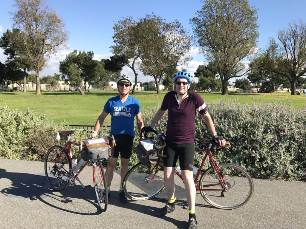
Andy (L) and Jeff (R) enjoy some sunshine.

The opportunity to ride 300 km in weather above 40 degrees sounded good. After riding several sub-40 degree rides in January, I was in need of some re-warming. The flat 5 Rivers 300 out of Corona sounded like it would do the trick. I sent out an email to my local guys and Jeff responded back. Yes, he would love to get a 300 in early in the season but did not want to sacrifice a day off from work. Ok. Less than ideal, but, with a flight out of Seattle at 5:00 P.M., we could do it and be in bed by before midnight. With an 0600 start we could get 5 hours of sleep. More than an overnight control. Perfect.

As with all plans, they started to crumble a bit on the day of the departure. Alaska Airlines alerted us to a delay of 45 minutes. As the day progressed, it became 90 minutes. No harm done. We arrived and waited for our rental car. Jeff had spoken to me at length about the advantage of using Avis and being a “Preferred Member,” so I have reserved a car and enrolled in their program. There is only one Avis guy on duty. A family of 8 is working through the details of their reservation with 4 children running around. The insurance liability conversation seems to go on forever. Jeff is lecturing me on the virtues of the Preferred member status and that I have not attained that designation. [Jeff:  Unfortunately this is an accurate accounting.]  At one point a second clerk appears and he inquires whether any of us are Preferred Members. I say I am. He asks if my name is Chappman. It is not, so he calls the next person in line. When it is my turn, he asks to see my ID, hands me a car key and calls the next person. Apparently, I am in the club. They are just a bit less organized at John Wayne Airport.

Our transportation is an SUV that swallows up our bikes and bags with room to spare. Off to Corona. A 27-29 minute drive on 55 and 91. There is some mention of a toll road, but it is now 11:30 at night. Traffic is flowing quite well. Off we go. After about 10 minutes the traffic slows and then STOPS. Jeff consults his mobile app. There seems to be a long red line. How long? Very long. I will spare you the details: our 29 minute drive becomes 2 hours. Wow. We arrive at the hotel at 1:30. The bad news is there is only one bed. The good news is that it is a king and there is plenty of room.

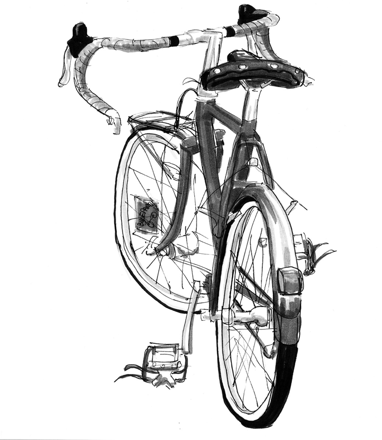
Now the fun stuff: build up the bikes. My bike is done in an hour. Jeff finishes soon after. [Jeff:  We made the decision to go fender-free because it is California and it speeds the assembly/disassembly process.]  I am in bed by 2:45. Jeff by 3:00. Up at 0500. 2 hours in bed. Yes, this is a 300 with an overnight control.

Morning upon us, we check in with Terry, the ride organizer, at 0530. There are around 14 participants. Nearly all from the LA and San Diego area. Michelle has flown in from Minnesota. The CA folks are bundled up. Jeff and I not so much. It is 54 degrees at the start. Within the hour we will be stripped down to short sleeve wool jerseys, shorts and fingerless gloves. At one point sunglasses are critical to being able to see. [Jeff:  We received many comments during the day about our lack of clothing.]

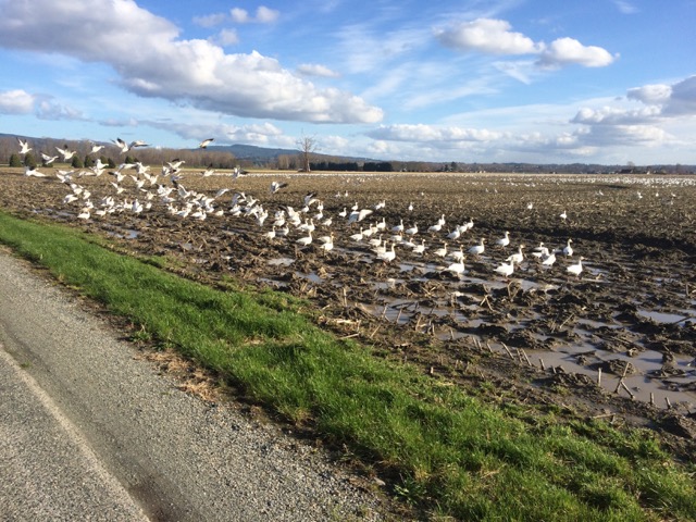
The route is 80 percent on paved bike trails. Though there has been recent rain and local flooding,  there is little sign of this on the trails. [Jeff:  A few puddles early in the day make us briefly regret the lack of fenders.  Andy rides straight through some of these, having forgotten his bike is naked.] The trails mostly follow rivers, waterways and freeways. This would not be described as a beautiful cycling adventure on rural quiet roads. Often there is the sound of highway traffic. When not along a highway, the trails run alongside rivers and waterways. Most are empty or trickling and filled with debris along the sides. There is much garbage in the trees.  [Jeff:  many of the trails are bordering older neighborhoods that now appear to be low-income areas.  Interestingly, there are large clusters of shacks and paddocks housing horses right here in the city.]

I did this ride last year and saw several homeless tent sites. This year there are tent cities along the trail. Most of these we pass by during daylight hours. There are large cities under the overpasses and at night this will resemble a scene from a Mad Max movie. The good news is that there appear to be several bike repair / replacement shops within the cities. Enter at your own peril.

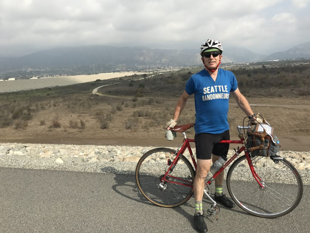
Andy on top of the Santa Fe Dam

[Jeff:  Heading into Long Beach we chat with a new randonneur from the area.  He is interested in our bikes and has clearly been reading Bicycle Quarterly.  A new recruit!  Andy has much to share…  A bit later Andy is stopped to answer nature’s call and a guy riding the other way on the trail sees our bikes and asks if we are on the Five Rivers ride!  It turns out he has ridden in in a previous year.  He offered to take our photo (at top of post.)]

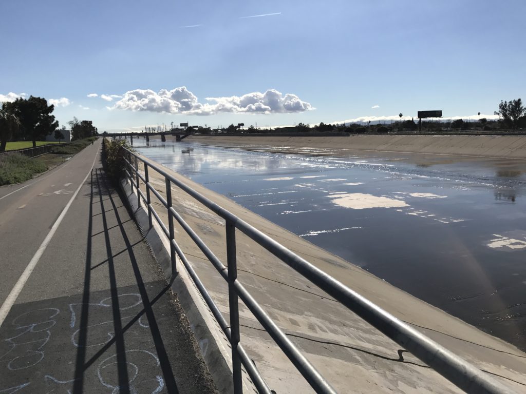
Across the River from Compton LA River and bike path

[Jeff:  Near this point we also pass a small convoy of mini-bikes and maybe one full-on motorcycle riding the other way on the bike path!]

We hit the Pacific Coast Highway and cycle through towns of Sunset, Seal Beach and Huntington Beach. There is an option to ride the bike trail along the coast and that is a blast. A bit slower than the highway, but it is the beach. The ocean. Waves. Did I mention we were cycling in shorts? Though it becomes windy, it is not a blow in your face knock you down wind, and we are quite happy. It has got to be one of the flattest 300 routes you will find. Terry has done an awesome job of linking up the various trails.

Between the route sheet and Jeff’s ride with GPS app, we get around quite well. We, of course, blow a couple of turns in the dark and add a few bonus miles here and there. “No flats or mechanicals,” I’m thinking as we are 6 km from the finish, topping the hill on a bike trail with a small group of randos. I hear something fall off my bike, but write it off to a stick, as everything on my bike is packed up well. The bike is still functioning and we are beginning to descend. (Note to self: stop and check the bike.) Jeff notices that my chain has too much slack and that something is wrong. I continue to pedal thinking I am not in gear. Then it dawns on me. I stop and investigate and, sure enough, I have lost the lower rear derailleur jockey wheel. Hmmm. Not good. Jeff is upset. We are so close to the end.

I tell Jeff I’m going to go back to look for it. Jeff is skeptical. “You’ll never find it in the dark,” he tells me. [Jeff:  Andy reminds me I am a “naysayer.”  Guilty.]  We turn around and start to ascend the hill we just descended. My bike does not want to go up hill so I run up the hill. I pull out a spare light and begin searching. Found the jockey wheel. Ok. So far so good. How about the bolt? Found it. Jeff is shocked. So am I. Jeff looks for the bushing and side plates, but I’m good with what we found and re-assemble it. A bit of friction, but it actually works. I can use all the gears and I can stand up and pedal going uphill. The bonus is, on the way bac,k I find my spare gear cable and the hotel room key, which I  lost when getting my light out.

We are a couple of km from the finish when we come upon road construction. Road closed. The Police Officer gives us directions and, after climbing a fairly long multi-block hill, we check Google Maps directions: we are now 4 km from the finish. Nothing ever comes easy. At this point it is downhill and flat with more downhill. We arrive at the Best Western Hotel, but don’t know what room Terry is in. The hotel clerk is not allowed to tell me, so I ask him to call. Done. Room 116. Pizza and snacks are waiting. It is nearly 10:00 pm. Not as impressive as our finish just after 7:00 last year, but it was a comfortable 300 in good weather and company.

Back in our room, we take our bikes apart and, just after midnight, we are back in bed. Bikes packed with an afternoon flight, we are all set. Real sleep tonight.

We receive an alert from Alaska airlines of a flight delay. We arrive at the airport and it is delayed yet again. Again, a 90 minute delay. Such is life. If all goes well, we’ll land safely and be home by 6:00 tonight…

Whew!


1 Comment

Filed under Other Rides, SIR Members

Permanents: Known Road Closures

Road construction and natural disasters often close roads our permanents use. The permanents team tries to post information about these closures on the Detours page. Formerly we posted lists of affected routes… but that has proven to be too much work to maintain.

Going forward, we will post a general description of the closure, dates of the closure if known, and links to official web pages about the closure, if available.

We will suggest detours. However, if there are no viable detours, routes will be deactivated until the roads are reopened.

Link:  http://permanents.seattlerando.org/p/known-current-detours.html

The detours page is also linked on the Perminator “Find a Permanent” page, and in the approval email the Perminator sends when you register for a permanent.

The permanents team makes no guarantee that the list of closures is complete. Riders are always responsible for checking for closures before starting a ride. To help with this, the detours page has links to several county road conditions websites. Also, Google Maps in Traffic View will show closures Google knows about. You will need to zoom in several steps to make closures on secondary roads visible.

If you have other resources for checking closures, please share them in the comments below.

Comments Off on Permanents: Known Road Closures

Filed under Club Info, SIR Rides

The SIR Ride with GPS Club Account

by Bill Gobie

You may have noticed that SIR’s Ride with GPS routes are in the Seattle International Randonneurs club account. The club account gives SIR members some great benefits.

Even if you only have a free basic RwGPS account, SIR members can access RwGPS’ premium-level features for SIR brevets and permanents. These features are:

  • If you use the RwGPS mobile app on your phone you get:
    • Voice navigation – your phone speaks each cue.
    • Offline maps – you can download the route and required maps to your phone, then navigate in areas without cell coverage. You can navigate with your phone in airplane mode to save power and data usage.
  • If you use a gps that uses TCX files, you get advanced turn notifications, which has your gps alert you prior to arriving at a turn. The distance before turns is customizable.
  • If you use a Garmin Edge GPS, you can use the Write to Garmin function to load a route onto your Garmin.
  • You can use the PDF Maps and Cuesheets features to produce printed directions. Since randonneur events must provide a cuesheet, these features are not very important for SIR members.

How to join the club account

  1. First you need to have a personal Ride with GPS account. Go to: https://ridewithgps.com/ and sign up. You only need to sign up for a free account.
  2. Go to the SIR RwGPS club main page: https://ridewithgps.com/clubs/29-seattle-international-randonneurs. Click on “Apply to join” and fill out the form. The account administrator will check that you are an SIR member and approve your membership.
  3. Once you are approved, your personal RwGPS home page will list SIR under Clubs in the left sidebar.

How to use your club membership

  1. Log in to your personal RwGPS account.
  2. Click on the SIR club link in the left sidebar on your personal RwGPS account home page. You will be taken to the SIR Club page.
  3. Scroll down to the Route Library. You can sort the routes by clicking on the column headings. You can use the Filters to efficiently find a route. You can filter by:
    • Route name or permanent number
    • Tag. We try to tag all the routes as permanents or brevets, by distance, and year for brevets. There are other tags, too, which you will see on the popup menu.
    • Location. Location is the city or county where a route starts, as determined by RwGPS.
  4. You can go to a route by clicking on a link, for example, in an SIR brevet description page. To get the premium features make sure you are signed into the club account first.
  5. You should watch Ride with GPS’ video to see how to use the premium features, such as downloading a route to your phone. https://ridewithgps.com/help/club-benefits/


Comments Off on The SIR Ride with GPS Club Account

Filed under Club Info, Rando How-Tos

WTS 5: Auburn-Lake Tapps-Orting-Carbonado-Buckley Ride Saturday 2/4

The 5th ride in our 8 ride Winter Training Series is another of our favorites and has remained unchanged. This is a wonderful route that takes in Lake Tapps, Orting, Carbonado, Buckley and lots of great back roads in between. This is one of the most rural rides of the series.  No good coffee shops along this route, but there is a Java’s Angels espresso stand in Buckley at mile 48. Please help out the Ride Leaders by pre-registering at: https://www.cascade.org/node/39535

Click here for an introduction to the Winter Training Series, including a bit of history, how the rides are conducted and rider expectations.

When: Saturday, February 4, 2017

Time: Sign-in begins at 8:30am. To save time please pre-register at: https://www.cascade.org/node/39535
Ride announcements at 8:50am
The peloton rolls at 9:00am sharp.

Distance: 66 miles / Approx. 2750′ gain

Where: Auburn Fred Meyers – 801 Auburn Way N; Auburn, WA 98002

Directions to Start: Take 167 South from Renton. Take the 15th St NW exit and head east about 0.4 mile. Turn right on A Street at stop light. Go 0.2 mile to 10th St NE.  Look for parking lot around the corner on your right. Park in NW corner of the lot at corner of A St and 10th St away from the entrance to Fred Meyers.

See you rain or shine!

RideWithGPS(Track)


Click here for more about the 2017 Winter Training Series.

Comments Off on WTS 5: Auburn-Lake Tapps-Orting-Carbonado-Buckley Ride Saturday 2/4

Filed under Uncategorized