Author Archives: Bill Dussler

Spring 400K Notes

400 kilometers is a long ways, and you can see a lot. This ride will keep you interested as it hits many highlights on local roads. With 12,500 ft of climbing, this 400K has a little more elevation per mile than PBP, but the sawtooth profile is similar with endless short climbs and descents.

Parking

Parking is pretty restricted in Mukilteo- most on-street parking is at most 4hrs with no parking 2-4am. Nobody wants to find their car towed after finishing the ride. Be sure to allow time to find parking and ride down to the ferry.

By far the most convenient parking is at the pay lot across the street from Silver Cloud Hotel. There are plenty of spots and it’s a couple minutes from the ferry. It’s not cheap at $28 for 24 hours. If you’re staying at the Silver Cloud, parking there will be just as easy- check with the hotel. I did see on-street parking 4 miles up the hill by the YMCA (10601 47th Pl W, Mukilteo, WA 98275).

Rider checkin

We’ll check riders in beginning 05:15am at the Mukilteo ferry terminal, after the toll booth. Get your brevet card from a volunteer and get a sticker from another volunteer after passing the safety check (front and rear lights, reflective vest and ankle bands).

The ferry leaves at 06:00am. Once we arrive at Clinton, ride up the hill 1 kilometer to the P&R on the left at Deer Lake Rd behind the Post Office. We’ll finish checking in riders there, and start shortly afterwards for a 0630± start. The start will be open for an hour, in case you miss the 06:00 ferry.

The Route

We’ll start out on the leg- tenderizing hills of Whidbey Island with many water views. The Deception Pass bridge marks a change to the quiet roads of Swinomish Island to La Conner. It’s too early for the tulips on the Skagit Flats but there may be tailwinds to push you towards Chuckanut Drive on the way to Bellingham, the northern- most point of the route.

Riding south along Lake Whatcom on our way past Sedro Wooley, we’ll turn on to S Skagit Hwy for an 80K out-and-back to Concrete (wave to your fellow randonneurs going the other way!). We make our way to the Nakashima Barn and the Centennial Trail. Note: the gate at the Nakashima trailhead will be closed when most riders get there- you will need to go around it to access the trail. Exit the Centennial Trail on 60th St NE, 17km after the penultimate control in Arlington. The route through Ebey Slough beginning at km 388 can be confusing for riders who have not ridden it before- see this post for additional information. There’s one more hill on E Mukilteo Blvd before the finish at the Silver Cloud Hotel near the waterfront in Mukilteo.

Services

The route passes through many towns, and finding food should not be a problem. The last two controls at Concrete (278K) and Arlington (359K) are 24hr convenience stores.

Comments Off on Spring 400K Notes

Filed under Brevets, Uncategorized

Centennial Trail to Mukilteo

A Sleepy Randonneur’s Guide

The 2023 Spring 400K starts on Whidbey Island and finishes in Mukilteo. All riders will be riding the last 20K at night, many will be doing it well after midnight. There will be very little traffic because of this, but randonneurs navigating this for the first time can be confused with all the turns, one way streets, and road furniture. Becoming familiar with this beforehand will hopefully ease your way to the finish.

17K after the control in Arlington, leave the Centennial Trail by making a right on 60th St NE, one of the many cross streets on the trail. There is a sign on the trail calling out the 60th St intersection as well as a stop sign.

Quiet roads will take you through Lake Stevens, where you will turn right on SR-204 at km 384.5 and go down the hill to US-2. Stay on SR-204 past the onramp to US-2 continuing to the stop sign at 20th St SE. You will turn right on to 20th St SE- there is a bike lane on the left side of 20th St and it will look like you’re going the wrong way on this one-way street.

Stay in the bike lane to the left as it crosses a bridge over Ebey Slough

After the bridge at km 388.4, stay to the left as the road passes underneath the trestle.

At the next intersection (km 388.6) turn right then left to go under the trestle and get on the ‘right’ side of 20th St.

After a kilometer at the stop sign, turn left on Homeacres Rd

At the T intersection at km 390.6 turn right on 43rd Ave SE and the trail over the Snohomish River.

The trail ends at km 392.1 at Hewitt Ave. The route crosses Hewitt Ave to get on Chestnut St. The raised lane divider blocks direct access to Chestnut St. Your choices are to (A) continue on Hewitt Ave past the lane divider to turn on to Hewitt Ave or (B) use crosswalk to access Hewitt Ave past raised divider.

The route to Mukilteo is straightforward from here, passing through Everett to E Mukilteo Blvd and one last climb before the descent to the finish by the ferry terminal. You’re done!

Comments Off on Centennial Trail to Mukilteo

Filed under Brevets, Uncategorized

Arlington – Washington Pass 400K

Last Saturday (7/30), Mick set off on the Summer 400K pre-ride from the Best Western Arlington (3721 172nd St NE, Arlington). In short, this is a beautiful and challenging 400K (I know, all 400K’s are challenging), which will require planning to ensure riders have enough calories, electrolytes and water. Mick had two bottles and a camelback, and needed all of that capacity.

I’ll expand on this below, but here are the significant points where riders will have to opportunity to take on fluids and calories:
Darrington (55K)- store, restaurant
Marblemount (100K)- store, restaurant
Newhalem (123K)- water, toilets at Info Ctr
Colonial Creek (139K)- water, toilets in campground
Canyon Creek Trailhead (156K)- water, toilets (SIR staffed)
Washington Pass Overlook (191K)- water, toilets, snacks (SIR staffed)
Colonial Creek (242K)- water, toilets in campground
Newhalem (259K)- water, toilets at Info Ctr
Marblemount (282K)- store, restaurant

Concrete (310K)- store (10pm),  restaurant

Clear Lake (353K) Clear Lake Market (10:30pm), Evelyn’s Tavern (midnight)

Big Lake (362K) Big Lake Grocery (10:00pm)

The start takes us out on Smokey Pt. Blvd, and within 5K we’re on WA-530. There were wisps of fog still in the fields on our way to Oso and Darrington, and not much traffic at that hour. The store at the gas station in Darrington is at 55K, at the left turn to stay on WA-530, but some riders may choose to wait to refuel until Marblemount (100K, 100m off course).

It’s river grade climbing following the Skagit river to Newhalem, where everyone should stop to take on water for the climbing to follow. There will only be water available at the Info Ctr, the store there is closed.

After Newhalem, the climbing starts in earnest. Earlier in the day, much of the climb is shaded. Take advantage of the occasional waterfall close by the road to cool off! There will be water and toilets available at Colonial Creek Campground, 100m from entrance on either side of the road. We will also have water available at the Canyon Creek Trailhead, in a shaded gravel parking area.

The turnaround is at the Washington Pass Overlook. There are toilets, and it will be SIR- staffed with water and snacks. Mick arrived there with approximately 9 hours on the clock for his first half of the ride.

Riders should be able to make better time getting back to Marblemount, possibly stopping for water at Colonial Creek and/or Newhalem. All riders should find a couple choices for food and restaurants in Marblemount (282K) and Concrete (310K). 

In Concrete, we’ll take  Concrete- Sauk Valley Rd and S. Skagit Hwy, shadier and quieter alternatives to WA-20. Near Sedro Woolley, we’ll take WA-9 to the Nakashima Barn and the Centennial Trail back to Arlington. Note that most of the stores after Concrete close by 10 or 10:30.

The finish is back at the Best Western where cold beer and pizza will be waiting for you. I hope to see you at the 0500 start on 8/6! Registration is online here.

Comments Off on Arlington – Washington Pass 400K

Filed under Uncategorized

Event Registration Changes

Beginning with the Winter 200K on Feb 5, we’ve made some changes to the event registration process to (hopefully) make it easier for people to register. These are listed below.


1. Email verification: This requirement has been dropped (yay!!), so people will no longer need to respond to the verification email from SmartWaiver. The waiver already includes the event name and date so riders will not need to add this information, but but you will need to include all other required information 

2. Riders need to initial the waiver to confirm that they understand its terms. 

waiverInitial.png

3. You will need to click the ‘Register Now’ button twice. The first click will open the waiver in a new window or tab (you may need to allow your browser to open popup windows).

registerNow.png

Once you have completed the waiver, close the tab containing the waiver and click the ‘Register Now’ button again to proceed with the registration process.

The ClubExpress platform used by the club and the SmartWaiver product required by RUSA don’t always play well together, but we’ve added some programmatic duct tape to make the process a little easier. If you have any questions or problems with your registration, please send an email to webm…@seattlerando.org. Include as much information as possible (screenshot, device, browser) to help us understand the situation.

Comments Off on Event Registration Changes

Filed under Uncategorized

Summer Solstice 1000K Pre-ride Report

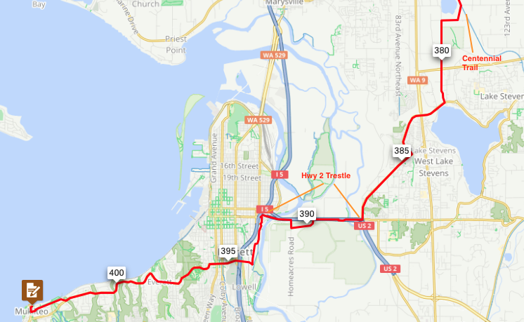
Ray Whitlock pre-rode the 1000K route, and provided this report. Registration closes next Wednesday, and you can register here.

I have 2 confessions to make. The first, I DNF’d this ride, not necessarily because of ride difficulty or because of medical or mechanical issues, but simply because the rain on Day 1 and for the last 5 hours of Day 2 was non-stop. The second is that I rode the days out of order. With the weather forecasting ½ inch of rain and temperatures in the low 40’s near Lake Quinault, there was no way I was going to ride a route with 30 miles of gravel and going through many areas with no cell coverage. They say that bad decisions make for good stories, but I wanted to survive to tell mine. The good news is that it appears I got the bad weather out of the way for you all and the forecast looks great for June 25 – June 28!

What follows is a daily account of what I found on the ride as if I had ridden it in the proper order. Since I couldn’t convince myself to ride an entire 300K in a downpour, I didn’t ride Day 3 but did drive most of the route and have a pretty good idea of what to expect. Well, except for the pit bulls. I also was able to ride the section of the Willapa Hills Trail that’s on Day 3’s route a couple weeks ago, so have first-hand knowledge of that section.

Day1 :

Heading out of town early in the morning, the route travels some normally busy roads. However, at 5:30 am, it will be no problem. Before you know it, you’re out of town and almost feel like you’re in the wilderness already. On a calm, misty morning, the sights along Mud Bay and Madrona Beach are gorgeous.

Highway 101 is a busy road but there’s a wide shoulder so no issues there. At approximately 8 miles from the Matlock Store, I was shocked out of my zone by a pit bull that came running out of his driveway unimpeded and headed straight for my left foot! It was all I could do to get unclipped and off my bike while nearly falling over to get my bike between me and the dog. I yelled at him to go home several times before he finally started doing so. As I started pedaling again, he once again gave chase. I yelled again and walked my bike for a while until I was certain he was back home, and I could outrun him if need be.

Your first opportunity for food and water comes at the Matlock Store ~37 miles from the start of the ride. The store doesn’t open until 8 am so if you’re fast, you may get there before they open. It may be worthwhile though as the next opportunity for water isn’t for another ~30 miles at Wynoochee Lake and your next opportunity for food isn’t for another ~70 miles at Lake Quinault.

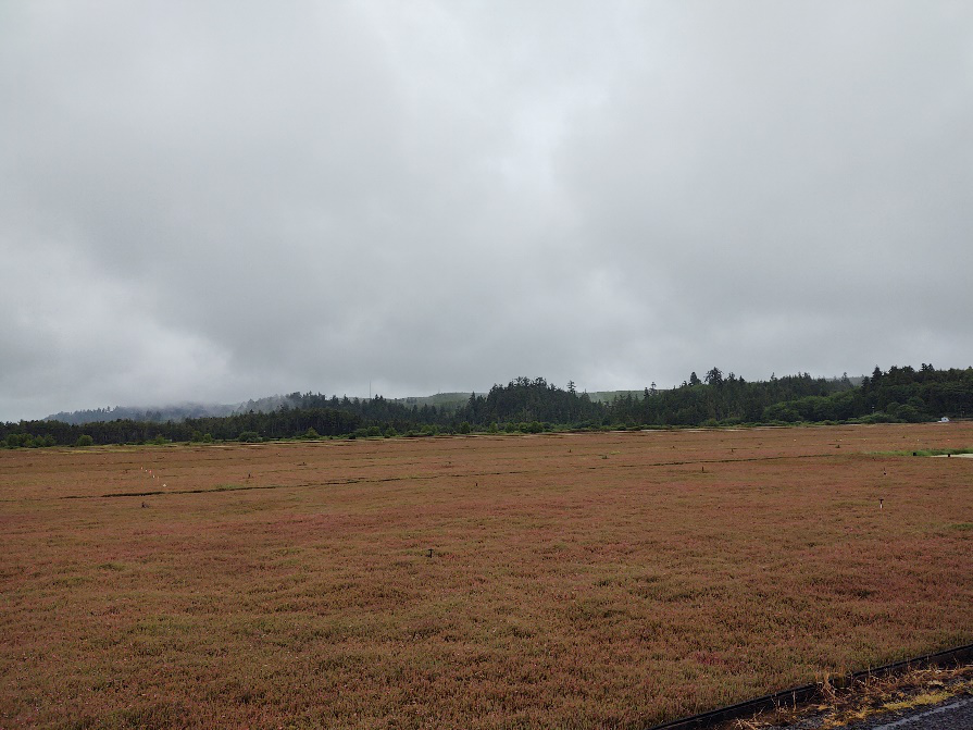
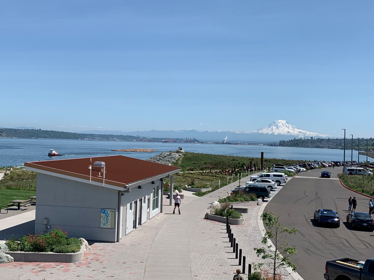
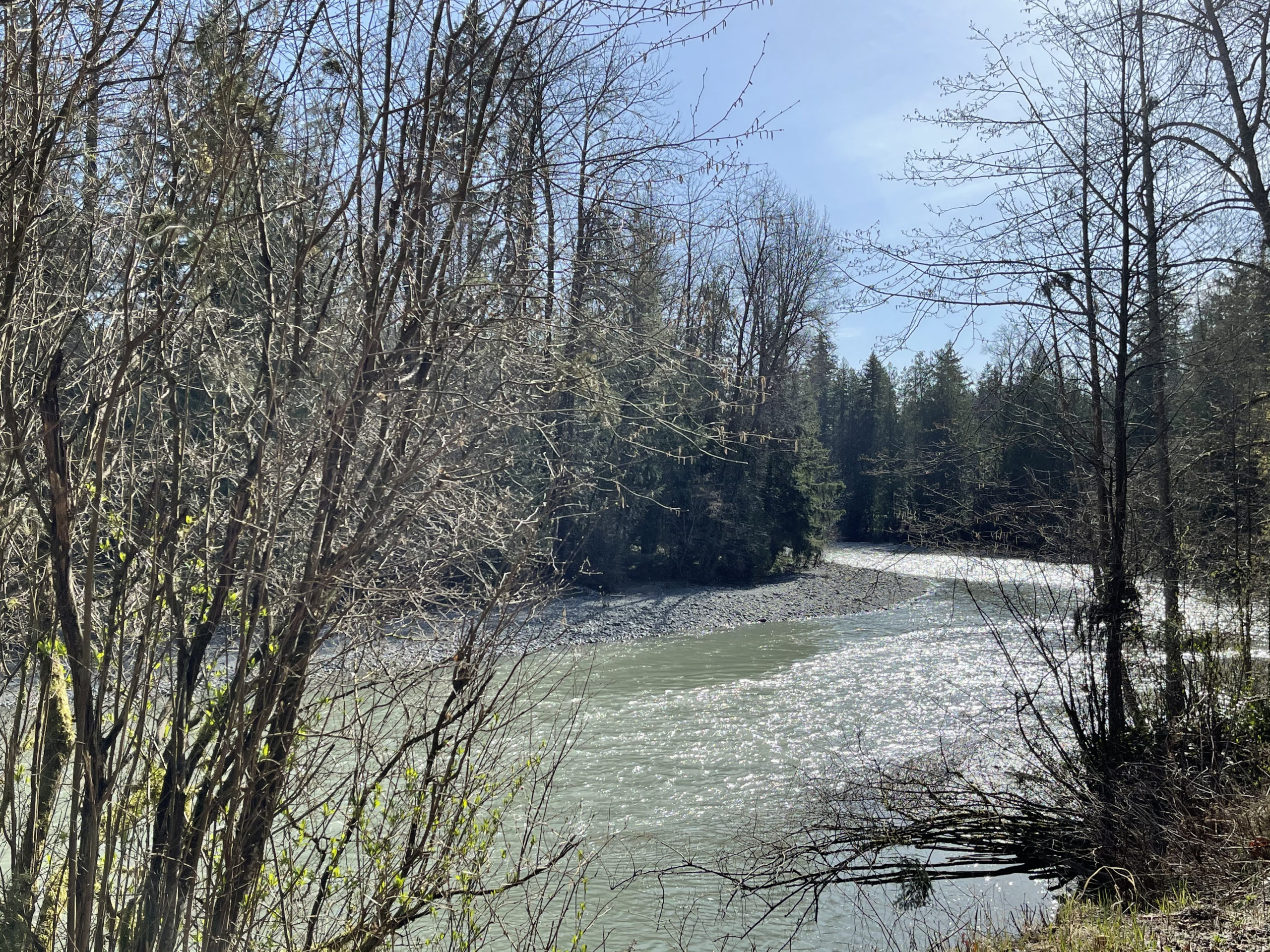
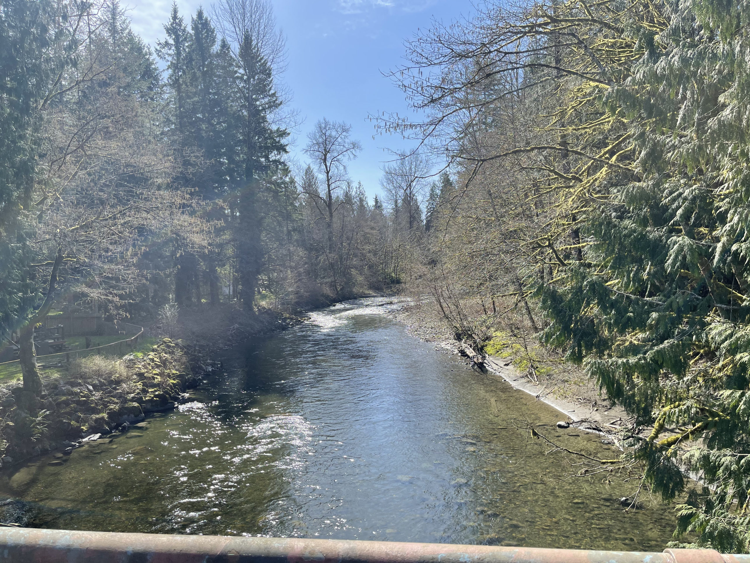
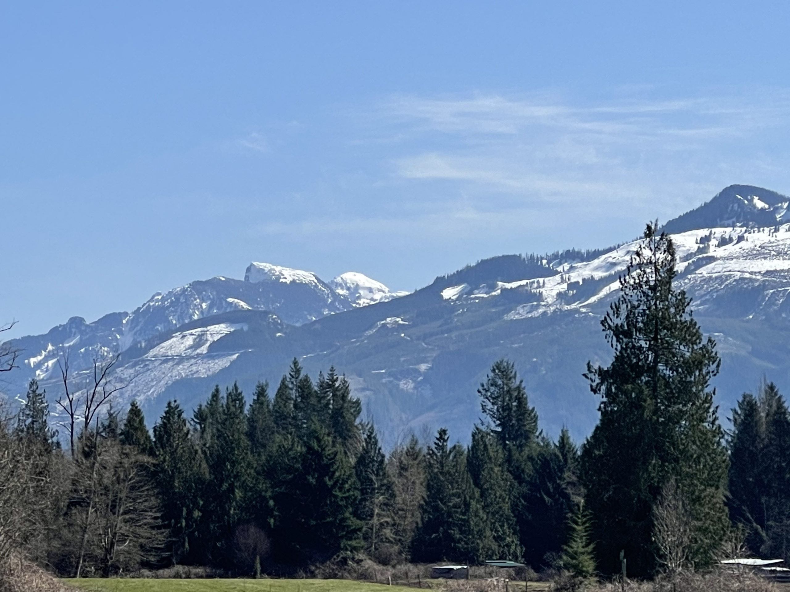
The section from Matlock to Wynoochee is straightforward. There’s a slow 2.5-mile section of gravel at mile 49, but I rode it on tubeless 28’s and didn’t have any issues. Turn right at mile 66.5 and you’ll have a nice descent on a beautiful paved road down to the Wynoochee Lake dam. Keep riding until you get to the signs indicating the campground and boat launch. I had some difficulty finding the boat launch, but if you veer right past the sign that says “Welcome to Coho Campground” and don’t enter Loop B of the campground, you will find a parking lot for boats, bathrooms and a steep, short downhill to the lake. The views are definitely worth it! Enjoy some lunch in the sunshine, fill up your water bottles and enjoy the spotless restrooms with running water.

Retrace your steps to get out of Wynoochee and turn right onto Forest Service Road 22/Donkey Creek Road. The gravel begins almost immediately and doesn’t stop completely for 14 miles. There’s a long stretch of gravel followed by a long stretch of pavement and then gravel and pavement interspersed with each other frequently. The gravel is in pretty good shape, but I did find myself riding on the wrong side of the road to find a good line. If you do this, beware that people camp along this road and you should expect vehicles. Stay alert, keep your headlight on and try not to do this on blind corners. I rode on 28’s but you may be able to go faster and be happier if you ride on 32’s or larger. Also, I had no Verizon cell service from Wynoochee all the way to Highway 101 so it may be a good idea to have a Spot or InReach GPS tracker with you on this ride in case you need help in this area.

Once you turn onto Highway 101, it’s 13 miles along this busy, but well-shouldered road to your next turn. The Lake Quinault area has 2 choices for food and beverages along the South Shore Road and 1 on the North Shore Road. It’s probably best to stock up as soon as you can as by now, as it’s been a long haul since Matlock. The Quinault Mercantile is open every day 8 AM – 8 PM. The road along the south side of the road is nice pavement for about 8 miles until you hit gravel. The gravel along the south side is buttery smooth, but the north side offers some bigger stuff along with some potholes.

I found that once I turned east onto the North Shore Road, both of my GPS devices were constantly alerting me that I was off route. Ignore the noise and keep riding. There’s only 1 road on this side of the lake so it would be difficult to be off route. Stop at the North Grocery (open 5 AM – 10 PM) and restock your supplies as it’s another 20 miles down to the Humptulips Grocery store for the next opportunity.

There’s nothing very exciting between here and the end of the ride, except for the fact that when I was entering the small town of Montesano, I had flashbacks of PBP 2019 as the entrance into town was slightly uphill with a church at the top! It was about then that I looked down at the road conditions and realized, nope, I’m not in France!

Day 2: Whereas Day 1 headed west to the Olympics, Day 2 takes us east to the Cascades and near Mt. Rainier. The day starts off heading south on less busier roads than days 1 or 3. You’re out of town before you know it with plenty of services along the way as you’re generally paralleling the west side of I-5 all the way down to Chehalis. Don’t miss the turn at mile 22.7 like I did! You really do take the I-5 South on ramp, but you don’t get onto I-5 as the road splits beforehand.

There is a nice couple mile long stretch of trail that parallels the road between Centralia and Chehalis which is a nice relief from riding on the road. Make sure you stock up in food and water once you get to Chehalis as the next opportunity to do isn’t for another 40 miles in Morton. Once you turn east out of Chehalis, it’s a long gradual climb out through Alpha and Cinebar with little traffic. Eventually, you parallel the Tilton River for several miles of beautiful riding through big forests.

In Morton, you’ll have to go off route south for about ½ mile to get to services at the Morton Country Market. However, I felt it was well worth it as they have everything you need including a hot food bar and a nice wood shed located right next to the entrance where I was able to sit and get out of the rain. For the rest of you, maybe you’ll need relief from the sun.

From Morton, you’ll continue on a nice stretch of road until you eventually hit Highway 12 which is a busy road but has a nice wide shoulder. The next opportunity for food and water is in Randle where you turn south to get off the highway. Now you’re back on pleasant and peaceful country roads with little traffic. That is, until you encounter the Pit Bull Challenge #2 along Cline Road at approximately 3.5 miles before you hit Bennett Road. I spotted this guy barking at me and running along the other side of the fence and didn’t think much of it as randonneurs encounter this all the time. You see the dog running but you know you’re safe because there’s a fence between you and him, so you blow him kisses or say sweet things like, “You’re such a good doggie”. Well, on this occasion, as I watched the good doggie running on the opposite side of the fence, I saw him disappear behind some trees and bushes temporarily until he got to the corner of his property where I thought the chase would end. To my shock and horror, he continued running as fast as ever but there didn’t appear to be a fence any longer! Next thing I knew, he was out on the road making a beeline toward my foot and it was déjà vu all over again trying not to fall over while fighting off this beast. He did eventually give up after a lot of yelling and walking of my bike and using it as a shield between him and I. On neither of these encounters did anyone at the homes of these good doggies appear or voice any kind of commands to their pets, so exercise caution as it may be a regular thing with all cyclists.

With my blood pumping, the next 6 or 7 miles along Bennett Road and Highway 12 into Packwood were a piece of cake. There are plenty of choices in Packwood for food and drink, but I chose the 76 station at Skate Creek Road as they have plenty of choices and there’s an info control there anyway. Stock up here because the next opportunity isn’t for another 25 miles in Ashford at the always friendly Suver’s General Store.

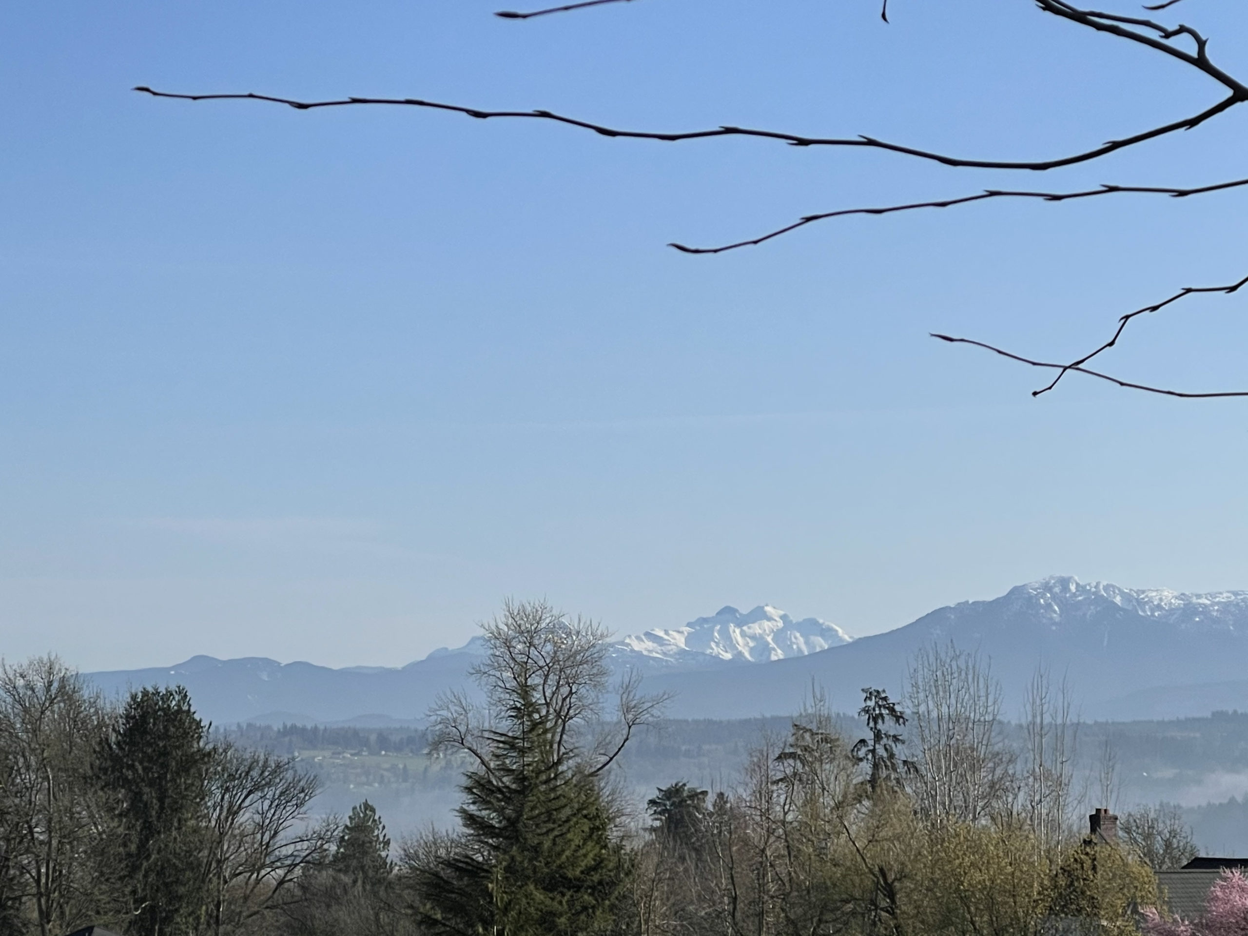
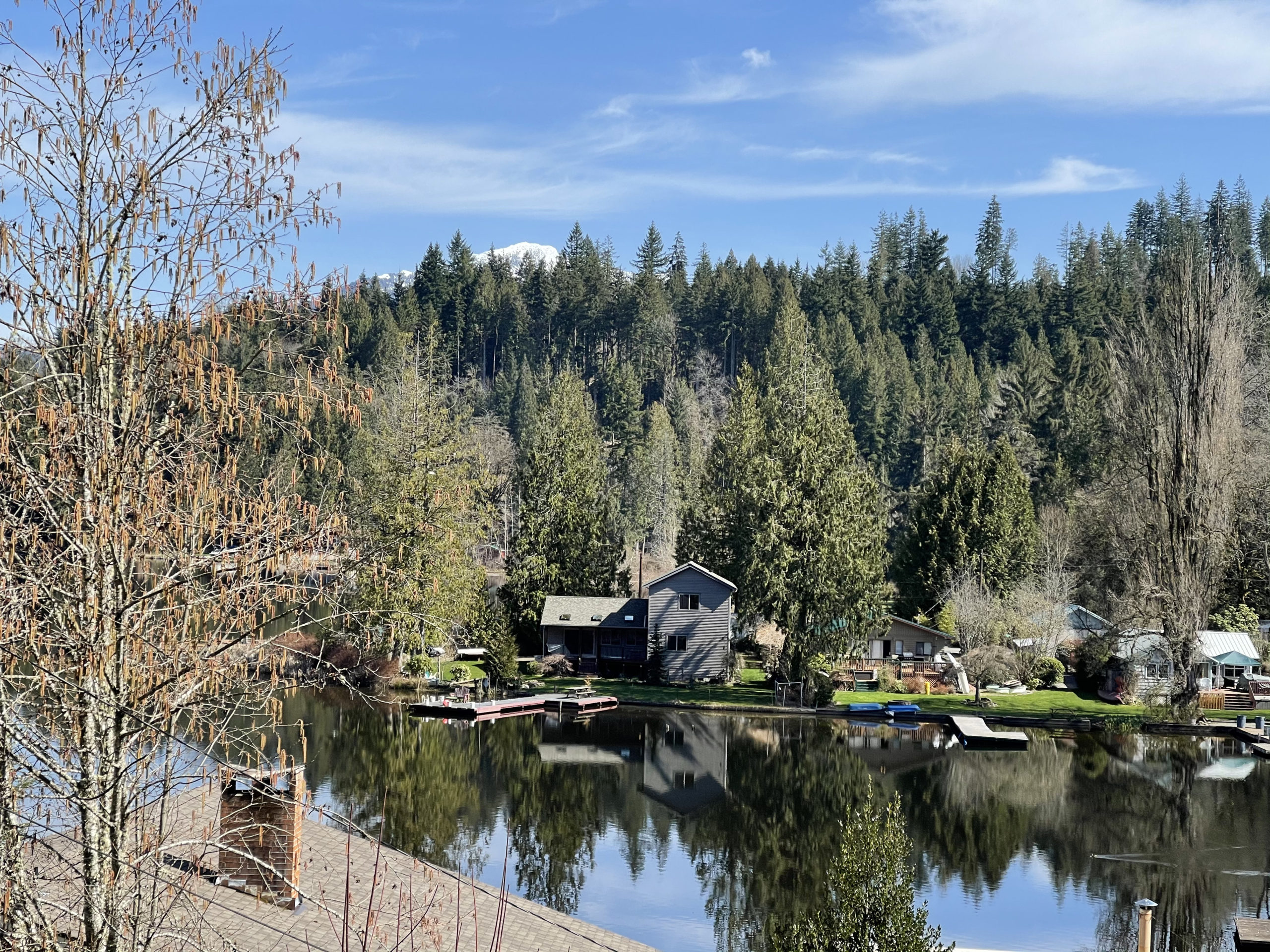
From there, it’s a beautiful ride up Skate Creek which is a 10- or 12-mile climb but it’s a nice, gradual incline coming from this side. The early Summer we had in May, followed by our most recent monsoons in June-uary have the greens of the forests and the whites of the gurgling creeks popping in a stunning array of colors. At the next stop of Ashford it’s a cruise along Highway 706 to Elbe where you join Highway 7. Beware of the railroad tracks both on your way into and out of Elbe as both sets are at treacherous angles to the road.

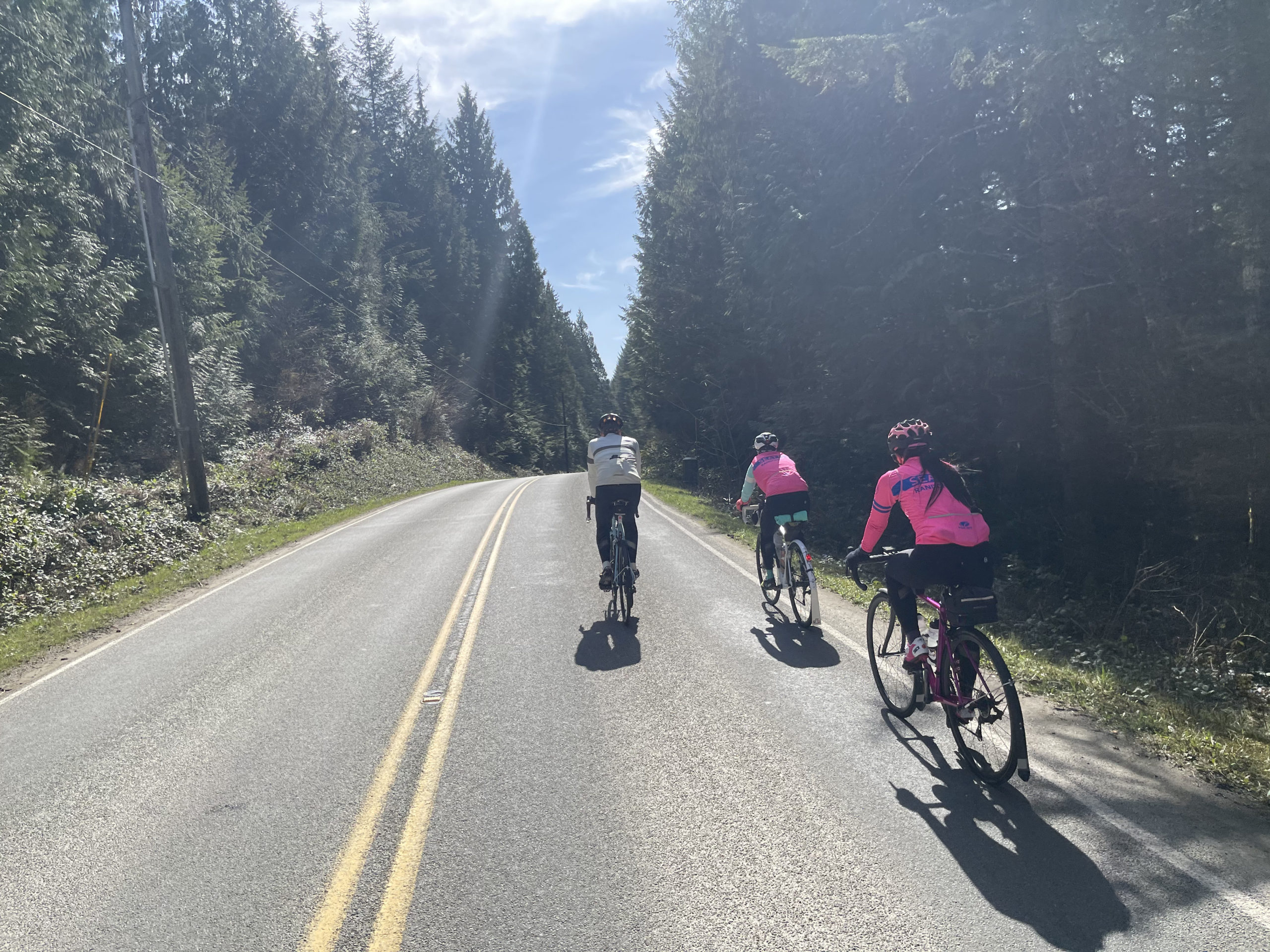
The next 10 miles of road are pretty busy with little to no shoulders in places. However, with it being a Saturday (instead of a Sunday when a lot of folks would be leaving Mt. Rainier) and the slow speed limits posted at some of the narrow, tight turns I think the traffic won’t be too much of a stress factor.

I must admit I really did not enjoy the 10 miles from Eatonville up to where you make the turn onto Kinsman Road. There’s a lot of traffic and once again, little to no shoulder in places. I did however find that most vehicles were courteous, and I don’t think I got honked at a single time. Make sure you have all your lights flashing and ride single file if you’re in a group.

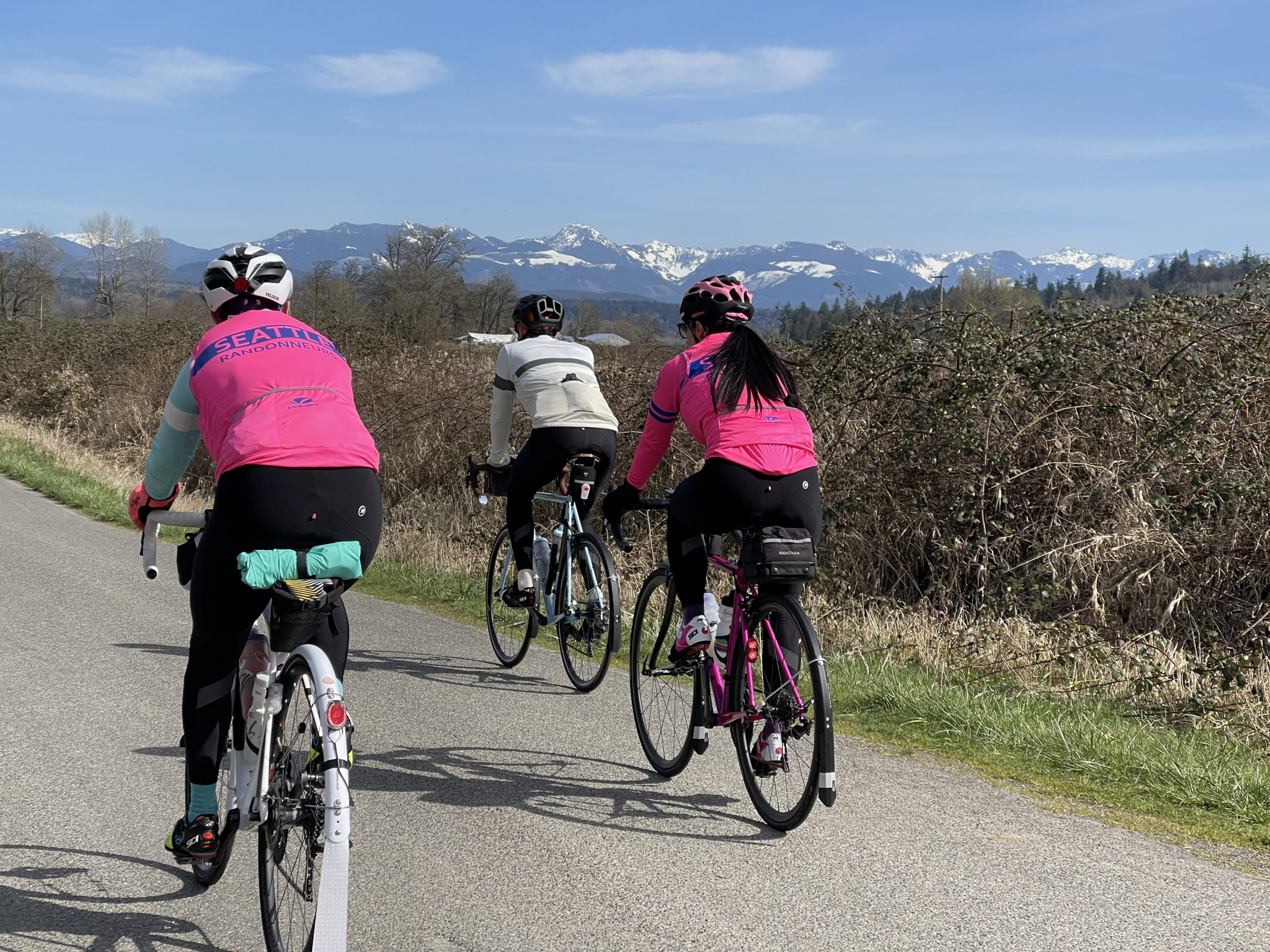
You get to enjoy some peaceful forested roads once again when you turn left at mile 168. Who knew that a military base could be so beautiful and tranquil? Highway 507 all the way down through Roy and McKenna will snap you out of your bliss as there’s a lot of traffic but good shoulders.

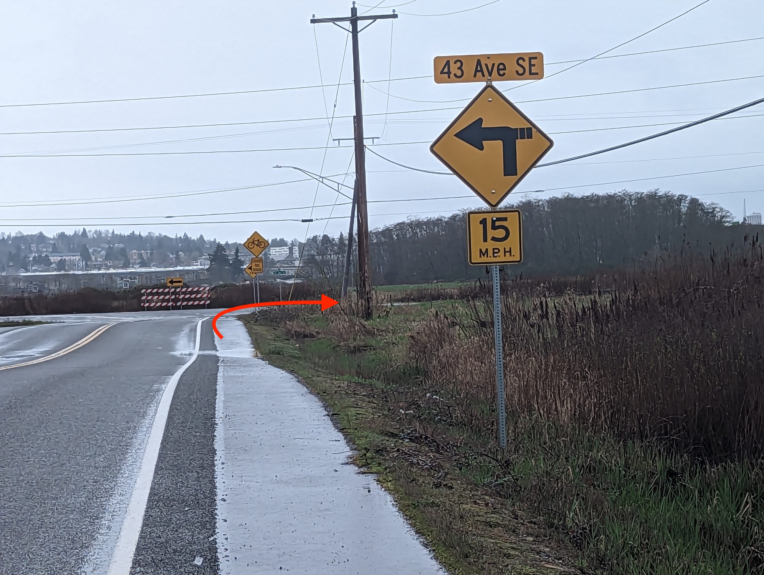
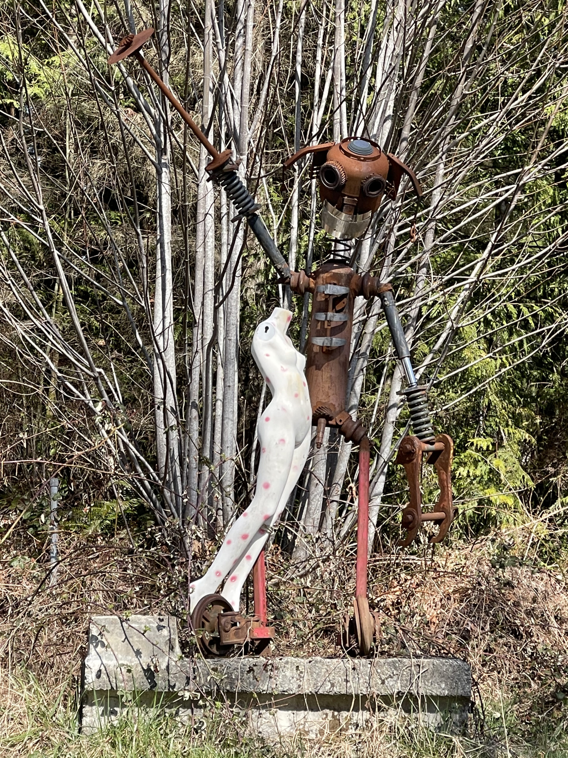
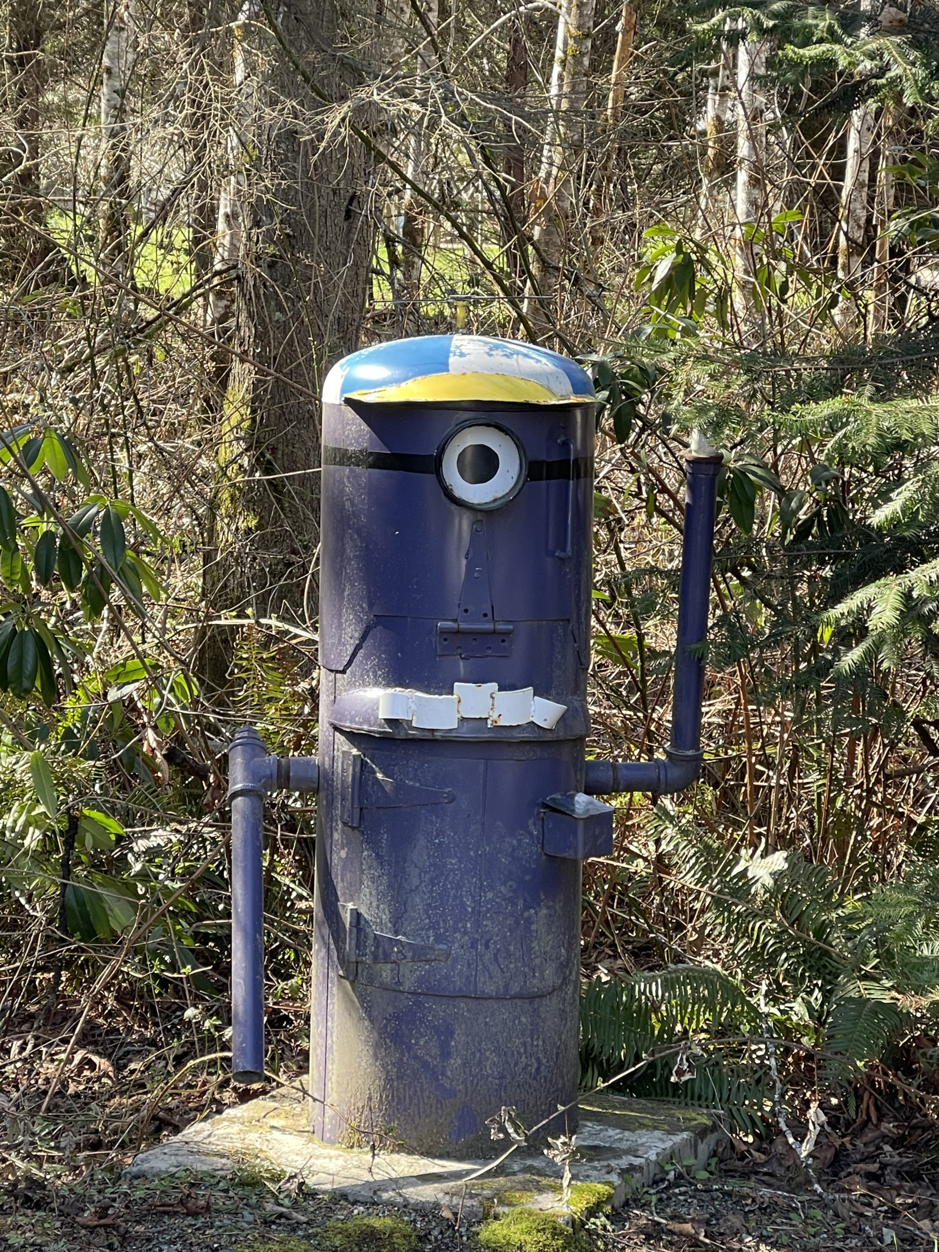
You pick up the bike path in Yelm for the next 13 miles. Enjoy being off the road for a while – you earned it! If you’re making good time and it’s still light outside, stop and enjoy the very funky and cool Monarch Sculpture Park. By now, you’re practically home, but don’t miss the turn on to Bonniewood Drive out near the airport as I did!

Once again, we’re heading west, but this time out to the Pacific Ocean instead of the Olympic Mountains. The road out of town takes a slightly different route than Day 1 due to RUSA rules. Early on a Sunday morning, it should be no problem. On this day, you take Highway 8 to go west. Again, a busy road with a wide shoulder. The first opportunity to restock your food and drinks is at McCleary, approximately 22 miles from the La Quinta. You’ll soon be following familiar roads, except that things look all turned around because on Day 1 you were traveling some of these roads in the opposite direction.

Stock up in Montesano because it may be a while longer for any other opportunities depending upon what you’re able to find in Cosmopolis and along the highway to Twin Harbors. Heading out of Montesano there are some narrow bridges and hills along Highway 7 but a good shoulder to ride on otherwise.

As you pull in to Cosmopolis up Blue Slough Road, make sure you take an immediate left onto 2nd to the left of the Cosmopolis sign as soon as you take a right on 1st. It comes up fast! Make your way to the trail adjacent to the yellow Lions Club building. There’s fountain water and honey buckets available.

You may get lucky and find some services open along Highway 105 on a tourist-filled Sunday afternoon. If not, enjoy the views of these lush forest and tidal landscapes. Just past the first Twin Harbors entrance, you’ll find a Shell station with a Subway sandwich shop on the right. Otherwise, the next entrance to Twin Harbors offers flush toilets and running water.

Once you enter Grayland (I’m starting to understand how it got its name), you get a nice reprieve from Highway 105 by turning onto some flat side roads through some very scenic cranberry bogs. Thank you, Ocean Spray! The next stop on this route offers some nice views of the ever-wild Pacific Ocean. If you hauled your surfboard with you, you may be able to curve some nice turns down there.

Further on up the road, Tokeland may offer some services at the casino or the 76 station. Otherwise, make your way down the coast to Raymond where there is a 76 station, a coffee shop, and a Dairy Queen. All are just a bit off route but probably worth it. The next opportunity isn’t for another 28 miles in Pe Ell.

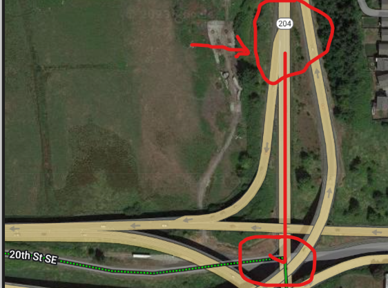
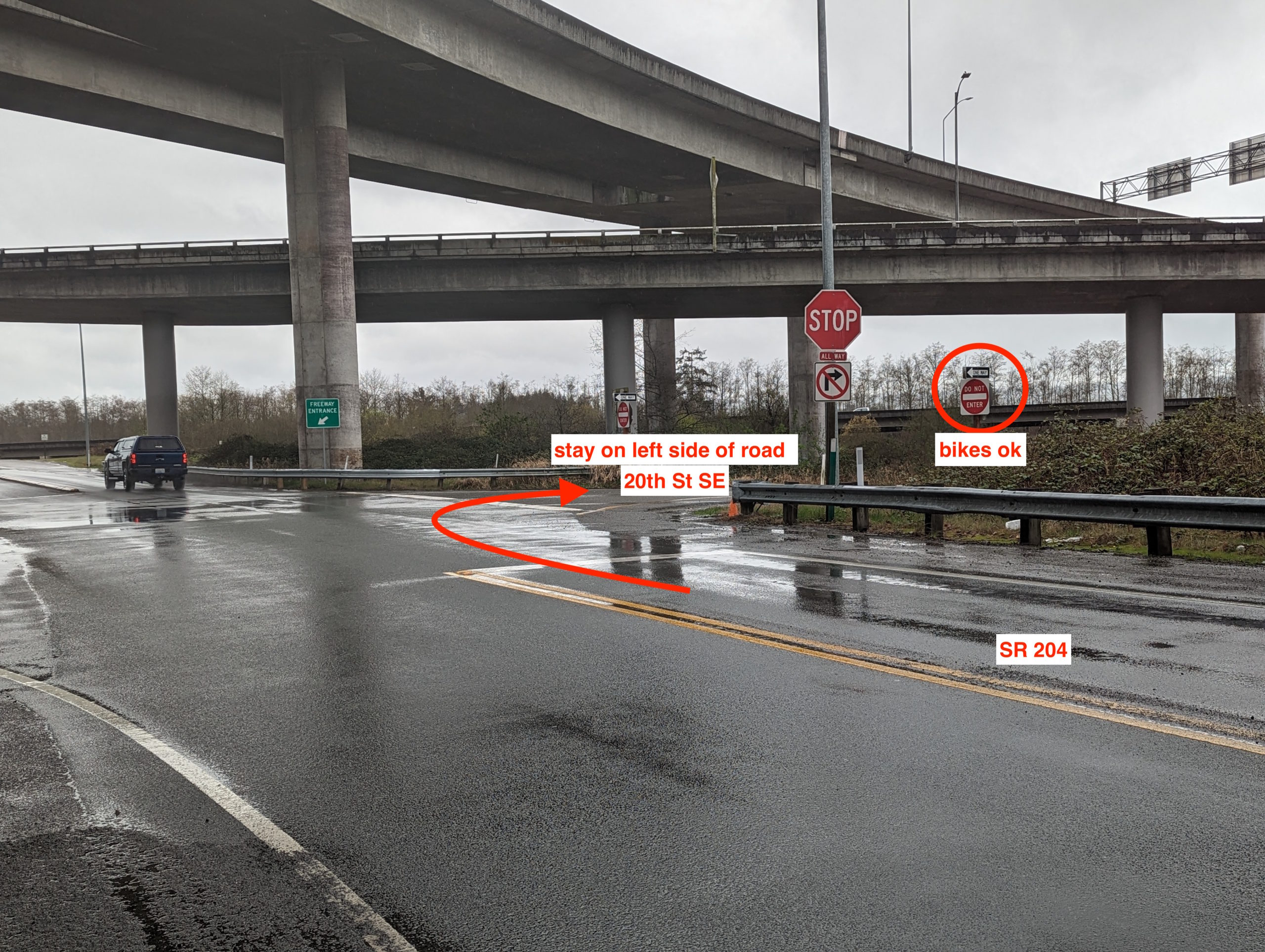
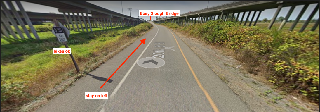
In Raymond, I was hoping the route could turn onto a short section of the Willapa Hills Trail to avoid some traffic on Highway 6. However, after checking it out in the pouring rain, I’m not certain the chunky gravel is very ridable once the pavement ends. Thus, up Highway 6 it goes with some tight turns and a narrow bridge right outside of Raymond, followed by a couple narrow bridges further on up the road.

There are sections along this road that have little or no shoulder; however, on a Sunday night with your bike lights flashing, I don’t think it will be an issue.

The Pe Ell Texaco station, 28 miles from Raymond, should be open until 10 pm on a Sunday night. Shortly thereafter, you finally get to turn onto the packed gravel and very dark by this point, Willapa Hills Trail. Over the Memorial Day weekend, I rode this section of mostly packed gravel at almost road speeds on tubeless 28’s. The only difference is that then it was broad daylight whereas by now, it will probably be completely dark. Have your headlights blazing and it will probably go just as smoothly for you.

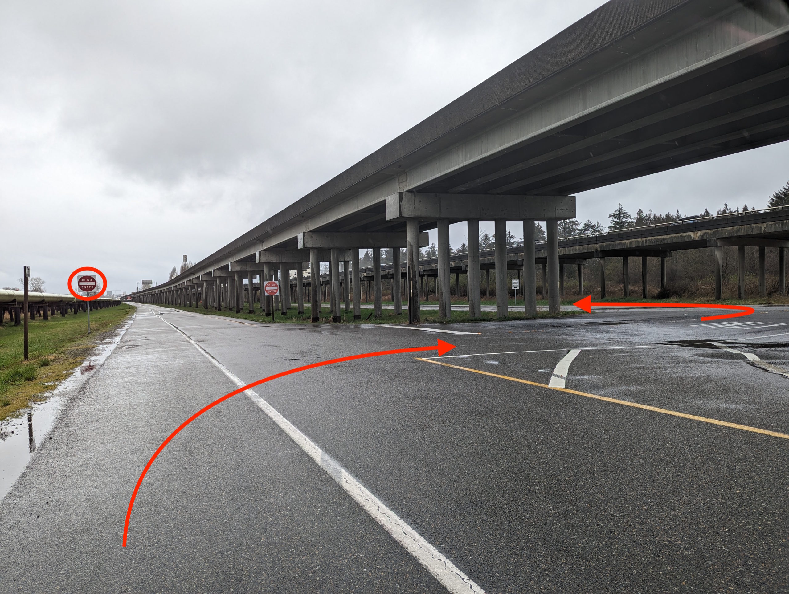
Approximately 19 miles later, as you’re preparing to turn left onto Highway 6, please exercise caution as the gravel here is very large and loose and the left-hand turn onto Highway 6 is a bit of a blind corner with vehicles approaching at high speeds from the left. There’s a 76 station not too far up the road from here.

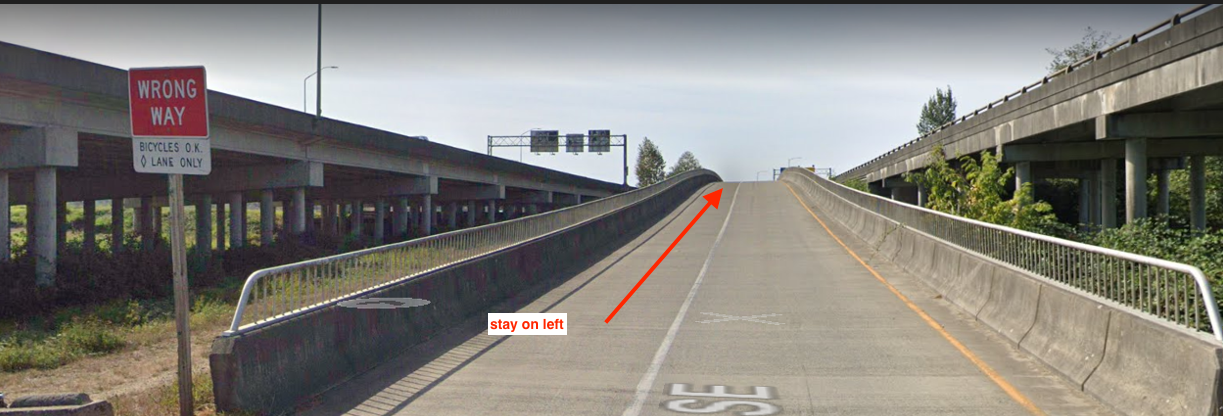
As you enter Centralia on the sidewalk under I-5, the Chevron straight ahead of you may be the last chance for supplies so you should probably stock up now if you need it. The last 30 miles into Tumwater is nothing exciting but fairly straightforward in getting the horses back to the barn.

Comments Off on Summer Solstice 1000K Pre-ride Report

Filed under Uncategorized

Summer Populaire- the perfect route??

Registration link (closes 6/16 at midnight)

When I think of what makes a great populaire, among the important parts are things like:

  • it should start with an espresso (doppio of course)
  • 20 meters of gravel and a bit of climbing at the beginning to warm up
  • have a near- equal number of left turns and right turns
  • at 33.7K (give or take a few hundred meters), a twice- baked almond croissant magically appears
  • gently rolling roads through farm- and pasture- land with views of a winding river
  • somewhere around 77K, maybe more coffee and a treat, before a bit of climbing to justify all those calories (don’t overdo it- there’s only 30K to go!)
  • 100 meters of single track, just enough to add to the excitement
  •  a nice, quick downhill before 7K of water views along E Lake Samammish Pkwy NE
  • finish at a brewery (with a food truck!) to quench my thirst and visit with other riders

If this checks any of your boxes, come to our Summer Populaire on Saturday, June 19. Checkin should be quick, just to pick up your brevet card to start around 8:00 AM.

Route & Cue Sheet: RWGPS Route (FINAL)
RUSA Route 1446 Snoqualmie River Run Populaired
https://ridewithgps.com/routes/28988869

Parking: Avoid parking in the Peet’s/ Whole Foods parking lot. There is a bike trail parking lot just to the west of Peet’s, enter from NE 70th St.

Or you may consider street parking on NE 65th street by Postdoc Brewing, less than a kilometer from the start.

Note:Printed cuesheets will not be available at the start. You may choose to print your own. To print it, from the route page, click the More button, then select Print Cuesheet.

Comments Off on Summer Populaire- the perfect route??

Filed under Uncategorized

Spring 400K Pre-ride Report

Andrew  Sapuntzakis, Sarah Stolz & Kevin Smith pre-rode the Spring 400K, packed with views, climbs, more views, even more climbs—the perfect SIR ride!

Note: There are many turns on this route. If relying on a cue sheet, pick a font you can read, and bring a “map light” once it’s dark. If using electronic navigation, make sure the device doesn’t choke on the 300+ course points, and have a way to recharge it. While there is lots of parking near the hotel and the stadium, for peace of mind please consider using the park & ride ~5 blocks away, just E of 102nd Ave. Now it’s onto the ride!

The start rolls down from McMenamins, crosses 522, and jogs left onto the new ped/bike bridge to the trail. Follow that all the way to Fremont. It’s not as smooth as it once was, so go easy through this part. Be nice to kids, pets, and other traffic along the way. Pro tip: Met Market is on the right at ~11.4 miles (18.3km), with bathrooms, water, and a decadent chocolate chip cookie that is sure to get you through the first few hills.

Northlake Pl, across from Gas Works, makes for a smooth transition onto 34th. A wide left onto the Fremont bridge sidewalk, then some quick rights to the ship canal trail take you under the Ballard bridge. Go through a made-u-look-both-ways railroad crossing, onto the sidewalk on the S side of Emerson, and then follow the 2-way bike lane over the railyard. Bike lane turns right on Gilman, becomes Gov’t Way, right up to the front entrance of Discovery Park. Don’t miss the left at the top, otherwise you’ll be backtracking up a solid extra climb.

Note the (former) stables on your right as you start to head down to the first control. At the bottom, avoid the right fork with the concrete overpass (or you’ll end up in the wastewater treatment plant- yuk). Answer the first question, take in the view to your next control destination at Alki Point, have a final bite of that gooey cookie, then head back up. Turn right just before the stables, and head toward the S park exit. Magnolia Blvd should be an easy cruise with stunning Elliott Bay views and homes to match. Don’t miss the turn onto Thorndyke, with its gentle incline down to the railyard. Admire the other Victorian technology, but be aware of an extremely narrow fenced ramp—communicate with oncoming trail traffic!

Take it easy on the trails through the waterfront parks, then go into the street once you reach Alaskan Way. Stay on it until King St to avoid the sidewalk/trail confusion caused by overlapping construction projects. After a short smooth trail segment, you’re back on Alaskan/E. Marginal Way. Activity is returning to the port, but watch for potholes! The cues will get you through to the W Seattle Bridge trail, but spare a glance for the repairs to the upper bridge. Traffic on the lower roads should still be reasonable, and the green lanes should help you get across the Delridge/Spokane/Chelan/Marginal spaghetti bowl intersection. Once across, getting to Harbor/Alki isn’t bad. The road that loops past the 2nd control has been “pedestrianized.”

As you head south, a short climb connects Beach Dr. to Fauntleroy, but you only head south briefly before turning to bypass the ferry traffic. The Original Bakery is at the foot of the Marine View Dr. climb. Enjoy more Sound views as you climb, then ~2.5 miles to prepare for Shorewood Blvd, which will make you glad you brought “easy” gears. Marvel at its multi-stage reveal.

From ~49 miles (79km) until Dash Point there are several sharp descents with tight turns—stay in your lane! If you’re not familiar with these roads, take it easy.

Work your way down to three-tree point for the next control, then more ups and downs to Redondo Beach, which has public restrooms. More climbs and drops—don’t miss the turn to get to the Dash Pt control. The climb out includes a steep segment and more great views. If you look closely, across the water is your next control destination, so close, yet…. Rejoin 509, but not for long, and don’t follow it down to the water.

As you approach Tacoma, use the sidewalk when you cross the Eells St bridge over the Puyallup. North of downtown Tacoma, the route jogs left to Commerce/Stadium, where construction materials and streetcar tracks make for a narrow path. Stay to the right of the tracks, you don’t need to cross them. Turn right at the light on Tacoma Ave, where Salamone’s pizza (opposite corner) sells by the slice, and it’s also a food option on the way out of town. Ruston Way is like a narrower Alki. The Point Ruston Public Market has bathrooms inside and food trucks outside. Options in the Ruston development may be busy. Consider grabbing some food to eat at the control in Dune Peninsula Park, taking in the sweeping views. Hopefully the Mountain will be out to show your next direction, you’ll be seeing it for hours. Water and bathrooms are available in the park pavilion.

In Puyallup, the river crossings aren’t bad, but take a wide left and get onto the sidewalk where Shaw goes over the tracks. Use the near crosswalk just after the tracks to get on the Foothills trail rather than turning onto busy Pioneer. Cruise all the way to Orting Safeway, McD’s, etc.

The initial climb on Orting Kapowsin Hwy doesn’t have much of a shoulder, so do your best to stick to the fog line. Eventually, the route passes the Kapowsin grocery (Texaco gas station) twice—it’s decently stocked, but has no bathrooms. From there, it’s mostly downhill back to Pioneer and the Foothills trail. The sani-can along the trail was not well maintained, so you might byo paper.

Leaving South Prairie, there’s another climb. On the way into Wilkeson, note the skillet-eggs-n-bacon feature in the skate park. There are a few food options, although the Pick & Shovel saloon is probably your best bet, with outdoor seating around back. Figure ~30 minutes to the Carbonado control and back.

From here, the route profile stays pretty tame for the next 100km, so you can hopefully make good time. Services can be found in Burnett, Buckley, Enumclaw, with a control before the Green River. Then head for the Safeway control (open till 1 AM) on Kent Kangley Rd. The staffed Landsburg control just three short miles away marks the return to trails (no services) all the way to Renton. The Landsburg control will have hot coffee, hot water for tea, cocoa, cup-o-soup, packaged sandwiches and energy providing snacks.

From Renton, it’s the East Side of Lake Washington that most of us can do in our sleep, although the gravel rail trail is almost entirely closed for construction, so we have you on the Lake Washington Loop trail. Then the I-90 trail to Mercer Island, and the scenic way around starting with the twisty bits. After the floating bridge, there’s a steep half block up to Seattle’s Lake Washington Blvd, and a twisty, bumpy descent through Frink/Leschi Park to a restroom info control at Madrona Park. Continue on, up the hairpin, west to MLK, and through the Montlake neighborhood to the 520 trail via the Montlake overpass due to the posted closure on the Roanoke trail stub.

Cross the lake again, and the “rolling” trail dumps you onto Northup, then 24th for some short climbs. Then it’s on the trail again to 148th for the last info control, and then back off the trail once more due to construction. Pass Microsoft and Nintendo, and a quick trail descent to Redmond. Onto the Sammamish River Trail all the way to Bothell, up the ramp, o’er the bridge, and back to the hotel where your author(s) will be waiting to congratulate you.

Comments Off on Spring 400K Pre-ride Report

Filed under Uncategorized

Travelogue Mann

Mark, Greg, Rose and Jan pre-rode the Spring 200K last week. Here is Mark’s ride report. Enjoy!

The SIR Spring 200k route, The End of Mann, offers a scenic and relatively gentle reintroduction to brevets after our extended pandemic hiatus. With only 1430m (4700ft) of climbing, the route is less hilly than most brevets, but features some really nice scenery.

The first quarter of the route has the substantial climb from Woodinville up to Maltby, but is otherwise quite gentle, with roughly half on gentle multiuse trails (Sammamish River Trail and Centennial Trail).

The climb rewards with some nice views of the hills and mountains to the north and east, including Mount Baker in the distance.

After leaving the trail, a short section of busy road leads to some really nice quiet riding west of Granite Falls, including a pretty stretch along the Stillaguamish River.

The town of Granite Falls, about 1/3 of the way through the ride, offers a few options for refueling, including a couple of gas station convenience stores and coffee stands. (Please wear a mask). River, lake, and mountain views dot the nice rural riding from Granite Falls to Sultan via Lake Roesiger.

Don’t forget to say hi to the locals.

The halfway point of the ride, Sultan offers the last services opportunity for 55km. A convenience store on the left just before you reach US-2 provides an opportunity for ice cream bars on the curb in classic randonneur style.

Please note that the least stressful way through Sultan is to stay on the north side of US-2, using sidewalk (and a bit of shoulder) to reach the pedestrian bridge across the Sultan River. That lovely new bike/pedestrian facility avoids the very bicycle-unfriendly US-2 bridge. After Sultan, the route crosses the Skykomish River and heads out to the end of the pavement on Mann Road, where some overly friendly SIR volunteers will be stationed. The quiet stretch out Mann Road has some nice views of the Cascades foothills and a few curious cycling fans.

After the control, Mann and Ben Howard roads take you over to the Snoqualmie Valley with just a few short, but leg-busting climbs to keep you focused. SIR-familiar farming roads in the valley bring you to Carnation.

If you are comfortable going into a coffee shop, I highly recommend patronizing Sandy’s Espresso on the left at Commercial Street. Sandy and her friendly staff are long-time supporters of SIR rides and the nicest folks in town. The shop has nice (newly expanded!) outdoor seating allowing comfortable distancing.

A quiet flat stretch along the river with views of Mount Si leads to the route’s last significant climbing stretch from the Snoqualmie Valley near Fall City up to the Sammamish Plateau. I won’t lie, Issaquah-Fall City Road hurt me. But soon enough, the route descends to Lake Sammamish and Marymoor Park for a flat finish up the Sammamish River Trail. Please take the trail section slowly and respect the slower users out having fun.

Really hope to see many of you out there. And maybe to share a beer in the large, distancing-friendly outdoor garden of Good Brewing near the finish.

Comments Off on Travelogue Mann

Filed under Uncategorized

End of Mann 200K

If you have not yet registered for Seattle Randonneurs “End of Mann” 200km brevet on April 10, there’s still time.  And you don’t want to miss it.

A group of us pre-rode the brevet course last weekend, and we all think you’ll enjoy this ride.  It follows a generally clockwise loop north from Woodinville to Granite Falls and then back south towards Sultan and Fall City before coming back to the start.

Taking in some familiar roads along with a few that we have not ridden in several years, the course passes by rivers, lakes, horse farms, and valleys with mountain views, as well as through a few small towns so that you can replenish your supplies along the way.  Keep your eyes open for eagles, llamas, horses, cows, ducks. You might even see a long-horned steer if you are lucky.  Because this is our first brevet in a long time, it’s not too hilly (although it would not be a brevet without a few bumps here and there.)

Almost all of the course follows quiet roads or trails.  There is one stretch of busy road after leaving the Centennial Trail along 84th Street NE for 3 miles.  The road has a wide shoulder, but please be very careful at the end of this stretch when turning left across the road onto 147th Avenue NE due to oncoming traffic.  Your reward after this stretch is one of the most beautiful parts of the course.

Here are a couple of reminders/suggestions for the ride:

  • Remember that there is no day-of-ride registration/payment.  Please pre-register and pre-pay online at the SIR website. https://www.seattlerando.org/
  • Bring your own pencil or pen. There will be several information controls, and you will need to write the answers to the control questions on your card.
  • Although there are services in towns along the route, none of the controls will be at convenience stores or supermarkets.  For this reason, you might wish to bring some extra food on the bike, and make sure that your water bottles are full.  Best stops for services are probably Snohomish (mile 16, with public restrooms on Main St on the right), Granite Falls (mile 39, with various choices), Sultan (mile 62, various choices but the Arco minimart is well-stocked and has restrooms, located on course at the left turn for Stevens Pass HWY), and Carnation (mile 98, various choices including Sandy’s Espresso, our favorite)
  • If the weather looks inclement, you will make more friends if your bike has fenders and a buddy flap.
  • It’s an early season brevet, so your bike should have a fixed taillight and headlight, and you should have a reflective vest with you.
  • The brevet finishes by taking the Sammamish River Trail from Marymoor Park in Redmond towards Woodinville.  If the weather is nice, the trail may be crowded, so please be respectful of other trail users – don’t ride too fast or in large groups.
  • Make sure you come to the correct starting location:  The Northshore Athletic Fields are the ones located off of NE 145th Street close to Hollywood Hills and the Chateau Ste Michelle winery, just off the Sammamish River Trail.

Finally, please observe good social distancing behavior:  Wear a mask at the start, finish and all controls, and don’t congregate closely; keep some distance from other riders on the road; bring some hand sanitizer; be self-supporting to the extent you can.

Bonne route!

Comments Off on End of Mann 200K

Filed under Uncategorized

Winter Solstice 200K

Joe says: “The fifth annual SIR Winter Solstice 200K will take place on Saturday the 21st of December.  We roll at 8PM.  Hilarity ensues.  Details to follow.”

Seattle Randonneurs from Dan McComb on Vimeo.

Comments Off on Winter Solstice 200K

Filed under SIR Rides, Winter Solstice Ride