Text by Sharan Daniel, photos by Sharan Daniel, Jason Hansen, Mitch Ishihara, Keith Moore, and John Nguyen
This brevet updates RUSA route #756, which some riders remember fondly from 2013. The first day, 383 km, takes you to the coast and back to Centralia. The second day, 220 km, takes you into mountains with stunning descents and lakes. While you pass through some remote areas, there are services about every 50 km, with an exception or two, as noted below.
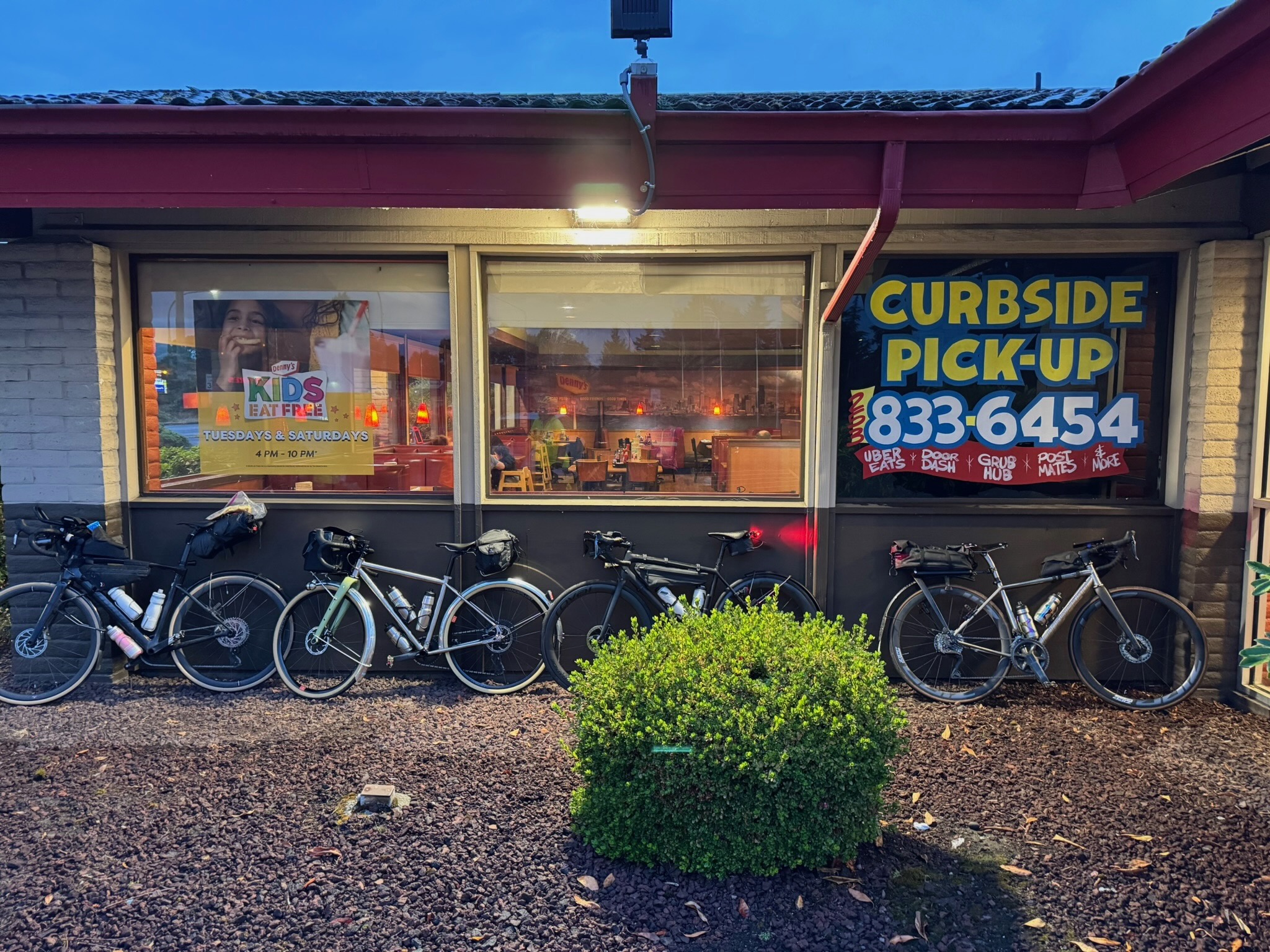
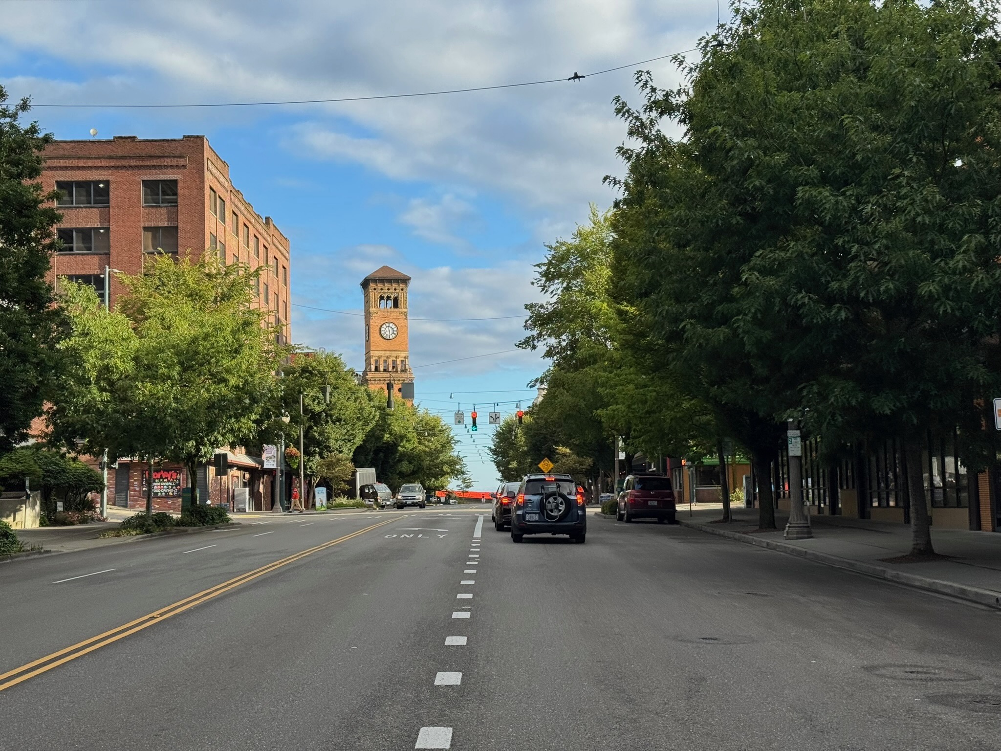
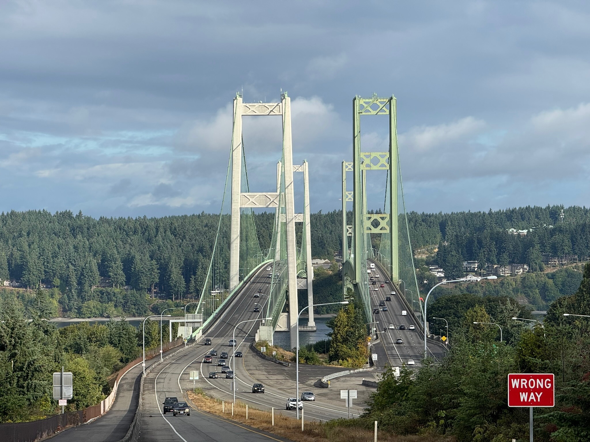
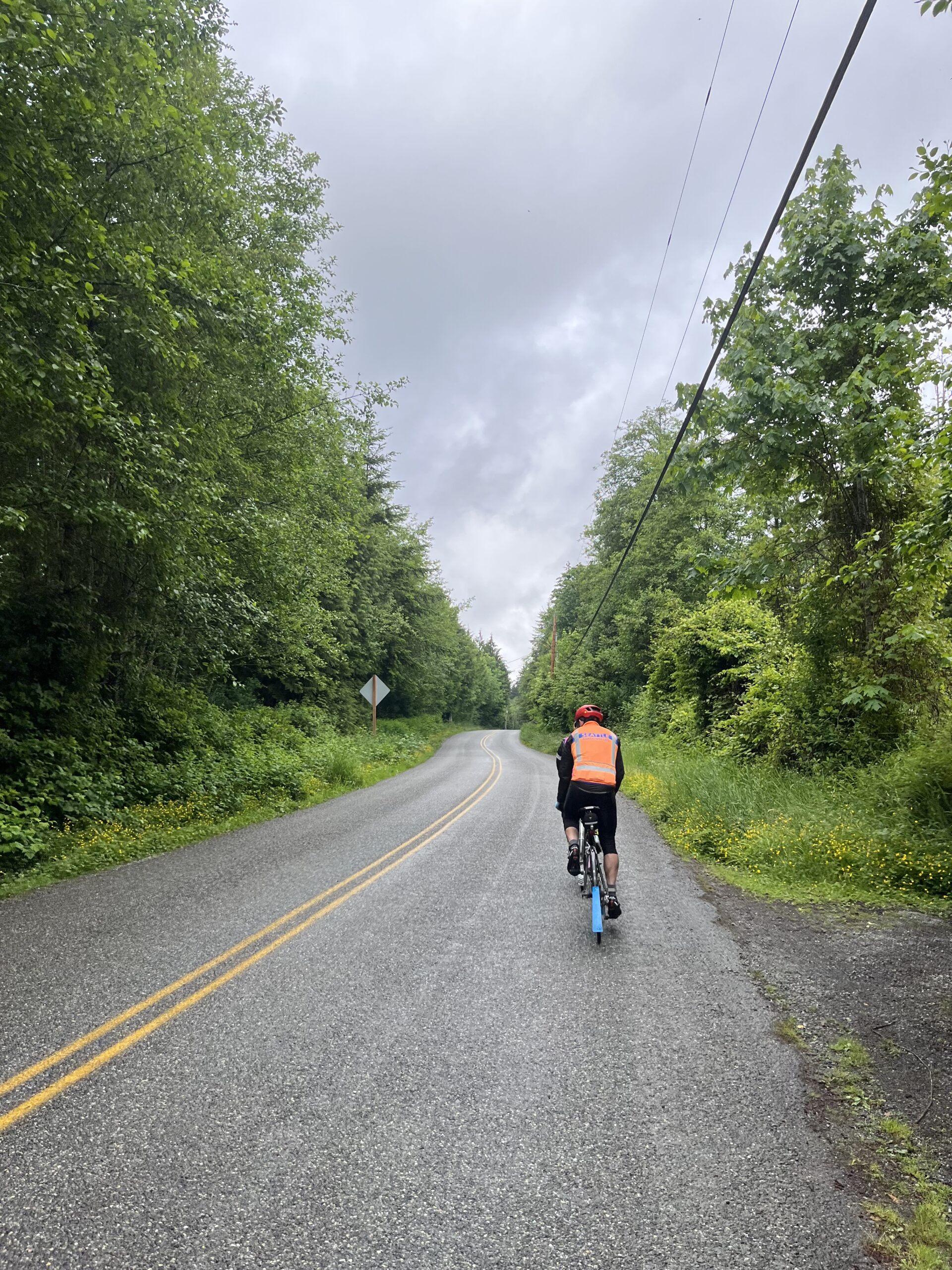
The ride starts at Denny’s in Auburn, where you can fuel up before heading out. Warm up on the Interurban Trail down to Pacific, then follow the Puyallup River to the outskirts of Tacoma. There are some twists and turns between km 19 and 21, as you cross the river twice, and another odd loop between km 32 and 34 as you make your way to the Lincoln Bridge, the best biking alternative to the Fishing Wars Memorial bridge that is now closed. Enjoy one more river crossing into Tacoma and and take in the quiet Saturday morning urban waterfront scene. Finish your first 50 km by crossing the grand Tacoma Narrows Bridge into Gig Harbor. You’ll pass a park restroom with water at 53.3 km.
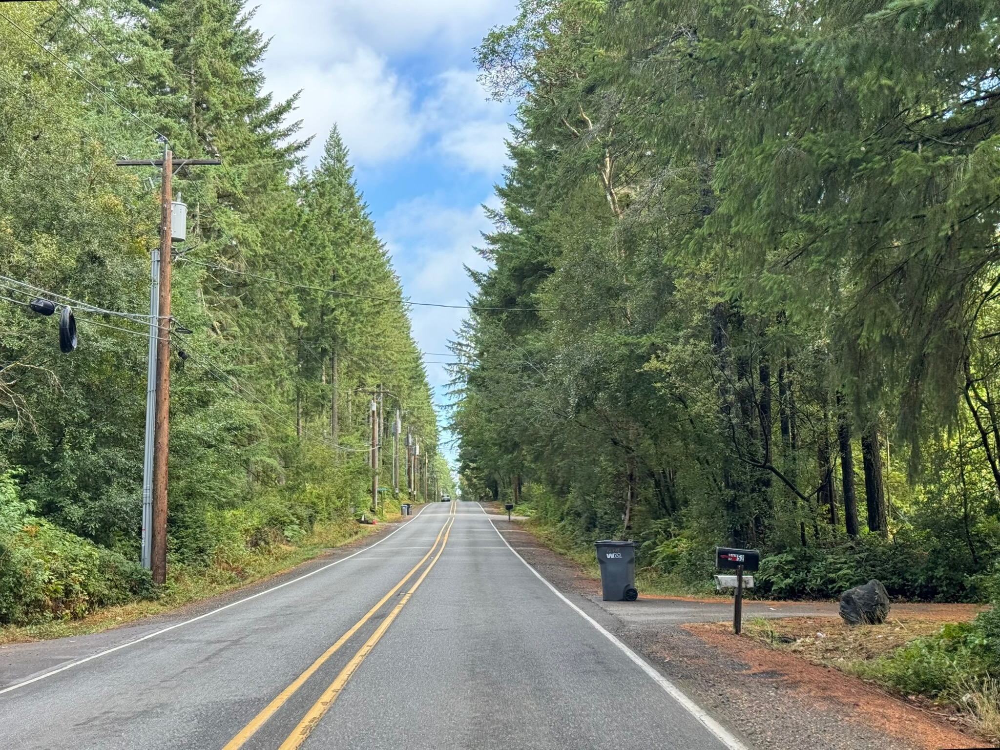
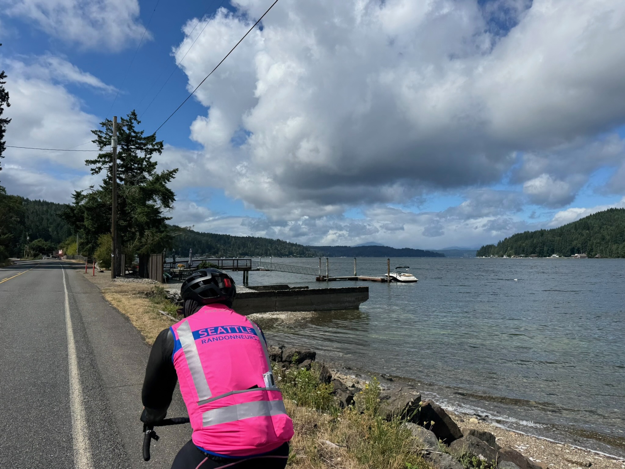
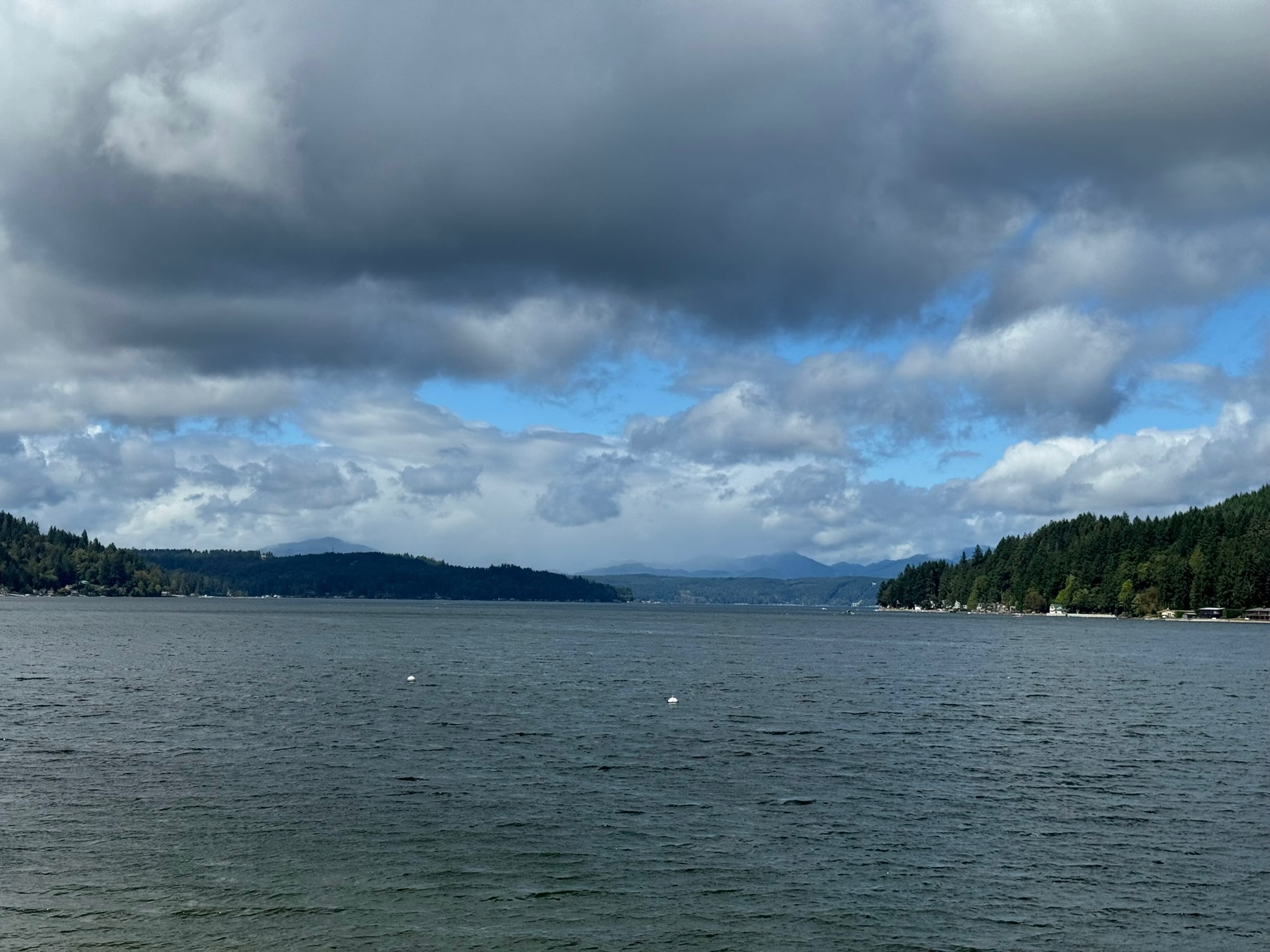
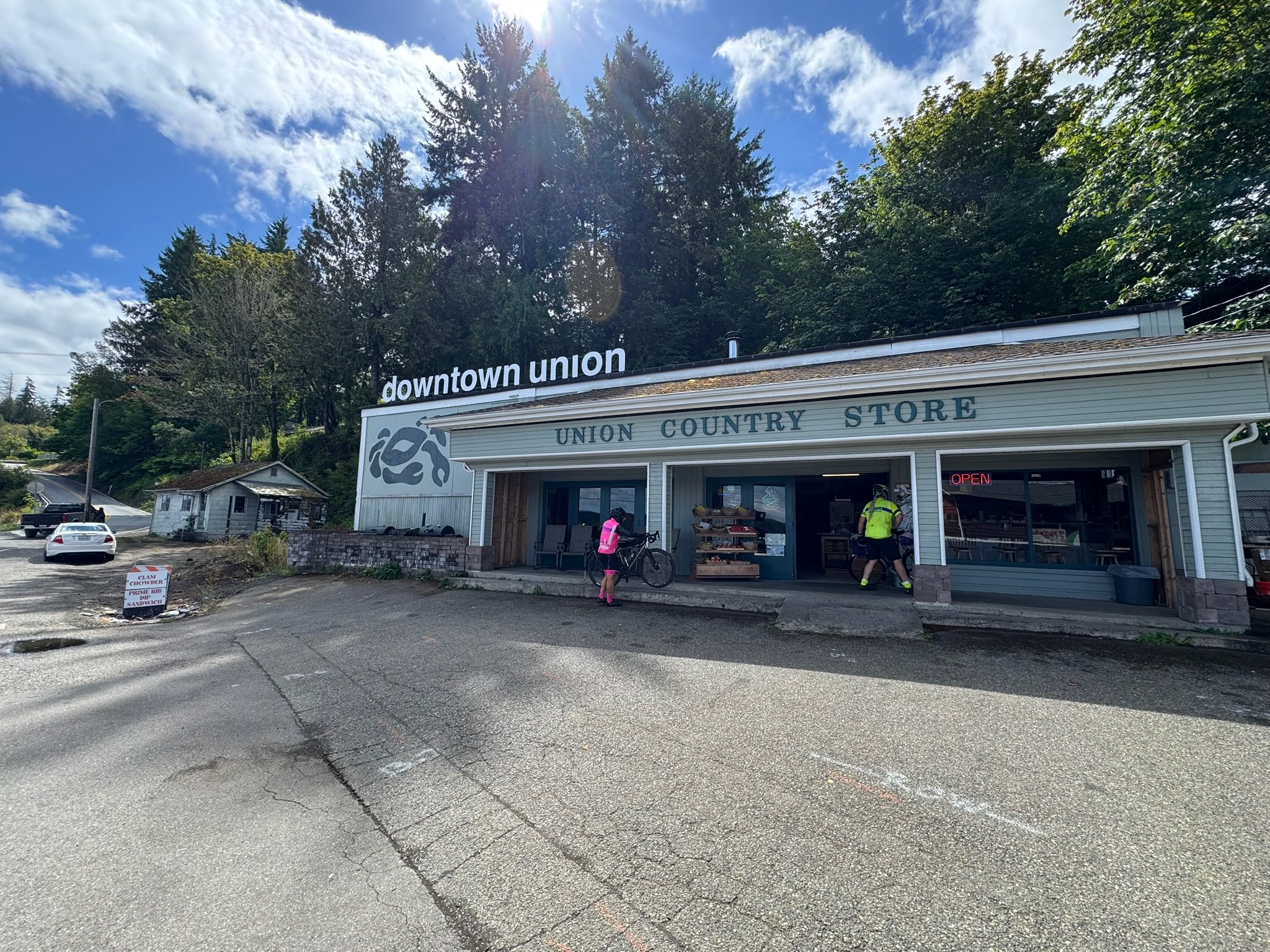
Quiet roads take you over to WA-3, which leads to Belfair and south along the Hood Canal. You’ll find a few options for food, water, and restrooms along this stretch, starting with the control at Belfair, Sandi’s Deli Mart (91 km), and ending with the Union Country Store (117.5 km), a pre-riders’ favorite for its tasty offerings. Follow WA-106 until you reach Purdy Cutoff Rd at 123 km. The road is forested and pretty, but traffic is fast; ride single file here. At km 127.4, take your time as you make a left onto US-101: more fast traffic here, and lots of it. Relief comes 5 km down the road, as you turn west. If you need a break or water, there is the small Dayton Store at 141.6 km. Another 15 km away is the Matlock General Store, with kind staff and a clean restroom; it’s also the control marking your turn south.
Brady Food Mart is at the turn west into Montesano at 186 km; it has a portable toilet. A little less than 10 km into town are a Chevron station (24 hrs) and the Fishin Hole restaurant (closes at 8:30 p.m.).
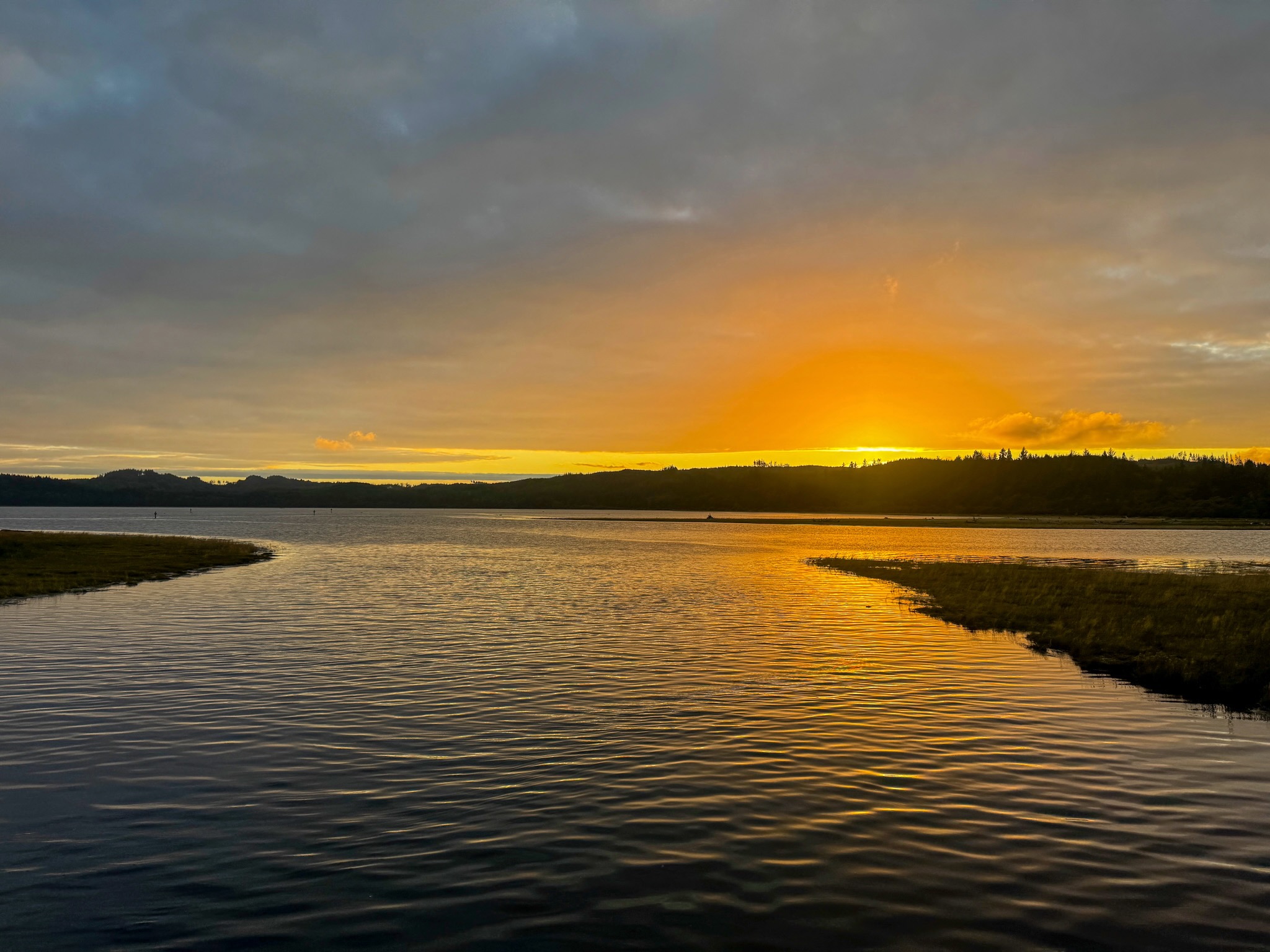
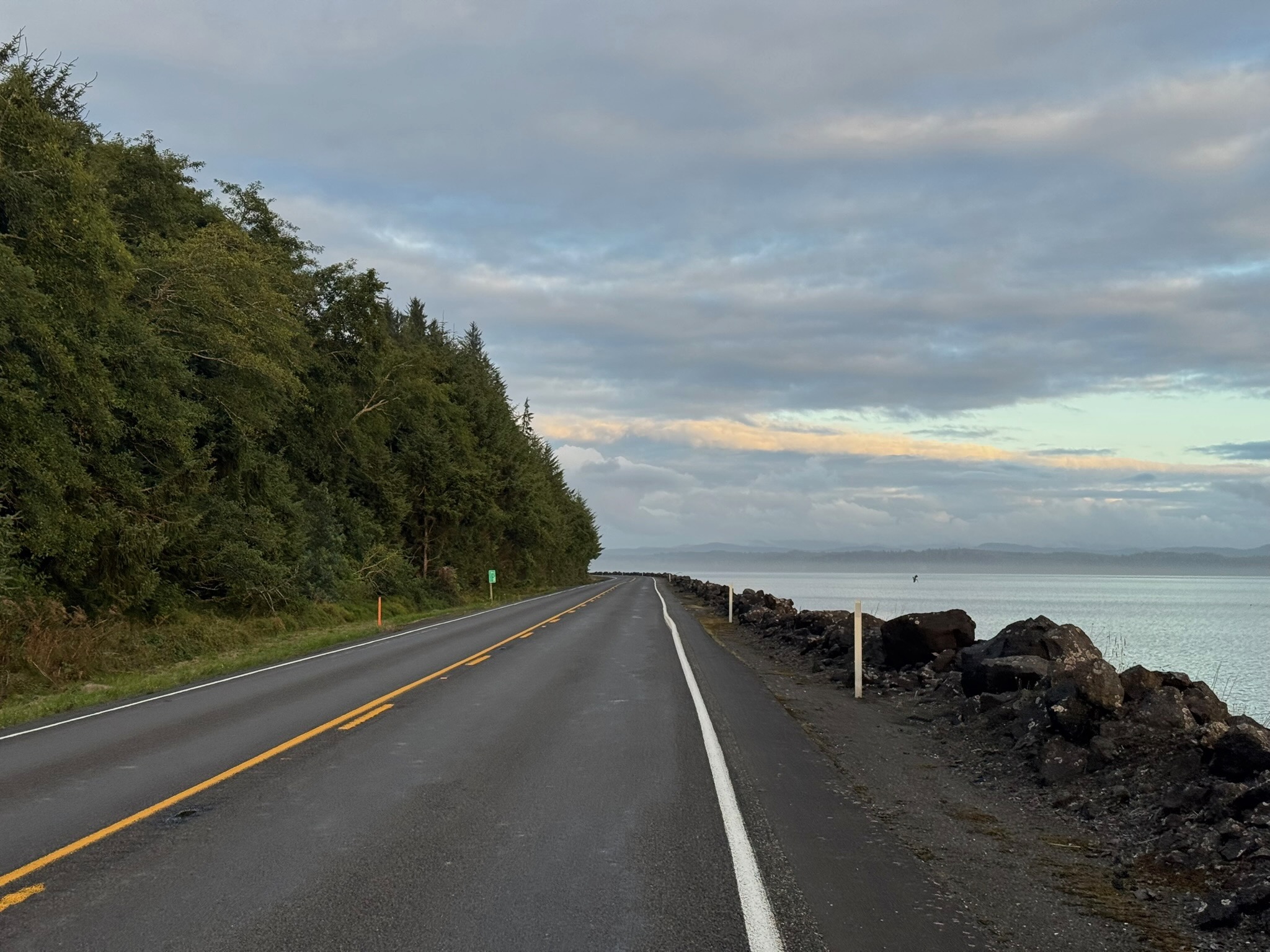
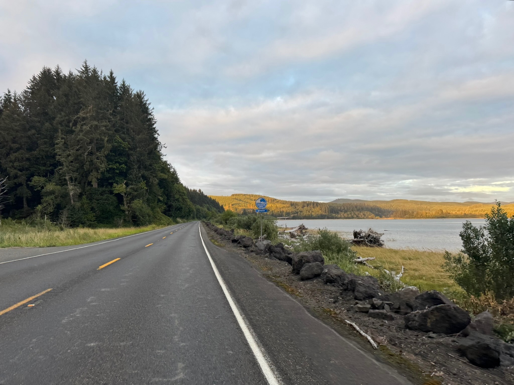
Heading into Cosmopolis you’ll begin to smell the ocean air. At 211 km, you’ll find another Chevron (closes at 8 p.m. on Saturdays). Soon you’re riding along the water and then heading into Westport, at 241.5 km, where there’s a Shell with Subway inside (open till 11 p.m.), though pre-riders found the restroom sub-par. Another 20 km gets you to the Tokeland 76 (open till 10 p.m.) with well-stocked convenience store and clean restrooms. Continue to bask in the ocean air, and if not the sights (as it may be dark), the sounds of the waves, as you make your way toward Raymond and the turn inland. The Quick Stop 101, open 24 hrs, with a portable toilet, is likely your last option for supplies for the day. In Pe Ell, at 340 km, there’s a Texaco, open until 11 p.m. Just before that, at 339.4 km, about a block off-route is a Willapa Hills trailhead with restrooms and water (there’s a cue for it). From there it’s another 43 quiet kilometers to the overnight control in Centralia.
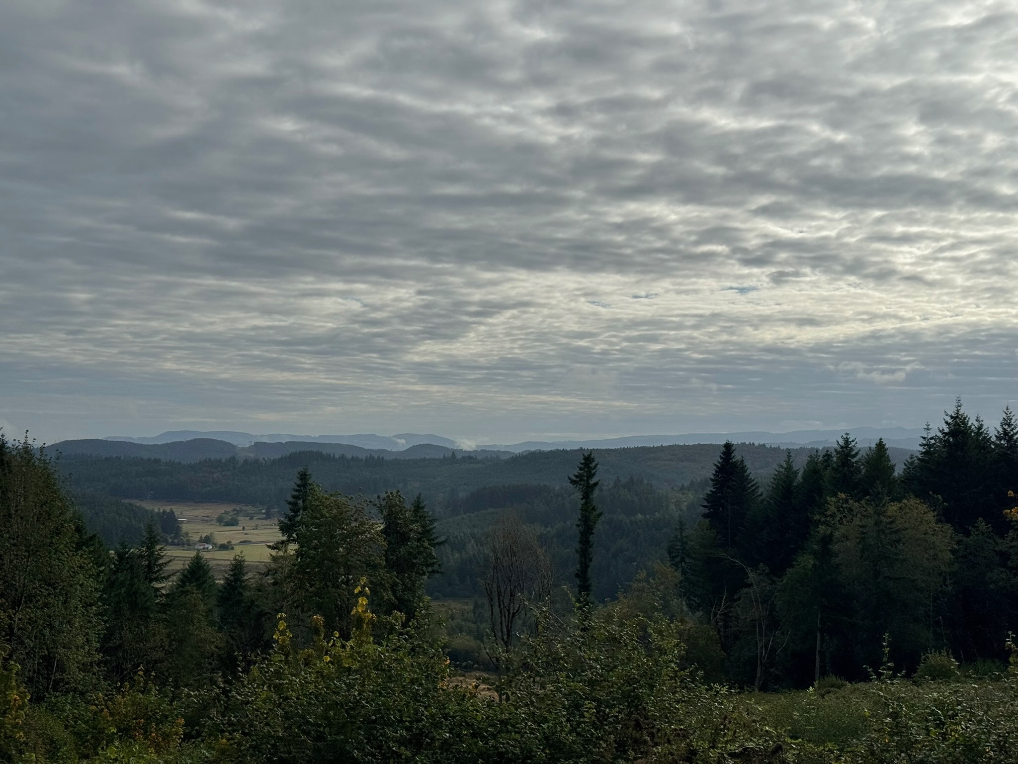
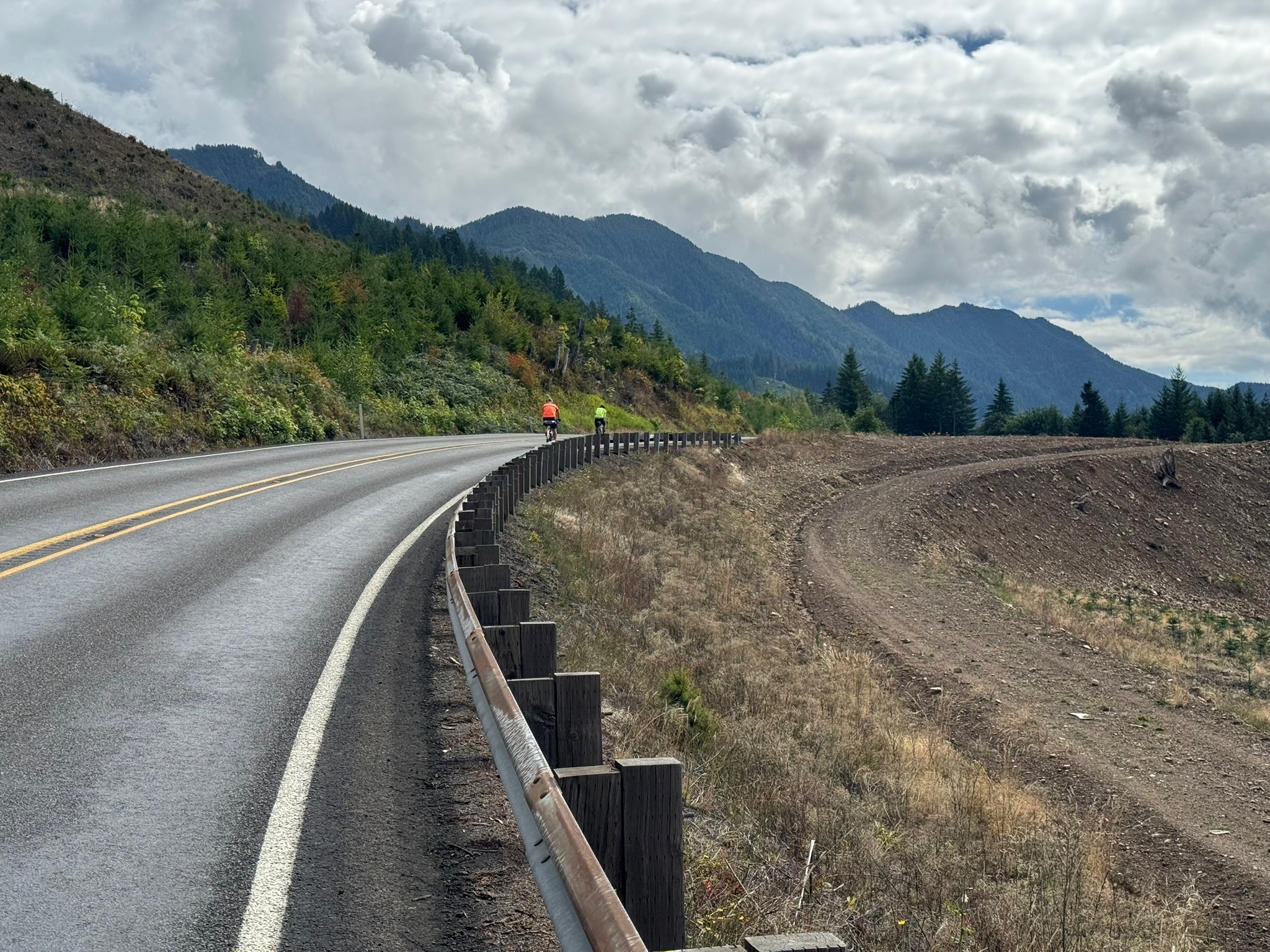
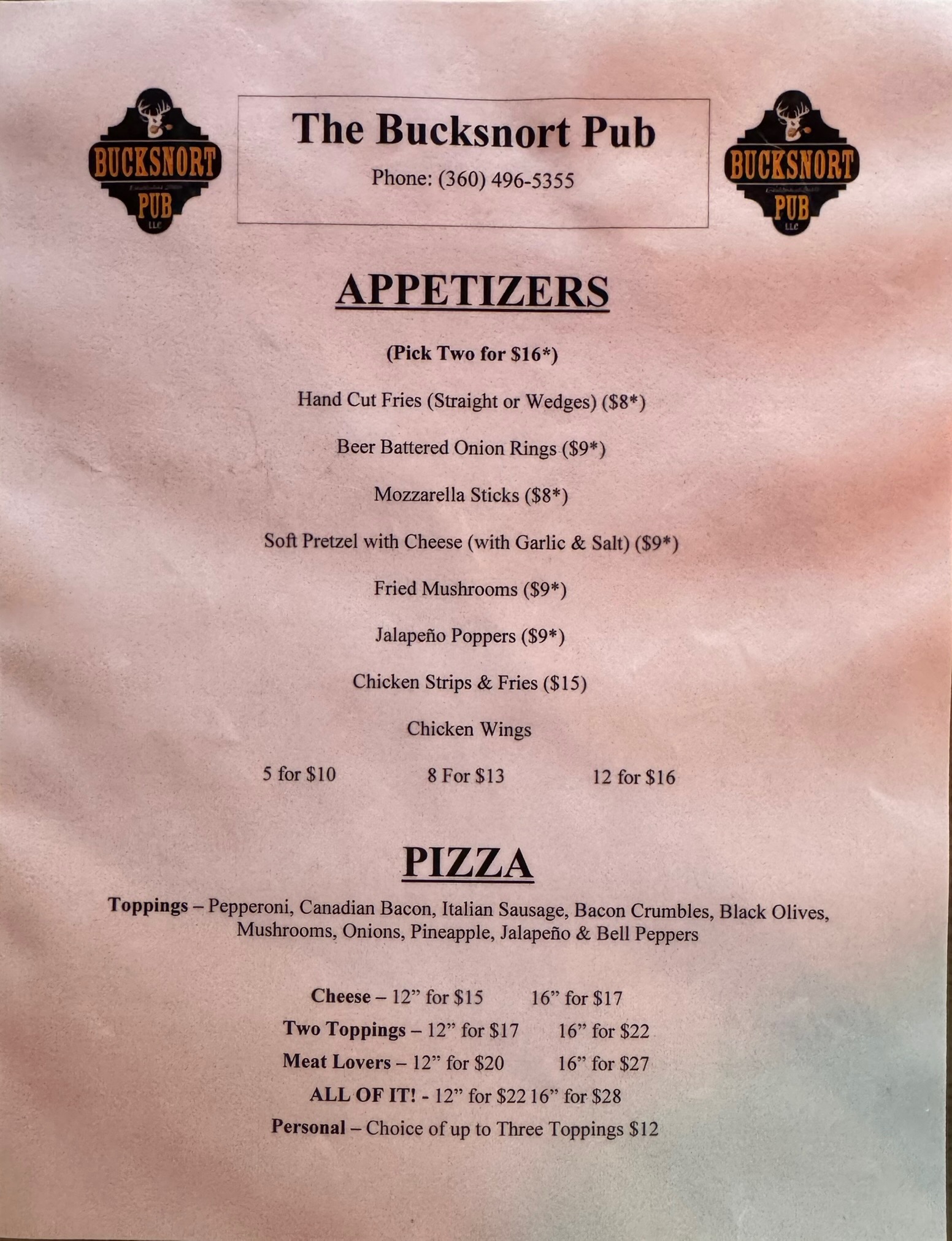
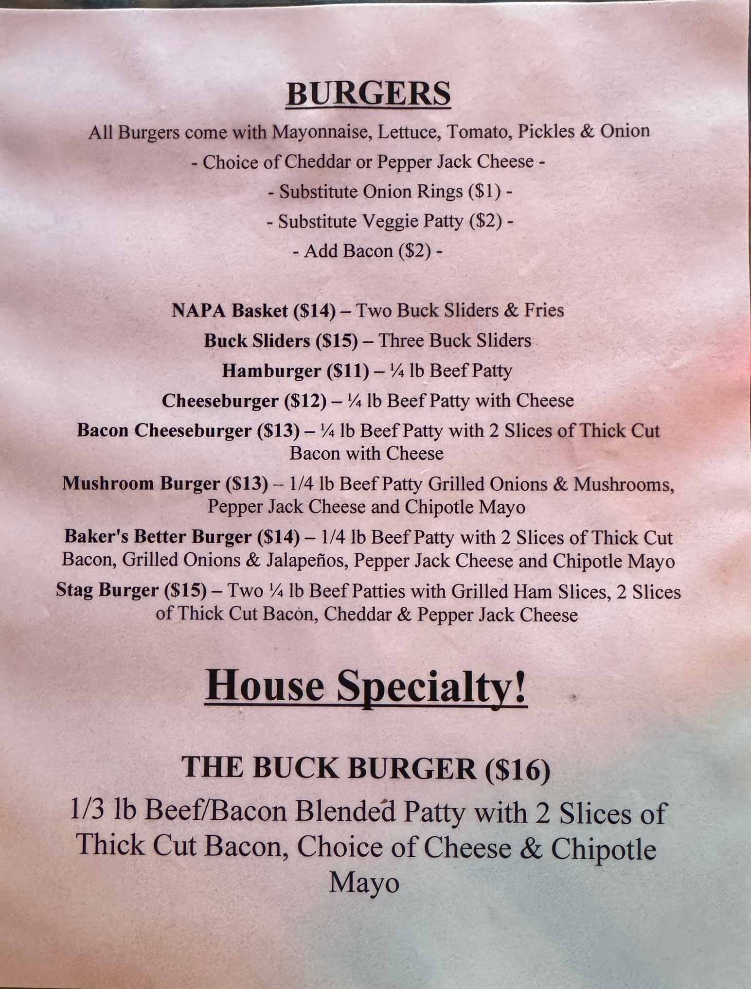
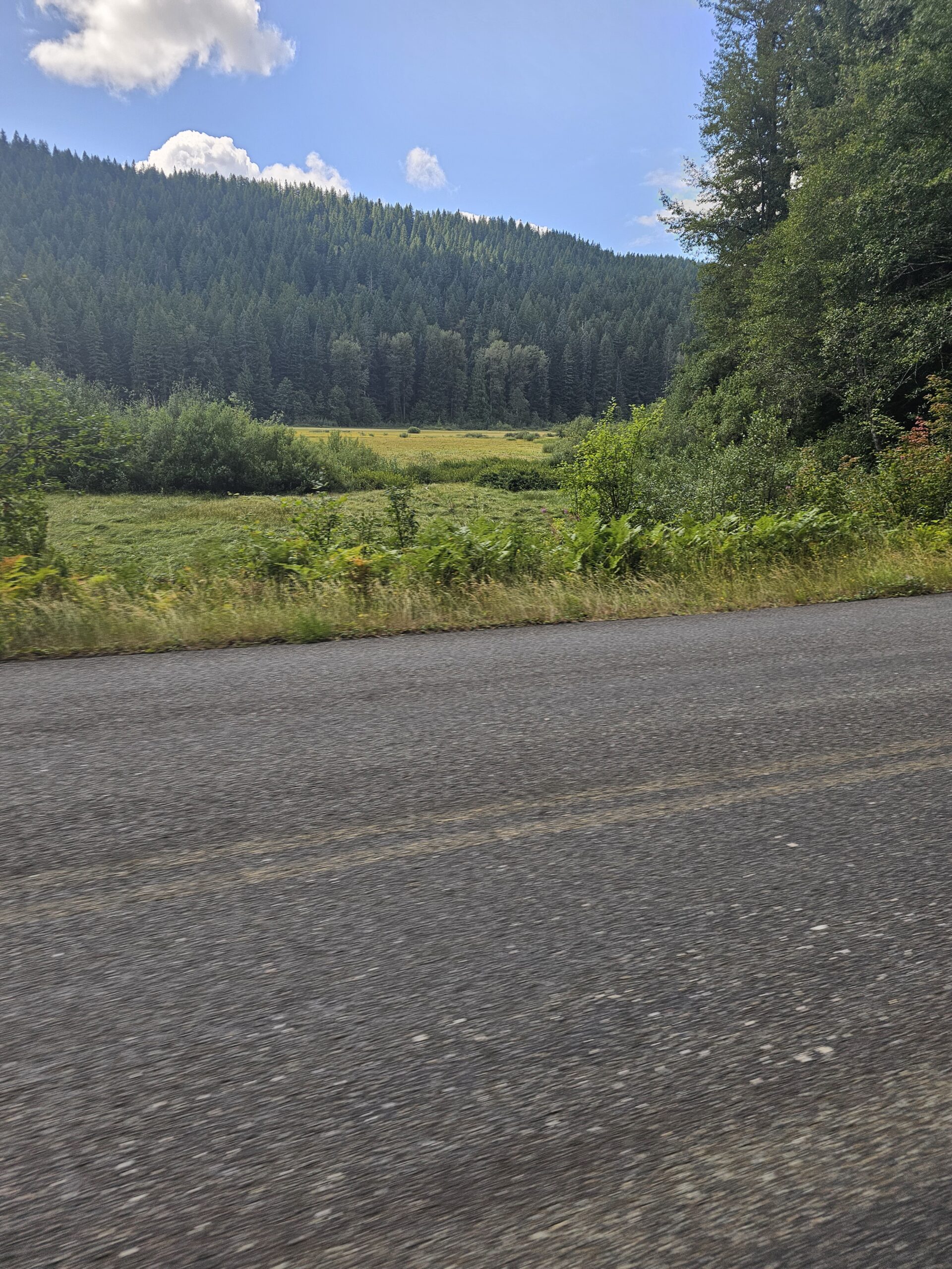
The second day (or the segment after the overnight control, if you’re riding through) takes you into the mountains via Centralia-Alpha Rd with a series of climbs through the countryside. Morton, your first opportunity for services, is 64 km away, but has several good options; pre-riders feasted on a breakfast sub and Jo-Jo potatoes at the 24-hr Chevron, and pizza at the Bucksnort Pub. From Morton to Elbe there’s more climbing, then an awesome descent (one of many on this day/segment). Also perhaps the most stressful riding of this brevet, on WA-7, with a narrow shoulder, fast traffic, lots of wide vehicles towing campers and boats. You may need a break at the Elbe Supply and Safety Stop even though it’s just 27 km from Morton. At Elbe the shoulder improves and you can enjoy stunning views and descents as you skirt Alder Lake.
Eatonville at 495 km offers more supply options before you turn onto Orville Rd at 497 km. This section is lovely, passing through forest with glimpses of Ohop Lake. It also has a narrow to nonexistent shoulder and can be busy with surprisingly impatient drivers on a Sunday. Same for Orville Rd E, which you turn onto at Kapowsin, at km 511.7 (where there’s also a convenience store with a portable toilet). At 526.6 km you turn onto WA-162, another highway with fast traffic and a narrow shoulder, but you turn off onto the Foothills trail in just a couple of kilometers; you can see the trail to your left for about .75 km before you make the turn. The trail ride is cut short by a bridge closure; you’ll get back on the highway at 537.2, where there is also a convenience store. There is a little better shoulder here for your climb to a plateau. In Buckley, at km 544.8 look for the trail again to your right, just before the intersection with WA-410. You’ll ride the beautiful Foothills Trail bridge over the White River, then take a left on Mud Mountain Rd and cross WA-410. There should be no traffic, because this stretch of highway is closed due to a—you guessed it—bridge closure. In Enumclaw, you’ll pass a 7-11 (24 hrs) at 551.5 km—perhaps your last services, unless you reach Black Diamond before 8 p.m. Then jostle through town on bumpy streets that lead right into farmlands.
The route passes through more rural scenery, then on to Franklin, a tiny town where you’ll ride over the Green River gorge, spectacular if you still have daylight. Climb out of the gorge and head into Black Diamond and your last opportunity for a bite, at the Black Diamond Bakery (open till 8 p.m.), about a block off-route at 575.8 km. From here on, it’s smooth riding, nice roads with good shoulders. There’s a control at 586.8 km, where you make a turn that’s hard to see in the dark. You’ll see a RR crossing sign; the turn is just before that sign. (Do not cross the tracks.) Heading into Auburn on SE Auburn-Black Diamond Rd, at km 598.9, you’ll encounter a notorious set of railroad tracks at a bad angle. Take care here; stopping is not out of the question, as you have to cross into the left lane if you want a perpendicular approach. After 4 km through town, you are finished.
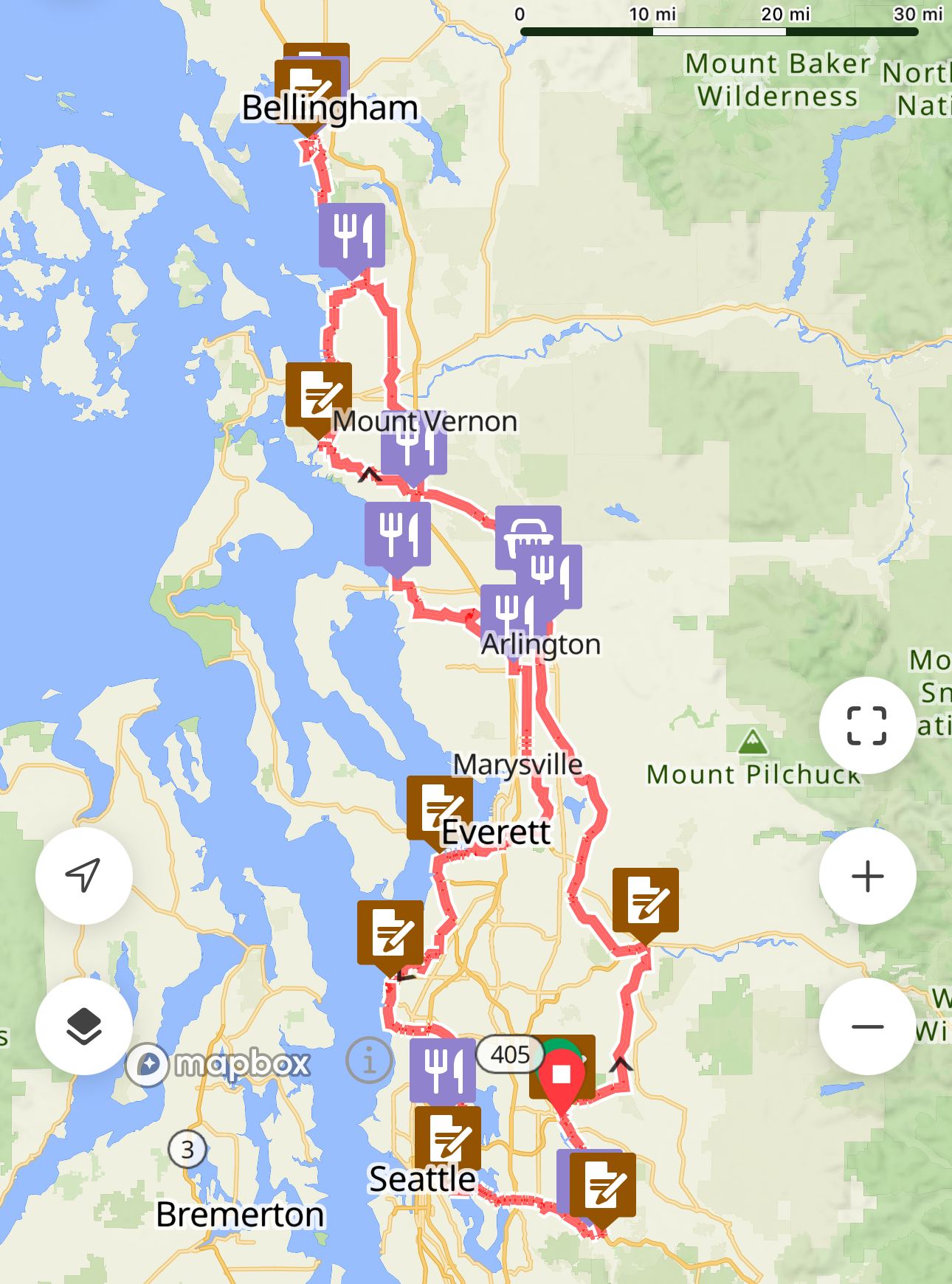
The Spring 600K offers a varied, rolling, but low-total elevation tour through the inland Puget Sound and into the foothills of the Cascades via the Middle Fork Snoqualmie. A backdoor into Bellingham provides a pleasant detour along Lake Samish, avoiding the closure of Chuckanut Drive. This route is optimized for EPP, please ensure that your ride is tracked or document your passage through controls with photos.
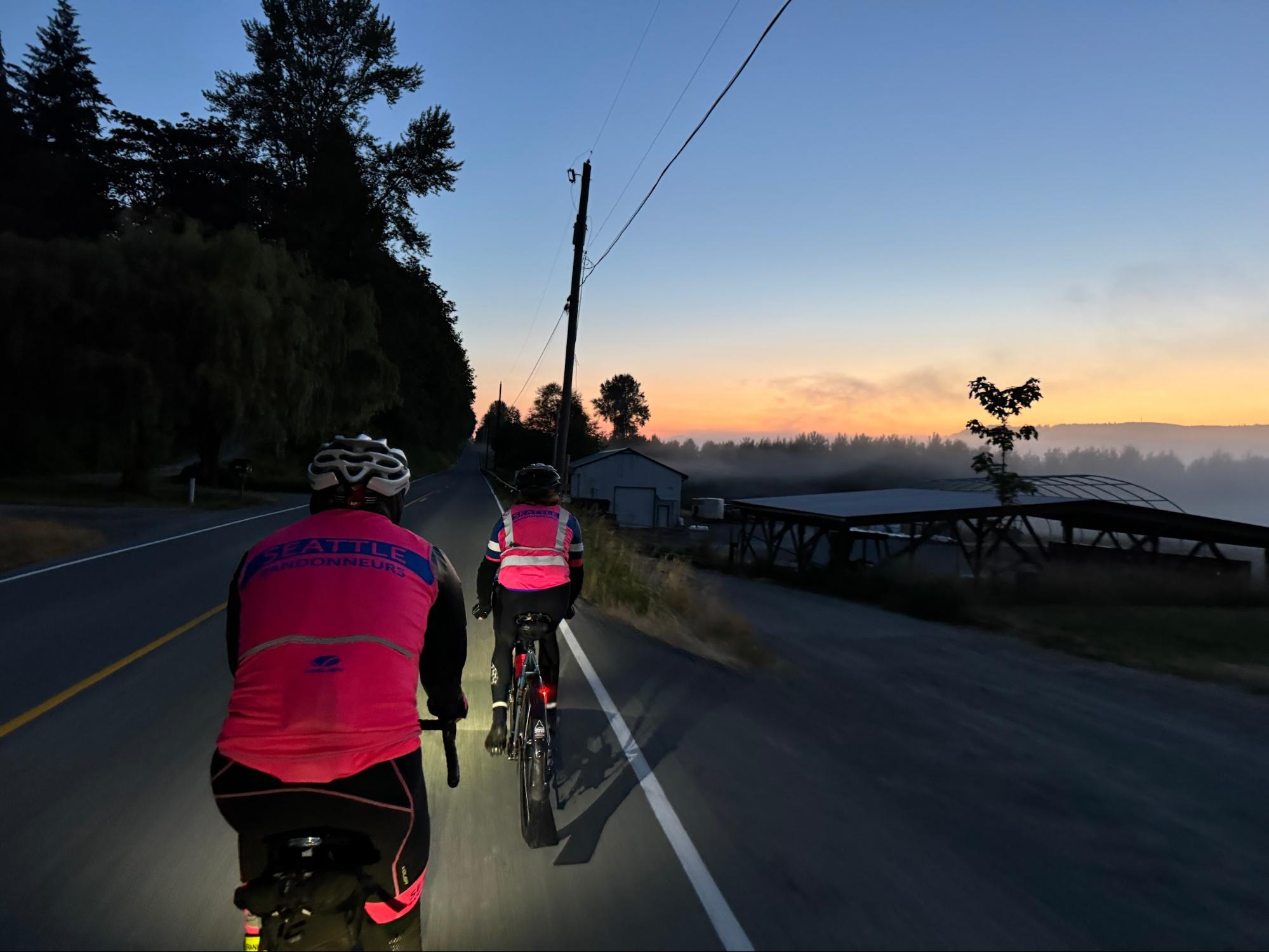
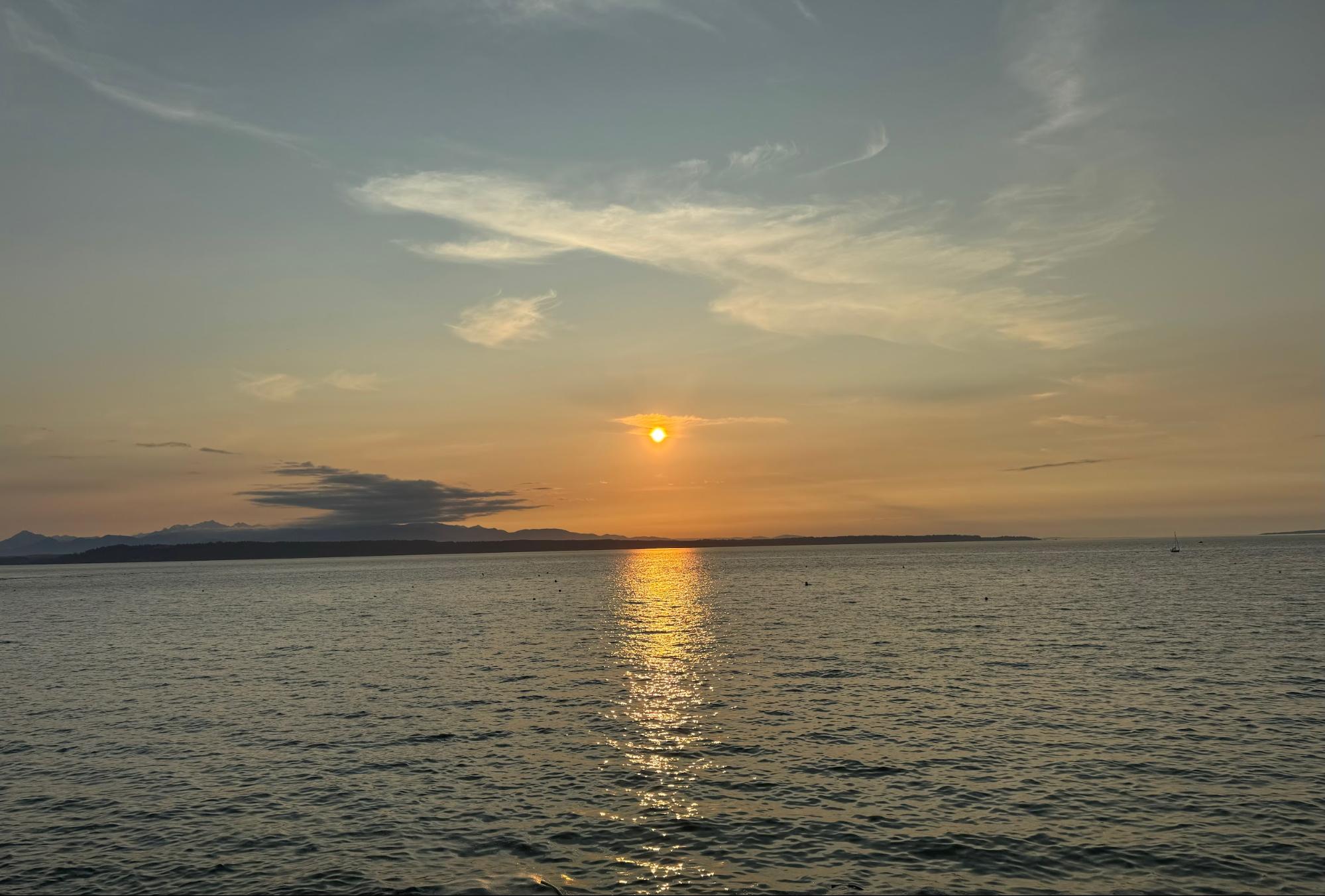
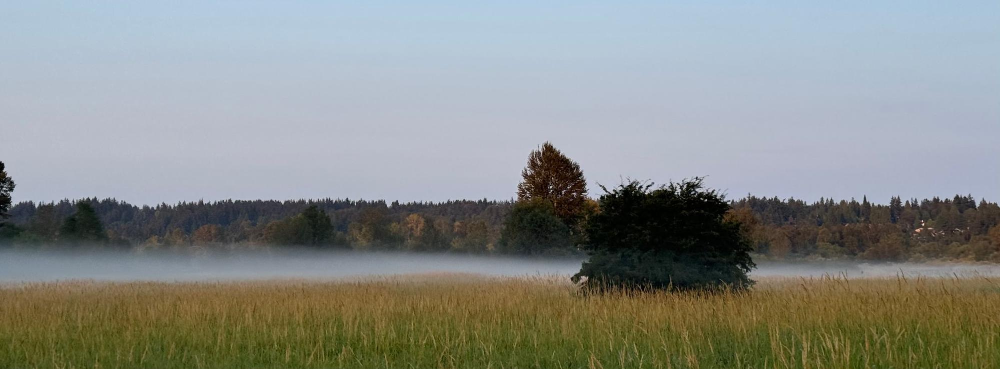
A sunny, quiet morning in the Snohomish valley. (Photo: Xiangzhou Kong)
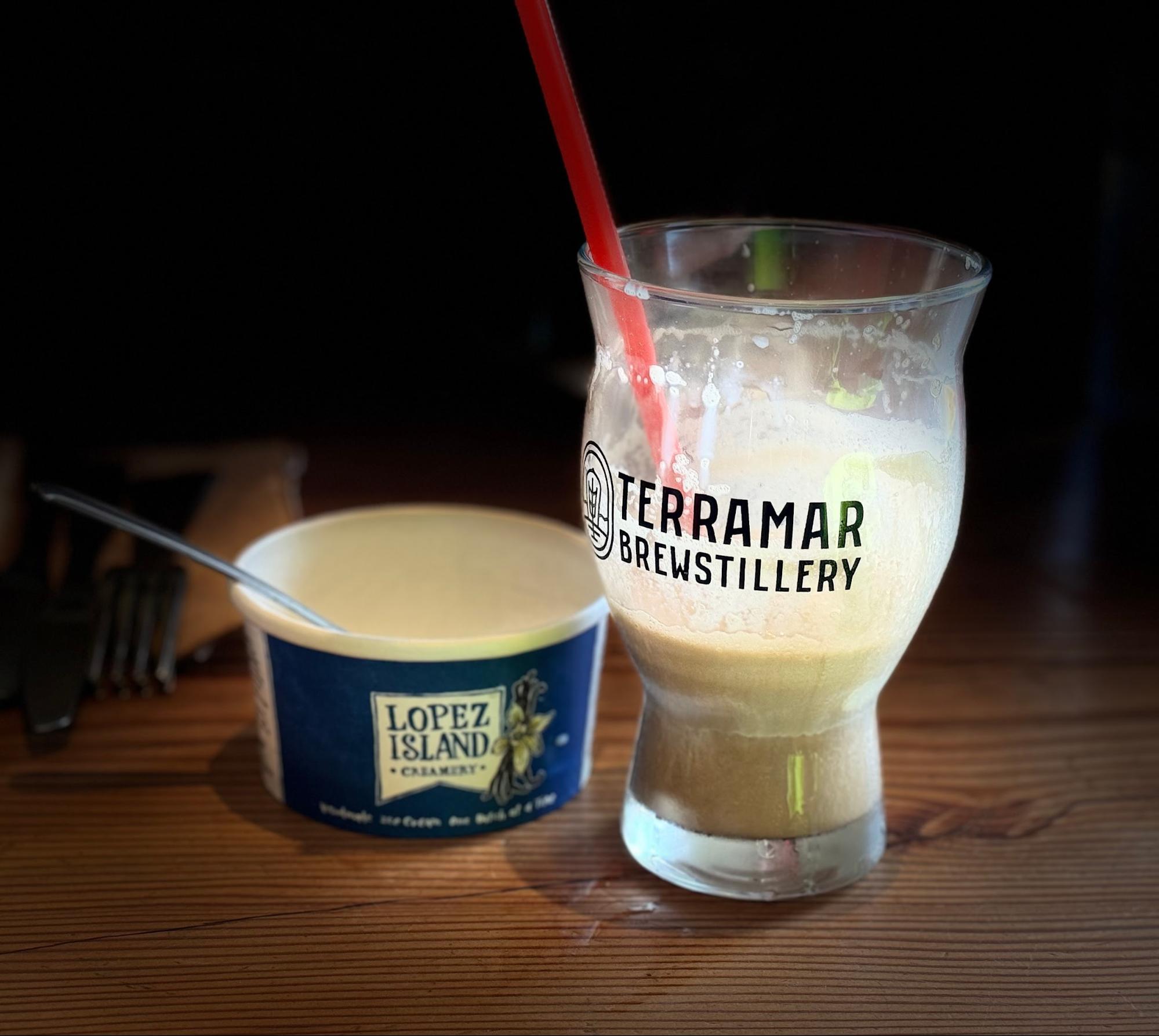
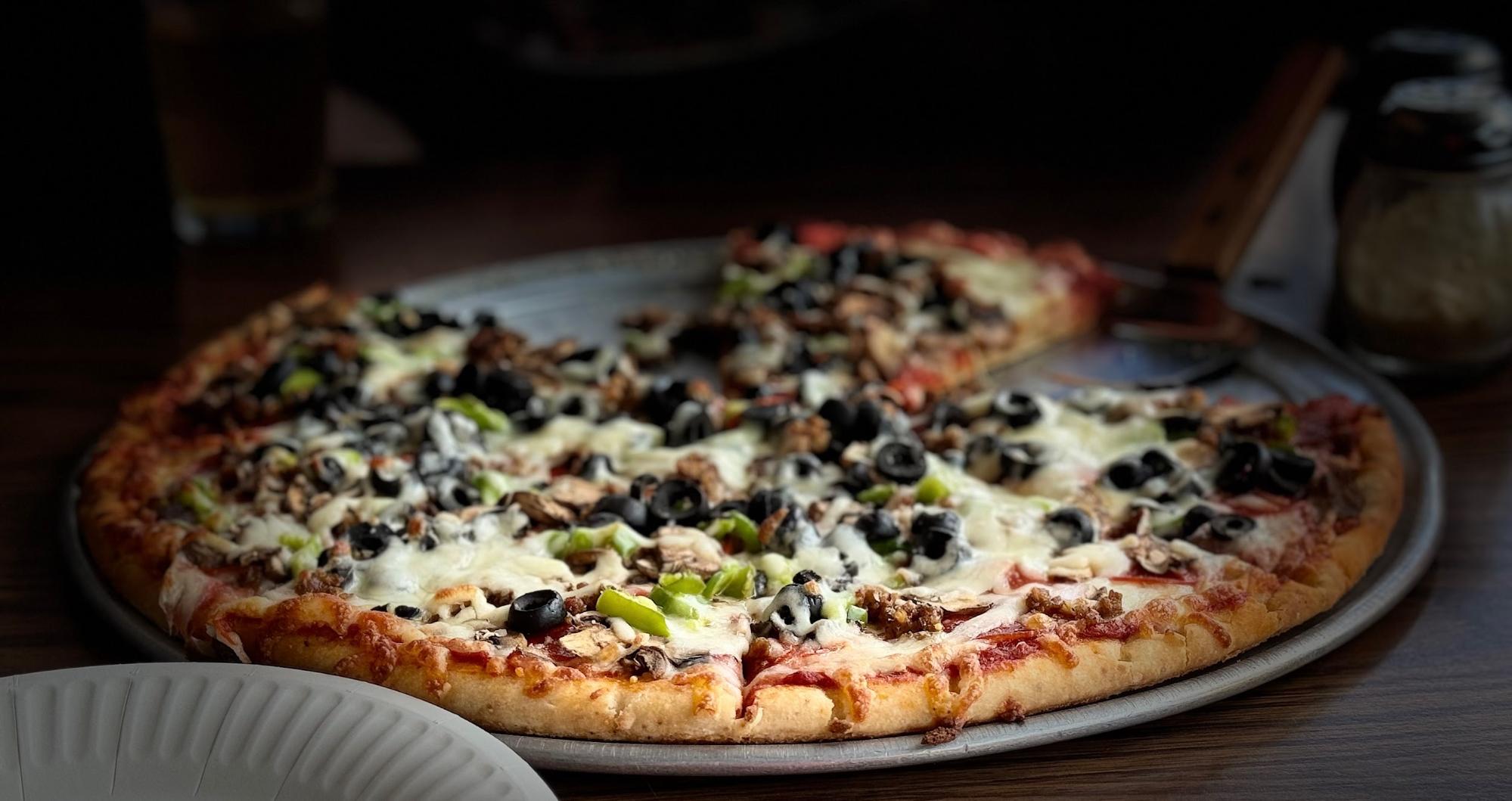
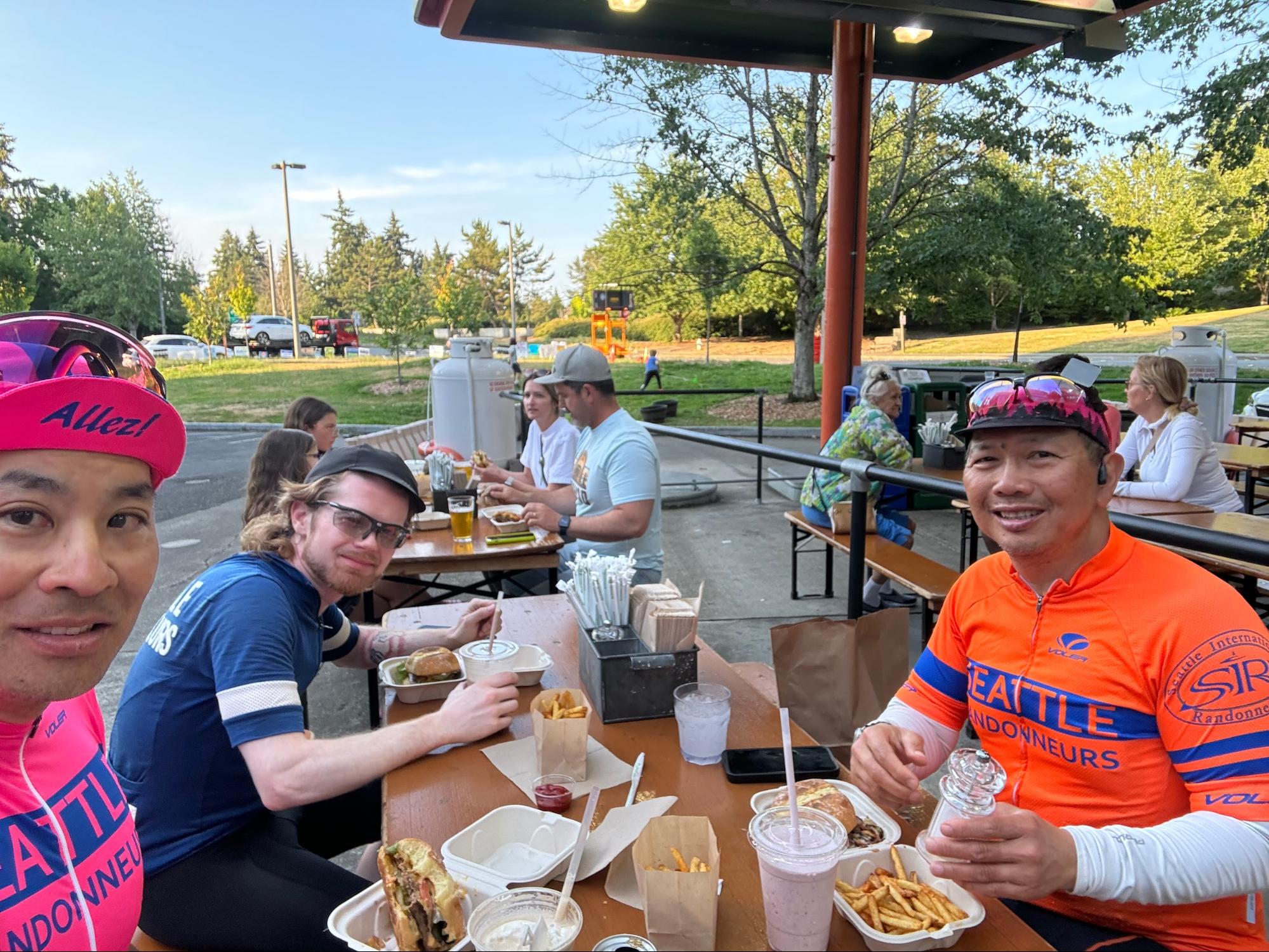
The route starts with mostly quiet rural roads through Snohomish and Marysville. Take care with the merge onto Highway 204 out of Everett’s Ebey Slough, followed by an immediate left turn onto Sunnyside Blvd. Climb over Lake Ki towards Camano Island, with some potentially busy sections of road through Stanwood. Wind and weather conditions will dictate your pace north along Padilla Bay into quaint Edison, where Terramar Brewstillery offers pizza and house-brewed beer and soft drinks.
Hot pizza, soft drinks, and drying gilets at Terramar Brewstillery. (Photo: James McKee)
The closure of Chuckanut Drive necessitates a detour up Bow Hill and along Lake Samish. Preriders found these roads to be low traffic and pleasant; despite hugging I-5, you’ll feel like you’re riding through a tunnel of rocky cliffs and trees up Lake Samish Drive (the pre-ride route profile included some phantom steep grades here that were not reflected on the road). Descend past the Galbraith MTB complex and down the Stair Step Streets (watch for cross traffic and stops) into Fairhaven and Bellingham. Preriders stocked up on snacks and sun at the Haagen grocery here before turning back south for the climb back out of Bellingham.
The Lake Samish detour into Fairhaven. “5 out of 5 didn’t suck!” – Andy S. (Photo: Phil Neff)
Rolling country roads lead south through Sedro-Wooley; the route winds through the Burlington suburbs and over the Conway hill on SR534 before briefly joining Highway 9 at Lake McMurray; from here, it’s the standard Centennial Trail, Broadway, Woodinville, Sammamish River Trail sequence back home to Redmond.
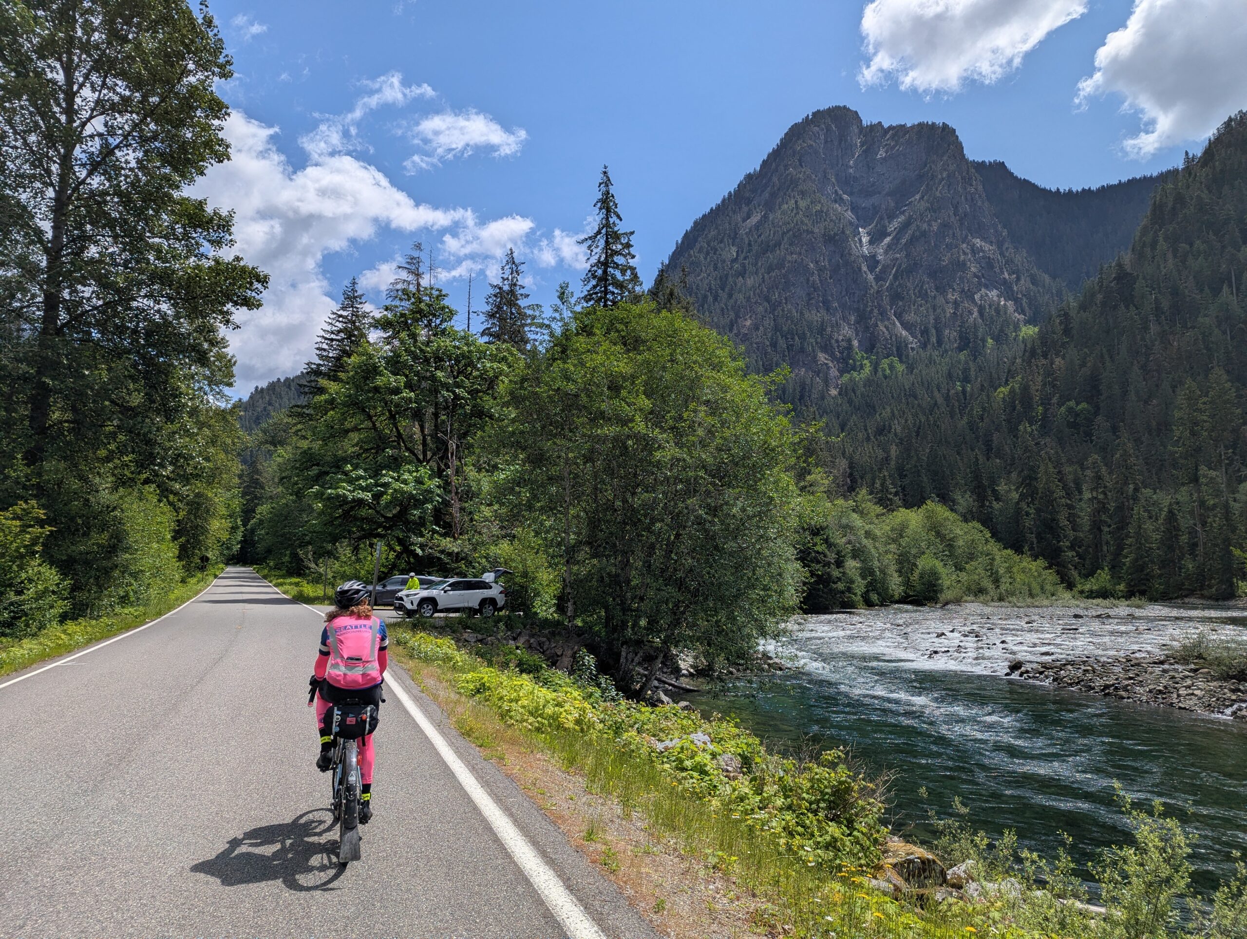
Day two starts with the punchy Union Hill climb, maxing out at 10% grade, before a descent into Carnation to the Snoqualmie Valley Trail. From here, it’s gradual railroad-grade climb on light gravel to Tokul Road, and then through the towns of Snoqualmie and North Bend. Stock up on food and water here before the approximately 25K long (one-way), 300m climb up the Middle Fork Snoqualmie trailhead. Gorgeous river and mountain views abound on this stretch.
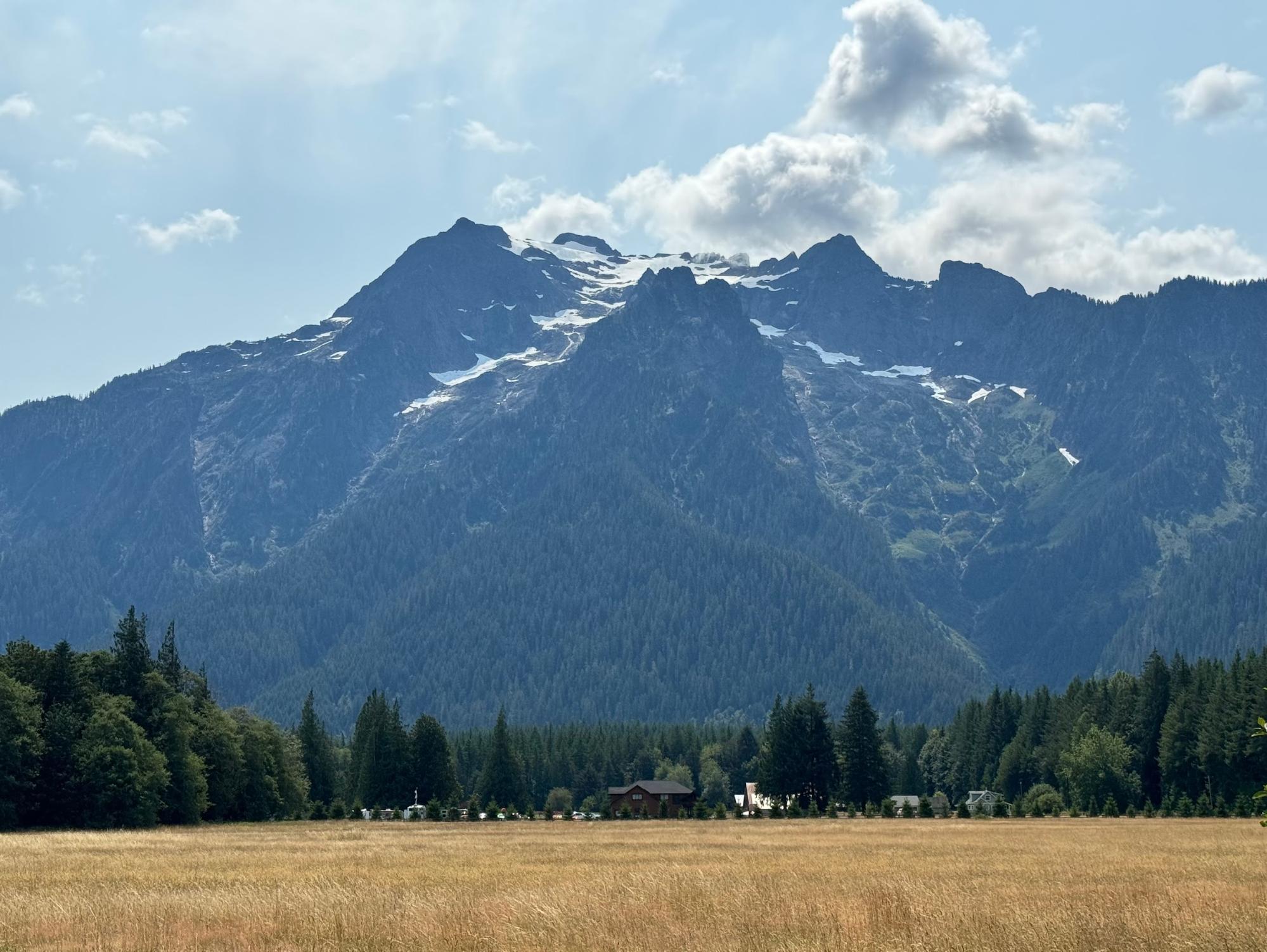
Astounding scenery on the Middle Fork Snoqualmie. (Photo: Xiangzhou Kong)
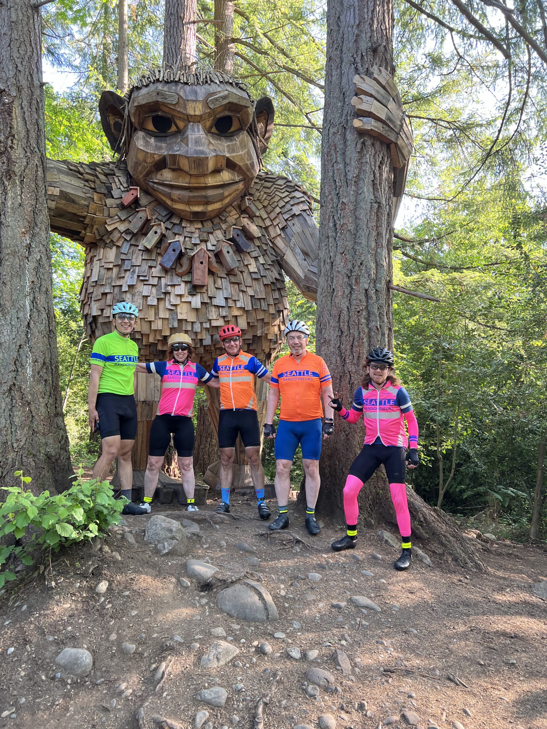
More punchy climbs punctuate the route back via the Issaquah Highlands, followed by the busy Issaquah-Hobart Road to Cedar Grove Road and the traffic-free relief of the Cedar River Trail. Wind through Renton and follow the familiar Lake Washington route through Factoria back into Issaquah, doubling back to pass the troll on the Rainier Trail.
The route finishes with a roll up the Sammamish River Trail to the Redmond Inn. Chapeau!
A celebratory group photo with the Issaquah troll before the final few Ks. (Photo: James McKee)
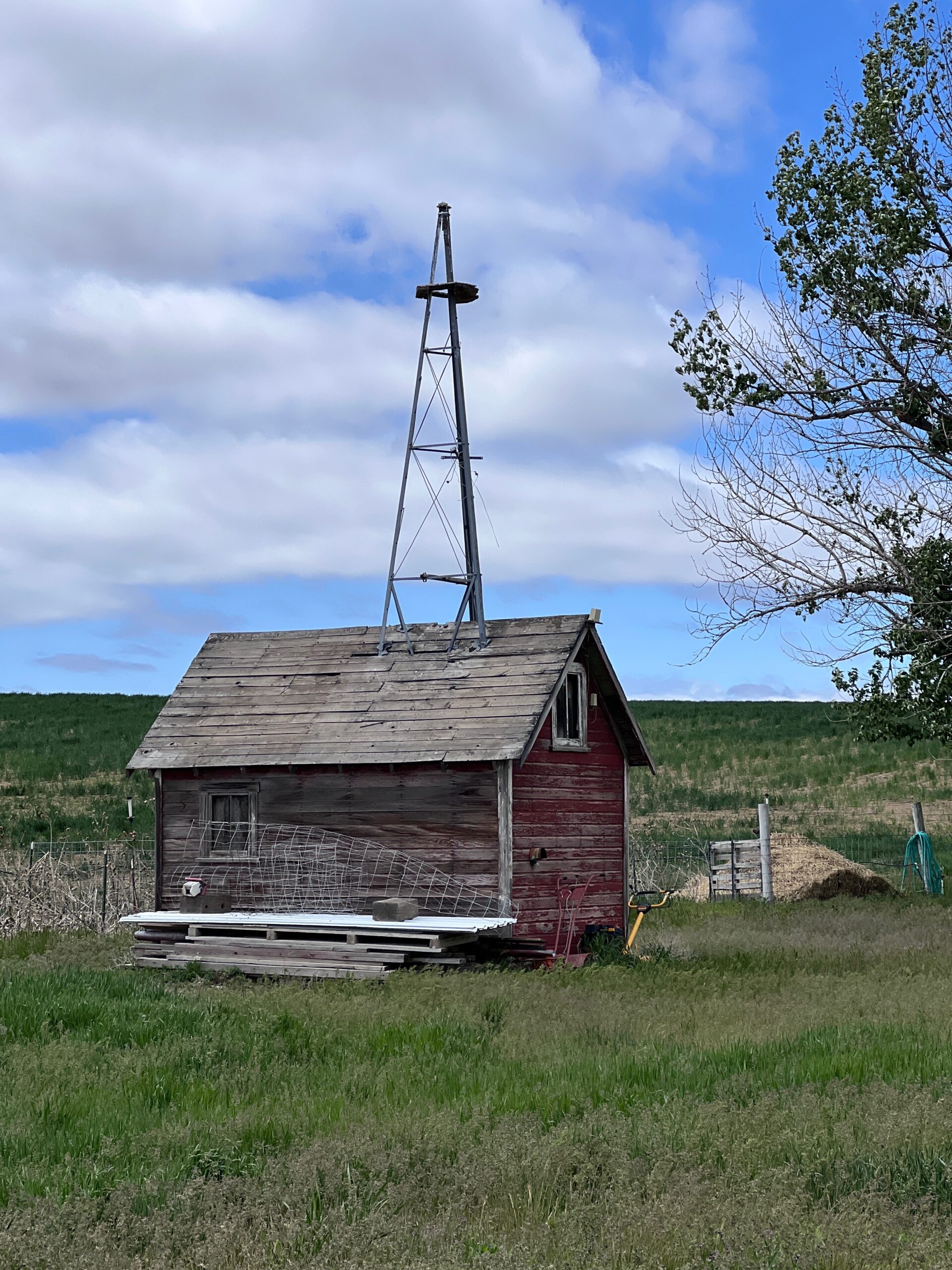
On June 7th, SIR returns to the Waterville plateau for our Summer Gravel Populaire. If you rode any events here last year, this is an all-new route once again crafted by local rando Don “shiggy” Person. I previewed the course with shiggy last week. After heading west from town, we made our way up to the northernmost corner at Fletcher Cemetery. Then turned south skirting Lamoine and Supplee, passing through Alstown and Douglas before returning to Waterville.
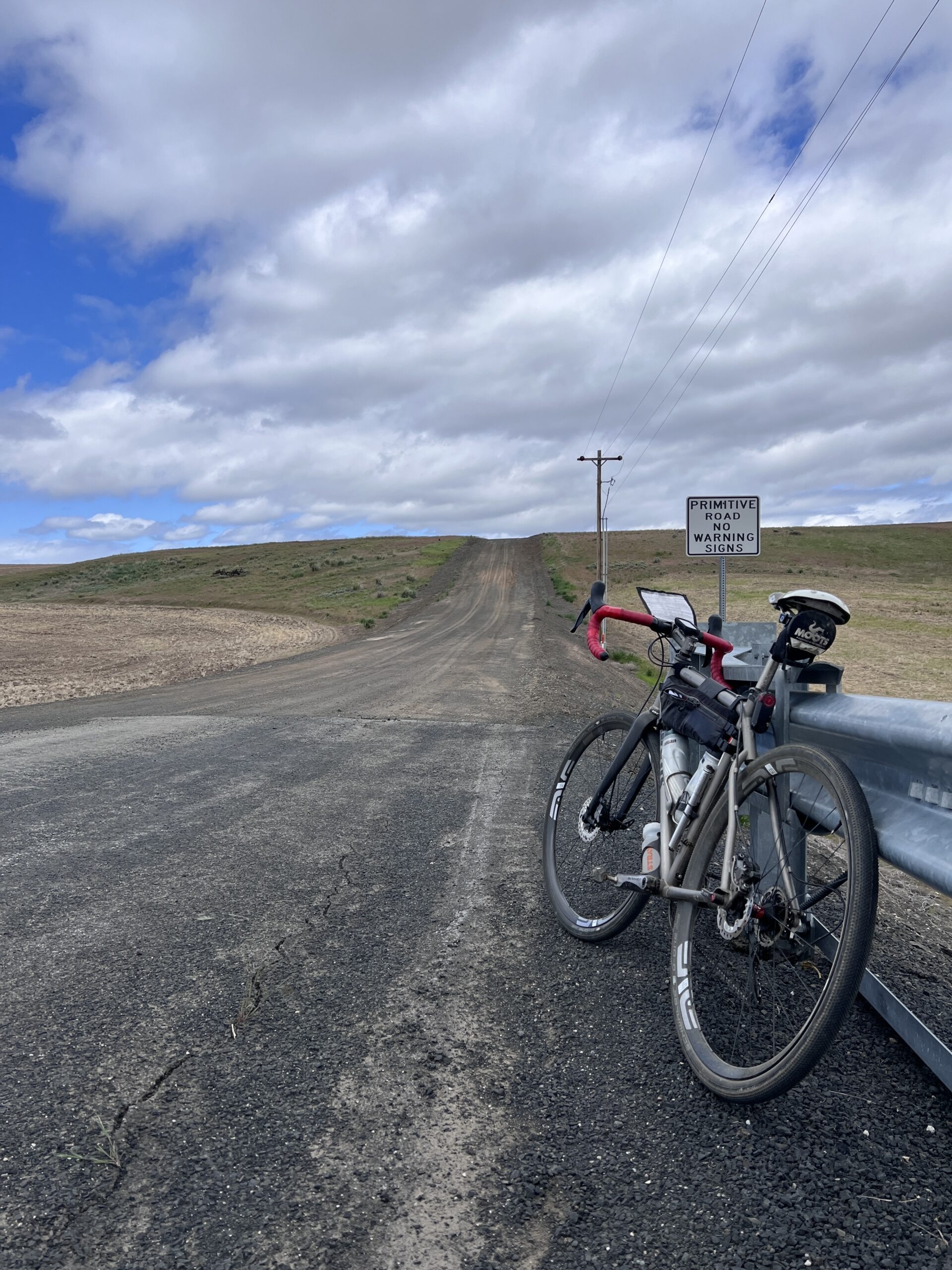
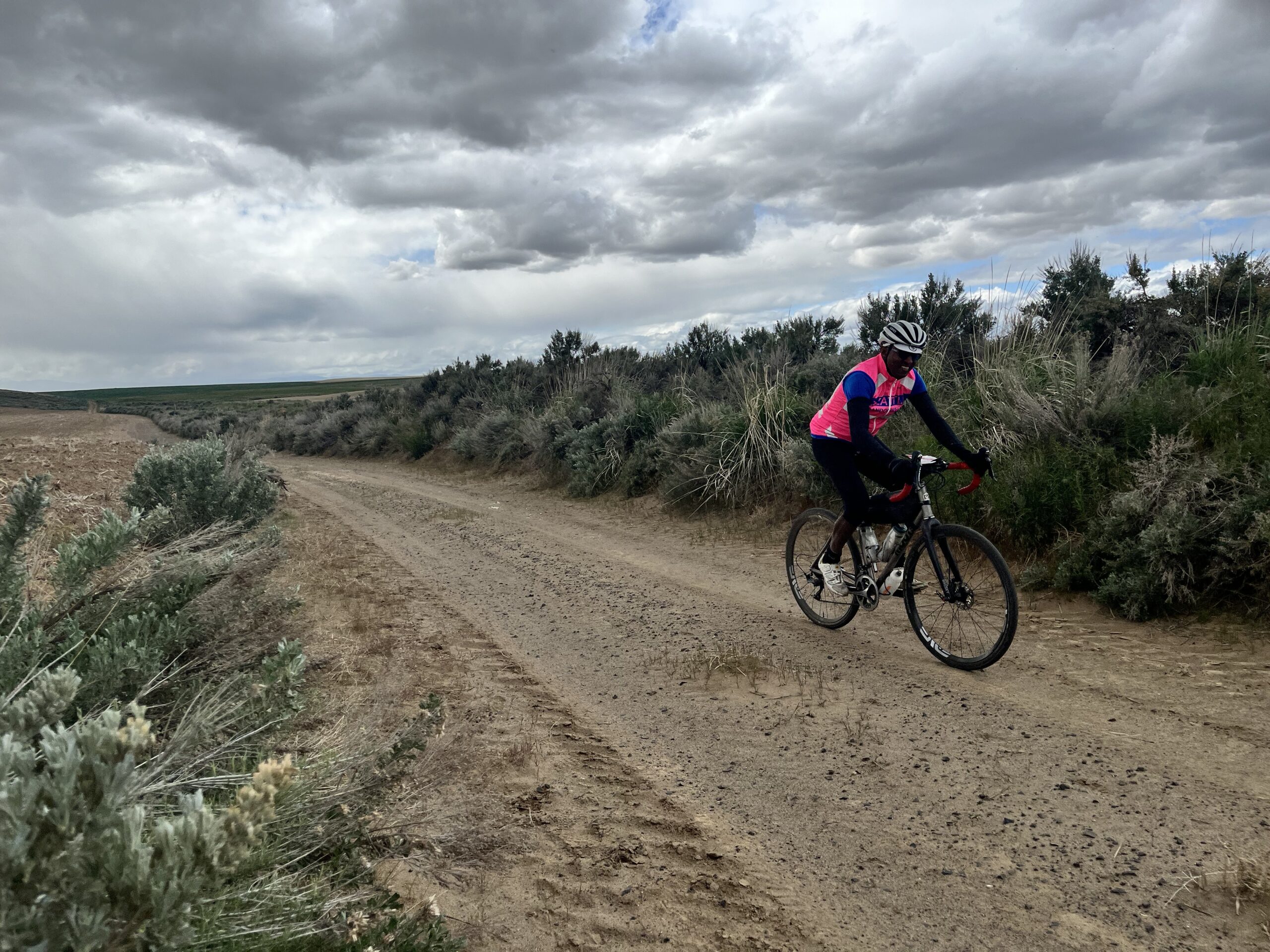
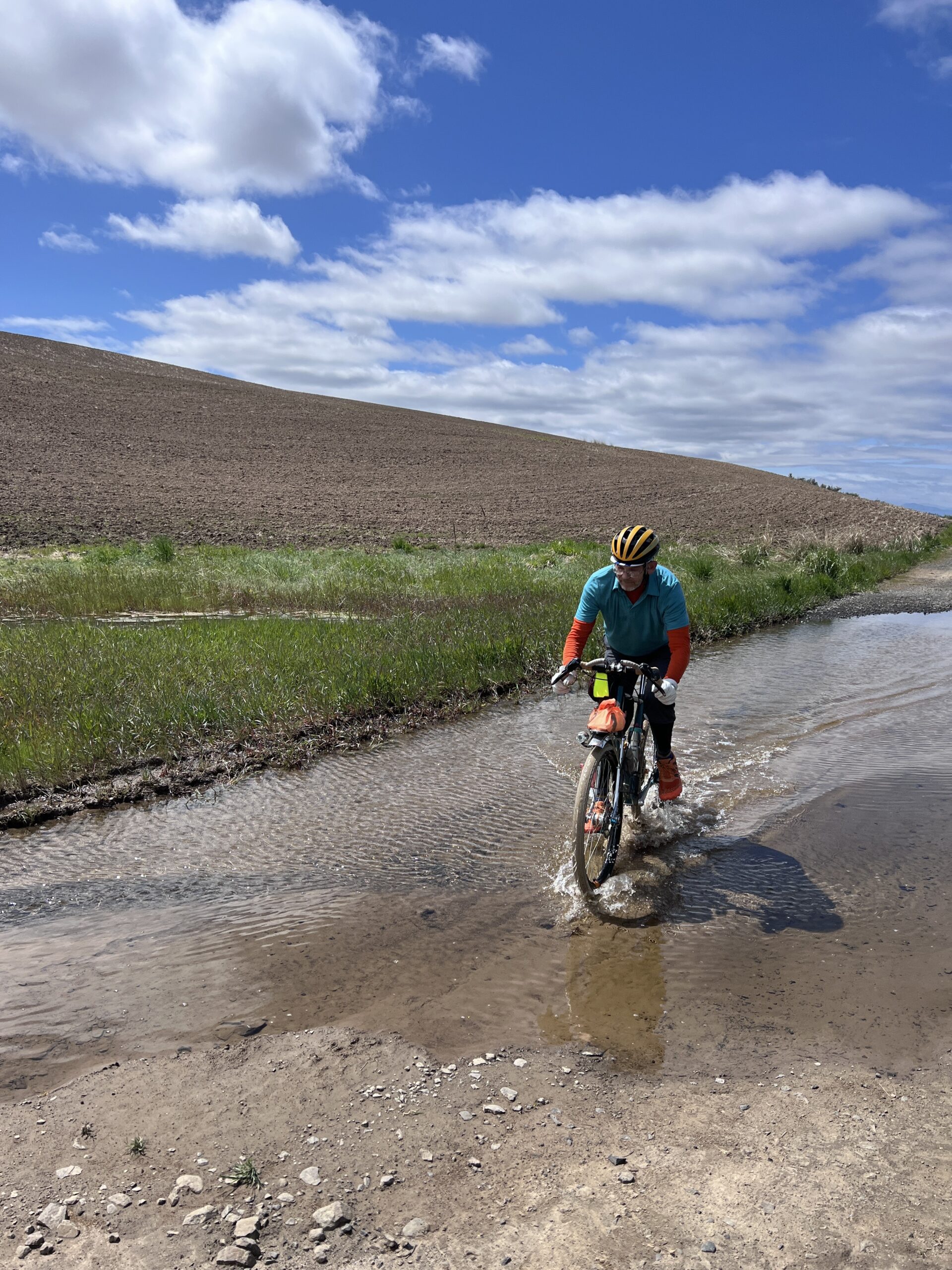
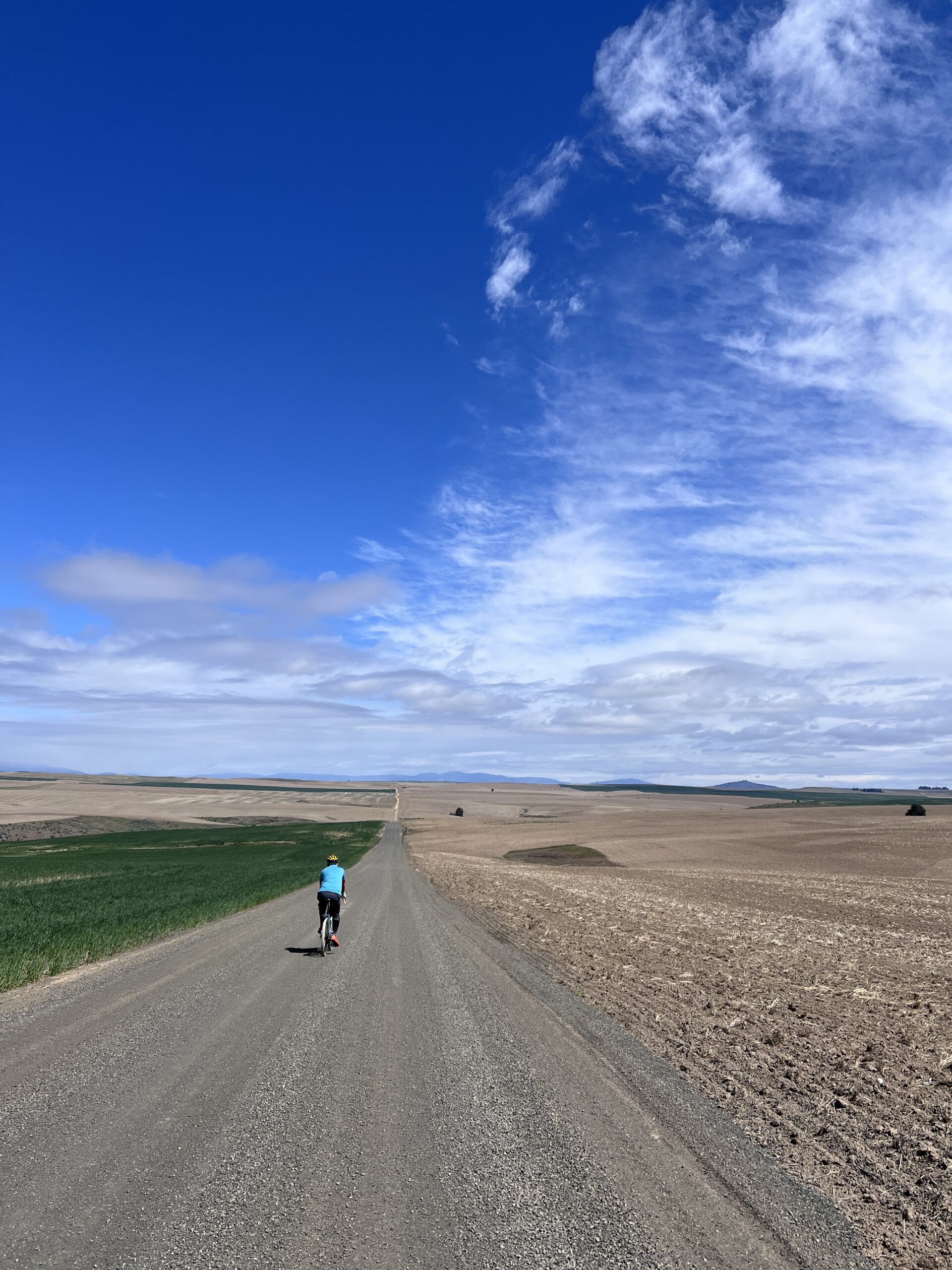
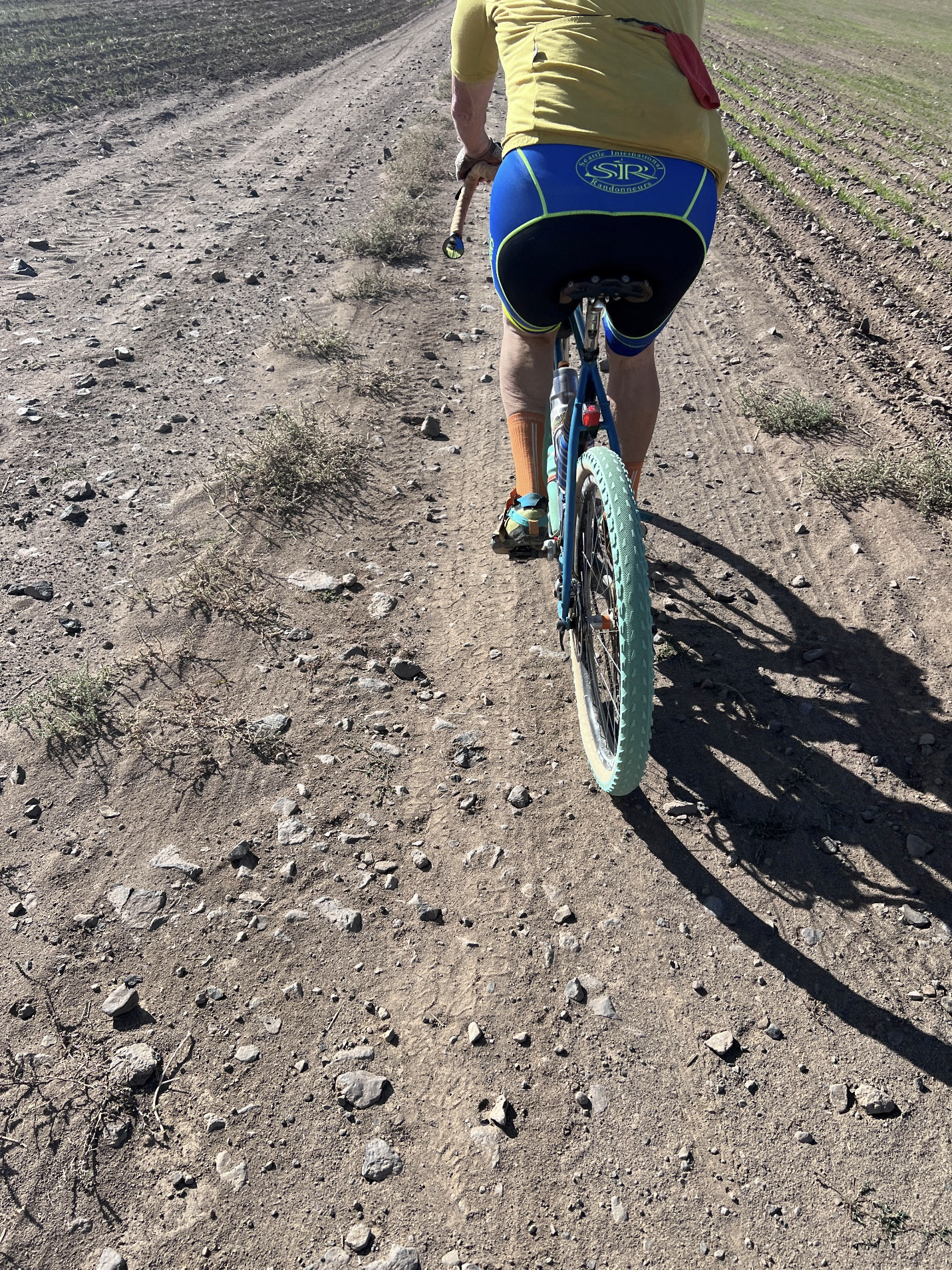
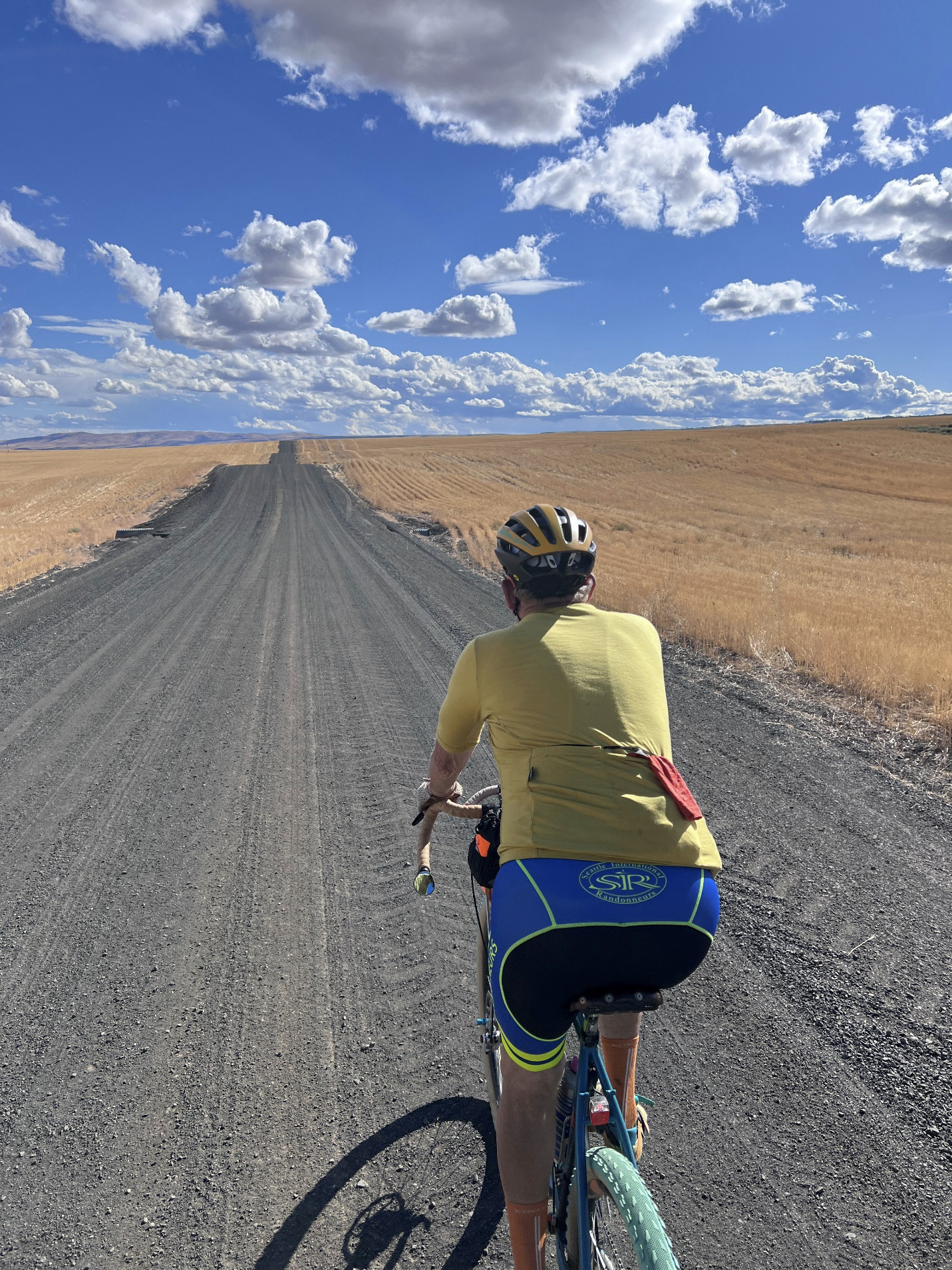
Of the 100K distance, just 9K is paved with the rest (91K) a diverse mix of gravel across a patchwork of interconnected, rolling farm roads. Elevation gain on RWGPS (https://ridewithgps.com/routes/49950178) shows 3590’/1094m, but we recorded 4514’/1376m. Expect surface conditions to vary from hard packed dirt to soft sand to chunky loose rocks – creating an intermediately challenging ride where bike handling skills will be tested. But nothing too extreme. I rode 42mm tires. Shiggy was on 55mm. Recommend minimum 38mm. Slicks are ok if you’re experienced. Many of the roads will NOT have markings, but we’ve verified accuracy of the turns (and also updated the cue-sheet with “Unsigned” designation). We do suggest bringing a printed copy to aid with your navigation.
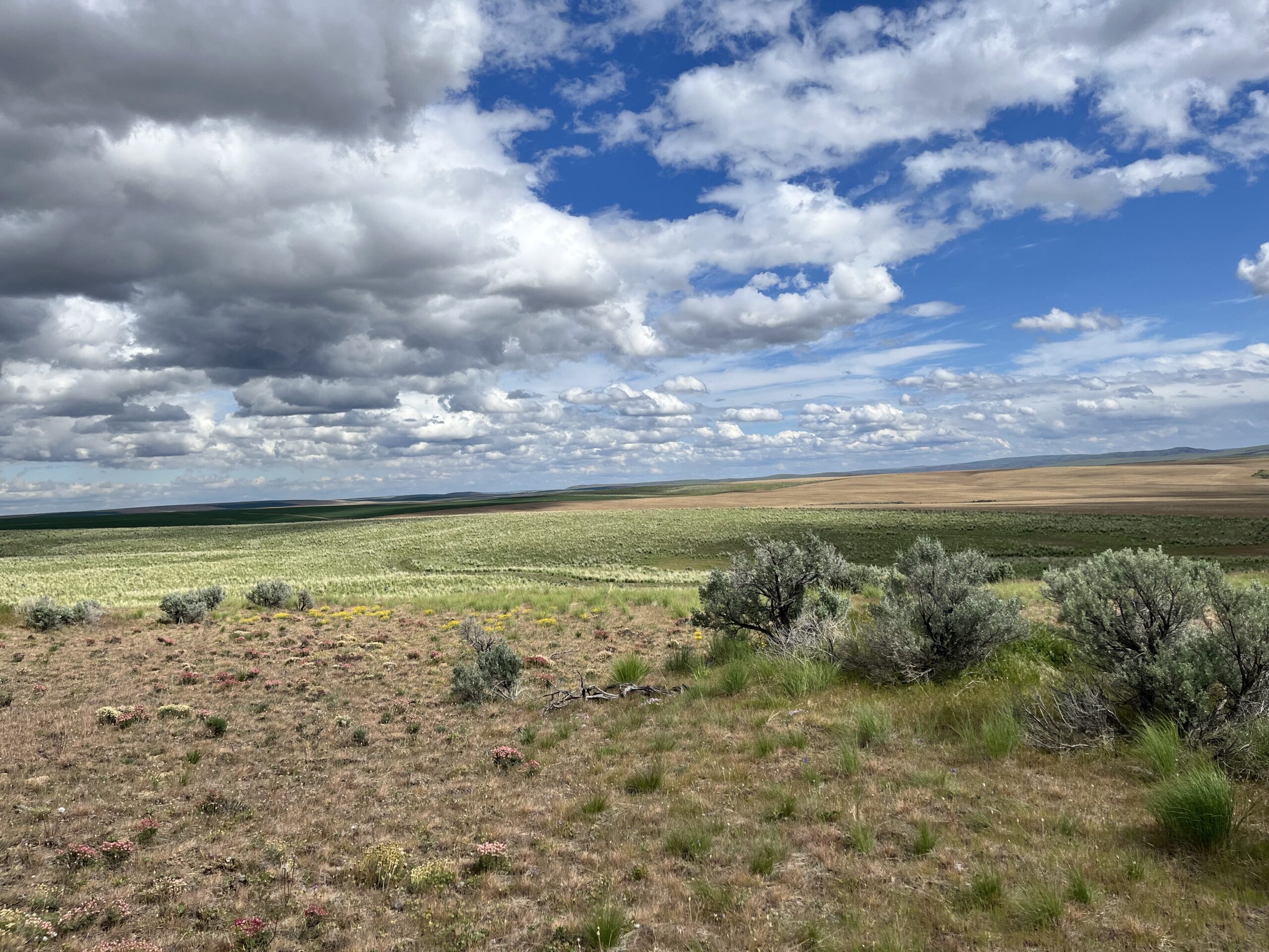
You’ll spend the day soaking up open skies, admiring acres of thriving wheat, punctuated by the occasional “alley” of deeply aromatic Sagebrush. These fields extend as far as the eye can see and were carved by glacial activity, floods and wind over millennia. The fertile soil, winter snow, spring rain, and dry summers create ideal growing conditions in these rugged lands. Expect to see no one and little auto traffic during your ride. We were passed by just 3 vehicles (a road grader, a gravel hauler, and a pickup) – all very bike friendly. Please remember, farm equipment ALWAYS have the right of way. It also gets hot in June, and there’s no real shade on the route. So come well prepared – carry extra tubes, check/top off sealant (if riding tubeless), bring ample food and no less than 2 water bottles. We’ll have a staffed SIR control at 53.9km (33.5mi) where you can refill them, but there’s no services or resupply points elsewhere. Cell service is spotty.
A few noteworthy items:
TURN at 13.7k (8.5mi): Right uphill onto 4 Rd NW [unsigned]. This turn comes immediately after passing some concrete barriers. Do not continue straight downhill!
TURN at 16.7k (10.3mi): Hidden Right onto Rd P NW [unsigned]. On road right before turn, there are buildings with farm equipment.
BAIL-OUT OPTION at 22.2km (13.8mi). At intersection of Rd N NW and 4 Rd NW, continue straight on Rd N NW. Turn right on Rd 3 NW and then left to Rd O NW/N Chelan Ave to Waterville.
SIR’s third gravel event this year brings another course designed by Don “shiggy” Person – who has arguably mapped more Douglas County backroads than anyone for over a decade. Those who rode his first one in June will find an all-new route that is a bit shorter (100km vs 134km), with slightly less climbing (4300’ vs 5100’), but still chock full of adventure. From Waterville, we’ll work our way to Douglas, then south towards Alstown, traverse the southern plateau, turn north to Supplee, tackle some big rollers heading west in the direction of the Columbia, and finally turn east back to the start. Hwy 2 and the river far down below can be spotted during the last bit.
This 100km (62mi) route is 83% unpaved. You’ll discover hard-packed farm roads, mid to smooth (“champagne”) gravel, loose sand, chunky rocks to “moondust” (deep talcum powder-like fine dirt). The remaining 17% strategically-scattered, paved patches will render your legs a refreshing boost. There’s something for everyone here – an excellent, intermediate ride if you’re “gravel curious”. Nothing extreme or over the top challenging. I rode 40mm tires. shiggy was on 55mm. Recommend minimum 38mm. Slicks are fine.
That said, you’ll be far away (no services/resupply points) with open skies in all directions, enveloped by expansive acres of wheat. You’ll see first-hand how our Eastern Washington landscape was shaped by glaciers, volcanos, floods and wind. Come prepared – carry extra tubes, check/top off sealant (if riding tubeless), bring extra food and no less than 2 water bottles. shiggy and I both had 3 bidons but ran out. However, with staffed controls at 21km (13mi) and 64km (40mi), you won’t have to worry about that happening to you. Expect to see no people and very little traffic all day. We were passed by only 2 cars the entire time. While, we rode past dozens of combines and other large vehicles, we saw just one in operation. Please remember, farm equipment ALWAYS have the right of way. No rain in current weather forecast. It may be hot, and there is ZERO shade on the route.
The most challenging downhill section with larger loose rocks comes early at 12km (7.5mi) on Rd 2 NW. Exercise high caution here. The steepest climb – also to highest point at 3100’ – comes at 89km (55mi). Your legs may grumble a bit, but it’s pretty much downhill from there. We let it rip on the final 5km (3mi) home stretch yelling “wheeeeeeeee”!
Ride Start: Pioneer Park in Waterville (North of W Walnut Street between E Park Street and S Chelan Ave, Waterville, WA 98858). Check-in begins at 8:00am. Briefing at 8:50am. Roll out 9:00am sharp.
Parking: Near the tennis courts in the park or at the high school on S Chelan Ave.
RV camping and coin operated showers (takes quarters) at Fairgrounds RV park – 1/4 mile away
Grocery store: Waterville Family Foods at (102 E Locust St; opens at 7:30am)
Finish and Post-ride: Knemeyers Eatery & Spirits (115 W Locust St; directly across from Pioneer Park) is friendly and has pizza, burgers, beer
While most roads are in a grid pattern (Rd 1, Rd 2, Rd D, Rd E…etc) several intersections WON’T have any signs. Pay close attention to GPS and/or cue-sheet (highly recommend you print & bring with you). The marked turns are very accurate and we never got lost.On the Waterville Plateau, wheat fields thrive from glaciers that melted a millennia ago. Erupting volcanoes, particularly the ash from Mount Mazama 7700 years ago, is a major contributor to the rich soils in the region. Mount St. Helen’s eruption in 1980 added to that.Large paw prints in deep sand that looked too big for a Coyote or Bobcat. Cougar??? We were later greeted by a Northern Harrier (with its distinctive white rump patch) gliding low over the wheat. And a Red Tail Hawk followed us overhead for a bit perhaps hoping the “crunch…crunch” of our wheels would scare a rodent snack out of hiding.Douglas CemeteryShan and shiggy
Comments Off on 2024 Fall Waterville Gravel Populaire Pre-Ride Report
View of Sunrise on a lovely day (note: not the pre-ride)
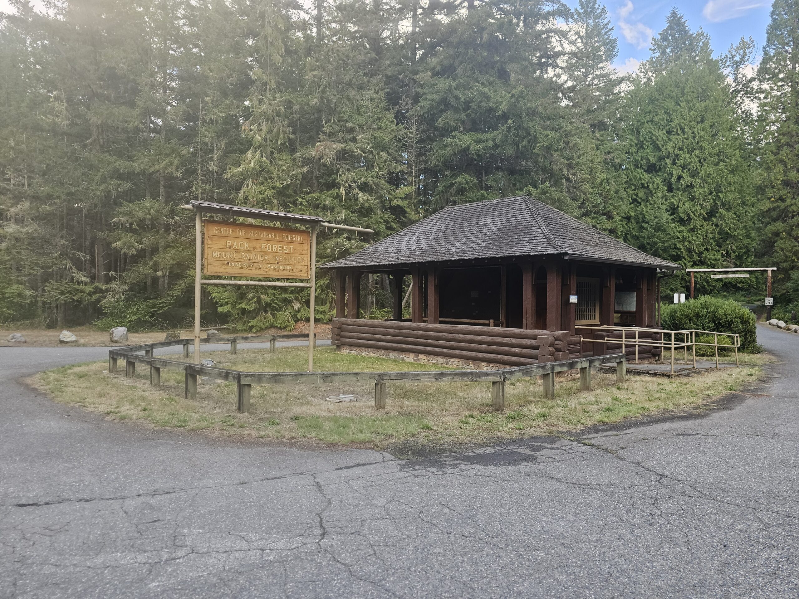
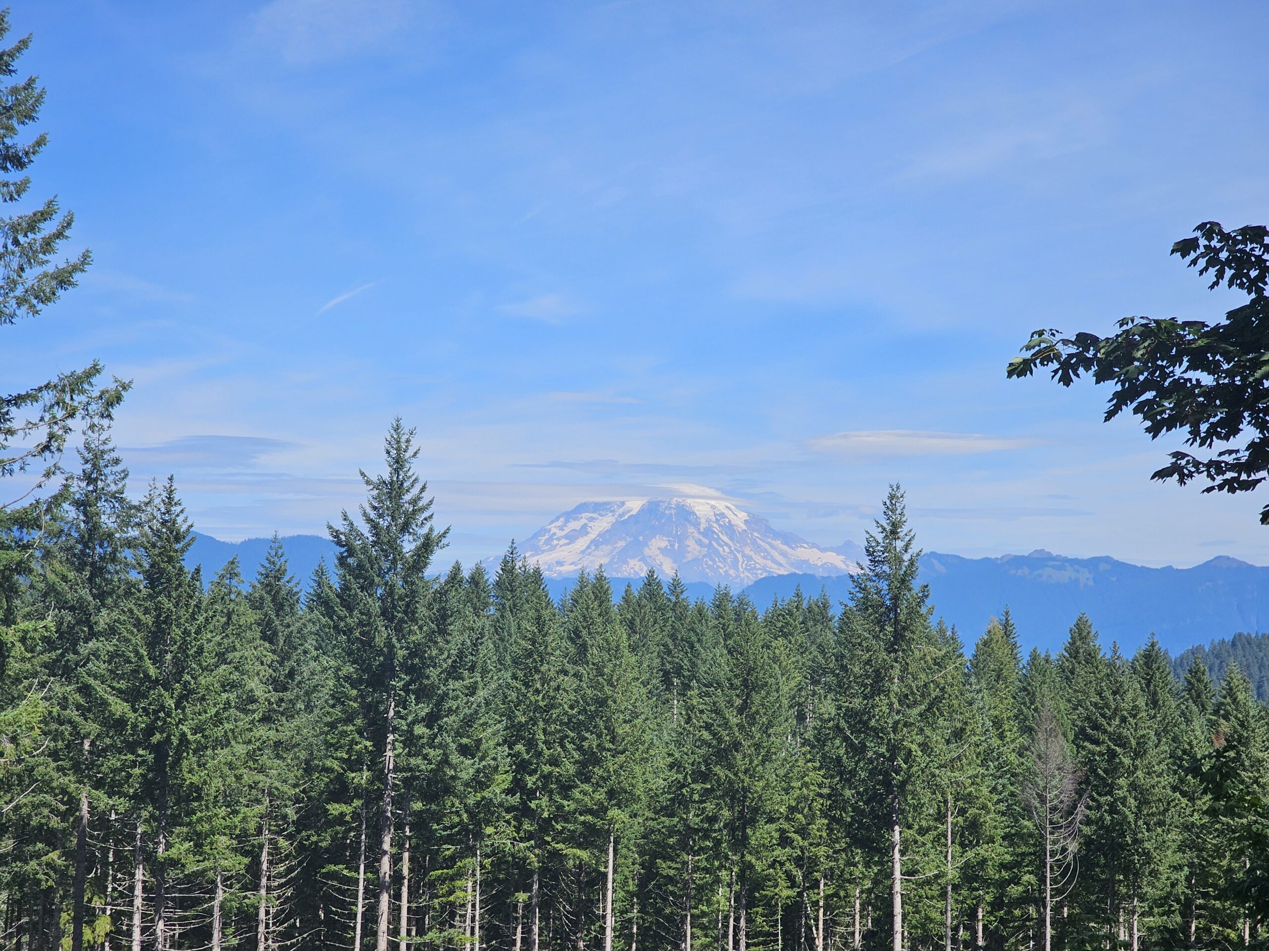
As seen from previous posts, this 8K600K route was rerouted several times to finally get a perfect storm of climbing around the scenic and amazing Mount Rainier National Park. Within a couple weeks of the pre-ride, we had to change the course due to a major wildfire on Hwy 12 east of White Pass. Even though the wildfire was all put out by all the rain, we couldn’t change it back to the original route since there was still wildfire danger and closures within a couple days before our pre-ride. I also established three 200K permanents to ride it in 3 days, so we could focus on each section of the route. Thanks to RUSA for approving these 3 permanents in short notice! Rick Blacker and I prerode a portion of the first section to Sunrise. We decided to be safe and not continue riding down off top of Sunrise due to cold and rainy conditions last weekend. We also pre-rode the 214k permanent from Cliffdell to Eatonville and got a lot of information along that section of the route, since there is a lot of stores with limited hours in the small towns. We also pre-drove the last section to also obtain important store hours and road conditions up to Bear Meadows.
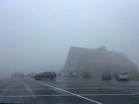
View of Sunrise during the pre-ride.
This 8K600K is important to prepare for the elements and requires some preplanning on where you will get food on this route. The cue sheet on the RWGPS has been updated to reflect all the store hours in each town or control towns. The first section of the course has 4 major climbs, that includes Cayuse Pass (4000 ft in 24 miles), Sunrise (3,000 ft in 13 miles) , and Chinook Pass twice (3700 ft in 26 miles 1st time from Greenwater and 3300 ft in 25 miles 2nd time from Cliffdell), totaling 15,000 ft of elevation gain in the first 157 miles, with a huge descent into Packwood at the halfway mark. Each of these climbs have a steeper section near the top (8-10 miles with grades of 10% or greater), so its important to take advantage and increase the speed on the lower section of each climb. Each major pass climb also has long descents following them and this is where you can make up a lot of time. Its important to be efficient at controls and while riding in order to keep ahead of the 15kph average speed (guideline cutoff – all noted on the RWGPS cue sheet). There are no intermediate cutoffs on this ride, but its important stay ahead for more sleep at the overnight and more time to relax on the second half in order to finish within the required 40 hours time limit. This ride will be EPP and will include instructions on the Brevet Card, essentially sending your Strava, RWGPS or GPX file to me after the finish.
There are no services after you start at Packwood, so plan on carrying extra food here for the first 2 big climbs. There is a water fountain and restrooms just past the National Park entrance. I plan to be there at Sunrise control for support since the Sunrise Lodge does not open until 11:00 AM. Greenwater has several places to stock up including the Wapiti Woolies amazing huckleberry shakes and sandwiches or the Mt Rainier general store, just down Hwy 410. After making the U-turn in Greenwater climbing up Hwy 410 along the White River, there is the Silver Springs visitor center with food and water, near the base of the steep part of the 1st Chinook Pass climb. Whistlin Jack’s in Cliffdell has a store that closes at 7:00 PM and they stop serving food at the bar at 8:30 PM, so a good incentive to make it here before then since these closing times are right about at the guideline cutoff time. There is water at Pleasant Valley Campground about 16 miles up from Cliffdell up the 2nd Chinook Pass climb. Additional note: Lodgepole campground is closed for the season. Plan on no services for food from Cliffdell to Packwood (54 miles).
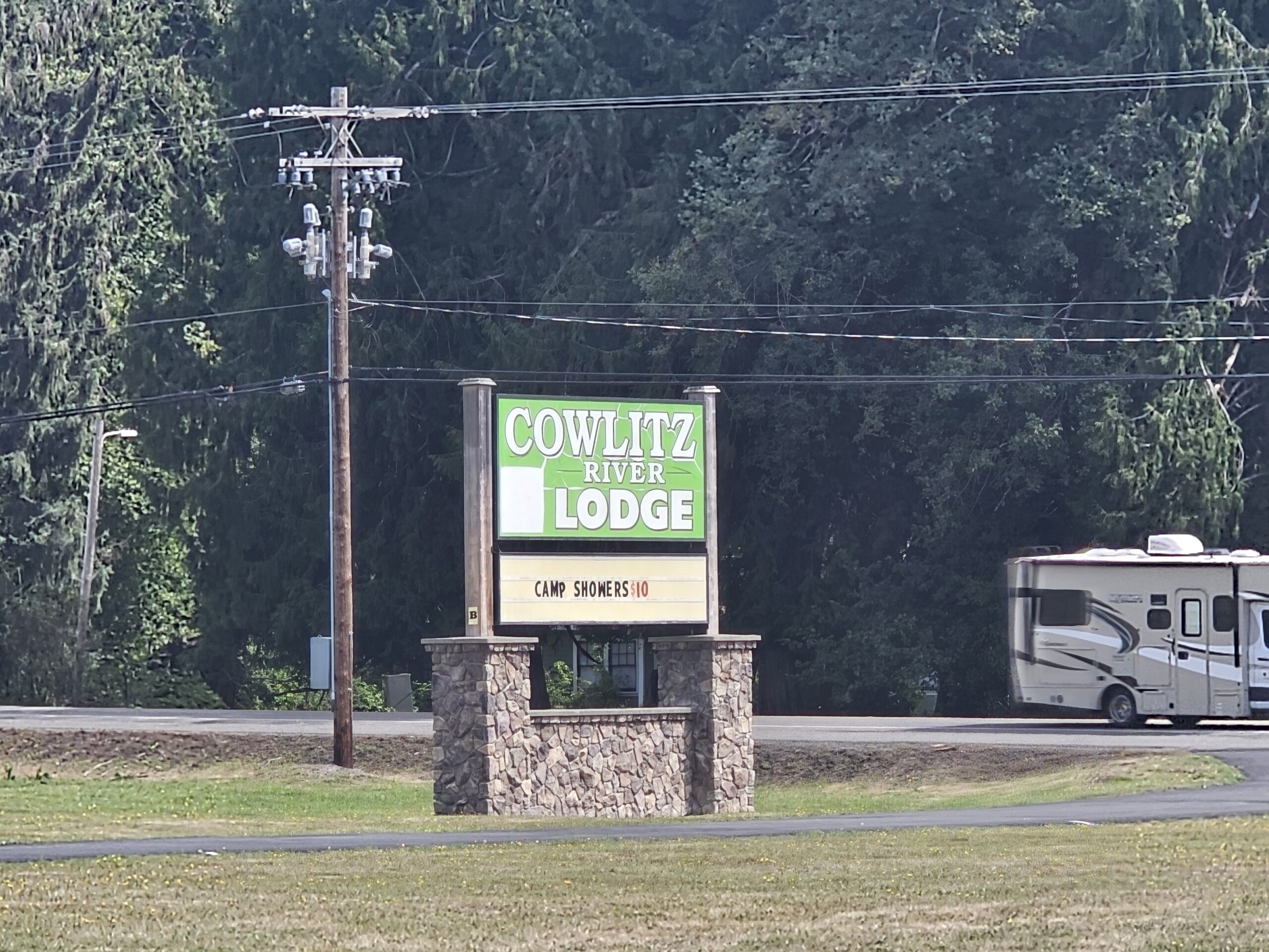
At Packwood, we will have a room at the Cowlitz River Lodge overnight control. Please check in at the control first if you are staying at a different place in Packwood. We will have sandwiches and soup. The imaginary cutoff at Packwood is at 0:48, so if you plan on leaving later than this please let me know at the overnight and then text me when you depart Packwood, so we know you are back on course.
The 2nd half of the ride has 2 major climbs, the first is the Skate Creek Road climb (1600 ft in 12 miles), immediately after Packwood. The 2nd major climb is the Bear Meadows climb (3100 ft in 15 miles), with a total elevation gain in 2nd half of about 11,000 ft. So there is a lot of rolling hills (100-300 ft) on the 2nd half and there is a long descent from the top of Skate Creek summit to Eatonville. There is some gravel sections for about 6 miles on the Skate Creek climb so be cautious as this will likely be in the dark. After you summit Skate Creek, it is paved all the way to Ashford. Just watch out of fallen trees or branches along the shoulder!
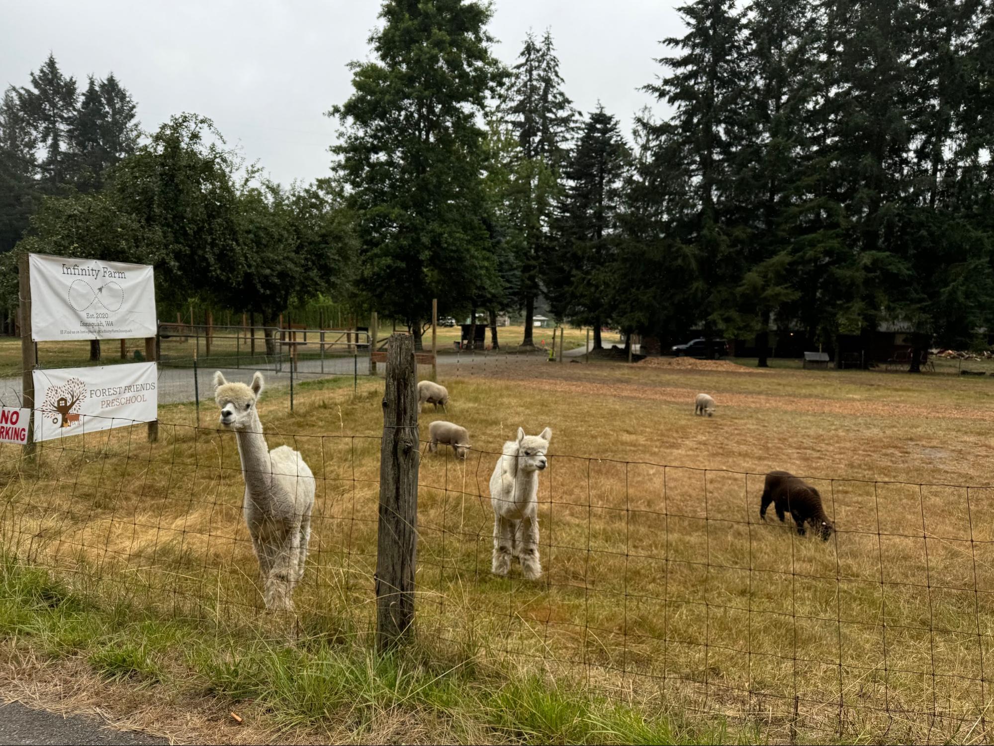
Store hours are very limited in Ashford, Elbe and Eatonville and should plan that they will be closed if you arrive through these towns between midnight and 6:00 AM, so plan on stocking up food at Packwood to go about 100k. There is a control just past the small community of LaGrande, at the bottom of the hill at Pack Forest along Hwy 7. Then after getting through Eatonville, there is a 50K out and back to the Puyallup River (at Brooks Rd/Orville Rd junction). This section has a few hills along Lake Kapowsin and back up into Eatonville. Kapowsin also has a store that opens at 6:00 AM.
After returning to Eatonville, you will take the Alder cutoff road back toward Alder Reservoir. At Elbe the route climbs up and over to Morton where there there is a control at Spiffys or the Shell store. Then reminder, the route goes on Davis Creek Road to get off of Hwy 12 for a while. Upon descending into Randle, there is great view of Mt Adams! At Randle, plan on stocking up for the final 65 miles that includes the climb up Bear Meadows. There is water in the Iron Creek campground at some noted campsites on the cue sheet, but might be hard to find at this late stage of the ride, but just made note just in case. NF25 has a lot of cracks in the asphalt, so be extremely cautious when climbing and descending along this forest road.
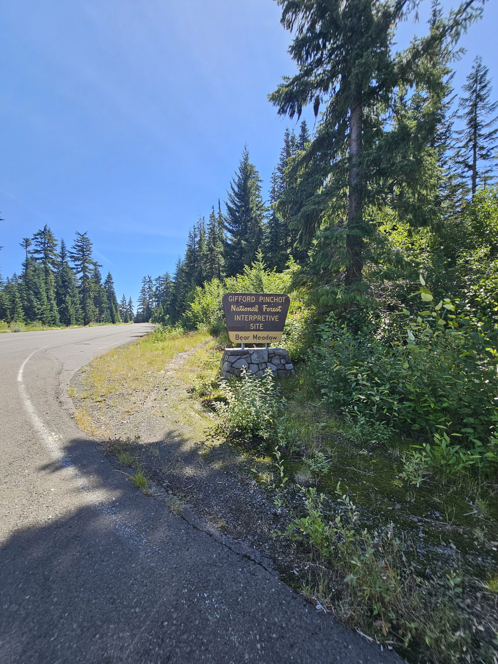
The NF99 road pitches up steeper for 5 miles but once you get to the summit at Bear Meadows, hopefully you get the view of Mt St Helens. There is a plaque there at the Mt St Helens viewpoint, so take in a few seconds to learn about the Gary Rosenquist famous photographs of the 1980 eruption!
The route then takes a U-turn back down NF99 to NF25, so hopefully you get back down before dark, cautiously descending with the bad cracks in the asphalt.
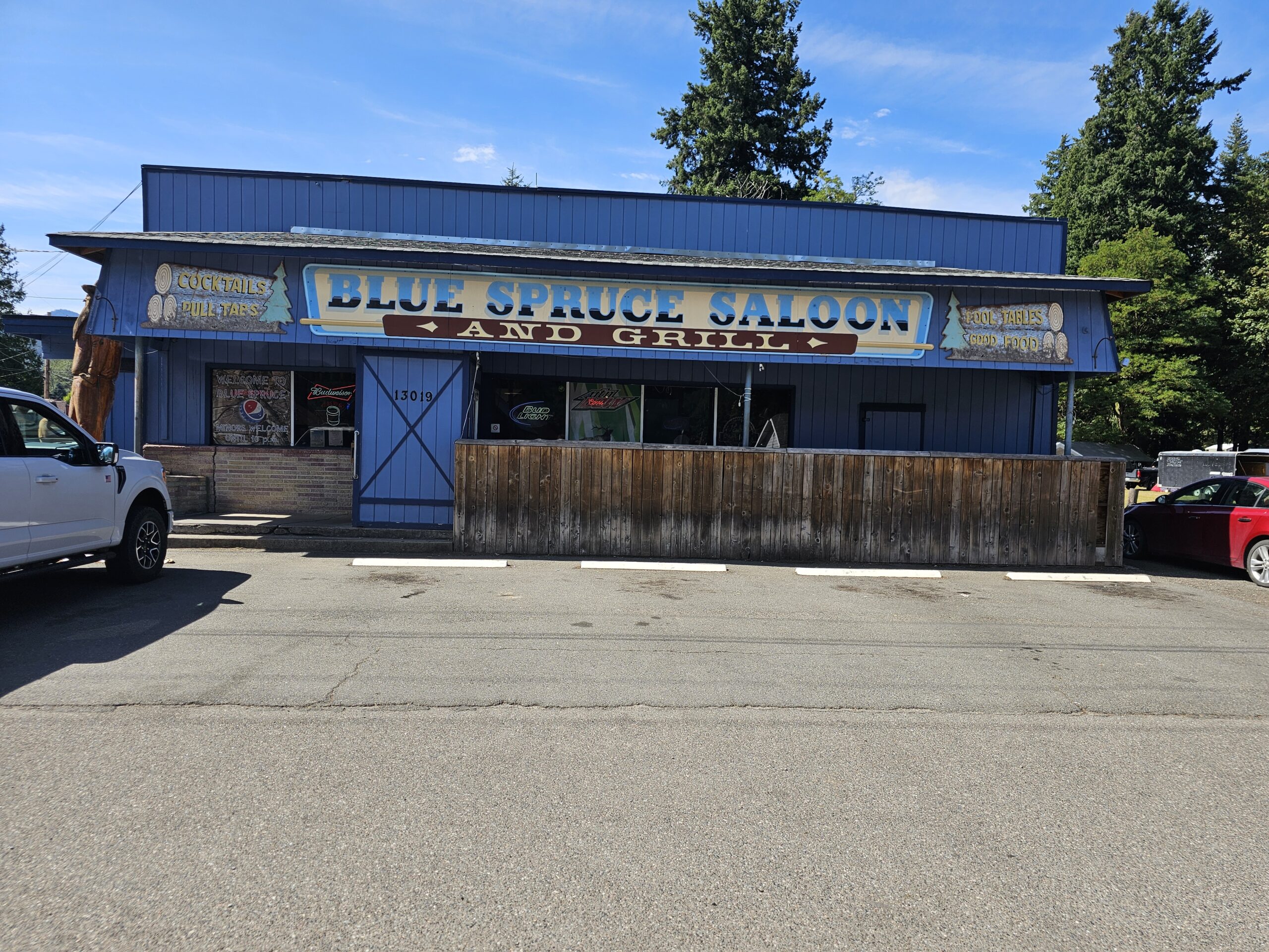
The route does not return to Randle, and takes the back roads (Woods Way, Cispus Rd and mostly on Cline Rd) along the south side of the Cowlitz River. Then finishes on US12 in the final 6 miles. Another update from the pre-ride is we changed the finish line at the Blue Spruce Saloon, which is open until 10:00 PM on Sunday.
I think you will enjoy this 8K600K (in whatever type fun you see fit) with all splendid “views” of Mount Rainier National Park and Mt St Helens, Hopefully weather forecast will hold but always bring extra clothing just in case. And make sure you remember all your reflective gear and lights! If you have a Spot tracker or other tracking device please send us your website link, so we can track you. I have a Spot for anyone need one.
Good luck!
Thanks to Marcy Moran for driving our drop bag to our hotels and other essential support along the way Thanks to Mark Thomas for all the help in creating this route. Thanks to Rick Blacker for helping with this pre-ride!
This 1000 kilometer route offers a meandering tour of the north Puget Sound, Cascade foothills, and outskirts of south Puget Sound. The overall elevation profile is low for the distance, but the climbing is concentrated, with a few punchy climbs coming right when legs will likely be feeling tender. Except for a 45 km section between Darrington and Concrete, services should be plentiful along the course at most times of day and evening. As such, this will be a fully self-supported ride, with no volunteer presence along the course except for the check in at the start and the finish control. Proof of passage will be accepted via GPS track.
The route was last run in September 2019, with notoriously rainy conditions; riders will hopefully encounter better weather this August 10-13. Each of the course’s three loops starts and ends at the venerable Redmond Inn; other hotel options are available nearby. Riders must make their own arrangements for all accommodations, there will be no staffed control at the Redmond Inn until the finish. Finishers will see this ride count towards the ACP Randonneur 5000 and 10000 awards requiring a 1000 km brevet.
Pre-riders Mitch Ishihara, John Nguyen, and Phil Neff rode the course starting Friday, July 26 in 65 hours 22 minutes; the event will run Saturday August 10 at 4am to Tuesday, August 13 at 7am (75 hour limit). Click here for more info and registration.
The event starts at 4am to offer the potential of reasonable sleep timings at the end of each day’s loop. Note possible presence of construction around the Redmond Inn including scraped pavement and harsh transitions. After exiting the Redmond Inn, cross Redmond Way directly across the street into what looks like a construction site, but is actually a half-block stretch of light gravel. The immediate climb of Novelty Hill will warm up your legs before you drop into the chilly and foggy Snoqualmie River valley, riding north to Monroe and then Snohomish; traffic here should be light in the early morning.
From Snohomish you’ll take the Centennial Trail north all the way to its terminus at the Nakashima Barn. Pre-riders stopped along the way in Arlington for breakfast at Moe’s on Olympic. Exiting the Centennial Trail, take State Routes 9 and 534 towards Conway, turning right on Cedardale Road just before I-5. Watch for views of Mount Baker peeking over the hills to the northeast.
This part of the Skagit Valley is pancake flat farmland all the way north through Bow and Edison, with mellow roads and traffic.
From Edison, Chuckanut Drive offers one of western Washington’s most enjoyable and scenic roads, with rolling hills and sweeping curves hugging the hillside along the Sound. However, the northbound shoulder is narrow, with rough pavement and debris, and Saturday traffic is likely to be heavy. Descend into Bellingham for a quick jaunt through town to the turnaround point at Boulevard Park; services here include the Woods Coffee cafe, restrooms, and water in addition to many other options in town. Watch for an active train crossing at the entrance to the park.
Head back south along the pedestrian boardwalk and through neighborhoods along the bluffs, back to Chuckanut Drive, where southbound conditions should be more comfortable, with wider shoulders and several scenic viewpoints where you can pull out for a photo op or to let cars pass. Watch for car doors and pedestrians at trailheads.
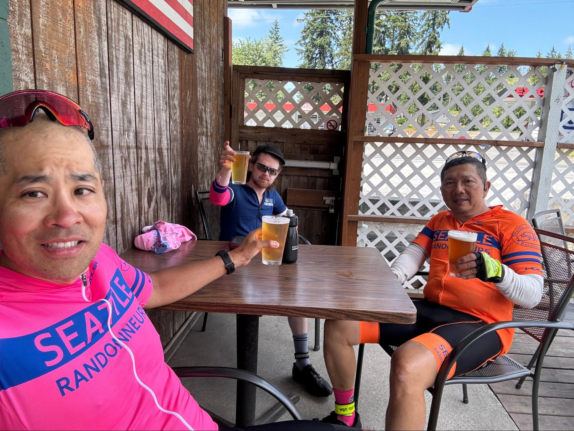
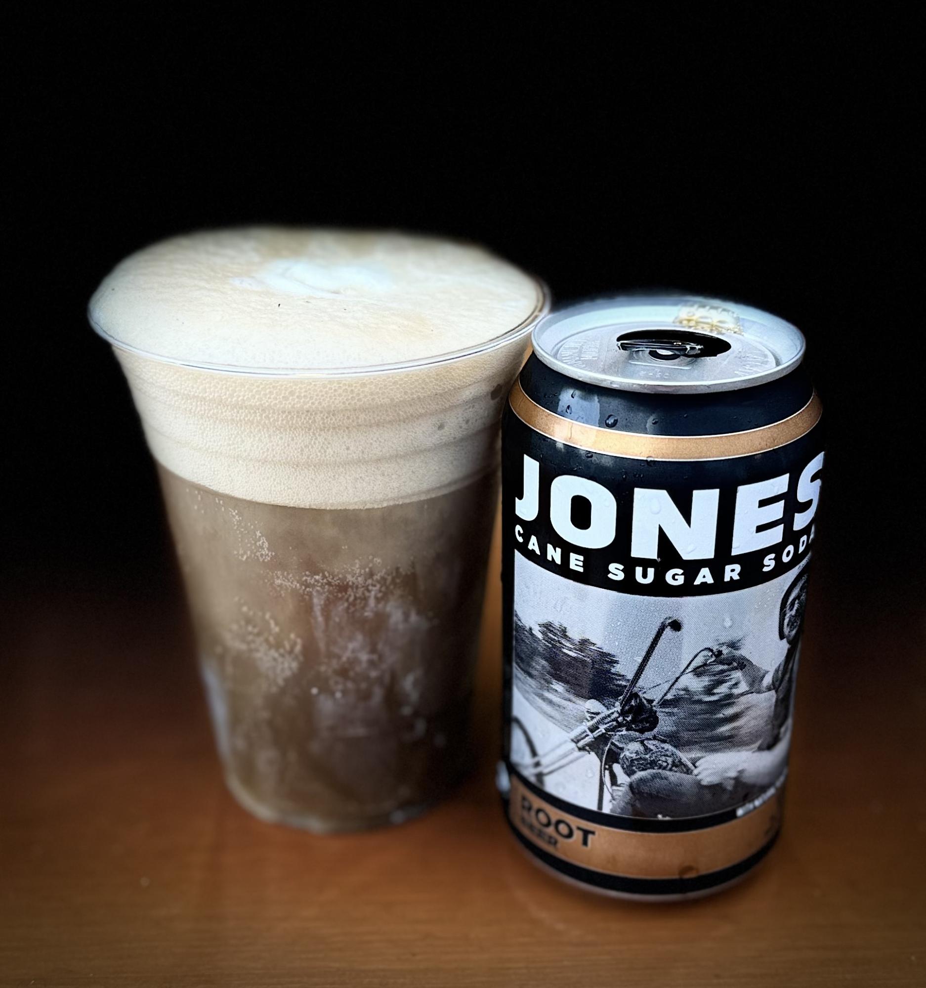
Descend back towards quaint Bow-Edison, with lots of food options; pre-riders enjoyed the reuben pizza and DIY root beer floats at Terramar Brewstillery.
Continue south along the Salish Sea coast towards La Conner; windy conditions are likely here.
At Conway, turn southbound onto the Pioneer Highway paralleling I-5. From here through Marysville, pre-riders encountered heavy end of week rush hour traffic, aggravated drivers, and inhospitable road conditions on rural highways and busy suburban roads. Put your head down and pedal through it; hopefully traffic conditions will be better here on a Saturday.
In case you’re still having fun, the Ebey Slough route into Everett at SR 204 is one of the most hostile and confusing “bike paths” in the state, with a wrong-way entrance on a highway off-ramp and plentiful glass and debris. See this step by step guide for navigating it if you’re unfamiliar or need a refresher. After this the pain continues with punchy climbs through downtown Everett, often with busy intersections mid-climb. The climbing doesn’t let up through Mukilteo, Edmonds, and Shoreline, but some fun descents and amazing views of the evening Puget Sound make up for it. Exercise caution on the Mukilteo Speedway and late night descents including NE Perkins Way.
MukilteoEdmonds
Entering Seattle, head south to Mercer Island via the Burke-Gilman Trail, largely following the familiar Lake Washington Loop route, with a deviation avoiding the Lakeview Park switchbacks. Pre-riders stopped along the way for dinner at Shake Shack in University Village; the Eureka! restaurant here is also open until midnight on Saturdays. Cross the I-90 Bridge and Mercer Island, climb Factoria, and roll north on the Lake Sammamish Trail to the finish. Again, be aware of construction involving minor detours on Mercer Island, some harsh transitions at road crossings on the Lake Sammamish Trail, and rough roads around the Redmond Inn. Get some sleep and prepare to do it all over again.
The route’s second loop starts off with a jog through Marymoor park to the Sammamish River Trail, exiting at Wilmot Gateway Park in Woodinville. Pre-riders opted for an early stop for bagels sandwiches at Woodinville Bagel Bakery before the climb up NE Woodinville Duvall Road, following the familiar route through Maltby and Broadway Avenue to Snohomish. A very short stretch on the Centennial Trail leads to a back roads route to Granite Falls, with multiple punchy climbs in store. Jordan Road out of Granite Falls and into Arlington is rolling and pleasant, if you can ignore the traffic. Pre-riders found themselves rolling at a significantly slower pace through this point of the route, with a slow start after the previous day’s effort.
Jordan Road terminates at Oso Slide Memorial Highway; take the right onto the shoulder and continue for some 40 kilometers of highway riding eastbound into the foothills of the north Cascades.
The shoulder is mostly generous except for a narrow and degraded stretch through the town of Oso itself; just outside of town, note a memorial and the remnants of the deadly 2014 landslide on the hillside to your left.
Approaching Darrington, the glaciated peak of Whitehorse Mountain looms to the south.
Darrington offers services including stores and restaurants; pre-riders again chose to eat at Moe’s Darrington (lunch service was a bit busy, pre-ordering online is an option both here and at Moe’s on Olympic in Arlington: https://moescoffee.com/). Note that this is the last option for services for at least 45 km until Concrete (a short ride off course); or 80 km to the general store in Clear Lake (on course, no restrooms; other services are available off course in Sedro-Wooley and further on in Mount Vernon).
From Darrington, turn north on Highway 530 and follow the Sauk and Skagit Rivers on a long, slow descent back into the valley via the South Skagit Highway.
The river views on your right, hills on your left, and dappled shade make for very pleasant, but potentially hypnotic riding.
Stay alert, enjoy the shade, and keep pedaling! After about 80 km, pass under and then merge onto the shoulder of Highway 9 for a short stretch. Services are available in Clear Lake as mentioned above. Take Mud Lake road westbound; a series of rural roads leads into the north end of Mount Vernon, with many options for services (pre-riders veered off-course to Safeway for resupply; one suffered a close encounter with a bathroom with no toilet paper).
Take Freeway Drive south along I-5 and cross over the Skagit River, following its North Fork through farmland, crossing the river again at Best Road in a short repeat of a section from yesterday’s route into Conway for the climb back up to Lake McMurray and the Centennial Trail trailhead at Nakashima Barn (note the trailhead gate will be closed after dusk).
Ride the full length of the trail back to Snohomish; be aware of root bumps in the dark. Just off the trail, the 7-Eleven in Arlington is open 24 hours. The route out of Snohomish is the traditional Springhetti to Broadway approach. One final late night roller coaster awaits after Maltby as you climb Paradise Lake Road to reenter Redmond the back way via Avondale Road.
That’s loop two finished. After a tough start to the day, pre-riders found that our pace picked up as the day went along, but we still finished the second day in only an hour less than the first day’s time, despite the shorter course. Rest up and prepare for a relatively easy final stretch..
Pre-riders started day three with a hearty breakfast at the Family Pancake House adjacent to the Redmond Inn (opens 6:30 am) before starting out southbound on the Lake Sammamish Trail.
Transition onto NW Gilman Boulevard and take the right onto Front Street, becoming Issaquah-Hobart Road. Climb steadily on the narrow shoulder; Monday morning traffic should largely be in the opposite direction. Ravensdale Market at the junction with Kent Kangley road is a good stop for supplies; continue to Kanaskat Kangley Road SE and make a left turn onto Cumberland Kanaskat Road SE.
Wind through Palmer towards Enumclaw, with many options for services. In Buckley, join the Foothills Trail briefly at Wally’s Drive-In, a great potential stop for lunch or a shake.
Re-join the road at 112th and turn left onto Mundy Loss Road and then right onto Pioneer Way East, bypassing the washed out bridge on the Foothills Trail. In South Prairie, re-join the Foothills Trail for about 10 km before hopping back onto Pioneer Way across from Patterson Road East; there are a few spots to exit the trail onto the road here. Pioneer Way becomes SR 162.
Turn left onto Orville Road East for the gentle 14 km climb up to Kapowsin.
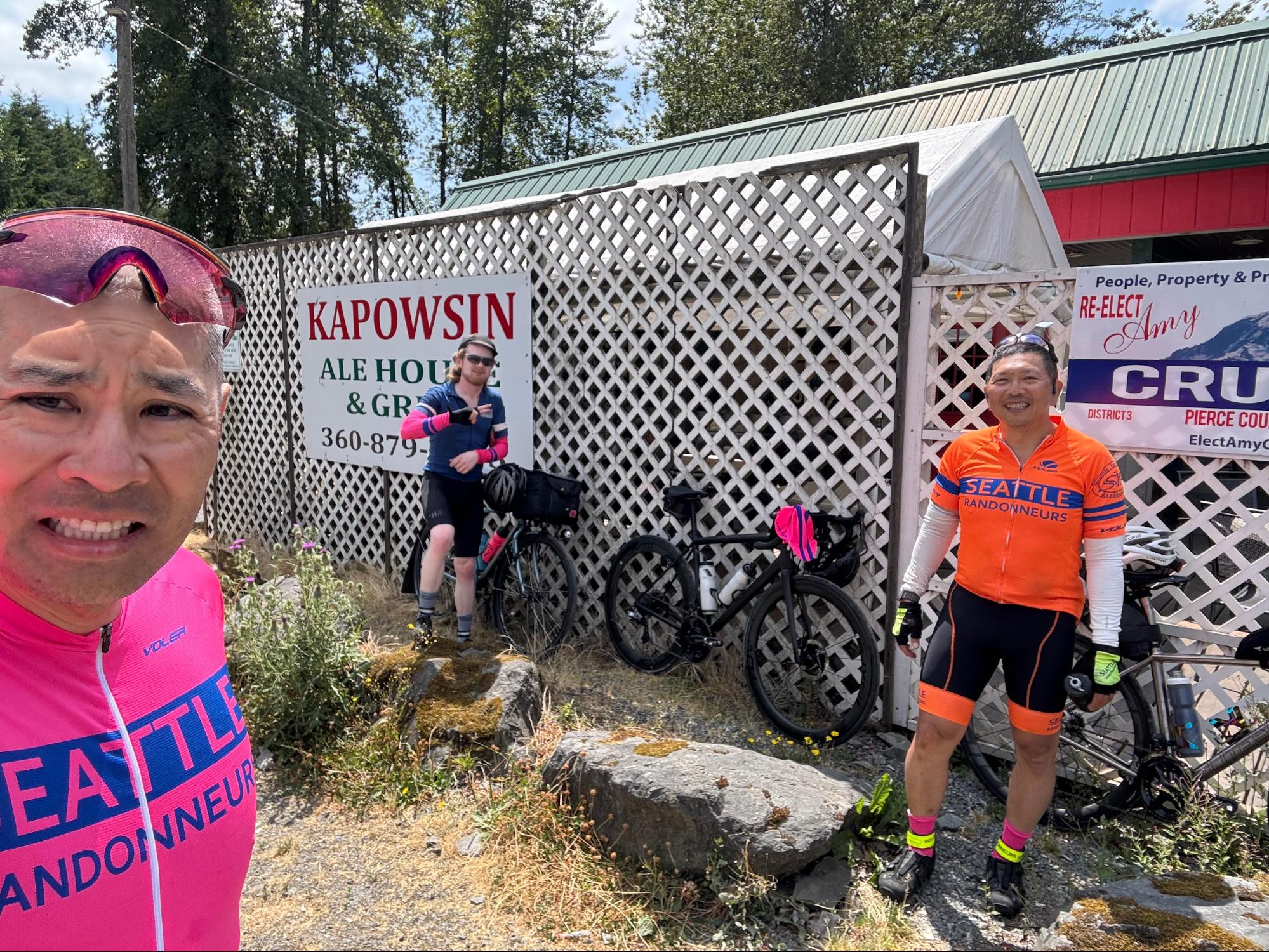
Here you can resupply at Kapowsin Grocery or stop in at Kapowsin Ale House & Grill, a biker joint with excellent tavern pizza.
Turn back the way you came and descend Orville Road East to SR 162, turning left into Orting. Hop back onto the Foothills Trail, which will take you most of the way to Sumner. At Shaw Road, cross over a busy railroad bypass and turn right on East Main, which becomes Traffic Avenue.
Carefully cross oncoming traffic onto the Sumner Link Trail near 142nd Avenue East. After about 5 km, the trail ends unceremoniously in a section of gravel with some deep patches before crossing the White River on a mixed use pedestrian bridge that dumps you into a grungy commercial park at 16th Avenue E. Continue straight for a few blocks, crossing railroad tracks, then turn onto Valentine Avenue SE and Milwaukee Boulevard S through Pacific and Algona.
Enter the Interurban Trail at the Algona Trailhead. The next 19 or so kilometers of the Interurban offer an object lesson in “suspension loss due to rider fatigue” as badly deteriorated, bumpy pavement and railroad crossings test your remaining capacity to avoid obstacles and cushion impacts. Be careful of multiple potentially busy traffic crossings. In Tukwila, exit the trail at Longacres Way and continue through the abandoned racing track parking lot and commercial parks into Renton.
Wind through downtown Renton towards Lake Washington Boulevard East. Cross left onto the Eastrail mixed use path just after the Seahawks Practice Field/Virginia Mason Athletic Center; after about 5 km, exit the trail right onto the Lake Washington Trail, and then join 118th Ave SE, being careful of oncoming and following traffic. At I-90, cross left onto the I-90 Trail and continue to Mercer Island. Construction obstructs the I-90 Trail at various points on Mercer Island, follow detour signs to North Mercer Way, rejoining the trail to cross the I-90 Bridge. Pre-riders stopped on Mercer Island at Hap’s Burgers & Taps (open until 8pm Monday) for our last milkshakes of the brevet.
Exit the I-90 Trail just before the East Portal Viewpoint, drop into your low gears for the short, steep climb up to Lake Washington Boulevard South. Continue north as the road winds down towards Leschi, watching for bumpy pavement and possible oncoming traffic at the intersection with S Frink Place/S Jackson Street.
Follow the clockwise Lake Washington Loop north on Lake Washington Boulevard, turning left to climb Madrona Drive to Madrona Place East; from here, you’re repeating the first night’s route in reverse as you skirt the Arboretum on side streets and join the Burke-Gilman Trail northbound across the Montlake Cut (be aware of potential construction impacts in Montlake).
From here, all that’s left is to push through the BGT and Sammamish River Trail to Marymoor Park and a 1000K finish. Chapeau!
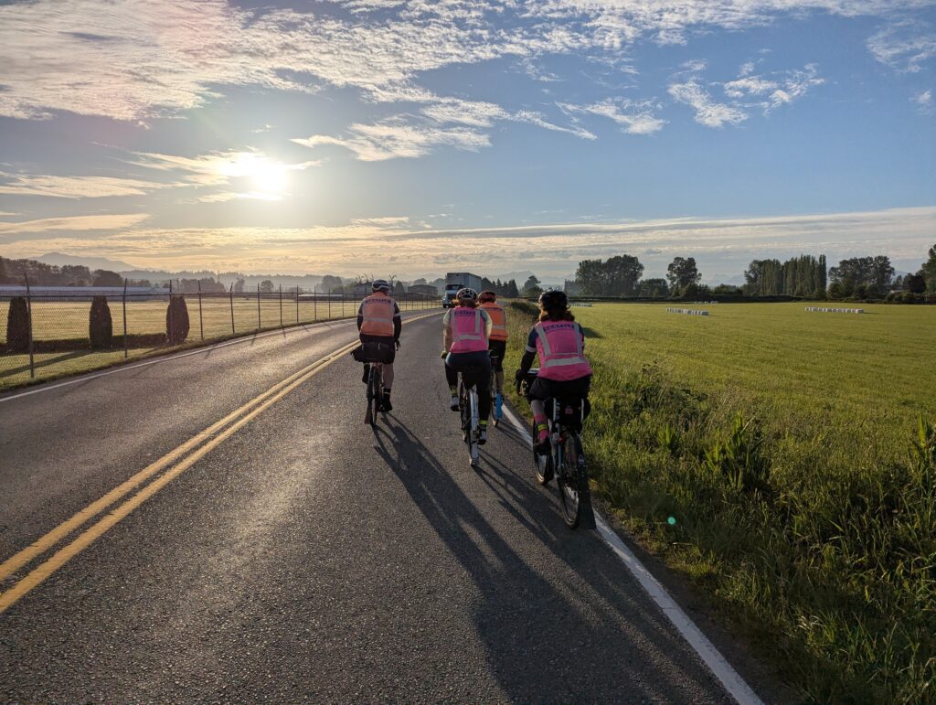
We headed out at 6 am Saturday, encouraged by the dry roads and lack of rain, unlike what the forecast had predicted. As soon as you leave the hotel and are riding east on NE 70th Street, stay in the right-hand lane as you approach Redmond Way/WA-202. Aim for the big gravel pile on the other side of the road. Go straight across and jog slightly left to cross the sidewalk and ride through some gravel to get over to 180th Ave NE and turn left. The gravel has some potholes, but otherwise is completely rideable. The ride then goes north on familiar roads to Snohomish and Marysville.
About the time we got a bit north of Marysville, the weather got real and we pulled off to don our matchy matchy Gore Shake-Dry jackets. The climb up to Lake Ki got us warm and we were careful not to miss the turn just beyond the top of the hill. Keep a close eye out for this one as it’s easy to miss and you don’t need any bonus hills on this route!
We were so wet and cold by the time we got to Stanwood, that we decided to make an early stop at the QFC where we were very disappointed to find out that the deli does not have any hot food or soup until 11 am on Saturdays. However, the SBUX inside the store does and there are plenty of other stops in Stanwood if you need to fuel up or get warm and dry.
The skies cleared up a bit after Stanwood, and we made the loop around the hilly northern half of Camano Island. We got to the INFO control at Utsalady Point Vista Park and finding the answer made us smile. This is not a ride-by control and you will have to get up close to the sign in order to find the answer. The next INFO control at Elger Bay Grocery was well stocked, especially with the restaurant inside serving hot food. We were still well nourished from our stop in Stanwood so we got our control card filled in and headed north and back to Stanwood.
The ride north to Conway and La Conner was pretty straightforward, except of course for the wind, which seems to be ever-present. May the gods and goddesses be kind and grant you a tailwind! We stopped at the Whitney Shell INFO control, crossed Highway 20, and were approaching Bay View. We were surprised to see a big “BRIDGE CLOSED 2.6 MILES AHEAD” sign that required us to take a right turn onto Josh Wilson Road over to Farm to Market Road and then north into Edison. There’s a bit of a hill going up Josh Wilson Road and even though there’s not much of a shoulder on Farm to Market Road, the traffic seemed reasonable, even on a holiday weekend. Follow the detour signs and you’ll be fine.
There are plenty of food choices going through Edison and Bow so fuel up if you feel like you need it to get up and over the Chuckanut Drive climbs. While there are plenty of uphills through here, they all come with downhills and some nice views. Once you’re in Fairhaven, make sure you catch the INFO control right at the turn onto Old Fairhaven Parkway! There are some places to stop along this road for food, but we opted to go north a couple blocks off route for the Haggen Foods market at the corner of 12th Street and Larrabee Avenue. There are plenty of other food choices in that part of town as well. Don’t fill up too much though as the route now climbs steeply, sometimes at 12.5% grade, stair stepping its way up about 600 feet in 3.5 miles. The route then follows beautiful roads along Lake Whatcom, where you’ll find a small shopping center with a market/deli and pizza place in Sudden Valley around 238K. We didn’t stop there, but a Google search claims that the pizza place is open until 9 PM and the market/deli, until 10 PM.
Rather than going all the way past Lake Whatcom out to Highway 9, the newer version of this route now turns south onto Cain Lake Road and down through Alger to Burlington, a much nicer route IMHO. There are plenty of food choices in Burlington, but if you need something beforehand, the Glenhaven Country Store is open until 10 PM at about 245K. As you cross the Skagit River around 277K, there may be heavy traffic. Use caution to get into the right-most left-hand turn lane in order to turn left onto Pacific Place shortly after descending from the bridge.
From the Burlington/Mount Vernon area, the route is pretty straightforward through the valley over to the “Conway hill climb.” However, take caution around 290K when turning left from E Stackpole Road onto Cedardale Road. There is a large hedge there that obscures the fast-moving traffic coming from the left. The 76 gas station at Cedardale Road and Highway 534 just before the climb is open 24 hours. Once you climb the hill, get yourself over to the Centennial Trail and make your way south to Snohomish where there are plenty of food choices. After the Broadway climb, the route takes familiar roads to Woodinville where you’ll find a 24-hour Arco station at 156th Ave NE and NE Woodinville Duvall Road if you need food or drink to get you back to the finish. Head down the hill and then hop on the Sammamish River Trail back to the overnight at Redmond Inn.
As you leave the overnight control, take the same route you did on Day 1 to get across Redmond Way and through the short stretch of gravel over to 180th Ave NE. You’ll have a formidable early-morning climb up and over the Union-Novelty Hill which just seems to keep giving! The first control today is Sandy’s Espresso. Fuel up on some caffeine to recover from that nasty hill. The route then heads south on the crushed gravel Snoqualmie Valley trail for some nice forest bathing on the way to North Bend. The 1,000 ft climb up Middle Fork is about a 15.5 mile climb (one way) to the end of pavement, so plan on stocking up on water and food at North Bend. Be really careful at the bridge when crossing over to the gravel to get to the control, as there are some deep potholes on either side that have been known to take out at least one rider in the not too distant past. There is absolutely no cell coverage in this area!
After returning to North Bend and then Snoqualmie, the route climbs up to and past Snoqualmie Falls and heads over to Fall City. As you’re approaching the very confusing traffic circle at Highways 203 and 202, make sure you stay in the left hand turn lane and take the 2nd exit out of the circle onto Highway 202. The first exit takes you onto Highway 203 which is not the way you want to go.
You may want to fuel up at the Fall City gas station where the control is as the next bit of riding takes you up quite a few more hills all the way up to the Issaquah Highlands. Use the sidewalk on the right side up the Highlands – it’s a much more pleasant experience than riding the road uphill. Once at the top, stay to the right and watch for the trail signs. Once you descend a way down the trail, you’ll have to take a right-hand turn to go back uphill a bit and cross back under Highlands Drive NE where you’ll now be on the east side of the road. Use caution at the intersection of Highlands Drive NE and the I-90 exit ramp and get on the road to head downhill on E Sunset Way into Issaquah.
The next bit of riding is pretty straightforward, although IMHO, much better than it has been in years past. I did quite a bit of work coming up with a better route and I hope you like it. Instead of riding all the way south along the very busy Issaquah-Hobart Road to Black Diamond, you now get off that nasty road at Cedar Grove Road SE. The one thing to be aware of along Issaquah-Hobart is the very narrow bridge just past the May Valley Road turn at around 529K. It’s an old bridge and there is no shoulder there. Make sure you look over your left shoulder and let the traffic know that you’re moving out onto the road to get across the bridge.
Cedar Grove Road is a nice respite from all the traffic and not too bad of a climb given everything else you’ve been through. Hang a left just after the summit onto Lake Francis Road and enjoy the cruise over to the Cedar River Trail. Be careful where you take a left onto 223rd Place SE just before getting to the trail. There is some nasty pavement and potholes through there.
At this point, the route back to Redmond is identical to the 2024 Spring 400K. Ride the Cedar River Trail into Renton, ride through Renton over to Gene Coulon Park and then onto the East Rail trail up to Lake Washington Boulevard SE. Head east up the I-90 bike trail and take it all the way to the barricade where it does a 180 degree turn up to SE 36th. Follow that over to the last big climb of the day up 154th Ave SE. Hang a left on SE Newport Way and roll down the hill all the way into Issaquah. Hang a sharp left off of 2nd Ave SE onto the Rainier Trail at 525K. It’s hard to spot so watch for the pedestrian warning signs as a clue for where to turn. Grab that last con-Troll, follow the maze of the Rainier Trail through Issaquah and soft pedal your way back to Redmond on the trail along the peaceful eastern shores of Lake Sammamish. Congratulations, you’re awesome!
Text and photos by Andrew Sapuntzakis and Kevin Smith
General
To set expectations, this is not a fast route, particularly the first 200K. Pace yourself and don’t get discouraged when looking at your time in the first half of this ride. Randonneuring is supposed to be challenging, so keep your head in the game and focus on persistent forward progress. You will accumulate stop time, but don’t let that bother you. Your ride pace will improve in the second half. You’ll feel a real sense of accomplishment when you finish.
You might come across a train stopped across the road in the Port of Tacoma. We did during the pre-ride. Look for a safe alternate around the train, or wait for the train to move. Don’t go under or between the cars, your life is not worth riding credit.
Details
Ride south to Woodinville Rd, cross, jog left (west) 2x, cross the wooden arch bridge, then left down to the trail, and turn right to head east.
Trail should be pretty empty this early on Saturday morning, but please be mindful of other users.
Metropolitan Market on the right at 18.5K.
Continue along the BGT past the views of Seattle and Gas Works Park. Route has you take Northlake Pl to 34th, but no big deal if you miss that turn. From 34th, turn left and use the far sidewalk to cross the Fremont bridge (and be counted).
Across the bridge, 2 quick rights get you to the ramp down to the South Ship Canal Trail. Follow that to Interbay, along Emerson, and a short climb up to Gilman. Turn right, and the climbing continues. Gradually at first, then it flattens as Gilman turns into Government, then into Discovery Park Blvd which pitches up and turns left at the top. Roll past some historic buildings, then down to the water – left at the Y! Answer the control question and take in the views – you can probably see the Alki Pt control across Elliott Bay – before heading back (up) the way you came.
After the climb, turn right onto Nebraska just before the stables. Follow the route out of the park. A jog left to Magnolia Blvd and more great views. Turn left onto Thorndyke rather than descending the Magnolia Bridge. At the bottom, take 20th thru the rail yard, then the Elliott Bay Trail. It gets very tight in places, so communicate with oncoming trail users. After crossing under the Magnolia Bridge, you’ll probably encounter cruise-ship buses and cabs. Continue on the trail, thru the sculpture park, until it puts you on Alaskan Way with more cruise-ship traffic! Near the aquarium, you’ll need to use the sidewalk due to the construction. (One day it’ll be done …)
Get back to the Portside Trail by King St. That will take you to E Marginal, where the early hour and construction should make for minimal traffic. Get onto the sidewalk as you approach Spokane St. Once across the Spokane St (lower) bridge, take the Alki fork to the right and down, across the (recently simplified) intersection, and left onto the Alki Trail.
Traffic should be minimal, so you can pick road or trail all the way out to Alki Pt, where you’ll find the 2nd control. Continue on to Beach Dr, up to Fauntleroy, and then over to 46th to avoid the ferry terminal.
From 69K to 116K there will be challenging climbs and steep descents. Bring your easy gears, walk if you prefer, and don’t overcook the tight turns on the descents.
When you get to 3 Tree Pt, look for the answer to the info control across from the 2 palm trees.
There are several services along this part. The last one before Tacoma is after Browns Pt – a market at the far end of the strip mall on your left, just before you rejoin the main road.
Starting with Marine View you will encounter multiple sets of railroad tracks on the way into Tacoma, most at angles. Communicate with fellow riders and motorists. We’ve ridden thru multiple times, and light traffic can allow some maneuvering space. Getting in & out of Tacoma is restricted due to the closing of the Fishing Wars bridge on Pacific Hwy. You may need to wait, you may need to backtrack. Do NOT try to go under/between rail cars.
The route thru Tacoma is pretty efficient. You’ll have services along the way, especially in the Stadium District and Ruston. The routing thru Point Defiance Park is pretty simple, except for the 3-way fork near the Visitors Ctr – take the left/middle one marked ZOO, not the descending path to the right. See photo:
There are bathrooms across from the Info Control.
Once out of the park, you’ll be on city streets all the way to the Narrows bridge. Trail is on the far side of the intersection. Once you’re across, the exit to Stone Dr is a gap in the chain-link fence on the left – closer than you might expect. Touch Raft Island for one info control, then the far end of Fox Island for the other. Services at the Chevron below the airport and in Arletta, as well as bathrooms at the Fox Island control.
Work your way back to the Narrows, back over the bridge, into War Memorial Park, then it’s all streets back thru Tacoma. Same caveats getting out thru the port.
Once you’ve escaped the Port of Tacoma it’s pretty flat thru Fife and Puyallup, and onto the Foothills trail (immediately after RR crossing). Services in Orting, and maybe your last views of Rainier? Continue on the trail until S Prairie, then switch to the road (Pioneer Way) since the trail is barricaded at the s-curve. Turn left after the metal bridge, and it’s a straight shot into Buckley. No need to bother with the trail – the segment in town is also under construction. After Buckley it’s a short ride into Enumclaw which has a QFC (1am close, 1 block E of the route) – next services are ~25K (staffed control in Kangley). From Kangley is downhill to Ravensdale, then over a hill to get to the Cedar River trailhead!
Take that to Renton – where there’s a construction detour at the end. A few city streets, and you’re on the Lake WA loop and Eastrail – pavement starts before Virginia Mason, ends near Coal Creek / Lake WA Blvd. Get on the I-90/MTSG trail for the last bit of climbing up thru the I-90/405 interchange, Honda Hill, etc. No need to get on the street by AAA, there is a protected bike lane almost all the way to the top despite the construction. Final climb at 154th! Descend to Issaquah, then go find the troll for the last info control. You may need to look behind you!
Slice thru town on Rainier Trail, then Rainier Ave, then onto the ELST which should be pretty empty. Up to Marymoor, over to the SRT, and back to Bothell.
“A lie has speed, the truth has endurance” – Edgar J. Mohn
This course winds through river valleys into the foothills of Tahoma at Carbon Glacier trailhead in Mt. Rainier National Park, diverts to a punchy climb of Mud Mountain in Enumclaw, and returns via a loop of Lake Washington and Lake Sammamish. With less than 2000 meters of climbing over 300 kilometers, this is a great “season opener” longer brevet, but keep in mind that most of the elevation gain comes during the middle section of the ride and save energy for the ride back in!
Start at U Village Starbucks in the University District; cross the Montlake Bridge and take the lane before a left-hander onto Lake Washington Boulevard (signage indicates the sidewalk after the bridge will be closed on 4/20). Enjoy the scenic Arboretum and then descend the Lakeview Park hairpins to Lake Washington; watch out for deteriorated pavement all along Lake Washington Blvd. Navigate a brief section of closed bike lane on Rainier Avenue before turning right up a short incline on 87th Ave S to avoid busy Renton intersections and connect to the Interurban Train.
Watch out for debris, bumps, railroad tracks, and several traffic crossings on the Interurban. After a brief jog through quaint Algona and Pacific, connect to the comparatively smooth Sumner Link Trail on the White River. A brief transition on the aptly named Traffic Avenue and Shaw Road leads to the Foothills Trail; enter the trail on your left just before the busy intersection of Shaw Road and East Pioneer Avenue.
The well-maintained Foothills Trail leads to the town of Orting, services, and if you’re lucky an eyeful of Tahoma in all its glory. Elevation gain begins with the punchy A P Tubbs Road into Wilkeson, your last stop for (limited) services on this out and back section; very little was open in the morning but the Simple Goodness Soda Shop (open 11am-8pm) is a great option for a lunch stop on the way back.
From here, enjoy a rolling, intensely scenic climb up the Carbon River canyon, some ~23 kms at about 2% grade with a max pitch of 8%. There’s a pit toilet at the Carbon River trailhead but no water. The descent is great fun, with smooth roads and no technical sections.
After Wilkeson, follow SR 165 right through Buckley (services) and then onto Mud Mtn Road, back along the White River. The out and back climb up Mud Mtn is the day’s steepest climb, 3.5 kms at 5.3% with a max grade of 11%. Navigate a one-lane section beneath a slide; the descent here is a bit more technical, with a hairpin and patches of gravel scattered on the roadway.
Following this diversion, it’s rural roads through Enumclaw into Ravensdale, most either with decent shoulder or long straightaways where traffic can easily pass. Services are available at the Ravensdale Market in Georgetown before a short climb on Landsburg Road SE; just after the bridge, be careful of the left-hand descending turn into the gravel parking lot of the Cedar River Trail trailhead. Enjoy the snap-crackle-pop of the light gravel trail and give strong consideration to a stop at Cascadia Pizza on your left immediately after crossing the Cedar River, just past the 200km mark. Continue the now-paved trail into Renton.
At the end of the Cedar River Trail in Renton, a detour directs you to cross the river on your right; follow posted signs to cross the one-way Houser Way North and take the sidewalk back to the Renton Historical Museum for an info control. Make your way through downtown Renton onto Lake Washington Boulevard North. From here, it’s a familiar two-lakes loop: you could do this in your sleep! Some of you probably have done this in your sleep!
Cross Lake WA Blvd left onto the Eastrail trail, and then back right onto Lake Washington Boulevard for the climb through Factoria to Newport Way into Issaquah. Hop onto the Lake Sammamish Trail and be wary of innumerable mid-trail posts, driveways, and nighttime trail users. Wind through Marymoor Park onto the Sammamish River Trail (late night restrooms available at Wilmot Gateway Park), connect to the Burke Gilman Trail in Kenmore, and before you know it you’ll be entering U Village again. Find your finish control at or near the Eureka! Restaurant (open until midnight) on the south side of the shopping complex. Congratulations, that’s another ride in the books!
The Spider was a permanent route created in 2011 for PBP training. A few of us in Olympia resurrected it into the new RUSA permanent program, and now we’re introducing it as a populaire.
There are 9 sets of hills on this ride, and there are a lot of downhills to make up the time from the climbing, Take advantage of these descents and minimize stop time at the stores. The 5 most notable climbs are:
Shaker Church/Hwy8: longest climb of the day, 546 ft gain in 5 miles.
Summit Lake: 633 ft gain, 631 loss in 10.5 miles.
Cedar Flats: misleading, as this is NOT flat, with steepest grade of the day (9.4%), 332 ft gain in 2.4 miles.
Delphi: 222 ft gain in 1.4 miles.
Alpine/Brown: 321 ft gain in 2.5 miles.
There are two stores early on at miles 14.5 and 23.7, so stock at either Steamboat or Summit Lake stores, so you don’t have to cross the 4-lane highway while descending Highway 8. Summit Lake store is on the climb up Hwy 8, and nothing at Summit Lake. Warning: there was a lot of glass on the shoulder along US101 and Hwy 8, so come with tubeless or extra tubes. After Summit Lake, take extra caution while crossing Highway 8, with 4 lanes of high speed traffic. Take advantage of the descent on highway 8 to catch up for all the hills.
The final 3 big hills are to come with steep pitches. If the road is wet take caution on the downhills. Cedar Flats and Alpine/Brown are out and backs, so these hills do have a reward on the return.
If needed, there is a store at Black Lake, about 58 miles. The final 100 ft climb over Sapp Rd, is nicer way to come into Olympia, compared to the busy roads in West Olympia. Check out the view of the Puget Sound/Budd Inlet in the distance when descending down Lakeridge into Capitol Lake!
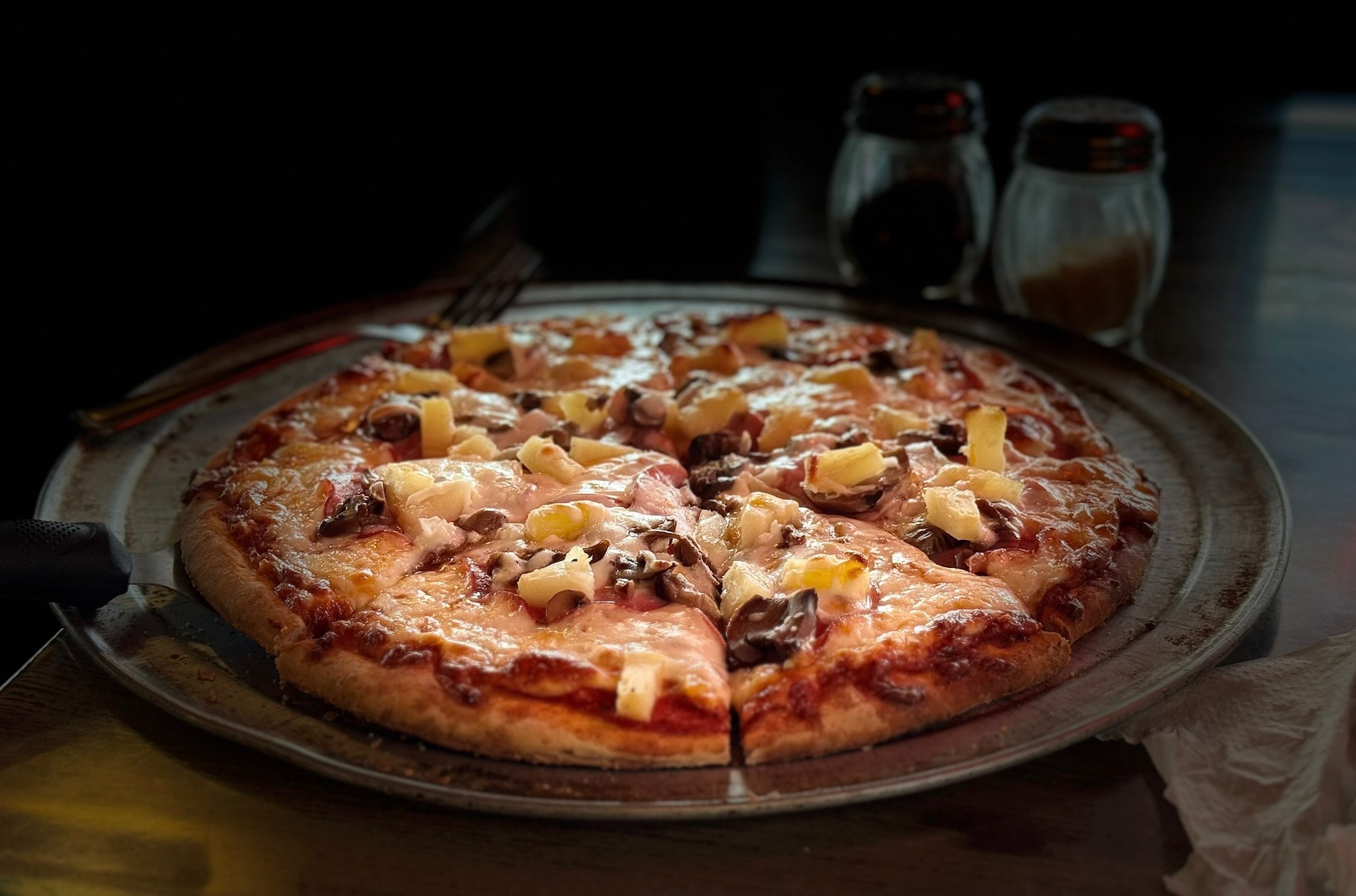
The finish at the Oly Taproom has a great selection of brew and pizza. Park either in street parking or in parking lot across the street from Bayview Thriftway, but don’t park in Bayview Thriftway parking lot. There is also free parking across from the Oly Taproom if you prefer.
Thanks to all who pre-rode including: Ricky Blacker, Matthew Sponseller, Andy Speier, and Renee Lewis.
Have a great ride!
Comments Off on 2024 Olympia Populaire Pre-Ride Report