00187 Three High Passes of the Cascade Mountains, 256 km, was reactivated this week. If you are still dizzy from the 320 cues on the Spring 400 Fear is the Mind Killer brevet this route’s one right and two lefts should help you decompress. Following a route doesn’t get much simpler than this one.
01555 Olympic Peninsula Spin is deactivated. The Quileute Nation’s Covid-19 closure to outsiders makes La Push and First Beach inaccessible.
The NE 195th St pedestrian bridge across I-5, dubbed the “Tetanus Tube” by some wags, is closed for light rail construction. It should reopen in July if work stays on schedule.
Concurrently, NE 185th St is heavily affected by construction that will extend into 2022.
If only one of these I-5 crossings were closed or compromised, riders could detour to the other. But with both affected, the most expedient option is to deactivate these three 100k routes:
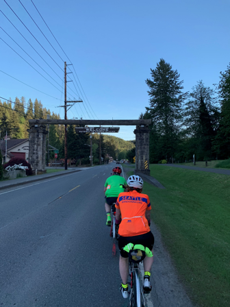
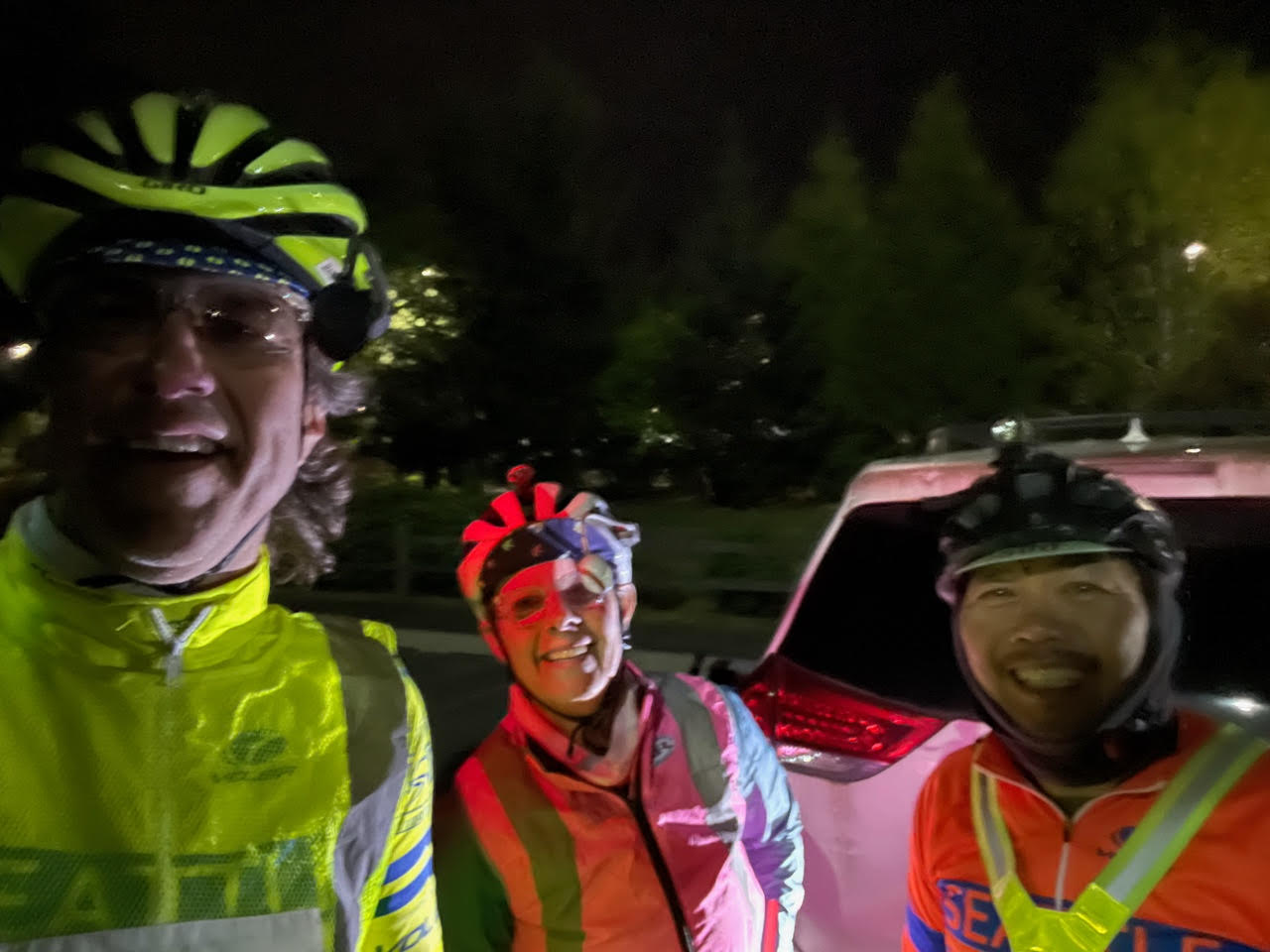
Andrew Sapuntzakis, Sarah Stolz & Kevin Smith pre-rode the Spring 400K, packed with views, climbs, more views, even more climbs—the perfect SIR ride!
Note: There are many turns on this route. If relying on a cue sheet, pick a font you can read, and bring a “map light” once it’s dark. If using electronic navigation, make sure the device doesn’t choke on the 300+ course points, and have a way to recharge it. While there is lots of parking near the hotel and the stadium, for peace of mind please consider using the park & ride ~5 blocks away, just E of 102nd Ave. Now it’s onto the ride!
The start rolls down from McMenamins, crosses 522, and jogs left onto the new ped/bike bridge to the trail. Follow that all the way to Fremont. It’s not as smooth as it once was, so go easy through this part. Be nice to kids, pets, and other traffic along the way. Pro tip: Met Market is on the right at ~11.4 miles (18.3km), with bathrooms, water, and a decadent chocolate chip cookie that is sure to get you through the first few hills.
Northlake Pl, across from Gas Works, makes for a smooth transition onto 34th. A wide left onto the Fremont bridge sidewalk, then some quick rights to the ship canal trail take you under the Ballard bridge. Go through a made-u-look-both-ways railroad crossing, onto the sidewalk on the S side of Emerson, and then follow the 2-way bike lane over the railyard. Bike lane turns right on Gilman, becomes Gov’t Way, right up to the front entrance of Discovery Park. Don’t miss the left at the top, otherwise you’ll be backtracking up a solid extra climb.
Note the (former) stables on your right as you start to head down to the first control. At the bottom, avoid the right fork with the concrete overpass (or you’ll end up in the wastewater treatment plant- yuk). Answer the first question, take in the view to your next control destination at Alki Point, have a final bite of that gooey cookie, then head back up. Turn right just before the stables, and head toward the S park exit. Magnolia Blvd should be an easy cruise with stunning Elliott Bay views and homes to match. Don’t miss the turn onto Thorndyke, with its gentle incline down to the railyard. Admire the other Victorian technology, but be aware of an extremely narrow fenced ramp—communicate with oncoming trail traffic!
Take it easy on the trails through the waterfront parks, then go into the street once you reach Alaskan Way. Stay on it until King St to avoid the sidewalk/trail confusion caused by overlapping construction projects. After a short smooth trail segment, you’re back on Alaskan/E. Marginal Way. Activity is returning to the port, but watch for potholes! The cues will get you through to the W Seattle Bridge trail, but spare a glance for the repairs to the upper bridge. Traffic on the lower roads should still be reasonable, and the green lanes should help you get across the Delridge/Spokane/Chelan/Marginal spaghetti bowl intersection. Once across, getting to Harbor/Alki isn’t bad. The road that loops past the 2nd control has been “pedestrianized.”
As you head south, a short climb connects Beach Dr. to Fauntleroy, but you only head south briefly before turning to bypass the ferry traffic. The Original Bakery is at the foot of the Marine View Dr. climb. Enjoy more Sound views as you climb, then ~2.5 miles to prepare for Shorewood Blvd, which will make you glad you brought “easy” gears. Marvel at its multi-stage reveal.
From ~49 miles (79km) until Dash Point there are several sharp descents with tight turns—stay in your lane! If you’re not familiar with these roads, take it easy.
Work your way down to three-tree point for the next control, then more ups and downs to Redondo Beach, which has public restrooms. More climbs and drops—don’t miss the turn to get to the Dash Pt control. The climb out includes a steep segment and more great views. If you look closely, across the water is your next control destination, so close, yet…. Rejoin 509, but not for long, and don’t follow it down to the water.
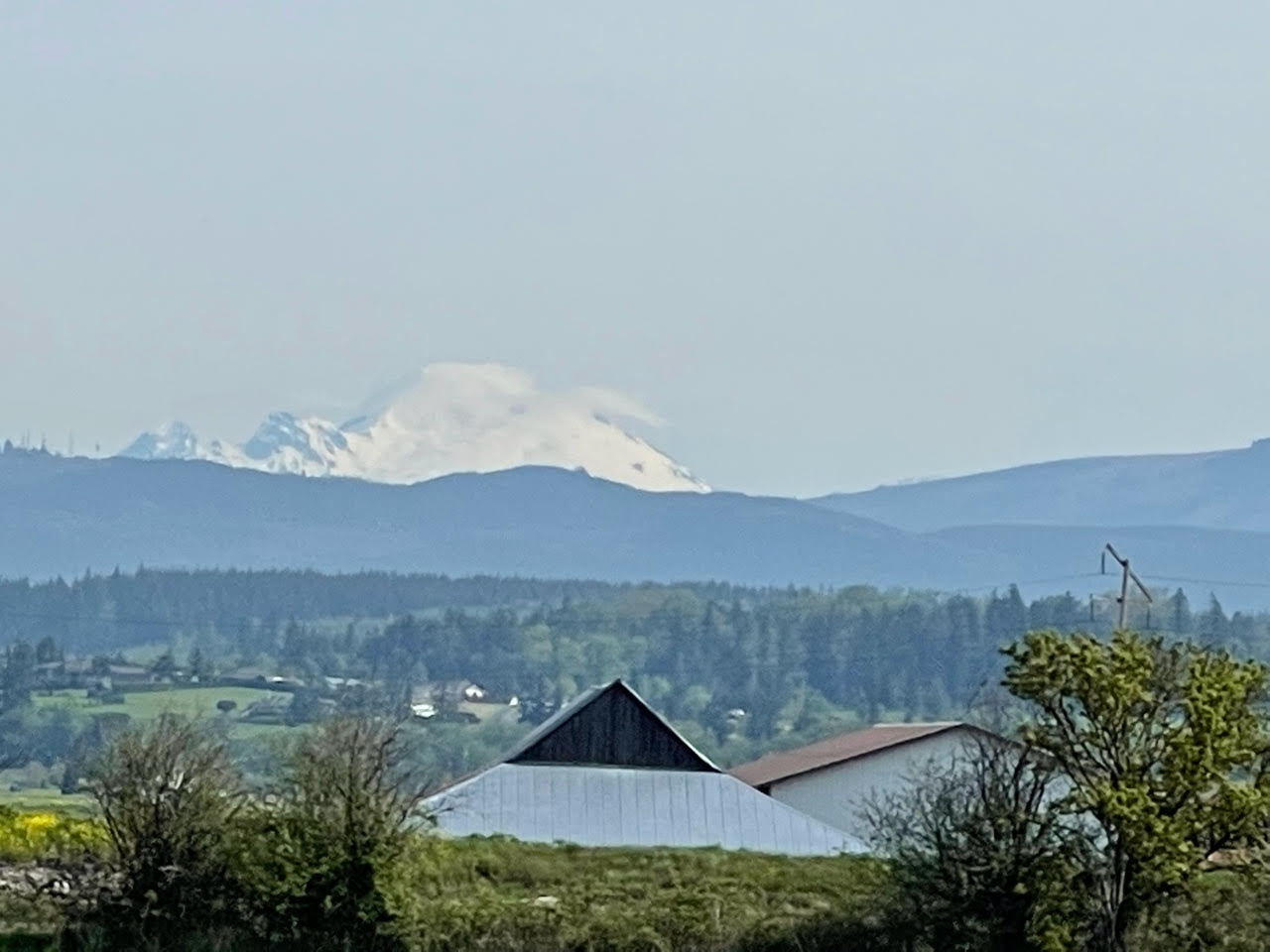
As you approach Tacoma, use the sidewalk when you cross the Eells St bridge over the Puyallup. North of downtown Tacoma, the route jogs left to Commerce/Stadium, where construction materials and streetcar tracks make for a narrow path. Stay to the right of the tracks, you don’t need to cross them. Turn right at the light on Tacoma Ave, where Salamone’s pizza (opposite corner) sells by the slice, and it’s also a food option on the way out of town. Ruston Way is like a narrower Alki. The Point Ruston Public Market has bathrooms inside and food trucks outside. Options in the Ruston development may be busy. Consider grabbing some food to eat at the control in Dune Peninsula Park, taking in the sweeping views. Hopefully the Mountain will be out to show your next direction, you’ll be seeing it for hours. Water and bathrooms are available in the park pavilion.
In Puyallup, the river crossings aren’t bad, but take a wide left and get onto the sidewalk where Shaw goes over the tracks. Use the near crosswalk just after the tracks to get on the Foothills trail rather than turning onto busy Pioneer. Cruise all the way to Orting Safeway, McD’s, etc.
The initial climb on Orting Kapowsin Hwy doesn’t have much of a shoulder, so do your best to stick to the fog line. Eventually, the route passes the Kapowsin grocery (Texaco gas station) twice—it’s decently stocked, but has no bathrooms. From there, it’s mostly downhill back to Pioneer and the Foothills trail. The sani-can along the trail was not well maintained, so you might byo paper.
Leaving South Prairie, there’s another climb. On the way into Wilkeson, note the skillet-eggs-n-bacon feature in the skate park. There are a few food options, although the Pick & Shovel saloon is probably your best bet, with outdoor seating around back. Figure ~30 minutes to the Carbonado control and back.
From here, the route profile stays pretty tame for the next 100km, so you can hopefully make good time. Services can be found in Burnett, Buckley, Enumclaw, with a control before the Green River. Then head for the Safeway control (open till 1 AM) on Kent Kangley Rd. The staffed Landsburg control just three short miles away marks the return to trails (no services) all the way to Renton. The Landsburg control will have hot coffee, hot water for tea, cocoa, cup-o-soup, packaged sandwiches and energy providing snacks.
From Renton, it’s the East Side of Lake Washington that most of us can do in our sleep, although the gravel rail trail is almost entirely closed for construction, so we have you on the Lake Washington Loop trail. Then the I-90 trail to Mercer Island, and the scenic way around starting with the twisty bits. After the floating bridge, there’s a steep half block up to Seattle’s Lake Washington Blvd, and a twisty, bumpy descent through Frink/Leschi Park to a restroom info control at Madrona Park. Continue on, up the hairpin, west to MLK, and through the Montlake neighborhood to the 520 trail via the Montlake overpass due to the posted closure on the Roanoke trail stub.
Cross the lake again, and the “rolling” trail dumps you onto Northup, then 24th for some short climbs. Then it’s on the trail again to 148th for the last info control, and then back off the trail once more due to construction. Pass Microsoft and Nintendo, and a quick trail descent to Redmond. Onto the Sammamish River Trail all the way to Bothell, up the ramp, o’er the bridge, and back to the hotel where your author(s) will be waiting to congratulate you.
Fabien and Yonnel did a preride on Sunday, May 10th. We had a wonderful time, this route is really special with incredible landscapes along the way. It’s also not a traditional rando event due to the gravel sections.
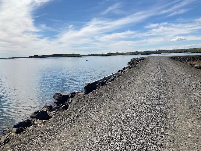
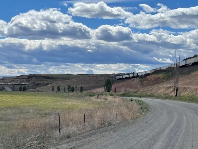
Speaking of gravel, the first question is about gear. Shiggy recommended 32mm tires minimum. Initially I was leaning towards taking my gravel bike (38, tubeless) but Fabien convinced me to take our road bikes instead. So he did it on 25mm tires and I had 28mm. We got lucky and did not flat or crash. It’s a matter of luck and comfort level on gravel. I think what Shiggy recommends make sense. However, you will only encounter 14 miles of gravel out of 125 – so you will spend a lot more time on nice pavement!
The first stretch of gravel is about 4 miles long and is also the chunkier (mp 34.2 to 38.1). It is fairly flat and goes by some nice lakes.
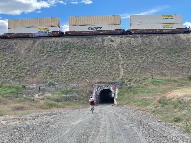
The second stretch of gravel is longer (10.5 miles). After you pass the initial hill, it’s all downhill or flat on pretty smooth gravel. Watch out for cattle and hunters, we encountered both. There is a fun tunnel to cross underneath the railroad tracks and then we found ourselves surrounded by train wagons on the other side.
Another major factor on this route is the wind. Tailwinds are almost guaranteed during the first half. Fun and fast, enjoy it while it lasts! The second half is when you’ll be more exposed with dominant northwest/west winds. We got very lucky on Sunday but the day before, the wind reached 20mph.
With regard to services, there is a rest area at 27 miles and this is the last water supply until mile 72. The logical places to stop for food/drinks are at George (mp 72.4) and Quincy (mp 87.7). After Quincy, there is a 30-mile section without any supplies. We stopped at the Shree’s Truck Stop & Gas Station in George, on the left side of the road. Very convenient with a Subway and outside seating. Sage Coffee House and Bistro at mile 74.5 is another good option.
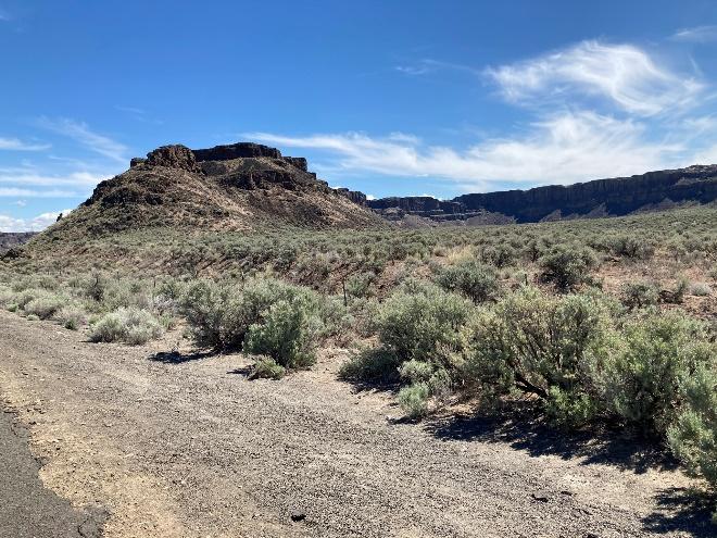
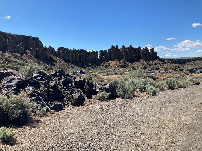
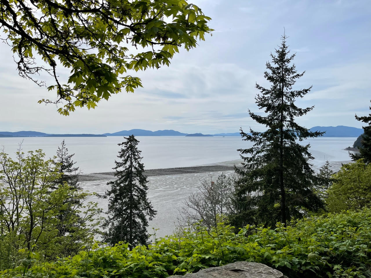
What makes this ride special is the beautiful scenery along the Columbia river and the rock formations. I was in Arizona just recently and that looked just the same, only the cactus were missing. The out and back to the river along the Frenchman Coulee is the highlight of this route in my opinion, and not just because of the name…
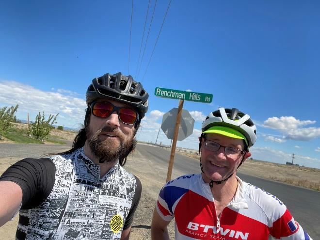
Shiggy did a really good job with control locations and questions. Curiously the Frenchman Hills sign is not an official control but I strongly recommend bowing to this sign and take a selfie like we did 😊
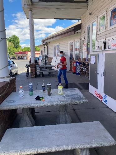
The Safeway lot at the start/end has plenty of parking. Shiggy met us at the start and end of the preride, which was really nice. Thanks so much for organizing this really cool event. I am sure all the participants will have a blast! Let me know if you have any questions. Yonnel_g@yahoo.com
The Brevet Week 600k follows almost the same route as the 400k with the exception that the 600k goes to Lake Samish, where the 400k goes to Lake Whatcom. See Mark Thomas 400k preride report with additional details. One additional small difference is that the 600k takes the Redmond Central Connector trail into Redmond, which goes by the McDonalds and Chevron. Most restaurants close at midnight (as of May 1st), but you need to check on this as closing hours have varied a lot lately. Redmond Inn is not serving breakfast, and only has coffee in the lobby. When in doubt have some food either in your car or in your hotel room at the Redmond Inn if you are staying there as the overnight.
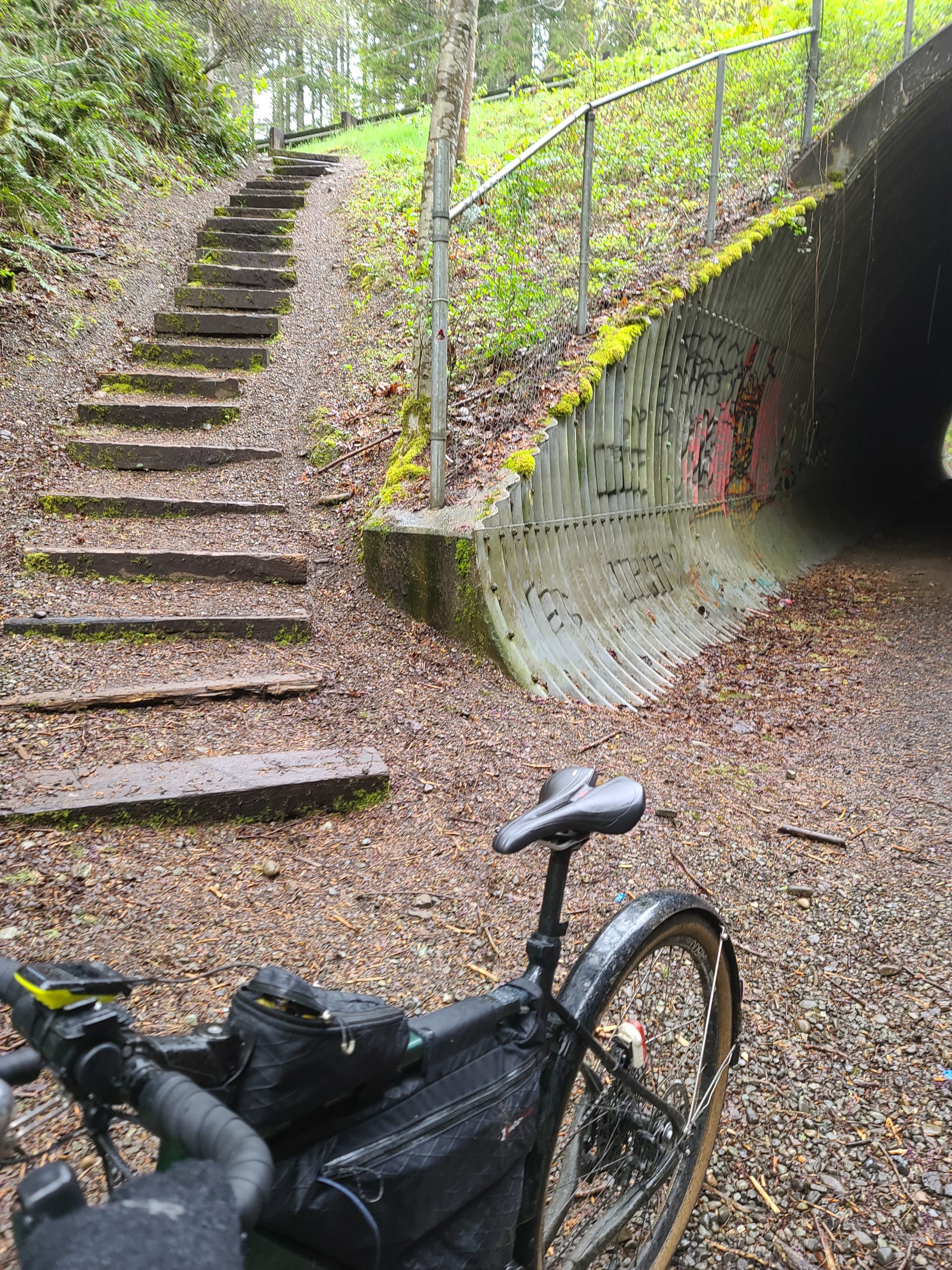
I prerode the last 215k of this route (after Redmond overnight) on April 24th, on a long rainy day (without credit). 😆 Keep in mind that the last 215k is quite hilly, about 6,000 accumulated feet of climbing. After the overnight you will climb up Union Hill up and over to Carnation, where you can get some awesome coffee at Sandies. From there you will have a steady climb up the Snoqualmie gravel trail, to the tunnel.
The route directs you through the tunnel then takes the stairs up (best option), then left on Tokul Rd.
The route goes through Snoqualmie then North Bend, so stock up where necessary as there are no services for 30 miles after North Bend. Just after North Bend there is construction on North Bend Way where the shoulder is closed. If you are from the area and know what you are doing, the alternative route is to take the Snoqualmie Trail by taking a left on Thrasher at the Forest Service office and then a right onto the Snoqualmie Trail (gravel), then a left back on North Bend Way.
The climb up to Middle Fork is spectacular. Hopefully the sun comes out for you all on this stretch as this has some of the best views on the entire route! Take caution as there are a couple steel grates about 4 km before the turnaround and also on the return. The info is at the Garfield Ledges trailhead, just past the bridge over the Middle Fork Snoqualmie River.
When returning to North Bend, you could take the Snoqualmie Valley Trail back into North Bend. The bakery in North Bend is the best bakery around!!
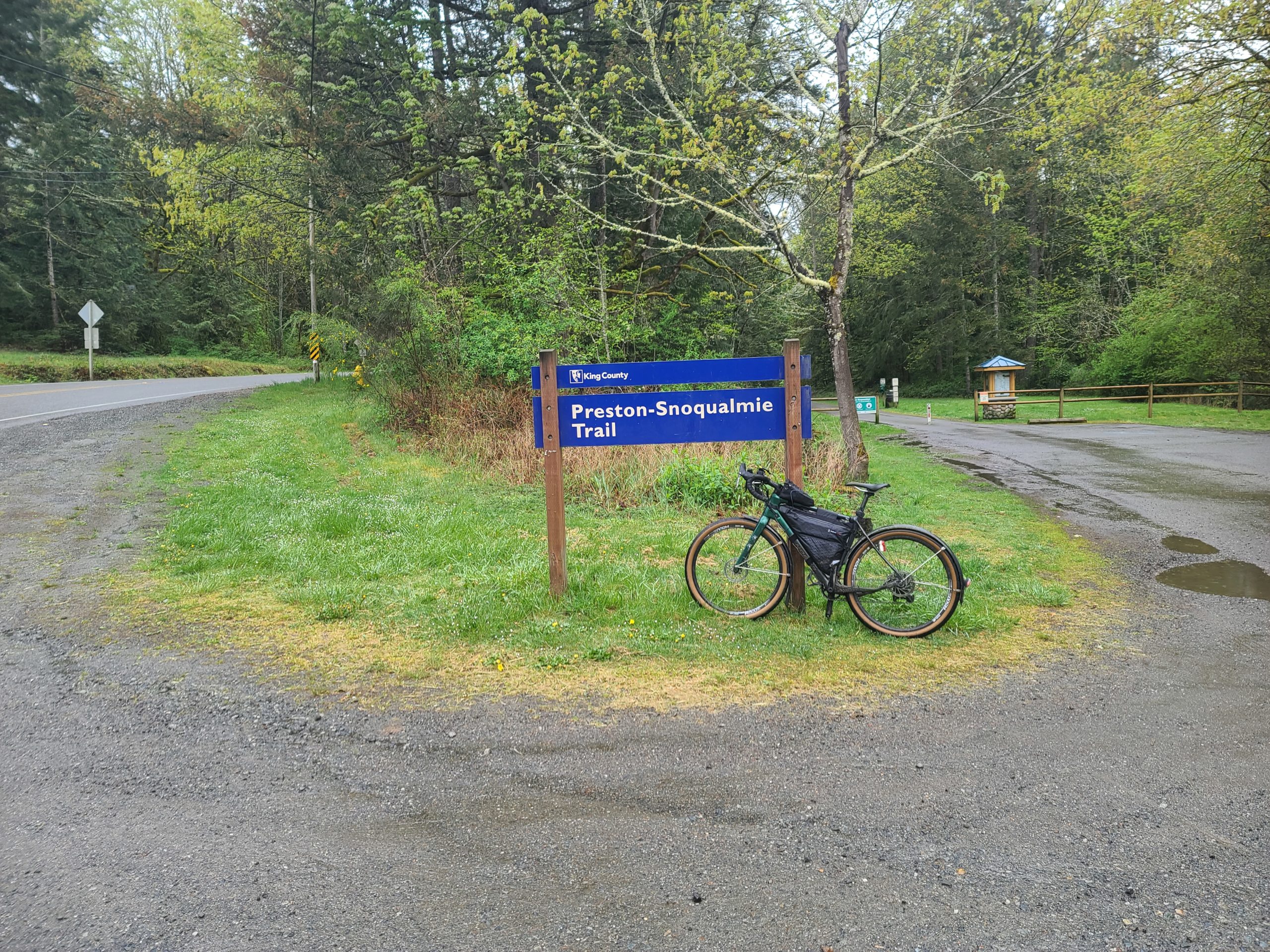
When you leave North Bend, the route goes on the Snoqualmie Valley Trail until the golf course and comes into the town of the Snoqualmie the back way. After Snoqualmie, you will climb up Snoqualmie Ridge (along the Snoqualmie Ridge trail-parallels Snoqualmie Ridge Parkway). The info at the Chevron is where all the Alps permanents climb up Lake Alice Rd, where on this 600, you will get to descend down this…but not all the way down!! You will need to take a sharp left turn onto the Preston-Snoqualmie Trail.
The Preston-Snoqualmie trail has some steep gravel switchbacks that is highly recommended to walk your bike down…at least I didJ
Take special caution crossing Preston-Falls City Road at the crosswalk, a very busy road! If you need services, you might want to stop in Preston, as the route avoids all services in Issaquah. After Preston you will follow the Preston-Issaquah Trail, paralleling I-90 then descend into Issaquah.
Issaquah-Hobart Rd becomes other road names south to Ravensdale and to Black Diamond. About 4k after the Black Diamond control, you will take the Green to Cedar (gravel) trail all the way down to the Cedar River Trail, which will take you all the way into Renton. We took the most direct route through Renton then will be on the East Rail Trail for about 2k, but once you get to the Seahawks training building, the East Rail Trail is still under construction and the route goes on Lake Washington Blvd and trail. You will then take the I-90 trail that will go over the brand new Factoria bike bridge.
After the bridge, you will go down underneath this same bike bridge and also I-90 to go through Bellevue and avoids the 36th. This is the final climb up and over into Redmond.
Please text me when you depart the 2nd day and also when you arrive in Black Diamond so I know approximately when you will be finishing. For those that finish in the normal hours, PostDoc Brewery is right nearby Redmond Inn that has food truck until about 7pm and still serves beer until 10pm. When Vinny and I prerode the 300k (on May 1st), everything was closed after midnight in Redmond, but found the IHOP in Bellevue open 24 hours. But keep an eye on the services hours as closing hours may change.
Note: All controls are info controls!
These are the changes we made from the 2019 Chuckacamano Middle Fork version:
· Starts up Paradise Lake Rd
· Deleted Chuckanut trail option,
· Goes to Lake Samish and not to Lake Whatcom where the 400k goes,
· Turns off SR9 onto N Fruitdale into Sedro Woolley and goes through less busy roads in Burlington and Mount Vernon instead of staying on SR9,
· Returns down into Woodinville and takes the Sammamish River trail into Redmond for the overnight
· Rerouted the more direct way through Renton
· Rerouted onto Lake Washington Trail since the East Rail Trail since it is under construction (north of the Seahawks training building)
· Takes the new bike bridge over Factoria and also goes under I-90 to avoid 36th
Susan Otcenas and Ian Shopland are organizing the flèche this year, to be held the weekend of 07/23-07/25. Full details will be forthcoming, but if you are interested in riding now would be a good time to start gathering together a team and creating a route. As usual, the destination will be Olympia. In a nod to COVID precautions, we will be foregoing our usual indoor banquet in favor of an outdoor celebration at a city park. With the date shift from cold and rainy Easter to warm and sunny July, we expect there to be a lot of interest in this event. So expect to be asked to have your route finalized and registration complete two weeks in advance of the event. Let us know if you have any questions, and thank you for your patience while we finalize the details.
Mark Thomas, Jan Acuff and John Nguyen pre-rode the Brevet Week 400k. Here is their report of the ride:
Starting in Redmond again, the 400k takes a standard route to Snohomish via Paradise Lake Road (with its one deadly little stinger of a hill) and Broadway. The route then follows the river towards Everett before veering north to Marysville. At 59km in Marysville, the pre-riders stopped at a Starbucks (there is also a convenience store) to fuel up for the sturdy climb to Lakes Ki and Goodwin.
With a Marysville stop, we headed straight through Stanwood and then over the bridge to Camano. Although busy and annoying, the bridge has a decent shoulder and should be fine. We definitely encountered some ups and downs on the north and west sides of Camano Island before refueling again at the Elger Bay store (123km).
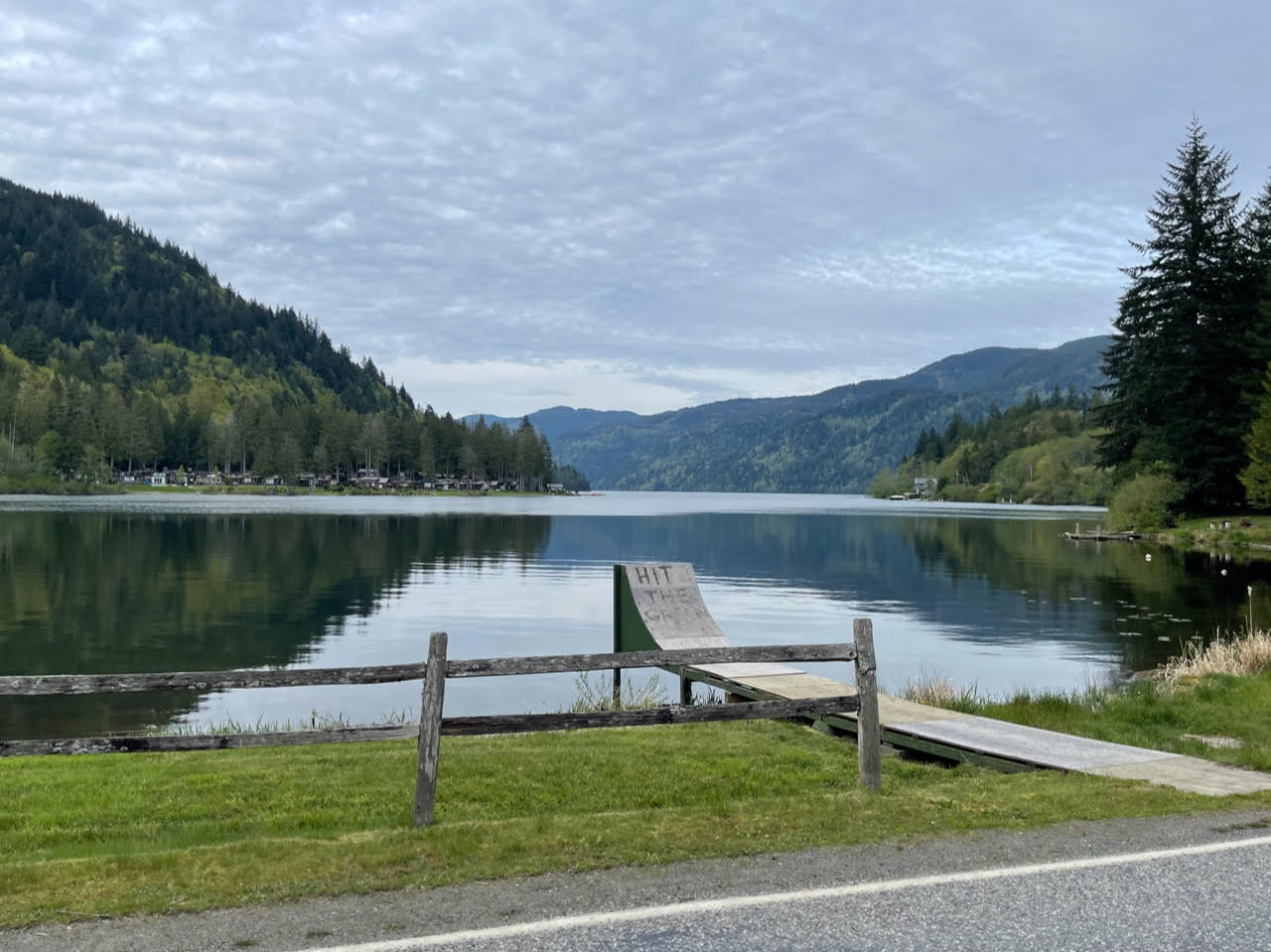
There may be nice views as you head up the east side of Camano and than back over to Stanwood. The 55 kilometer or so stretch from Stanwood to the base of Chuckanut is the flattest part of the ride. We stopped for convenience store sustenance at the Whitney control at 178km partway through this stretch. Chuckanut Drive is terrific and a couple of the overlooks on the left would be worth a picture stop.
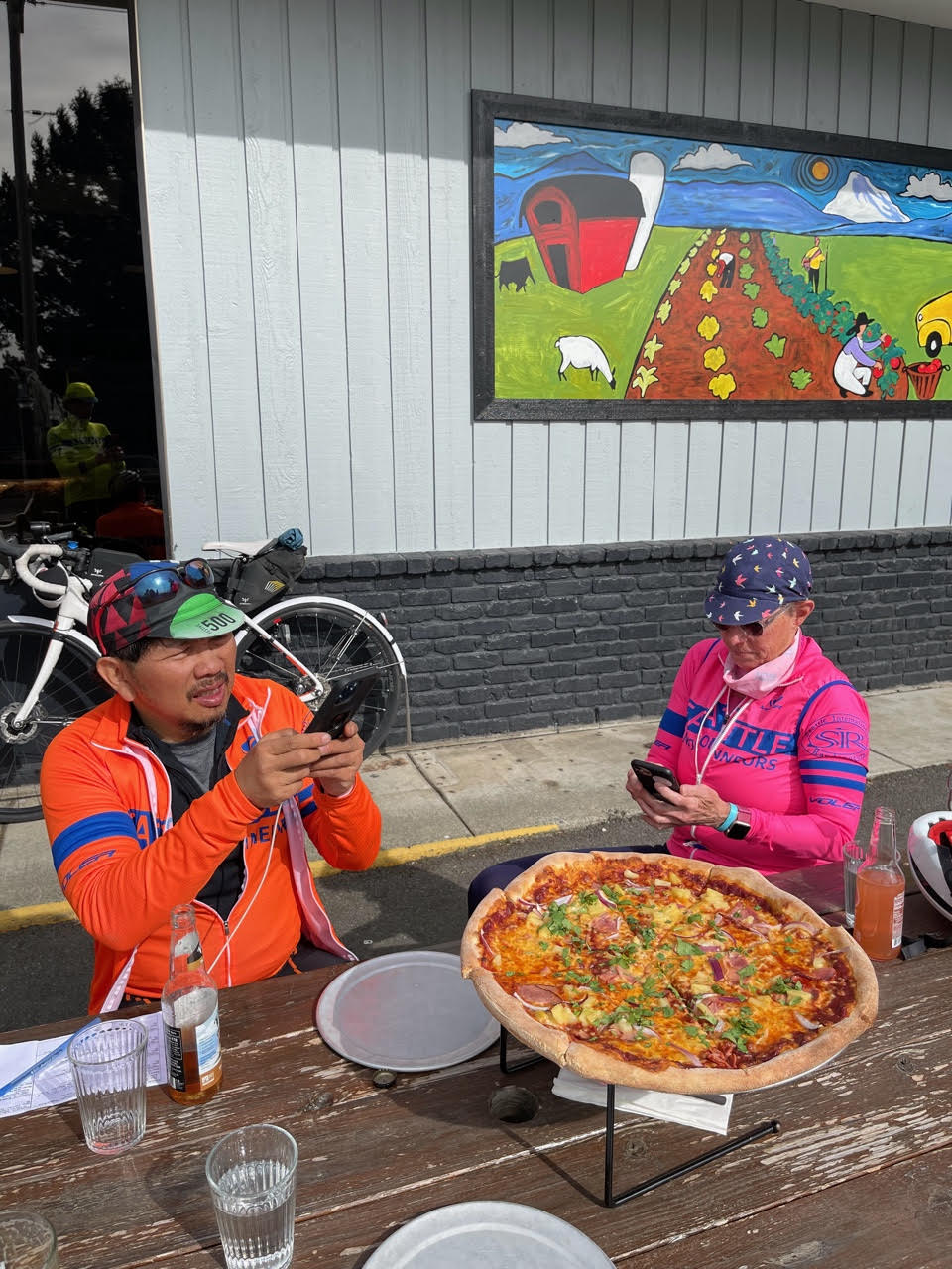
We had pizza (and maybe a beer) at the Fairhaven control a bit past halfway (212km). In addition to the pizza place, there is a grocery store just beyond and then a few more restaurants past that.
The upcoming climb from Fairhaven to Lake Padden and beyond is a leg buster with occasional double digit grades. We sort of knew it was coming, but it was a doozy nonetheless. A bit of an inconsistent descent took us to Lake Whatcom. Plenty of nice scenery along the Lake, but unfortunately, this was, for us, the busiest section of the ride for traffic. Once we left the lake, it was pretty quiet to Sedro-Woolley. (Note that the 600k takes a bit of an alternate route to Sedro-Wooley, featuring Lake Samish instead of Lake Whatcom, but not depriving its riders of the nasty climb out of Fairhaven).
Services are available in Sedro-Woolley after about 55km of nothing from Fairhaven, but with only another 18km to Mount Vernon, we opted not to stop. The route goes west on Cook and south on Gardner instead of following WA-20 from Sedro-Woolley to Burlington. When the route reaches 20, cross over to the other side and use the trail, which is paved to about a block before the turn south through Burlington. To cross the Skagit River, the route goes under the bridge and then up the ramp onto the bridge over the river. On the other side, there are a few blocks of fairly convoluted routing that kept us from having to cross lanes of traffic to make left turns and otherwise avoid the worst of the traffic.
We stopped at the McDonalds/convenience store across the street from the control in Mount Vernon. I believe that they are both open 24 hours. If you expect to be there late (reference control closure is about 1:30am), you might want to call ahead and confirm the hours. From the control, bike lanes and then nice quiet roads brought us to Conway. It may not be the absolute flattest way out of Mount Vernon, but it’s pretty nice. It got dark for us in that stretch. After Conway, the second to last significant climb goes up to Lake McMurray and shortly thereafter, we found ourselves on the Centennial Trail for about a 50km jaunt to Snohomish. If needed, services can be found about a block west of the trail in Arlington at a 7-11 visible from the route. We didn’t stop there and indeed pushed on to the finish without any further refuel stops (about 110km from Mount Vernon to finish). Additional services are available in Snohomish before the final climb up Springhetti and Broadway to Matlby. A quick downhill into Woodinville and trail riding back to Marymoor make for a quick(ish) last bit.
The Summer Solstice 1000k is a brand new route and should entail some great adventuring. We have traveled most of these roads on other Brevets and Permanents, but there are a few twists and turns to keep you entertained. The route consists of 3 loops all starting and finishing at the La Quinta Inn in Tumwater, WA. While that will make it easy to clean up and grab some sleep after each loop, it will also provide an easy temptation to abandon. There are portions of the ride that will require more than the usual rando self-sufficiency. Make sure you check your yearning for sleep and civilization at the door so that you can successfully finish the entire adventure!
Day 1 has us heading out for the biggest challenge of the 3 days where we will ride out past Shelton and Matlock on mainly paved back roads. We make a visit to Wynoochee Lake for some incredible views of the Wynoochee River valley, refill our water bottles, visit some civilized restrooms and maybe even take a swim if it’s a warm day. From there, we will head southwest onto Donkey Creek Road (FS Development Road 22) and approximately 7 miles of gravel before the pavement begins again. At Highway 101, we turn north up to and around Lake Quinault, circumnavigating it in a counter-clockwise fashion. The south shore of the lake is a bit of a roller coaster, but nicely paved with a couple choices for services along the way. Stock up there and get ready for another approximately 11-mile stretch of well-packed gravel (rideable on 25’s/28’s) just beyond the east end of the lake and around to the north shore where we’ll head west and eventually rejoin 101 to head south. From there, it’s a 16-mile cruise down the wide-shouldered 101 where we will pick up some more back roads all the way down to Montesano. At Montesano, we head east to Elma along the Monte-Elma Road and then head south all the way down past Oakville on lightly trafficked back roads. The final stretch of the day has us heading north up through the Mima Mounds area and back to Tumwater for a well-deserved night of rest.
Day 2 will be a nice break from the hard work you put in the previous day and should give your legs somewhat of a break in preparation for the adventures of Day 3. We head west to Montesano, Cosmopolis and all the way out to Twin Harbors State Park for a view of the Pacific Ocean where we will head south along the water down to the northern portion of Willapa Bay. From there it’s a trip through Raymond for a restocking of food and water and then along the well-shouldered Highway 6 for a return trip towards the east. With any luck, we’ll be able to ride a 20-30 mile stretch of the Willapa Hills Trail on pavement and well-packed gravel starting at the town of Pe Ell or at Rainbow Falls State Park. How much of this trail is rideable will be determined during the pre-ride or maybe sooner. From there, we’ll make our way back north through Centralia, Bucoda and Tenino for our second overnight in Tumwater.
Day 3 has us going east into the foothills near Mt. Rainier. We head south along generally flat roads through Centralia and Chehalis until we turn east and climb steadily up through Alpha and Cinebar. We will travel along Highway 12 for approximately 20k until we get to Randle and head a bit south and cross the Cowlitz River. With some luck the Eastern Washington wind machine will give riders a nice push up Highway 12.
We travel along the south side of the river along Cline Road most of the way into Packwood. Packwood will be a good opportunity to stock up on food and water before heading up the largest climb of the day, Skate Creek Road. We’ll follow the scenic Johnson Creek all the way up and back down to near the Nisqually River where we will head back to the west and along the river into Ashford for a restocking of supplies. From there it’s east through Elbe and along Alder Lake and then north on Highway 7 to avoid some of the angry traffic along the Alder Cutoff Road. From Eatonville we head north and even further north to avoid the heavy traffic and lack of shoulder along Highway 702. We then head south and cruise through Roy and McKenna until we pick up the Chehalis Western Trail in Yelm. The trail will send us north and east along the north side of Offutt Lake and back to the finish line in Tumwater.
Registration Information:
Registration Opens May 25
Hotel accommodations – Registered riders will be responsible for making their own hotel accommodations
There are portions of the ride that will require more than the usual rando self-sufficiency
RwGPS route and or information will be updated on the registration page as it becomes available
This week 00751 Bremerton-Elma-Rainier-Seattle was reactivated after being rerouted in Puyallup for the closed Milwaukee Ave bridge.
A new route by Mark Thomas was added, 04119 Mann Up, 201 km, based on the recent Spring 200k brevet.
The North Cascades Highway is fully plowed. This looks like the weekend this year to bike the passes before the road is opened to cars. WSDOT post. Apologies for not having 857 Marblemount-Mazama-Marblemount ready to ride…there’s always next year!