by Ray Whitlock
Preriders: Jan Acuff, Ben Schauland, Ray Whitlock
Day 1:

Heading out of town early in the morning, the route travels some normally busy roads. However, at 5:00 am, there should be lighter traffic than in the heat of rush hour. Before you know it, you’re out of town and almost feel like you’re in the wilderness already. The route travels along Mud Bay and Madrona Beach which are both gorgeous, but you probably won’t see the sights given that it will still be mostly dark during this part of the route.
The next section of the route travels 12 miles along Highway 101 which is a very busy road on a Friday, but there’s a wide shoulder. It will be noisy and annoying, but a necessary evil to get out to the gorgeous sights awaiting you. Your first opportunity for food and water may be the Dayton Store at approximately mile 28. As we rode past a little after 7 am, it appeared to be open even though Google Maps lists its opening time as 8 am. The first control is at the Matlock Store, 37 miles from the start, which again doesn’t officially open until 8 am, but I have shown up there as early as 7:45 am in the past and they let me in. If they’re not open, it may be worth waiting along with the old codgers’ coffee clutch hanging out in their vehicles as the next opportunity for water isn’t for another ~30 miles at Wynoochee Lake and your next opportunity for food isn’t for another ~70 miles at Lake Quinault.
The section from Matlock to Wynoochee is straightforward. There’s a slow 2.5-mile section of gravel at mile 49, but I rode it on tubeless 30’s and didn’t have any issues.
Turn right at mile 66.5 and you’ll have a nice descent on a beautifully paved road down to the Wynoochee Lake dam. Keep riding up the hill until you get to the signs indicating the campground and boat launch. Don’t turn at the “Day Use Area” sign, but instead turn right past the next sign that says, “Boat Launch Coho Campground”.
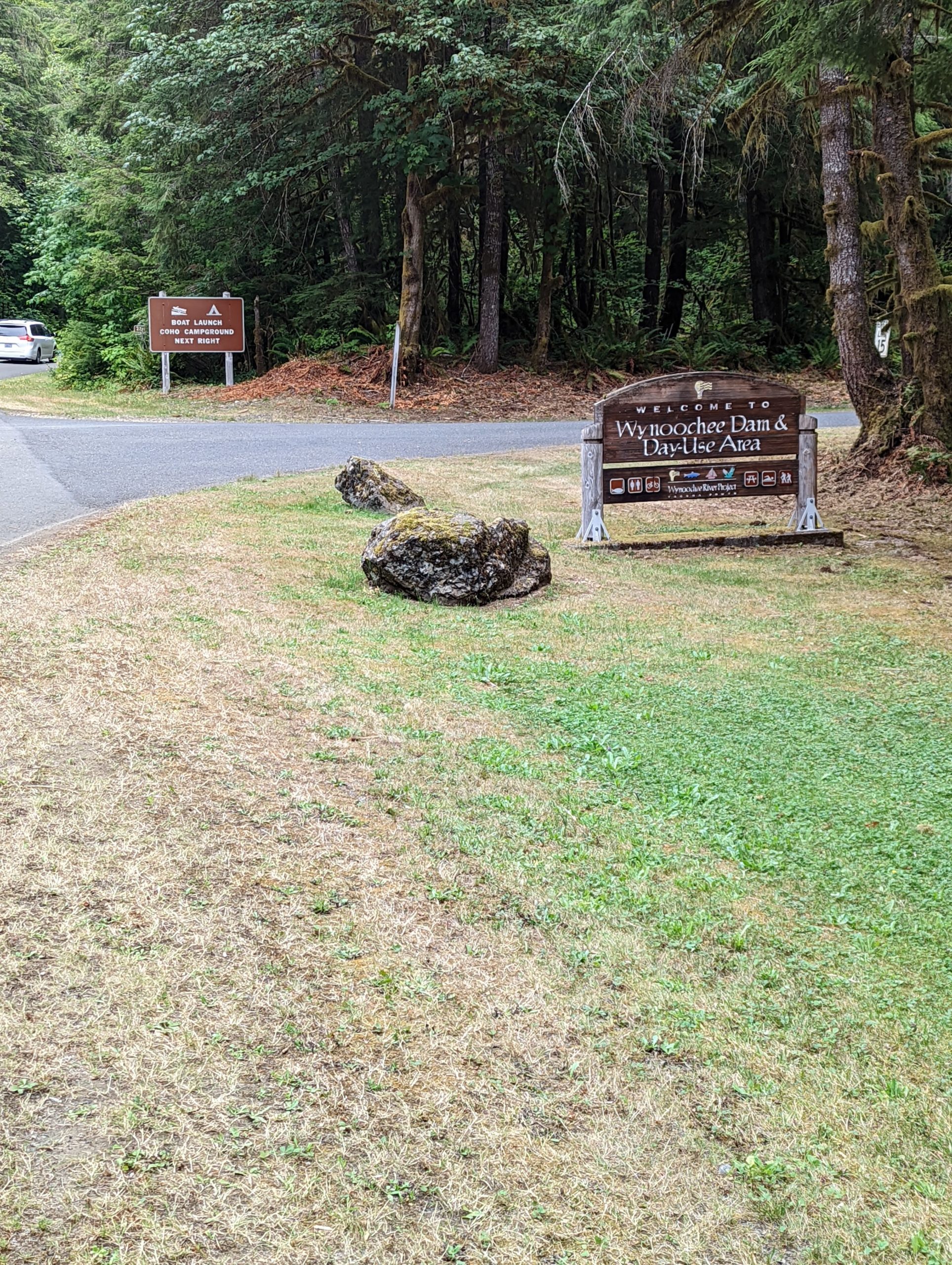
Stay left at the ICE sign at the campground hosts and take an immediate right. Don’t go into campground loops A or B. Look for a parking lot with boat trailers and go past them and down the hill to the launch. If you can’t find the boat launch, just go back and ask the campground hosts or ask someone who looks like they know where they’re going.

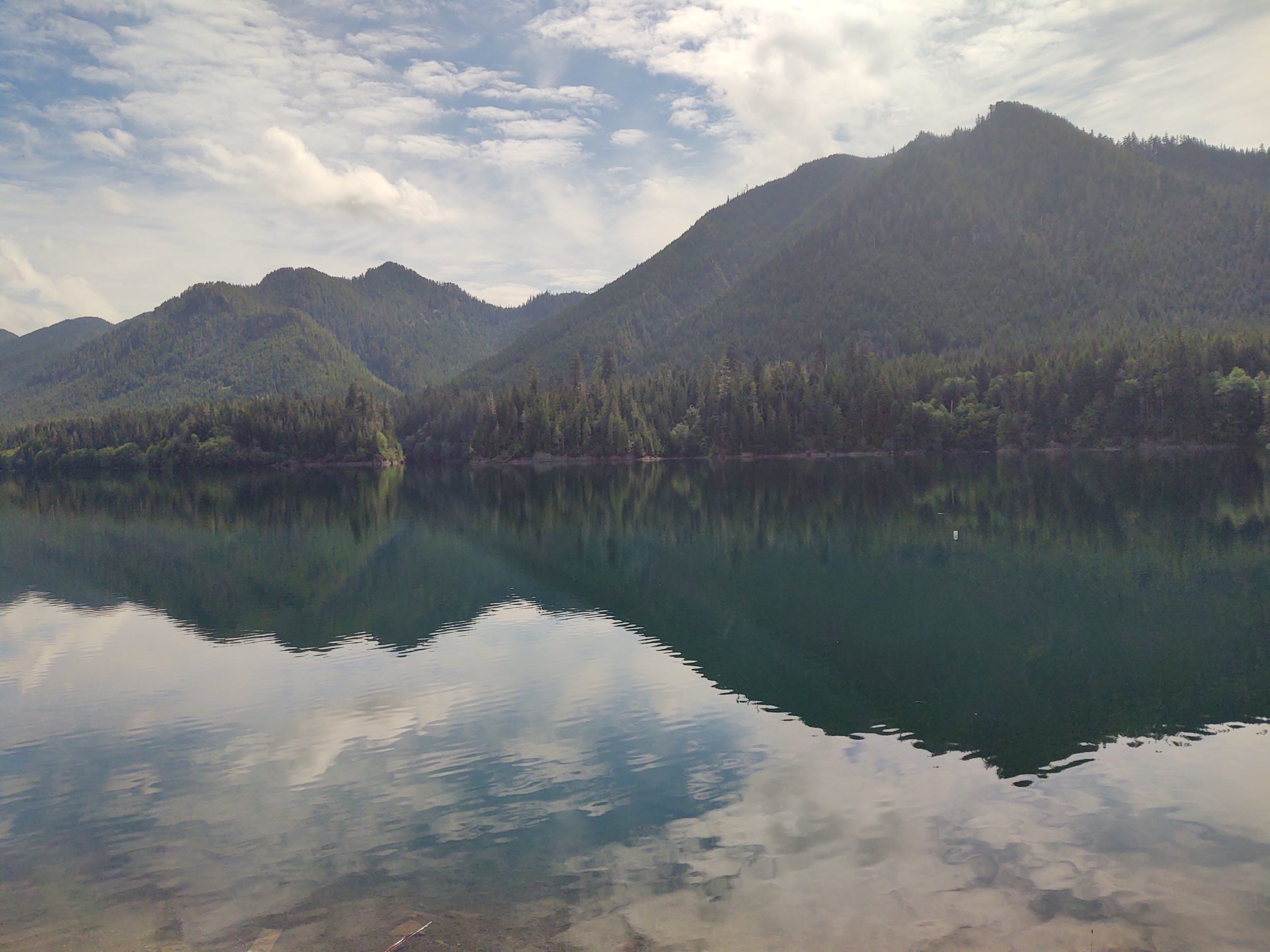
If the clouds aren’t too low over the hills, you’ll have an amazing view up the Wynoochee Valley. We may have a staffed control here, but if not fill up your water bottles in the spotless restrooms at the top of the hill you came down near the boat trailer parking lot.
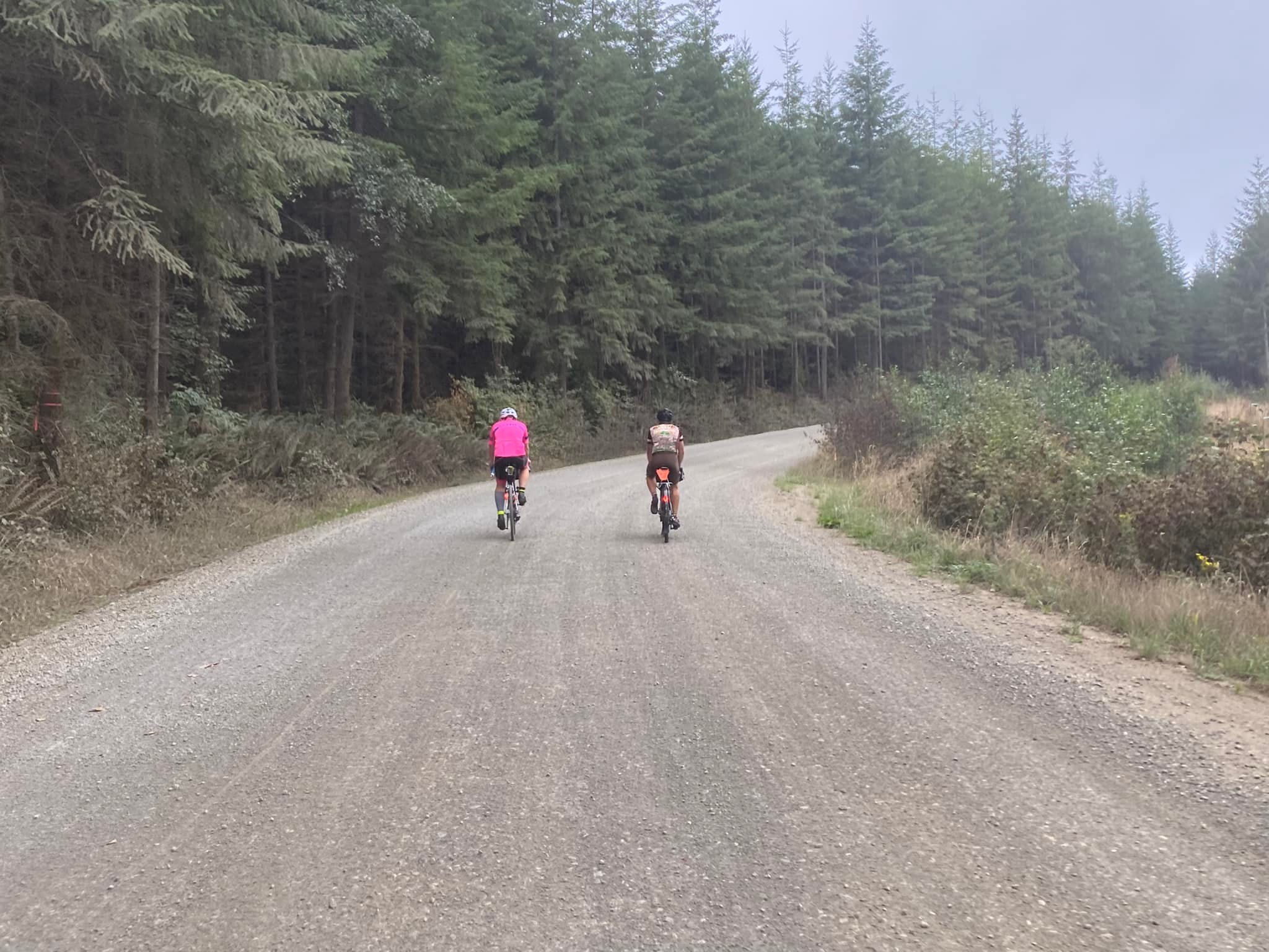
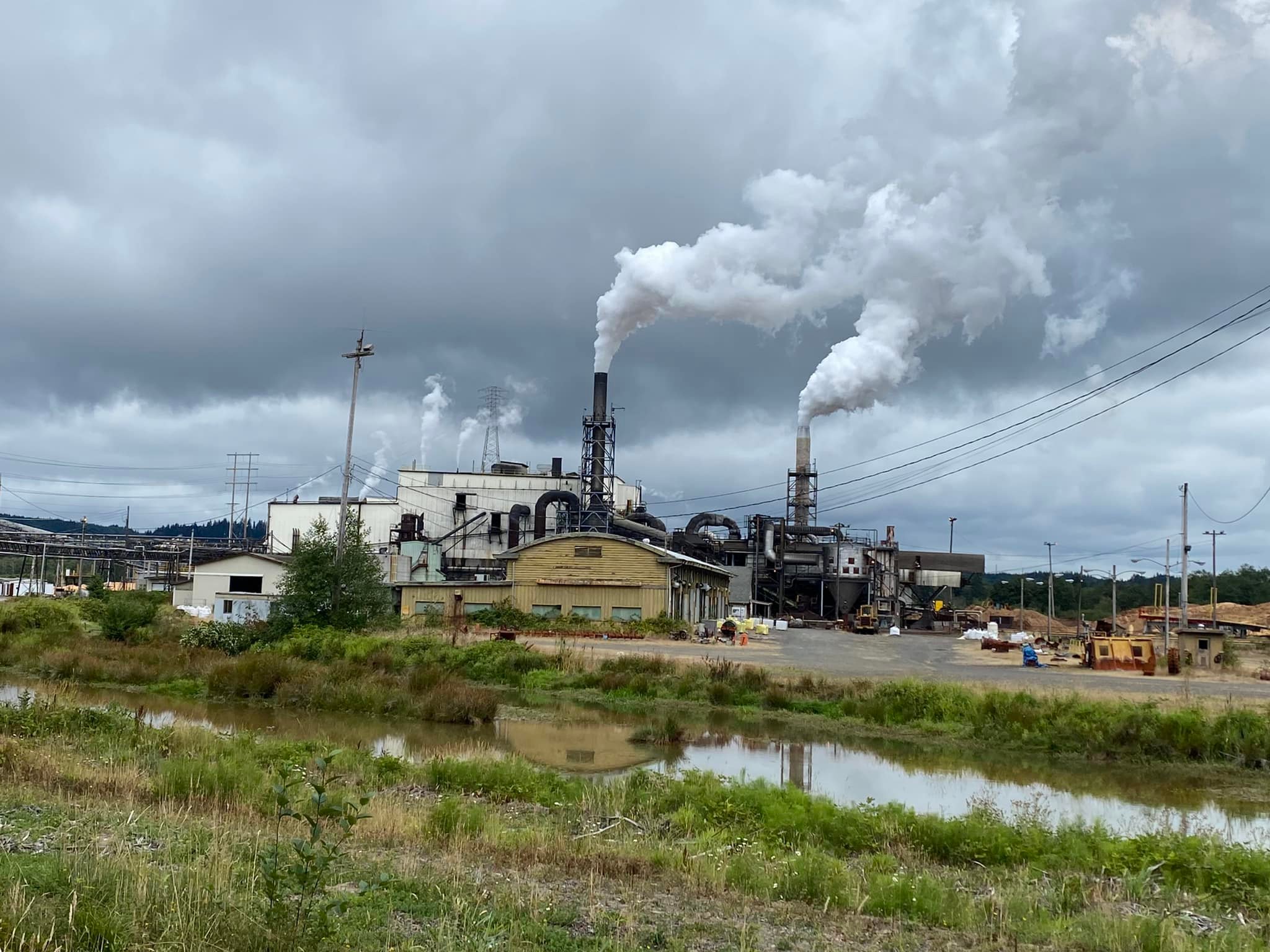
Retrace your steps to get out of Wynoochee and turn right onto Forest Service Road 22/Donkey Creek Road. The gravel begins almost immediately and doesn’t stop completely for 14 miles. There’s a long stretch of gravel followed by a long stretch of pavement and then gravel and pavement interspersed with each other frequently. There has been some new somewhat chunky gravel added this year so there will be a few loose sections along the way. We saw very little traffic on this road on a Friday, but did find ourselves riding on the wrong side of the road to find a good line. If you do this, beware that people camp along this road and you should expect vehicles. Stay alert, keep your headlight on and try not to ride on the left around blind corners. I rode on 30’s but you may be able to go faster and be happier if you ride on 32’s or larger. Also, there is no Verizon cell service (not sure about T-Mobile, ATT, etc.) from Wynoochee all the way to Highway 101 so it may be a good idea to have a Spot or InReach GPS tracker with you on this ride in case you need help in this area.
Once you turn onto Highway 101, it’s 13 miles along this busy road to your next turn. The shoulder comes and goes so the best bet would be to ride single file. The Lake Quinault area has 2 choices for food and beverages along the South Shore Road and 1 on the North Shore Road. It’s probably best to stock up as soon as you can, as by now, as it’s been a long haul since Matlock. The Quinault Mercantile is open every day 8 AM – 8 PM and has a lot of good choices, including sandwiches that you can warm up in the microwave at the rear of the store. Grab some food and plop down at the picnic tables across the street. The road along the south side of the road is nice pavement for about 8 miles until you hit gravel which fairly smooth but has some nasty potholes closer to your next turn.

Once you cross the bridge over the river and turn left, the road starts off as pavement but quickly turns to gravel. There are a couple tough climbs through here with some loose gravel.
I found that once I turned east onto the North Shore Road, both of my GPS devices were constantly alerting me that I was off route. Ignore the noise and keep riding. There’s only 1 road on this side of the lake so it would be difficult to be off route. Stop at the North Grocery (open 5 AM – 10 PM) and restock your supplies as it’s another 20 miles down to the Humptulips Grocery store which is open until 11 pm and has another selection of fine bio-engineered food and another microwave.
There’s nothing very exciting between here and the end of the ride, except for probably a lot of darkness. The next opportunities for food and drink are Montesano and Elma. The last control of the day, the End of Trail Shell closes at 11 pm. If you’re in need of supplies and aren’t going to make it there by 11, you may hit the jackpot at The Lucky Eagle Casino (closes at 4 am!) approximately 1 mile prior. After the last control, use extreme caution when turning left off Highway 12 and onto Moon Valley Road as although there’s a turn lane there, there’s no light and traffic is moving very fast along Highway 12! Enjoy a quick night’s sleep so you can get up and do it all over again Saturday morning.
Day 2:
Whereas Day 1 headed west to the Olympics, Day 2 takes us east to the Cascades and near Mt. Rainier. The day starts off heading south on less busier roads than days 1 or 3. Pay close attention to the cue sheet near the Home Depot at mile 1.6 in order to get onto the bike overpass that crosses over I-5. You’re out of town before you know it with plenty of services along the way as you’re generally paralleling the west side of I-5 all the way down to Chehalis. Don’t miss the turn at mile 22.7 like I did in 2021! You really do take the I-5 South on ramp, but you don’t get onto I-5 as the road splits beforehand.
There is a nice couple mile long stretch of trail that parallels the road between Centralia and Chehalis which is a nice relief from riding on the road. Make sure you stock up on food and water once you get to Chehalis as the next opportunity to do so isn’t for another 40 miles in Morton. Enjoy the flatness of the first 36 miles or so as once you turn off Jackson Highway and onto the Middle Fork Road, your legs will remind you that you already rode a double century + the day before. There will be more hills as you get closer to Morton.
In Morton, you can choose to continue ~37 miles to Packwood, eat at one of the cafes in town right on the route or head south off route for about ½ mile to get to services at the Morton Country Market. We felt the Market was well worth the effort as they have everything you need including a hot food bar and glamorous seating right outside the store.


From Morton, you’ll continue on a nice stretch of road until you eventually hit Highway 12 which is a busy road but has a nice wide shoulder. The next opportunity for food and water is in Randle where you turn south to get off the highway. Now you’re back on pleasant and peaceful country roads with little traffic, albeit with a few rollers along the way.
There are plenty of choices in Packwood for food and drink, but the 76 station at Skate Creek Road where the next info control is located, has plenty of choices. Stock up here because the next opportunity isn’t for another 25 miles in Ashford.
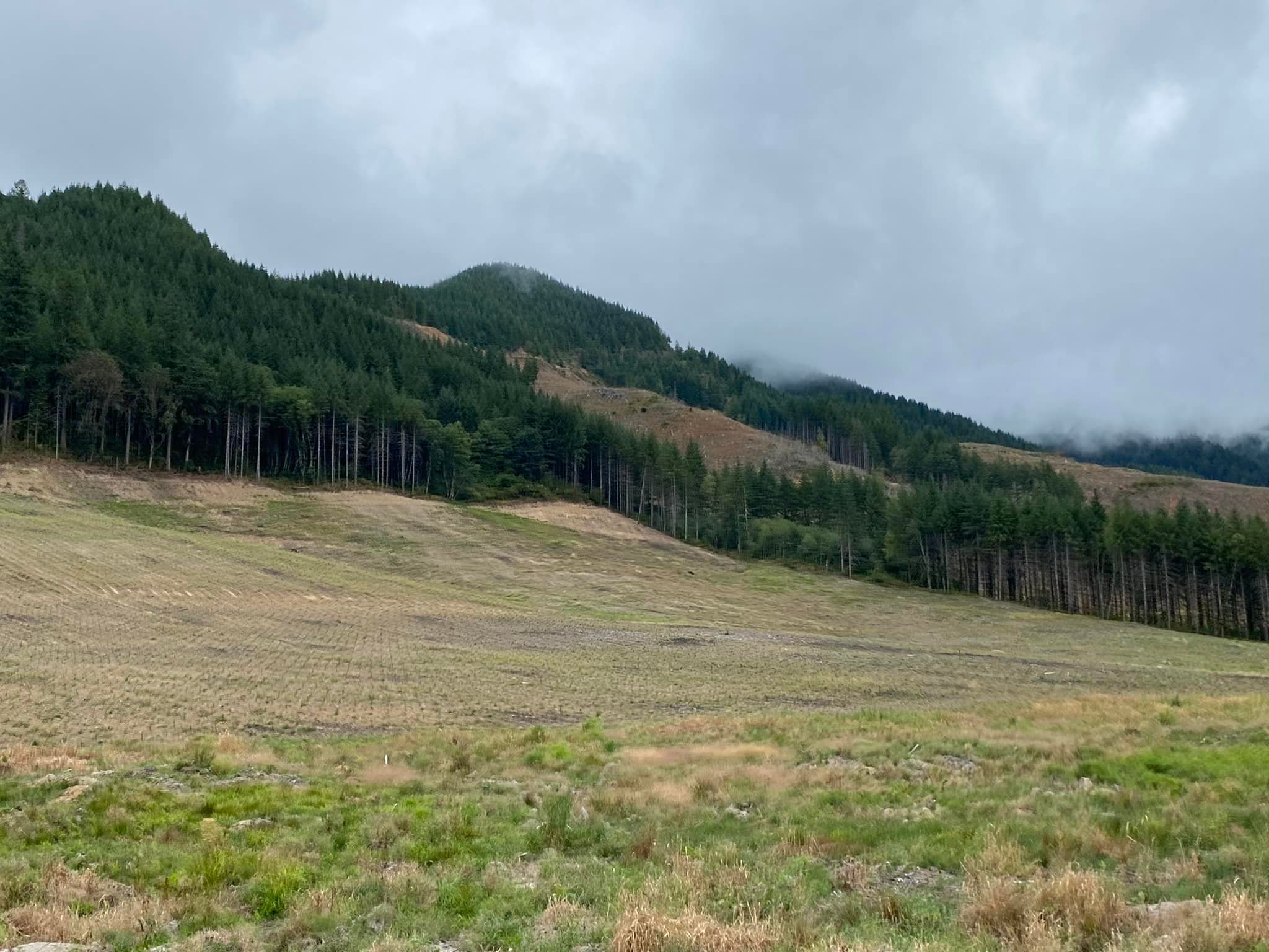
From there, it’s a beautiful ride up Skate Creek which is a 13-mile climb but it’s a nice, gradual incline coming from this side. Enjoy the shade and gurgling creeks if we’ve had any recent rain. If you get lucky on the descent, you’ll get this amazing view of Mt. Rainier.

Once you turn left onto Highway 706, the traffic increases and the shoulder width decreases. We were shocked at how much traffic was coming out of the park on a Saturday evening, but maybe since the official ride is scheduled after Labor Day and the kids are all back in school, the volume won’t be as heavy as it was on the pre-ride. It’s an easy 2.5 miles into Ashford with Suver’s General Store on the left which is open until 10 pm or a couple bars and another store a little further up the road. Beware of multiple sets of RR tracks on Highway 706 which are located at treacherous angles for bike tires!
The next opportunity for food and drinks is at the Elbe Bar and Grill which is open until 2 am on Saturdays. It’s on your right as you’re heading into town around the curve right across from the junction of Highway 7. You’ll probably hear it before you see it! Again, watch for another bad set of RR tracks just as you’re leaving Elbe! The next 10 miles of road on Highway 7 is very busy with little to no shoulders in places. We tried the Alder Cutoff Road on the pre-ride but decided Hwy 7 was the lesser of 2 evils. Stay single file with all your lights blazing and beware of blind corners on hills with no shoulders! Don’t forget the info control at Pack Forest on the right in order to decompress from the craziness you just rode through. Once you’ve made it to Eatonville there are a smattering of choices to choose from, including a couple restaurants and a grocery store. We ate at Cruiser Café on the left and enjoyed it immensely!
The route from Eatonville up to Kapowsin across to just south of Roy is a last-minute change that wasn’t ridden during the pre-ride. We rode the original route up Highway 161 and the Eatonville Cutoff Road and did not feel safe at all and have thus, decided to change the route. This section has been featured on other rides though and we will have more info about this section in the announcements the morning of the ride.
There seem to be plenty of markets, cafes and bars near Roy, McKenna and Yelm should you need them. You pick up the bike path in Yelm for the next 13 miles. Enjoy being off the road for a while – you earned it! If you’re making good time and it’s still light outside, stop and enjoy the very funky and cool Monarch Sculpture Park. By now, you’re practically home, but don’t miss the turn on to Bonniewood Drive out near the airport as I did!

Day 3:
Once again, we’re heading west, but this time out to the Pacific Ocean instead of the Olympic Mountains. The road out of town takes a slightly different route than Day 1 due to RUSA rules. Early on a Sunday morning, it should be no problem. On this day, you take Highway 8 to go west. Again, a busy road with a wide shoulder. The first opportunity to restock your food and drinks is at McCleary, approximately 22 miles from the La Quinta. You’ll soon be following familiar roads, except that things look all turned around because on Day 1 you were traveling some of these roads in the opposite direction.
Stock up in Montesano because it may be a while longer for any other opportunities depending upon what you’re able to find in Cosmopolis and along the highway to Twin Harbors. Heading out of Montesano there are some narrow bridges and hills along Highway 7 but a good shoulder to ride on otherwise.
As you pull in to Cosmopolis up Blue Slough Road, just past this view of the Pacific Northwest at its finest, make sure you take an immediate left onto 2nd to the left of the Cosmopolis sign as soon as you take a right onto Highway 101 (First Street). It comes up fast! Make your way to the trail adjacent to the yellow Lions Club building. There are restrooms with running water available there. Continue onto to the trail for about a mile and then take a left off the trail and onto South Evans Street and head south and west out of town.
You may get lucky and find some services open along Highway 105 on a tourist-filled Sunday afternoon. If not, enjoy the views of these lush forest and tidal landscapes. Just past the first Twin Harbors entrance on your left, you’ll find a Shell station with a Subway sandwich shop on the right. Otherwise, the next entrance to Twin Harbors where the control is located offers flush toilets and running water.
Once you enter Grayland (I’m starting to understand how it got its name), you get a nice reprieve from Highway 105 by turning onto some flat side roads through some very scenic cranberry bogs. Thank you, Ocean Spray! The next stop on this route offers some nice views of the ever-wild Pacific Ocean. If you hauled your surfboard with you, you may be able to carve some nice turns down there.


Further on up the road, the Tokeland 76 station is open until 9 pm and the casino across the road is open until 12 am. Make your way down the coast to Raymond which has a smattering of cafes and restaurants on route as you ride through town. Otherwise, the 76 station slightly off route at approximately mile 102 is open 24 hours. It may be a good idea to stock up in Raymond, as there’s a whole lot of nothing for the next 28 miles along Highway 6 to Pe Ell. Highway 6 has a decent shoulder and wasn’t too busy when we rode it on a Sunday evening.
At West 4th Avenue and Main in Pe Ell, you’ll find the Pe Ell Country Market and Liquor Store on your right and open until 10 pm. Directly across the street from the Market, you’ll find the Willapa Hills Trailhead, bathrooms and a control. It’s time to take a break from the road and ride the next 17 miles on gravel. There has been some gravel recently added in places along the trail so those areas may be a bit deep and loose. However, if you just ride really fast everything will be OK! If you ride the trail during the daylight, enjoy the beautiful sights. If you ride it in the dark, have your headlights blazing and keep an eye out for heffalumps and woozles.
You exit the trail in the booming metropolis of Adna with the only service there being the Adna Grocery Store which closes at 6 pm Sundays. There’s a 76 station out on Highway 6 and near the turn onto Scheuber Road but I don’t know their hours.
As you’re approaching the underpass of I-5 in Centralia, make sure you stay on the sidewalk to the right of the road to get under I-5 as the road is one-way coming toward you. The Chevron straight ahead of you may be the last chance for supplies so you should probably stock up now if you need it. There will probably also be a lot of entertaining people there late at night, so that alone, may be worth stopping for. The last 30 miles into Tumwater is nothing very exciting and should be straightforward.