I have tried to pull together everything you need to know about the revived Permanents program. On the SIR home page select the menu item Rides>Permanents.
Also, Yogy Namara has come up with better maps of Permanents, linked on the updated page. The maps on the SIR Ride with GPS home page announced in the previous blog post have been replaced with these maps. The advantage of these maps is they pull routes from the RUSA route library, rather than SIR’s. The new maps always display the official version of routes, rather than depending on SIR’s library being synchronized with RUSA’s.
If you have registered for a permanent since the new national system started up, you know searching for a route is a bit inconvenient.
If you want to find a route using a map, from the main RUSA page you can pick the Permanents drop down menu and choose Route Search. On the next page click Search for permanents on a map (created and supported by Jake Kassen). Jake’s search will show you routes that are currently available in the new program. Unfortunately it only plots start locations. It does not show where the routes go.
Until the national site displays maps of routes, the SIR team is using Ride with GPS’s Events facility to show you SIR’s routes. For technical reasons a few of the routes displayed may not be active yet in the national system.
Go to SIR’s RwGPS Club page. Click on the Events tab. (You might want to bookmark the events page.) On the left we currently have three groups of Permanents to view: all of them, 100s, and 200s. Click on the set you want to view. It takes a few seconds for the set to load. In the future we might further subdivide the routes by region to keep this process from becoming too slow.
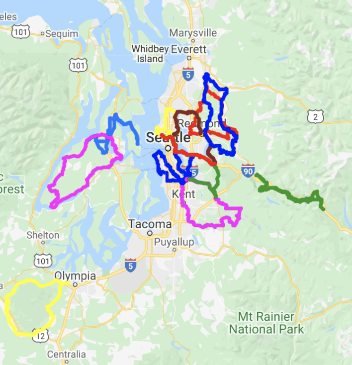
The routes are listed on the left. The selected route (green highlighting) is displayed on the map on the right. To see all the routes at once, click on Show all on map at the bottom of the list. You might have to scroll the list down when we have more routes available.
Now the map will display all the routes.
The various colors just distinguish the different routes. If you mouse over a route in the list, its trace on the map will highlight black.
Thanks to Yogy Namara for realizing Events could be used for this purpose, and keeping the lists of routes regularly updated.