Monthly Archives: July 2018

Crescent Beach Summer 300 km Brevet Pre-ride Report

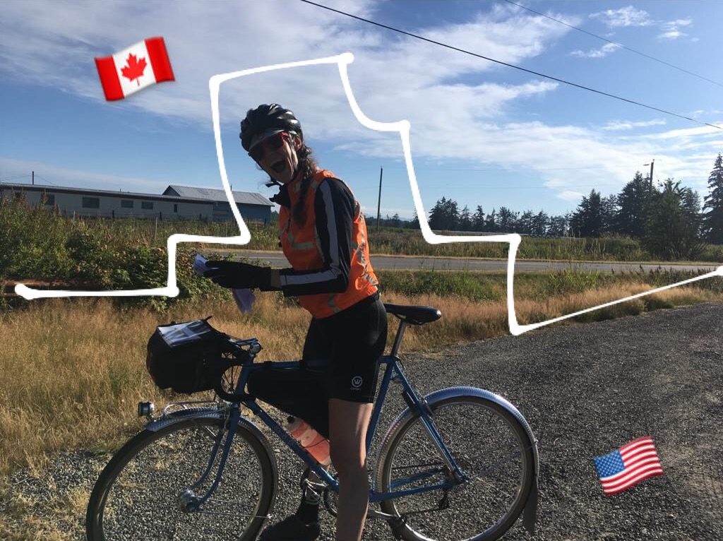
by Bill Gobie, ride organizer

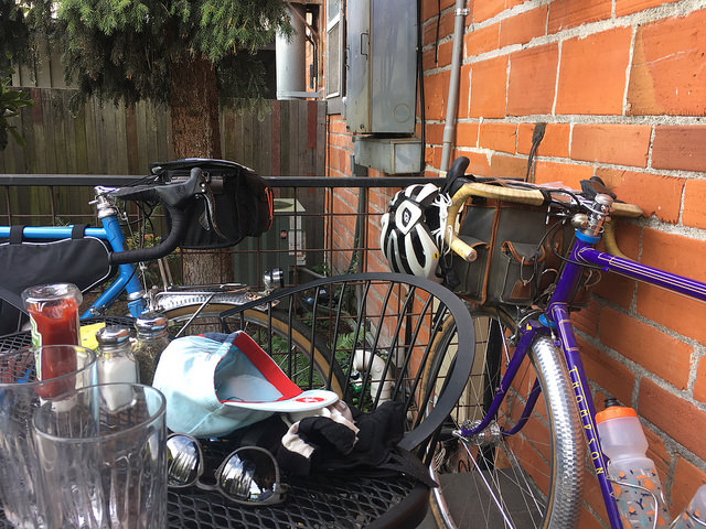
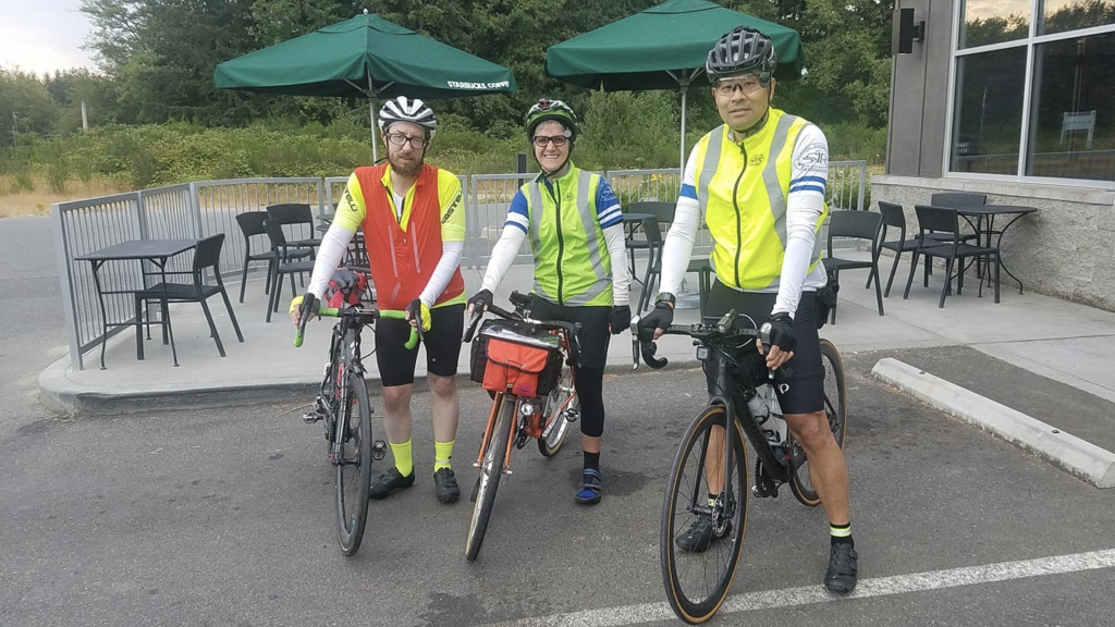
Pre-riders: Peg Winczewski, Mitch Ishihara, and Adam Glass

 — Important Notes —

The finish

The finish has been moved to the 24-hour AM/PM convenience store in Kingston. The AM/PM is virtually as convenient to the ferry as the previously planned finish at the Filling Station. The finish will not be SIR-staffed. Riders will be given a stamped, addressed envelope to mail their cards to the organizer (Bill).

Mitch & Adam discovered the Filling Station was in the process of shutting down at midnight. Peg found it was entirely closed up at 1:30 AM. Without an attractive finish venue that will definitely be open, it is too much to ask a volunteer to hang out for hours waiting for riders. We regret this departure from SIR tradition. Early finishers will probably find the Filling Station a nice place to wait for the ferry.

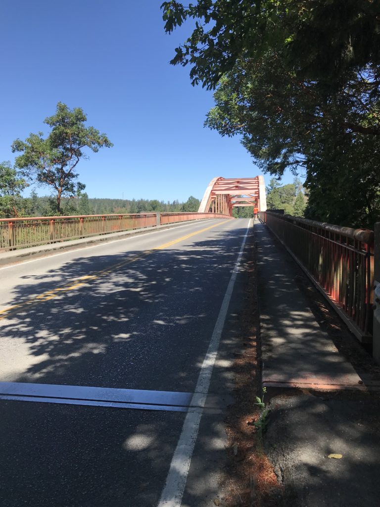
Potential delay at the Hood Canal Bridge when returning

WSDOT is conducting work on the bridge that can only be accomplished at slack water (minimum tidal flow). The bridge is closed to all traffic during this period. A slack will occur at approximately 11:30 PM Saturday night. WSDOT is vague as to whether work will actually occur on a given night. While WSDOT has posted a standing warning about the work, the pre-riders did not encounter a delay. You should be prepared for a delay of up to one hour in the window from 10 PM to midnight. A closure like this is part of the unpredictable conditions randonneurs are expected to overcome; no extra time will be given if the bridge is closed. You may want to pack some warm clothes in case you are forced to wait.

Weather

The weather forecast for the weekend calls for significantly cooler temperatures than we have recently endured. The pre-riders noted a cooling marine effect near the water, and much warmer temperatures after leaving Crescent Lake. Generally high humidity may make nighttime temperatures feel chilly.

Parking

There is ample parking in the Park & Ride lot on Hansville Rd NE, just north of the start location, if you elect to drive your car to the start. The SIR ride page discusses the issues of overnighting or catching the last ferries either to Edmonds or Seattle and why you may want your car.

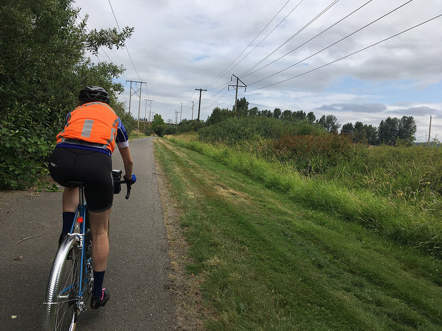
The Olympic Discovery Trail

The route uses the ODT extensively. While the ODT is a marvelous facility, it is not a bicycle superhighway. It has poor sightlines preceeding sudden 90-degree turns and 15% pitches that can take you by surprise. Some road crossings are a little vague – the trail may resume a bit to the left or right vs straight across a crossroad. It is popular with walkers and families with small children; please ride cautiously and be respectful of all users. Portions are paved with rough, slow chip seal.

Support

There will be vanishingly little support. A volunteer might be available to assist with an emergency DNF until early evening. Phone coverage is spotty; do not count on assistance being available. Bus service is available on the Olympic Peninsula.

Cell coverage/roaming

Bill’s cell phone connected to a Canadian network in the vicinity of Crescent Beach. If you do not want to be hit with surprise roaming charges you might want to put your phone in airplane mode in this area.

— The Pre-Ride —

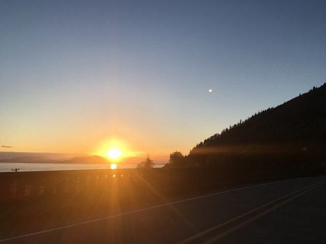
Our day began with a surprise rain shower in Edmonds. Dawn broke as the ferry reached Kingston. The pre-riders departed on schedule in pleasantly cool conditions.


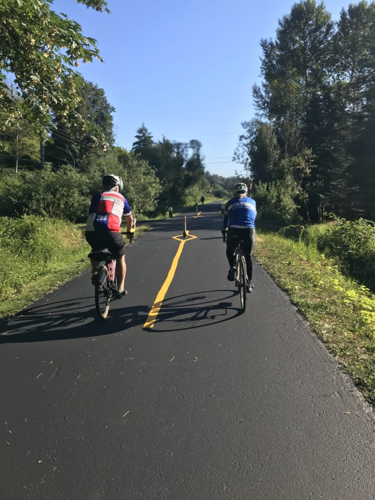
The route begins with a ramble over to Big Valley Rd, then heads north on WA-3 and across the Hood Canal Bridge. We leave the main highway for the quieter, and steeper, parallel route on Larson Lake and Eaglemount Rds.

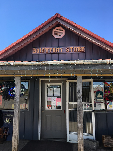
The first resupply opportunity comes at the Discovery Bay Village Store at 54 km. The store opens at 9 AM, 2 hours 15 min after the ride starts. Fast riders may arrive before the store opens. They should plan to resupply in Sequim, at 87 km. Water is available sooner, at 77 km in Sequim Bay State Park. The Longhouse Deli in Blyn is not recommended because reaching it requires crossing busy US-101.

After Discovery Bay the route uses Old Gardiner Rd. Old Gardiner Rd is remarkably tranquil for being so close to US-101.

In Blyn the route sheet directs your attention to the pedestrian tunnel under US-101. Riders navigating by route sheet should take note of the tunnel’s location. The return route uses the tunnel. Its entrance is difficult to see in the return direction.

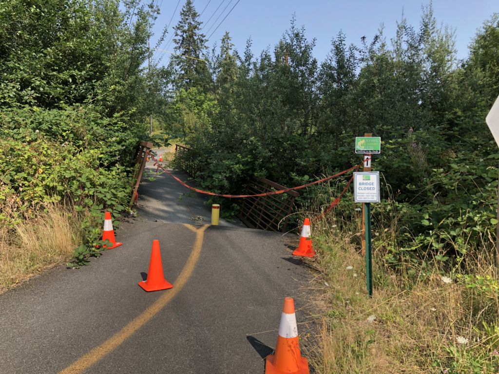
In Blyn the route picks up the Olympic Discovery Trail. The pre-riders discovered a wee problem with the trail. Fortunately detouring around the collapsed bridge is easy. The detour has been added to the route.

A few miles after passing through Sequim Bay State Park, the route leaves the trail to approach Sequim on Brownfield Rd, avoiding the strip mall congestion that the trail would lead you into. It is important to stop when turning off the trail because the road to the left is an uncontrolled exit ramp from 101. Traffic does not stop! An information control at this spot reinforces the need to stop.

In Sequim the route passes by the Safeway. Other food options are available off-route on Washington St.

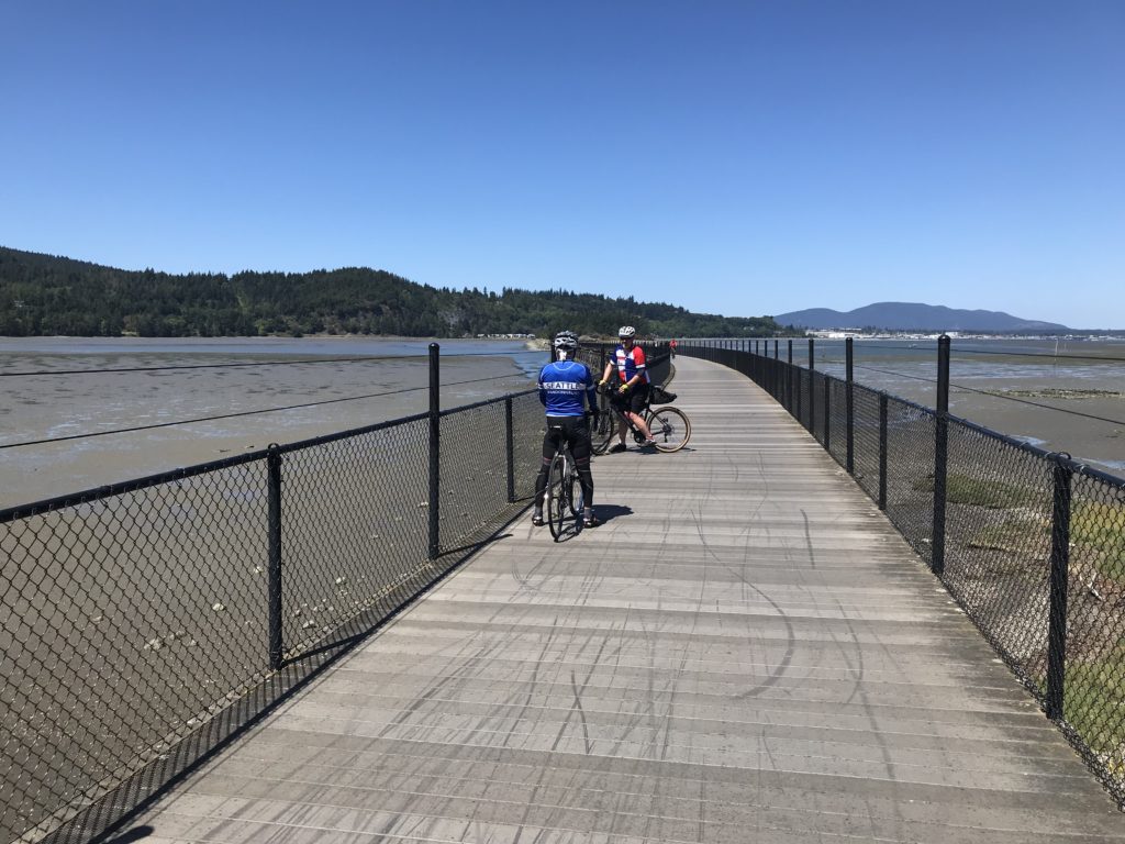
Leaving Sequim you visit the salacious intersection of Woodcock and Kitchen Dick Rds. Proceeding west, the route eventually returns to the Olympic Discovery Trail, remaining on the trail all the way to Port Angeles. If the waves are high you may literally get a taste of salt water!

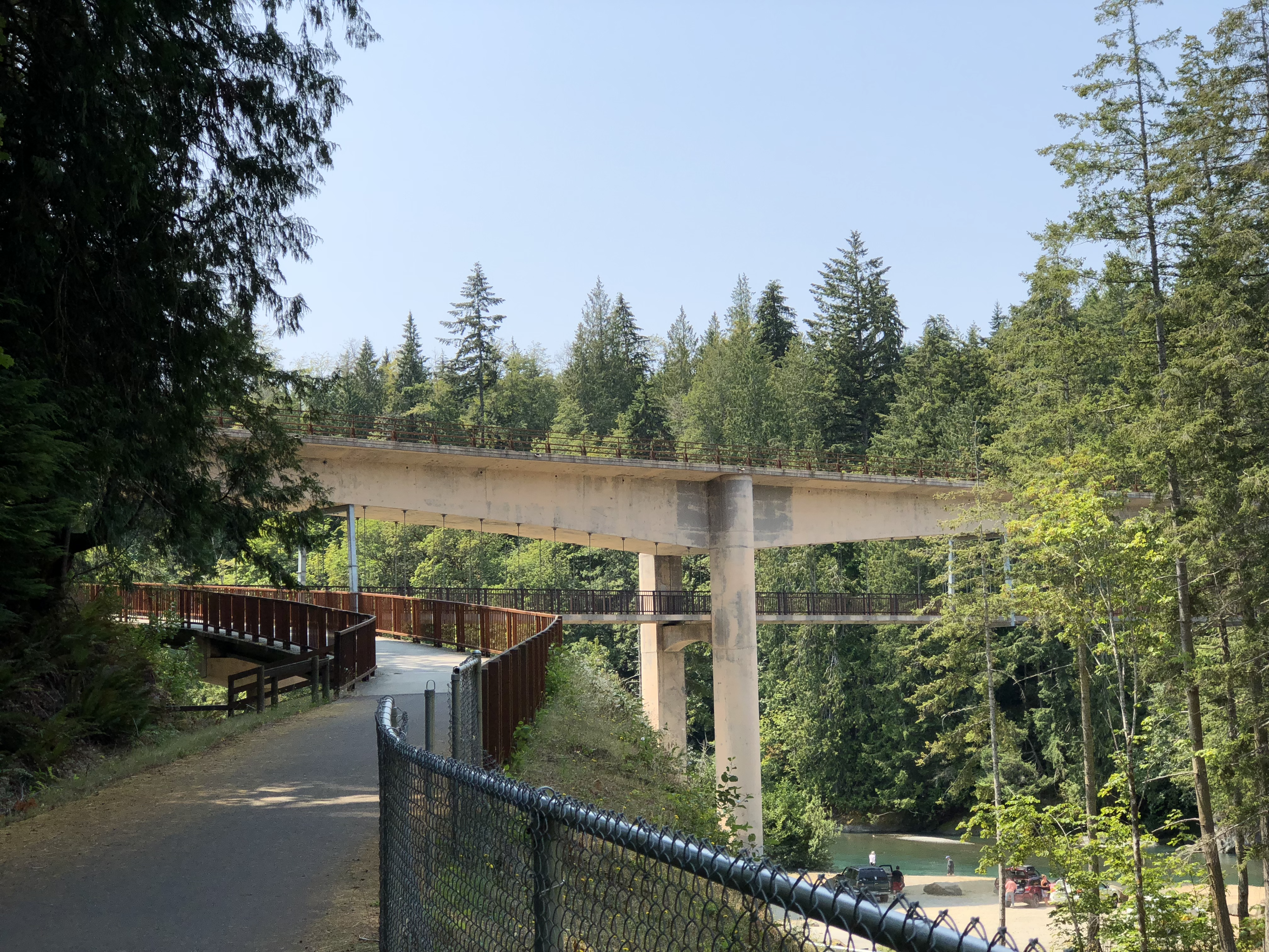
Port Angeles offers resupply opportunities. The route returns to the trail after leaving Port Angeles. At the Elwha River you cross the cool bike bridge suspended beneath the highway bridge.

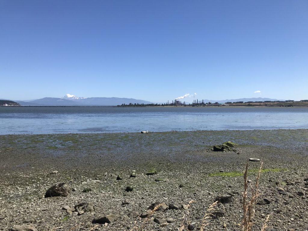
The route follows WA-112 for a few miles before turning for Crescent Beach. At Salt Creek Campground military history geeks can take a short off-route detour to see the casemates built shortly before World War II for two 16″ naval guns. Uniquely, the park road goes right through both emplacements.

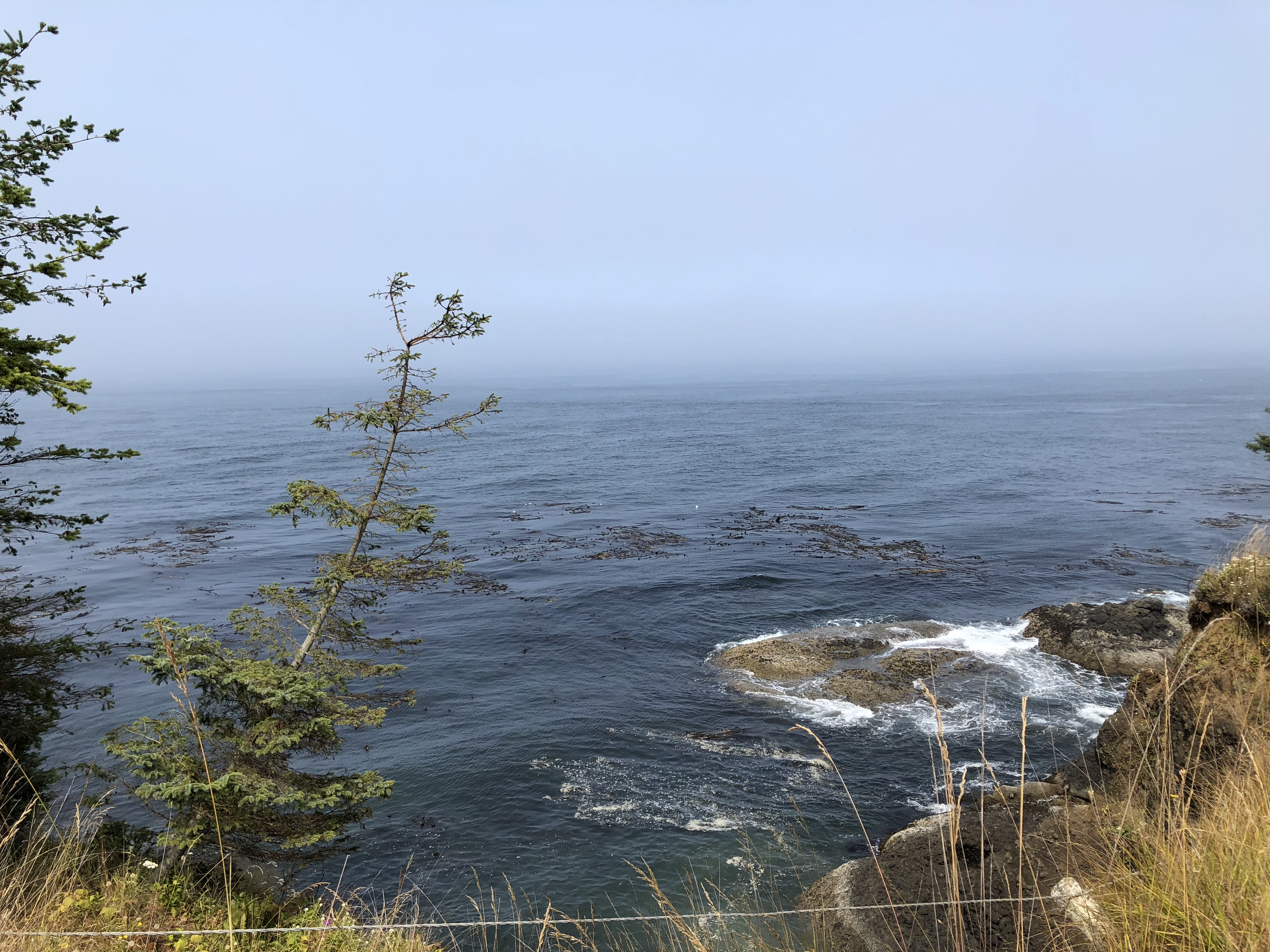
Scenic Crescent Beach marks the westernmost point of the ride. After passing by the beach, the route climbs and turns inland on a narrow, forest-hemmed road heading for Crescent Lake. At the WA-112 crossing you can go a short distance off route left to the Blackberry Cafe in Joyce for a milkshake, pie, or something more substantial. But don’t get too stuffed; you still have to climb over the hill to Crescent Lake.

Alongside Crescent Lake, Beach Rd offers pretty views of the east end of the lake. After climbing out of the lake’s basin, the pre-riders suddenly encountered much hotter conditions on US-101. The control at Shadow Mountain General Store is a good place to prepare yourself for the challenge of Little River Rd. Be sure to leave with full bottles and good energy. The store’s ice cream is highly recommended!

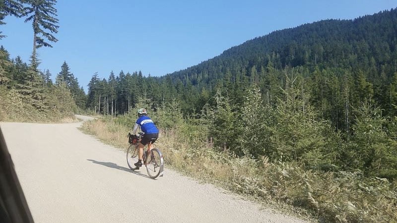
After some noisy miles on US-101, you turn onto Olympic Hot Springs Rd then onto Little River Rd. Little River has the longest and steepest climbing on the route. The grade reaches 15% in places. About 4 km of this road is dirt. There is not much large gravel. Mitch & Adam rode 25 & 28 mm tires with no trouble, although there are places where you may have trouble resuming riding if you stop. The road heads uphill through a mix of forest and clearcuts. If the day is warm the clearcuts will be exposed and hot.

The route turns downhill on Hurricane Ridge Rd. The road is newly resurfaced and very smooth. However, it has some odd divots, so stay alert on this fast descent.

After passing through Port Angeles, with its resupply opportunities, the route largely retraces itself on the Olympic Discovery Trail. The Sequim Safeway or another restaurant is a good place for a substantial meal. For many riders this will be the last, best resupply opportunity. The 24-hour Longhouse Market at Blyn is a final option but requires crossing 101. The deli in the market may not be open much later than 6 PM.

In Blyn use the tunnel mentioned previously to cross safely under US-101. The route stays on 101 to Discovery Bay; using Old Gardiner Rd in this direction would require multiple left turns across 101.

Fast riders will be able to resupply at the Discovery Bay Village Store. The store closes at 8 PM.

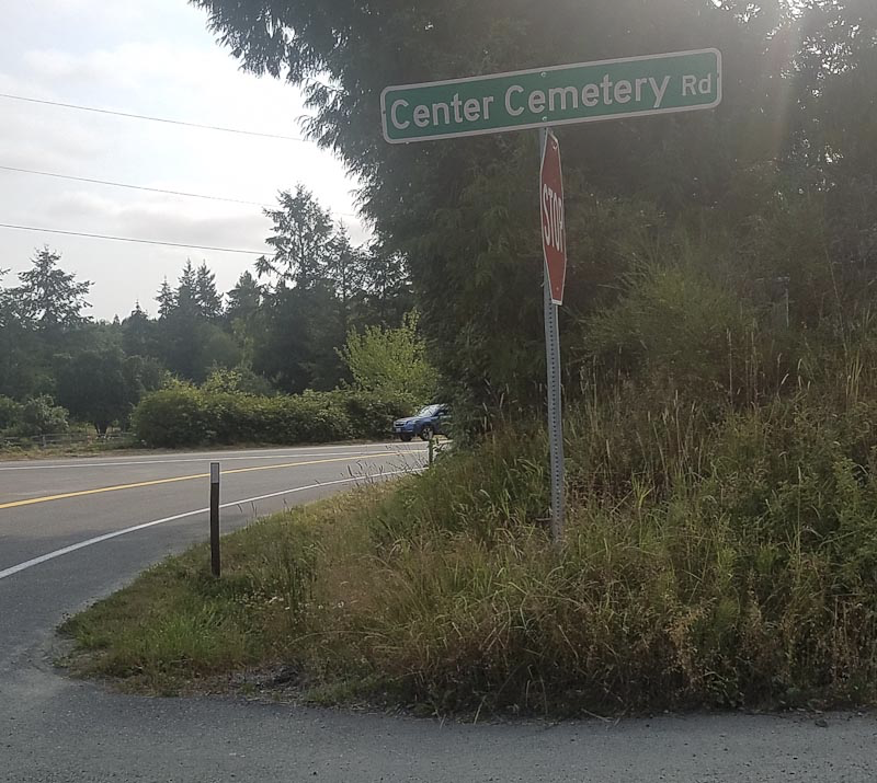
The route leaves 101 at Discovery Bay to again take the parallel route on Eaglemount and Larson Lake Rds. The final information control is at Center Cemetery Rd, just before the turn onto Larson Lake. The control asks a question about the stop sign on Center Cemetery Rd, not Larson Lake. Don’t mix them up.

With some luck you will not be delayed at the Hood Canal Bridge, and can cruise the last miles to Kingston.

As a special consideration for riders overnighting at The Point Casino Hotel, you may ride directly to the hotel and have your card signed there. This is a harder finish than going to Kingston! Mitch and Adam report that the food at the casino is better than a convenience store.

Comments Off on Crescent Beach Summer 300 km Brevet Pre-ride Report

Filed under Uncategorized

High Impact Closure: East Lake Sammamish Pkwy & Trail

During August 6-20 the road and “likely” the trail will be closed for a culvert replacement. The closure extends from Louis Thompson Rd NE at the north to 212th Way SE at the south.

There will be a signed detour on Louis Thompson Rd, 212th Ave, and 212th Way. However, judging from Street View images, this will be an unpleasant and dangerous bicycle route. Louis Thompson Rd and 212th Way climb steeply with narrow or no shoulders.

A safer bicycle detour should be NE Inglewood Hill Rd, 228 Ave NE, and SE 43rd Way. This route has adequate shoulders or bicycle lanes the whole way. This detour has about 660 ft of climbing vs 170 ft on the road. The detour adds about 5 km vs the road.

Map: https://ridewithgps.com/routes/28173893

City of Sammamish project page: https://www.sammamish.us/government/departments/public-works/current-projects/zackuse-creek-fish-passage-and-stream-restoration-project/

Affected routes (not guaranteed comprehensive, courtesy of Yogy Namara):52, 359, 401, 531, 541, 605, 757, 758, 838, 1004, 1005, 1305, 1315, 1321, 1322, 1449, 1511, 1514, 1515, 1516, 1522, 1704, 1755, 1756, 2173, 2174, 2176, 2292, 2432, 2525, 2575, 2576, 2795, 3022, 3081, 3159, 3226, 3227, 3502, 3539, 3591.

Comments Off on High Impact Closure: East Lake Sammamish Pkwy & Trail

Filed under Notable Detours, Permanent Change, Permanents

Border to Border 1000K

by Theo Roffe and Rachel Wood

Complete route on RWGPS: https://ridewithgps.com/routes/27656925 
Cue sheets: https://docs.google.com/spreadsheets/d/1nmGcZ86ygDuhFXS0zd_5VuAZgG0SrGz-xAYvsSDB-I0/edit?usp=sharing

Day 1, Friday: Olympia to Bellingham

https://ridewithgps.com/routes/28158220

On Friday morning, in the chill air of the South Sound, we started our ride to the Canada border by heading south east. That felt a bit confusing, but the first control is in Rainier and, from there, the route backtracks along the Seattle-to-Portland route into Seattle. While this routing isn’t as scenic as sticking to the edge of the sound through Tacoma and Des Moines, it sure avoids a lot of climbing. And, despite what the cumulative elevation of 6713 m might suggest, avoiding big climbs was a goal for this route.

Riding the Interurban

Beginning in Sumner, you’ll be on the Interurban trail. During the pre-ride, some sections were closed for a repaving project that should be completed in time for the ride. We were able to make it through with only minimal swerving around “Trail Closed” signs and riding through gravel. You’ll also want to watch out for railroad tracks along the trail – some were barely noticeable, but others were quite bumpy.

The Interurban trail drops you off in Renton, where you’ll find your way to the coast of Lake Washington for 40 km of watery views. Along this section, we stopped in Seward park to refill our water bottles, have a snack, and admire the lake with its variety of boats. After the lakeside riding, the route features a section of the Burke-Gilman and Lake Sammamish Trails. Even on a weekday afternoon, these are popular trails, so be attentive to other cyclists and pedestrians who may be moving more slowly.

Things get steep for a while through Woodinville and Maltby before descending into Snohomish County where broad plains offer bucolic views framed by the Cascade Mountains to the east. Marysville offers up some traffic and one of the route’s less pleasant roads, but the rolling hills from Tulalip Bay to Warm Beach are a great payoff. Due to a road closure just north of Warm Beach, you’ll trek back inland to Silvana before heading up through Stanwood and Conway to the Skagit Valley; however, the detour has a nice curvy descent into lovely farmland. Come back in the spring time for a wonderful display of Tulips in this area!

If you catch Bayview State park before 8 pm, there are bathrooms and nice views across Padilla Bay to Anacortes and Gumes Island. Chuckanut Drive, to the north, is a highlight of the route. Yes, it’s climby, but it sticks you right on the edge of Samish and Bellingham Bays where you can watch the sun set behind Lummi Island.

Sunset from Chuckanut, just before the climbing starts

You’ll be able to get food in Fairhaven or Bellingham before the out-and-back to the Canada border. But don’t make the same mistake Rachel and I did and save that out-and-back for day 2! It’ll make for a very long, tough day – day 2 already has more climbing, it doesn’t need more distance. (Our splits for the pre-ride were 325 / 415 / 260 km. The official splits with the revised route are 405 / 338 / 264 km.)

Anyway, the route from Fairhaven to Bellingham features a nice gravel trail that is totally rideable on a road bike with narrow tires. But if you can’t stand that kind of thing, feel free to stay on State Street into town. Keep in mind that Bellingham is a college town: Friday night downtown can be a bit of a party. We didn’t have any trouble, but you should keep both eyes open for young, dumb drivers and bar-hopping pedestrians.

If you’re fast, you might pass through Lynden in time for services, otherwise plan on packing what you need before leaving Bellingham. On the pre-ride, we had some trouble with a dog within 5 km of the border, but he’s likely to be locked up in his kennel at night. We just had the bad luck to come by as his people were opening his kennel and the gate! They came out to the street with his leash and treats and we squirted him with our water bottles until he finally went home. If you meet Duke, squirt him right in his face for us. Thanks! He hates that.

At the overnight control in Bellingham, we’ll have your drop-bags (if you choose to leave one at the start) and beds, but little else. For the pre-ride, we fit a change of clothes for day 2 in our bags. There’s a 24-hour Denny’s in the same parking lot where you can get dinner and breakfast regardless of your timing. We slept for 5 hours at this control. That was restful, but probably too much time by 1 or 2 hours; we were behind the clock all day Saturday.

Snohomish Day 2

Day 2, Saturday: Bellingham to Olympia

https://ridewithgps.com/routes/28158228

The route leaves Bellingham without passing many services, so be sure you have what you’ll need as there’s really very little over the next 50 km. There are some steep climbs to get out of town and wake you up, but the bright side is that they aren’t long, and they lead into a lovely descent on a quiet road along Lake Samish, followed by the similarly nice Old Highway 99. We had to avoid a road closure near turning off Old 99 (don’t let the signs scare you up Bow Hill Road! The route uses a much shorter, flatter detour) and headed into Burlington, which was terrible. Lucky for you, the route now skips Burlington and goes into downtown Mount Vernon. There is one section where you’ll have to rejoin main-road traffic to cross the Skagit River, but there is a bike lane on the bridge. In Mount Vernon, the Skagit Valley Co-op has everything, but we enjoyed a leisurely stop at the Calico Cupboard Café and Bakery. It’s an open control, so feel free to stop wherever you like to get your card signed.

The 200K riders were also at the Calico Cupboard Cafe! In Anacortes… 🙁

You’ll stick to frontage roads along I-5 returning nearly to Conway before heading east to Lake McMurray and the Centennial Trail. The trail is a popular place for slow cyclists and pedestrians, so please be cautious and attentive. You can keep a decent pace nonetheless, just ring your bell and pass with plenty of space. The Centennial Trail brings you back in Snohomish where you controlled on day 1. But leaving town you’ll head south east into the Snoqualmie River Valley to Carnation. This section offers mostly shaded, rolling roads with views of the Cascades and picturesque farms. Resupply in Carnation before the hill out of Fall City; there are a couple cafes in town, plus the grocery store where we went. As Rachel said on the pre-ride, that hill is no joke. Descending from the Issaquah Highlands you can pick up some good speed (we were going 40+ mph on our single bikes). Just be sure to get over to the left lane and avoid joining the freeway onramps!

Control in Issaquah and then head out for more climbing: the highest elevation section of the route begins just as you leave Issaquah and ends 50 km later with a lovely descent into Orting on the Foothills trail. There was some road construction on the bridge between Enumclaw and Buckley which narrowed things down to one lane and stopped traffic in alternate directions. This seemed like a bad thing, but it resulted in making the left turn from 410 to Park Ave much easier than usual – there was only traffic coming from one direction by the time we finished the climb up from the bridge! From Orting, you’ll climb a steep ridge and work your way back to familiar roads: 507 to Yelm, the Yelm-Tenino trail to Rainier and Rainier Road back into Tumwater. We got here very late on the pre-ride and it was cold and slow going. Bring your layers for night riding!

After chasing the clock all day and riding extra distance to Eatonville (no longer on the route!), we arrived in Tumwater at 5:00 am. We slept ~3 hours (I really didn’t want to tackle day 3 on any less) and started Sunday behind the clock again. Fortunately, the clock slows down this far into a ride and we started picking up a buffer with each control.

Day 3, Sunday: Olympia to Longview and Back

https://ridewithgps.com/routes/28158231

For the pre-ride, day 3 was forecasted to be the hottest, as it is for the event. We started relatively late in the day (9:40 a.m.) and thus missed out on the typically cool morning hours. Instead, we hit the beginning of the heat with a high temperature reportedly about 93°F. According to our cycling computers it was 105°F. Considering that official air temperatures are measured at a height of 2 meters above ground, while you’ll be riding just above the hot asphalt, it’s going to feel much more like 100°F than 90°F. And there’s less shade than you’d expect. That said, we had a strong tailwind for most of the morning and early afternoon.

Curtis Hill Road will probably have you cursing us (blame Ian!), but the descent is fantastic and the roads on either side of the Boistfort Store are beautiful. You’ll get patches of shade here (though Rachel pointed out that all the climbs were sunny) and on the Westside Highway where the route heads south along the Cowlitz River to Longview. Longview has some big terrible roads, so we won’t go all the way to the Columbia river where the border is drawn between Oregon and Washington, but you’re very close. Instead, we’ll stick to lower traffic toads and then cross the Cowlitz into Kelso to join frontage roads along I5 where you’ll head north on the final leg of the journey. These frontage roads were shady and rolling – quite nice to ride!

At the control in Toledo there’s a public bathroom at the boat launch just left after crossing the bridge into town. There’s also an IGA market (grocery store) open until 9 p.m. (they locked the door precisely on the hour!). The info control is at a gas station convenience store that’s open until 10 p.m. If you don’t want to stop, read the question in advance: you should be able to find the answer from your bike and remember it to write down later. Jackson Highway featured, for us, a beautiful sunset. If you’re earlier you’ll probably get great views of the valley, Mt St Helens, and Mt Rainier (we could just see both in the fading light). You’ll also get the last big climb through Lewis and Clark State Park at 939 km. But this means plenty of good descending into Chehalis and Centralia. Then you’ll go on through the valley with a few rollers to Bucoda and Tenino. Another info control at a gas station will leave your card with just one more slot to fill! Climb the last of the climbs out of town and (mostly) descend back to Tumwater. Of course, you can never believe “it’s all downhill from here,” but in this case, it mostly is.

We rolled into the finish at 1:30 a.m. for 68 hours elapsed (the pre-ride started 30 minutes later than the brevet will start. Also note that we rode 1032.9 km and your route will be 1007 km). Then we enjoyed a celebratory beer, a well-earned shower, and bed!

Strava users can look at our ride recording here: https://www.strava.com/activities/1721889143 (if you don’t log in, only high-level details are visible).

Comments Off on Border to Border 1000K

Filed under Pre Rides

2018 SIR Summer 200K Report: Snohomish–Anacortes–Snohomish

by Narayan Krishnamoorthy

NOTE CHANGE OF START and FINISH LOCATIONS

Ride start: 7 am
Registration start: 6 am
Ride start Location: Snohomish Library
Ride Finish: Trails End Brewery
Parking: Plenty of on-street parking along main drag and near the Library
Warning: Watch for road closures along Downtown Snohomish

Registration and additional details: http://seattlerando.org/content.aspx?page_id=87&club_id=928629&item_id=827535

As 200Ks go, this one is a fairly known commodity, but it combines elements from different types of routes in one rarely found package: low in traffic, high on trails, scenery, frequency of services, and quality of pavement.

We start early on Saturday from the Snohomish Public Library to avoid the hullabaloo of the Kla Ha Ya Days festival in Downtown Snohomish (and some possibly heavy headwinds later in the day); the early start allows us to enjoy cooler temperatures for longer, and the trail is less crowded (it promises to be a zoo once the 5K run starts at 8 am. Don’t be late). The first couple of miles are downhill – and feature very new smooth pavement – but the trail ventures gently uphill past the Machias store, and kicks up one more percent past Lake Stevens. You should have lovely views of the valley and the farms that line the sides of the trail. You’ll have a brief stretch of riding on Highway 9, but traffic volume should be low that time of day. You may begin to notice the first signs of a headwind or a crosswind here, but that bodes well for the return home.

The first control at Lake McMurray is a delight: it features a fabulous lake view and a very happy control volunteer eager to apply her bicycle stamp to your card, but only if you don’t block the gas pumps; if you do, you will get a bit of a talking to. Please make sure you clean up your garbage/recycling here (the store is a one person operation). This is a wonderful opportunity to refuel and to support the local economy. But fret not if you forget something: a brief and easy climb on Highway 534 leads you to Conway where even more services are available. Once you get past Conway, you will be blessed with lovely views of Mount Baker and, as an added bonus, will not see traffic until you hit the right turn onto Best Road. You’ll cross the Skagit River and find one more country store to refuel at (Rexville Grocery, can’t miss it on the right after you descend the Skagit River Bridge).

A short pedal brings you to lovely La Conner (a good coffee stop right as you enter town, should you feel the need) and our first possible hiccup: Maple Ave is easy to miss. Look for the Washington Federal Bank. Traffic was a bit higher than usual for the pre-riders because of Ragnar 2018, but you should have no traffic issues. The pre-riders found brief stretches of glass on Snee-Oosh Road, but the lovely water views more than made up for that risk. A brief battle with the headwind should bring you to one of the gems of the route: the Tommy Thompson trail that goes over Fidalgo Bay and brings you into Anacortes. On a hot day, the cool breeze off the bay will cool you right down and the water views will make you happy that you chose this ride. The trail does feature bollards, road crossings, and some weird chicanes, but it allows for a mostly stress-free ride into Anacortes.

The Calico Cupboard is lovely and has baked goodies and savoury foods that are sure to please your tired self. There is also a tavern across the street, but we found service slow on a previous ride. For quick service, get things to go at the bakery. A sit-down meal is recommended here as you are more than likely to be blessed with a tailwind on the way back. The route is an out and back, so you will have the luxury of retracing your steps with few complications.

The finish is at Trails End Taphouse, where eager volunteers will be on hand to shower you with kudos (and mooch free beers off of you).

1 Comment

Filed under Pre Rides, SIR Rides

Bakery Run Populaire 7/14/2018

For this summer’s populaire, start with a coffee, end with a beer, and avail yourself of bakeries along the way.

The ride starts at 9:00 AM on July 14th from Starbucks Lake Forest Park.

We will be opening registration at 8:30. To simplify the process for yourself and the organizers on Saturday, please preregister.

It looks like this is going to be one of the rare events where both the pre-riders and the day of riders get excellent weather. This is great because, in addition to passing by coffee shops, bakeries, and breweries, we spend a fair amount of time next to Lake Washington — riders will get to enjoy the views.

Although there is not a ton of climbing, this is not a fast course as there is a fair amount of trail riding. There were lots of children, dogs, and people not paying attention on the trail during the pre-ride. Please be careful. Keep your speed down and break into smaller groups.

The climb up to the control at the coffee shop is steep but only ½ mile long. So, as you are cursing the ride organizer, remember that you’ll have finished 90% of the climbing once you get to the coffee shop.

There are lots of street fairs and festivals scheduled along the course. We saw signs for events in Kirkland, Mercer Island and Redmond scheduled for the same day as the ride.

More information available on the SIR website.

Route on RWGPS

Cue sheet on Google Sheets

1 Comment

Filed under SIR Rides