Monthly Archives: March 2016

Olympia 300K Pre Ride Report

Tacoma Narrows Bridge. Photo by Lynne Fitzsimmons

Tacoma Narrows Bridge.
Photo by Lynne Fitzsimmons


The Olympia rides starts in Tacoma, just to make it easier for our riders up north. We begin at Bertolino’s Coffee Bar on S Union; plenty of dining opportunities.

It’s a new route out of the city as you fly down Chambers Bay into Steilacoom and nice views of the Sound and the Olympic Mountains. Thru Dupont, plenty of services, into the Nisqually valley and south on some familiar roads into Centralia. The route then heads west into the Independence valley. There are no, ZERO, services in the Valley, ’bout 50K: plan according.

The first half of the ride is basically flat. As your cruise up Moon road there are great views of Mt Rainier. Then on thru the Delphi Valley into Mud Bay on the west side of Olympia. Hence the Olympia 300.

Before you up head northwest on Hwy 101, there are services at Steamboat Island. Hwy 101 has its rollers, but a good shoulder. As you leave the control in Shelton, we reverse the route of last year’s 600k, round Lake Limerick and Mason Lake, and descend on the Hood Canal and into Belfair. This is a great place to fuel up for the finial 50K.

Here is where the fun starts. Getting off the Kitsap Peninsula is a roller coaster. Once you start From Belfair it continues thru Gig Harbor. From there you take the Narrows Bike Trail and the Scott Pierson Trail to the finish.

Rick Blacker and Josh Morse bit the bullet and took the rain and the marginal road conditions on the pre ride with predicated a route change.

It looking like the weather gods are on smiling on this ride.
Come on Down.
Sun In the South Sound.

Pre-registration and full ride details, click here.
The peloton rolls out promptly at 07:00, April 2, 2015.

-Millison

Comments Off on Olympia 300K Pre Ride Report

Filed under Pre Rides, SIR Rides

Island Views 300k Pre-Ride Report

Scenic Views

On 3/19, five hardy souls – Adam, Albert, Jason, Mitch and Thai set out to pre-ride the 3/26 Island Views 300k route.  This report is based on their experience as well as an earlier pre-ride by Mark, Mark, and Vinnie.

Parking

There is ample parking at the Safeway about 100 ft north of the Starbucks and at the Park & Ride (.4 miles north).

Do not park at the Starbucks — there isn’t much parking and the signage suggests your car won’t be welcome for long.

The first 100K

After dealing with paperwork at the Ave D Starbucks that’ll serve as our start control, we set out into the morning darkness.  The route heads west, and then north on reasonably quiet roads to Mt Vernon.  We stopped here for coffee and baked goods at Ristretto Coffee Lounge & Wine Bar but you may want to keep moving to add time in the bank for later.  We then proceeded further west and north to State Route 20 before the bridge.  On the bridge we recommend taking the separated pedestrian/biking path.  Welcome to Fidalgo Island.

Island Views

Once on Fidalgo, you’ll quickly leave 20 to explore northwards on quieter roads and trails to March Point.  This segment features views of the bay, islands and shipping as well as the oil refinery.  After the refinery, you’ll take the Tommy Thompson wooden trestle bridge across the Fidalgo Bay Aquatic Reserve.  The bridge (and the subsequent trail) are multi-use and you can expect to encounter a few pedestrians and other bicyclists.  The bridge also features shells deposited by local birds.  We had one flat on an older tire caused by the shells.

Once across the bridge, you’ll head north to Anacortes and and a control at The Market at Anacortes.  The control is open but the market has a good selection of soups, breads, general groceries, and a coffee shop with exterior seating.  The pre-riders recommend you fuel up in Anacortes.  There is also a bike shop across the street.

From Anacortes we headed further west for more coastal views and hilly terrain before turning south towards Whidbey itself. To get onto Whidbey, you’ll be crossing Deception Pass — take the lane here.  There is no control here but it’s worth stopping to take a look.  Once across the bridge you are on Whidbey Island.

On Whidbey, we take you South around the naval base and then down to the coast for quieter riding and some hills.  There are some services on this stretch while it remains on 20 but with decreasing frequency as you venture further south.  At Fort Ebey State Park you’ll find a SIR manned control at a picnic shelter with rando delicacies and a view. You don’t want to rest too long before heading out as more climbing awaits between the park and La Conner.

From the manned control we go west and north around Penn Cove and continuing along the coast collecting views and hills.  Again the services are limited until you reach the city of Oak Harbor — the largest city on the Island where all manner of sustenance can be found.  From there we head back across Deception Pass and on to La Conner.

The last 80k

In La Conner we enjoyed sandwiches at the Pioneer Market but the control is open if you prefer other fare. The route from here will be familiar to many as you race east towards Lake McMurray, and then south on the Centennial trail.   Full services can be found along route 594 and in Arlington (7-11, others).    On our pre-ride, we found the Lake McMurray store closed as well as the Arlington public services.

As you arrive in Snohomish, remember to turn on 10th and head over to Ave D.  There we will await at Starbucks (til 8pm), then Safeway (indoors or in a van in the lot with the flashing SIR sign).

The route features some 8k+ ft of climbing over 308km  You can think of it as a ride of 3 parts — 100 km of relative flat to Anacortes, 100 km on Whidbey/Fidalgo over hilly coastal views, and 100 km of relative flat to get to the finish.

Pre-registration

Help the organizers by pre-registering for this brevet here:

http://brevets.seattlerando.org/register_for_event/369

Comments Off on Island Views 300k Pre-Ride Report

Filed under SIR Rides

Flèche NW 2016 — 4/15 to 4/17

It’s time to plan for this year’s Flèche NW! Design your route, sign up your team, and get all that information turned in by April 1st.

The Fleche-eating Zombies

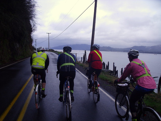
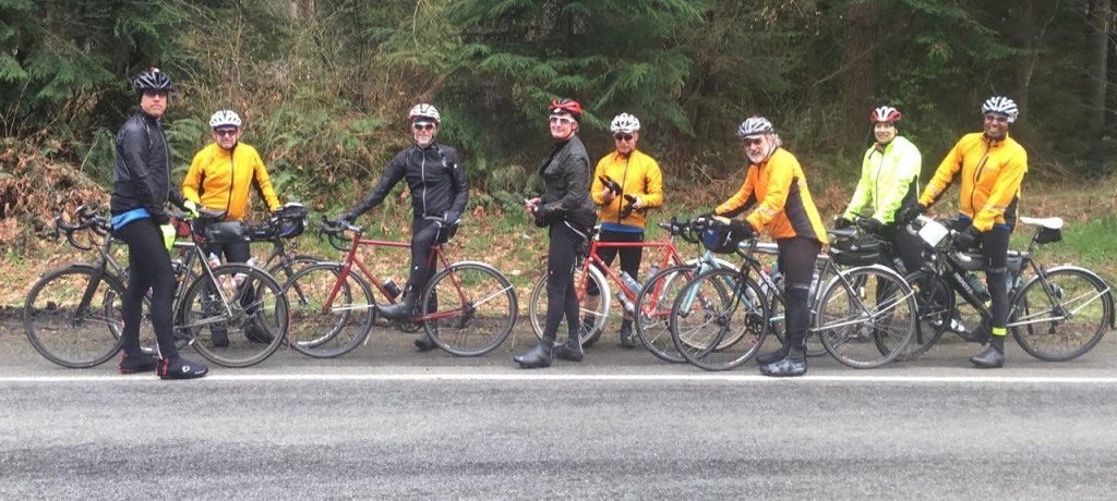
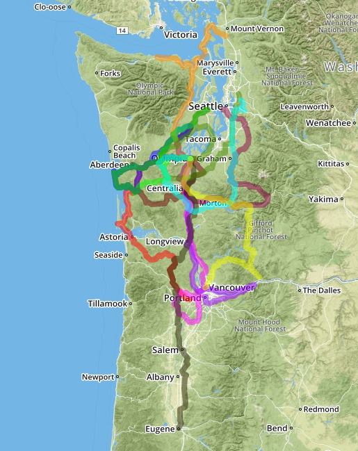
The Flèche is a 24 hour team event of at least 360 KM in distance and run similar to a brevet. Each team plans its own route with a common destination in mind. The Flèche is a fun event fostering friendships, teamwork and camaraderie during the planning, riding and finishing celebration of the accomplishment. This year we are returning to Olympia, WA for our finish location. You again have a myriad of route possibilities.

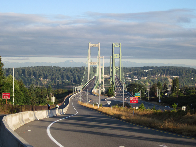
Destination: Olympia

Finish: Governor Hotel in Downtown Olympia; 621 Capitol Way S; Olympia, WA 98501

Questions? email: randotheo AT gmail DOT com

Start time range: Noon Thursday, April 14th through 08:00 Saturday, April 16th

Finish by: 8:00 AM Sunday, April 17, 2016 – All Control Cards due at this time!

Fleche Brunch: 09:00 Sunday April 17th, Governor Hotel

Entry Fees: $25 per person

Banquet Brunch: We will hold our banquet celebrating this year’s Flèche Northwest on Sunday morning April 17th at 9:00 a.m. The banquet will cost $20 per person (includes tax and gratuity). Payment for the brunch must be made at the time of team registration.

Registration form and full details available on the SIR event page.

Designing your route:

Ed and Asta Navigate

Each team is to design its own route that is at least 360 KM in length. The traditional format for a Flèche is point-to-point, like an archer’s arrow (flèche in French) flying toward its target. In France, the destination is usually a resort community providing a festive surrounding for waiting family and friends. We try to replicate some of this by ending our Flèche at a nice locale and having an awards brunch with our friends and families.

Though not a classic Flèche route, a large circuit or loop may also be used, such as to make a scenic tour of a region. However, an out-and-back route is not consistent with the traditions of the Flèche. A short out-and-back route segment is permitted, such as to obtain food and supplies in remote regions, but no control may be used more than once and no road segment may be used more than once in the same direction. If an out-and-back route segment is utilized in the overall route design, a control point must be located at its turnaround.

Distance traveled is calculated on the basis of the shortest route between checkpoints that can be legally traveled by bicycle. Maps or mapping software with accurate mileages will be used to determine distances.

No rest stop may exceed two hours in any one location.

If more than one team uses the same starting point, then starting times for individual teams shall be spaced at least one hour apart.

Each team may start its ride between noon Thursday April 14th and 8:00 AM on Saturday April 16th. Cards are due at 8:00 AM on Sunday April 17th.

The start time and starting place approved with the team’s registration must be used.

22 Hour Control: At least 25 KM must be ridden between the end of the 22nd hour and the end of the 24th hour of the ride. Under no circumstances may these two checkpoints be the same place, even if the planned distance has already been completed. The exact time and the location of the team at the 22 hour point must be noted on each control card and verified by the signature or business receipt imprinted with the time, date and location. (In the event that the 22 hour point is reached where no verification is available, the time, distance, and location of the team shall be noted by the team members on their route card and verification must be obtained at the next available location along the route.)

Final 24 Hour Control: Teams may stop their Flèche at any point after reaching a total distance of 360 KM and a minimum of 25KM past the 22 Hour Control. This means that the Governor Hotel in Olympia does not have to the final end point.

One last break

Team Composition and Riding Rules:

Each team is limited to a maximum of five members (machines) and a minimum of three members. Tandems or other multi-rider vehicles count as a single member.

Members of the same team may assist one another. However, teams are expressly forbidden to aid each other, even teams from the same club. The one exception to this is in the event of a medical emergency.

During the event, riders may not draft anyone except their own Flèche teammates.

At least three team members (read machines) must have ridden the same distance and arrive at the finish together.

No following cars are allowed under any circumstances. Teams using a support car can receive support from their car only at the control points listed on their route cards.

Assistance from other motorized non-participants is also not permitted, except in the case of a medical emergency. There may be secret and roving checkpoints.

All riders are reminded that any failure to conduct the ride in accordance with SIR Brevet Rider Expectations, RUSA Flèche Rules, applicable laws, or any special instructions or equipment requirements for this ride may result in a time penalty or disqualification.

All riders are reminded to please conduct themselves per SIR standards. Be courteous to control workers and staff.

All the team’s Brevet Control Cards are due to the organizers no later than 8:00 AM Sunday, April 17th, 2016.

Logistics:

We would like everyone to stay at the Governor Hotel. We have negotiated a very reasonable rate of $89.00 per double occupancy (a little more for 3-4 in a room). Please make sure to make your reservations early and to mention Seattle Randonneurs to get the discounted rate.

The Governor Hotel has indicated they accept packages for guests. You can send clothes and other items to the hotel within a couple of days of our Flèche. Please contact the hotel in advance.

Additional logistics information, including suggested routes into Olympia, permanent routes home to Seattle or Portland, and a nice way to get from the hotel to Amtrak on the SIR event page, here.

Team F.R. after Brunch in Olympia
Awards:

Awards will be presented at the brunch banquet on Sunday. We are considering the following:

Over Achievers (Longest distance)

Lowball (Shortest distance – closest to 360KM)

Newbie (Highest average RUSA number)

Grey Hair (Lowest average RUSA number)

Highest Flyers (Most elevation gain on planned route)

Pancake Award (Least elevation gain on planned route)

Drunkard (Most circuitous route)

William Tell (Most direct route)

Herding Cats (Most team members)

Xena Award (Team with most female members registered)

Mark Twain (Best tale from ride) to be voted on at brunch

Best Handle (Best Team Nickname) to be voted on at brunch

Completing a Flèche is required for attaining a Randonneur 5000 or 10000 standing with Audax Club Parisien, and counts as a Team Event for the RUSA Cup

Flèche NW SPOT Tracks

Satellite (SPOT) Tracking:

Michal Young will be setting up optional satellite tracking (SPOT) for any teams that have a tracker. If your team has one or more SPOT trackers and would like to be included, your team captain should email michal.young AT gmail DOT com Please include the device identification and preferred label for each SPOT tracker.

2 Comments

Filed under Flèche NW, SIR Rides

March Olympia 200K Update


Six Olympia-area randonneurs pre-rode the Olympia 200k route yesterday. We left from Top Rung Brewing in Lacey. We chose Top Rung as start/finish for a few reasons:

  • They have excellent beer for post-ride rehydration
  • It moves the start a little farther north on I5 for people coming from Seattle
  • It positioned the route with easy access to brand-new-to-SIR roads
  • The owners work with Andy Speier and agreed to let us use the bathrooms pre-ride

We’re moving the start time to 7:30 am to avoid some traffic, and we’ve rerouted through back byways in Yelm. We’ve also rerouted to avoid a road closure near the Shell station in Oakville due to flooding.

You’ll see very few cars (especially after the first 36k), and just lovely roads. A large portion of the route is on low-traffic roads, but some unavoidable sections are high-traffic, although most of those have wide shoulders. The ride has only about 3000 feet of elevation gain, and that’s mostly rolling hills through the country. Harts Lake, Bald Hills, and Vail Cut Off are all new for SIR, and favorites like Johnson Creek and Mima Gate Road are not to be missed.


Most of the controls are info controls, but there are lots of provisioning opportunities on the route or really close. Some will be marked on the cue sheet.

This was a great ride, even with the unusual headwinds this weekend. We’ve ordered partly sunny skies and high-50s to low-60s temperatures for the ride.

Please preregister so we have enough cookies at the secret control.

Park in the lot behind the Top Rung building or in the Richmond Engineering lot (there’s an orange realtor sign in front) at 8365 Hogum Bay Ln NE, Lacey, WA 98516. Check-in starts at 7:00!

Kirk says: Don't forget to preregister for the Olympia 200k.

Kirk says: Don’t forget to preregister for the Olympia 200k.

Text and photos by Stefanie Randolph.

Comments Off on March Olympia 200K Update

Filed under SIR Rides

Spring 200K – Preride Report

(L to R) Mark Thomas,   Doug Migden,   Bob Brudvik, Mark Roberts, Andy Speier, Rick Blacker, Mitch Ishihara, and Shan Perera. Not pictured: the camera-shy Tom Brett and the camera-wielding Lyn Gill).

(L to R) Mark Thomas, Doug Migden, Bob Brudvik, Mark Roberts, Andy Speier, Rick Blacker, Mitch Ishihara, and Shan Perera. Not pictured: the camera-shy Tom Brett and the camera-wielding Lyn Gill).

On Sunday, March 6th, an intrepid crew of volunteers braved the rainy forecast to scout the course for the upcoming 200k brevet (March 12th). With Mitch in charge of managing the micro-climate around us, however, we had almost no rain and a few glorious helping of blue skies. Flats were a different story as Ricky and Andy were cursed by the flat gods. The cue sheet was in pretty good shape, but the eagle eyes of Andy, Ricky, and Mark caught a few “opportunities for improvement.” (The RideWithGPS route has been updated and a revised cue sheet will be published shortly). All in all, it was a lovely day on the bike with good friends on a really nice route. Some notes about the route follow.

By and large, the route was on low-traffic roads. A couple of places to watch out:

(1) 1.5 miles of Woodinville-Duvall road early in the ride have a good shoulder, but please be cautious making the left onto 222nd Way noting that the road ahead is coming around a curve.

(2) Airport Way into Snohomish at the beginning and out of Snohomish near the end can be busy and it has no shoulder. (They can’t make a trail out of the train tracks from Snohomish to Woodinville soon enough for me. Maybe in my lifetime.)

(3) A half-mile on Machias Road after leaving the Centennial Trail outbound was a bit unpleasant.

(4) A little bit of uphill on Broadway after Snohomish on the way home can be unpleasant, but then the route turns left onto Connelly for a very nice back-road alternative to climbing the rest of Broadway.

(5) Caution also is advisable on the last part of Yew Way and the crossing of WA-522 near the end of the ride.

The route has a pretty decent amount of climbing – about 6000 feet of elevation gain. The route has a few steep pitches but no sustained double digit grades. We may have happened on the climb-iest way to get to Granite Falls on pavement, but the nice climb rewards you with views of Lake Bosworth before descending down towards Pilchuck Creek before Granite Falls. Save some of your climbing mojo for the end – more than 20% of the elevation gain in the ride comes in the last 17 miles. I’d say the climbing is all quite manageable unless you have Bob and Dr. Doug goading you into sprinting up all the hills. But we took one for the team and brought them with us on the pre-ride, so the regular ride should be quite ok.

Please note that there is nearly a mile of the route that is not paved (at mile 9). Two thirds of that is hard packed gravel, but there is about a quarter of a mile of dirt horse track. It was muddy and pocked with puddles on the pre-ride, but rideable on road bikes without issue. Be prepared, however, to walk some of it, depending on conditions, next Saturday. It’s a single file ride for all but the most skilled (and trusting) of randos.

Some notes on services:

(1) Don’t know if bathrooms will be open at the start. You are welcome to use the facilities at the house and then come down to start. Public restrooms (and bakeries) are available in Snohomish at 22 miles.

(2) There is a store at the Machias Road / OK Mill Road intersection (28 miles) before the climb up to Lake Bosworth.

(3) Mark’s Country Store (the Granite Falls control at mile 38) has good food options, tables, and nice people.

(4) The Bryant store where the Centennial Trail crosses WA-9 (mile 54 and again at mile 79) has the usual convenience store fare and offers growler fills if you happen to bring some along and need to take some beer home. A Mocha Death from the brewery that makes Irish Death looked quite interesting. But we forgot our growlers.

(5) We will have a manned control at a fire station near Big Lake (mile 68) with snacks and lunch-y sort of food. Andy has worked his fireman’s magic to get us access to the bathroom in the firehouse.

(6) The control at the Lake Stevens Mini-Mart (mile 98) does not have public restrooms. You can find facilities right afterwards – where you turn right onto the trail, look left instead and there is a sani-can in the trailhead parking lot. (The Machias Station on the trail three miles later has nice bathrooms. They were open when we came through, but no guarantees.) Also, this is an “open control” so feel free to stop at one of the other restaurants or markets near the Lake Stevens control for food or supplies and ask them to mark your card.

(7) The route follows 2nd Street through Snohomish (mile 106) to pass by two convenience stores (on left – Shell and 7-11). If you’d rather have a sit-down dinner, feel free to go down 1st Street instead and have a burger and beer with the weekend revelers.

(8) Convenience stores are also available at mile 117 and 121 if you need that one last Red Bull to get it done.

We will have food and drink at the house after the ride. It’s 2 miles downhill from the house to the start – https://goo.gl/maps/zp4QqzuEiaJ2 – you are welcome to leave your car in the neighborhood in the morning or drop off a bag of clothes at the house in the morning if you’d like to change after the ride. Or you can turn in your card and ride down and bring car back at the end. But please plan to spend some time after the ride. Tales of the day’s triumphs and old faded glories will be freely traded. Along with big talk about plans for the year.

Click here to register now for the ride on March 12th, starting at 7:30 AM. This will save you time at the start and helps the organizers stay organized.

Comments Off on Spring 200K – Preride Report

Filed under Pre Rides, SIR Rides

Sunny Spring Populaire Photos

The Spring 2016 Populaire went off beautifully, in no small part thanks to Lyn and Anita having arranged for summer weather. I can’t remember my last ride with short sleeves (PBP 2015?).


Here are a couple of photos from the start snapped by paparazzo Jeff Loomis:

Lyn, Populaire Organizer Extrordinaire

Getting Signed In

Click here to visit a photoset on Flickr of all photos with the tag 100KMar052016. If you’re on Flickr, add the tag to include your photos. If your computer isn’t allergic to Flash, you can see a slideshow of the entire photoset at the end of this post.

Cheers! Dan J and Narayan K. Photo by Lyn Gill.

Cheers! Dan J and Narayan K. Photo by Lyn Gill.

Did you write a ride report? Or share photos on another website? Please leave a comment with a link!

Comments Off on Sunny Spring Populaire Photos

Filed under SIR Rides

Island Views 300km Brevet – 3/26

Scenic Views

Organizers Adam Glass and Mitch Ishihara are inaugurating a new 300k route this year.  The Island Views 300 will take you from Snohomish, north to Fidalgo Island, across a trestle bridge to Anacortes, and then across Deception Pass onto Whidbey Island.

A Bridge

An SIR-manned stop will await you at Fort Ebey Park, followed by a return north via Oak Harbor,  La Conner and back to Snohomish.   The route features many pretty views and settings.  We think you’re going to like it!

A Park

The ride starts 3/26 at 06:00 in Downtown Snohomish (exact location TBA). It will help immensely if you pre-register (and prepay) before the day of ride to reduce the congestion at the start and to give us a sense of what supplies we need.  For more details and to register, click here.

Please remember that your bicycle should be equipped with a taillight and headlight and you should come to the start wearing your reflective gear. The days are still short in early March.

We hope to see you out there!

Click here for additional ride details and registration.
Preliminary route: https://ridewithgps.com/routes/12393704

Comments Off on Island Views 300km Brevet – 3/26

Filed under SIR Rides