Monthly Archives: August 2014

Summer 600k – What a blast

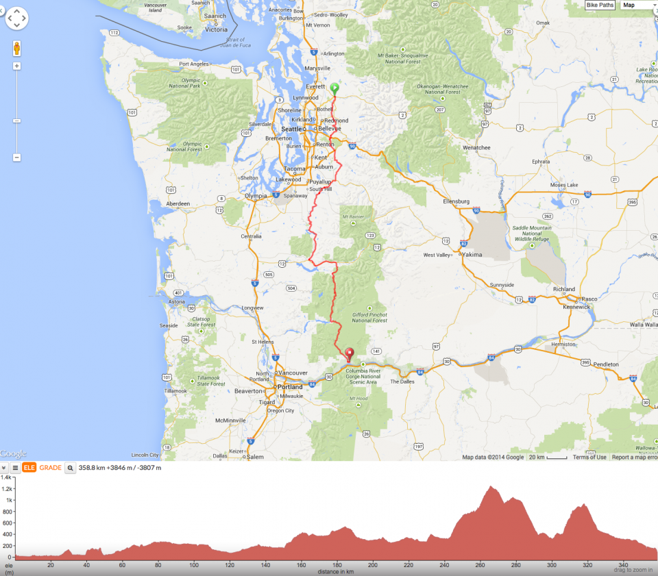
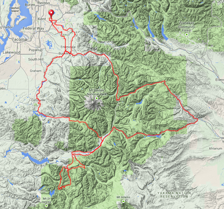
The SIR Summer 600k may not be the ride for you . . .

. . . if you are looking for an easy flat ride (this one is difficult and has hills)

. . . if you need to update Facebook often (at least 400km of no cell coverage)

. . . if you require pristine pavement (lightly traveled forest roads are also lightly maintained)

. . . if you aren’t prepared for long stretches without services (it’s130km from Randle up into the forest and back to Packwood)

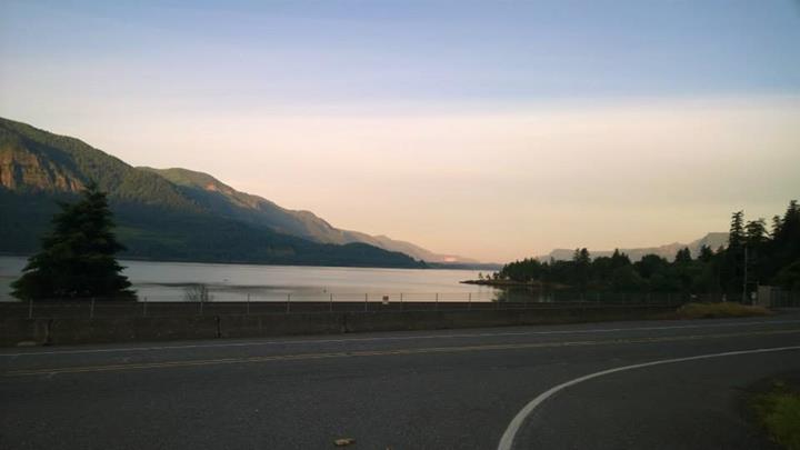
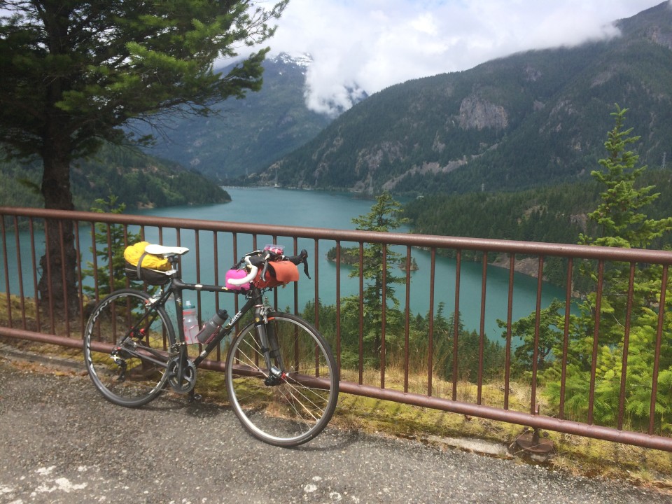
. . . if you don’t like seeing the mountains (we had jaw-dropping views of Mount Rainier, Mount St. Helens, and Mount Adams)

. . . if you don’t like the sights and sounds of rushing rivers and creeks (paralleling and crisscrossing the route)

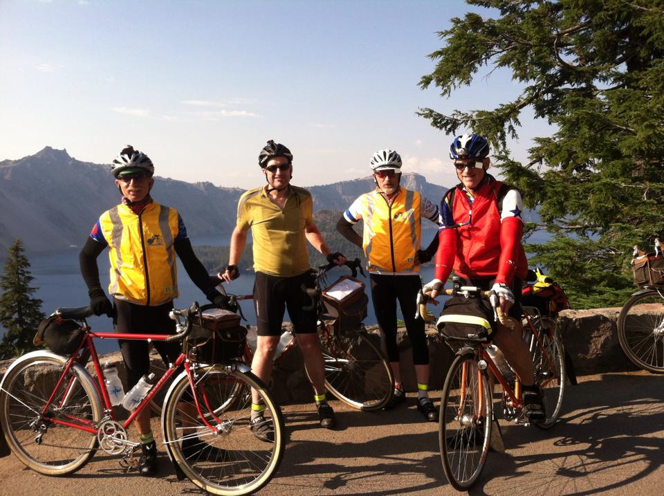
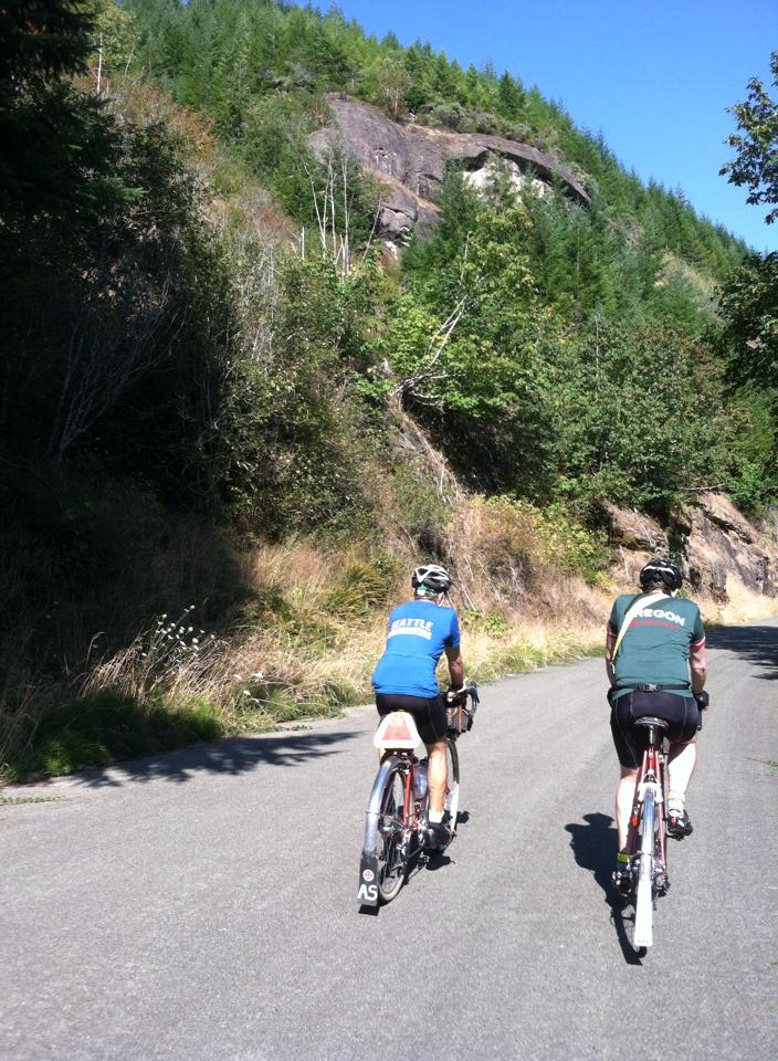
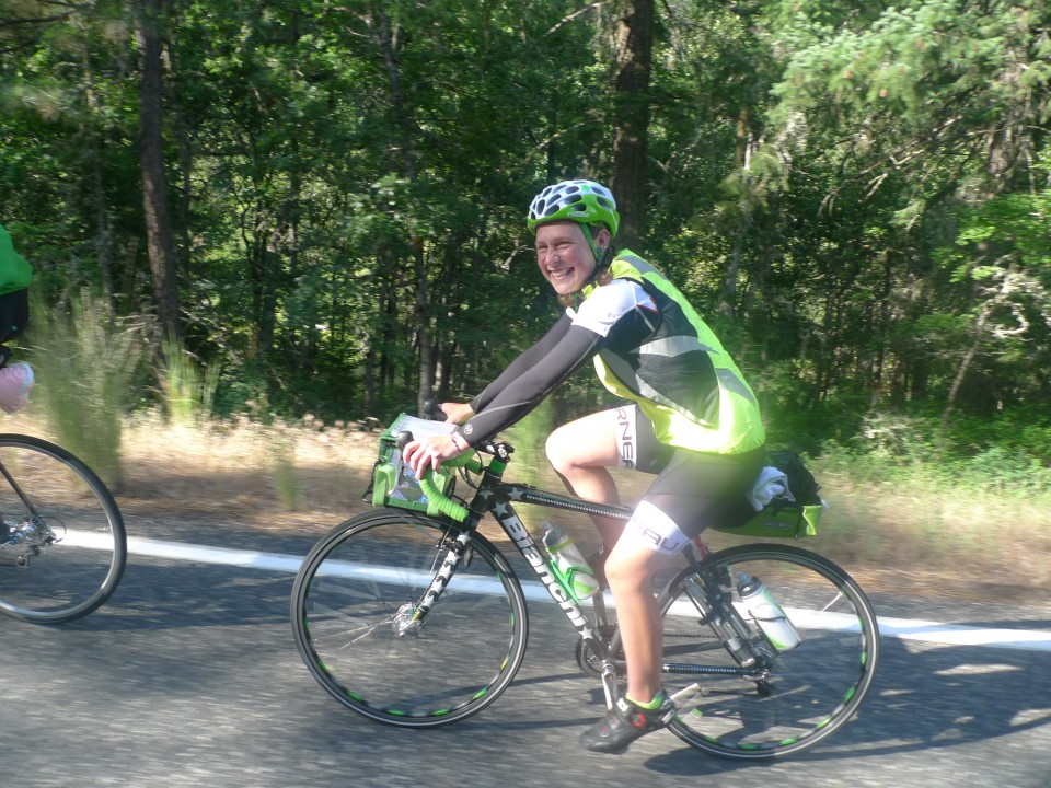
Rick Blacker, Vincent Muoneke, and I did a scouting ride of the 600k course this past Wednesday and Thursday. The ride is spectacular and challenging. I’ll try to give a bit of a preview of what to expect. Bear in mind that we rode on weekdays, not on a weekend, so there may be differences in traffic and services from what we encountered.

Map

Elevation Profile

The warmup first 20k takes you to Black Diamond, but you’ll be there before the bakery opens, so no apple turnover temptation. The Green River gorge stands between you and the first information control in Cumberland. Be careful with the one lane bridge across the river. There may be an SIR volunteer to sign cards in Cumberland; if not, answer the question on the card.

Familiar roads will take you to Enumclaw (which you’ll skip by going around on Mud Mountain Road), Buckley, South Prairie, and Eatonville. In South Prairie, divert to the bike path, but be alert for the turn to rejoin the road. It’s an unmarked turn onto gravel street heading toward a red barn and just as the trail starts to diverge from the highway. We encountered truck traffic (but quite respectful) on the first part of Orville Road after South Prairie, but otherwise the first 100km was pretty calm.

At 100km, we had a wonderful breakfast stop at the Eatonville control at the Cottage Bakery Cafe (on right as you enter town) – pastries and nice breakfast sandwiches are available. If you get there before 8AM, the good news is that you’re killing it. The bad news is that you’ll have to head down to the convenience store for your control (the Shell station/market is on the left after the turn onto Center Street).

The climb up to WA-7 on the Alder Cutoff Road can be a bit unpleasant with traffic, so be careful. Be even more careful about the railroad tracks that you’ll encounter just before and just after Elbe. The tracks cross the road at a very sharp angle. Please be mindful of the vehicles behind, if any, as you manuever to cross them at a better angle. Elbe (120km) and Ashford (132km) provide the last opportunity for services before Packwood (174km). Elbe has nice public restrooms on left before at the entrance to the town. (I recall that Ashford does too at the Rainier Base Camp area on left, but we didn’t check that).

Skate Creek Road takes you to the first of the four major summits of the route. It’s a wonderful road and much of the elevation gain came along the way to Ashford, so the descent is way bigger than the climb. Which is nice. With the creek alongside, the descent to Packwood provides a great treat. But please be cautious about the pavement. Potholes and road subsidences appear suddenly when you are travelling at descending speed. Someone (RAMROD volunteer, perhaps) has highlighted many of the flaws with spray paint, but be alert everywhere. The last part of the descent to Packwood after you exit the forest is a wonderful thrill ride on good pavement.

The Shell at the corner of US-12 has a sandwich shop and lots of food options. The town offers other choices, but we used the Shell. After the control, head west to Randle on US-12. Some of our traditional opportunities to avoid the highway are no longer available. Davis Creek Road has been two dead-end spurs since a bridge washout a few years ago. But US-12 has a good shoulder except for a couple of bridges and traffic was light. After about 17km look for Silverbrook Road on the right, which will deliver you to Randle via a nice back road.

Randle has a convenience store (just before US-12) and a market and a cafe (on the other side of US-12). Fuel up and stock up here; the next store you’ll see is nearly 130 challenging kilometers away. We expect to have SIR support at the high point at Bear Meadows, but it’s a long way up to there.

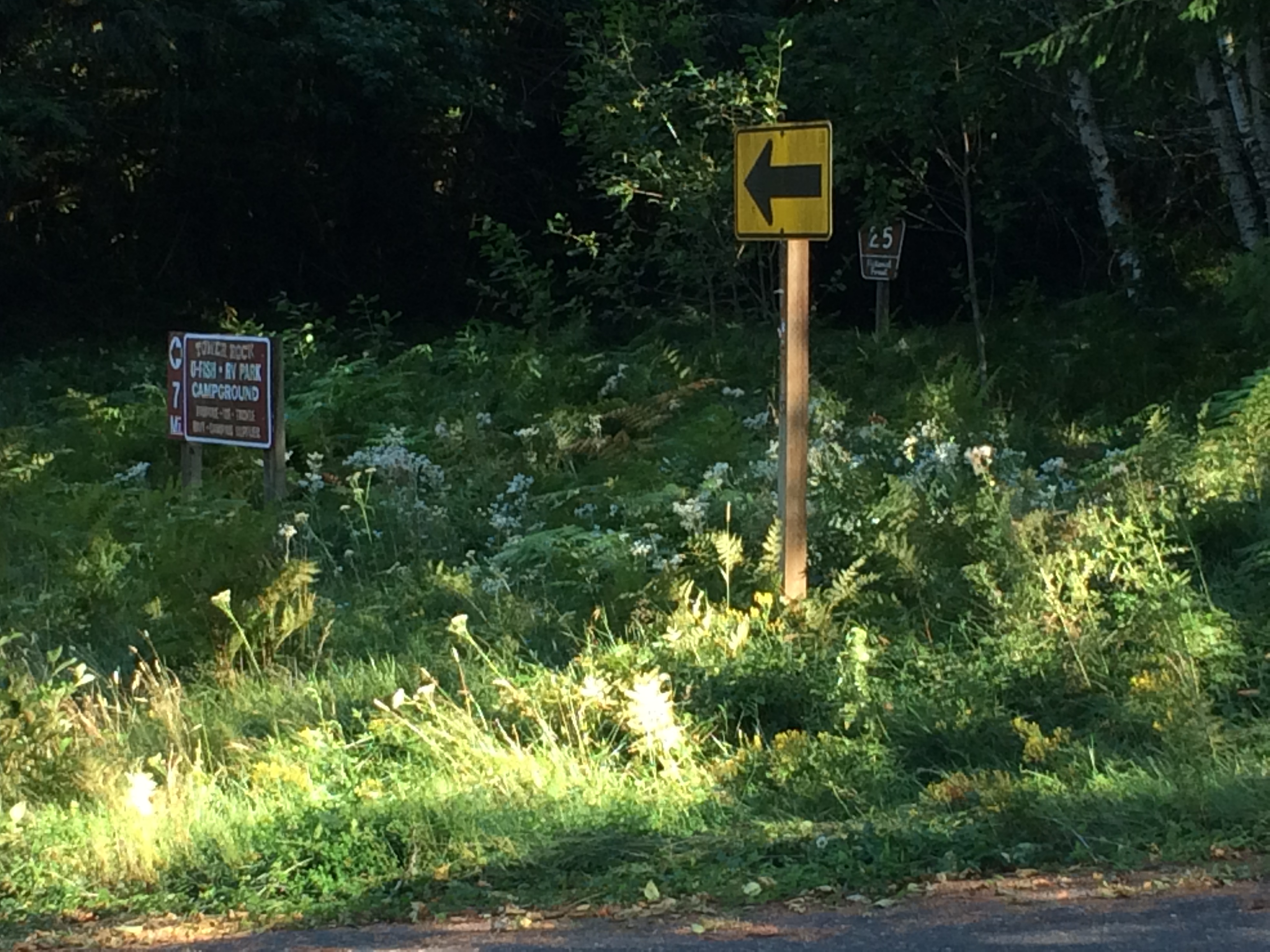
After Randle comes one of the key navigational challenges of the ride – finding Forest Road 26. Although you could get up the hill on Forest Road 25, you’d miss one of the nicest parts of the ride. When you head south from Randle, the route starts as WA-131, but changes to Forest Road 25 without fanfare as you enter the Gifford Pinchot National Forest. The turn to Forest Road 26 comes about 14km after Randle. I suggest being alert to the milepost markers on the right side of Road 25 and pay special attention after you pass MP7. Note also the signs on the bridges. After MP7 you’ll cross a bridge over the Cispus River. Just past that, the main road (25) bears left (a black on yellow arrow directs the Road 25 traffic to left; there is also a sign indicating that the Tower Rock RV Park and campground are 7 miles to the left – see photo). Forest Road 26 heads straight at this point. Don’t follow the arrow! If you look carefully in the weeds to the right, you can see a brown post with “26” on it. Also ahead there was a big sign that faces uphill, but on the downhill side that you can see, someone has painted an indication that you’ve found road 26.

NF26

I love this road. We saw fewer than ten vehicles on the entire stretch of road 26 and the scenery is wonderful. The climbing is gentle and fierce by turns. The road isn’t in great shape and includes patches of gravel. Not much of an issue when ascending, but be especially careful on any descents where you may be picking up speed. Near the top, after you start seeing the scarred blast zone trees from 34 years ago, you’ll get a pretty extended descent. I hit a stretch of gravel at a pretty good clip and exploded a tire beyond repair. Don’t do that. (I was glad I hadn’t dumped the spare tire to save weight on this ride).

At the top of Forest Road 25 is the T-intersection with Forest Road 99. To the right is Windy Ridge; the route heads left towards Bear Meadows (the highest point of the second big bump on the elevation profile of the ride). Views of Mount Saint Helens and Mount Adams took my breath away. Look in the parking lot on the right at Bear Meadows for Bill Gobie (and bathrooms). (Of course, it’s possible that unforeseen circumstances prevent him from making it up there, but that’s the plan. If no SIR presence is possible, there will be no way to notify riders, but check our backup spot at the Wakepish Sno-Park on left just before the left turn onto Forest Road 25.)

Mountain

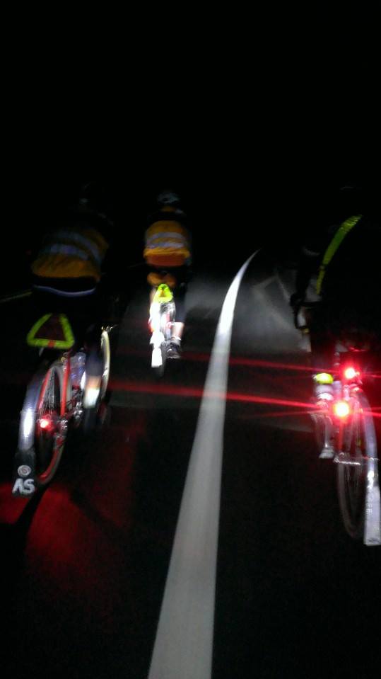
A long descent awaits on Forest Road 25. This starts at about the 260km point of the ride. If you’ve managed to reach this point before nightfall, that’s great. The road surface is far from ideal here. By night, or by day, please be really careful and keep your speed in check. Have good lights, good tires, good alertness, and good reflexes.

Watch for the next turn carefully. I’m pretty sure that it came after MP9. In addition to the indications for NF-76, you should also see signs indicating the Cispus Center. (There may also be signs for the Tower Rock U-Fish, RV Park, and Campground, but I can’t recall seeing those. By the way, there may be water when you get to Tower Rock, but we didn’t investigate). Forest Road 76 and Cispus Road provided some wonderful quiet night riding in the forest along the Cispus River. With the earlier 4am start for the brevet (we started at 6am), some of you may do this in daylight, which is probably pretty cool as well. You’ll encounter few T-intersections along the way. The first, before Cispus Learning Center, is a right turn, the others are lefts. One is the location of the information control. After the last one, you’ll be heading west back towards Randle. Look carefully after another 12km or so for the right turn onto Cline Road. (If you miss it, you’ll fairly quickly arrive at where the road ends in a T-intersection with WA-131/NF-25 where you were before the climb. Head back a short way and look again for Cline Road.)

Cline Road and Bennett Road will keep you off US-12 until about 12km before Packwood. No control this time, but a stop for supplies before the climb up White Pass is a good idea. White Pass is a thousand meters above Packwood, so settle in for a long climb. We had a glorious starry night for our climb, with the occasional meteor for inspiration. Three of four of the big bumps done. A nice, possibly cold, descent (about 450 meters worth) takes you to Rimrock Lake. Look for the Silver Beach resort on the right for an SIR staffed control with food and beds.

After the break, the route continues east (and down) towards the junction with WA-410. Unless you’re desperate to visit Yakima, follow the route west (uphill and into the wind) towards Chinook Pass. The next 75km will take you up about 1150 meters. That’s only about 1.5% on average. Sounds easy. Partway up you’ll see evidence of the Nile Valley landslide that closed the highway five years ago. Not that you’ll really need a reminder of the power of gravity.

33 kilometers up is the Whistlin’ Jack resort on the left. (The info control is a sign on the right side of the road opposite the resort). Whistlin’ Jack’s has a convenience store as well as a restaurant with great breakfast offerings. For us, the breakfast break was wonderful; totally worth the time spent fortifying ourselves for the next 43km up to the summit. (If you run short of water on the way up, the Lodgepole Campground on the right about 12km from the summit has a water pump – right side of campground opposite campsite 23. The water is cold and likely good for the iron-deficient.)

Chinook

Chinook Pass represents the highest elevation of the ride. Enjoy the triumph; we did. Ain’t over yet, though. Still another 100km to the finish. As always, be careful on the downhill. The steep section down to Cayuse Pass has some tight turns and tourist traffic. About 40km after Chinook, you’ll reach Greenwater. Given the likely headwind, the milkshakes at the deli on the left may provide the needed power for the last stretch home. We opted for beer and food at the Naches Tavern on the right. 21km after Greenwater, watch for the left turn to Mud Mountain Dam. Take the Mud Mountain Road all the way to 410 (west of Enumclaw) to find the last information control near the Boise Creek grocery store.

Just under 20km from the finish, the ride has a little sting left in its tail. “Enjoy” the climb up from the Green River valley on 218th Avenue. The finish is close!

Comments Off on Summer 600k – What a blast

Filed under Pre Rides

2015 Draft Calendar

Here are some possible dates for the 2015 calendar.

Training rides
Jan-Feb – WTS
03/07 100k

ACP brevets (PBP qualifiers)
03/14 200k
03/28 300k
04/04 makeup 300k
04/05 makeup 200k

Fleche
04/10-12 Fleche NW

NW Crank / Brevet Week (PBP qualifiers)
04/18-26 Brevet Week
04/18 NWC-BW ACP600k
04/21 NWC-BW ACP300k
04/22 NWC-BW ACP400k
04/26 NWC-BW ACP200k
04/23-26 NW Crank

ACP brevets (PBP qualifiers)
05/02 400k
05/30 600k (changed from 5/23 to avoid Memorial Day weekend)

Additional PBP qualifiers
06/13 Second chance 400k/600k
06/27 Last chance 400k/600k

PBP training rides
07/16 Night start 400k and 1000k (with other options, likely permanents, for 18th and 19th)
08/01 300k
08/02 200k

Fall rides
09/11 1000k
09/19 200k
09/26 100k

4 Comments

Filed under Club Info, SIR Rides

Crater Lake 1000k – Jeff Loomis

Crater Lake 1000k
by Jeff Loomis,
photos by Noel Howes & Shan Perera.

Andy,   Jeff,   Noel and Eric Peterson at Crater Lake (by Noel Howes)

Andy, Jeff, Noel and Eric Peterson at Crater Lake (by Noel Howes)

Thursday before the ride

I took the day off to sleep late, get my bike ready, pack and nap before the 10:30 PM start.  In the morning I got my bike all tuned up and was ready to declare it “perfect” when I decided to loosen my pedals to make sure they weren’t stuck.  I knew I would need to remove them with a small wrench for the trip home from the finish.  Pedals were fine but I noticed what looked like a crack in the left crank.  Closer inspection revealed it was cracking from both sides.  I didn’t feel safe riding  this for 3 days and nights.  Uh-oh, panic time!  I called my buddy Andy who is a great mechanic with a large parts stash.  We were planning to do the ride together along with Noel and Shan, some other riding buddies.

Me:  I can’t do the ride, I just found my crank is cracked
Andy (paraphrasing):  You idiot, just take the left crank off another bike
Me:  duh, OK, I’ll call you back

The left crank on a neglected bike looked like it would fit so I made the swap.  Everything looked fine initially until I noticed the cranks wouldn’t line up with each other.  It turns out my TA Carmina crank (the cracked one) has the square taper such that the sides of the square are parallel to the crank arm.  Every other square taper crank I have encountered, including the Sugino I was trying to substitute, has the taper at a 45 degree angle.  I call Andy again:

Me:  I can’t do the ride (explain the problem)
Andy:  Your commute bike has 46-30 chainrings right?  (the same as the rando bike I am trying to fix.)
Me:  Uh, yeah (mumble, mumble some misgivings…)
Andy:  throw both bikes on the car and get over here

With the help of Andy’s fully equipped shop we swap the cranks and bottom bracket from my commute bike to my Boxer randonneuring bike in record time, adjust the front derailleur for a slightly different chainline, and the ride is saved!  We also notice my right crank is starting to crack as well.  Whew, that was a bullet dodged.  I’m not impressed with the design of the cranks because it seems to focus the stress in a way that will cause these cracks.  The original chainrings are still in good shape but the cranks are toast.

After a panicked pack due to all the wasted time my wife gives me a ride to the ferry dock along with the drop bags for the guys (they are riding to the ferry.)  Waiting for the ferry we run into most of the other riders, including Hahn, a super strong rider who decided to do the ride at the last minute.  The rest of us have booked train tickets for Monday or Tuesday after the ride finish on Sunday afternoon/evening.  Hahn is so confident he booked a Sunday morning train ticket.  He isn’t using a drop bag, planning to ride the entire way with only the contents of his handlebar bag.  He even forgot his water bottles but fortunately finds some water that fits from the ferry cafeteria.

First leg

We roll out at 10:30 and after a fast start south out of Bremerton the pack quickly divides into the racers and the plodders.  We decide early on to let the fast group go.  It’s a long way to Klamath Falls.  I run over some debris on the shoulder of route 3 and notice a rubbing sound.  I ignore it for a while but Andy is sensitive to any noise from a bike.  “Are you going to stop and fix that rubbing?”  I decide to stop and Andy stops too.  We discover a thick, stiff wire wedged between my rear tire and fender.  Andy can barely turn the wheel with it in there.  Yikes another disaster averted.  We are now all alone at the back.  A strong effort lets us rejoin the slower group but we notice that Shan is gone, having hung on with the fast group.  We joke that he will pay for that effort later…

Noel, Jeff & Andy on the long Astoria bridge crossing (by Shan Perera)

Noel, Jeff & Andy on the long Astoria bridge crossing (by Shan Perera)

It starts to drizzle as we ride familiar roads through the night, passing Belfair, riding along the Hood Canal then past the prison to the first control in Matlock.  We find tireless ride volunteer Vinny sleeping in the van with the drop bags, but he has left us some water and coke.  It’s nice to ride these roads with minimal traffic in the quiet of the nighttime rain.  The weather is warm enough I don’t bother with a rain jacket and it is light enough I don’t get really wet.  We are all happy for our fendered bikes and think about the faster crew who mostly removed them to save weight.  Somewhere around here we find Shan who has been shelled by the fast group and is now beat.  Leaving the control we notice Eric, a rider from Chicago, has left the wrong way going back the way we came.  He doesn’t hear our yelling and we hope he figures it out before putting in too many bonus miles.

After Montesano we head south towards Raymond.  Empty log trucks are passing on the way to their morning pickups.  They mostly give us plenty of room but one driver lays on his air horn right behind us and passes uncomfortably closely with the horn blaring the entire way.  The road is completely empty so I guess he just hates bikes and doesn’t mind possibly killing someone.  Entering Raymond around 7 AM we debate stopping at McDonalds or the Kosy Kitchen Café for breakfast.  I vote McD’s for speed but Andy hates it.  He is outvoted and we make an uncomfortably slow McDonald’s stop.  The tiny early morning staff prioritizes the drive through customers.  Conclusion:  always listen to Andy.  Somehow we never learn.

Jeff, Shan and Andy in McD's (by Noel Howes)

Jeff, Shan and Andy in McD’s (by Noel Howes)

The route continues south to Astoria where we make a scary bridge crossing and look for lunch.  Andy knows a great “hippie café” downtown but decides it will be too slow.  We settle for a bad burrito.  Our first sleep stop destination is Pacific City.  The route is hilly but nothing too crazy.  Sometime in the afternoon Noel jumps ahead.  We regroup in Cannon Beach and make a quick ice cream stop.  Unfortunately Andy and I end up dropping Shan and Noel pretty quickly on one of the many climbs along the coast.

We decide to look for dinner in Tillamook so we can just go right to sleep in Pacific City.  We crave Teriyaki but don’t find anything so end up settling for the Chinese steam table in the Safeway.  We look for Noel and Shan but they end up passing us while we eat.  We arrive around 8:30 to see them headed to the Mexican place by the motel where the organizer has booked some shared rooms.  Vinny is sleepy and confused about the room assignments but we eventually agree to get up at midnight and sack out for 3 hours.  400km done.

Second leg

Day 2 begins (by Shan Perera)

Day 2 begins (by Shan Perera)

We roll around 12:45AM after some snacking with a plan to stop in Newport for a real breakfast.  There is a detour to an info control up Slab Creek Road where the coastal bike route skirts some dangerous bridges on 101.  Near the top of the steep climb Noel’s GPS says the info control is here but we don’t see the described sign anywhere.  The mile marker matches the cue sheet also.  We hunt around for a while but eventually give up, figuring we will get the answer from another rider.  The other side of the canyon is a screaming descent down dark, twisty roads.  Shortly afterward we hit Lincoln City and get some rando gas station food.  I make the unwise choice to eat a microwaved Jimmy Dean egg and sausage bagel that burns my mouth.

The sun is coming up and the views are beautiful as we make our way to Newport.  Night riding is a good antidote to crazy 101 RV traffic.  Unfortunately our route takes us though a trendy district where everything is closed.  We see a bakery and beg though the glass but it doesn’t open until 7 and we are ignored.  Andy asks a local if there is a breakfast place in town that is open and it is a mile back on the main road.  We decide to press on to Waldport where we find an espresso stand with muffins and scones.

Traffic is picking up and we notice an incredible number of huge wheeled pickup trucks, often pulling boats or travel trailers.  Most people are willing to give us room when there is no traffic but we often get squeezed when there is oncoming traffic.  The giant motorhomes are the scariest.  We saw one tour bus sized motorhome pulling a pickup truck with an ATV in the back.  The traffic and noise are balanced by beautiful views.  Rolling climbs are pretty constant.  On one we are passed by a couple on bikes carrying small packs.  Andy chats with them to find they are doing a credit card tour of the coast.  He feels the need to leapfrog them on the next several climbs and I hang on too so we are feeling pretty strong.  Noel is just a little way back but Shan is out of sight.

There are a couple of pretty scary tunnels on this stretch.  It is a designated bike route but the shoulders are often narrow or nonexistent.  After the final tunnel I stop at a view point and put on sunscreen.  When I put my glove back on I get stung by an ant that was inside!  Andy finds my reaction hilarious:  “you were screaming like a little girl.”

Florence is a wasteland of strip malls and traffic.  We decide to press on to Reedsport to eat lunch right before the major climb of the day.  Now we are in full-on pickup truck pulling sand buggy territory.  101 is getting tiresome and I am fighting sleep from time to time.  It is unusual for me to get sleepy during the day on these rides but maybe the night start is taking a toll.

In Reedsport we go to a great local restaurant for sandwiches and milkshakes.  The staff is super friendly and quick.  Shan texts that he is at the McD’s.  I reply that we are heading out:  get over here.  We don’t see him as we leave.

The next section thankfully takes us off the main road.  We follow the Umpqua river which goes all the way to our next sleep stop in Roseburg.  That would be a nice flat ride, but we are not going that way.  Instead we turn uphill on Loon Lake road.  This is an amazing, fun climb along a beautiful stream.  Before reaching Loon Lake, we head onto an even smaller road:  Camp Creek Road.  We know we have to climb around 2000 feet but the road is very gentle.  Ominous.

We are startled by a pickup truck that pulls up with a redneck straight out of central casting at the wheel.  He has a beer between his knees, is chewing tobacco, wearing a trucker cap and overalls with no shirt and has a stereotypical hillbilly accent.  He is curious where all the bikes are going.  We tell him about our ride and he enthusiastically wishes us a good ride.  He and his buddies are fishing and bear hunting.  They have to keep moving camp because “the rangers keep hassling us.”  Currently he is on a beer run.  We wish him the best and head onward.

After several miles of gentle climbing we reach the elevation gain.  The road just heads up with one steep switchback after another.  We see only one or two vehicles in a two hour period.  The road has shifted in a couple places such that only a higher clearance vehicle could pass.  This is a climb I would love if starting on fresh legs but today I am just looking to survive.  I have to stand in my 30×32 granny gear on several occasions.  Andy is waiting as I reach the top and Noel arrives a couple minutes later.  The descent is crazy steep on fresh chipseal and loose gravel.  Andy is gone on his 42mm 650B tires.  I am a bit more cautious and Noel brings up the rear, stopping a couple times to cool his rims.

Once we reach the bottom we paceline it into Roseburg as the sun sets, anxious for sleep.  Entering town we decide to stop at Sizzler just as they are closing.  Noel has a slow leak so he fixes it in the Sizzler lobby while we finish dinner.  I have not been to a Sizzler in decades, if ever, but it is rando heaven.  The salad bar includes pasta, meatballs, dozens of salad fixings and a dessert bar.  We load up, knowing we will sleep soon.

Making our way to the sleep stop at the Travelodge we follow a cue that says “meander through park.”  Huh.  Good thing Noel has the route in his GPS or we would be screwed.  Mark the organizer is waiting for us and has saved a room with 3 beds.  Mark also reveals that Hahn is sleeping, having underestimated the course a bit.  We leave the bed by the door for Shan who is the last one left out on the road.  Deciding we have plenty of time on the final day we allow ourselves 3 ½ hours of sleep, setting alarms for 2:30AM.  730km done.

Final Leg

Andy and Jeff (by Noel Howes)

Andy and Jeff (by Noel Howes)

Today is the shortest day but we have to climb around 7000′ to the peak of the Crater Lake rim road.  There are a few downhills on the way as well to make a total of about 10000′ of climbing for the day.

We awake to find Shan has arrived during the night but only slept for one hour.  He was at least an hour back at the top of the climb and then made a wrong turn coming into town.  His GPS battery was dead and he had a miserable time but finally found the Travelodge after two hours of riding in circles.
Breakfast at Denny’s fortifies us for the day and we are on the road by 3:30 or so.  There are few turns between here and Crater Lake and we take off enthusiastically.  Unfortunately the lack of rest is catching up with Shan and he drops off the back on every climb.  Eventually the three of us left decide we are going to ride and hope he catches up.  He does find us when we stop for a snack at the Dry Creek store control but then he immediately decides to nap so we press on.

The scenery today is awesome and the roads mostly have decent shoulder to give us room when the RVs speed past.  I fix my only flat of the ride this morning.  We climb steadily and are making good pace when we find Mark waiting for us with cokes and snacks in the late morning.  I tell Mark I could kiss him when I see the cokes.  He isn’t enthusiastic about this idea.

We stop at the Diamond Lake resort for lunch.  Andy says, “This is a resort, but for working people.”  Noel thinks it is straight out of the ’50s “like everything in Oregon.”  It’s a pretty cool spot that I would like to visit when I have more time to spend.  I have a rueben, fries, and a milkshake.  Hopefully that will power me to the top.  As we leave the resort we pass the biggest campground I have ever seen along the shore of Diamond Lake.

Once we enter Crater Lake park we lose the shoulder but not the RVs.  Fortunately it is getting later in the day so there aren’t too many vehicles entering.  The speed limit is theoretically 40 but some cars still seem to be in an awful hurry given that it is a park road.  Some of the climbs are getting steeper but I am still enjoying the day.  Noel passes us when I stop for a restroom break and I fall behind Andy on one of the climbs.  Eventually I reach the rim road and stop to enjoy the views of the lake.  There is still some significant climbing to the highest point, and then a fast descent to the lodge and the penultimate control.

At the lodge we regroup and meet up with Eric and his family who had arranged to meet him there.  We get a photo overlooking the lake.  There has been a reroute on the final section to get us off US-97 into Klamath Falls and there are two riders from Vancouver who can’t read the cue sheet in English.  The reroute isn’t on the GPS route so we tell them to follow us.  We all head out and enjoy the winding descent from the lodge followed by a long, fast, straight downhill for many miles.

We enjoy a tailwind on some rural roads and make fast time to US-97 for the final stretch into Klamath falls.  It has high traffic and narrow/no shoulders in spots so I am designated to lead the train to the turn onto the dirt road reroute.  I memorize the turn info and as we take off a cloud of bugs appears.  They are so dense they are pelting me like raindrops in a thunderstorm.  I try to speed up to get out of the cloud but that makes it worse and I keep dropping the others.  They are getting in my mouth, jersey, helmet, glasses, everywhere and I am very agitated.  This is actually the worst part of the entire ride for me.  Later Noel tells me he just slowed down to keep pace with the wind and barely noticed the bugs.  Finally I reach the turnoff and we head away from the marshy lake with the bug clouds.

Everyone is thinking we have an easy 12 miles to the finish now but there is one more surprise in store.  We know about the 6 miles of dirt but it turns into a steep climb and it is now dark.  One of the Canadian riders loses traction on his skinny racing tires and goes down.  He is OK but very tired.  He also has no rear light, his battery having run down.  We try to keep him in the middle and flag down a car, asking how far to the end of the dirt.  The driver tells us only 500 feet of dirt and then “just one steep climb” before coming down in an old fort.  Well, cyclists know that when a driver tells you that a climb is steep, you better believe it is STEEP.
It turns out we have what amounts to a mini mountain pass between us and Klamath Falls.  Fifteen or twenty minutes of hard climbing get us to the top, where we start an incredibly steep, twisty downhill.  It is now completely dark and I drop my chain for the only time on this ride.  Everyone else is gone as I struggle with my inexplicably hard to remount chain, covering my hand with grease.  Finally I get back on the road and everyone is waiting for me at the bottom of the hill.

Ten minutes of easy riding later and Mark is greeting us at the finish motel.  The best cold pizza and local beer awaits us.  Mark even has a gojo wipe for my greasy hand.  He’s the best.  1000km done in 71:26.  Shan rolls in just after midnight, having skipped the optional dirt road reroute.

Many of the riders booked Monday morning train tickets or got rides from family.  We opted to sleep late, rest, and eat several meals on Monday before heading out on the Tuesday morning train.  Tales were told over beers as randonesia kicked in and we were already planning the next ride.

Andy had everything organized for us to have our bikes ready to go in the Amtrak boxes the second the train station opened.  He was first in line to get the boxes and we got all the bikes packed up just in time.  Then it was a relaxing twelve hour trip back to Seattle.

CL100-04

Andy and Jeff packing bikes for the trip back to Seattle (by Shan Perera)

Ride details here:
http://www.seattlerandonneur.org/index.php?option=com_content&view=article&id=483:crater-lake-1000k-acp-&catid=51:2014-brevets


Comments Off on Crater Lake 1000k – Jeff Loomis

Filed under SIR Members, SIR Rides

SIR 1240k – Debra Banks

Debra Banks originally posted this ride report on the Rivet Cycle Works Blog. Debra founded Rivet to design and sell saddles for endurance cycling.

SIR 1240k
by Debra Banks

It’s summer and that means longer rides. I have signed up for three 1200k brevets (not exactly sure why I have, but hope to figure it out while riding them) and the first is the Seattle International Randonneur’s (SIR) Cascades 1240k or 770 miles of bliss cycling around Mt Rainier, with abundant views of sibling volcanoes, Mt Hood, Mt Adams and Mt St. Helens. It’s beautiful countryside – the ride description promises mountains, desert, and hills. Plenty of hills.

I was up in WA earlier this year for SIR’s Crank and Brevet Week, and had a delightful if not windy time, so I was familiar with some of the landscape and the way in which the SIR folk’s design rides. They are… well, hard. This year’s edition of the Cascades 1200k was longer and had more climbing than the last two versions. Day one is longish and hilly, day 2 is longer and a bit less hilly, day three is our recovery day crossing the desert and day four is longer, but mostly downhill after passes in the early AM. We have 94 hours to complete the ride.

The big question prior to the ride was: Fenders? No fenders? SIR rando’s almost always have their fenders on their bikes – at all times. It rains up there. A lot. Fenders and wool, two things you can count on with an SIR rando. The weather kept reporting only a 10% chance of rain during the ride. It seemed like the weather gods were smiling on us, so after consulting a crystal ball and a tarot card reading, most of the out-of-towner’s skipped fenders.

Riding buddy Drew and I drove up the night before and met another rando-pal for dinner at his place in Seattle. We moved on up the road to the start and settled in after the hotel had given away our reserved room. After a bit of wrangling, we got ourselves set up for the oh-dark-thirty-wake-up and start.

Day 1 Monroe to Carson
Distance: 358.8 km
Elevation: + 3846 / – 3807 m

Day 1 – Monroe to Carson Hot Springs

Day 1 – Monroe to Carson Hot Springs

Up early and out the door, the start is a block away. I realize I have forgotten my water bottles, (had to be something) but this is minor. Two are quickly offered by SIR fellow randos – Thanks Shan and Michael! I see SIR friends and a bunch of SFR randos are in attendance for our cycling adventure. A few friends from Australia have also made the trip: I ran into Peter Donovan in the elevator, who’s home I went to for a post Sydney-Melbourne BBQ, and then on my way to the bathroom, walked right in to Danny, a very fast rider from Western Australia, who I lent my wheel to last October so he could finish Sydney Melbourne after I had DNF’d. The rando world is very small AND holds a very great group of folks.

Mark (the head of SIR) tells us to be careful and as we ride out, he yells to me to keep the rubber side down. I’m only a week out from having crashed hard on a gravel ride, La Ruta Loca Rando in the Marin hills. I am smothered in vitamin E oil, to help keep the wounds moist and on the mend. Nothing hurts while pedaling (yet) so off I go.

The group moves on down the road and there is a lot of chatter amongst the riders. I have already missed a light, which splits groups into smaller units, and I think I won’t see those folks until the rest stop this evening – 230 miles away. The weather is cool, no wind and the company is good. It’s a nice day for a bike ride. We easily move on down the road.

Drewski rides by with Mt. St. Helens in the distance. Photo: D. Banks

Drewski rides by with Mt. St. Helens in the distance. Photo: D. Banks

At some point, Asta Chastain, a very fast rider from SIR who lives in OR is in my little group. We hopscotch with each other and decide to hang with each other in our small rando posse. I have been on the same ride as Asta a few times, but rarely ride with her. She is much too fast for me, but today she wants to ride with us slower (and older) people, and she’s a pleasure. We talk about outdoor education and MBTI scores. It’s fun to get to know each other while riding along and she’s cheery and has a fast yet steady wheel.

Asta on the Green Machine. Photo: E. Larson

Asta on the Green Machine. Photo: E. Larson

Somewhere down the road we stop at a control and there is GP. I thought I’d be riding with him, but we had gotten separated at that first light. He says he’s burned some matches riding with the “fast boys” and I tell him to hang with us, we’ve got Asta! We’re not the slowest and we have plenty in the tank for what’s still to come.

Which is a really beautiful climb up into a forest that then traverses the mountainside providing stunning views of Mt Adams. It is really pretty and as the miles tick by we are graced with a great forest service road and a really nice ride. It drops us at a control where we tank up for the last work of the day, eating ice cream, chips and Drew has his first beer of the day. We ride up and over Elk Pass, which isn’t pleasant, but we get the job done.

Up next is Oldman Pass and it seems to go a bit easier. The descent is fast, and now it’s dark. We make our way down and I am reminded of one of the final stretches this past Spring in Wenatchee, when I didn’t know how long it was to the end and I kept thinking to myself, “Is it now? Around the next bend? Now? Where the heck is the town?” at some point every day, you are just ready to be Off. Your. Bike.

Finally we reach Carson Hot Springs, and there to greet us is the smiling face of Susan Otcenas and her merry band of rando-volunteers. Asta has assured us that Susan has bought good beer and there will be a lot of it at the control. We check in, take showers and drop into the dining room to eat. There is beer, but not anything close to good stuff. I buy two Bud Lites (pathetic!), and pass one to Drewski, who says, it’s better than nothing…but just barely better than nothing. It does the trick, we sleep, for 6 hours! A first for me.

Day 2 Carson to Ephrata
Distance: 369.3 km
Elevation: + 3377 / – 3086 m

Day 2 – Carson Hot Springs to Ephrata

Day 2 – Carson Hot Springs to Ephrata

We depart after a hearty breakfast. We are among the last to leave, the fastest folks can sleep longer as they will pass us. The slower folks have had less sleep and they are gone. It’s Sunday and we are in need of some caffeine. The cafes are closed; it’s too early for them to be open. In the meantime, we ride along the Columbia River and I realize we are across from the town of Mt. Hood, Oregon. We have already ridden from the outskirts of Seattle to the Oregon border. Mt. Hood is in the distance and town is right across the river. It’s a great town – I was there mountain biking a number of years ago. Super fun riding – much of it over my skill level.
We are on a flattish road and I am ticking out a pace to make some time. We start to skip past some of the other folks who left earlier, but who are operating on less sleep.

Looking across to Oregon on the great Columbia Morning breaks – day 2. photo: P. Auriemma

Looking across to Oregon on the great Columbia Morning breaks – day 2. photo: P. Auriemma

It’s one of the funny dynamics about randonnuering. If you are fast, you complete the day faster, which gives you more time to sleep. The more sleep you have the safer on the road you are. If you are slower, you take longer on the road and end up getting less sleep, which means you will be sleep deprived on the ride, which adds challenge and raises safety issues. There are some people who like to ride on minimal sleep, but I’m not one of them. I want to get as much sleep as possible, and by that I mean 3 hours if I’m lucky (which as I write this, doesn’t sound like much… and… it isn’t). I’ve worked harder this past year and have gotten a bit faster, which has yielded more sleep, and so to get 6 hours on the first night is HEAVEN!

Still sleep does not help when what you want is coffee and we are on the hunt for some in the early morning on Sunday. Our day is longer today, but has less climbing, and our small group is feeling pretty good. We stop in a small town past our turn to get some coffee and run into a couple of others who have the same idea. Ron Himshoot, a strong rider is leaving as we are drinking on the sidewalk, and he takes a wrong turn. GP yells to him to turn around. Then Ron turns up a driveway and is again going in the wrong direction, and GP again rights him. Finally, after much, confused route finding, he disappears in the right direction.

We get up to leave and the group takes off without me. I see a backpack sitting against the wall. I pick it up and find out that it is Ron’s. His brevet card and wallet are present in the top pocket. No brevet card, no credit for completion. I shoulder the backpack and scurry to catch up to my riding partners. Almost to them, I am cresting a hill and Ron zooms back our way.

“I’ve got it!” I yell to him and he stops. “ I realized it wasn’t there when I went for a sip of water out of the Camelbak”. He shoulders his load and says, “I’m having a bit of a low point here.” It will change, that’s one thing you can count on when riding these distances. Sort of like the weather. He asks me what kind of beer I like and I tell him IPA. “Alright”, he says and starts to trudge back up the hill.

I get up to our group and we head on. The topography is amazing. We climb out of the Columbia River Gorge and up onto a high plateau. The land is golden with wheatfields, and views of Mt Hood and Mt St. Helens are visible. The coffee has kicked in and we are enjoying the miles.

As the day wears on, the land heats up and we arrive at the control hot and hungry. Everyone is regrouping inside the air-conditioned fast food store, downing soda’s filled with ice. We tank up, as the next section is hard and exposed and it will be hot.
This section is rollers with an upward trend. They keep going and going and going. At one point, we top out on a longish climb to see the road traverse around the hillside losing all of the elevation we have just earned, and then it climbs back up re-gaining all of the elevation. Ugh! Who thought up this engineering feat?

We continue onward and upward. Today feels harder than the day before. Maybe it’s because we are already somewhat fatigued, or maybe it’s the heat, but getting to the Bickleton control is really tough. Once we are there it is an oasis. Ice cream, fresh strawberries, soda, cookies. The SIR volunteers are there with big smiles and helping hands. The locals are inside the store watching us in the midst of our weird processes – collapse on bench, rally for the bathroom, sit again and rest, re-fill water bottles, eat, rest. Rally to leave…

A number of rando’s throw in their cards in Bickleton, and abandon the ride. They are too spent to continue on. Our group carries forward. We drop down into a valley that we will cross and stop for another break. It is really hot – well into the 90s. Manny comes into the C-Store and looks absolutely trashed. “Would you all be willing to go 12 MPH and give me a pull”, he asks? “I need a break, but need to keep going”. We saddle up and put Manny in the middle. It’s hard to go slower, but he needs the rest (he’s only had an hour or two of sleep) and he’s asked for help. Of course, we’ll aid if we can. We scoop up another rider from British Columbia and Jaime stays with us the rest of the day into night.

We usher Manny to the next climb and then leave him to his own cadence and continue on. We make our way again down to the Columbia River. It’s wonderful to cross the water. The air is cool, a fly hatch and swarms of small flies are circling themselves like a mini-tornado, and the sun is setting. We head up a hill where a friend of mine severely bonked during the last edition of the ride and I think of Irene. There are large, very weird Mormon crickets on the road. They look pre-historic and give me the creeps as they hop around.

On the other side we continue on across the valley towards the next ridge. We’ll head there and then turn left, continuing onto the control. I flat and fix it, our group of riders strings out and regroups. It is well into night by the time we reach the control, and again we are welcomed by the SIR volunteers. Thank you Bill’s Gobie and Dussler and crew. Cup of Noodles, ravioli, soda, coffee, water, cookies, fruit. I want everything and nothing.

We still have 50 miles to go until the sleep control in Ephrata. It feels like forever to get there. We paceline as a group and now small things are irritating. Someone’s rear light seems to shine directly into my eyes, another person can’t hold a straight line and is wobbling all over the road. I’m sure I am doing something aggravating too. We ride in silence managing the irritations, but thank everyone for each pull they do as it brings us closer to Ephrata. We are all tired.

We have been passed by a strong rider from SoCal. His red blinky is way off in the distance, and I keep an eye on it. We are in the midst of endless rollers and that blinky keeps dipping in and out of sight. Most of us stop for a nature break or to adjust something, but GP heads off to catch up with me. I am behind him on the side of the road peeing, but he thinks I am somewhere between our group and the blinky. He kills himself catching up to the SoCal blinky, and he does, only to find out that I am back with the group. Oops!
We come by and scoop GP back up into our posse and finally reach Ephrata. There are still people trickling in as we eat and crash. Manny arrives just as we are turning in for a 4 hour sleep. Tomorrow is our “rest” day.

Day 3, Ephrata to Mazama
Distance: 231.1 km
Elevation: + 2597 / – 2334 m

Day 3 – Ephrata to Mazama

Day 3 – Ephrata to Mazama

Up and out by 7:00 AM, today is the “rest” day. Only 150 miles! Woot! We have thought that if we survive days 1 & 2, that there’s a good chance we’ll make it to the finish. We saddle up and head out into the sun. The morning brings us onto roads I traveled in April during the SIR Brevet week. We stop in Farmer at a fabulous community hall and sit inside in the cool shade, joking with fellow riders.
Drew, GP and I are strung out a bit, but stay together throughout much of the day. We have climbed up to the Moses Coulee; a high plateau of wheatfields. As far as the eye can see are golden waves of grain… We drop down to the Columbia River after taking a quick look at Chief Joseph Dam, and head to Bridgeport for lunch. We relax in the shade in a park and hang out. It has gotten really warm as we climb out of the river valley. Heat and lack of sleep is starting to take a toll.

Miles of wheatfields. photo: D. Banks

Miles of wheatfields. photo: D. Banks

We continue on to Malott and stop in the shade where the SIR vollies have set up shop. The help and support of this group is outstanding. They are smiling and cheerful (which boosts me enormously) and while chatting with us, I can tell they are checking us out to see what kind of condition we are really in.

The last piece of the day is to climb up and over Loup Loup pass. A long sustained climb that will drop us into the Mazama and Methow river valley. GP and I take our time but Drewski gets after it. We will see him at the sleep control in Mazama. I’m not a fast climber, slow and steady, but I love a great downhill. The SoCal blinky guy is up the road and we stop to talk with him. While doing so a cub and mother bear cross the road about 200 yards down and away from us. Very cool.

GP heads up the road, while I continue my steady slog. SoCal blinky guy sticks with me and we chat our way to the top. I sit down on the ground for a rest, but GP is urging me to move along. I snap at him, “I pulled you all the way to Malott, so I will sit here and have a break”. I eat half a sandwich and pull on clothes. In the meantime Ron Himshoot has joined us at the top of the pass.

We start down and just as we are picking up speed, a female moose pops out of the forest and stands by the left-hand side of the road. GP slows way down, me too. They are some of my favorite creatures, and they spook easily. Not something you want to hit, or have come at you. While we are sizing the moose up and the moose us, Ron comes barreling by yelling, “Don’t scare the moooooose!”

She disappears.

It’s a fun descent and at the bottom we are in a lush valley at the foot of the Cascades. GP and I hope to make it to the supermarket before it closes, but we miss it by a few minutes. We take the scenic road around the valley and as the sun sets, we cruise by farms and homes, corrals and gardens. Bucolic.

In Winthrop, I need a break. I’m starved and am running on fumes. We still have about 25 miles to go, so a break is in order. Unbeknownst to us, the wind picks up and of course, it is a pretty good headwind for the last stretch of riding. Trading pulls we make our way, stopping on a bridge at some point to get some relief from the wind. There aren’t any blinky’s in the distance to help us tonight and we slog to the control. Felt like it took forever to reach the Mazama Resort, and it’s too bad we didn’t get there early enough to enjoy the “rest” day, because the resort is exactly that, a full on resort. Hot tubs, pools, bar… Sigh. We eat and drop into bed.

Day 4. Mazama to Monroe.
Distance: 280.5 km
Elevation: + 2507 / – 3109 m

Day 4 – Mazama to Monroe

Day 4 – Mazama to Monroe

Breakfast is a feast. Everyone is in great spirits, we are finishing today. We chow down and head out… into a light rain. Dammit! No fenders.

No matter, we are climbing up to Washington Pass in North Cascades NP and it is beautiful. Big trees, left over snow, waterfalls, mist and a ribbon of road that disappears between cliffs. Sure our legs are sore and progress isn’t fast, but it’s so pretty that the pain is dampened. Up, up up, and through to the other side’s downhill. Another bump up and over a second pass.

Heading up to Washington Pass – AM on Day 4. photo: D. Banks

Heading up to Washington Pass – AM on Day 4. photo: D. Banks

We stop there to put on more clothes and an elder couple is walking along the road. They say hello and stop to chat with us.
“Ten years ago, we walked the entire Appalachian Trail. It took us 6 weeks.”
“That’s fabulous”, I say. “Do you mind telling me how old you are?” (they look 70ish)
“Sure, I’m 84 now”, says the woman.
Her husband adds, “She’s my older woman.”
She blushes, I’m three days older.”
“She’s my Cougar!” he blurts out with pride.
We all laugh.

How great is that?

Back on our bikes, we head on down the pass and lo and behold, there again are the SIR volunteers. They have stopped on the side of the road and set up a makeshift coffee stand. Bill D. hands me a French pressed coffee with half and half. Fabulous. We hang and chat, and I retell the story of the lovely couple we just met.

We need to continue on down the road because Monroe isn’t getting any closer, so we meander down the valley. There is water everywhere. Big waterfalls cascading off of cliff shelves (I’m guessing this is how the park came to be named?), dropping tons of water into the river, which is at near peak water levels. I watch the torrent below, trying to pick the correct line as if I were boating it in a kayak.

The water flows into the large dammed Lake Diablo surrounded by peaks. The water is aqua colored – glacial silt making it that special cold color. Three valleys extend in different directions here and we head downward out and towards Newhalem and flatter topography. Really, really, beautiful.

The new Dragonfly with a new Indy pose by Diablo Lake. photo: D. Banks

The new Dragonfly with a new Indy pose by Diablo Lake. photo: D. Banks

Drew has gone ahead, so it’s GP and me riding along, heading to Monroe. We stop for lunch at this whacky old style hamburger place in Concrete. Really? The town is called Concrete? Says so on the water tower…. Really?

The route goes across the Skagit River and winds down a tree tunnel. We stop for a 10 minute powernap on the concrete slab of the fire station. Good thing too, because 5 minutes after we have started to ride again, we are chased by a mean-sounding dog. I pick it up, and GP is left to fend for himself.

At the final control, we eat and have a beer. There are rando’s there who are relaxing before the final push back to Monroe. Manny and Glenn are there, Drewski and Phil have recently departed. We have about 50 miles left, and we have a beer and a cup of coffee and are on our way. The last 30 miles is on a bike path and we mosey along. I am fading and my stomach is upset, so we stop for a ginger ale and crackers.

Finally, we reach Monroe. We have finished in 90 hours, right around midnight. Asta, Drew, Phil and Ron Himshoot are there eating pizza, waiting for riders to come in. Ron hands me a paperbag, In it is a note and a large IPA! Woot!

In the bag along with a Ninkasi IPA. Woot!

In the bag along with a Ninkasi IPA. Woot!

I would highly recommend it if anyone wanted to do this ride as a tour. Three or four days would be a lovely pace and you’d get a chance to really enjoy the scenery. And for the rando’s out there – put this ride at the top of your list. It is a beautiful ride hosted by a great club. The SIR folks were top notch.

Many thanks to those I rode with: Drew, GP, Glenn, Phil and Manny, who completed his first 1200k. To the SIR organizers and volunteers – you are total ROCK STARS! You all seemed to be everywhere with helping hands, warm smiles and good cheer – at all times. To Shan and Michael for loaning me water bottles in a pinch. To Phil A. And Eric L. for letting me crib some photos. And, as always, thanks for reading.

2 Comments

Filed under Cascade 1200, SIR Rides

Crystal Blue Persuasion 300k Pre-Ride

Crystal Blue Persuasion 300k Pre-Ride
By Joe Llona

Orting Foothills Trail

Shan Perera, Bill Dussler, Rick Groth, Joe Llona and Jason Hansen on the Orting Foothills Trail. By Shan Perera.

The ride starts off through downtown Renton and on to the Cedar River Trail.  At Maple Valley the trail turns to hard-packed gravel and turns onto the Cedar River to Green River Trail.   The 4 mile section is really hard packed and riding it with 25’s was a non-issue, except for at three underpasses that get pretty dark.  No issues there either really except that I was guessing and the gravel was a little looser there.  Just go slower and maybe take the dark glasses off and you’ll be fine.

You get onto the highway for a few miles near Black Diamond and then turn left and go down to the Green River Gorge then climb back up to Cumberland, where the first control will be.  This will be staffed and water will be available.  Restrooms are available about a mile further down from the control at Nolte State Park.

Continuing onto Enumclaw and then onto Highway 410, which can be pretty busy at times.  This will be compounded by the chip sealing operation in that has been in progress for several weeks.  This is the case most of the way from Enumclaw to Crystal Mountain Blvd, with a few (very relieving) breaks. No loose tar to gunk up the frame, but lots of loose gravel scattered on the shoulders.  Tire size is not an issue, but tire durability is.  On the pre-ride there were three flats from the loose rocks on the shoulder.  What I would recommend is if you can, bring a bike without fenders.  Saturday I rode a bike with fenders with a tight clearance and had several times where a rock jammed between the fender and the tire, usually clearing itself in a few rotations but once I had to stop and remove the wheel to clear it.  There are no fog lines and the rumble strips are difficult to see but definitely still there.  There has been progress from week to week, with the road sealed in some places already (was not the case the week before) but still no striping.

After about 30 miles on 410 you turn onto Crystal Mountain Boulevard (CMB).  Before you make that turn though, take inventory of your water bottles.  There is water available 1 mile before the turn onto CMB at Silver Springs Campground on your right.  The climb is on a nice road, consistent 6% grade for first 4 miles then levels for a bit then climbs again.  If it’s warm it will be a two-water-bottle-climb.

At the top you will find another SIR staffed control.  There will be sandwiches, snacks and drinks.  Water and restrooms are available and there is a store and a food truck as well.

The descent is fast and easy, then back onto loose chip seal and headwinds on 410.  At Mud Mountain Road you are off the chip seal project for good.  The descent of Mud Mountain road to Enumclaw is exhilarating, but be wary of on-coming cars coming around the bends.

Back onto 410 (no chip seal project on this stretch) then through Buckley, Burnett, Wilkeson, and Carbonado.  The weather forecast is for it to be pretty warm, so I’d recommend stopping in Burnett or Wilkeson for water before the gentle rolling climb up to the Carbon River Ranger Station.  At the end of the road you will find the Old Ranger Station and an SIR control staffed by an old ranger.  There will be water and drinks available there.

From Carbon River you backtrack down to Wilkeson, and then continue descending to South Prairie, where you get on the beautiful Foothills Trail and parallel the Carbon River into Orting.  As you approach Orting, make sure you look behind you for some awesome views of Mt. Rainier.  The Orting control is not staffed, but there is a Safeway and a Subway at the shopping center along the course.

Continuing on the Foothill Trail towards Puyallup and Sumner the rest of the ride is pancake flat except for an overpass or two.  There are multiple unsigned crossings before your right turn onto Shaw Rd. E, which is clearly signed.  In Sumner the White River Trail should be easy to find from the cue sheet, but shortly after you get on it, there are two places that can become confusing, at least in the dark – just remember to take the left fork of the trail two times and keep the warehouse to your right and you’ll stay on course.

As you approach Pacific, you’re off the White River Trail and then eventually onto Interurban Trail, with clear sailing to Renton, but look out for track crossings, the last one’s pretty bad. In Renton you work your way back to the finish at Fred Meyer, where you began.

Steve put an awesome course together here and except for the chip-sealing on 410 I think you will find the ride very worthwhile.  See you on Saturday.

Clue Sheet: http://goo.gl/x33nKU
Map: http://ridewithgps.com/routes/5453446

Comments Off on Crystal Blue Persuasion 300k Pre-Ride

Filed under Pre Rides, SIR Rides