Text and photos by Shan Perera
On June 7th, SIR returns to the Waterville plateau for our Summer Gravel Populaire. If you rode any events here last year, this is an all-new route once again crafted by local rando Don “shiggy” Person. I previewed the course with shiggy last week. After heading west from town, we made our way up to the northernmost corner at Fletcher Cemetery. Then turned south skirting Lamoine and Supplee, passing through Alstown and Douglas before returning to Waterville.
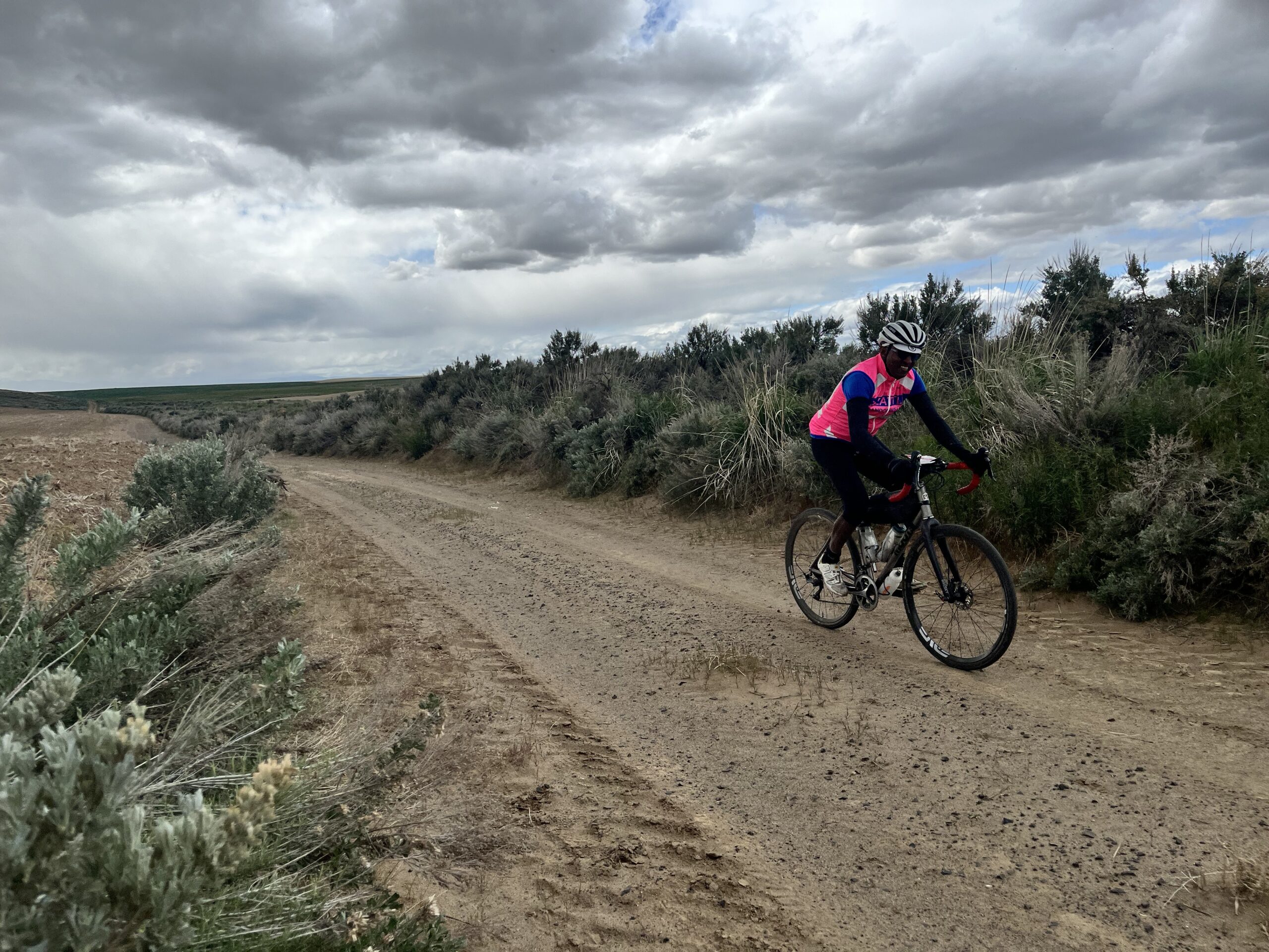
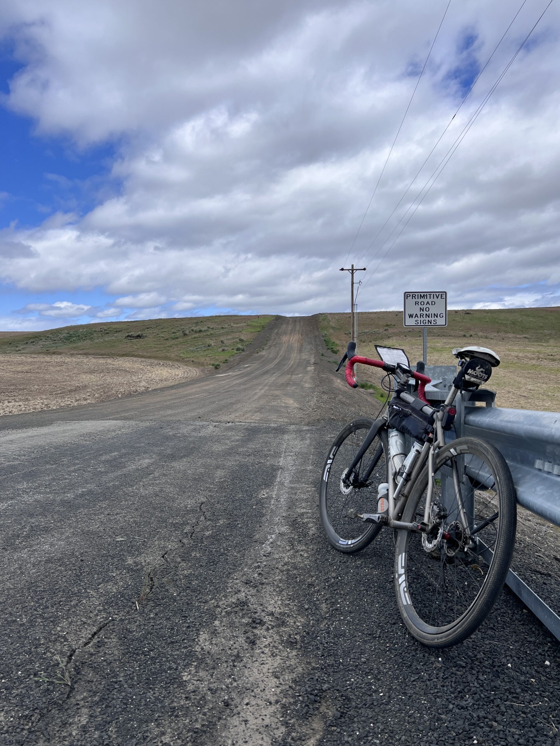
Of the 100K distance, just 9K is paved with the rest (91K) a diverse mix of gravel across a patchwork of interconnected, rolling farm roads. Elevation gain on RWGPS (https://ridewithgps.com/routes/49950178) shows 3590’/1094m, but we recorded 4514’/1376m. Expect surface conditions to vary from hard packed dirt to soft sand to chunky loose rocks – creating an intermediately challenging ride where bike handling skills will be tested. But nothing too extreme. I rode 42mm tires. Shiggy was on 55mm. Recommend minimum 38mm. Slicks are ok if you’re experienced. Many of the roads will NOT have markings, but we’ve verified accuracy of the turns (and also updated the cue-sheet with “Unsigned” designation). We do suggest bringing a printed copy to aid with your navigation.

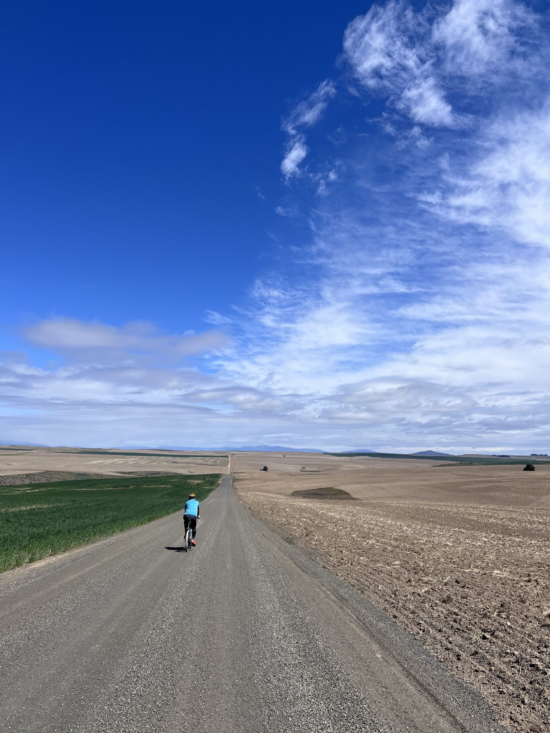
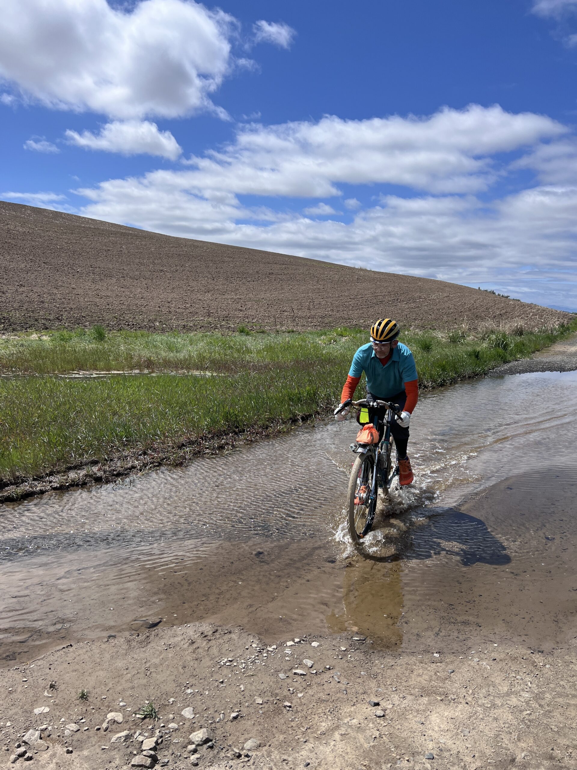
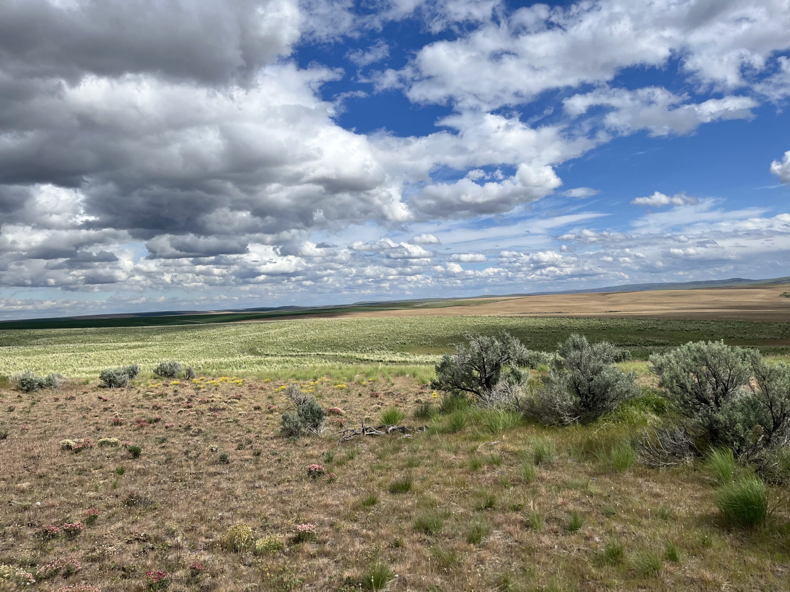
You’ll spend the day soaking up open skies, admiring acres of thriving wheat, punctuated by the occasional “alley” of deeply aromatic Sagebrush. These fields extend as far as the eye can see and were carved by glacial activity, floods and wind over millennia. The fertile soil, winter snow, spring rain, and dry summers create ideal growing conditions in these rugged lands. Expect to see no one and little auto traffic during your ride. We were passed by just 3 vehicles (a road grader, a gravel hauler, and a pickup) – all very bike friendly. Please remember, farm equipment ALWAYS have the right of way. It also gets hot in June, and there’s no real shade on the route. So come well prepared – carry extra tubes, check/top off sealant (if riding tubeless), bring ample food and no less than 2 water bottles. We’ll have a staffed SIR control at 53.9km (33.5mi) where you can refill them, but there’s no services or resupply points elsewhere. Cell service is spotty.
A few noteworthy items:
- TURN at 13.7k (8.5mi): Right uphill onto 4 Rd NW [unsigned]. This turn comes immediately after
passing some concrete barriers. Do not continue straight downhill! - TURN at 16.7k (10.3mi): Hidden Right onto Rd P NW [unsigned]. On road right before turn, there
are buildings with farm equipment. - BAIL-OUT OPTION at 22.2km (13.8mi). At intersection of Rd N NW and 4 Rd NW, continue straight
on Rd N NW. Turn right on Rd 3 NW and then left to Rd O NW/N Chelan Ave to Waterville.
Additional details:
- Registration: https://seattlerando.org/content.aspx?page_id=4091&club_id=928629&item_id=2554577
- Ride Start: Tennis courts on W Walnut St between E Park St and S Chelan Ave, Waterville, WA
98858. - Check-in 8:00am, Briefing 8:55am, Roll out 9:00am.
- Parking: Near the tennis courts by Pioneer Park or at the high school on S Chelan Ave.
- RV camping & coin operated showers (takes quarters) at Fairgrounds RV park – 1/4 mile away.
- Grocery store: Waterville Family Foods at (102 E Locust St; opens at 7:30am).
- Finish and Post-ride: Knemeyers Eatery & Spirits (115 W Locust St; directly across from Pioneer Park) – pizza, burgers, beer.
- Waterville Plateau history: https://www.historylink.org/file/9357