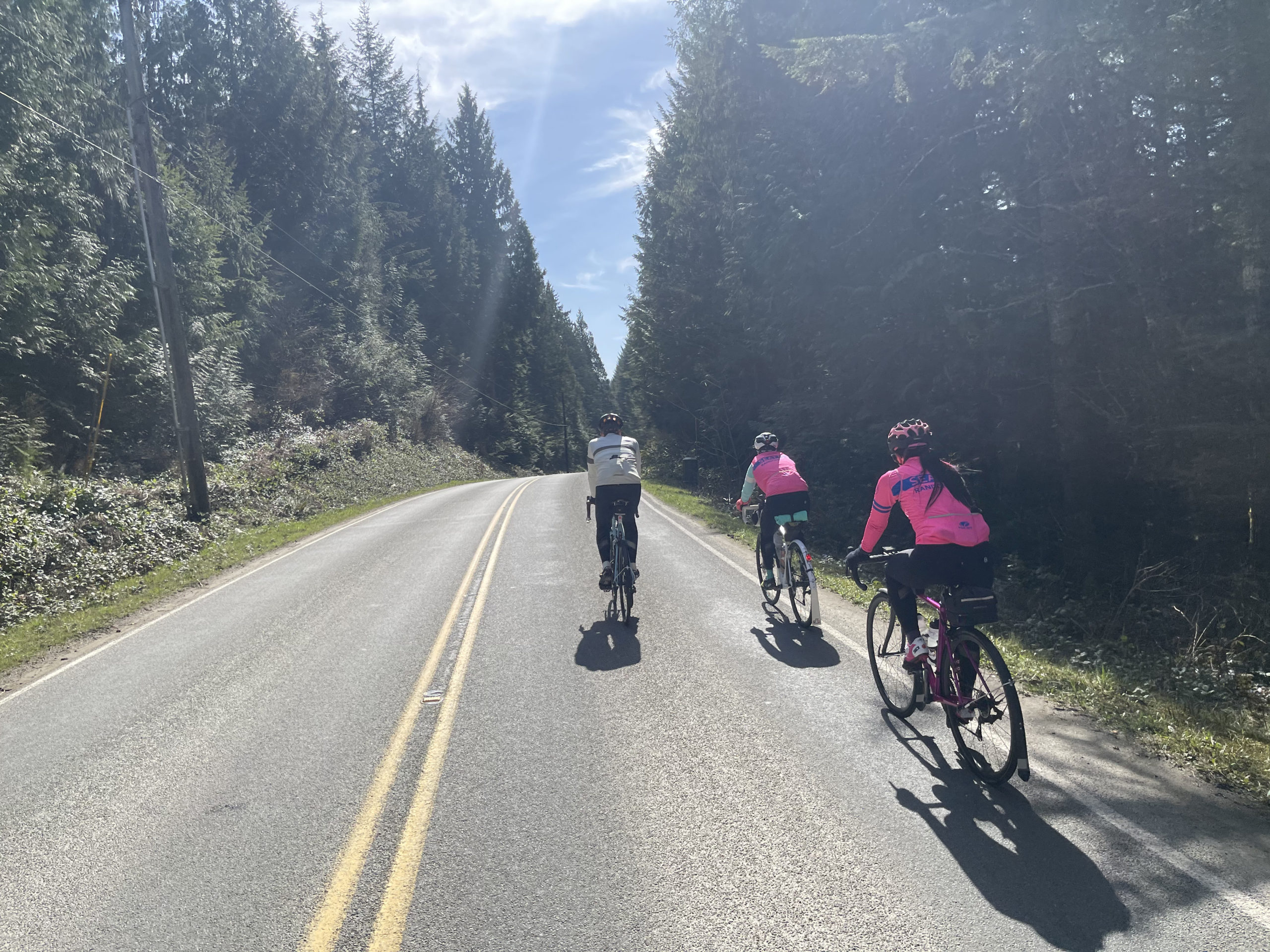
The Seattle International Randonneurs headed to the eastern Washington city of Wenatchee to host brevet week of 2023. My name is Kiel Safstrom, or some in the club like to call me, Hand Grenade. Surprisingly, there was no self-implosion completing all four of these bombastically designed routes by Don “Shiggy” Person. Let’s pull the pin and recount the routes for those aspiring to ride amongst the tumbleweeds.
Saturday May 20th – Lake Wenatchee 200K
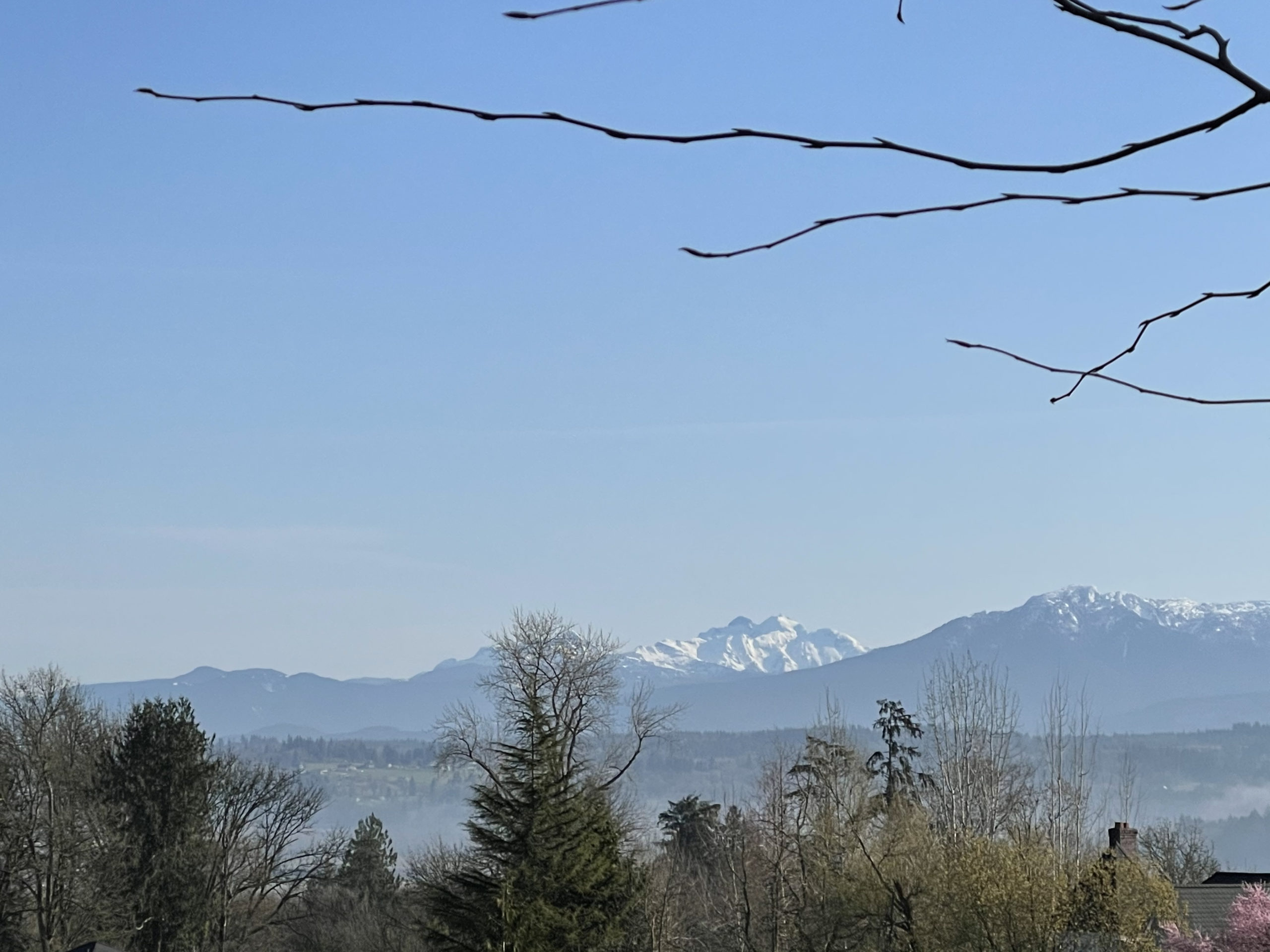
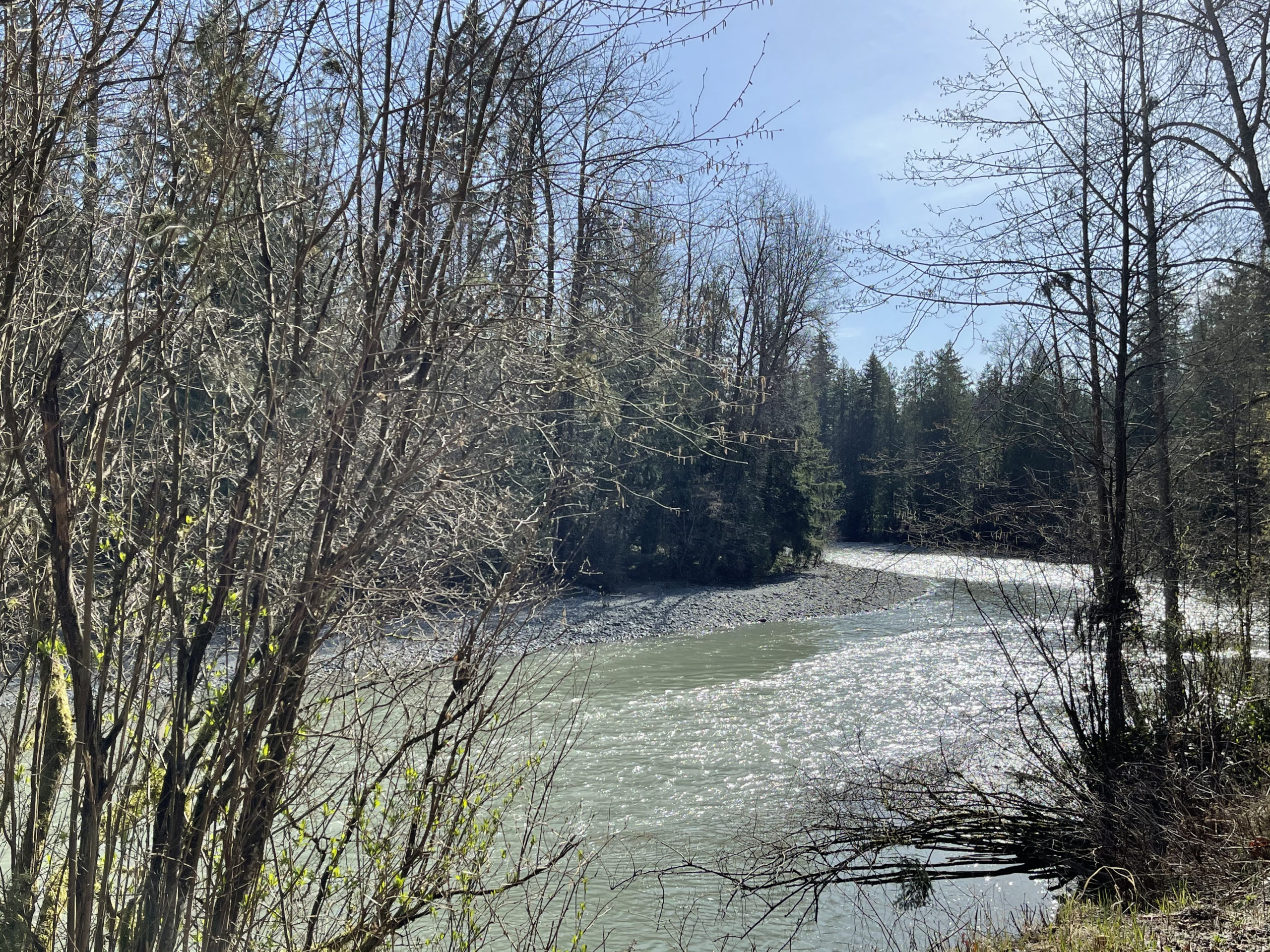
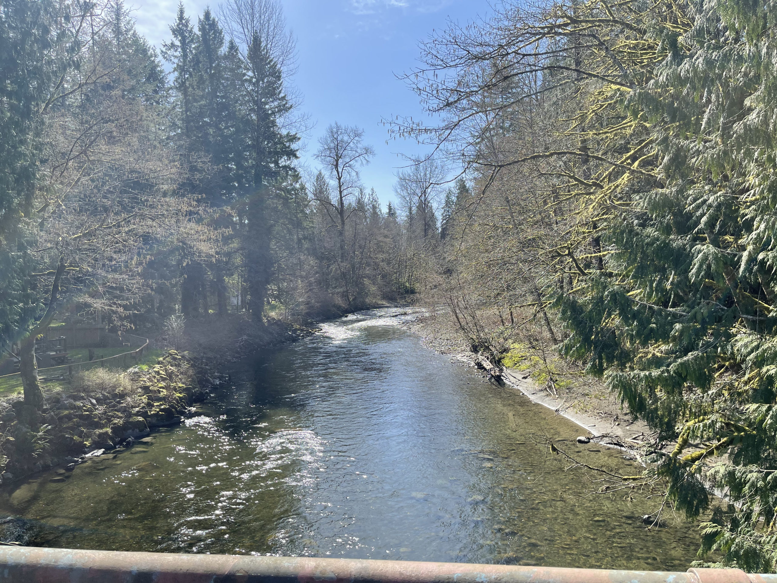
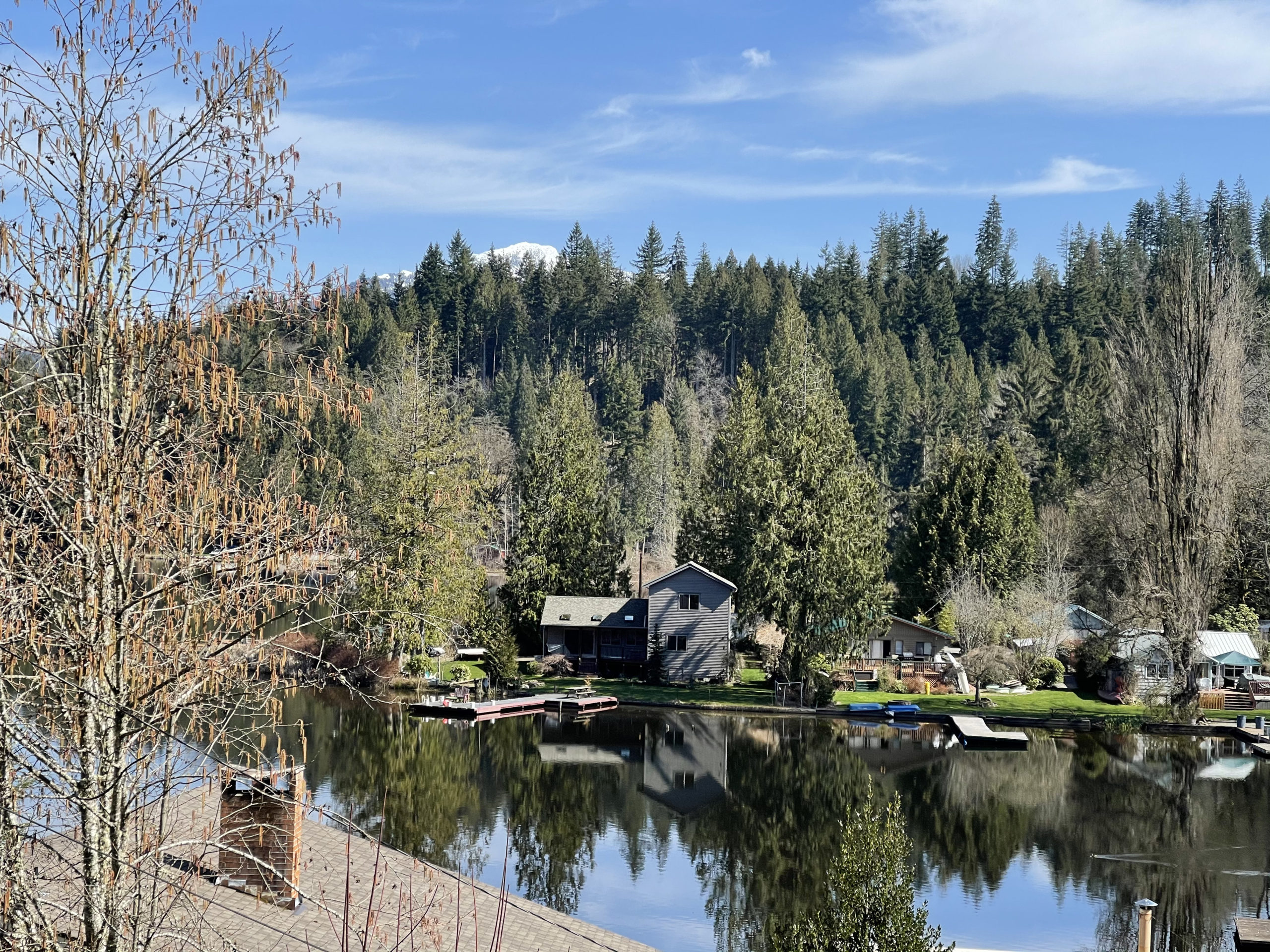
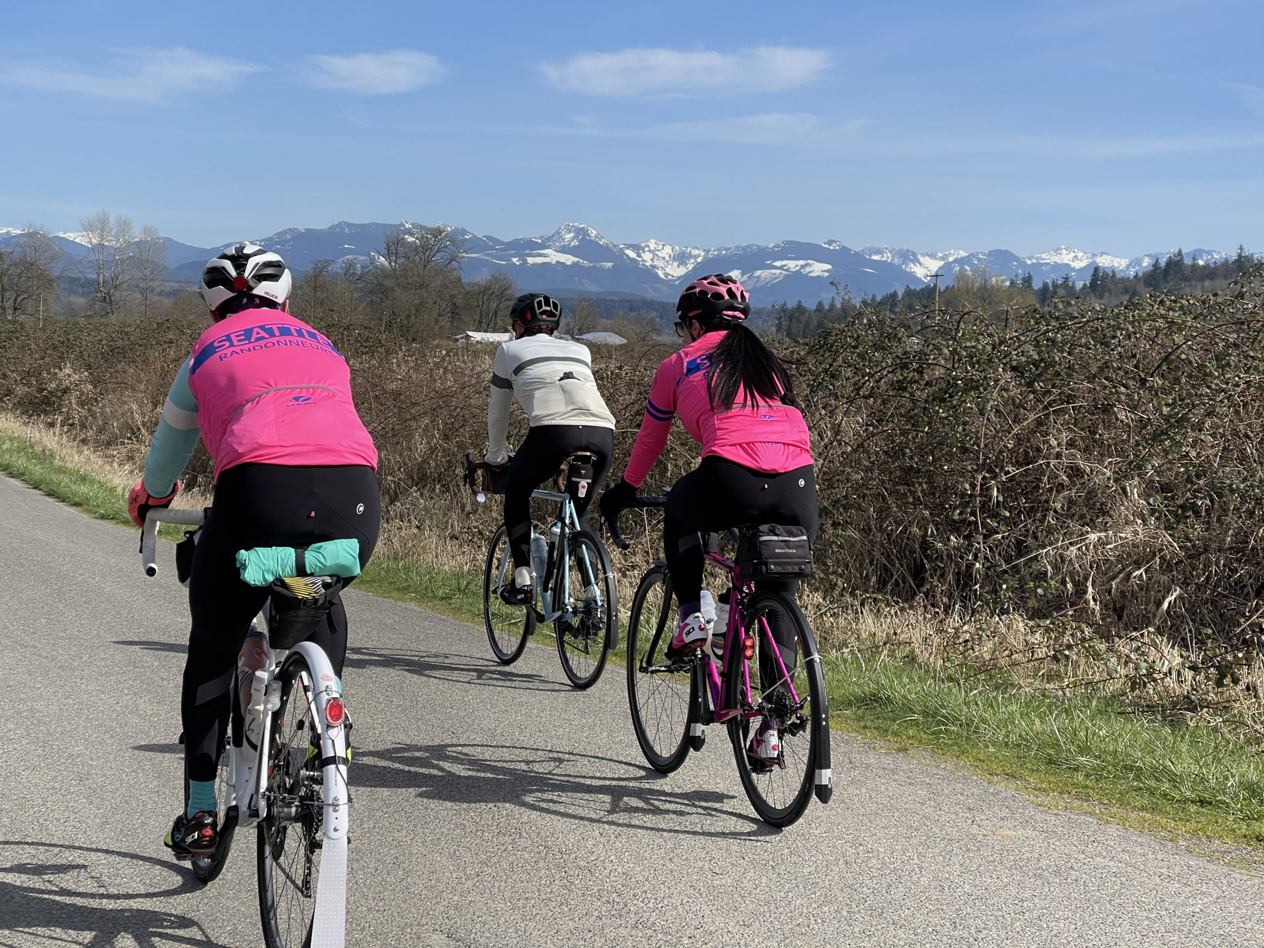
15 registered riders gathered before the 6 am. start at the Hilton Garden Inn, the main base of this entire week’s operations. We roll out on the hour north on the Apple Capitol Trail and very soon we are headed west on Easy St. in the Wenatchee hillsides. We jump onto Highway 2 around Monitor for about 4 miles of shoulder riding before we make a right on Dryden St. We ride next to the Ollala Canyon which offers great views of the Wenatchee River. The river was the highest some riders have ever seen, engulfing trees and shorelines normally seen. We pass over the river, skirt under the BNSF Railway through Peshastin and up Chumstick Hwy. Our direction heads northwest to our further point on an out and back to the Napeequa River on the White River Rd.

We turn back, wave and ring our bells at other members proceeding to the turnaround point. The 14.5 miles has us cycling parallel to the Wenatchee Lake, it’s cool near the water and a relief from the high heat the day has brought. Within the State Park, I found a spigot for water prior to the camp store. The store offered sound bits of ‘Free Bird’. The clerk mentioned her spin coach would have them sprint during the four and a quarter minute solo of the song, she loathed it. An iced espresso with coconut milk and Milano’s were enjoyed. Mint Ice cream and a Root beer for the tandem duo, Greg and Rose was their treat of choice for the heat.

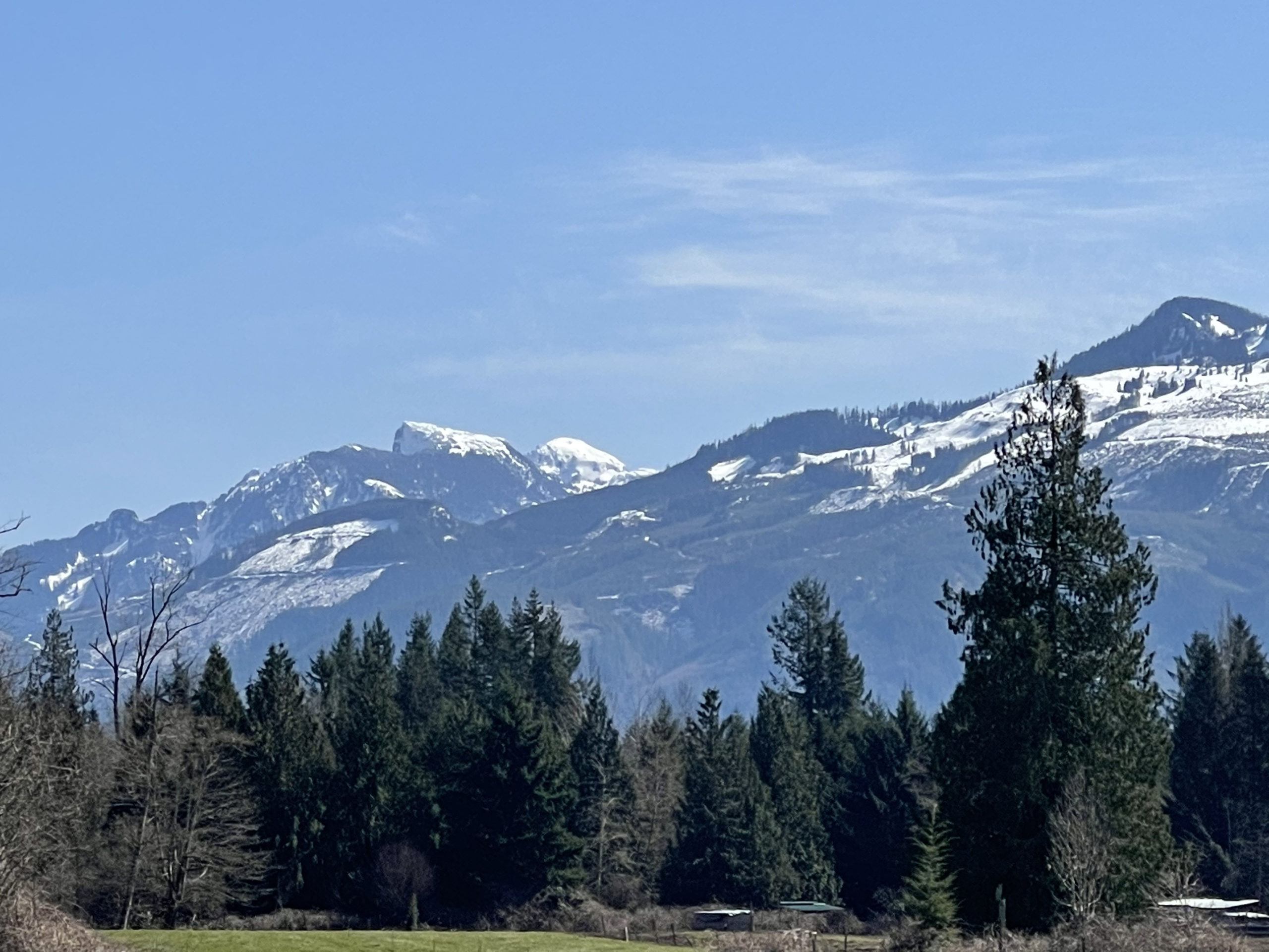
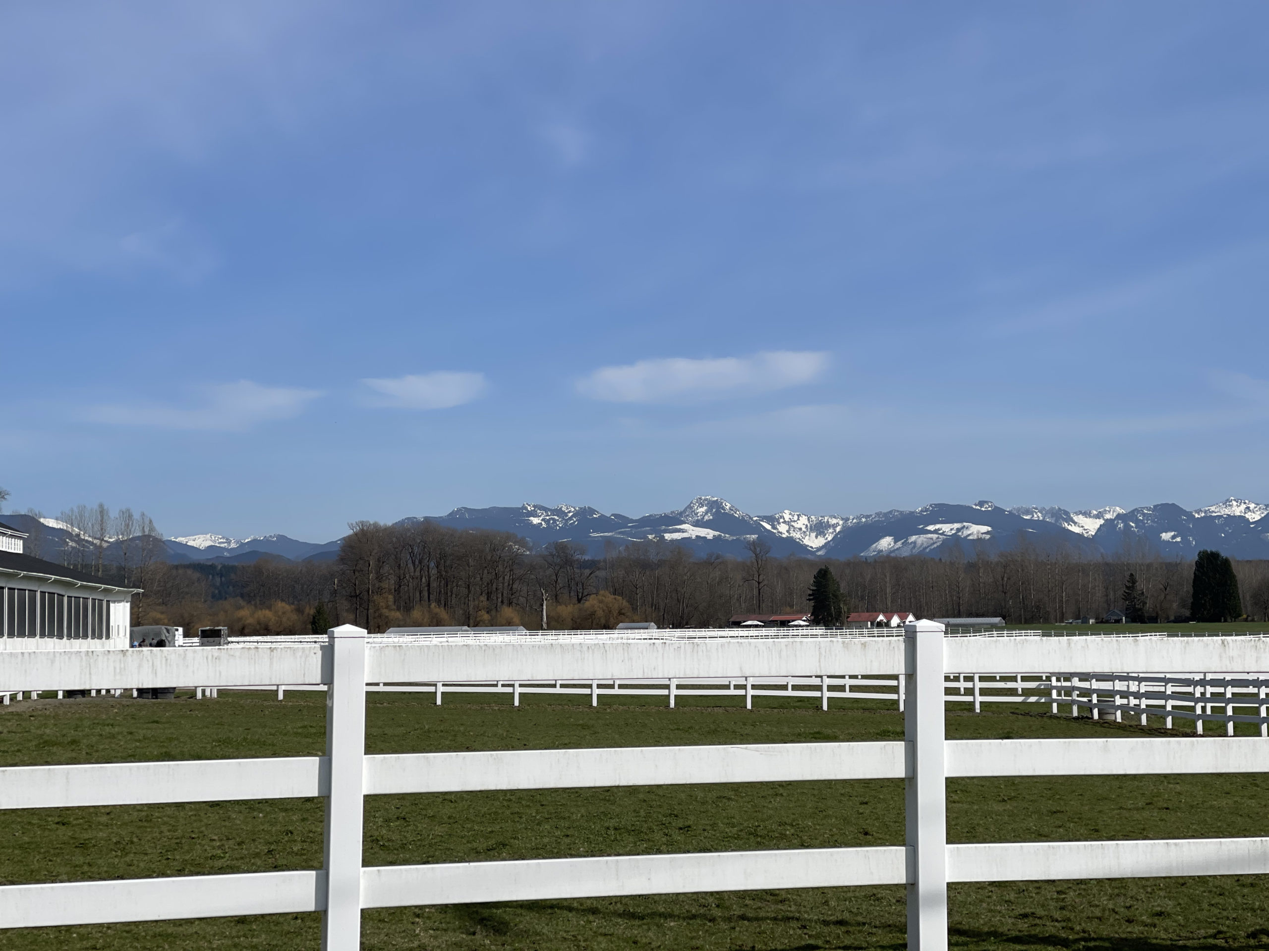
Onward to Leavenworth, the Bavarian tourist trap, which I made a costly stop for a schnitzel at the Sausage Garten compared to individuals who had stopped at Starbucks. There were 15 different condiment bottles to squeeze onto the brat, sauerkraut, jalapeños and grilled onions. I can’t forget the misting fans that offered small relief from the heat. A smart rando knows, how to maximize efficiency off the bike. I bit it and doubled my normal allowed time off the bike. Back on, we loop south of the town out toward Icicle Rd. The Temple, Edward Peak, Cannon Mountain makes up some of those mountains in the distance. For good measure on liquids, I stop at the 76 where some other randos are using to resupply.

Out of Leavenworth we return from which we came and eventually are back HYW 2 turning right on Deadman Hill Rd, which turns into Pine Flats Loop. The Wenatchee Valley roads south of HWY 2 are extremely quiet and by then the heat was at its’ highest of the day. We were met with a short sun shower that cooled us off only moderately.

We roll through Cashmere, Monitor and re-cross the Wenatchee River to rejoin with the Apple Capital Trail.

Post the 200K finish, I enjoyed dinner with randouneering legends Vinny and Yonnel, building camaraderie as we filled our stomachs for the 300K the next day.

Sunday May 21 – Ancient Ice Age Floods 300K

12 registered riders took to the road, this time heading south and over the Columbia River per the Old Wenatchee bridge. We cut through East Wenatchee and past Pangborn Memorial Airport before a pleasant descent on Batterman Rd. to join with HYW 28. We ride the highway shoulder for 4 miles, on this Sunday morning it is not heavily populated with vehicles. We make a left turn on Sunrise Ln. and sneak over to the Palisades Rd. taking our adventure northeast through a valley with mountainous hills on both sides. We encountered some cross winds in this section as I watched tumbleweeds get blown up mountain cliff sides.

This section is paved for 15.5 miles until the first gravel section of the day begins. It’s an easy section until the 3 Devils Grade which has a max of 9.8% with some heavily pitted sections. With a planted seat the punchy section is swiftly taken care of. You’ll know you’re done with the climbing and halfway through the gravel when you cross a Cattle Guard, more dangerous than any railroad crossing I’ve needed to make thus far in my cycling tenure. We make a left on B SE Rd after the Mayer Farms which turns into Coulee Meadows Rd and eventually onto HWY 2, where we make a right turn.

It’s 20.5 miles until the Dry Falls Visitor Center, once there a water bottle refill station, bathrooms, the scenic Sun Lakes-Dry Falls State Park and Stacy’s Top Chef Concessions services are here. Highly recommend a scoop of ice cream or Blue Star espresso from the food truck. I don’t stay longer than a yo-yo mindbender trick can be performed and head out towards Coluee City for the out and back along the Banks Lake.

Along 155, Coluee Blvd., I see Yonnel and Clayton returning from the northern stretch about 22 kilometers ahead of me. The turnaround point is called the Million Dollar North Public Access to the left and on the right is the Lower Lewis Creek Waterfall. Looking back don’t be deflated to have to climb back from that descent, it’s only 6.2% and less then 200 ft.

On the return to Coluee City, around the same section I saw the leaders, I pass the tandem of Greg and Rose, behind them is Mitch and John all looking strong. At the Coulee City Campground, I make a left and dip into the Banks Lake Brew & Bistro for blueberry pastry and Sunrise breakfast sandwich. They were pleasant and accommodating there.

Back on to HWY2 before turning right on 17. It is about 6 miles until a left-hand turn is made on 6 Rd NE / St. Edwards West Rd., the second gravel section. Which, had I been listening more intently at the start, was completely optional! The 9 miles of gravel north seemed to roll on for eternity but was extremely grateful for the intermittent cloud coverage being provided as this was a 30-mile stretch with 1,470 ft. of climbing to Mansfield against a growing headwind.

As I was about to turn left onto 172, I see this BMW turn down the gravel road and chuckle given there isn’t anything in the direction I just came from that would interest anyone. The driver was Mark a randonueer using the extra days for rest for the upcoming 600K. He offered some beverages but politely denied as I wasn’t expecting for anyone out here. I scoot on into Mansfield just in time to be in ear shot of a gun salute for a former service member. Mansfield Mercantile is only open until 5 pm. on Sundays and the Golden Grain next door offers restrooms. All stocked up, I press on through the next 34-mile section where we all battled 25 mph headwinds into Waterville. There were momentary reliefs when we would turn left to head south for a few miles. Never had I been at such an angle while attempting to ride straight.

The Waterville Family Foods provided the last services needed before inching my way, stilling furiously punching through the wind, to the top of the Orando grade on Sunset HWY. It seriously felt like I was on the slowest lift hill of a rollercoaster before the 6-mile descent. Crosswinds during this section were the most dangerous as speed maxed out at 40 mph. there was a small bridge section that was exposed and felt the winds blows from all directions. Back at 740 ft. the 18-mile slugged on. Tree branches were blown down along the back roads of NW Cascade Ave. and dust storms littered the air. The last fight with the wind was across the Richard Odabashian Bridge as road debris was blown up and pelted into our faces. With our heads positioned down we pierced through and finished the soul cleansing route.
Tuesday May 23 – Electric City 600K
16 registered riders huddled around Rose, the SIR RBA, as she gave the pre-ride speech reminding riders to be safe and to ensure communication if having to DNF on the ride. These statements are a must at such lengthy course attempts, best thought through plans are usually discarded as fatigue or discomfort sets in. We roll out a few moments around 6 am. and head north on the Apple Capitol trail across the Columbia River.

Following HWY 2, what goes down must always go up and thus we begin the roughly 6.5-mile ascent up Orando grade. From 785 ft. climbing 1,995 ft. reaching Waterville and rolling through the plains of Lamonie and north of Mansfield. Seeing forever in each direction atop of the plateau, if The Who’s, ‘I Can See For Miles’ isn’t playing in your head yet. The twangy guitar was the chorus was ringing in mine along the 70 miles to Grand Coulee.

A quick hydration stop at the Chevron on the corner was required before proceeding down to the gravity dam producing hydroelectric for four different power houses and irrigation water to Banks Lake.

In another 17 miles, I make a second stop at the Nespelem Trading Post for more liquids as it’s going to be a 45-mile stretch without services along the Columbia River Rd. If you are to stop here, there is a restroom in the far back left corner of the store past the produce and frozen food section. On this Tuesday, there was one cashier working and the line was 6 deep. I quickly ate all my food in line and paid to limit any waste of time.

These next sections of roads are the most scenic of the entire route, riding parallel to the Columbia River until we follow the road to continue heading north west up to Omak Lake, the 3,244 acre lake will be in view on your right as the road provides steady rolling elevation. Soon after Beer Can Beach Rd. your descent will take you into Omak which if you were seeking services, you’ll be out of luck as the dismal looking Omak Market on Jackson is closed.

Proceeding to Okanagon, aka as O-town, if you can’t pronounce it. A 76 on the right of 2nd Ave and Oak St. provided rehydration and a bag of TGIF Potato Skin chips. There is no Subway currently in the store do not be deceived as I was. Some used the IGA Market three blocks on the right off 2nd Ave.
I refilled again about 25 miles down HWY 97 at the Chevorn, McDonalds, similarly designed like the one out in Granite Falls. Major déjà vu vibes in there. After filling up it was time to proceed yet another 25 miles to Chelan Lake.

The Alt 97 climb after having a double century in the legs was humbling. With the sun setting over the lake, the quick descent into town as rewarding. The Port for the Lady of the Lake had an open and extremely clean restroom right on the dock. With dusk and night setting in, lights on from here on out.

With 36 miles remaining until we returned into Wenatchee, the only grade encountered was the climb out of Chelan. Be sure to have your lights on for the Knapp’s Hill Tunnel! On Alt 97 south of Entiat, our visiting Oregon randonueers, Todd and Stuart (John) caught on and we battled 18 mph headwinds before taking a short rest to tackle the remaining 200K.

Having got in around 10:55 pm., I slept until 4:15 am. and was back riding before 5 am., as I rode out a rider was just coming in from the trail. I needed to stop for a moment as my Garmin was having difficulties acquiring satellites. Later found out that changing the GPS mode from GLONASS to GALILEO should resolve that issue immediately without a computer restart, which I needed to perform twice.
Once resolved, I rode south of Wenatchee for a second time, after the climbing near the Rock Island grade, I noticed a highlighter looking individual and arrived just in time, to hold Mark’s bike as he pumped air into his tubeless that had snagged a stable. He had rolled out about 20 minutes earlier then I had and as he mentioned, I had perfect timing.
Traffic was immensely noticeable this Wednesday morning. We stuck to the highway shoulder until the right turn off Rd 10 NW, near the Quincy Valley Rest Stop, we take these back roads on through to Quincy and planned for a stop at Starbucks in Ephrata. We made our way onto Martin Rd. for the 13-mile stretch through the orchards and spun along until four dogs gave chase and attacked. Mark was caught up in a crash, he suffered no injuries but the shifters on the bike had suffered insurmountable damage. He stayed behind to sort out the claim.

I rode on and stopped at the Starbucks as originally planned. The staff was overly nice as I was not in any mood for pleasantries having a few hours of sleep and had been road ridden 300 miles in the last 26 hours. The next 44 mile stretch from Ephrata to Waterville about 2,640 ft. of gain. proved to be the hardest part of this ride. With fatigue taking hold, distant storm clouds and rain showers ensured I didn’t lollygag too much and pressed on along HWY 2 heading west.

I stopped at the Waterville Family Grocery where I was greeted by Jan who was riding some unpleasant gravel in the area. After a pose for a photo and downing the remaining Gatorade. I proceeded up to and down Sunset HWY for the second time and third time being on the road that week. With no headwinds to battle this time around, it seemed I had caught the road all to myself midday on this Wednesday utilizing the full lane through the windy descent.
In no time was I off HWY 2, through Cascade Ave and still on the east side of the Columbia River for the 4.5 miles of trail before crossing on the Old Wenatchee bridge and sprinting to the Hilton, ecstatic to be finished with the 600K.
Friday May 27 – 400K Eastern Washington Loop

On the last event of the week, only 6 riders including myself were present and hungry for the road. Our morning ride out to Quincy via HWY 28 was wet as a storm cloud paraded the first 35 miles. It did make for a refreshingly cool climb up HWY 28 for the second time that week.

The early morning sun was not far behind the clouds and began drying out as I made my way through George and onto Frenchmen Hills Rd. to begin the 73 mile stretch out east to Ralston. On this road, some dogs gave chase longer than usual and out of caution I sent a message to have the RBA warn others.
Pothole General Store was the first stop of the day to rehydrate, carb up just to get stuck behind a gentlemen proceeding to buy what must be the last pack of Marlboro Silvers the store has. May it be the last ride of the week but the inquisitive looks from the local clientele was strong on this day amongst the eastern Washington loop.
Out of the store and back on the road, the road takes us next to the Potholes Reservoir on the left. On the right is Corral Lake. Warden is a potato town; one can tell by the orphaned potatoes scattered on the street. In town, at the Astro Express Mart, I ran into two WXA rider filling up. Jose from Ellensburg was looking strong, and I bide them both a safe journey to Idaho!

20 miles down the road my next services stop was in Lind, desolate little thing. Along the way, I see three horseback riders on my right. The route proceeds with climbs, on the Lind-Warden Rd. on the left at the street of Hoffman is a field that had 6 dust devils before coming into Lind. The tattooed gal running, Jim’s Market was kind to fill the water bottles, whip up a lotus energy drink from my random dice roll and wish me good luck finishing the series.

With a snapshot of the bike near the mural, I’m a sucker for a historic mural, I pedal on through the countryside. Along the way to Ralston, three deer run parallel to the road with me for over a minute. One crosses the road first, the second peels off and the third keeps running for another 20 seconds before crossing in front of me.
I turn north, and proceed the 9 miles to Ritzville for a stop at the Circle K. I waste no time here as I feel as the main attraction for the mass’s eyes. We cut through historic Ritzville and out onto the long straight of Rosenoff Rd. for the 40 miles of headwinds, rolling climbs and chasing a storm cloud off to our right. Even through the route is perceived to be descending over time, this stretch of road felt to be the hardest part of the ride.

I by past the right turn on Rd L NE, to retrieve services at the One Stop Mart. The drink fountains do not have water here, luckily the lady behind the counter fills them up in the kitchen and then back on course through Moses Lake.
We are nearing the end and I’m beginning to sense the accomplishment as I ride on HWY 17 to 282. The afternoon glow makes Ephrata very rustic, and I dip into the 76 for the last stop of the day after the last 23 miles of headwinds.
With 50 miles remaining and it mostly a descent, the only thing that had me worried was having to cycle back on Martin Rd/ Rd 12 NW through those orchard fields that we encountered the dog chase two days before. Sure enough, as I approached those pesks were sitting in the road. Luckily, the dark gray aggressive one was nowhere in sight, and I scooted through unscathed.

By now dusk was here and I was on HWY 28 for what felt like a blitz of 28 miles, yet a minor slog through the 10-mile Rock Island and Eastern Wenatchee stretch. One last time, totaling four crosses of the Old Wenatchee bridge and the sprint up Worhten St. to the Hilton. When I arrive at 10:22 pm. it marks a result of 953.67 miles covered with 42,820 ft. of elevation climbed, having spent 60:41:17 in moving time on the bike. I considered this a resounding success.