Text and photos by Ray Whitlock
We headed out at 6 am Saturday, encouraged by the dry roads and lack of rain, unlike what the forecast had predicted. As soon as you leave the hotel and are riding east on NE 70th Street, stay in the right-hand lane as you approach Redmond Way/WA-202. Aim for the big gravel pile on the other side of the road. Go straight across and jog slightly left to cross the sidewalk and ride through some gravel to get over to 180th Ave NE and turn left. The gravel has some potholes, but otherwise is completely rideable. The ride then goes north on familiar roads to Snohomish and Marysville.
About the time we got a bit north of Marysville, the weather got real and we pulled off to don our matchy matchy Gore Shake-Dry jackets. The climb up to Lake Ki got us warm and we were careful not to miss the turn just beyond the top of the hill. Keep a close eye out for this one as it’s easy to miss and you don’t need any bonus hills on this route!
We were so wet and cold by the time we got to Stanwood, that we decided to make an early stop at the QFC where we were very disappointed to find out that the deli does not have any hot food or soup until 11 am on Saturdays. However, the SBUX inside the store does and there are plenty of other stops in Stanwood if you need to fuel up or get warm and dry.
The skies cleared up a bit after Stanwood, and we made the loop around the hilly northern half of Camano Island. We got to the INFO control at Utsalady Point Vista Park and finding the answer made us smile. This is not a ride-by control and you will have to get up close to the sign in order to find the answer. The next INFO control at Elger Bay Grocery was well stocked, especially with the restaurant inside serving hot food. We were still well nourished from our stop in Stanwood so we got our control card filled in and headed north and back to Stanwood.
The ride north to Conway and La Conner was pretty straightforward, except of course for the wind, which seems to be ever-present. May the gods and goddesses be kind and grant you a tailwind! We stopped at the Whitney Shell INFO control, crossed Highway 20, and were approaching Bay View. We were surprised to see a big “BRIDGE CLOSED 2.6 MILES AHEAD” sign that required us to take a right turn onto Josh Wilson Road over to Farm to Market Road and then north into Edison. There’s a bit of a hill going up Josh Wilson Road and even though there’s not much of a shoulder on Farm to Market Road, the traffic seemed reasonable, even on a holiday weekend. Follow the detour signs and you’ll be fine.
There are plenty of food choices going through Edison and Bow so fuel up if you feel like you need it to get up and over the Chuckanut Drive climbs. While there are plenty of uphills through here, they all come with downhills and some nice views. Once you’re in Fairhaven, make sure you catch the INFO control right at the turn onto Old Fairhaven Parkway! There are some places to stop along this road for food, but we opted to go north a couple blocks off route for the Haggen Foods market at the corner of 12th Street and Larrabee Avenue. There are plenty of other food choices in that part of town as well. Don’t fill up too much though as the route now climbs steeply, sometimes at 12.5% grade, stair stepping its way up about 600 feet in 3.5 miles. The route then follows beautiful roads along Lake Whatcom, where you’ll find a small shopping center with a market/deli and pizza place in Sudden Valley around 238K. We didn’t stop there, but a Google search claims that the pizza place is open until 9 PM and the market/deli, until 10 PM.
Rather than going all the way past Lake Whatcom out to Highway 9, the newer version of this route now turns south onto Cain Lake Road and down through Alger to Burlington, a much nicer route IMHO. There are plenty of food choices in Burlington, but if you need something beforehand, the Glenhaven Country Store is open until 10 PM at about 245K. As you cross the Skagit River around 277K, there may be heavy traffic. Use caution to get into the right-most left-hand turn lane in order to turn left onto Pacific Place shortly after descending from the bridge.
From the Burlington/Mount Vernon area, the route is pretty straightforward through the valley over to the “Conway hill climb.” However, take caution around 290K when turning left from E Stackpole Road onto Cedardale Road. There is a large hedge there that obscures the fast-moving traffic coming from the left. The 76 gas station at Cedardale Road and Highway 534 just before the climb is open 24 hours. Once you climb the hill, get yourself over to the Centennial Trail and make your way south to Snohomish where there are plenty of food choices. After the Broadway climb, the route takes familiar roads to Woodinville where you’ll find a 24-hour Arco station at 156th Ave NE and NE Woodinville Duvall Road if you need food or drink to get you back to the finish. Head down the hill and then hop on the Sammamish River Trail back to the overnight at Redmond Inn.
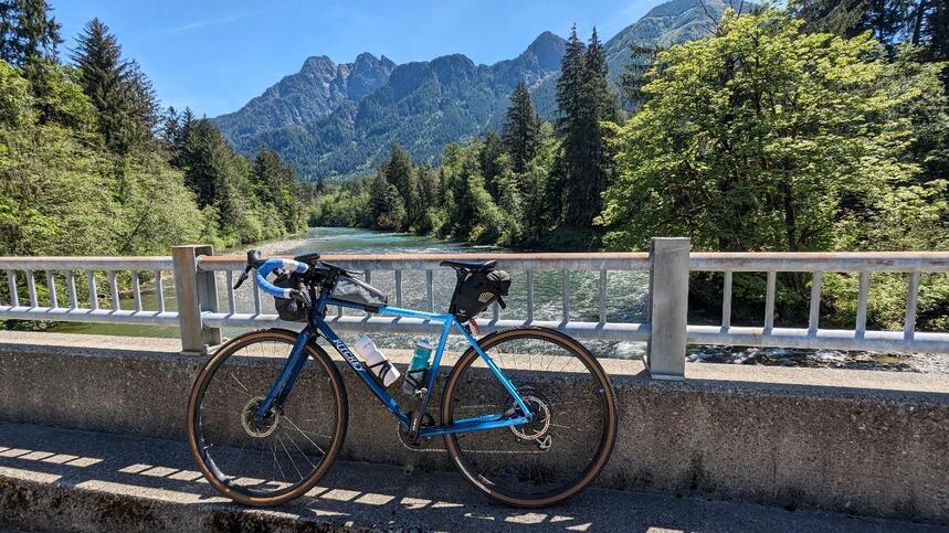
As you leave the overnight control, take the same route you did on Day 1 to get across Redmond Way and through the short stretch of gravel over to 180th Ave NE. You’ll have a formidable early-morning climb up and over the Union-Novelty Hill which just seems to keep giving! The first control today is Sandy’s Espresso. Fuel up on some caffeine to recover from that nasty hill. The route then heads south on the crushed gravel Snoqualmie Valley trail for some nice forest bathing on the way to North Bend. The 1,000 ft climb up Middle Fork is about a 15.5 mile climb (one way) to the end of pavement, so plan on stocking up on water and food at North Bend. Be really careful at the bridge when crossing over to the gravel to get to the control, as there are some deep potholes on either side that have been known to take out at least one rider in the not too distant past. There is absolutely no cell coverage in this area!
After returning to North Bend and then Snoqualmie, the route climbs up to and past Snoqualmie Falls and heads over to Fall City. As you’re approaching the very confusing traffic circle at Highways 203 and 202, make sure you stay in the left hand turn lane and take the 2nd exit out of the circle onto Highway 202. The first exit takes you onto Highway 203 which is not the way you want to go.
You may want to fuel up at the Fall City gas station where the control is as the next bit of riding takes you up quite a few more hills all the way up to the Issaquah Highlands. Use the sidewalk on the right side up the Highlands – it’s a much more pleasant experience than riding the road uphill. Once at the top, stay to the right and watch for the trail signs. Once you descend a way down the trail, you’ll have to take a right-hand turn to go back uphill a bit and cross back under Highlands Drive NE where you’ll now be on the east side of the road. Use caution at the intersection of Highlands Drive NE and the I-90 exit ramp and get on the road to head downhill on E Sunset Way into Issaquah.
The next bit of riding is pretty straightforward, although IMHO, much better than it has been in years past. I did quite a bit of work coming up with a better route and I hope you like it. Instead of riding all the way south along the very busy Issaquah-Hobart Road to Black Diamond, you now get off that nasty road at Cedar Grove Road SE. The one thing to be aware of along Issaquah-Hobart is the very narrow bridge just past the May Valley Road turn at around 529K. It’s an old bridge and there is no shoulder there. Make sure you look over your left shoulder and let the traffic know that you’re moving out onto the road to get across the bridge.
Cedar Grove Road is a nice respite from all the traffic and not too bad of a climb given everything else you’ve been through. Hang a left just after the summit onto Lake Francis Road and enjoy the cruise over to the Cedar River Trail. Be careful where you take a left onto 223rd Place SE just before getting to the trail. There is some nasty pavement and potholes through there.
At this point, the route back to Redmond is identical to the 2024 Spring 400K. Ride the Cedar River Trail into Renton, ride through Renton over to Gene Coulon Park and then onto the East Rail trail up to Lake Washington Boulevard SE. Head east up the I-90 bike trail and take it all the way to the barricade where it does a 180 degree turn up to SE 36th. Follow that over to the last big climb of the day up 154th Ave SE. Hang a left on SE Newport Way and roll down the hill all the way into Issaquah. Hang a sharp left off of 2nd Ave SE onto the Rainier Trail at 525K. It’s hard to spot so watch for the pedestrian warning signs as a clue for where to turn. Grab that last con-Troll, follow the maze of the Rainier Trail through Issaquah and soft pedal your way back to Redmond on the trail along the peaceful eastern shores of Lake Sammamish. Congratulations, you’re awesome!