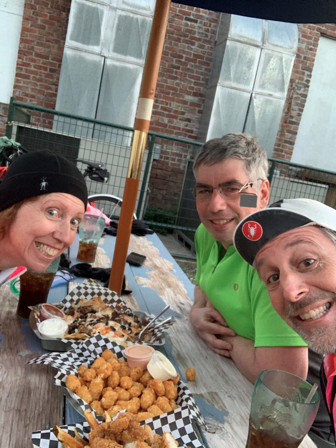
Andrew Sapuntzakis, Sarah Stolz & Kevin Smith pre-rode the Spring 400K, packed with views, climbs, more views, even more climbs—the perfect SIR ride!
Note: There are many turns on this route. If relying on a cue sheet, pick a font you can read, and bring a “map light” once it’s dark. If using electronic navigation, make sure the device doesn’t choke on the 300+ course points, and have a way to recharge it. While there is lots of parking near the hotel and the stadium, for peace of mind please consider using the park & ride ~5 blocks away, just E of 102nd Ave. Now it’s onto the ride!
The start rolls down from McMenamins, crosses 522, and jogs left onto the new ped/bike bridge to the trail. Follow that all the way to Fremont. It’s not as smooth as it once was, so go easy through this part. Be nice to kids, pets, and other traffic along the way. Pro tip: Met Market is on the right at ~11.4 miles (18.3km), with bathrooms, water, and a decadent chocolate chip cookie that is sure to get you through the first few hills.
Northlake Pl, across from Gas Works, makes for a smooth transition onto 34th. A wide left onto the Fremont bridge sidewalk, then some quick rights to the ship canal trail take you under the Ballard bridge. Go through a made-u-look-both-ways railroad crossing, onto the sidewalk on the S side of Emerson, and then follow the 2-way bike lane over the railyard. Bike lane turns right on Gilman, becomes Gov’t Way, right up to the front entrance of Discovery Park. Don’t miss the left at the top, otherwise you’ll be backtracking up a solid extra climb.
Note the (former) stables on your right as you start to head down to the first control. At the bottom, avoid the right fork with the concrete overpass (or you’ll end up in the wastewater treatment plant- yuk). Answer the first question, take in the view to your next control destination at Alki Point, have a final bite of that gooey cookie, then head back up. Turn right just before the stables, and head toward the S park exit. Magnolia Blvd should be an easy cruise with stunning Elliott Bay views and homes to match. Don’t miss the turn onto Thorndyke, with its gentle incline down to the railyard. Admire the other Victorian technology, but be aware of an extremely narrow fenced ramp—communicate with oncoming trail traffic!
Take it easy on the trails through the waterfront parks, then go into the street once you reach Alaskan Way. Stay on it until King St to avoid the sidewalk/trail confusion caused by overlapping construction projects. After a short smooth trail segment, you’re back on Alaskan/E. Marginal Way. Activity is returning to the port, but watch for potholes! The cues will get you through to the W Seattle Bridge trail, but spare a glance for the repairs to the upper bridge. Traffic on the lower roads should still be reasonable, and the green lanes should help you get across the Delridge/Spokane/Chelan/Marginal spaghetti bowl intersection. Once across, getting to Harbor/Alki isn’t bad. The road that loops past the 2nd control has been “pedestrianized.”
As you head south, a short climb connects Beach Dr. to Fauntleroy, but you only head south briefly before turning to bypass the ferry traffic. The Original Bakery is at the foot of the Marine View Dr. climb. Enjoy more Sound views as you climb, then ~2.5 miles to prepare for Shorewood Blvd, which will make you glad you brought “easy” gears. Marvel at its multi-stage reveal.
From ~49 miles (79km) until Dash Point there are several sharp descents with tight turns—stay in your lane! If you’re not familiar with these roads, take it easy.
Work your way down to three-tree point for the next control, then more ups and downs to Redondo Beach, which has public restrooms. More climbs and drops—don’t miss the turn to get to the Dash Pt control. The climb out includes a steep segment and more great views. If you look closely, across the water is your next control destination, so close, yet…. Rejoin 509, but not for long, and don’t follow it down to the water.
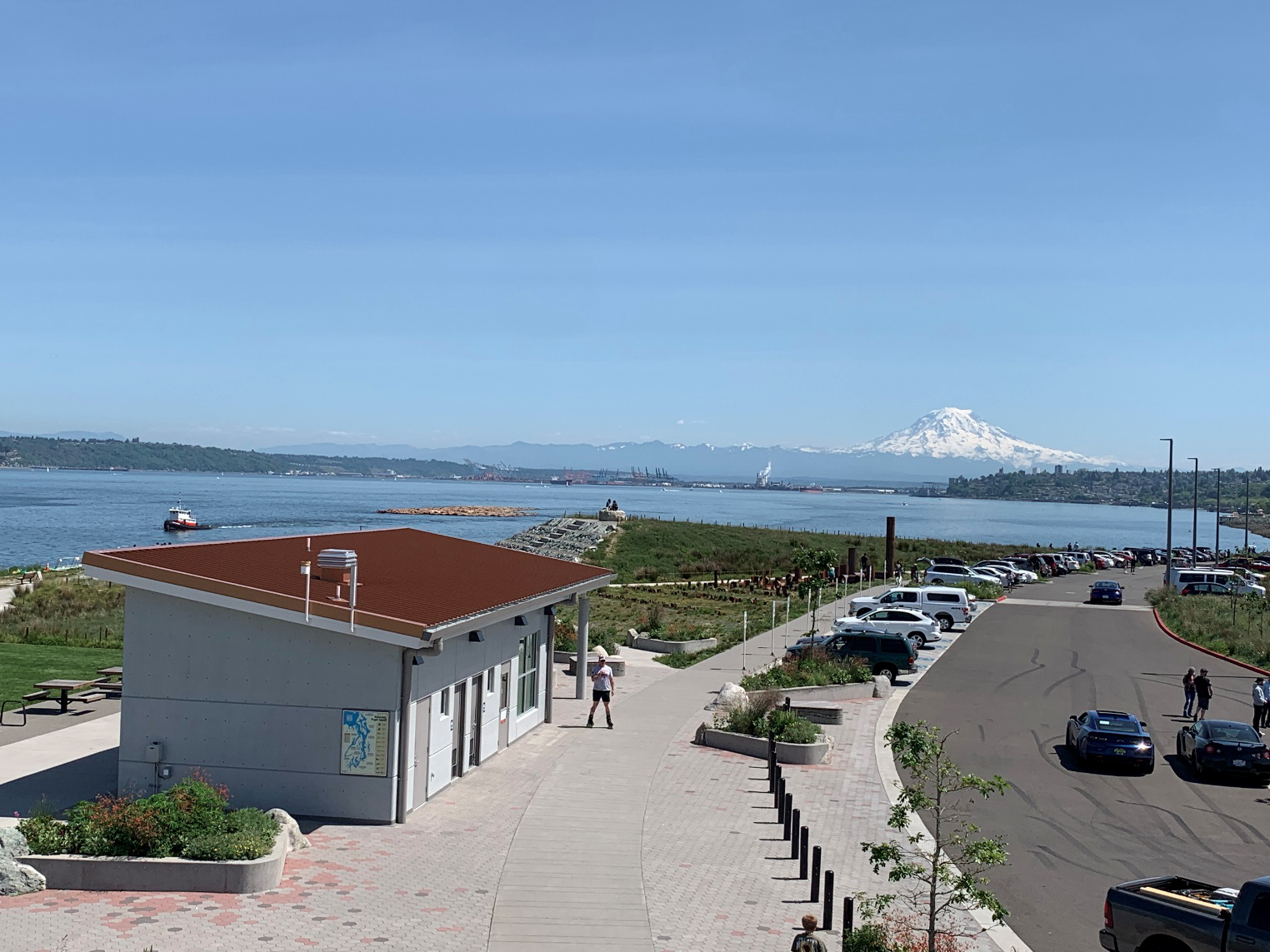
As you approach Tacoma, use the sidewalk when you cross the Eells St bridge over the Puyallup. North of downtown Tacoma, the route jogs left to Commerce/Stadium, where construction materials and streetcar tracks make for a narrow path. Stay to the right of the tracks, you don’t need to cross them. Turn right at the light on Tacoma Ave, where Salamone’s pizza (opposite corner) sells by the slice, and it’s also a food option on the way out of town. Ruston Way is like a narrower Alki. The Point Ruston Public Market has bathrooms inside and food trucks outside. Options in the Ruston development may be busy. Consider grabbing some food to eat at the control in Dune Peninsula Park, taking in the sweeping views. Hopefully the Mountain will be out to show your next direction, you’ll be seeing it for hours. Water and bathrooms are available in the park pavilion.
In Puyallup, the river crossings aren’t bad, but take a wide left and get onto the sidewalk where Shaw goes over the tracks. Use the near crosswalk just after the tracks to get on the Foothills trail rather than turning onto busy Pioneer. Cruise all the way to Orting Safeway, McD’s, etc.
The initial climb on Orting Kapowsin Hwy doesn’t have much of a shoulder, so do your best to stick to the fog line. Eventually, the route passes the Kapowsin grocery (Texaco gas station) twice—it’s decently stocked, but has no bathrooms. From there, it’s mostly downhill back to Pioneer and the Foothills trail. The sani-can along the trail was not well maintained, so you might byo paper.
Leaving South Prairie, there’s another climb. On the way into Wilkeson, note the skillet-eggs-n-bacon feature in the skate park. There are a few food options, although the Pick & Shovel saloon is probably your best bet, with outdoor seating around back. Figure ~30 minutes to the Carbonado control and back.
From here, the route profile stays pretty tame for the next 100km, so you can hopefully make good time. Services can be found in Burnett, Buckley, Enumclaw, with a control before the Green River. Then head for the Safeway control (open till 1 AM) on Kent Kangley Rd. The staffed Landsburg control just three short miles away marks the return to trails (no services) all the way to Renton. The Landsburg control will have hot coffee, hot water for tea, cocoa, cup-o-soup, packaged sandwiches and energy providing snacks.
From Renton, it’s the East Side of Lake Washington that most of us can do in our sleep, although the gravel rail trail is almost entirely closed for construction, so we have you on the Lake Washington Loop trail. Then the I-90 trail to Mercer Island, and the scenic way around starting with the twisty bits. After the floating bridge, there’s a steep half block up to Seattle’s Lake Washington Blvd, and a twisty, bumpy descent through Frink/Leschi Park to a restroom info control at Madrona Park. Continue on, up the hairpin, west to MLK, and through the Montlake neighborhood to the 520 trail via the Montlake overpass due to the posted closure on the Roanoke trail stub.
Cross the lake again, and the “rolling” trail dumps you onto Northup, then 24th for some short climbs. Then it’s on the trail again to 148th for the last info control, and then back off the trail once more due to construction. Pass Microsoft and Nintendo, and a quick trail descent to Redmond. Onto the Sammamish River Trail all the way to Bothell, up the ramp, o’er the bridge, and back to the hotel where your author(s) will be waiting to congratulate you.