Author Archives: Rose Cox

Basin’s Edge 200k Pre-ride Report

by Yonnel Gardes

Fabien and Yonnel did a preride on Sunday, May 10th. We had a wonderful time, this route is really special with incredible landscapes along the way. It’s also not a traditional rando event due to the gravel sections. 

Speaking of gravel, the first question is about gear. Shiggy recommended 32mm tires minimum. Initially I was leaning towards taking my gravel bike (38, tubeless) but Fabien convinced me to take our road bikes instead. So he did it on 25mm tires and I had 28mm. We got lucky and did not flat or crash. It’s a matter of luck and comfort level on gravel. I think what Shiggy recommends make sense. However, you will only encounter 14 miles of gravel out of 125 – so you will spend a lot more time on nice pavement!

A picture containing water, outdoor, sky, ground

Description automatically generated
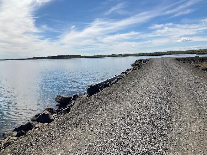
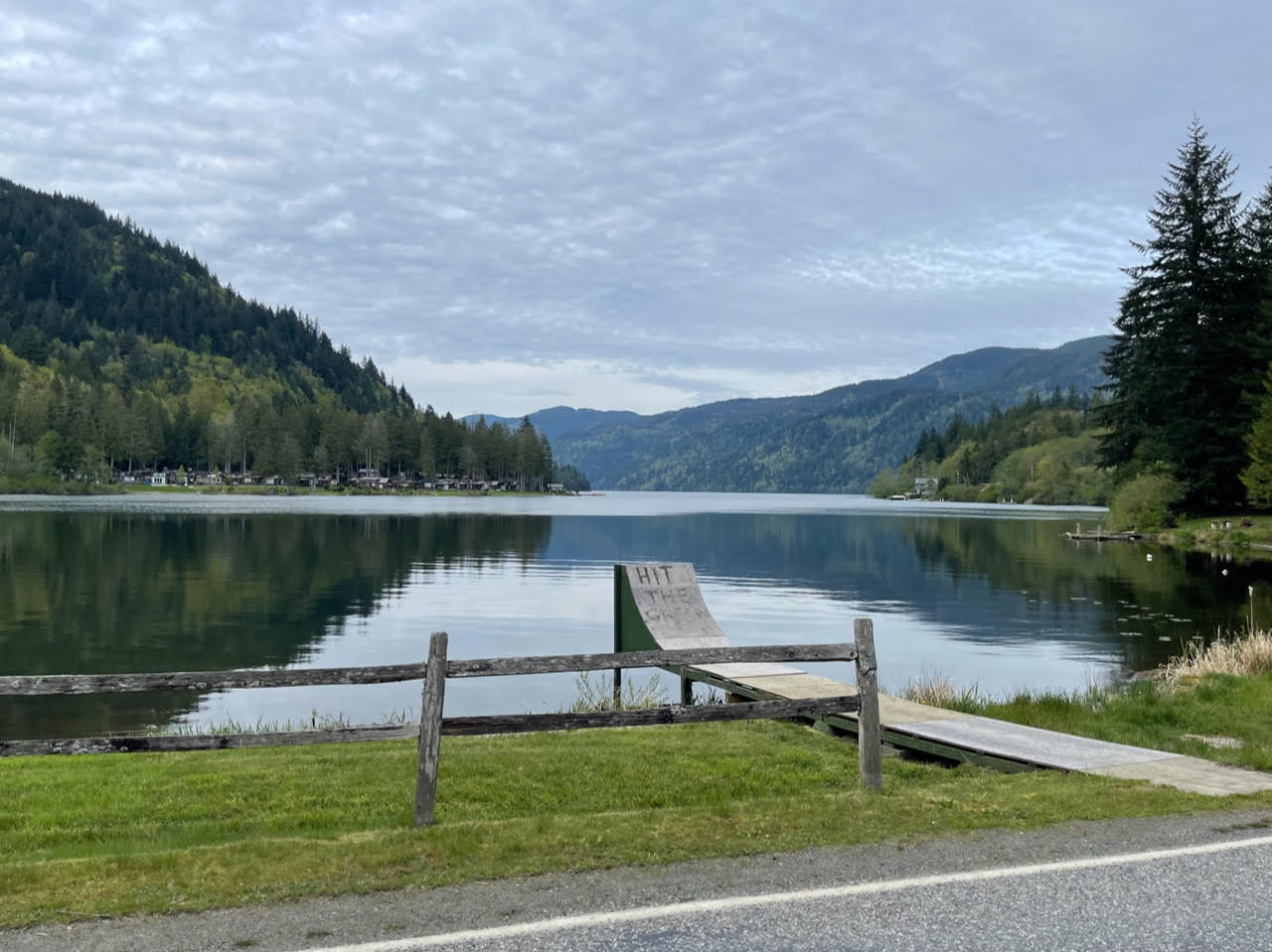
  • The first stretch of gravel is about 4 miles long and is also the chunkier (mp 34.2 to 38.1). It is fairly flat and goes by some nice lakes.
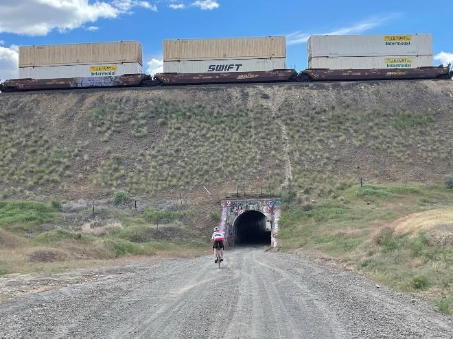
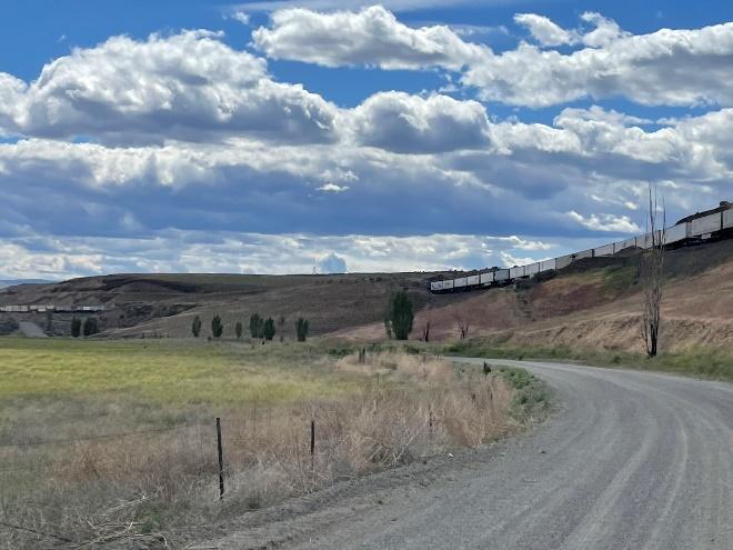
  • The second stretch of gravel is longer (10.5 miles). After you pass the initial hill, it’s all downhill or flat on pretty smooth gravel. Watch out for cattle and hunters, we encountered both.  There is a fun tunnel to cross underneath the railroad tracks and then we found ourselves surrounded by train wagons on the other side.A person riding a bicycle in a tunnel

Description automatically generated with low confidence

A picture containing grass, sky, outdoor, road

Description automatically generated

Another major factor on this route is the wind. Tailwinds are almost guaranteed during the first half. Fun and fast, enjoy it while it lasts! The second half is when you’ll be more exposed with dominant northwest/west winds. We got very lucky on Sunday but the day before, the wind reached 20mph. 

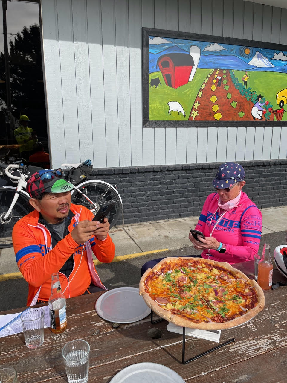
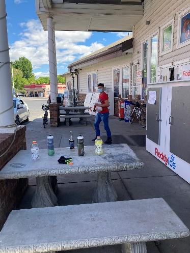
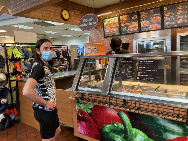
With regard to services, there is a rest area at 27 miles and this is the last water supply until mile 72. The logical places to stop for food/drinks are at George (mp 72.4) and Quincy (mp 87.7). After Quincy, there is a 30-mile section without any supplies. We stopped at the Shree’s Truck Stop & Gas Station in George, on the left side of the road. Very convenient with a Subway and outside seating. Sage Coffee House and Bistro at mile 74.5 is another good option.

A picture containing text, outdoor

Description automatically generated
A picture containing text, indoor, table

Description automatically generated

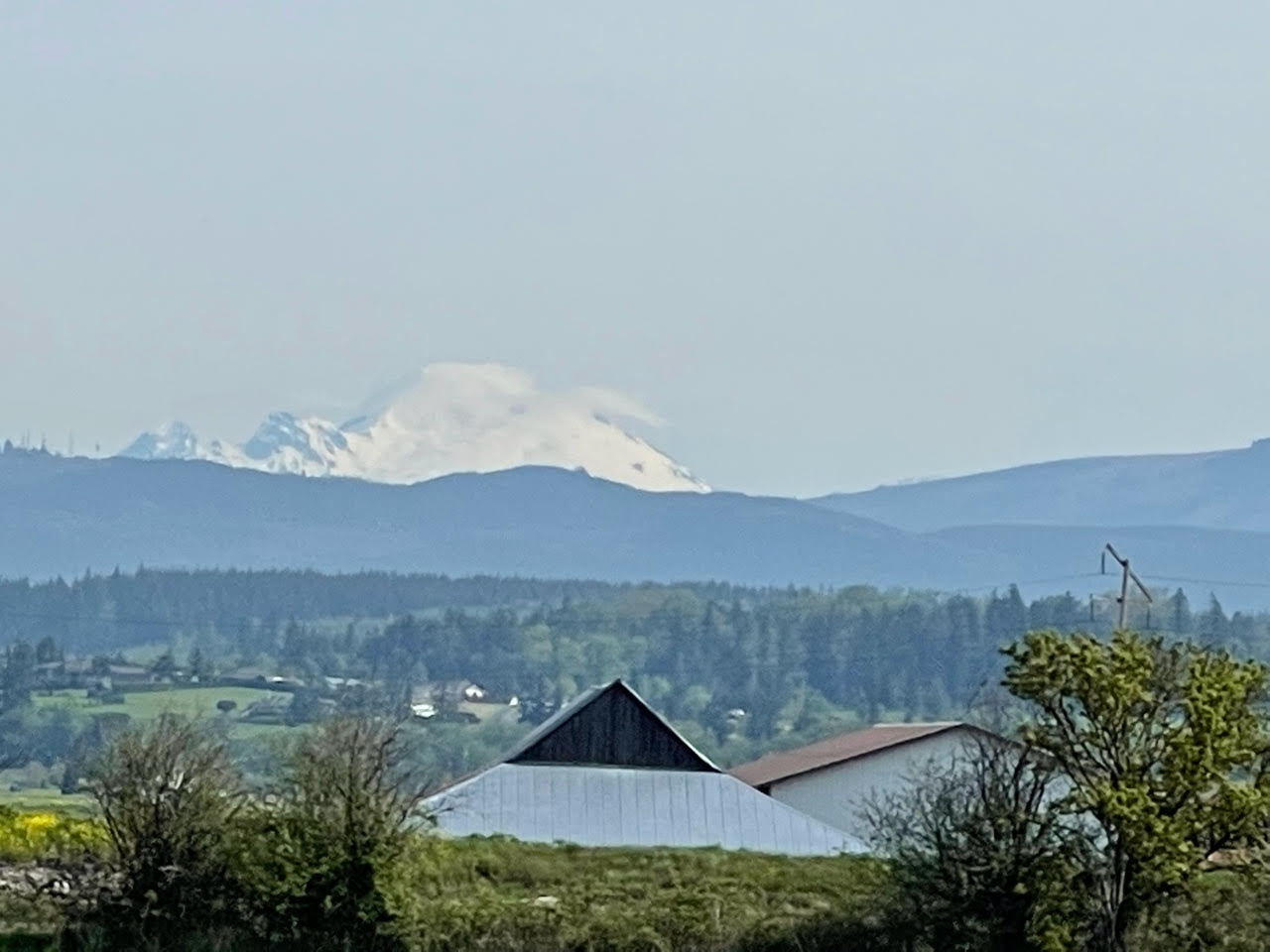
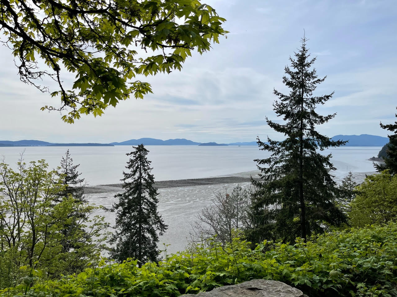
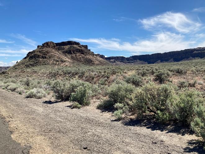
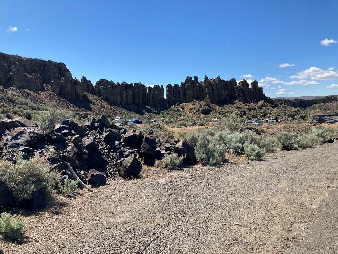
What makes this ride special is the beautiful scenery along the Columbia river and the rock formations.  I was in Arizona just recently and that looked just the same, only the cactus were missing. The out and back to the river along the Frenchman Coulee is the highlight of this route in my opinion, and not just because of the name…A picture containing outdoor, sky, ground, mountain

Description automatically generated

A picture containing outdoor, sky, ground, nature

Description automatically generated

A picture containing sky, person, outdoor, person

Description automatically generated

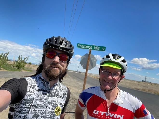
Shiggy did a really good job with control locations and questions. Curiously the Frenchman Hills sign is not an official control but I strongly recommend bowing to this sign and take a selfie like we did 😊

The Safeway lot at the start/end has plenty of parking. Shiggy met us at the start and end of the preride, which was really nice. Thanks so much for organizing this really cool event. I am sure all the participants will have a blast!  Let me know if you have any questions.  Yonnel_g@yahoo.com 

Comments Off on Basin’s Edge 200k Pre-ride Report

by | May 10, 2021 · 6:23 pm

Brevet Week 400K Pre-Ride Report

Mark Thomas, Jan Acuff and John Nguyen pre-rode the Brevet Week 400k. Here is their report of the ride:

Starting in Redmond again, the 400k takes a standard route to Snohomish via Paradise Lake Road (with its one deadly little stinger of a hill) and Broadway. The route then follows the river towards Everett before veering north to Marysville. At 59km in Marysville, the pre-riders stopped at a Starbucks (there is also a convenience store) to fuel up for the sturdy climb to Lakes Ki and Goodwin. 

With a Marysville stop, we headed straight through Stanwood and then over the bridge to Camano. Although busy and annoying, the bridge has a decent shoulder and should be fine. We definitely encountered some ups and downs on the north and west sides of Camano Island before refueling again at the Elger Bay store (123km).

There may be nice views as you head up the east side of Camano and than back over to Stanwood. The 55 kilometer or so stretch from Stanwood to the base of Chuckanut is the flattest part of the ride. We stopped for convenience store sustenance at the Whitney control at 178km partway through this stretch. Chuckanut Drive is terrific and a couple of the overlooks on the left would be worth a picture stop.

We had pizza (and maybe a beer) at the Fairhaven control a bit past halfway (212km). In addition to the pizza place, there is a grocery store just beyond and then a few more restaurants past that.

The upcoming climb from Fairhaven to Lake Padden and beyond is a leg buster with occasional double digit grades. We sort of knew it was coming, but it was a doozy nonetheless. A bit of an inconsistent descent took us to Lake Whatcom. Plenty of nice scenery along the Lake, but unfortunately, this was, for us, the busiest section of the ride for traffic. Once we left the lake, it was pretty quiet to Sedro-Woolley. (Note that the 600k takes a bit of an alternate route to Sedro-Wooley, featuring Lake Samish instead of Lake Whatcom, but not depriving its riders of the nasty climb out of Fairhaven).

Services are available in Sedro-Woolley after about 55km of nothing from Fairhaven, but with only another 18km to Mount Vernon, we opted not to stop. The route goes west on Cook and south on Gardner instead of following WA-20 from Sedro-Woolley to Burlington. When the route reaches 20, cross over to the other side and use the trail, which is paved to about a block before the turn south through Burlington. To cross the Skagit River, the route goes under the bridge and then up the ramp onto the bridge over the river. On the other side, there are a few blocks of fairly convoluted routing that kept us from having to cross lanes of traffic to make left turns and otherwise avoid the worst of the traffic.

May be an image of burger and french fries

We stopped at the McDonalds/convenience store across the street from the control in Mount Vernon. I believe that they are both open 24 hours. If you expect to be there late (reference control closure is about 1:30am), you might want to call ahead and confirm the hours. From the control, bike lanes and then nice quiet roads brought us to Conway. It may not be the absolute flattest way out of Mount Vernon, but it’s pretty nice. It got dark for us in that stretch. 
After Conway, the second to last significant climb goes up to Lake McMurray and shortly thereafter, we found ourselves on the Centennial Trail for about a 50km jaunt to Snohomish. If needed, services can be found about a block west of the trail in Arlington at a 7-11 visible from the route. We didn’t stop there and indeed pushed on to the finish without any further refuel stops (about 110km from Mount Vernon to finish). Additional services are available in Snohomish before the final climb up Springhetti and Broadway to Matlby. A quick downhill into Woodinville and trail riding back to Marymoor make for a quick(ish) last bit.

Comments Off on Brevet Week 400K Pre-Ride Report

Filed under Uncategorized

Solstice 1000k

by Ray Whitlock

Routes: https://ridewithgps.com/events/148081-2021-summer-solstice-1000

The Summer Solstice 1000k is a brand new route and should entail some great adventuring. We have traveled most of these roads on other Brevets and Permanents, but there are a few twists and turns to keep you entertained. The route consists of 3 loops all starting and finishing at the La Quinta Inn in Tumwater, WA. While that will make it easy to clean up and grab some sleep after each loop, it will also provide an easy temptation to abandon. There are portions of the ride that will require more than the usual rando self-sufficiency.  Make sure you check your yearning for sleep and civilization at the door so that you can successfully finish the entire adventure!

Day 1 has us heading out for the biggest challenge of the 3 days where we will ride out past Shelton and Matlock on mainly paved back roads. We make a visit to Wynoochee Lake for some incredible views of the Wynoochee River valley, refill our water bottles, visit some civilized restrooms and maybe even take a swim if it’s a warm day. From there, we will head southwest onto Donkey Creek Road (FS Development Road 22) and approximately 7 miles of gravel before the pavement begins again. At Highway 101, we turn north up to and around Lake Quinault, circumnavigating it in a counter-clockwise fashion. The south shore of the lake is a bit of a roller coaster, but nicely paved with a couple choices for services along the way. Stock up there and get ready for another approximately 11-mile stretch of well-packed gravel (rideable on 25’s/28’s) just beyond the east end of the lake and around to the north shore where we’ll head west and eventually rejoin 101 to head south. From there, it’s a 16-mile cruise down the wide-shouldered 101 where we will pick up some more back roads all the way down to Montesano. At Montesano, we head east to Elma along the Monte-Elma Road and then head south all the way down past Oakville on lightly trafficked back roads. The final stretch of the day has us heading north up through the Mima Mounds area and back to Tumwater for a well-deserved night of rest.

Day 2 will be a nice break from the hard work you put in the previous day and should give your legs somewhat of a break in preparation for the adventures of Day 3. We head west to Montesano, Cosmopolis and all the way out to Twin Harbors State Park for a view of the Pacific Ocean where we will head south along the water down to the northern portion of Willapa Bay. From there it’s a trip through Raymond for a restocking of food and water and then along the well-shouldered Highway 6 for a return trip towards the east. With any luck, we’ll be able to ride a 20-30 mile stretch of the Willapa Hills Trail on pavement and well-packed gravel starting at the town of Pe Ell or at Rainbow Falls State Park. How much of this trail is rideable will be determined during the pre-ride or maybe sooner. From there, we’ll make our way back north through Centralia, Bucoda and Tenino for our second overnight in Tumwater.

Day 3 has us going east into the foothills near Mt. Rainier. We head south along generally flat roads through Centralia and Chehalis until we turn east and climb steadily up through Alpha and Cinebar. We will travel along Highway 12 for approximately 20k until we get to Randle and head a bit south and cross the Cowlitz River. With some luck the Eastern Washington wind machine will give riders a nice push up Highway 12.

We travel along the south side of the river along Cline Road most of the way into Packwood. Packwood will be a good opportunity to stock up on food and water before heading up the largest climb of the day, Skate Creek Road. We’ll follow the scenic Johnson Creek all the way up and back down to near the Nisqually River where we will head back to the west and along the river into Ashford for a restocking of supplies. From there it’s east through Elbe and along Alder Lake and then north on Highway 7 to avoid some of the angry traffic along the Alder Cutoff Road. From Eatonville we head north and even further north to avoid the heavy traffic and lack of shoulder along Highway 702. We then head south and cruise through Roy and McKenna until we pick up the Chehalis Western Trail in Yelm. The trail will send us north and east along the north side of Offutt Lake and back to the finish line in Tumwater.

Registration Information:

  • Registration Opens May 25
  • Hotel accommodations – Registered riders will be responsible for making their own hotel accommodations
  • There are portions of the ride that will require more than the usual rando self-sufficiency
  • RwGPS route and or information will be updated on the registration page as it becomes available

Comments Off on Solstice 1000k

Filed under Uncategorized