Category Archives: SIR Rides

Brevet Week 600k Pre-ride Report

by John Pearch

The Brevet Week 600k follows almost the same route as the 400k with the exception that the 600k goes to Lake Samish, where the 400k goes to Lake Whatcom.  See Mark Thomas 400k preride report with additional details. One additional small difference is that the 600k takes the Redmond Central Connector trail into Redmond, which goes by the McDonalds and Chevron. Most restaurants close at midnight (as of May 1st), but you need to check on this as closing hours have varied a lot lately. Redmond Inn is not serving breakfast, and only has coffee in the lobby.  When in doubt have some food either in your car or in your hotel room at the Redmond Inn if you are staying there as the overnight.

I prerode the last 215k of this route (after Redmond overnight) on April 24th, on a long rainy day (without credit). 😆 Keep in mind that the last 215k is quite hilly, about 6,000 accumulated feet of climbing. After the overnight you will climb up Union Hill up and over to Carnation, where you can get some awesome coffee at Sandies. From there you will have a steady climb up the Snoqualmie gravel trail, to the tunnel.

The route directs you through the tunnel then takes the stairs up (best option), then left on Tokul Rd.

The route goes through Snoqualmie then North Bend, so stock up where necessary as there are no services for 30 miles after North Bend.  Just after North Bend there is construction on North Bend Way where the shoulder is closed. If you are from the area and know what you are doing, the alternative route is to take the Snoqualmie Trail by taking a left on Thrasher at the Forest Service office and then a right onto the Snoqualmie Trail (gravel), then a left back on North Bend Way.

The climb up to Middle Fork is spectacular. Hopefully the sun comes out for you all on this stretch as this has some of the best views on the entire route! Take caution as there are a couple steel grates about 4 km before the turnaround and also on the return. The info is at the Garfield Ledges trailhead, just past the bridge over the Middle Fork Snoqualmie River.

When returning to North Bend, you could take the Snoqualmie Valley Trail back into North Bend. The bakery in North Bend is the best bakery around!!

When you leave North Bend, the route goes on the Snoqualmie Valley Trail until the golf course and comes into the town of the Snoqualmie the back way. After Snoqualmie, you will climb up Snoqualmie Ridge (along the Snoqualmie Ridge trail-parallels Snoqualmie Ridge Parkway). The info at the Chevron is where all the Alps permanents climb up Lake Alice Rd, where on this 600, you will get to descend down this…but not all the way down!! You will need to take a sharp left turn onto the Preston-Snoqualmie Trail.

The Preston-Snoqualmie trail has some steep gravel switchbacks that is highly recommended to walk your bike down…at least I didJ

Take special caution crossing Preston-Falls City Road at the crosswalk, a very busy road! If you need services, you might want to stop in Preston, as the route avoids all services in Issaquah.  After Preston you will follow the Preston-Issaquah Trail, paralleling I-90 then descend into Issaquah.

Issaquah-Hobart Rd becomes other road names south to Ravensdale and to Black Diamond. About 4k after the Black Diamond control, you will take the Green to Cedar (gravel) trail all the way down to the Cedar River Trail, which will take you all the way into Renton. We took the most direct route through Renton then will be on the East Rail Trail for about 2k, but once you get to the Seahawks training building, the East Rail Trail is still under construction and the route goes on Lake Washington Blvd and trail. You will then take the I-90 trail that will go over the brand new Factoria bike bridge.

After the bridge, you will go down underneath this same bike bridge and also I-90 to go through Bellevue and avoids the 36th. This is the final climb up and over into Redmond.

Please text me when you depart the 2nd day and also when you arrive in Black Diamond so I know approximately when you will be finishing.  For those that finish in the normal hours, PostDoc Brewery is right nearby Redmond Inn that has food truck until about 7pm and still serves beer until 10pm. When Vinny and I prerode the 300k (on May 1st), everything was closed after midnight in Redmond, but found the IHOP in Bellevue open 24 hours. But keep an eye on the services hours as closing hours may change.

Note: All controls are info controls!

These are the changes we made from the 2019 Chuckacamano Middle Fork version:

·         Starts up Paradise Lake Rd

·         Deleted Chuckanut trail option,

·         Goes to Lake Samish and not to Lake Whatcom where the 400k goes,

·         Turns off SR9 onto N Fruitdale into Sedro Woolley and goes through less busy roads in Burlington and Mount Vernon instead of staying on SR9,

·         Returns down into Woodinville and takes the Sammamish River trail into Redmond for the overnight

·         Rerouted the more direct way through Renton

·         Rerouted onto Lake Washington Trail since the East Rail Trail since it is under construction (north of the Seahawks training building)

·         Takes the new bike bridge over Factoria and also goes under I-90 to avoid 36th

Comments Off on Brevet Week 600k Pre-ride Report

Filed under Brevets, Pre Rides, SIR Rides

Mossyrock 200K Pre-Ride Report

[Pre-ride report by John Pearch and Josh Morse]

While everyone else was battling headwinds or flooded roads up north, John Pearch and Josh Morse prerode the Mossyrock 200k with very little rain and no flooded roads.
This route differs slightly from the permanent route (#801) — the brevet takes a more direct route back to Centralia, turning north on Jackson Hwy at 135K. This brevet route was last ridden in 2010 and has about 4600 feet of climbing.

This brevet starts at Olympia Coffee Roasters in downtown Olympia, taking Capitol Blvd/Old Hwy 99 to Tenino.

We chose a great place for control in Centralia — The Station: Coffee Bar and Bistro. Best French Toast Mochas!

Stock up in Centrailia because there is nothing but hills (no services) until you arrive in Mossyrock. Centrailia to Mossyrock is about 55K with 2200 feet of gain. Centrailia-Alpha Road never stops giving.

There are great views of the Mayfield Reservoir while crossing the Tilton River and Cowlitz River bridges.

After Mossyrock there are rollers along Spencer and Jackson Hwy. Enjoy the great views of the Cowlitz River! It’s about 40K from Mossyrock to Mary’s Corner. Services include an on-route Chevron. If you’re trying to avoid gas station services, Avenue Espresso has great breakfast burritos.

Once you get back to Centralia it’s the traditional flat stretch taking you back home to Olympia.

Areas to be extra attentive:

  • Caution in the railroad tunnel on Hwy 99 at 17.9K and crossing railroad tracks at 18.5K.
  • Heading south out of Centrailia watch for traffic as you make your way from Hwy 507 to the control and then across the RR tracks.
  • On Gold St in both directions there are seams in the road that could catch a tire.
  • Mossyrock to Salkum is on Hwy 12 with fast moving traffic but mostly a very nice shoulder for a highway.
  • There is the bridge crossing Mayfield Lake with no shoulder so check behind you before entering and use caution.
  • Northbound as you leave downtown Chehalis on National (becomes Kresky) there is a brief section of road with no shoulder — there is a concrete curb and then a wall. We rode through here at dusk and traffic was not bad but this area and the old pavement deserve some extra attention.
  • The transition from Kresky to Gold in Centralia requires you to take the left lane to follow the turn to Gold.
  • Northbound on our ride it was just after sunset and dark with a fair amount of traffic on Main St and then Harrison.
  • There are good bike lane through the busiest part of town but there can be a lot of traffic so stay visible and alert.
  • It was very dark on the side of the road from Centralia up to Grand Mound with a fair number of cars.
  • Good lighting will be very helpful if you are here after dark.
  • From Grand Mound north to Olympia we saw only a handful of cars to the finish.

Fingers crossed for tailwinds!

Comments Off on Mossyrock 200K Pre-Ride Report

Filed under Brevets, Pre Rides, SIR Rides

Factoria 100K Pre-ride Report

[Pre-ride report by Mark Thomas]

Yesterday, Jan, Rick, Vinny, and I scouted out the route for Saturday’s 100k. I’d like to say that we took the rain bullet for the ride, but it seems that mother nature has more ammunition.

We made a couple changes from the route previously posted on RideWithGPS. Those are now reflected at the same link (https://ridewithgps.com/routes/31749069). Here are a few notes.

  • Early in the route, there is some construction work along the trail, but we had no trouble getting through. I think I saw a post warning of some work on the trail at around 5km that may cause short delays, but we were able to just ride around the vehicles parked in the trail.
  • At km 13, there is an info control. The referenced sign is on the north-east corner of the intersection of Shattuck Ave and Airport Way at the stop light.
  • From km 31-32, we made a route change to eliminate the walk up a muddy trail covered with blackberry vines leading to a cafe that no longer exists (at least not under the name in the old route). Some quick instructions: As you head down toward Maple Valley, stay on the trail under SR-18 overpasses, pass through a tunnel, and ride to a bridge over the Cedar River. The information control question is at the beginning of the bridge. This is also the turnaround point. After the U-turn, proceed back through the tunnel and under the freeway again. Just past the freeway, there is a gravel parking lot on the left side of the trail. About even with the north end of that parking lot, you’ll see some posts on the right. Go through those to get to Maxwell Road.
  • There are a couple of options to re-stock at the mid-point of the ride. At about 41.1km, just after the left turn onto Issaquah-Hobart Road, there is a convenience store end an espresso stand on the left side. Or at km 49.1, just after crossing busy Front Street, there is a convenience store on the right. Note that all of the controls on the ride are information controls, so if you need to restock, you’ll need to do it outside of a control.
  • Just past that, you need to turn from Gilman Road to the East Lake Sammamish Trail. You either need to hop over the curb at the start of the trail or turn onto the sidewalk at the driveway right before the trail (as on cue sheet). If you reach the crosswalk traffic light, you’ve missed it.
  • Recent rains resulted in a mudslide on the trail somewhere around km 56. The trail is closed. There is a trail closed sign just after where the trail crosses SE33rd St. The revised route turns right on SE 33rd to get up to East Lake Sammamish Parkway. This is a bit awkward, because you go up a short pitch and then need to stop and cross the busy parkway to turn left. Be careful. More information is available here: https://content.govdelivery.com/accounts/WAKING/bulletins/273c9fe
  • Once past the detour, the easiest navigation is to continue on East Lake Sammamish Parkway to the light at NE 65th and go into Marymoor that way. But if you feel comfortable finding your way back to the trail after the closure, that’s ok too. Just be aware that on at least part of the trail, they have just dumped a bunch of new gravel and it’s deep and loose. Ugh.
  • At the end of the route, around km105, there is a lot of construction. It’s work on a new flyover for bikes to get past the awful factoria intersection, so they’re doing it for us! We were able to get around on the right side even without a shoulder, but at some point after the Honda dealership, we crossed over and used the sidewalk on the south side.

Have fun,
Mark Thomas

Comments Off on Factoria 100K Pre-ride Report

Filed under Brevets, Pre Rides, SIR Rides, Uncategorized

Iron Horse Unpopulaire Pre-ride Report


By Bill Gobie

Pre-riders: Bill Gobie, Jason Hansen, Keith Moore


Bright morning sun and a half hour spent inside a warm bakery mislead yours truly into underdressing at the start. After a quick stop to add clothing the pre-ride got underway in earnest. The air was very cold, and continued to be cold all the way to the tunnel. While the Iron Horse Trail’s location on the shady north-facing side of the valley makes the trail very pleasant on a hot summer day, on a cold fall day the trail is cold, period.

At the start the course follows paved streets in North Bend for a few blocks, then turns on to gravel and remains on gravel for more than 50 km, all the way to Hyak. The return is on pavement, very hard dirt, and gravel. In all there is 76 km of gravel, 10 km of hard dirt, and the balance pavement.

We rolled up the trail without mishap, this dog with his prize stick notwithstanding.

The trail is used by horseback riders. If you encounter a horse, do not ring your bell! Bells can startle horses. Call out, ask the rider for permission to pass. Some riders will want to turn their horses to face you.

There were a fair number of people using the trail. If the weather is nice on the day of the ride, expect to encounter a goodly number of hikers taking advantage of the nice conditions. There may also be families with small children on bikes.

We got some welcome sunshine crossing the big trestles. The climbing areas near the trestles were lightly populated. Be aware people belaying climbers are paying full attention to their friends up on the rock. Give them lots of warning and pass slowly.

The portable toilets had been removed from the climbing areas. Three pit toilets are available on the trail, at Alice Creek Campground, Carter Creek Campground, and at the west end of the tunnel. On the east side of the tunnel Hyak has heated restrooms. These are all noted on the route sheet.

If you’ve not been to the Snoqualmie tunnel, it is a surprisingly long way up the trail. But eventually you arrive. Since the day was cold, we did not find the interior of the tunnel significantly colder. There were a few spots dripping water from the ceiling with small puddles beneath. The surface was generally very hard, although bumpy in a few places.

The tunnel is close to the parking area at Hyak. You will almost certainly encounter pedestrians in the tunnel. Most have lights, although somehow some people are able to make their way through without any lights. Virtually none wear reflective clothing nor do any have tail lights. Distance can be hard to judge, so approach pedestrians cautiously.

When we popped out of the tunnel on the Hyak side the air was significantly warmer and we had lots of nice sunshine. Hyak has a restroom building with heated restrooms. There is a water spigot on the west side of the building (nearest the tunnel).

Continuing on the trail we saw lots of foliage putting on its fall colors. Will the show last until the ride day? You will have to ride to find out!

The turnaround point is at a large interpretive sign. The views are great from here (see picture at the top). We had a second look at the fall colors on the way back to Hyak.

From Hyak the route takes the frontage road alongside I-90, passing the ski areas. The second-steepest climbing on the route occurs here. The control at the Summit Deli/Chevron marks the high point of the route. Since this control comes after nearly 60 km of unbroken climbing, it is untimed – you are not required to reach this point within four hours elapsed time. However, if you are over four hours, don’t dally here. You will be able to make up time on the descent, but you don’t want to have to be a daredevil.

A little way from the control the route turns left onto the original pass road, Forest Service Road 58, and begins a splendid descent. On a nice day the day-use areas along Road 58 will be busy. Be aware there may be uphill car traffic around every bend and curve. Around one hairpin I encountered a car making a three-point turn, entirely blocking the road. There are a few metal plates in the road. If it has rained within the last several days the shady portions of the road may still be wet. In some places we could see moss was beginning to regrow on the road.

The fast plunge through the forest eventually ends. The route crosses I-90 and turns onto Tinkham Rd. There is an enormous hole at this turn, 43.7 mi/70.1 km!

As usual, Tinkham Rd has numerous potholes. It will be a good idea for groups to spread out on Tinkham so everyone has a clear view of the pothole fields.

Tinkham has two fixed hazards, a wooden bridge with a gap down the center at 46.6 mi/75.0 km, and a large grate resembling a diagonal cattle guard spanning the entire road at 48.6 mi /78.2 km. These are noted on the route sheet.

After Tinkham there is a 2.4 mile noisy downhill run on I-90 to the next exit. The shoulder is wide but covered with debris. Ride carefully.

Exiting onto Homestead Valley Rd you will regain peace and quiet. From Homestead the route rejoins the Iron Horse Trail, but you have to work to do so! The steepest climbing on the route occurs on this short pitch. From there the rest of the ride is all downhill and then nearly level into North Bend.

To find the exit from the trail look for a building with a chain link fence topped with barbed wire. At the start of the ride the cue sheet prompts you to look at this fence as you pass it. From there it’s a minute or two to the ride finish at The Pour House.

Comments Off on Iron Horse Unpopulaire Pre-ride Report

Filed under Pre Rides, SIR Rides

R5000 1000K Pre-ride Report – September 14, 2019

by John Pearch


No 1000k is easy, regardless of the accumulative elevation gain. The SIR 2019 Fall 1000k has about 17,300 ft of climbing (according to Strava), but the hard part is really about navigation! Even if you are from Seattle, ask yourself, have you ever rode the Snohomish Interurban or other trails in the dark? Even if you are familiar with all the trails and turns in the dark, it is still highly suggested you have a GPS. But if you plan just using a cuesheet, reviewing the RWGPS links is essential before the ride!

Thanks to Geoff Swarts, a new route was created and approved by RUSA. Vinny and I pre-rode this past weekend and found many changes to the cuesheet.  We made many changes to the route immediately after the pre-ride. We decided to take out on the 3rd day the Green River Trail and also the control in South Park. The alternative is to go up to Kapowsin before Orting. We also modified the course to go over Montlake Blvd Bridge instead of 24th, that will be closed this weekend; this is on the 1st and 3rd days.
The Redmond Inn is very generous and a bike friendly atmosphere. They have a great breakfast during normal business hours and dry breakfast food after hours (before 6am).
The 1st Day is 407k that goes north of Redmond to essentially Bellingham and back. The route follows familiar back roads to Paradise Lake climb, however the route descends down the Snohomish a different way instead of Broadway, so watch for the right turn on Downs Rd! After getting to Snohomish you’ll take the Centennial Trail to Lake McMurray store for the first control. Then descend to Conway and follow the I5 corridor through Mt Vernon. Then eventually Chuckanut Dr to Fairhaven/ Bellingham for a control. After returning on Chuckanut you’ll go to LaConner open control…we chose Stompin Grounds Coffee, they have the best latte milkshakes!! You’ll then go back over the Skagit on Fir Island then further south to Stanwood. After getting through a few busy intersections, the route then goes through Marysville that has some quiet city streets. After turning right off Sunnyside onto WA-204, be cautious of crossing the on ramp for US-2! Immediately after this you’ll make a right on 20th (under the US-2 bridge) and get in the left shoulder. Bikes are OK in the left shoulder so ignore the Do Not Enter signs—just don’t ride on the right side of the the road as this is an off ramp!! You’ll be down under and between both US-2 bridges still staying in this left shoulder until the there is another Do Not Enter sign. Caution taking a right turn, as exiting traffic does not stop!
After you take a left on Home Acres Rd, you’ll go right on 43rd and go up the bike path ramp onto a the US-2 bridge and cross over the Snohomish River into Everett. There is an INFO control at McDonald’s in Everett at the Colby/41st intersection. Kitty-corner to the McDonald’s is the Interurban Trail where you will continue on for the next 18 miles. The Snohomish Interurban Trail is full of adjoining feeder trails and also follow along city streets. We did our best to get as many details or landmarks as possible. But if your using a cuesheet and get off course, I would try and pull up Google Maps and find your way to Lake Ballinger station (info control).
After the info you’ll make a left a left on 76th and go over the I-5 pedestrian bridge and eventually descend to Lake Forest Park, where you will then get on the Burke Gilman Trail. This is a lot more straight forward trail that takes you all the way into Seattle and UW. I  didn’t want to waste time in U Village so I went to the 76/Circle K on 25th. You’ll need to go over the Montlake Blvd pedestrian bridge at Husky Stadium then take the sidewalk along Montlake until you cross over 520, as the 24th Ave bridge will be closed starting this weekend!
You’ll start finding some climbing gears through the next few miles through the Montlake and Madrona ‘hoods. This has a lot of quiet city street turns that will keep you awake, watching for the signs or diligently following your GPS track for the next turn! After a short cruise on Lake Washington Blvd, you’ll climb up 50th Ave hill into the Seward Park neighborhood and  eventually to Renton. There are services in Renton, so it is advised to stock up here as there may not be anything open in until Issaquah. The Shell was closed for me in Maple Valley when I got there long past midnight. The Cedar River Trail is a nice grade up to the Info at Maxwell Rd.  A few rollers on Maxwell and you’ll be descending all the way back to Issaquah.  In Issaquah, you’ll get on the East Lake Sammamish Trail that has a compact gravel section for a few miles then turns back to pavement. The ELST goes straight to the Redmond Inn.
Day 2 is 352k and the most scenic day.  This has some rolling hills after Snohomish, including the DuBuque Rd (aka 2 Pukes Rd;), on the way to Granite Falls. Granite Falls is an open control (you can choose any location to get your card signed), but we always go to the McDonalds/Chevron on the far side of town as it’s a traditional control on Cascade 1200. If you are lucky you might get a tailwind on Hwy 530 to Darrington.  Stock up in Darrington as there are no services on route for 95k until Mt Vernon. But if you are desperate, at the turn S Skagit Hwy turnoff, you can go over the Skagit River into Concrete that is about 1.3 miles one way (off route). There are a couple steel grate bridges going over the Sauk River. There is also an Info on the South Skagit Hwy at the Day Creek  Fire Station. The 600k mark is somewhere on the S Skagit Hwy, so you will start to gain additional time and have time to get some dinner in Mt Vernon. There is a 24 hr Denny’s and Safeway on the east side of I-5 on E College Way. Rexville (Info control) closes at 6pm but only few more miles, there is a 76 station  open 24 hrs in Conway (on east side of I-5). The last part of the day 3 are the climbs up to Lake McMurray and Centennial Trail and also up Broadway. There is a 7-11 in Arlington and Snohomish  open 24 hrs.  Once you climb up Broadway you’ll descend back similar roads as on the 1st day into Redmond.
Day 3 is about 247k starts off on East Lake Samamish Trail to Issaquah. You’ll climb about 1400 ft in 20 miles up Issaquah Hobart Rd and up Kent Kangley Rd to the Info on Kanasket Kangley Rd.  The store in Cumberland is an SIR classic control. Once you get south to Enumclaw and Buckley, the route starts descending. At South Prairie you’ll get on the Foothills trail for a few miles then will exit the trail (just after the Carbon River bridge) onto Hwy 162 and up  to Kapowsin Control on Orville Rd then return back down to Orting.  Kapowin store or tavern are open until 10pm. Orting McDonald’s is open until midnight and Safeway is open until 1am.  After Orting you’ll continue on the Foothills trail into Sumner and eventually onto the Sumner Link Trail. Although, you will exit the Sumner Link Trail at 16th and follow city streets in Pacific until you get to the Interurban Trail. For those not from the area, this is King County Interurban and not associated with the one you were on in the 1st day.  You’ll take the Interurban all the way to Renton. There are some 24 hr services along the Interurban in Kent and Tukwilla.
You’ll eventually go north along Lake Washington Blvd and find the Seahawks training building at an info. There is an unpaved trail just beyond the Info that will eventually join the  Lake Washington Loop (paved) trail, that you take to I-90. The I-90 trail for those that haven’t been on it starts immediately beneath the I-90 bridge. There is a steep bridge you’ll need to climb up and over (aka “THE CHILD”). Then eventually loop down and up over the Lake Washington to Mercer Island. There is an Info on Mercer Island at N Mercer Way. There is also a QFC open 24hr slightly off course on 80th Ave SE.  You’ll eventually cross over the I-90 bridge over Lake Washington. On the far side Irving St is extremely steep to get up to Lake Washington Blvd. You’ll find similar roads as the 1st day up over to UW and will take the Burke Gilman Trail all the way to Lake Forest Park (Info). Then eventually get on the Sammamish River Trail all the way back to Redmond Inn.
The big thunderstorm of the century hit me right when I was having dinner in Mt Vernon. So I just went next door and got a room in the Quality Inn and got a couple hours of sleep, until the storm passed over.  I was so glad I made good time in the first 650k, which gave me 4 hours to spare in Mt Vernon. Thank you to everyone offering me a ride, but it was good to keep going and finish this ride since the storm had completely passed over by midnight.  The storm actually allowed me to get some sleep a lot earlier, otherwise I would have had to ride all night, a 100k further in Redmond. This was my 16th 1000k finish!
Thanks to  Geoff,Vinny, and Mark for developing this great route.
Good luck to everyone riding! See you all at the overnight control in Redmond!
Additional ride details and links to RWGPS on seattlerando.org.

Comments Off on R5000 1000K Pre-ride Report – September 14, 2019

Filed under Pre Rides, SIR Rides

2019 Tune-Up 300 Pre-Ride Report

By Jun Tay, John Nguyen, Kelly White and Mitch Ishihara


View of Mt. Rainier from WA-410 in Enumclaw

The SIR 2019 Tune-up 300 starts this Saturday, July 27 at 6 AM. Please note check in opens at 5:30 and closes at 6:30 AM.

Anciens recommend a PBP Tune-Up ride practicing efficient controls with a goal of finishing in under 15 hours. So, test out those legs and practice keeping control stops brief, even while many mountain views lure you off the saddle for selfies and scenic background photos. In addition to the tune-up for your fitness and shake-down for your bike, it would be hard to find a more beautiful ride.

The route begins and ends in the parking lot between Shari’s Cafe and Pies and the Quality Inn in Renton to dovetail with the Tune-Up 200 (on Sunday, July 28). It follows mostly familiar routes around Mt. Rainier through south King, Pierce and Lewis counties, with a few surprises thrown in for good measure. We ride through the renowned Western Washington locations of Renton, Cedar River Trail, Maple Valley, Black Diamond, Enumclaw, Greenwater, Gilford Pinchot National Forest, Cayuse Pass, Packwood, Ashford, Elbe, Eatonville, Kapowsin, Orting, Sumner, Pacific, Algona, Interurban Trail, Auburn, Kent, and Tukwila. The ride is self-supported, but there are plenty of services available along the way with a little bit planning ahead of time—see the volunteers’ pre-ride experience below.

Parking

We rode the pre-ride on Sunday July 21 and parked at the Renton Community Center which is across from (and a little bit south of) Shari’s. However, signage indicates that there is a six-hour time limit and the Renton Community Center is open to reserved events on Saturdays according to the website. Online reviews suggest the parking lot can get packed. We recommend not parking here.

Update: We recommend you do not park at the Cedar River trail head.

The City of Renton Cedar River Trail website notes the following parking locations: Cedar River Trail Park, Renton Memorial Stadium, Renton Senior Activity Center, Liberty Park, Cedar River Park, Riverview Park, Maplewood Roadside Park, Ron Regis Park and at Landsburg.

Some additional suggestions for parking can be found here: https://www.rentonriverdays.org/directions-parking/

Renton is also a relatively short ride from Seattle, Bellevue, Sammamish or Issaquah, so local riders may enjoy extending their day with “transport stages” rather than deal with parking.

Out-of-towners staying at the Quality Inn in Renton might ask the hotel about parking during their stay.

The Pre-Ride

Renton to Cedar River Trail to Maple Valley

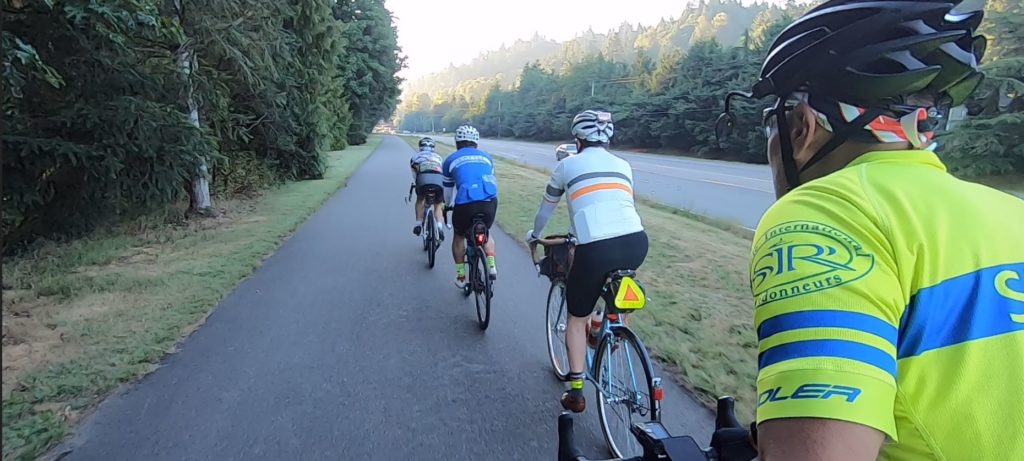
Just after sunrise, four volunteers enthusiastically gathered at the start as shown in the photo below. For the pre-ride, the weather forecast promised sunny and warm weather, 84°F (28.8°C) in Seattle, in contrast to the cooler and rainy weather in early July. However, if we look a bit rigid and uptight in the photo, maybe that’s because we were awakened by 44°F (6.66°C) summer morning air. The Cedar River Valley is one of those places where the cool air seems to sink in and hang about. One of the volunteers wished he’d brought his base layer and arm warmers. [Ed’s note: No prize for guessing.]

Our intrepid pre-riders: Kelly White, Jun Tay, John D Nguyen, Mitch Ishihara

After navigating under and around gates through Cedar River Park, and a few minutes of searching around for the Cedar River Trail, we headed toward Maple Valley. A light morning dew greeted us before any mountain views.

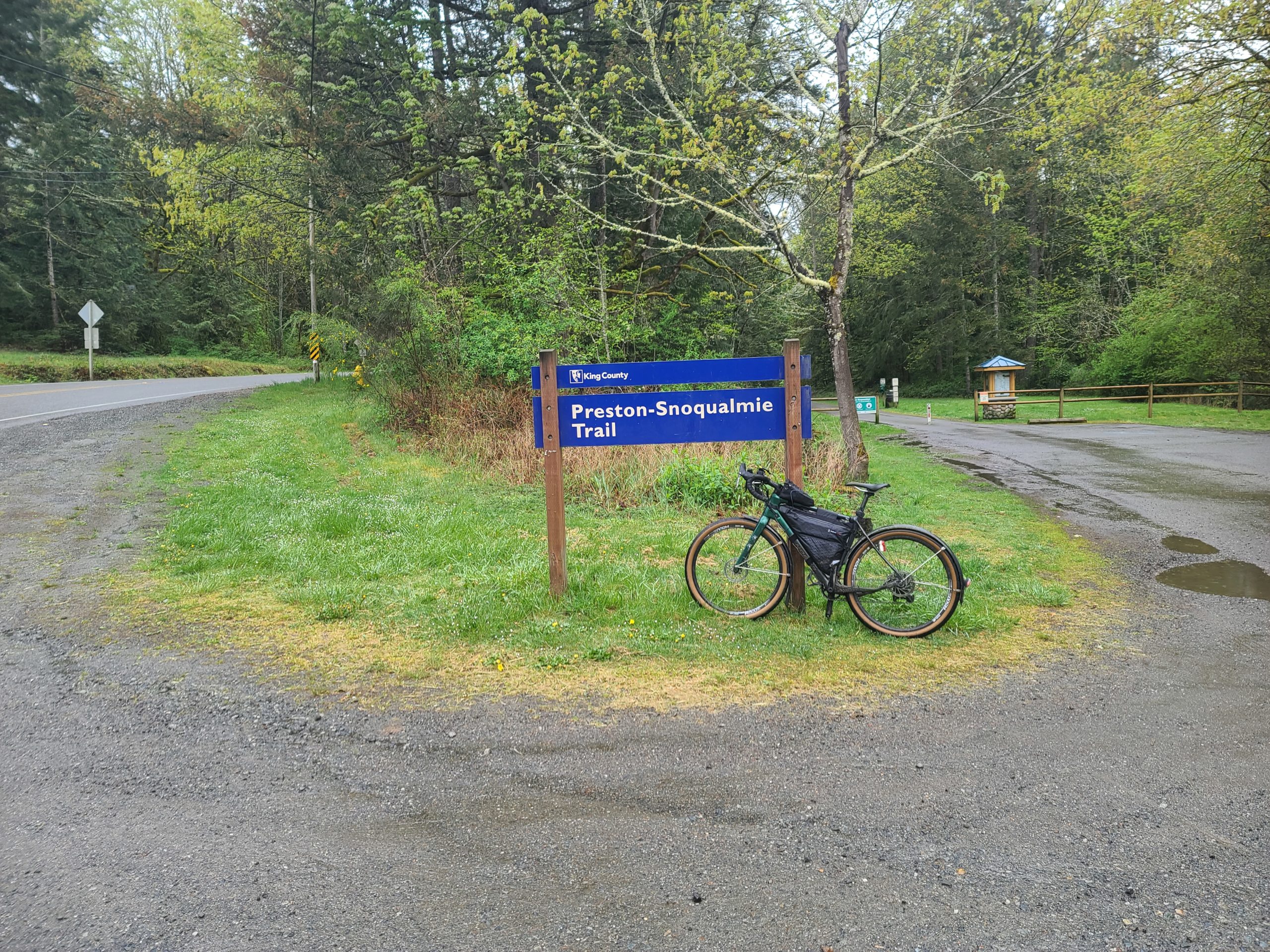
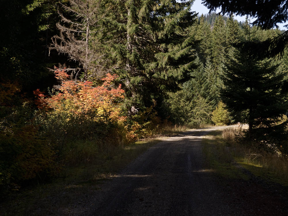
The nice and pleasant, cool summer morning air warmed up a few degrees before we turned right, uphill, and the paved trail gave way to 3.3 miles of compact dirt and gravel along Lake Wilderness. At the end of the gravel trail, and after a couple turns, we traveled another small stretch of loose gravel prior to a right turn onto WA-169 S/Maple Valley Black Diamond Rd SE (at mile point 15.2). That about concludes the gravel for this brevet!

Maple Valley to Black Diamond to Enumclaw

Proceeding to Enumclaw, elevation gain trends up imperceptibly with one dip and subsequent climb crossing over the Green River Gorge. We noted several SIR-grade food services found along the stretch of WA-169 for those in need—like Jun and Kelly, who made a quick bathroom/food stop at McDonald’s where they were surprised by the nicest bathroom they have seen on any brevet—otherwise we kept moving.

That is, until we spotted this almost perfectly lined up view of Mt. Rainier:

Followed by this…

“Views of the massive and glorious hulk of Mt Rainier will inspire you as you work your way south in the cool of the morning.”—Kelly

Enumclaw to Greenwater

After turning left onto Griffin Avenue in Enumclaw (at mile point 26.2), we noted a few food services were open near the intersection of Griffin Avenue and Roosevelt Avenue (WA-410) such as 76 station, Safeway and McDonald’s.

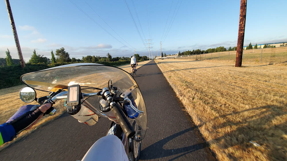
After turning left on WA-410, not a cloud in sight could be seen, as shown in the background of the photo below. We didn’t stop to check out Enumclaw Ski & Mountain Sports (bicycle gear?) in the foreground since it was not open yet.


As you leave Enumclaw, a highway sign shows 40 miles to Cayuse pass, the first of two big hills of the day. Over the next 18 miles, we climbed from an elevation of 760 feet to 1,700 feet (+1,360 feet / -420 feet), working our way up to Cayuse Pass. We all regrouped at the Greenwater Control where we practiced PBP control skills: A brief stop to get the brevet cards signed, then refuel, bathroom break, back on the road.


A few hundred yards ahead of the general store is Greenwater Outfitters Café and Snowboard Shop, a tempting control option for those who love coffee and prefer warm food to refrigerated sandwiches. We didn’t stop to check the place out—we were practicing quick controls—though looking at their menu now (https://www.greenwateroutfitters.net/deli), maybe we should have.

Leaving Greenwater, we looked forward to getting to the summit of Cayuse pass before the heat of the day really kicked in. Depending on the temperature forecast for the brevet, consider bringing along a 3rd water bottle, as the next full services won’t be until Packwood, 46 miles and quite some climbing away.

For those keeping your total elevation for the day, the gain thus far is probably 2,700 feet.

Greenwater to Gilford Pinchot National Forest/Cayuse Pass to Packwood

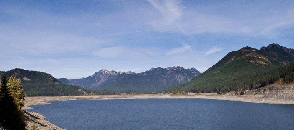
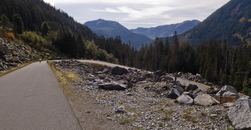
It is 46.5 miles between Greenwater and Packwood. This includes a 23 mile climb up to Cayuse Pass (+3,150 feet / -150 feet), including a 17 mile stretch of 1.4% average grade up to about the entrance of Mt. Rainier National Park at mile 59.5. For the next 10 miles be prepared for real climbing a 5.4% average grade and sections up to 7%. Traffic was unpleasantly heavy; fortunately, speeds are low and drivers mostly polite. On the right there will be a couple of breathtaking views of Mt. Rainier, stop to take some pictures, catch your breath and hydrate.

With the heat of the day kicking in—it would eventually rise to at least 98.6°F (37°C)—Kelly finished his water at the summit of Cayuse Pass. Jun Tay will staff a secret control here, and water and sodas will be provided to keep you well-hydrated. Leaving the summit with water bottles refilled, you’ll be pleased to note that the majority of the traffic continues on Highway 410 to Yakima while you will continue to the right on 123.

Stay right and enjoy the descent toward Packwood

You now have a 22-mile descent (mostly descending) to Packwood to enjoy. The first 10 miles is your big reward for the climb: a screaming descent where the main exercise will be for your forearm muscles from feathering your brakes. [Ed’s note: If you’re braking too much, try sitting up to catch more wind; it’ll slow you down some and help to spare your rims or rotors.] Enjoy it, but do remain attentive and cautious as cars will be moving quickly and there can be strong crosswinds.

The sunny approach to Packwood

Highway 123 joins highway 12 at mile 84. With 7 sunny miles to go to Packwood and services, Kelly suddenly noticed that his throat was dry and he was very thirsty. The heat of the day was really kicking in and while still descending, the 7 miles took some effort. What a relief to arrive at the Packwood Tatoosh Food Mart, air conditioning and ice cream bars! The temperature turned out to be 94°F (34°C)—and likely hotter on the pavement. Anyway, please top up your water bottles and get ready to work those ice cream calories off.

Packwood to Ashford to Elbe to Pack Forest

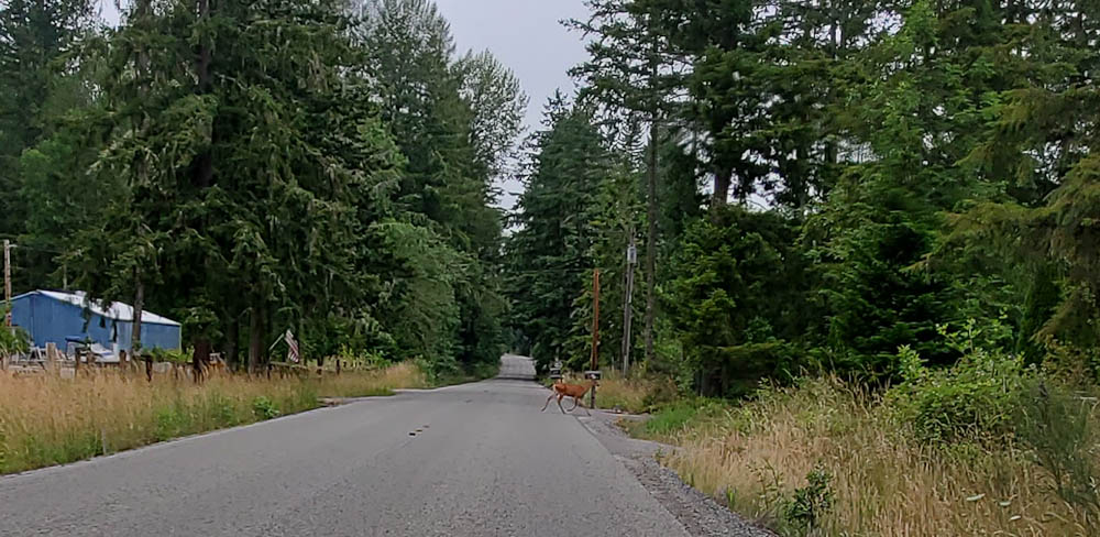
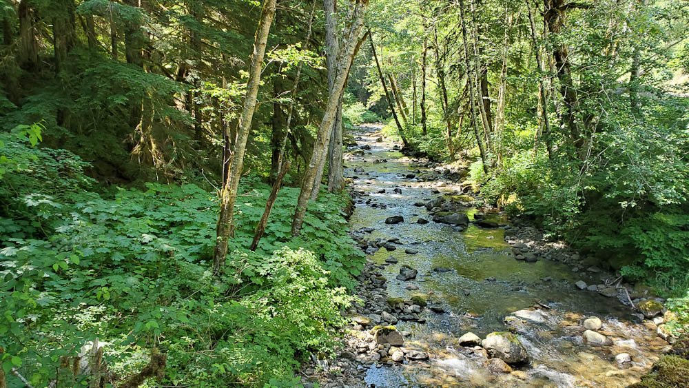
Cooled off, refueled and rehydrated, with sun sleeves and hats soaked with cold water, we set off on the 2nd big hill and last major challenge of the day: Skate Creek Road. This is the same route that was part of the Tahuya Hills 600k in June, but in the opposite direction. Thinking of that ride, we fondly recall descending Skate Creek road with its twists and turns. Ascending it, however, presented a different pleasure: climbing Skate Creek Road is among the prettiest rides we have enjoyed. A beautiful boulder strewn creek and shade, lots of shade. Given the heat of the day, that in and of itself made the climb.

From the top of Skate Creek, we made our way to Ashford, home to Mt Rainier climbing expeditions, where we settled in for a civilized meal of pizza, and for Kelly, a chicken sandwich with bacon and Swiss cheese on a gluten free bun (unheard of on a Rando ride!), all at the Base Camp Grill. From there it was mostly paceline work with John and Mitch doing the lion’s share of the effort. We made good time in spite of some significant headwinds.

Rando gourmet

As you arrive in Elbe, be extra careful getting thru a couple of bad railroad tracks depending when you get there. There was still plenty of daylight for us to watch out for those bad spots.

Orting to Renton

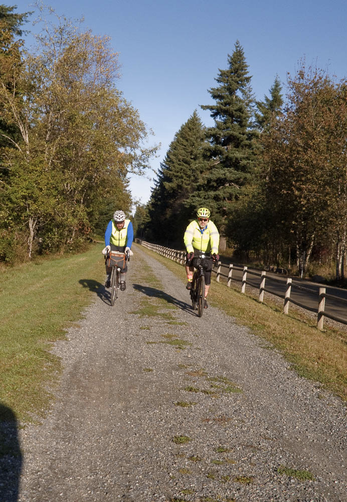
At this point, the pre-ride felt fairly uneventful with mostly small rollers as the climbing is pretty much done after about mile 150 (240km). The remainder of the ride included a surprising amount of bike trail, the highlight of which was the newer Foothills Trail connecting Orting to Puyllup. From Puyllup to Sumner, you’ll ride the Sumner Link Trail (plus a few roads).

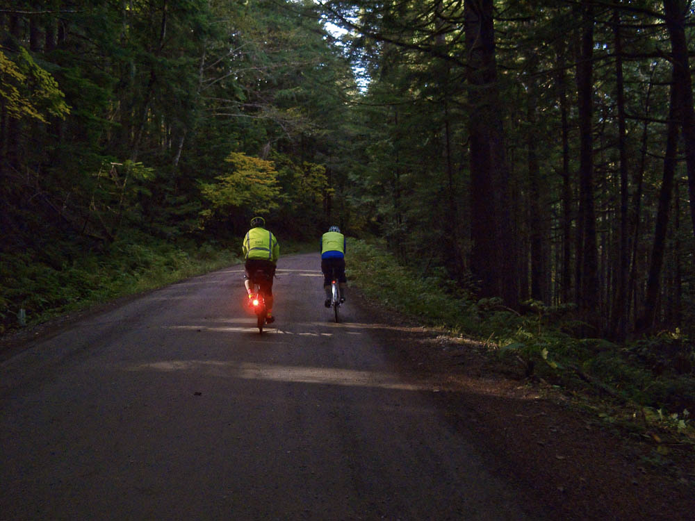
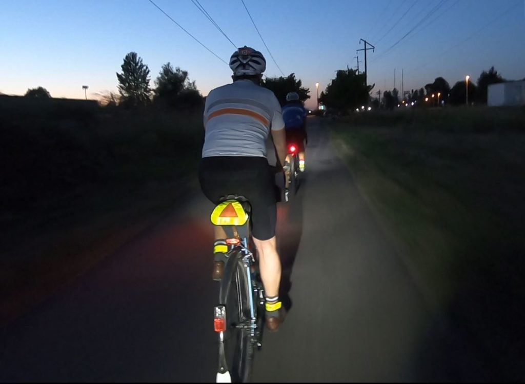
Sunset over bike trail

And from Sumner to Tukwila, you can sit back and enjoy your ride to (very nearly) the finish via the famous Interurban trail. [Ed’s note: There’s an annoying detour in Kent as a section of the Interurban is closed until some time in 2020. But follow your cue sheet (or GPS) and you’ll be back on the quiet trail in no time.]

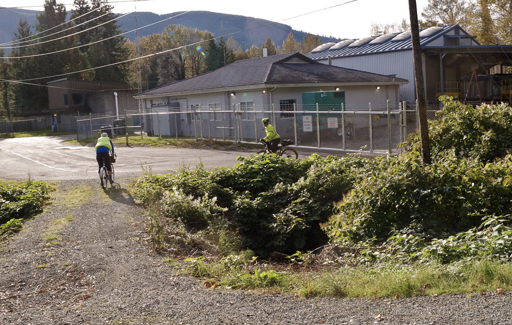
Doing the Interurban

From Tukwila back to Renton is just a few miles, including a return to Cedar River Park and those gates from the start. We rolled into Shari’s happy but beat from the heat. Tired but exhilarated. We’d say that is a perfect way to end a long day on the bike.

We will see you at the start this Saturday and wish you the best of luck and a safe ride!

Preregistration and route details on the SIR website: https://www.seattlerando.org/

Comments Off on 2019 Tune-Up 300 Pre-Ride Report

Filed under Pre Rides

PBP Tune-Up 200 Pre-Ride Report

by Mike McHale

Come join us for the PBP Tune-Up 200. The ride will start and end in the parking lot between Shari’s restaurant and the Quality Inn in Renton which were selected to dovetail with the Tune-Up 300 (Saturday, July 27).

The ride will start at 7:00 AM. Check in will open at 6:30. Please note that check in will close at 7:30 AM.

Since this is a PBP Tune-Up ride, anciens strongly recommend practicing an efficient ride (brief control stops) with a goal of finishing under 10 hours.

The course is a northern loop on familiar roads and trails—some of which we will ride in less familiar directions. For the pre-ride, we parked at the Cedar River Park which is across from (and a little bit south of) Shari’s. However, signage indicates that there is a six-hour time limit. The City of Renton Cedar River Trail website notes the following parking locations:

Parking is available at Cedar River Trail Park, Renton Stadium, Renton Senior Activity Center, Liberty Park, Cedar River Park, Riverview Park, Maplewood Roadside Park, Ron Regis Park and at Landsburg.

Update: We recommend you do not park at the Cedar River trail head.

The course goes from Renton to Lake Roesiger via Issaquah and the Snoqualmie Valley, and back around the north end of Lake Washington with a few new roads tossed in to keep riders on their toes.

As you climb Honda Hill (SE 36th), pay particular attention to the turn off to Newport Way as this may not be how you normally go and there is an info control. After the Carnation Control (Sandy’s) we head up the valley to Monroe—taking the Tualco road detour along the way. Wood Creek Road leaving Monroe was the busiest stretch of the day, fortunately, we exit Wood Creek onto Yeager and then Bollenbaugh Hill Road. Despite pre-ride grumbling about the steep pitch early on Bollenbaugh Hill, pre-riders agreed it was much quieter. We then go around the south/east side of Lake Roesiger to the next control at the store where most of the pre-riders ate ice cream bars. After pre-riders got done cursing at the ride organizer for making the group climb out of the control, we made a left on N Carpenter Road which made for a wickedly fun ride back to Machias. From Machias, it was very familiar roads and trails back around the north end of Lake Washington to Renton. There are a few non-perpendicular tracks to watch out for and remember to pay attention to the “cross traffic does not stop” sign as you approach SR 522.

We had good weather on the pre-ride and hopefully took one for the team as we waited for a Boeing parts train in Snohomish and the draw bridge in Montlake. Please note this is not a fast course and we will be sharing the trail with children, dogs, and inexperienced riders. Please observe the speed limit and keep a smile on your face as you navigate your way back.

There are store controls at miles 32 and 65, but plenty of places to forage along or very close to the route. Specifically, stores are located in Issaquah, Monroe, Snohomish, Maltby, Woodinville, and Lake Forest Park (off route slightly). There are also parks with flush toilets and water in Renton, Bellevue, Monroe (if open), Machias, Snohomish, Log Boom Park and Seward Park.

Preregistration and route details on the SIR website.

Comments Off on PBP Tune-Up 200 Pre-Ride Report

Filed under Pre Rides

2019 Border To Border Pre-Ride Report

by Kevin Smith

On paper, the climbing elevation to total distance indicates this ride is ‘a bit less challenging’ than previous SIR brevets this year.  Don’t let that fool you, because the route orientation means you are bound to face either north or south winds for a long time.  Make friends, ride together, share the effort.

The ride begins with a lovely roll from Tumwater out to Rainier, Wash. At one point, you’ll go through what I assume is an old artillery or training range as evidenced by the large white signs saying Don’t Enter, Don’t Dig, etc.  You won’t really want to stroll off the road anyway, since its so nice and quiet, but I envision a scarred landscape at some point in the past, where troops were training for war.  It looked how I’d expect the Forest of Arenberg might look when young troops, tanks commanders, and artillery teams were getting ready for their most heroic effort.  Now you are facing your own kind of heroic effort.

There will be some road items to pay attention between Rainier and Spanaway. First, multiple railroad crossings at horrible angles.  Take your time, slow down–stop even–find large breaks in traffic, and make sure you use the whole road to cross these tracks at 90 degrees.  Don’t end your fun early by catching a wheel in these things. Second: Highway 507. It’s been a few years since I was on 507.  I recall rather crappy road conditions, grit and gravel on the shoulder, and trucks zooming past, too close, at 70 mph.  Well, the road surface got upgraded with fresh pavement and wider shoulders—that’s a plus because you’ll want the space from the drivers.  Beware grooves in the pavement where they installed recessed road reflectors.  They looked like ugly front wheel traps.  Word of warning for folks riding through in a group: Leader, pick a line clear of these grooves; Followers, don’t stray from the wheel ahead, else you might wander into one of the grooves and, next thing you know, you’ll be performing an up-close inspection of that nice new pavement.

At the Rivers Edge info control, give them a stop and get a macchiato or something. Hot items will take longer than expected based on my stop–but I entered behind a family of 5.  #randoluck I let them know another group of crazies will roll through this coming Friday–she said she’ll look for us. She thought I was completely nuts when I said I was going to the Canadian border that day and asked if I was “really okay.”

Depending upon the wind direction, you’ll feel either superhuman or super sluggish riding the section from Rivers Edge to UW. If you get the south wind, enjoy, but save some energy for the coming miles. If you get the north wind, well, make friends fast and buckle up—it’s going to be a long day.

Can’t say much about getting to Snohomish and riding through Marysville: If you’ve done a lot of SIR rides you know the route. I was dealing with my own set of challenges with a broken spoke and an (unrelated) flat, so I basically have blacked this section out of my memory.

#thankyoufiberfix

You’ll enjoy some nice gentle climbing through the Lake Goodwin area and a decent to the Warm Beach control. I asked to use the bathroom but was denied; not sure if you might have the same fate, but factor that in.

From Conway to Bellingham: First, deal with the inevitable wind that always exists in this flat region. If the winds are light, you should make some good time in the flat terrain. I always enjoy the view of Chuckanut looming in the distance; it looked particularly menacing during my ride. That said, I always enjoy the hills and curvy descents along Chuckanut, Depending on your pace, you might enjoy nice dusk light while riding this area—and its fantastic views. Among my favorite areas of Washington.

Chuckanut looms in the distance

The route through Bellingham brings you onto a waterfront trail and off the road. There is a Woods Coffee shop in Boulevard Park. It might look closed, but if you need some coffee for the upcoming night riding, stop—the views of the Bellingham Bay are wonderful. I liked that the route did not pass the overnight hotel too closely—otherwise one might be tempted to stop, sleep and get the Canadian Border a little later. But keep moving. The roads up to the border are relatively flat and you should make good time. [Editor’s note: Seriously, don’t sleep on the way to the border. Read the pre-ride report from 2018 if you have doubts.]

Be aware of random large trucks traveling around Lynden. It’s Friday night, dark. Stay together or buddy up if you can.  If you’re fast enough to do this in daylight or had a massive tail wind all day, kudos! Get some extra sleep!

Boundary Rd!!! Yeah, you made it to the Canadian border! No joke, at this point my Spotify playlist played Fly by Night by Rush, How did it know??? Say Hello to the border patrols who cruise the road network up there looking for people doing weird things at odd hours of the night dressed in strange clothes.

For those stopping at the overnight, enjoy the hotel in Bellingham for a few hours, get some food, sleep, and prepare for another long day.

Leaving Bellingham, you’ll enjoy a quiet morning ride along the south shore of Lake Whatcom, soaking in the morning light. The climb up to the lake and subsequent rollers will certainly wake up your morning legs. There are services at the Sudden Valley info control, and it’s a nice spot for a coffee and morning snack if you want.

Farther along, on Old Highway 99, the bridge over Friday Creek, just north of Belfast, was under construction during the pre-ride so a route detour has been made. The construction crew let me walk through when I explained what I was up to and they suggested a route change to Parson Creek Road and Prarie Road a few miles to the east, which is what you will ride. Riding from Bryant to Snohomish and Issaquah should be uneventful for those who know these roads well. Anyone new to this region will experience some of our most scenic valley riding and the no-traffic Centennial Trail.

Maybe it was me, but the section from Issaquah to Spanaway felt like the hardest section of the course. Endless long climbs with steeper grades than what you’ve experienced on the ride thus far. Get some food and drink in Issaquah and keep your energy levels up since it might be a long night.

The trail from Buckley to Orting is a regional gem and you will experience a tranquil ride and respite from the day’s road traffic. Thank you taxpayers and the leaders of Pierce County for converting this old railbed to a magic carpet ride through the forest along the Carbon River. During my ride, there was a significant bug hatch and I was glad I brought my clear riding glasses to deflect the bugs from my eyes. Riding through these bugs without glasses would have been very annoying, so plan accordingly. If you need a ditch nap, there are many great spots along the Carbon River.

At this point, getting from Orting back to Tumwater for my overnight seemed like an impossible task. But I remembered someone’s advice earlier in the riding season to not think about the remaining distance and just focus on the present. So refuel, make sure your bike is right and your lights are in good shape. Leaving Orting requires a challenging climb up South Hill on Orting Kapowsin Hwy E. The grade is steep, there are some tight turns, plus the road shoulder is unsettlingly narrow. Add some Saturday night road traffic zooming up the hill, and you’ve got a potentially hazardous environment. I’d look to group up and leave Orting together if you can.

The Spanaway-to-Tumwater section will have you return to roads you traveled a day earlier and will help give you some motivation that your getting close to your overnight. I made a coffee stop at the Denny’s on the Hwy 7/Mountain Highway to perk up. It’s a good reference point for the turn you need to make into the Twin Firs Mobile Estates trailer park anyway. I had to pause and check the route to figure out if riding through the trailer park made sense and it does help get you away from higher traffic intersections in Spanaway and puts you back on Highway 507. I was expecting more traffic on Highway 507, but was pleasantly surprised; hopefully you get the same conditions. Entering Rainier again will help you “smell the barn” and keep moving onto Tumwater. You’re close!

Now you have a lovely Sunday ride left. The bigger mile and climbing days are behind you. So, roll out of Tumwater with a smile—you got this! Grab an apple fritter or bear claw at the control in Chehalis Village. Who said “Don’t quit until you’ve had an apple fritter” during the SIR meeting about PBP earlier this year?  Well – thanks for that comment because I went for the apple fritter and was not going to quit, it definitely worked. [Editor’s note: Sounds like Ron Himschoot.]

Then came Curtis Hill Rd southwest of Centralia (813 km). I had a decent headwind out of the south sapping my energy and a wobbling rear wheel being held together with FiberFix, so I decided to swallow my pride and walk the hill to avoid further damage to the wheel.  In the process of pulling over, a second spoke broke on the rear wheel!  I said some things I was not proud of, but which were appropriate for the moment. Well, I wanted to try randonneuring this year and this is part of the deal. Figure it out and get yourself in. I wish you all good luck riding that hill.

Approaching the Boistfort Store Control in Curtis, I had to wonder where the store might be because there is not much there, but it’s a little oasis of sustenance in a beautiful rural rolling terrain. There was, however, no bathroom.

At the Longview Control, get ready for the payoff if you’ve been battling a headwind to this point. If you’ve had a tail wind to this point, I hope you have saved some energy! There is not much to say about the Safeway in Longview—just get there, turn around, and go home!

Longview to Toledo and Chehalis. I’ve never ridden this road before but have seen it many times driving on I-5. Although you’re near the highway, the road has very low traffic and is extremely nice. You’ll notice many spots where they cut I-5 through hills that you must traverse up and down. It was a little torturous the see a flat grade off to the left while struggling up a hill. Services are available in Castle Rock (908 km), Toledo (932 km), and Centralia (970 km) to keep you fueled. Or if you need a place the nap.  Another nice nap spot could be Lewis and Clark State Park at 940 km (there is water, but no food available—unless you bum food from one of the campers).

At the Tenino Control (990 km), you will hopefully feel the energy come back as you know the finish is near. There are services at the 76 gas station info control if needed.

There is always one last hill! After Teninom you’ll need to climb Chein Hill. Not the hardest on the route, but a sting in the tail no less. I had some choice words for the route designer at this point. [Editor’s note: It was Ian Shopland! Don’t blame me!] But it will soon pass and hopefully you’ll fly into the finish.

Tumwater! Congratulate yourself and everyone else who made it in. If you’re using this as a PBP-prep ride like I was, hopefully it goes well, and you gain some confidence that you’re ready for France. I hope everyone has a safe and successful ride this weekend.

Comments Off on 2019 Border To Border Pre-Ride Report

Filed under Pre Rides, SIR Rides

2019 Chuckamano 400 and 600K Pre-Ride Reports

Pre-riders Thai and Ray

by Ray, Hugh, John, Rachel and Theo

Note: The 6/29/2019 Last Chance 400K and 600K follow the same routes described here.

Magnificent views a little gravel and a lot of hills? We’ve got all that and more in these returns to the wonderful 2017 Chuckamano Views 400K route from 2017. We’ve also added a 200K extension to the Middle Fork Snoqualmie River to create a 600K brevet option. The original report covers most of what you’ll want to know for the first 400K, but in this report we’ll provide a few updates as well as information about the 200K extension.

Leaving the Bear Creek Park and Ride on Sunday morning, Rachel and Theo were surprised to find themselves shivering in the mist, trying to warm up on the first few hills. So much for Epic Ride Weather, an app Theo has recently become obsessed with! Though, in truth, its promises of headwinds for the first 200K of their 400K pre-ride would bear out all too accurately. On the upside, the cold, inverted weather held a beautiful layer of cloud in valley trees, making for a lovely view looking down from Broadway rolling toward Snohomish.  But let this be a reminder: Bring a warm layer as it could be cold at the start and again on the way back to Redmond via the Centennial trail, even if daytime temperatures are forecast to be nice and hot.

Edison Slough

This theme of beauty along the route was a constant for all six pre-riders—and they’re confident that you’ll experience the same. Hugh remarked on the striking flowers, everywhere along the course: California poppies, buttercups, fox glove, daises, and a lot more. He also had this to say about the stiff climb out of Fairhaven: “I enjoyed the climb out of Fairhaven. It was on a small road with many turns and well-kept properties. It reminded me of roads in France.” Whether you have the presence of mind to imagine the roads of the South of France, where the ACP Super Randonneur 600K challenge was born, or not will, depend on your gearing. Bring something low enough that you can settle into a steady spin, or be prepared to stand up and go! (Perhaps easier said than done if one fills up on too much pizza and beer at the open control in Fairhaven.)

Lake Whatcom

From Fairhaven, the routes diverge from the 2017 original and skips Deming altogether. Instead, you’ll ride along Lake Whatcom through the incredibly striking Sudden Valley. Here, preriders saw many deer, experienced a bit of car traffic (likely dependant on time of day), and wondered what it would cost to move into one of the triple-size homes along the gorgeous lake and take up watersports… but they kept pedaling anyway.

Eventually, the winding roads of Sudden Valley meet Highway 9. 600K riders will turn right, riding south toward Sedro Woolley. 400K riders will turn left, riding north to an info control in Acme before turning around to catch up with the 600K riders. For this next section of the rote, whichever distance you’ve chosen, you’ll be on the narrow-to-nonexistent shoulder of the highway and it pays to remain attentive and cautious throughout. Traffic here seems to vary widely by time of day. Hugh specifically mentioned that this section was good. Rachel and Theo were passed by car after car, including a semi-trailer truck which zoomed by much too close, clearly in excess of the speed limit, and nearly hit an oncoming car. Theo rode most of these miles looking over his shoulder. Perhaps a rearview mirror would be advisable. In any case, please be attentive as you ride and be sure to stop and don your reflective gear (vest and ankle bands) and turn on your lights as the day wears on and grows dark.

Both routes return to Redmond via the Centennial Trail (Arlington to Snohomish) and short section of the Sammamish and Marymoor Connector Trails. A welcome respite from car traffic and stop lights, these trails can have a somnolent effect on some riders (looking at you, Theo). But don’t sleep on your bike! Stay alert and on the watch for the many bollards along the way—there are even a few without reflective tape—we don’t want you to hit them. You can, however, sleep at the Redmond Inn, where 600K riders will have their overnight control and 400K riders are encouraged to have a bite to eat and close their eyes for at least a few minutes before attempting to drive home. Better yet, book a room and get several hours of sleep. Driving home after a 400K may seem reasonable when you’re full of energy from the excitement of finishing, but it can be very unsafe as your body will be very tired.

Views from the Middle Fork

Day 2 finds our tired but determined 600K riders warming their way up Union Hill before dropping down into the cool fog of the Snoqualmie Valley. After a quick stop in Carnation for some hot coffee, there’s a nice section of hard-packed gravel to get you ready for the crown jewel of the day—the Middle Fork of the Snoqualmie River. The newer asphalt rolls like butter as you take in the views of the river, mountains and forests. If you’re tuckered out at the end of the road near the campground, don’t despair as it’s mostly a nice downhill cruise all the way back to North Bend.

The return back to Snoqualmie features some smooth-rolling gravel. It’s a bit of a climb up to Snoqualmie Ridge, but the steep, flowing descent down Lake Alice Road makes it all seem worthwhile. Don’t get too complacent though, as the climb up the Preston–Fall City Road reminds you that gravity is king! From there, it’s a nice cruise on the mostly shaded Issaquah-Preston gravel trail.

The stretch from Issaquah to Black Diamond is your typical highly-trafficked Sunday bike ride. From the southern terminus of the route, it’s a quick jaunt up WA-169 before more gravel along the ever-pleasing Lake Wilderness. The miles flow quickly on the Cedar River Trail into Renton as you ride mostly downhill like a salmon on its journey to the ocean. The section through Renton is not the typical SIR route, so pay close attention to the cues as you near end of the trail: Instead of exiting onto Mill Avenue and crossing over Houser Way you will take a right turn on the bridge across the Cedar River, hang a quick left and then a sharp right onto Houser Way. Use caution as traffic can be moving quickly on Houser and you’ll need to quickly move 3 lanes to the left to be set up to go straight onto Factory Avenue at the traffic signal.

From there, it’s your typical cruise up Lake Washington Boulevard. Make sure you REALLY DO STOP at all those stop signs, now with additional verbiage spelling it out. No good SIR ride can end without some hills and, yes, there are a few as you make your way onto the I-90 bike trail, through the neighborhood streets and back to the finish at the Redmond Inn.

Additional ride details, RWGPS links and preregistration available on seattlerando.org

Comments Off on 2019 Chuckamano 400 and 600K Pre-Ride Reports

Filed under Pre Rides, SIR Rides

2019 Makeup 200K

Whidbey Island Views & Hills Pre-ride Report

By Mitch Ishihara, Adam Glass, and John Nguyen

Reviving our islands and views theme from previous years1, we bring you scenic vistas on Whidbey Island with the added bonus of sufficiently steep and copious hills compressed into 202K (7900 feet elevation). Whidbey Island’s back roads also offer an escape from (un)civilization showcasing mouth watering baked goods, boutique coffee, plenty of real food options, and of course refreshing beer options at the finish. We reshaped SIR’s RUSA Permanent 998 Whidbey Coast, giving it a trim to down to 202 km and a detour away from the automobile-congested Deception Pass. For those who’ve never been to Whidbey Island, we think you’ll discover why tourists are attracted to it after a sampling on this ride.

Parking

Depending on if you intend to be on the island with a car or ride your bike onto the ferry instead, there are a few common options. Mukilteo has various park and ride locations located along I-5 which is a fair distance from the ferry terminal. Various signed 4-hour street parking spots are located near the ferry terminal up the hill along 3rd, 4th, and 5th Street. These are rumored to be unenforced on the weekend; use at your own risk. Your volunteers took a calculated risk. Also beware of automated speeding cameras on Mukilteo Speedway heading down to the ferry. Of course you can consider giving the city of Mukilteo a modest non-tax-deductible donation.

As for Clinton, it has a park and ride conveniently located near the finish: SR 525 at Clinton P&R.

Departing Mukilteo

After paying the $6.10 fare each at the toll booth, John and Mitch proceeded ‘like regulars’ to the passenger loading zone on the left side of the ferry dock and waited. A morning chat with the friendly ferry attendant ensued as we described our upcoming bike ride on the island – a common destination for cyclists. We scanned our paper tickets and walked our bikes aboard the 7:00 AM ferry sailing. Once on the ferry, you’re allowed to ride the bike to the front to secure your bike to one of the many yellow ropes for bicycles. For those who happen to arrive at the ferry after the cars begin loading, you’ll be boarded last with your bikes at the back of the boat in addition to being last off the boat in Clinton. As an aside, there is an option to pre-purchase your ferry ticket but it is mostly used by folks with an automobile.

Arriving Clinton

The crossing is a quick 15 minutes! Make use of the facilities expeditiously as there is limited restroom capacity at the start. After scouting out a location to process registration on the ferry, we decided we’ll be hanging out on the bow, port side of the ferry. Given the current weather forecast, you may be greeted with this welcoming view below. We disembarked the ferry around 7:15 AM.

Whidbey Island Bagel Factory – Start Contrôle

Finding an open business early on Sunday morning for a manned start location proved a small challenge. A short 2.7 mile and 450 feet ride up WA-525 gets us to an open complex apparently popular with the locals. Barring a misfortune, this stretch should take about 15-20 minutes, in plenty of time for an 8:00 AM start. We arrived at 7:30 AM.

Of course, once Mitch found Whidbey Island Bagel Factory, it was on the list of candidates to verify for the pre-ride. The peanut gallery couldn’t resist commenting on bagels and how many a certain volunteer rider would consume that day. After taking a bite, the commentary shifted to, “these are pretty good bagels.” Good enough for a New Yorker!


We were a little disoriented leaving Ken’s Korner Shopping Center heading to the loading zone behind the complex. We’ll get you going in the right direction for the Brevet – head south near the Les Schwab Tire Center. We then turned left onto Surface Road which is a one mile descent down to Bob Galbreath Road.

The Views & Hills

Freeland Park @ mile 19

Freeland Park on the right offers public restrooms for those who need it. For those who don’t, you can enjoy the view while waiting for your riding buddies. Or you can zoom on by covering ground while the clock is ticking.

Honeymoon Bay Road @ mile 20.4

An eastern view of Holmes Harbor down Bercot Road on Honeymoon Bay Road with the Snohomish convergence zone (clouds) in the distance.

Resort Road @ mile 24

The hills, where do we start with this? They are relentless repeats oscillating somewhere between sea level and about 400 feet as the course hugs the coastline of Whidbey Island (hence the original Whidbey Coast permanent). One volunteer brought their fresh legs to this ride while another went all out the day before.

WA-525/WA-20

There are portions of this route which require traveling on WA-525 or WA-20 – the main highway down the middle of Whidbey Island. Ride well on the shoulder at all times on these stretches in single file.

Greenbank Farm @ mile 27

Looking to your left around mile 27, Greenbank Farm shines in the morning sun. Unfortunately they do not open until 10 AM. You can only dream of eating scrumptious fresh baked pies from here for another time. Heads down, we continued on.

Houston Road @ mile 31.4

After you’ve scribbled your info control answer, take a peek at the Olympic Mountains in the distance.

Coupeville @ mile 41.5

About ⅓ of the ride done for the day, we arrived in Coupeville ready to gobble down a few fresh baked goods. We needed the calories later in the day for sure.

Knead & Feed Restaurant

4 Front St NW, Coupeville, WA 98239

https://goo.gl/maps/nXABiepHvuAM4Y4U8

The peach pie features a perfectly flakey crust with an exterior crunch. The peaches are firm and sweet. You may see the volunteers hanging out here the day of the ride too! We promise to try to not eat all of the goods before you arrive.


Note that there are public restrooms on Alexander Street on the side of the Coupeville Chamber of Commerce building.

View of Penn Cove @ mile 45

Oak Harbor @ mile 52

By the time we made it to Oak Harbor, the island life awakened with a hustle and bustle. We rode the permanent on April 27th, greeted by a parade and street fair on Pioneer Way. For the May 26th pre-ride, we encountered light traffic. There are plenty of services options in Oak Harbor, as well as Skagit Cycle Center (but it is closed on Sunday).

Descent down Monkey Hill Road @ mile 64.4

What goes up must come down. This is one of the many descents to enjoy on the island. Be safe!

Cornet Bay @ mile 66.5

For the brevet, we rerouted to Cornet Bay instead of Deception Pass Bridge to avoid heavy automobile traffic near the bridge. Cornet Bay features panoramic views in an open setting. Boat tours of Deception Pass are available, though we didn’t take time to do the hour long tour while on the pre-ride.

For the Makeup 200 Brevet, we reserved the picnic shelter below for a SIR manned food stop and contrôle. There’s running water conveniently located nearby.

After finishing our scouting of the location, we left Cornet Bay with about an hour in the bank, returning on Cornet Bay Road back to WA-20. The route continues on WA-20 for 6 miles where we banked some time. The shoulders are wide.

Ault Field Road @ mile 74.1

Swantown @ mile 80

After scribbling down the info control answer we captured some photos on West Beach Road.

A bit further down the road on the right we stopped at West Beach County Park to enjoy the views of Puget Sound.

Callen’s in Coupeville (Fort Casey/Keystone) @ mile 93.6

At about the ¾ mark on the Brevet just past the Coupeville-Port Townsend ferry terminal, there’s a nice restaurant and market, Callen’s Restaurant and Co. The right side features the restaurant. The left side features a market with coffee, drinks, and water. Callen’s is open Sunday 8:00 AM – 8:00 PM. We stopped here for an early dinner.

Cozy’s Roadhouse Finish

We made it to the finish at 6:32 PM with 3 hours in the bank.

Heading back to Mukilteo

There are plenty of ferry sailings to return to Mukilteo departing approximately every half-hour until 12:30 AM.

Schedule: Mukilteo/Clinton

Summary

This is a pretty but hilly 202 km with about 8000 feet of climbing on mostly quiet roads to be completed in the 200K ACP Brevet maximum time of 13.5 hours. We’ve modified the brevet route slightly from the permanent route. Searching the SIR permanent inventory, 998 Whidbey Coast permanent is in the top 10 most climbing for a SIR 200K. The winner is of course 517 The Alps permanent at 9900 feet of climbing over 202 km.

Weather Forecast

The weather forecast for Sunday June 9, 2019 is looking fantastic!


Pre-registrations

Help the organizers by pre-registering for this brevet here:

https://www.seattlerando.org/content.aspx?page_id=4002&club_id=928629&item_id=896680


  1. 2017 Chuckacamano Views 400K, 2016 Island Views 300K (Camano Island and north Whidbey Island), 2015 Bainbridge Island – Port Townsend Easter 200K

Comments Off on 2019 Makeup 200K

Filed under Brevets, SIR Rides