Author Archives: Theo Roffe

About Theo Roffe

SIR Newsletter/Blog Editor RUSA 5988

R5000 1000K Pre-ride Report – September 14, 2019

by John Pearch


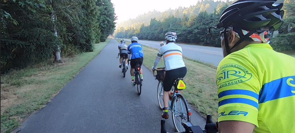
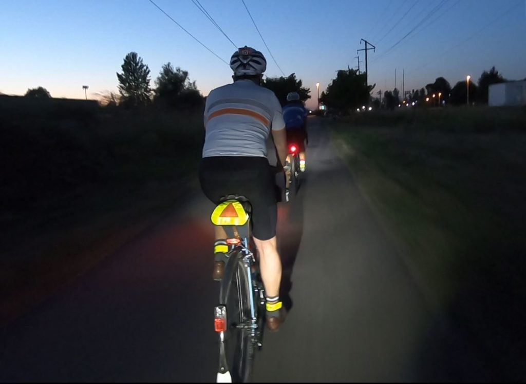
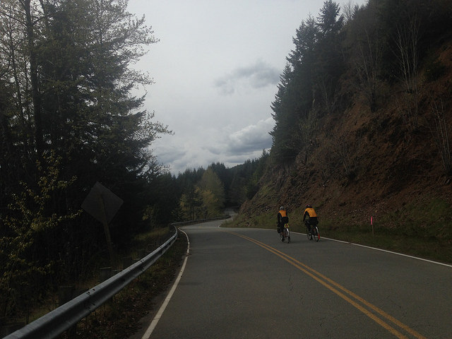
No 1000k is easy, regardless of the accumulative elevation gain. The SIR 2019 Fall 1000k has about 17,300 ft of climbing (according to Strava), but the hard part is really about navigation! Even if you are from Seattle, ask yourself, have you ever rode the Snohomish Interurban or other trails in the dark? Even if you are familiar with all the trails and turns in the dark, it is still highly suggested you have a GPS. But if you plan just using a cuesheet, reviewing the RWGPS links is essential before the ride!

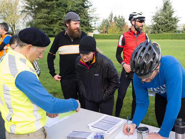
Thanks to Geoff Swarts, a new route was created and approved by RUSA. Vinny and I pre-rode this past weekend and found many changes to the cuesheet.  We made many changes to the route immediately after the pre-ride. We decided to take out on the 3rd day the Green River Trail and also the control in South Park. The alternative is to go up to Kapowsin before Orting. We also modified the course to go over Montlake Blvd Bridge instead of 24th, that will be closed this weekend; this is on the 1st and 3rd days.
The Redmond Inn is very generous and a bike friendly atmosphere. They have a great breakfast during normal business hours and dry breakfast food after hours (before 6am).
The 1st Day is 407k that goes north of Redmond to essentially Bellingham and back. The route follows familiar back roads to Paradise Lake climb, however the route descends down the Snohomish a different way instead of Broadway, so watch for the right turn on Downs Rd! After getting to Snohomish you’ll take the Centennial Trail to Lake McMurray store for the first control. Then descend to Conway and follow the I5 corridor through Mt Vernon. Then eventually Chuckanut Dr to Fairhaven/ Bellingham for a control. After returning on Chuckanut you’ll go to LaConner open control…we chose Stompin Grounds Coffee, they have the best latte milkshakes!! You’ll then go back over the Skagit on Fir Island then further south to Stanwood. After getting through a few busy intersections, the route then goes through Marysville that has some quiet city streets. After turning right off Sunnyside onto WA-204, be cautious of crossing the on ramp for US-2! Immediately after this you’ll make a right on 20th (under the US-2 bridge) and get in the left shoulder. Bikes are OK in the left shoulder so ignore the Do Not Enter signs—just don’t ride on the right side of the the road as this is an off ramp!! You’ll be down under and between both US-2 bridges still staying in this left shoulder until the there is another Do Not Enter sign. Caution taking a right turn, as exiting traffic does not stop!
After you take a left on Home Acres Rd, you’ll go right on 43rd and go up the bike path ramp onto a the US-2 bridge and cross over the Snohomish River into Everett. There is an INFO control at McDonald’s in Everett at the Colby/41st intersection. Kitty-corner to the McDonald’s is the Interurban Trail where you will continue on for the next 18 miles. The Snohomish Interurban Trail is full of adjoining feeder trails and also follow along city streets. We did our best to get as many details or landmarks as possible. But if your using a cuesheet and get off course, I would try and pull up Google Maps and find your way to Lake Ballinger station (info control).
After the info you’ll make a left a left on 76th and go over the I-5 pedestrian bridge and eventually descend to Lake Forest Park, where you will then get on the Burke Gilman Trail. This is a lot more straight forward trail that takes you all the way into Seattle and UW. I  didn’t want to waste time in U Village so I went to the 76/Circle K on 25th. You’ll need to go over the Montlake Blvd pedestrian bridge at Husky Stadium then take the sidewalk along Montlake until you cross over 520, as the 24th Ave bridge will be closed starting this weekend!
You’ll start finding some climbing gears through the next few miles through the Montlake and Madrona ‘hoods. This has a lot of quiet city street turns that will keep you awake, watching for the signs or diligently following your GPS track for the next turn! After a short cruise on Lake Washington Blvd, you’ll climb up 50th Ave hill into the Seward Park neighborhood and  eventually to Renton. There are services in Renton, so it is advised to stock up here as there may not be anything open in until Issaquah. The Shell was closed for me in Maple Valley when I got there long past midnight. The Cedar River Trail is a nice grade up to the Info at Maxwell Rd.  A few rollers on Maxwell and you’ll be descending all the way back to Issaquah.  In Issaquah, you’ll get on the East Lake Sammamish Trail that has a compact gravel section for a few miles then turns back to pavement. The ELST goes straight to the Redmond Inn.
Day 2 is 352k and the most scenic day.  This has some rolling hills after Snohomish, including the DuBuque Rd (aka 2 Pukes Rd;), on the way to Granite Falls. Granite Falls is an open control (you can choose any location to get your card signed), but we always go to the McDonalds/Chevron on the far side of town as it’s a traditional control on Cascade 1200. If you are lucky you might get a tailwind on Hwy 530 to Darrington.  Stock up in Darrington as there are no services on route for 95k until Mt Vernon. But if you are desperate, at the turn S Skagit Hwy turnoff, you can go over the Skagit River into Concrete that is about 1.3 miles one way (off route). There are a couple steel grate bridges going over the Sauk River. There is also an Info on the South Skagit Hwy at the Day Creek  Fire Station. The 600k mark is somewhere on the S Skagit Hwy, so you will start to gain additional time and have time to get some dinner in Mt Vernon. There is a 24 hr Denny’s and Safeway on the east side of I-5 on E College Way. Rexville (Info control) closes at 6pm but only few more miles, there is a 76 station  open 24 hrs in Conway (on east side of I-5). The last part of the day 3 are the climbs up to Lake McMurray and Centennial Trail and also up Broadway. There is a 7-11 in Arlington and Snohomish  open 24 hrs.  Once you climb up Broadway you’ll descend back similar roads as on the 1st day into Redmond.
Day 3 is about 247k starts off on East Lake Samamish Trail to Issaquah. You’ll climb about 1400 ft in 20 miles up Issaquah Hobart Rd and up Kent Kangley Rd to the Info on Kanasket Kangley Rd.  The store in Cumberland is an SIR classic control. Once you get south to Enumclaw and Buckley, the route starts descending. At South Prairie you’ll get on the Foothills trail for a few miles then will exit the trail (just after the Carbon River bridge) onto Hwy 162 and up  to Kapowsin Control on Orville Rd then return back down to Orting.  Kapowin store or tavern are open until 10pm. Orting McDonald’s is open until midnight and Safeway is open until 1am.  After Orting you’ll continue on the Foothills trail into Sumner and eventually onto the Sumner Link Trail. Although, you will exit the Sumner Link Trail at 16th and follow city streets in Pacific until you get to the Interurban Trail. For those not from the area, this is King County Interurban and not associated with the one you were on in the 1st day.  You’ll take the Interurban all the way to Renton. There are some 24 hr services along the Interurban in Kent and Tukwilla.
You’ll eventually go north along Lake Washington Blvd and find the Seahawks training building at an info. There is an unpaved trail just beyond the Info that will eventually join the  Lake Washington Loop (paved) trail, that you take to I-90. The I-90 trail for those that haven’t been on it starts immediately beneath the I-90 bridge. There is a steep bridge you’ll need to climb up and over (aka “THE CHILD”). Then eventually loop down and up over the Lake Washington to Mercer Island. There is an Info on Mercer Island at N Mercer Way. There is also a QFC open 24hr slightly off course on 80th Ave SE.  You’ll eventually cross over the I-90 bridge over Lake Washington. On the far side Irving St is extremely steep to get up to Lake Washington Blvd. You’ll find similar roads as the 1st day up over to UW and will take the Burke Gilman Trail all the way to Lake Forest Park (Info). Then eventually get on the Sammamish River Trail all the way back to Redmond Inn.
The big thunderstorm of the century hit me right when I was having dinner in Mt Vernon. So I just went next door and got a room in the Quality Inn and got a couple hours of sleep, until the storm passed over.  I was so glad I made good time in the first 650k, which gave me 4 hours to spare in Mt Vernon. Thank you to everyone offering me a ride, but it was good to keep going and finish this ride since the storm had completely passed over by midnight.  The storm actually allowed me to get some sleep a lot earlier, otherwise I would have had to ride all night, a 100k further in Redmond. This was my 16th 1000k finish!
Thanks to  Geoff,Vinny, and Mark for developing this great route.
Good luck to everyone riding! See you all at the overnight control in Redmond!
Additional ride details and links to RWGPS on seattlerando.org.

Comments Off on R5000 1000K Pre-ride Report – September 14, 2019

Filed under Pre Rides, SIR Rides

2019 Tune-Up 300 Pre-Ride Report

By Jun Tay, John Nguyen, Kelly White and Mitch Ishihara


View of Mt. Rainier from WA-410 in Enumclaw

The SIR 2019 Tune-up 300 starts this Saturday, July 27 at 6 AM. Please note check in opens at 5:30 and closes at 6:30 AM.

Anciens recommend a PBP Tune-Up ride practicing efficient controls with a goal of finishing in under 15 hours. So, test out those legs and practice keeping control stops brief, even while many mountain views lure you off the saddle for selfies and scenic background photos. In addition to the tune-up for your fitness and shake-down for your bike, it would be hard to find a more beautiful ride.

The route begins and ends in the parking lot between Shari’s Cafe and Pies and the Quality Inn in Renton to dovetail with the Tune-Up 200 (on Sunday, July 28). It follows mostly familiar routes around Mt. Rainier through south King, Pierce and Lewis counties, with a few surprises thrown in for good measure. We ride through the renowned Western Washington locations of Renton, Cedar River Trail, Maple Valley, Black Diamond, Enumclaw, Greenwater, Gilford Pinchot National Forest, Cayuse Pass, Packwood, Ashford, Elbe, Eatonville, Kapowsin, Orting, Sumner, Pacific, Algona, Interurban Trail, Auburn, Kent, and Tukwila. The ride is self-supported, but there are plenty of services available along the way with a little bit planning ahead of time—see the volunteers’ pre-ride experience below.

Parking

We rode the pre-ride on Sunday July 21 and parked at the Renton Community Center which is across from (and a little bit south of) Shari’s. However, signage indicates that there is a six-hour time limit and the Renton Community Center is open to reserved events on Saturdays according to the website. Online reviews suggest the parking lot can get packed. We recommend not parking here.

Update: We recommend you do not park at the Cedar River trail head.

The City of Renton Cedar River Trail website notes the following parking locations: Cedar River Trail Park, Renton Memorial Stadium, Renton Senior Activity Center, Liberty Park, Cedar River Park, Riverview Park, Maplewood Roadside Park, Ron Regis Park and at Landsburg.

Some additional suggestions for parking can be found here: https://www.rentonriverdays.org/directions-parking/

Renton is also a relatively short ride from Seattle, Bellevue, Sammamish or Issaquah, so local riders may enjoy extending their day with “transport stages” rather than deal with parking.

Out-of-towners staying at the Quality Inn in Renton might ask the hotel about parking during their stay.

The Pre-Ride

Renton to Cedar River Trail to Maple Valley

Just after sunrise, four volunteers enthusiastically gathered at the start as shown in the photo below. For the pre-ride, the weather forecast promised sunny and warm weather, 84°F (28.8°C) in Seattle, in contrast to the cooler and rainy weather in early July. However, if we look a bit rigid and uptight in the photo, maybe that’s because we were awakened by 44°F (6.66°C) summer morning air. The Cedar River Valley is one of those places where the cool air seems to sink in and hang about. One of the volunteers wished he’d brought his base layer and arm warmers. [Ed’s note: No prize for guessing.]

Our intrepid pre-riders: Kelly White, Jun Tay, John D Nguyen, Mitch Ishihara

After navigating under and around gates through Cedar River Park, and a few minutes of searching around for the Cedar River Trail, we headed toward Maple Valley. A light morning dew greeted us before any mountain views.

The nice and pleasant, cool summer morning air warmed up a few degrees before we turned right, uphill, and the paved trail gave way to 3.3 miles of compact dirt and gravel along Lake Wilderness. At the end of the gravel trail, and after a couple turns, we traveled another small stretch of loose gravel prior to a right turn onto WA-169 S/Maple Valley Black Diamond Rd SE (at mile point 15.2). That about concludes the gravel for this brevet!

Maple Valley to Black Diamond to Enumclaw

Proceeding to Enumclaw, elevation gain trends up imperceptibly with one dip and subsequent climb crossing over the Green River Gorge. We noted several SIR-grade food services found along the stretch of WA-169 for those in need—like Jun and Kelly, who made a quick bathroom/food stop at McDonald’s where they were surprised by the nicest bathroom they have seen on any brevet—otherwise we kept moving.

That is, until we spotted this almost perfectly lined up view of Mt. Rainier:

Followed by this…

“Views of the massive and glorious hulk of Mt Rainier will inspire you as you work your way south in the cool of the morning.”—Kelly

Enumclaw to Greenwater

After turning left onto Griffin Avenue in Enumclaw (at mile point 26.2), we noted a few food services were open near the intersection of Griffin Avenue and Roosevelt Avenue (WA-410) such as 76 station, Safeway and McDonald’s.

After turning left on WA-410, not a cloud in sight could be seen, as shown in the background of the photo below. We didn’t stop to check out Enumclaw Ski & Mountain Sports (bicycle gear?) in the foreground since it was not open yet.


As you leave Enumclaw, a highway sign shows 40 miles to Cayuse pass, the first of two big hills of the day. Over the next 18 miles, we climbed from an elevation of 760 feet to 1,700 feet (+1,360 feet / -420 feet), working our way up to Cayuse Pass. We all regrouped at the Greenwater Control where we practiced PBP control skills: A brief stop to get the brevet cards signed, then refuel, bathroom break, back on the road.


A few hundred yards ahead of the general store is Greenwater Outfitters Café and Snowboard Shop, a tempting control option for those who love coffee and prefer warm food to refrigerated sandwiches. We didn’t stop to check the place out—we were practicing quick controls—though looking at their menu now (https://www.greenwateroutfitters.net/deli), maybe we should have.

Leaving Greenwater, we looked forward to getting to the summit of Cayuse pass before the heat of the day really kicked in. Depending on the temperature forecast for the brevet, consider bringing along a 3rd water bottle, as the next full services won’t be until Packwood, 46 miles and quite some climbing away.

For those keeping your total elevation for the day, the gain thus far is probably 2,700 feet.

Greenwater to Gilford Pinchot National Forest/Cayuse Pass to Packwood

It is 46.5 miles between Greenwater and Packwood. This includes a 23 mile climb up to Cayuse Pass (+3,150 feet / -150 feet), including a 17 mile stretch of 1.4% average grade up to about the entrance of Mt. Rainier National Park at mile 59.5. For the next 10 miles be prepared for real climbing a 5.4% average grade and sections up to 7%. Traffic was unpleasantly heavy; fortunately, speeds are low and drivers mostly polite. On the right there will be a couple of breathtaking views of Mt. Rainier, stop to take some pictures, catch your breath and hydrate.

With the heat of the day kicking in—it would eventually rise to at least 98.6°F (37°C)—Kelly finished his water at the summit of Cayuse Pass. Jun Tay will staff a secret control here, and water and sodas will be provided to keep you well-hydrated. Leaving the summit with water bottles refilled, you’ll be pleased to note that the majority of the traffic continues on Highway 410 to Yakima while you will continue to the right on 123.

Stay right and enjoy the descent toward Packwood

You now have a 22-mile descent (mostly descending) to Packwood to enjoy. The first 10 miles is your big reward for the climb: a screaming descent where the main exercise will be for your forearm muscles from feathering your brakes. [Ed’s note: If you’re braking too much, try sitting up to catch more wind; it’ll slow you down some and help to spare your rims or rotors.] Enjoy it, but do remain attentive and cautious as cars will be moving quickly and there can be strong crosswinds.

The sunny approach to Packwood

Highway 123 joins highway 12 at mile 84. With 7 sunny miles to go to Packwood and services, Kelly suddenly noticed that his throat was dry and he was very thirsty. The heat of the day was really kicking in and while still descending, the 7 miles took some effort. What a relief to arrive at the Packwood Tatoosh Food Mart, air conditioning and ice cream bars! The temperature turned out to be 94°F (34°C)—and likely hotter on the pavement. Anyway, please top up your water bottles and get ready to work those ice cream calories off.

Packwood to Ashford to Elbe to Pack Forest

Cooled off, refueled and rehydrated, with sun sleeves and hats soaked with cold water, we set off on the 2nd big hill and last major challenge of the day: Skate Creek Road. This is the same route that was part of the Tahuya Hills 600k in June, but in the opposite direction. Thinking of that ride, we fondly recall descending Skate Creek road with its twists and turns. Ascending it, however, presented a different pleasure: climbing Skate Creek Road is among the prettiest rides we have enjoyed. A beautiful boulder strewn creek and shade, lots of shade. Given the heat of the day, that in and of itself made the climb.

From the top of Skate Creek, we made our way to Ashford, home to Mt Rainier climbing expeditions, where we settled in for a civilized meal of pizza, and for Kelly, a chicken sandwich with bacon and Swiss cheese on a gluten free bun (unheard of on a Rando ride!), all at the Base Camp Grill. From there it was mostly paceline work with John and Mitch doing the lion’s share of the effort. We made good time in spite of some significant headwinds.

Rando gourmet

As you arrive in Elbe, be extra careful getting thru a couple of bad railroad tracks depending when you get there. There was still plenty of daylight for us to watch out for those bad spots.

Orting to Renton

At this point, the pre-ride felt fairly uneventful with mostly small rollers as the climbing is pretty much done after about mile 150 (240km). The remainder of the ride included a surprising amount of bike trail, the highlight of which was the newer Foothills Trail connecting Orting to Puyllup. From Puyllup to Sumner, you’ll ride the Sumner Link Trail (plus a few roads).

Sunset over bike trail

And from Sumner to Tukwila, you can sit back and enjoy your ride to (very nearly) the finish via the famous Interurban trail. [Ed’s note: There’s an annoying detour in Kent as a section of the Interurban is closed until some time in 2020. But follow your cue sheet (or GPS) and you’ll be back on the quiet trail in no time.]

Doing the Interurban

From Tukwila back to Renton is just a few miles, including a return to Cedar River Park and those gates from the start. We rolled into Shari’s happy but beat from the heat. Tired but exhilarated. We’d say that is a perfect way to end a long day on the bike.

We will see you at the start this Saturday and wish you the best of luck and a safe ride!

Preregistration and route details on the SIR website: https://www.seattlerando.org/

Comments Off on 2019 Tune-Up 300 Pre-Ride Report

Filed under Pre Rides

PBP Tune-Up 200 Pre-Ride Report

by Mike McHale

Come join us for the PBP Tune-Up 200. The ride will start and end in the parking lot between Shari’s restaurant and the Quality Inn in Renton which were selected to dovetail with the Tune-Up 300 (Saturday, July 27).

The ride will start at 7:00 AM. Check in will open at 6:30. Please note that check in will close at 7:30 AM.

Since this is a PBP Tune-Up ride, anciens strongly recommend practicing an efficient ride (brief control stops) with a goal of finishing under 10 hours.

The course is a northern loop on familiar roads and trails—some of which we will ride in less familiar directions. For the pre-ride, we parked at the Cedar River Park which is across from (and a little bit south of) Shari’s. However, signage indicates that there is a six-hour time limit. The City of Renton Cedar River Trail website notes the following parking locations:

Parking is available at Cedar River Trail Park, Renton Stadium, Renton Senior Activity Center, Liberty Park, Cedar River Park, Riverview Park, Maplewood Roadside Park, Ron Regis Park and at Landsburg.

Update: We recommend you do not park at the Cedar River trail head.

The course goes from Renton to Lake Roesiger via Issaquah and the Snoqualmie Valley, and back around the north end of Lake Washington with a few new roads tossed in to keep riders on their toes.

As you climb Honda Hill (SE 36th), pay particular attention to the turn off to Newport Way as this may not be how you normally go and there is an info control. After the Carnation Control (Sandy’s) we head up the valley to Monroe—taking the Tualco road detour along the way. Wood Creek Road leaving Monroe was the busiest stretch of the day, fortunately, we exit Wood Creek onto Yeager and then Bollenbaugh Hill Road. Despite pre-ride grumbling about the steep pitch early on Bollenbaugh Hill, pre-riders agreed it was much quieter. We then go around the south/east side of Lake Roesiger to the next control at the store where most of the pre-riders ate ice cream bars. After pre-riders got done cursing at the ride organizer for making the group climb out of the control, we made a left on N Carpenter Road which made for a wickedly fun ride back to Machias. From Machias, it was very familiar roads and trails back around the north end of Lake Washington to Renton. There are a few non-perpendicular tracks to watch out for and remember to pay attention to the “cross traffic does not stop” sign as you approach SR 522.

We had good weather on the pre-ride and hopefully took one for the team as we waited for a Boeing parts train in Snohomish and the draw bridge in Montlake. Please note this is not a fast course and we will be sharing the trail with children, dogs, and inexperienced riders. Please observe the speed limit and keep a smile on your face as you navigate your way back.

There are store controls at miles 32 and 65, but plenty of places to forage along or very close to the route. Specifically, stores are located in Issaquah, Monroe, Snohomish, Maltby, Woodinville, and Lake Forest Park (off route slightly). There are also parks with flush toilets and water in Renton, Bellevue, Monroe (if open), Machias, Snohomish, Log Boom Park and Seward Park.

Preregistration and route details on the SIR website.

Comments Off on PBP Tune-Up 200 Pre-Ride Report

Filed under Pre Rides

2019 Border To Border Pre-Ride Report

by Kevin Smith

On paper, the climbing elevation to total distance indicates this ride is ‘a bit less challenging’ than previous SIR brevets this year.  Don’t let that fool you, because the route orientation means you are bound to face either north or south winds for a long time.  Make friends, ride together, share the effort.

The ride begins with a lovely roll from Tumwater out to Rainier, Wash. At one point, you’ll go through what I assume is an old artillery or training range as evidenced by the large white signs saying Don’t Enter, Don’t Dig, etc.  You won’t really want to stroll off the road anyway, since its so nice and quiet, but I envision a scarred landscape at some point in the past, where troops were training for war.  It looked how I’d expect the Forest of Arenberg might look when young troops, tanks commanders, and artillery teams were getting ready for their most heroic effort.  Now you are facing your own kind of heroic effort.

There will be some road items to pay attention between Rainier and Spanaway. First, multiple railroad crossings at horrible angles.  Take your time, slow down–stop even–find large breaks in traffic, and make sure you use the whole road to cross these tracks at 90 degrees.  Don’t end your fun early by catching a wheel in these things. Second: Highway 507. It’s been a few years since I was on 507.  I recall rather crappy road conditions, grit and gravel on the shoulder, and trucks zooming past, too close, at 70 mph.  Well, the road surface got upgraded with fresh pavement and wider shoulders—that’s a plus because you’ll want the space from the drivers.  Beware grooves in the pavement where they installed recessed road reflectors.  They looked like ugly front wheel traps.  Word of warning for folks riding through in a group: Leader, pick a line clear of these grooves; Followers, don’t stray from the wheel ahead, else you might wander into one of the grooves and, next thing you know, you’ll be performing an up-close inspection of that nice new pavement.

At the Rivers Edge info control, give them a stop and get a macchiato or something. Hot items will take longer than expected based on my stop–but I entered behind a family of 5.  #randoluck I let them know another group of crazies will roll through this coming Friday–she said she’ll look for us. She thought I was completely nuts when I said I was going to the Canadian border that day and asked if I was “really okay.”

Depending upon the wind direction, you’ll feel either superhuman or super sluggish riding the section from Rivers Edge to UW. If you get the south wind, enjoy, but save some energy for the coming miles. If you get the north wind, well, make friends fast and buckle up—it’s going to be a long day.

Can’t say much about getting to Snohomish and riding through Marysville: If you’ve done a lot of SIR rides you know the route. I was dealing with my own set of challenges with a broken spoke and an (unrelated) flat, so I basically have blacked this section out of my memory.

#thankyoufiberfix

You’ll enjoy some nice gentle climbing through the Lake Goodwin area and a decent to the Warm Beach control. I asked to use the bathroom but was denied; not sure if you might have the same fate, but factor that in.

From Conway to Bellingham: First, deal with the inevitable wind that always exists in this flat region. If the winds are light, you should make some good time in the flat terrain. I always enjoy the view of Chuckanut looming in the distance; it looked particularly menacing during my ride. That said, I always enjoy the hills and curvy descents along Chuckanut, Depending on your pace, you might enjoy nice dusk light while riding this area—and its fantastic views. Among my favorite areas of Washington.

Chuckanut looms in the distance

The route through Bellingham brings you onto a waterfront trail and off the road. There is a Woods Coffee shop in Boulevard Park. It might look closed, but if you need some coffee for the upcoming night riding, stop—the views of the Bellingham Bay are wonderful. I liked that the route did not pass the overnight hotel too closely—otherwise one might be tempted to stop, sleep and get the Canadian Border a little later. But keep moving. The roads up to the border are relatively flat and you should make good time. [Editor’s note: Seriously, don’t sleep on the way to the border. Read the pre-ride report from 2018 if you have doubts.]

Be aware of random large trucks traveling around Lynden. It’s Friday night, dark. Stay together or buddy up if you can.  If you’re fast enough to do this in daylight or had a massive tail wind all day, kudos! Get some extra sleep!

Boundary Rd!!! Yeah, you made it to the Canadian border! No joke, at this point my Spotify playlist played Fly by Night by Rush, How did it know??? Say Hello to the border patrols who cruise the road network up there looking for people doing weird things at odd hours of the night dressed in strange clothes.

For those stopping at the overnight, enjoy the hotel in Bellingham for a few hours, get some food, sleep, and prepare for another long day.

Leaving Bellingham, you’ll enjoy a quiet morning ride along the south shore of Lake Whatcom, soaking in the morning light. The climb up to the lake and subsequent rollers will certainly wake up your morning legs. There are services at the Sudden Valley info control, and it’s a nice spot for a coffee and morning snack if you want.

Farther along, on Old Highway 99, the bridge over Friday Creek, just north of Belfast, was under construction during the pre-ride so a route detour has been made. The construction crew let me walk through when I explained what I was up to and they suggested a route change to Parson Creek Road and Prarie Road a few miles to the east, which is what you will ride. Riding from Bryant to Snohomish and Issaquah should be uneventful for those who know these roads well. Anyone new to this region will experience some of our most scenic valley riding and the no-traffic Centennial Trail.

Maybe it was me, but the section from Issaquah to Spanaway felt like the hardest section of the course. Endless long climbs with steeper grades than what you’ve experienced on the ride thus far. Get some food and drink in Issaquah and keep your energy levels up since it might be a long night.

The trail from Buckley to Orting is a regional gem and you will experience a tranquil ride and respite from the day’s road traffic. Thank you taxpayers and the leaders of Pierce County for converting this old railbed to a magic carpet ride through the forest along the Carbon River. During my ride, there was a significant bug hatch and I was glad I brought my clear riding glasses to deflect the bugs from my eyes. Riding through these bugs without glasses would have been very annoying, so plan accordingly. If you need a ditch nap, there are many great spots along the Carbon River.

At this point, getting from Orting back to Tumwater for my overnight seemed like an impossible task. But I remembered someone’s advice earlier in the riding season to not think about the remaining distance and just focus on the present. So refuel, make sure your bike is right and your lights are in good shape. Leaving Orting requires a challenging climb up South Hill on Orting Kapowsin Hwy E. The grade is steep, there are some tight turns, plus the road shoulder is unsettlingly narrow. Add some Saturday night road traffic zooming up the hill, and you’ve got a potentially hazardous environment. I’d look to group up and leave Orting together if you can.

The Spanaway-to-Tumwater section will have you return to roads you traveled a day earlier and will help give you some motivation that your getting close to your overnight. I made a coffee stop at the Denny’s on the Hwy 7/Mountain Highway to perk up. It’s a good reference point for the turn you need to make into the Twin Firs Mobile Estates trailer park anyway. I had to pause and check the route to figure out if riding through the trailer park made sense and it does help get you away from higher traffic intersections in Spanaway and puts you back on Highway 507. I was expecting more traffic on Highway 507, but was pleasantly surprised; hopefully you get the same conditions. Entering Rainier again will help you “smell the barn” and keep moving onto Tumwater. You’re close!

Now you have a lovely Sunday ride left. The bigger mile and climbing days are behind you. So, roll out of Tumwater with a smile—you got this! Grab an apple fritter or bear claw at the control in Chehalis Village. Who said “Don’t quit until you’ve had an apple fritter” during the SIR meeting about PBP earlier this year?  Well – thanks for that comment because I went for the apple fritter and was not going to quit, it definitely worked. [Editor’s note: Sounds like Ron Himschoot.]

Then came Curtis Hill Rd southwest of Centralia (813 km). I had a decent headwind out of the south sapping my energy and a wobbling rear wheel being held together with FiberFix, so I decided to swallow my pride and walk the hill to avoid further damage to the wheel.  In the process of pulling over, a second spoke broke on the rear wheel!  I said some things I was not proud of, but which were appropriate for the moment. Well, I wanted to try randonneuring this year and this is part of the deal. Figure it out and get yourself in. I wish you all good luck riding that hill.

Approaching the Boistfort Store Control in Curtis, I had to wonder where the store might be because there is not much there, but it’s a little oasis of sustenance in a beautiful rural rolling terrain. There was, however, no bathroom.

At the Longview Control, get ready for the payoff if you’ve been battling a headwind to this point. If you’ve had a tail wind to this point, I hope you have saved some energy! There is not much to say about the Safeway in Longview—just get there, turn around, and go home!

Longview to Toledo and Chehalis. I’ve never ridden this road before but have seen it many times driving on I-5. Although you’re near the highway, the road has very low traffic and is extremely nice. You’ll notice many spots where they cut I-5 through hills that you must traverse up and down. It was a little torturous the see a flat grade off to the left while struggling up a hill. Services are available in Castle Rock (908 km), Toledo (932 km), and Centralia (970 km) to keep you fueled. Or if you need a place the nap.  Another nice nap spot could be Lewis and Clark State Park at 940 km (there is water, but no food available—unless you bum food from one of the campers).

At the Tenino Control (990 km), you will hopefully feel the energy come back as you know the finish is near. There are services at the 76 gas station info control if needed.

There is always one last hill! After Teninom you’ll need to climb Chein Hill. Not the hardest on the route, but a sting in the tail no less. I had some choice words for the route designer at this point. [Editor’s note: It was Ian Shopland! Don’t blame me!] But it will soon pass and hopefully you’ll fly into the finish.

Tumwater! Congratulate yourself and everyone else who made it in. If you’re using this as a PBP-prep ride like I was, hopefully it goes well, and you gain some confidence that you’re ready for France. I hope everyone has a safe and successful ride this weekend.

Comments Off on 2019 Border To Border Pre-Ride Report

Filed under Pre Rides, SIR Rides

2019 Chuckamano 400 and 600K Pre-Ride Reports

Pre-riders Thai and Ray

by Ray, Hugh, John, Rachel and Theo

Note: The 6/29/2019 Last Chance 400K and 600K follow the same routes described here.

Magnificent views a little gravel and a lot of hills? We’ve got all that and more in these returns to the wonderful 2017 Chuckamano Views 400K route from 2017. We’ve also added a 200K extension to the Middle Fork Snoqualmie River to create a 600K brevet option. The original report covers most of what you’ll want to know for the first 400K, but in this report we’ll provide a few updates as well as information about the 200K extension.

Leaving the Bear Creek Park and Ride on Sunday morning, Rachel and Theo were surprised to find themselves shivering in the mist, trying to warm up on the first few hills. So much for Epic Ride Weather, an app Theo has recently become obsessed with! Though, in truth, its promises of headwinds for the first 200K of their 400K pre-ride would bear out all too accurately. On the upside, the cold, inverted weather held a beautiful layer of cloud in valley trees, making for a lovely view looking down from Broadway rolling toward Snohomish.  But let this be a reminder: Bring a warm layer as it could be cold at the start and again on the way back to Redmond via the Centennial trail, even if daytime temperatures are forecast to be nice and hot.

Edison Slough

This theme of beauty along the route was a constant for all six pre-riders—and they’re confident that you’ll experience the same. Hugh remarked on the striking flowers, everywhere along the course: California poppies, buttercups, fox glove, daises, and a lot more. He also had this to say about the stiff climb out of Fairhaven: “I enjoyed the climb out of Fairhaven. It was on a small road with many turns and well-kept properties. It reminded me of roads in France.” Whether you have the presence of mind to imagine the roads of the South of France, where the ACP Super Randonneur 600K challenge was born, or not will, depend on your gearing. Bring something low enough that you can settle into a steady spin, or be prepared to stand up and go! (Perhaps easier said than done if one fills up on too much pizza and beer at the open control in Fairhaven.)

Lake Whatcom

From Fairhaven, the routes diverge from the 2017 original and skips Deming altogether. Instead, you’ll ride along Lake Whatcom through the incredibly striking Sudden Valley. Here, preriders saw many deer, experienced a bit of car traffic (likely dependant on time of day), and wondered what it would cost to move into one of the triple-size homes along the gorgeous lake and take up watersports… but they kept pedaling anyway.

Eventually, the winding roads of Sudden Valley meet Highway 9. 600K riders will turn right, riding south toward Sedro Woolley. 400K riders will turn left, riding north to an info control in Acme before turning around to catch up with the 600K riders. For this next section of the rote, whichever distance you’ve chosen, you’ll be on the narrow-to-nonexistent shoulder of the highway and it pays to remain attentive and cautious throughout. Traffic here seems to vary widely by time of day. Hugh specifically mentioned that this section was good. Rachel and Theo were passed by car after car, including a semi-trailer truck which zoomed by much too close, clearly in excess of the speed limit, and nearly hit an oncoming car. Theo rode most of these miles looking over his shoulder. Perhaps a rearview mirror would be advisable. In any case, please be attentive as you ride and be sure to stop and don your reflective gear (vest and ankle bands) and turn on your lights as the day wears on and grows dark.

Both routes return to Redmond via the Centennial Trail (Arlington to Snohomish) and short section of the Sammamish and Marymoor Connector Trails. A welcome respite from car traffic and stop lights, these trails can have a somnolent effect on some riders (looking at you, Theo). But don’t sleep on your bike! Stay alert and on the watch for the many bollards along the way—there are even a few without reflective tape—we don’t want you to hit them. You can, however, sleep at the Redmond Inn, where 600K riders will have their overnight control and 400K riders are encouraged to have a bite to eat and close their eyes for at least a few minutes before attempting to drive home. Better yet, book a room and get several hours of sleep. Driving home after a 400K may seem reasonable when you’re full of energy from the excitement of finishing, but it can be very unsafe as your body will be very tired.

Views from the Middle Fork

Day 2 finds our tired but determined 600K riders warming their way up Union Hill before dropping down into the cool fog of the Snoqualmie Valley. After a quick stop in Carnation for some hot coffee, there’s a nice section of hard-packed gravel to get you ready for the crown jewel of the day—the Middle Fork of the Snoqualmie River. The newer asphalt rolls like butter as you take in the views of the river, mountains and forests. If you’re tuckered out at the end of the road near the campground, don’t despair as it’s mostly a nice downhill cruise all the way back to North Bend.

The return back to Snoqualmie features some smooth-rolling gravel. It’s a bit of a climb up to Snoqualmie Ridge, but the steep, flowing descent down Lake Alice Road makes it all seem worthwhile. Don’t get too complacent though, as the climb up the Preston–Fall City Road reminds you that gravity is king! From there, it’s a nice cruise on the mostly shaded Issaquah-Preston gravel trail.

The stretch from Issaquah to Black Diamond is your typical highly-trafficked Sunday bike ride. From the southern terminus of the route, it’s a quick jaunt up WA-169 before more gravel along the ever-pleasing Lake Wilderness. The miles flow quickly on the Cedar River Trail into Renton as you ride mostly downhill like a salmon on its journey to the ocean. The section through Renton is not the typical SIR route, so pay close attention to the cues as you near end of the trail: Instead of exiting onto Mill Avenue and crossing over Houser Way you will take a right turn on the bridge across the Cedar River, hang a quick left and then a sharp right onto Houser Way. Use caution as traffic can be moving quickly on Houser and you’ll need to quickly move 3 lanes to the left to be set up to go straight onto Factory Avenue at the traffic signal.

From there, it’s your typical cruise up Lake Washington Boulevard. Make sure you REALLY DO STOP at all those stop signs, now with additional verbiage spelling it out. No good SIR ride can end without some hills and, yes, there are a few as you make your way onto the I-90 bike trail, through the neighborhood streets and back to the finish at the Redmond Inn.

Additional ride details, RWGPS links and preregistration available on seattlerando.org

Comments Off on 2019 Chuckamano 400 and 600K Pre-Ride Reports

Filed under Pre Rides, SIR Rides

2019 Spring 600K Pre-Ride Report: Tahuya Hills

Gifford Pinchot National Forest, near Randle

Words by Andy Speier, photos by Kate Hotler

We left under a cloudy sky on Saturday morning. The Starbucks start location worked out well for us as they open at 0400. If you’re arriving early, please don’t pile your bikes out in front of the shop until they put the tables and chairs out. There is a wall available for leaning the bikes on the south side of the building. The challenge for starting a ride in SODO is travelling across there sets of active rail lines. We were lucky and no trains impeded our progress. [RBA’s note: If there is a train, please stop and wait. If it turns out to be very long, we’ll take an alternate route or correct the ride times to account for the delay.]

To set the mood for the ride and give you an insight into the hill climbing to come, we travel east up S Holgate street. Don’t get too into the climb or you will miss the left turn mid hill onto the Mountains to Sound Greenway Trail. On the trail, it’s the usual ride thru the tunnel and up Irving to Lake Washington Blvd. For you out of towners, be sure to shift into your low gear before you transition from the trail to Irving street.

Over the first 56 miles we rode on several trails which was a fun way to get out of the largest city in the state. Pay attention to the cue sheet instructions at mile 25.1 to change from the Cedar River Trail to the Green River/Lake Wilderness Trail up s short, steep gravel climb. A bit later, you will pass thru the edge of Black Diamond. There are services at the gas station on the left that you will pass. If you inhale deeply you may be able to smell the cinnamon rolls at the Black Diamond Bakery [ed’s note: the bakery is off route]. You’ll wind around on some nice country roads and then turn onto Highway 410. It’s a busy road, so after crossing the river and climbing a short hill you’ll turn off the road at the light onto Park Ave in Buckley. The route skips the commercial section of the highway to get you on quiet streets with an info control. There are restrooms in the park off N River Road and up the street on N River Road. For those looking to stock up on food, there is a sidewalk trail prior to Ryan Road that will take you back to Highway 410 where there is a Subway and a Chevron station.

From Buckley, the Foothills Trail is a treat. It has been recently re-surfaced and much of it is downhill. The turn onto SE 276th street at mile 28.9 is not signed. There is however pink/orange flagging on a post on the right side of the trail to alert you to the turn (if you are riding solely by the cue sheet). Nothing lasts forever and you are back on busier roads. Be mindful of the vehicles on Oroville Road E along Lake Kapowsin. Anxious fishermen seem to be speeding to and from somewhere. A left on WA 161 will take you up into the metropolis of Eatonville. The route will turn right onto Center St W to take you out of town. If you turn left on Center St E you will find a grocery store, subway and a Mexican restaurant. Do not leave town as you always do (for, say RAMROD) or you will find yourself off route and on the dreaded Alder Cut-Off Road. Turn right on Center St E to follow the route out of town thru La Grande (another town in western Washington that you can check off on your bucket list).

The RR Xing noted on your cue sheet as you enter and leave Elbe are worthy of your attention. On your left are WA State DOT restrooms. Heated with a great covered area to get out of the weather. There is no water, but the overhead cover is well worth it in poor weather conditions. There is also a store if you need to re-supply. The turn onto NF-52/Kernaham Road (which becomes Skate Creek Road) will take you off into the Gifford Pinchot on the backside of Mt Rainier National Park. There is a climb, but when you descend the other side, you will discover that you got the better end of the deal. The descent is windy and has some craters, so pay attention. The gravel sections have been repaired. You just have to look out for holes and an uneven surface along the edge of the road. As you enter Packwood look for Elk. There are many. The pre-riders encountered 40 degree temperatures and rain on this section. Hopefully you will have better weather. We bought out the hand warmers but there are a couple of wool toques and socks left if you need ’em. Best to pack your rain jacket!

You will leave Packwood on Hwy 12, but there is relief. You will turn onto Silverbrook Road for a while and then again onto Davis Lake Road. Davis Lake Road will take you into Morton by passing the commercial businesses on the highway. If don’t need any food, there are public restrooms as you cross the RR Xing and can continue out of town until the turnoff onto the Centralia Alpha Road. From Morton, it is nearly 40 miles to services in Centralia. If you want to find services in Morton turn left on 2nd street and ride for 6 blocks. You’ll find a grocery store Chevron station store. The ride up and down the Centralia Alpha Road will remind you Anciens of PBP—for the rest of you, it’s good preparation.

We fueled up on warm beverages and snacks back counting how many hours of sleep we would get if we headed out to after a quick pit stop. The rain had let up so our spirits were high. The terrain from Centralia to Elma is not challenging. It’s easy to make up a bit of time.

Dinner at the Rusty Tractor in Elma

The overnight control will be at the Stay Beyond Inn & Suite (formerly known as the Guesthouse Inn). For those of you riding thru we will have a warm meal for you (vegetarian or meat), beverages and a smile. For those looking to get a few hours of shut eye we have a plan in place to quickly get you to a room.

Leaving Elma you will bear left on the Coquallum Road. The RR Xing there is the real deal. Dark or daylight hours pay attention. In Skokomish the Twin Totems Store closes at midnight and opens at 0500. If you arrive prior to 0200 the casino is still open. The security guard can sign your card and may even invite you in for coffee. If you arrive past 0200 and prior to the 0500 of the opening of the Twin Totems Store than there will be an info control question. The route from Skokomish takes you thru the residential area of the reservation.

We (at least I was) excited about the thought of ice cream sandwiches at the Summertide Resort Control. For those that will arrive at the control prior to the store being open the control workers will have warm drinks, cup of noodles and other snacks. We took a few minutes to enjoy the sunshine, ice cream and soft drinks prior to the start of the Tahuya Hills. For those that will arrive while this control is SIR-staffed, there will be snacks and drinks. If you’re looking for a more substantial meal, you’d be better off stopping in Belfair about 16 miles earlier.

Dewatto Holly Road

The hills of Dewatto Road—be sure to slow for the steep and sharp curves on Dewato Road shortly after the 3 mile marker (just past km 504/ mile 313)—and Seabeck Holly Road got our legs loosened up and ready for what was coming after Seabeck. The sun was out and the ride into Seabeck along the water was beautiful. The Seabeck Store is well stocked and there are fresh (at least that’s what the sign says) sandwiches in the cooler were labeled MEAT. There is a pizza place next door. [Ed’s note: The pizza is good, but not super fast.] The café is no longer in business. Behind the store there are picnic tables to sit at and enjoy the view. If you are cruising thru prior to the store opening then you will have an info control question. There is a toilet behind the Pizza place.

We left Seabeck under a beautiful sky and put on our game faces for the infamous Anderson Hill Road. It lives up to its reputation. When you think you have completed the climb and begin to let up, thinking to yourself “that wasn’t so bad,” you will find yourself heading down an impressive descent. Remember: “But wait, there’s more!” For each descent, you’ll return to the water and begin the next portion of your hill climbing adventure.

Dewatto Road

There are some roller hills on Highway 3 for a few miles before heading into the picture-perfect company town of Port Gamble. To save you time, there is an info control at the upscale bakery in the old gas station on the right. If you take a left at the large parking lot, you can ride over to the company general store that has snacks and a deli in the back. There are toilets in the post office building. At this point most you will be smelling the barn door and in the “get ’er done” mode.

To keep you off the high weekend traffic roads, the route takes you to Suquamish the back way. It’s a beautiful route with a bit of climbing.

Highway 305 on Bainbridge Island is the final leg of the journey. You can (almost) see the barn doors. For those of you using this 600 as a PBP qualifier we will see you in (near) Paris.

Headed home on the Bainbridge ferry

Route: https://ridewithgps.com/routes/29225332

Cue sheet: https://docs.google.com/spreadsheets/d/12vt6X4EvAzNnPwGCMS7fWkXe17ghmTC-0Tf9rl2k0G4/edit#gid=1670164969

Additional ride information: https://www.seattlerando.org/content.aspx?page_id=4002&club_id=928629&item_id=896679

Comments Off on 2019 Spring 600K Pre-Ride Report: Tahuya Hills

Filed under Pre Rides, SIR Rides

Report for the 4/7/19 Olympia 200K

by Millison and Rick


The ride starts at the La Quinta in Tumwater. We head west, under the freeway, on familiar roads to Delphi Rd for an info control. From there, we climb a little from Waddell Creek, for info control #2, and skirt the east side of Capitol Forest to the timed control at The End of the Trail Shell in Oakville.

We take a little jaunt on Hwy 12, going into and out of the control. This first 24 miles (40k) was cold and foggy on the pre-ride. As we departed the control, we got just a hint of the sun.

Make sure you leave the control with enough supplies; it’s 30 miles until the next available services.

Leaving the control east on Hwy 12 for a mile, we turn south on some new roads and into Independence Valley and to Michigan Hill, the first of the climbs. Over the hill, we cruise along Lincoln Creek headed to the next climb up Ingalls road. Coming down, we head south toward Adna. Before the town, we take a left turn on the Willapa Hills Trail for a nice, quite, and flat respite before a short trip on Hwy 6. Hwy 6 is busy with fast traffic, use caution crossing it. Enjoy the twists and turns of Scheuber Rd to Centralia and the next control at the Chevron station. Use caution crossing under I-5 following the sidewalk. Use and obey the crosswalk signal. There is also a coffee shop/deli next door to the Chevron and a Subway across the parking lot. We weave through Centralia headed east, toward the new roads that Ian Shopland says should be interesting and make will make this a great ride.

Riding into Salzer Valley we found little traffic, good scenery and new roads—a rando’s dream. A short, steep pull will get you up Grimes Road where you’ll climb a little more up Seminary Hill as you head to the Steam Plant and another info control. Continue northeast on Tono Rd and with that, the Tono Hills, before services in Bucoda.

After the Tono Hills, the route will seem flat and fast. A mile and a half on WA-507, then a right turn on Skookumchuck Road, where we had a little tail wind, which leads to the next info control at Johnson Creek. From there, it’s time for the Yelm-Tenino Trail. Use caution as you cross WA-7, a very busy highway. Then, enjoy a pleasant cruise into Yelm and the last timed control. Return west on the trail to connect with the northbound Chehalis Western Trail to the last info control at Monarch Sculpture Park. Continue north on the trail for another 6 miles, before exiting on Fir Tree Rd, and making your way west to the finish.

For more information on this 300K brevet, head over to the Seattle Randonneurs website.

Comments Off on Report for the 4/7/19 Olympia 200K

Filed under Pre Rides

Olympia-Westport 300K Pre-Ride Report

by Vinny Muoneke


Started the ride in La Quinta in Tumwater at 6am as the riders will, went straight under the freeway and had a gentle warm up as I approached the first information control after passing the northern tip of Black Lake and going a little south on the west side of the lake to Delphi Road. I snapped a few photos and continued on Delphi. The first rays of sunlight revealed that there was some kind of work on the shoulder of Delphi almost for its whole length, but at this time on a Wednesday there was very little traffic to concern me and the ride became even more bucolic as I rode further on to begin the gentle climbing of the Coastal Range on Old Hwy 410 and Old Olympic Hwy.

This 300k is dumbbell shaped and I was thinking how dumb it was that I did not bring extra warm clothes as I was freezing. Sunlight revealed frosties everywhere and I distracted myself with views of the southern sound to the right as I climbed. I snapped to attention as I crossed WA-8, but again, at this time, traffic was not that heavy. The gentle climbing continued on WA-8 and I noticed the Summit Lake store was already open—on the right and convenient side of the highway. Nothing for me at this point, and I also ignored any chance for refueling as I exited to McCleary. You will also find services in Elma just before the timed control at Montesano.

WA-107 from Montesano will take you to the US-101 as you continue west towards the Pacific, dipping south on the 101 to Raymond. The bridge after Montesano was under some repair with flaggers, though they were gone on the return phase of this section. If you are in Party Mode, there is a restaurant in Arctic on the left side that’s open early and has saved my bacon on many a Flèche. The crossing of the coastal range continues on the 101, and, in this episode, I counted 5 significant rollers. The 5th one was a dwarf like the “planet” Pluto, but I counted it as it crested to a long descent into Raymond, and I know from experience that it is a bit of a whopper in the opposite direction. Watch the shoulders on the 101 here as mini-lahars may lead to some washing down of the road on the shoulder.

The timed control at Raymond is at the Chevron but there are a few places to refuel besides for something different than gas station fare. Retrace your steps for just a bit, head north and west along the scenic Willapa Bay, and pass through the little towns of Tokeland and Grayland with services. Ride past the cranberry beds on the way to the little fishing town of Westport, your information control and the turn-around point. More pictures snapped and I returned eastward.

By Grayland the clear sky was beginning to gray, but there were still good views of the snow-capped Olympics. And still great views of the mountains as I returned east, but shortly afterward, the sky went completely gray. I guess I should have listened to Captain Fambles who predicted better weather on Tuesday, but I needed recovery from a 400K on Saturday.

I don’t know why I expected tailwinds at this point, but what I got was cold rain almost till the end of the ride. So, hopefully the weather will be great Saturday for the brevet. I could barely stay warm with all my clothes on. I stopped at Aberdeen to warm up with a hot drink, and again at Cosmopolis where I got off the bike trail to find hot chocolate. The rollers on Blue Slough Road were welcome to warm the core.

Back on the handle of the dumbbell, heading east now, I ignored services at Montesano and Elma. At Elma, head south to go around the southern part of Capitol Forest with an informational control at Sharon Grange in Oakville to keep you honest. This grange may be easy to miss at dark, so watch out for it. After the penultimate control at the “End of Trail Shell” by the Chehalis Reservation, I did a short stint on the US-12. There is debris on the shoulder here; I took my eyes off the road to check my instruments as I was getting antsy for the finish and darn, flatted the 42mm rear tire on my Thompson 650B. I pulled a big screw out of the tire and put in a new tube, under rather conveniently placed street lights. All pumped and ready to finish, I rode a little further on US-12 and turned left, across oncoming highway traffic to more bucolic roads back to the finish.

For more information on this 300K brevet, head over to the Seattle Randonneurs website.

Comments Off on Olympia-Westport 300K Pre-Ride Report

Filed under Pre Rides, SIR Rides

2019 Spring Populaire Pre-ride Report

Seattle International Randonneurs (SIR) superstition holds that the better the weather on the pre-ride, the worse the weather on the actual ride—and vice versa. Fortunately for those superstitious riders among us, we’ve devised a new tactic: We sent the organizers off to California to ride in poor weather while a group of volunteers stayed behind to suffer in sunny Seattle. That should balance things out.

The Spring Populaire conveniently begins from the Woodland Park soccer fields just south of Green Lake. This is close to the Greenlake Park and Ride and several bus lines, so should be fairly easy to get to. While the ride starts at a civilized 9 AM, please be sure to arrive early to get signed in. If this is your first ride with SIR, we recommend that you show up at 8:30 AM; we’ll help get you oriented and set to go with your cue sheet and control card. What’s a control card, you ask. It’s your passport, or manifest, for the ride and you’ll turn it in at the finish to serve as your proof of passage through the ride’s checkpoints.

From Woodland Park, you’ll roll out at a neutral pace, turning left from the parking lot to depart north on East Greenlake Way N. In just 3 kilometers, you get your first taste of a randonneuring control (a checkpoint) at Cowen Park. This is an info control, so check your card for the question and your surroundings for the answer. If SIR volunteers are present (hint, hint), they can sign your card in lieu of the answer. The route then goes through Cowen and Ravenna parks along a dirt and gravel path. Keep speed low and be courteous to pedestrian and canine visitors to the park—randonneuring isn’t a race, so there’s no need to zip through this section.

At the park’s southeasterly end, you’ll leave the path and get back on the roads briefly to connect with the Burke Gilman Trail, which will take you to Montlake Bridge and across the cut. Counterintuitively, you’ll ride a couple blocks on a wide sidewalk to make the connection to the 520 bike path and into Madison Valley (if you find yourself crossing the 520 bridge over Lake Washington, you’ve gone the wrong way). This zig-zagging route to Lake Washington will be familiar to many locals and there are way-finding signs for bikes, but your cue sheet or GPS unit is a helpful back-up if you don’t know the dance steps.

Zigs and zags now past, you’ll ride south along the edge of Lake Washington to Leschi and the I90 bridge. If our weather gambit paid off, you’ll get lovely views of downtown Bellevue and Mt Rainier in the distance. If it didn’t, put on your rain jackets and get low for the ride over the lake and across Mercer Island.

In Factoria, you’ll get to warm up with some nice climbing and then descend SE Newport Way. The shoulder is likely to be narrower than usual as it’s about halfway filled with sand and gravel, courtesy of snowpocalypse. There’s also a newish traffic circle toward the bottom (author’s note: I should have recorded its exact location, but it’s about kilometer 36), but if you continue along straight through it and stay on Newport, you’ll do just fine. The narrow shoulder conditions continue through Issaquah and on to Squak Valley Park, where you’ll pull off the road for another info control (answer the question on your card). This park does have a bathroom, but if you need more than a toilet at this point in the ride (~42km), just pedal along a bit farther to the Tiger Mountain Country Store about 4 km down the road. Well, up the road, as you’ll climb about 50 meters on your way there.

A couple more roads and you’ll reach the staffed control at the Cedar River Trail parking lot. Have your card ready for SIR volunteers to sign or stamp to indicate your passage. Then you can get back to it, riding the trail toward Renton. There isn’t really a ton to say about the trail, but three notes come to mind: First, take care at the road crossings as traffic can be fast and drivers may not be looking for you. Second, though it goes without saying, be courteous with other trail users and give notice and space when passing. Third, from Ron Regis Park (about kilometer 67) to the end of the trail, there’s a posted speed limit of 10 miles per hour. It’s tempting to ride faster, particularly if you’re getting behind on time, but there is a $101 fine for speeding on your bike through this section. Better to keep it mellow and make up time elsewhere. Depending on the weather, you’ll want to be attentive to ice/frost in this area, too.

Several turns through Renton and you’ll be back to Lake Washington, where you can put in a bit of speed stay ahead of the ride’s 3:40 PM cut-off time. Though if you get the same headwind we had on the pre-ride, that speed will be hard-earned. Nevertheless, take a moment to appreciate Lake Washington Boulevard, designed by the Olmsted Brothers and constructed beginning in 1904. With its many beautiful turns, hills, and views, it’s easy to see how this road made the National Register of Historic Places in 2017 and has been popular with cyclists for the past century. And if that’s not scenic enough for you, the route soon detours into the Washington Park Arboretum. Ride slowly and admire the trees—you’ll be sharing the path with walkers who are likely not expecting a large group of cyclists to join them on their dendrological stroll.

Then it’s back across the Montlake Bridge and onto the Burke, though you’ll go west rather than returning the way you came. In Fremont, you’ll leave the trail and start climbing: First on Stone Way, then on Fremont Avenue. The climb up to Phinney Ridge may feel steep and long, but it’s only 90 meters gain over 3 kilometers. OK, so maybe its steep. But there are stoplights along the way…. Ok, so maybe I’m not helping. But at the finish there’s beer, pizza, and good company, so it’s worth that last effort. Remember to turn your card in to the volunteers at the end, thank them for their work, and give yourself a high-five. You did it!

Get all the ride details here: https://www.seattlerando.org/content.aspx?page_id=4002&club_id=928629&item_id=896674

Comments Off on 2019 Spring Populaire Pre-ride Report

Filed under Pre Rides, SIR Rides

2018 Summer 600K Pre-Ride Report

by Tom Beck

Mt. Rainier through clouds and haze.

Get ready for a challenging and scenic ride!  The Summer 600 km route starts at AAA Washington headquarters at 3605 132nd Avenue SE in Bellevue. Secure free parking is available to all participants. Bring a drop bag for the overnight control and, if you’d like, another one for the end of the ride. You will have access to rest rooms and showers (with towels).

Given the heat and smoke we have seen for the past several weeks, there was some concern about what we Tom Beck, Jim Ryan, and Eddie Bishop  would have to endure during the pre-ride this past weekend. While there was still some smoke in the air, it only obscured the views. The morning was cool and crisp, and more layers of clothing would have been a good idea because it took quite some time before the temperature warmed up. The first part of the ride takes you from Factoria (initially via bike path) to Coal Creek Parkway through Newcastle and Renton to the Cedar River Trail. Don’t forget to exit the Cedar River Trail before Testy Chef (mile 16.6) be careful of the loose gravel.

In Maple Valley, there’s a Starbucks on the left at mile 20.6 in case you need a shot of caffeine. There are also services in Black Diamond. The shoulder goes away on the Green River bridge deck (mile 26.7), so stay alert and take the lane. In Enumclaw, there is a QFC on the left and a park with Porta-Potty on the right. Use care making the left turn onto 410; you have a stop sign and cross traffic does not. Unfortunately for all you Egg McMuffin fans, the McDonalds in Enumclaw is currently closed for renovation. Plan accordingly.

The road to Cayuse Pass.

Top-up water bottles and snack packs at Greenwater because it’s a long climb to Cayuse Pass and a long ride down to next control in Packwood (47 miles and 3,500 ft of elevation gain). On the pre-ride, the Greenwater General Store was low on stock. If you can’t find what you’re looking for, there’s more to choose from about 100 yards farther up the road on the right. Enjoy some spectacular views of Mt. Rainier as you climb to Cayuse. Once you reach the pass, keep right at the huge Y to follow highway 123 toward Packwood. Do not follow 410 left up toward Naches.

In Packwood, there is a convenient convenience store, where you can get your card signed and enjoy the usual rando food. They also make great sandwiches to order  If you’re in need of water or a bathroom, Ohanapekosh Campground (mile 86) has restrooms and water. Expect headwinds between Packwood and Randle on highway 12 – winds are much less noticeable once you make the turn from Hwy 12 onto Silverbrook Road at mile 108.3. Leaving Randle, top-up again. You get about a mile of flat terrain before the climbing starts. There is an initial steep section, followed by miles of rolling terrain – some really great riding through here. The second half of the climb is more work for the legs; road conditions on the climb are good, and there are ample turn outs to pull off for pictures or a quick break. Be prepared for anything weather wise – and expect colder temperatures at the top.

If you make it to Elk Pass in daylight hours, you’ll have a couple of amazing scenic vistas of Mt. St. Helens, but you’re going to want to pay very close attention to the road surface to get there safely. The descent of Elk Pass has cracks, uneven pavement and slide damage, along with some smooth stuff. In the dark you will want to be especially careful. If you have a high intensity light setting, this would be the time to use it. The good news is it’s a lightly traveled road and traffic should be minimal.

Take a left turn at mile 160.4 to get to the Northwoods control (Eagle Cliff Store and campground). After you make the left, cross the bridge and start looking for an uphill gravel driveway on the left 1/2 mile after you made the turn – that’s your control. After checking in, head back the way you came – cross the bridge and turn left – at this point NFD 25 becomes Hwy 90. The store closes at 8:00 p.m., but this control will be staffed for all but the very fastest of riders. Eddie Bishop will be there by late afternoon. Restrooms are unlocked but unlit, so you might want your headlamp at night. There’s about 75 km to the overnight control and nothing in between, but it’s flat-ish and the air should be cool, so you may not need much.

Hwy 90 during daylight. (Photo by Theo Roffe)

Hwy 90 is a fun road; it parallels several lakes first Swift Reservoir, then Yale Lake, then Lake Merwin, along with the Lewis River in places. Around mile 175, Hwy 90 changes to Hwy 503 you don’t even need to turn your handlebars. Hwys 90 and 503 have some climbs, some rollers, some great flat sections, and twists and turns. You’ll be riding in the dark, and the road has no shoulder; stay alert and make sure your taillights have ample power. The town of Cougar has services, but only if you get there early enough. The gas station on the left as you ride through town has a picnic table with umbrella if you need a place to sit and take a break.

The overnight control will be Best Western in Woodland. It’s close to, but not directly on, the road, nestled among some industrial-looking buildings. However, it was easy to find in the dark. There will be food available at the hotel. If you don’t care for what’s offered, there are several restaurants in close proximity.

After Woodland, you head to what may be the crown jewel of the pain cave Green Mountain Highway. Your legs will get about a 10-minute warm up. Is it a long grind like Cayuse Pass? No. Is it a combination of long climbs and shorter flat sections like Elk Pass? Well, no. It’s a couple of miles of graduated climbing ranging from 8% to 15%. Once you get to the top (however you choose to get there on foot, paperboy, full-gas straight line, or secret granny gears) you’ve got a few spots of tricky descending to do. At mile 211.8, while flying down the hill, you have a sharp, tight downhill turn to stay on Green Mountain Hwy. Again, around mile 213, you start down a steep grade and there is a 90-degree right-hander if you overshoot the turn you’ll ride into some guy’s living room. Bottom line: There are a lot of tricky sections descending Green Mountain that you’ll need to be alert about.

In the next section you’ll be riding parallel to I-5 with rollers, decent roads, and wide shoulders (watch for occasional glass and debris). There are services in Kalama and Kelso. These towns can have a lot of traffic even on a weekend especially Kelso around mile 230 (a popular I-5 exit for motorists seeking services). Be mindful and watch for inattentive drivers.

You’ll enjoy rollers after Kelso on Pacific Avenue, and later when it becomes Bond Rd. In a few places you’ll cross intersections with I-5 access – be watchful as we saw a lot of morning traffic at all of these. Your last I-5 intersection is around mile 249 by Peppers Truck Repair (truck stop across the street) – you’ll cross I-5 and then make a left onto Jackson Hwy South and head to Toledo.

At the control in Toledo, mile 255, you’ll find services including a mini-mart, IGA market, and some restaurants. This is where the pre-ride ended. The next 80 miles has all the climbing that is left: You’ll ascend and descend just over 4,000 feet as you ride through Mossyrock, Morton, Elbe, Eatonville, and Orting. These roads generally have good shoulders, but watch for holiday traffic given the proximity to Mount Rainier National Park and Mount St. Helens.

You’ll be greeted and congratulated finishing at AAA where you can get a little food and something hot or cold to drink. You are welcome to shower (towel provided) as well, so bring along something comfortable to change into and we’ll hang onto it until you get back.

The route is available on Ride With GPS: https://ridewithgps.com/routes/28231241

Please preregister for this ride.

Comments Off on 2018 Summer 600K Pre-Ride Report

Filed under Pre Rides, SIR Rides