Category Archives: Pre Rides

Preride Notes For Spring 2016 600 km

Pre-Pre-riders Rick, Peg, and Noel

This is not a flat ride – 14,000 feet of climbing, the bulk in the second day. It is a beautiful ride and ranges from bucolic roads through farms in the Chehalis River Valley to views of The Toutle River and the implied natural destruction of St. Helen’s.

We Start and end at La Quinta Motel – very modern and reach by going north on Capitol via the Trosper Exit from I-5. Motel on right as you go north from Trosper.

At 17.1 miles is a turn onto 185th. The main route is Marble so don’t stay on into the trailer park on 185th. We climb on two roads with Hill in the name.

Vader control is actually at Mt. St. Helens Grocery – Peggy had to call on her Social Work skills to wake up the old fellow tending store – He didn’t seem like the weekend guy but, if he’s there, remind him of his stamp so he doesn’t have to try and sign your card.

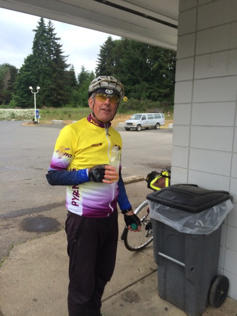
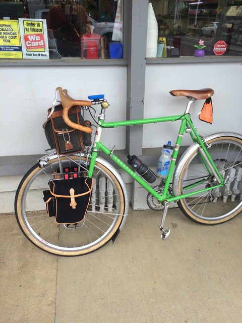
Pre-rider getting a break Bright green Thompson rando bike

Eric made a cue sheet remark about chip seal ending before Winlock – there is some on the route but it has either mellowed or been replaced with smoother asphalt.

We come out to Raymond to the south of all the usual spots to eat (Dairy Queen and downtown) but the grocery and Subway/MacDonald’s are on our route going toward South Bend. Sadly, it looked like the Bowling Alley was gone in SB?

Caution on the shoulderless roads before Willapa Bay – hopefully the RVs will have gone to ground and the logging trucks that we saw in abundance will take the holiday weekend.

The distance between Long Beach and Kelso is only 80 some miles but very lonely and serviceless – your last water is in Long Beach. A smart organizer would have a secret control along there. This is where my low training miles for the year were evidenced and I lost valuable time.

I have moved the overnight control to the Econo Lodge mainly for lower cost and that I had reserved months before the Memorial Day weekend – this puts you back and forth over a bridge on a busyish road – if you’re as fast as me there won’t even be drunks out by then. There will be beds and some breakfast and dinner selections – simple because no kitchen.

Eggs on toast for breakfast

I don’t think this breakfast is to be expected in Kelso… – Editor

US -12 is a way to get to Morton, wide shoulder and busy on a weekday. The Morton Country Market is a grocery store that affords a quick in and out and has a covered area right of the front door to hide bikes out of the weather.

The Alpha road is my favorite, certainly a few steep parts, but rolling in a way that you can play at keeping momentum and fly along. This is the dessert of the ride!

Coming out from Centralia on 507 seems long and the turn in Bucoda onto Wichman now has double yellow striping so crossing to the sidewalk on the west or going around the turn and picking a clear view is advised.

Keep moving on the first day – you may need the time in the bank for the hilly bits later.

Additional details on the SIR website.

Please pre-register by Thursday night (5/26).

5/28 – 5/29/2016 Start 6:00 AM
Bike inspection begins 5:30: lights, extra batteries and vest/sash and leg bands.

Note: bring a towel and change of clothes for the finish – the drive home will be better!

There will be parking updates to this post soon.

CUE SHEET: Now available on Google Drive, click here.

Route on RWGPS: https://ridewithgps.com/routes/13981403

TCX file is available here.

Parking: We have permission to park at the Tumwater school district building at 621 Linwood Ave SW, Tumwater, WA 98512.

1 Comment

Filed under Pre Rides, SIR Rides

400K brevet – 5/14 Le Tour d’Hood Canal

by Joe Llona

13094244_805453366252040_3030815409099073836_n

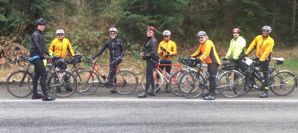
Pre-riders: Jan Acuff, Joe Llona, Rose Pantley, Greg Cox, Albert Meersceidt, and Anita Schiltz

First, the pre-ride team must apologize to all of you good people. Apparently we were overly gluttonous with the good weather and used it all up. We were so bad that we even ran out of good weather before we finished and wound up riding in the rain the last couple of dozen miles as we finished after dawn on Sunday morning.

I  want to be clear about something: this is not an easy ride. It took a fairly strong pre-ride team nearly (or in two cases, over) 23 hours to finish. Now pre-riding has its own logistical issues and maybe a couple of hours could have been shaved off that. But it would not have been enough to catch the last ferry out of Bremerton Saturday night. Besides the difficult course this ride has some difficult logistics, such as parking in Seattle for more than 24 hours and ferry timing.

Parking – I strongly suggest you figure that out now and not Saturday morning. I must admit that even though I work in downtown Seattle I know little about parking there as it is something I find easier to just avoid altogether. Here are some suggestions you might research for parking options:

I would suggest finding a spot on the outskirts of Seattle and riding a mile or two into the ferry.

Ferries – The last ferry for Seattle leaves at 11:40 pm (not 12:50 am as I incorrectly reported on the website). Few of you will make that. The first sailing out is 6:20 am Sunday morning. Some of you will arrive in Bremerton during that gap, but many of you will still be riding when the ferries start running again. For those of you fortunate enough to get in during the ferry gap we will have two rooms available at the Fairfield Inn. This will be a rack and roll flophouse operation though, so if you feel you want some more privacy or want to sleep in I would encourage you to make your own arrangements.

Dropbags – We will be able to take small dropbags. We will not pick them up until you get off of the ferry in Bremerton though, so they have to be something you can ride onto and off of the ferry with. Think toothbrush and a change of clothes. Toothpaste and deodorant too if you insist. Post-ride, the dropbags will be available at the Fairfield Inn only.

Ok, so with the course difficulty and the logistical issues, why do you want to do this ride anyway? Well because you love to ride your bike of course, and this gives you the opportunity to do it for a very long time. Oh yeah, and there’s a definite WOW factor for some of this course. I’ve ridden the Tahuya hills many times, but it’s usually towards the end of an otherwise challenging ride and occasionally in the dark. On this ride you get a whole new perspective on this area because you’ll still have fresh legs and it’s a definite eye pleaser.

Pre-riders Take In The View

A rare bit of flat road, says Jan Acuff

You’ll start at Bremerton, but instead of rolling past the shipyard you’ll go east across the Manette Bridge. Do take note of the grade of this bridge as you descend across Dyes Inlet. After some rollers you get to Silverdale where you’ll have to take a detour off of Bucklin Hill Road due to a bridge reconstruction project. This will be noted in the final versions of the cuesheet and RWGPS file.

After Silverdale the real fun begins. First Anderson Hill with what looks and feels like a wall. After Anderson Hill is Seabeck where your first control (info) will be. Make sure you replenish your water in Seabeck because you’ll be climbing up Seabeck Holly Road shortly thereafter. After an exhilarating descent from Holly you’ll be turning up Dewatto Road and into the Tahuya Hills.

After you descend from the Tahuya Hills you’ll get to the second control at Kay’s Corner. There you will be able to water up before heading to Belfair. As you get nearer to Belfair you’ll start encountering some denser traffic and probably some impatient motorists, so please be careful. After Belfair you’ll head south on SR 300 where some road construction has made the shoulder of little use, so again please be careful. After a few miles you’ll turn onto SR 106 where for a while you’ll still be encountering heavy and sometimes impatient traffic. This seems to calm down by the time you get to Twanoh State Park, where you can find restrooms and water. The shoulder on 106 is on again off again, with a few places where there are some pretty bad cracks. There’s also a lot of parking on 106 so watch out for residents and car doors.

When you get to US 101 you’ll turn north to Hoodsport. There are services along the way. Please make sure you have full water bottles for the Climb to Lake Cushman. At Hoodsport you turn up to Lake Cushman. This is the biggest climb of the ride. The first two miles of the climb are fairly steep running at over 6% but then it transitions to 1% to 3% with some rollers for the remainder. As in last year’s 400 at Baker Lake, we could not find a suitable location to station the third control at the far turnaround point, so that will be turned into an info control with support (snacks and beverages) available about 3 miles after the turn-around point. After this you will descend back to Hoodsport among some more impatient motorists and then continue north on US 101 over Walker Pass. Like the climb to Lake Cushman, Walker Pass starts out steep at about 6% the first 1.5 miles and then tapers off to more like 3% for the remainder.

Pre-riders at Lake Cushman

Lake Cushman. This beautiful spot will be the lunch/control location. Photo by Anita Schlitz

Another view of Lake Cushman. Photo by Jan Acuff

Another view of Lake Cushman. Photo by Jan Acuff

After descending Walker Pass you’ll go through Quilcene. Peninsula Food Market on the left and a couple of cafes on the right. Here you turn onto Center Road to the right for another climb up to Dabob Road. More climbing and rollers bring you to Coyle. Make sure you don’t miss the left turn onto Hazel Point Road. It’s easy to miss as you bomb down the descent towards Coyle, especially in the dark. Your fourth (and final staffed) control will be here to provision you with hot soup, and other snacks and beverages at the Laurel B. Johnson Community Center.

The Laurel B. Johnson Community Center fills several roles in the community, one of which is a food bank, which is utilized by a surprising number of the local residents. You’ll still have a lot of climbing ahead of you so you might want to lighten your wallet a bit at the collection jar we’ll have set up there.

With your wallet a bit lightened and your belly filled you’ll climb back out of Coyle and backtrack your route a way before turning onto Thorndyke Road which will take you to SR 104, then to SR 19 and into Port Townsend. The final control is at the Safeway on your left at the bottom of a big hill. Not much happening there, but at least it’s open, there are restrooms and groceries, but nothing hot at this hour.

Backtracking again from Port Townsend you’ll turn off of SR 19 onto Irondale, SR 116, Oak Bay Rd, and Paradise Bay Road. Please be careful on the final descent of Paradise Bay Road before SR 104. There are two sets of rather aggressive stop sign warning rumble strips that could cause you to lose control of your bicycle.

Also, please be careful crossing the Hood Canal Bridge. Stay to the right of the shoulder as you approach the metal grating sections as that’s where the solid plating is located. Watch for debris – glass, garbage, and usually enough car parts to get a complete build.

After the Hood Canal Bridge you go right onto SR 3 for Poulsbo. Then SR 308 and onto Brownsville Hwy NE. After a few miles on Brownsville Hwy you’ll turn onto Illahee Rd NE. The signage here is misleading (at least it is for me as I repeated the same mistake I made in 2013 on this course). Illahee Road is the second left as you roll into Brownsville. Don’t take the first left down into the Marina.

Following Illahee Road you’ll go south towards Bremerton. You’ll still two pretty good climbs ahead of you, particularly the one just before Illahee Road becomes Trenton Road. As you get into Bremerton you’ll be feeling that you’ve done that last climb, but remember that descent on the Manette Bridge right after you started?

This post wouldn’t be complete without a big Thank You to the pre-riders: Albert Meersceidt, Anita Schiltz, Jan Acuff, Rose Pantley, and Greg Cox.

Start:  May 14th at 7:15am Bremerton Starbucks at the ferry terminal. (Catch the 6am ferry from Seattle and finalize registration on board. We will also have registration at the Starbucks at the Bremerton ferry terminal. Note the control closes at 8:15am.)

Finish: Frairfield Inn & Suites 239 4th St. Bremerton

Register here: http://brevets.seattlerando.org/register_for_event/355

Full ride details here: http://seattlerando.org/index.php?option=com_content&view=article&id=573:400k-brevet-514&catid=59:2016-brevets

1 Comment

Filed under Pre Rides, SIR Rides

Olympia 300K Pre Ride Report

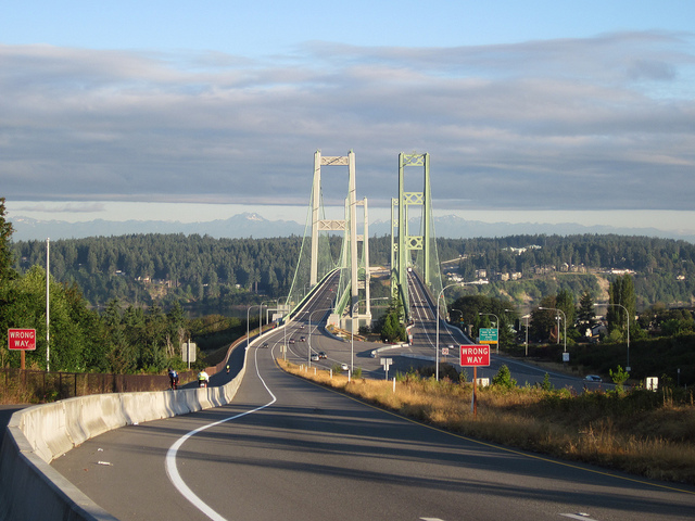
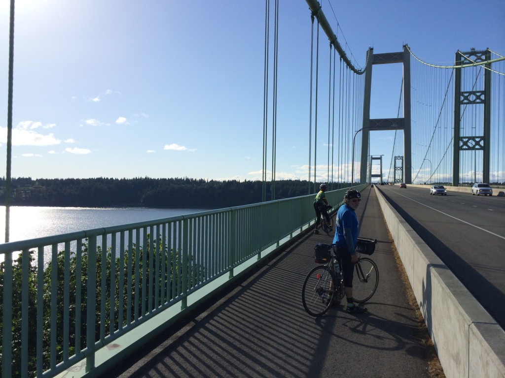
Tacoma Narrows Bridge. Photo by Lynne Fitzsimmons

Tacoma Narrows Bridge.
Photo by Lynne Fitzsimmons


The Olympia rides starts in Tacoma, just to make it easier for our riders up north. We begin at Bertolino’s Coffee Bar on S Union; plenty of dining opportunities.

It’s a new route out of the city as you fly down Chambers Bay into Steilacoom and nice views of the Sound and the Olympic Mountains. Thru Dupont, plenty of services, into the Nisqually valley and south on some familiar roads into Centralia. The route then heads west into the Independence valley. There are no, ZERO, services in the Valley, ’bout 50K: plan according.

The first half of the ride is basically flat. As your cruise up Moon road there are great views of Mt Rainier. Then on thru the Delphi Valley into Mud Bay on the west side of Olympia. Hence the Olympia 300.

Before you up head northwest on Hwy 101, there are services at Steamboat Island. Hwy 101 has its rollers, but a good shoulder. As you leave the control in Shelton, we reverse the route of last year’s 600k, round Lake Limerick and Mason Lake, and descend on the Hood Canal and into Belfair. This is a great place to fuel up for the finial 50K.

Here is where the fun starts. Getting off the Kitsap Peninsula is a roller coaster. Once you start From Belfair it continues thru Gig Harbor. From there you take the Narrows Bike Trail and the Scott Pierson Trail to the finish.

Rick Blacker and Josh Morse bit the bullet and took the rain and the marginal road conditions on the pre ride with predicated a route change.

It looking like the weather gods are on smiling on this ride.
Come on Down.
Sun In the South Sound.

Pre-registration and full ride details, click here.
The peloton rolls out promptly at 07:00, April 2, 2015.

-Millison

Comments Off on Olympia 300K Pre Ride Report

Filed under Pre Rides, SIR Rides

Spring 200K – Preride Report

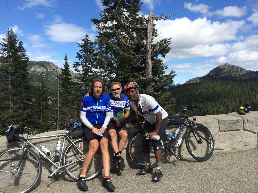
(L to R) Mark Thomas,   Doug Migden,   Bob Brudvik, Mark Roberts, Andy Speier, Rick Blacker, Mitch Ishihara, and Shan Perera. Not pictured: the camera-shy Tom Brett and the camera-wielding Lyn Gill).

(L to R) Mark Thomas, Doug Migden, Bob Brudvik, Mark Roberts, Andy Speier, Rick Blacker, Mitch Ishihara, and Shan Perera. Not pictured: the camera-shy Tom Brett and the camera-wielding Lyn Gill).

On Sunday, March 6th, an intrepid crew of volunteers braved the rainy forecast to scout the course for the upcoming 200k brevet (March 12th). With Mitch in charge of managing the micro-climate around us, however, we had almost no rain and a few glorious helping of blue skies. Flats were a different story as Ricky and Andy were cursed by the flat gods. The cue sheet was in pretty good shape, but the eagle eyes of Andy, Ricky, and Mark caught a few “opportunities for improvement.” (The RideWithGPS route has been updated and a revised cue sheet will be published shortly). All in all, it was a lovely day on the bike with good friends on a really nice route. Some notes about the route follow.

By and large, the route was on low-traffic roads. A couple of places to watch out:

(1) 1.5 miles of Woodinville-Duvall road early in the ride have a good shoulder, but please be cautious making the left onto 222nd Way noting that the road ahead is coming around a curve.

(2) Airport Way into Snohomish at the beginning and out of Snohomish near the end can be busy and it has no shoulder. (They can’t make a trail out of the train tracks from Snohomish to Woodinville soon enough for me. Maybe in my lifetime.)

(3) A half-mile on Machias Road after leaving the Centennial Trail outbound was a bit unpleasant.

(4) A little bit of uphill on Broadway after Snohomish on the way home can be unpleasant, but then the route turns left onto Connelly for a very nice back-road alternative to climbing the rest of Broadway.

(5) Caution also is advisable on the last part of Yew Way and the crossing of WA-522 near the end of the ride.

The route has a pretty decent amount of climbing – about 6000 feet of elevation gain. The route has a few steep pitches but no sustained double digit grades. We may have happened on the climb-iest way to get to Granite Falls on pavement, but the nice climb rewards you with views of Lake Bosworth before descending down towards Pilchuck Creek before Granite Falls. Save some of your climbing mojo for the end – more than 20% of the elevation gain in the ride comes in the last 17 miles. I’d say the climbing is all quite manageable unless you have Bob and Dr. Doug goading you into sprinting up all the hills. But we took one for the team and brought them with us on the pre-ride, so the regular ride should be quite ok.

Please note that there is nearly a mile of the route that is not paved (at mile 9). Two thirds of that is hard packed gravel, but there is about a quarter of a mile of dirt horse track. It was muddy and pocked with puddles on the pre-ride, but rideable on road bikes without issue. Be prepared, however, to walk some of it, depending on conditions, next Saturday. It’s a single file ride for all but the most skilled (and trusting) of randos.

Some notes on services:

(1) Don’t know if bathrooms will be open at the start. You are welcome to use the facilities at the house and then come down to start. Public restrooms (and bakeries) are available in Snohomish at 22 miles.

(2) There is a store at the Machias Road / OK Mill Road intersection (28 miles) before the climb up to Lake Bosworth.

(3) Mark’s Country Store (the Granite Falls control at mile 38) has good food options, tables, and nice people.

(4) The Bryant store where the Centennial Trail crosses WA-9 (mile 54 and again at mile 79) has the usual convenience store fare and offers growler fills if you happen to bring some along and need to take some beer home. A Mocha Death from the brewery that makes Irish Death looked quite interesting. But we forgot our growlers.

(5) We will have a manned control at a fire station near Big Lake (mile 68) with snacks and lunch-y sort of food. Andy has worked his fireman’s magic to get us access to the bathroom in the firehouse.

(6) The control at the Lake Stevens Mini-Mart (mile 98) does not have public restrooms. You can find facilities right afterwards – where you turn right onto the trail, look left instead and there is a sani-can in the trailhead parking lot. (The Machias Station on the trail three miles later has nice bathrooms. They were open when we came through, but no guarantees.) Also, this is an “open control” so feel free to stop at one of the other restaurants or markets near the Lake Stevens control for food or supplies and ask them to mark your card.

(7) The route follows 2nd Street through Snohomish (mile 106) to pass by two convenience stores (on left – Shell and 7-11). If you’d rather have a sit-down dinner, feel free to go down 1st Street instead and have a burger and beer with the weekend revelers.

(8) Convenience stores are also available at mile 117 and 121 if you need that one last Red Bull to get it done.

We will have food and drink at the house after the ride. It’s 2 miles downhill from the house to the start – https://goo.gl/maps/zp4QqzuEiaJ2 – you are welcome to leave your car in the neighborhood in the morning or drop off a bag of clothes at the house in the morning if you’d like to change after the ride. Or you can turn in your card and ride down and bring car back at the end. But please plan to spend some time after the ride. Tales of the day’s triumphs and old faded glories will be freely traded. Along with big talk about plans for the year.

Click here to register now for the ride on March 12th, starting at 7:30 AM. This will save you time at the start and helps the organizers stay organized.

Comments Off on Spring 200K – Preride Report

Filed under Pre Rides, SIR Rides

Summer 400/600 6/27 Pre-Ride Report

by Ian Shopland

Millison and I completed the 400k pre-ride last Sunday. We didn’t find any gravel (surprise) but we did find a fierce hill. The start leaves Tumwater and immediately enters beautiful farm land. Usually this section was busy, but at 6am there was little to no traffic. The airport might see some congestion as it is the airshow this weekend. We were in Tenino in no time and then stopped for some coffee in Centralia. This is an open control. The route goes by Fuller Market Grocery, but there are other coffee shops and convenience stores on route. Scheuber Road rolls along and you will catch glimpses of Mt Rainier and Mt Saint Helens. The first info control is at the Claquato Church built in 1857 and is the oldest standing building in Washington. Just after the control, there is a 76 Station if you forgot anything in Centralia.

Where's Rickie????  Photo by Millison Fables

Where’s Rickie???? Photo by Millison Fables

Once you turn on 603, the route starts in on the rollers. It’s not that this ride has the most elevation, but that all of the climbing is steep. Berry and Tennessee will take you into Winlock. There are services to your left, off route by one block. It is important to note that the route diverges from the “normal” route out of Winlock. Please read your cue sheet carefully. We follow the STP trade route into Kelso/Longview. We will be using the Chevron just past the bridge but it is an open control. It is important to be efficient at this control because the serious climbs begin after this point in the ride.
There are two strange intersections just after the control where the ride skirts along I-5. At both intersections, it is easy to navigate if you don’t get on the freeway. There is only one road that isn’t an on or off ramp, but it isn’t well signed. A few bumps and you are in Kalama, your last services before the big climb. Make sure that you have enough water to get through this exposed climb. There are no services for 6 miles. The road curves inland and begins a puke-tastic climb that jumps over 15% and stays there for about a mile. Don’t forget to turn around and look over your shoulder, there are huge sweeping views of the lower Columbia. The climb continues, but the grade lessens (a bit) as you make your way up to 1,500ft above the river. ***Important*** the control is not at the top of the climb. Continue down the climb to Schmitz road for the info control. It is important to go straight at this point, and NOT follow the main road to the right. If you do, there will be more steep climbing ahead.
Use caution on the rest of the descent, the grade is steep and the curves are tight on this technical descent. Once you are back on flat land, you can get supplies at Woodland. There is an Arco station on the corner at the turn on CC street as well as many different services. The route follows the south side of the Lewis River to an 1876 mill and covered bridge. The bridge is at the bottom of a steep descent and the control is on the sign before you cross the bridge. Enjoy a short breather before you begin the series of climbs out of the Lewis River Valley.
The route brings you into Vancouver and passes lots of services. There is no timed control in this part of town, but we stopped at a McDonalds before the info control. Just after the McDonalds, the route cuts through a park on a short bike path that isn’t well marked. Just after the turn, you enter a parking lot and there are 3 different ways to get to the same trail on your left. Pick one and follow it up the short hill. The trail comes out on Reserve Street along Clark College. Follow this street south down the hill to the fort. We had beautiful views of Mt Hood towering over the historic fort. The info control is on the next corner. After the info control there are lots of food options at the many restaurants in downtown.
The timed control is a well stocked gas station on the west side of town. There is also a 24 hour gas station at mi 152. Soon you will be back in Woodland and just after, start up the other side of Green Mountain redux. The climb is shorter but not any less steep. Hopefully you saved some of those low gears for the grunt up to the top. Use caution on the descent, there is a well marked section (20 feet) of gravel through a construction area. This is the last of the major climbs on the ride.
Back in Kelso, we re-visited the 24 hour gas station for a control. There is hot coffee, sandwiches, etc to get stocked up for the end of the ride. The rest of the ride north was uneventful. We took shelter in the warm Toledo post office for a nap and then coffee in Centralia.
This is not any easy ride. Millison and I didn’t finish until 8am the following morning, but we ran into ‘pre-ride’ problems. We had a 9 mile detour and an additional steep (18%) climb that we removed. We also were held up a busy Safeway in Kelso. The repeated steep hills didn’t allow us to make up any time during the middle of the ride. The easiest parts of the ride are the sections before and after Kelso, so it is important to be efficient through these sections, especially in the morning. There are plenty of places to get services along the route so even in the heat, you should be able to stay well hydrated.
For those who are riding the 600k, we will have rooms at the Guesthouse Inn and standard overnight fare. The 200k section of the 600k is much easier than the previous 400k. It has 4000 feet of climbing and beautiful, quiet country roads.
We will see you in the parking lot at the Guesthouse at 6am.


Comments Off on Summer 400/600 6/27 Pre-Ride Report

Filed under Pre Rides, SIR Rides

Pre-Ride Report: 400/600K , June 13-14

by Susan Otcenas

The “Big Picture” summary of the ride is that while not an easy course by any measure, it is definitely doable even by randonneurs of modest ability.   The key to success is not pushing too hard on the first day, pacing yourself on all the climbing early in the ride, and exercising control efficiency to gain as much time in the bank as possible heading into the overnight.    While Day 2 is quite a bit easier than Day 1, I nonetheless recommend leaving the overnight with 30-45 minutes in the bank.  The hilliest bits come at the beginning and end of the day.

effyeah, Mt Rainier!

#effyeah #600k #MtRainier photo by Susan Otecenas

Keith Moore and I pre-rode the 600K on May 30/31.  Jan Acuff & Audunn Ludviksson pre-rode the 400K on June 6th.  Many thanks to the three of them for vetting my cuesheets, setting up info controls and providing feedback on the routing.

The 400K is substantially similar to the first loop of the 600K, with the “extra” miles need to bring it up to 400K accomplished on Hwy 12 west of Randle.  400K riders should read the 600K Day 1 summary for all of the relevant information.

Links for GPS data and Cue Sheets here:

(RWGPS 600K Day 1 )   (RWGPS 600K Day 2 )   (Cue Sheet 600K)
(RWGPS 400K)   (Cue Sheet 400K)

600K Day 1: 240 miles (386km).  10,500-11,500 feet of gain, depending upon your GPS.

Registration will be from 4:00 to 4:45am INSIDE the IHOP adjacent to the Motel 6 at 1885 15th Place NW in Issaquah.  Look for me and William Willaford inside.   Pre-ride instructions will be given in the parking lot outside the IHOP at 4:50am.  You may leave a small overnight bag with me for safe keeping in the control room. [See end of post for information about parking — ed. ]

Riders will depart at 5am, at which point the sky will already be surprisingly light.   You will spend several miles on the Cedar River Trail and the Cedar to Green River Trail.  The Cedar to Green River Trail is gravel.  Gravel generally makes me nervous, but I did just fine on 28mm tires.  Note that the gravel is a little looser at underpasses, so use caution.

Clever routing right past Sandys Espresso just in time for breakfast. You can thank me later. Photo by Susan Otcenas

Clever routing right past Sandys Espresso just in time for breakfast. You can thank me later. Photo by Susan Otcenas

It’s an easy ride to Enumclaw, your first control.   We used the expedient Chevron option.  Other than the Chevron, I think there is a coffee stand a few blocks later.   There are also a few restaurants at the corner of 410 at mile 29.5 if Chevron doesn’t tickle your fancy.

Over the next 40 miles you will climb about 4000 feet.  We highly recommend you carry three bottles. You’ll find services in Greenwater at mile 47, and there are some campgrounds beyond that which may have water (but we did not investigate).  We stopped at Greenwater to top off.   I had enough water in my bottles to make it to Packwood at mile 93, but Keith was running low between the summit and Packwood.

Cayuse Pass comes at mile 69, at which point you will have climbed roughly 5500 feet.  DO NOT PANIC if you are behind the clock a little.  You will make it up on the way into Packwood, which is 3500 feet below you.  (For reference, Keith & I had roughly 45 minutes “banked” at the top of Cayuse, and no one ever accused me of being a nimble climber.)

Don’t be fooled into thinking it’s ALL downhill from Cayuse Pass to Packwood.   There are a few smaller hills to climb after the first big drop.   We had a tailwind climbing to Cayuse and then a surprisingly stiff headwind for much of the descent and then into Packwood.  While the road surface is generally alright, some sections of the descent were surprisingly bumpy.

The expedient stop in Packwood is at the Shell on the right.   Departing Packwood, you will head west on Hwy 12 for 10 miles (we had a stiff headwind) and then get relief from the traffic by following Silverbrook the rest of the way to Randle.  600K riders will answer an info control question in Randle, while 400K riders will continue on west on Hwy 12 from Randle to an info control a few more miles down the road, and then back to Randle, to get the extra distance required to bring the day up to 400Km.  There are services in Randle.  600K riders may not need them, but 400K riders would be advised to fill up their water bottles as there are no services after Randle until returning to Packwood.

From Randle, you’ll ride Cispus Rd, then head east on the delightfully shady and delightfully traffic-free Cline Rd, where there’s another info control question to keep you honest.
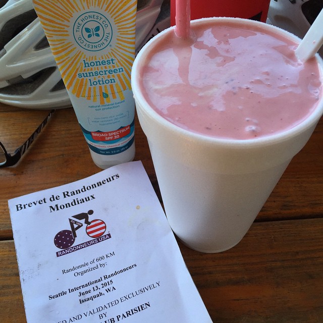
"2nd time through Packwood at mile 129. Big miles call for big shakes." Photo by Susan Otcenas

“2nd time through Packwood at mile 129. Big miles call for big shakes.” Photo by Susan Otcenas

Packwood is once again a control on the return.  If you are shy on time, you’ll probably want the Shell again.  Keith and I didn’t have oodles of time in the bank, but wanting something a little more solid, we opted for the burger and milkshake place on the right.   The milkshakes are handmade with fresh berries and plenty of ice cream.  That plus some salty fries to go in the handlebar bag made me a happy camper.    Keith came to regret his decision to eat a burger while climbing Skate Creek a short time later.  Let your stomach be your guide.

Skate Creek is a long climb, gaining 1500 feet, but it’s gently graded.   You’ll also find it blissfully shaded and extremely low traffic.    There are no services between Packwood and Ashford (grocery store on left) at mile 154 (163 for the 400K riders), so be sure you have enough water on board.  There are additional services in Elbe beyond that, though if you are a slower rider you might just find restaurants still open.  The store was closed when we arrived.

Please use caution and ride single file on Alder Cutoff Rd on the way to Eatonville.  It’s narrow and without much shoulder, which makes it somewhat stressful.  Audunn and Jan had several motorists yell at them on this stretch, though Jan did allow as one of those yelling motorists was making a complimentary statement about the shape of her derriere.  Audunn also had the novel experience of having a passenger attempt to pee on him from the window of a moving vehicle, so there’s that to add to your bucket list as well.

Continuing the Tour de Shell in Eatonville, we took time to put on our reflective and get ready for nightfall here.  It was still light for us, though slower riders may find themselves here after sunset.

20 miles after Eatonville, you will make the unsigned turn onto WA-162/Pioneer way.   There’s not much shoulder and there was more traffic than I was expecting at that hour (10pm ish).   Please use caution and ride single file!  Fortunately, you will only be on that road for 2.4 miles before the safety and serenity of the Foothills Trail.

Although not a control, you’ll likely want to stop, as we did, in Enumclaw, where you will find plenty of services on route.  At Hwy 410 there are several fast food options, and a 24 hour Safeway.   We brought our bikes into the Safeway and dined in great luxury while lounging on the mobility scooters.    After Enumclaw, there’s not much in the way of services until the overnight in Issaquah, though I recall an open Texaco somewhere along the line.

There is one last info control on Cumberland Kanasket Rd, and we made sure to create a question that would be easy to answer in the dark.

Look for the SIR control sign when you get back to the Motel 6.  I’ll post my room number on the sign.  Due to limited facilities (read: the mini fridge and microwave in my room) we will not be serving full-meal-worthy fare.   We will, however, have plenty of drinks, snacks, fruit, and enough pizza for you to feel satisfied.   If you have enough time banked, however, you may wish to avail yourself of the IHOP immediately next door.   Service is fast at oh-dark-thirty and they are open 24 hours on the weekends.  I also let them know we would be there, so with any luck they will have extra staff on hand.
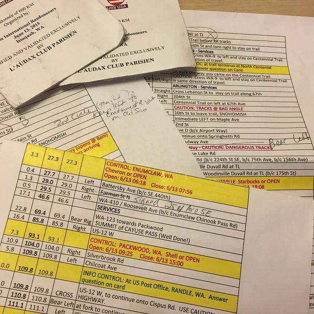
"One of the pleasures of doing a pre-ride is taking the time to annotate the cuesheet as you go so that the event's riders can have the best possible experience. This course is a beaut and I hope to see lots of riders in 2 weeks!” Susan Otcenas

“One of the pleasures of doing a pre-ride is taking the time to annotate the cuesheet as you go so that the event’s riders can have the best possible experience. This course is a beaut and I hope to see lots of riders!” Photo by Susan Otcenas


600K Day 2: 135 miles (217km).  3,000-4,000 feet of gain, depending upon your GPS.

We recommend you leave the overnight with 30-45 minutes in the bank if possible.

Within the first mile, you will curse my name.  Repeatedly and loudly.    There’s a stupidly steep hill to climb.   Just accept right now that you will walk it.   Jan said it’s OK to walk the hills; apparently all the cool kids are doing it, so you are absolved of any guilt.

Issaquah – Fall City Rd is undeniably bumpy but once you get over the early set of hills, you’ll drop down into the valley and have a pancake flat ride to Carnation.   The control is open, so use the (24 hr) Shell, or do what we did and head down the road a little further and have coffee and 2nd breakfast at Sandy’s Espresso (on right, open at 7am).  You can have 3rd breakfast during the next control at the Snohomish Bakery.  24 hour riders who come through Snohomish in the middle of the night may use the 24hr 7-11 a few blocks off-route at 2nd & D as a control.

After Snohomish, you will do a looooong out-n-back on the Centennial Trail.  Arlington is a good place to use the restrooms (public restrooms right on the trail) and fill your bottles in both directions.   There’s an info control at the North Centennial Trailhead turnaround.

There’s no control when you swing back through Snohomish, but we stopped anyway, to tank up before the hilly section to come up Broadway.  The milkshakes at the Pilchuck Drive-in in Snohomish are worth the stop.

You won’t likely enjoy the hills bits on Springhetti/Boadway/Bostian etc, but take heart in knowing that when you finish them you’ll be nearly done with the climbing for the day.   When you zoon down into Woodinville there are plenty of food options for the penultimate control.

Leaving Woodinville, you’ll spend quite a few serene miles on the Sammamish River Trail and the Marymoor Connector Trail.  After a short stretch on the East Lake Sammamish Trail, you will be forced to leave the trail where it’s closed due to a paving project. (I walked the hill to get back up to the roadway.  No shame, people, no shame.)

The final tricky instruction comes just 2 miles from the end at the traffic circle on E Lake Sammamish Parkway. Locals probably know this turn, but as an out-of-towner I think it’s easy to miss.   As you enter the traffic circle, follow the bike markings up on to the circle sidewalk.   This will lead you onto the bike/ped path that parallels the Parkway, which is high speed and has no shoulders on this stretch.

When you return to the Motel 6, come back to the same control room at the Motel 6.   We will be there to help you celebrate your successful completion of the ride!

If you have any questions, please don’t hesitate to ask.   See you soon!
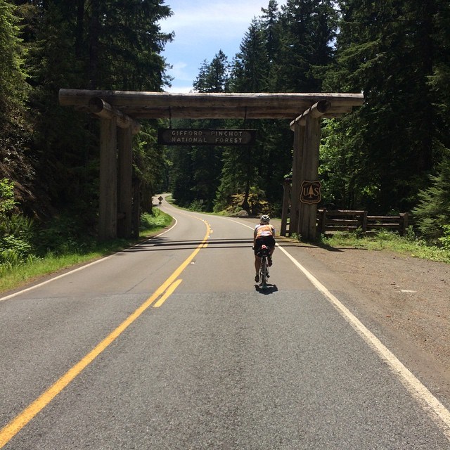
photo Keith Moore

Susan rides into the Gifford Pinchot National Forest. Photo Keith Moore


PARKING:

600K riders: Park at the Motel 6. At sign-in I will ask you for your license plate number, and will turn those in to the front desk. PRIORITY WILL BE GIVEN TO 600K RIDERS WHO PRE-REGISTER. If you turn up to ride the 600K but have not pre-registered, I can not guarantee you either a parking spot or a place to sleep. (The control room will NOT be available for you to sleep in/crash in. It’s a small room, has a hard uncarpeted floor, and the single bed will be used by the workers who are staying up all night to take care of riders coming and going). Pre-register here for the 600K.

400K riders: there are lots of towing signs in the Motel 6 parking lot. I have no idea if they enforce it, but I probably wouldn’t chance it. Instead, you might consider utilizing a space in the HUGE parking lots in front of Costco, Lowe’s etc just to the East of the motel. A scan of the area doesn’t indicate that there’s much in the way of on street parking in the area, but if you have a favorite spot, please share the information. Thanks! Pre-register here for the 400K.

Comments Off on Pre-Ride Report: 400/600K , June 13-14

Filed under Pre Rides, SIR Rides

Summer 600k – What a blast

The SIR Summer 600k may not be the ride for you . . .

. . . if you are looking for an easy flat ride (this one is difficult and has hills)

. . . if you need to update Facebook often (at least 400km of no cell coverage)

. . . if you require pristine pavement (lightly traveled forest roads are also lightly maintained)

. . . if you aren’t prepared for long stretches without services (it’s130km from Randle up into the forest and back to Packwood)

. . . if you don’t like seeing the mountains (we had jaw-dropping views of Mount Rainier, Mount St. Helens, and Mount Adams)

. . . if you don’t like the sights and sounds of rushing rivers and creeks (paralleling and crisscrossing the route)

Rick Blacker, Vincent Muoneke, and I did a scouting ride of the 600k course this past Wednesday and Thursday. The ride is spectacular and challenging. I’ll try to give a bit of a preview of what to expect. Bear in mind that we rode on weekdays, not on a weekend, so there may be differences in traffic and services from what we encountered.

Map

Elevation Profile

The warmup first 20k takes you to Black Diamond, but you’ll be there before the bakery opens, so no apple turnover temptation. The Green River gorge stands between you and the first information control in Cumberland. Be careful with the one lane bridge across the river. There may be an SIR volunteer to sign cards in Cumberland; if not, answer the question on the card.

Familiar roads will take you to Enumclaw (which you’ll skip by going around on Mud Mountain Road), Buckley, South Prairie, and Eatonville. In South Prairie, divert to the bike path, but be alert for the turn to rejoin the road. It’s an unmarked turn onto gravel street heading toward a red barn and just as the trail starts to diverge from the highway. We encountered truck traffic (but quite respectful) on the first part of Orville Road after South Prairie, but otherwise the first 100km was pretty calm.

At 100km, we had a wonderful breakfast stop at the Eatonville control at the Cottage Bakery Cafe (on right as you enter town) – pastries and nice breakfast sandwiches are available. If you get there before 8AM, the good news is that you’re killing it. The bad news is that you’ll have to head down to the convenience store for your control (the Shell station/market is on the left after the turn onto Center Street).

The climb up to WA-7 on the Alder Cutoff Road can be a bit unpleasant with traffic, so be careful. Be even more careful about the railroad tracks that you’ll encounter just before and just after Elbe. The tracks cross the road at a very sharp angle. Please be mindful of the vehicles behind, if any, as you manuever to cross them at a better angle. Elbe (120km) and Ashford (132km) provide the last opportunity for services before Packwood (174km). Elbe has nice public restrooms on left before at the entrance to the town. (I recall that Ashford does too at the Rainier Base Camp area on left, but we didn’t check that).

Skate Creek Road takes you to the first of the four major summits of the route. It’s a wonderful road and much of the elevation gain came along the way to Ashford, so the descent is way bigger than the climb. Which is nice. With the creek alongside, the descent to Packwood provides a great treat. But please be cautious about the pavement. Potholes and road subsidences appear suddenly when you are travelling at descending speed. Someone (RAMROD volunteer, perhaps) has highlighted many of the flaws with spray paint, but be alert everywhere. The last part of the descent to Packwood after you exit the forest is a wonderful thrill ride on good pavement.

The Shell at the corner of US-12 has a sandwich shop and lots of food options. The town offers other choices, but we used the Shell. After the control, head west to Randle on US-12. Some of our traditional opportunities to avoid the highway are no longer available. Davis Creek Road has been two dead-end spurs since a bridge washout a few years ago. But US-12 has a good shoulder except for a couple of bridges and traffic was light. After about 17km look for Silverbrook Road on the right, which will deliver you to Randle via a nice back road.

Randle has a convenience store (just before US-12) and a market and a cafe (on the other side of US-12). Fuel up and stock up here; the next store you’ll see is nearly 130 challenging kilometers away. We expect to have SIR support at the high point at Bear Meadows, but it’s a long way up to there.

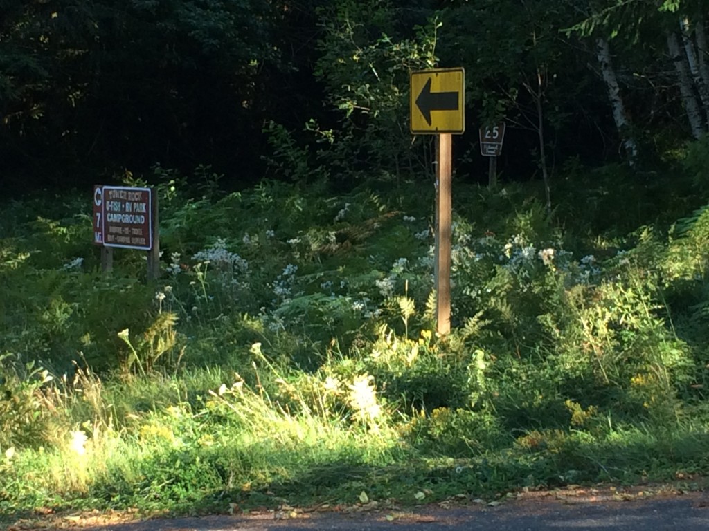
After Randle comes one of the key navigational challenges of the ride – finding Forest Road 26. Although you could get up the hill on Forest Road 25, you’d miss one of the nicest parts of the ride. When you head south from Randle, the route starts as WA-131, but changes to Forest Road 25 without fanfare as you enter the Gifford Pinchot National Forest. The turn to Forest Road 26 comes about 14km after Randle. I suggest being alert to the milepost markers on the right side of Road 25 and pay special attention after you pass MP7. Note also the signs on the bridges. After MP7 you’ll cross a bridge over the Cispus River. Just past that, the main road (25) bears left (a black on yellow arrow directs the Road 25 traffic to left; there is also a sign indicating that the Tower Rock RV Park and campground are 7 miles to the left – see photo). Forest Road 26 heads straight at this point. Don’t follow the arrow! If you look carefully in the weeds to the right, you can see a brown post with “26” on it. Also ahead there was a big sign that faces uphill, but on the downhill side that you can see, someone has painted an indication that you’ve found road 26.

NF26

I love this road. We saw fewer than ten vehicles on the entire stretch of road 26 and the scenery is wonderful. The climbing is gentle and fierce by turns. The road isn’t in great shape and includes patches of gravel. Not much of an issue when ascending, but be especially careful on any descents where you may be picking up speed. Near the top, after you start seeing the scarred blast zone trees from 34 years ago, you’ll get a pretty extended descent. I hit a stretch of gravel at a pretty good clip and exploded a tire beyond repair. Don’t do that. (I was glad I hadn’t dumped the spare tire to save weight on this ride).

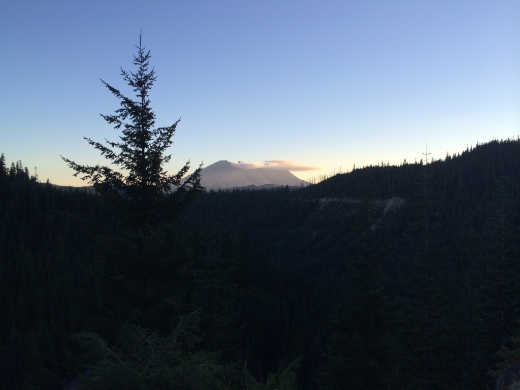
At the top of Forest Road 25 is the T-intersection with Forest Road 99. To the right is Windy Ridge; the route heads left towards Bear Meadows (the highest point of the second big bump on the elevation profile of the ride). Views of Mount Saint Helens and Mount Adams took my breath away. Look in the parking lot on the right at Bear Meadows for Bill Gobie (and bathrooms). (Of course, it’s possible that unforeseen circumstances prevent him from making it up there, but that’s the plan. If no SIR presence is possible, there will be no way to notify riders, but check our backup spot at the Wakepish Sno-Park on left just before the left turn onto Forest Road 25.)

Mountain

A long descent awaits on Forest Road 25. This starts at about the 260km point of the ride. If you’ve managed to reach this point before nightfall, that’s great. The road surface is far from ideal here. By night, or by day, please be really careful and keep your speed in check. Have good lights, good tires, good alertness, and good reflexes.

Watch for the next turn carefully. I’m pretty sure that it came after MP9. In addition to the indications for NF-76, you should also see signs indicating the Cispus Center. (There may also be signs for the Tower Rock U-Fish, RV Park, and Campground, but I can’t recall seeing those. By the way, there may be water when you get to Tower Rock, but we didn’t investigate). Forest Road 76 and Cispus Road provided some wonderful quiet night riding in the forest along the Cispus River. With the earlier 4am start for the brevet (we started at 6am), some of you may do this in daylight, which is probably pretty cool as well. You’ll encounter few T-intersections along the way. The first, before Cispus Learning Center, is a right turn, the others are lefts. One is the location of the information control. After the last one, you’ll be heading west back towards Randle. Look carefully after another 12km or so for the right turn onto Cline Road. (If you miss it, you’ll fairly quickly arrive at where the road ends in a T-intersection with WA-131/NF-25 where you were before the climb. Head back a short way and look again for Cline Road.)

Cline Road and Bennett Road will keep you off US-12 until about 12km before Packwood. No control this time, but a stop for supplies before the climb up White Pass is a good idea. White Pass is a thousand meters above Packwood, so settle in for a long climb. We had a glorious starry night for our climb, with the occasional meteor for inspiration. Three of four of the big bumps done. A nice, possibly cold, descent (about 450 meters worth) takes you to Rimrock Lake. Look for the Silver Beach resort on the right for an SIR staffed control with food and beds.

After the break, the route continues east (and down) towards the junction with WA-410. Unless you’re desperate to visit Yakima, follow the route west (uphill and into the wind) towards Chinook Pass. The next 75km will take you up about 1150 meters. That’s only about 1.5% on average. Sounds easy. Partway up you’ll see evidence of the Nile Valley landslide that closed the highway five years ago. Not that you’ll really need a reminder of the power of gravity.

33 kilometers up is the Whistlin’ Jack resort on the left. (The info control is a sign on the right side of the road opposite the resort). Whistlin’ Jack’s has a convenience store as well as a restaurant with great breakfast offerings. For us, the breakfast break was wonderful; totally worth the time spent fortifying ourselves for the next 43km up to the summit. (If you run short of water on the way up, the Lodgepole Campground on the right about 12km from the summit has a water pump – right side of campground opposite campsite 23. The water is cold and likely good for the iron-deficient.)

Chinook

Chinook Pass represents the highest elevation of the ride. Enjoy the triumph; we did. Ain’t over yet, though. Still another 100km to the finish. As always, be careful on the downhill. The steep section down to Cayuse Pass has some tight turns and tourist traffic. About 40km after Chinook, you’ll reach Greenwater. Given the likely headwind, the milkshakes at the deli on the left may provide the needed power for the last stretch home. We opted for beer and food at the Naches Tavern on the right. 21km after Greenwater, watch for the left turn to Mud Mountain Dam. Take the Mud Mountain Road all the way to 410 (west of Enumclaw) to find the last information control near the Boise Creek grocery store.

Just under 20km from the finish, the ride has a little sting left in its tail. “Enjoy” the climb up from the Green River valley on 218th Avenue. The finish is close!

Comments Off on Summer 600k – What a blast

Filed under Pre Rides

Crystal Blue Persuasion 300k Pre-Ride

Crystal Blue Persuasion 300k Pre-Ride
By Joe Llona

Orting Foothills Trail

Shan Perera, Bill Dussler, Rick Groth, Joe Llona and Jason Hansen on the Orting Foothills Trail. By Shan Perera.

The ride starts off through downtown Renton and on to the Cedar River Trail.  At Maple Valley the trail turns to hard-packed gravel and turns onto the Cedar River to Green River Trail.   The 4 mile section is really hard packed and riding it with 25’s was a non-issue, except for at three underpasses that get pretty dark.  No issues there either really except that I was guessing and the gravel was a little looser there.  Just go slower and maybe take the dark glasses off and you’ll be fine.

You get onto the highway for a few miles near Black Diamond and then turn left and go down to the Green River Gorge then climb back up to Cumberland, where the first control will be.  This will be staffed and water will be available.  Restrooms are available about a mile further down from the control at Nolte State Park.

Continuing onto Enumclaw and then onto Highway 410, which can be pretty busy at times.  This will be compounded by the chip sealing operation in that has been in progress for several weeks.  This is the case most of the way from Enumclaw to Crystal Mountain Blvd, with a few (very relieving) breaks. No loose tar to gunk up the frame, but lots of loose gravel scattered on the shoulders.  Tire size is not an issue, but tire durability is.  On the pre-ride there were three flats from the loose rocks on the shoulder.  What I would recommend is if you can, bring a bike without fenders.  Saturday I rode a bike with fenders with a tight clearance and had several times where a rock jammed between the fender and the tire, usually clearing itself in a few rotations but once I had to stop and remove the wheel to clear it.  There are no fog lines and the rumble strips are difficult to see but definitely still there.  There has been progress from week to week, with the road sealed in some places already (was not the case the week before) but still no striping.

After about 30 miles on 410 you turn onto Crystal Mountain Boulevard (CMB).  Before you make that turn though, take inventory of your water bottles.  There is water available 1 mile before the turn onto CMB at Silver Springs Campground on your right.  The climb is on a nice road, consistent 6% grade for first 4 miles then levels for a bit then climbs again.  If it’s warm it will be a two-water-bottle-climb.

At the top you will find another SIR staffed control.  There will be sandwiches, snacks and drinks.  Water and restrooms are available and there is a store and a food truck as well.

The descent is fast and easy, then back onto loose chip seal and headwinds on 410.  At Mud Mountain Road you are off the chip seal project for good.  The descent of Mud Mountain road to Enumclaw is exhilarating, but be wary of on-coming cars coming around the bends.

Back onto 410 (no chip seal project on this stretch) then through Buckley, Burnett, Wilkeson, and Carbonado.  The weather forecast is for it to be pretty warm, so I’d recommend stopping in Burnett or Wilkeson for water before the gentle rolling climb up to the Carbon River Ranger Station.  At the end of the road you will find the Old Ranger Station and an SIR control staffed by an old ranger.  There will be water and drinks available there.

From Carbon River you backtrack down to Wilkeson, and then continue descending to South Prairie, where you get on the beautiful Foothills Trail and parallel the Carbon River into Orting.  As you approach Orting, make sure you look behind you for some awesome views of Mt. Rainier.  The Orting control is not staffed, but there is a Safeway and a Subway at the shopping center along the course.

Continuing on the Foothill Trail towards Puyallup and Sumner the rest of the ride is pancake flat except for an overpass or two.  There are multiple unsigned crossings before your right turn onto Shaw Rd. E, which is clearly signed.  In Sumner the White River Trail should be easy to find from the cue sheet, but shortly after you get on it, there are two places that can become confusing, at least in the dark – just remember to take the left fork of the trail two times and keep the warehouse to your right and you’ll stay on course.

As you approach Pacific, you’re off the White River Trail and then eventually onto Interurban Trail, with clear sailing to Renton, but look out for track crossings, the last one’s pretty bad. In Renton you work your way back to the finish at Fred Meyer, where you began.

Steve put an awesome course together here and except for the chip-sealing on 410 I think you will find the ride very worthwhile.  See you on Saturday.

Clue Sheet: http://goo.gl/x33nKU
Map: http://ridewithgps.com/routes/5453446

Comments Off on Crystal Blue Persuasion 300k Pre-Ride

Filed under Pre Rides, SIR Rides

Tsunami 600k Pre-Ride

Tsunami 600k Pre-Ride
By Vincent Muoneke

Vincent originally published this report on his blog, Spokesong.

photo

Looking back on the Narrows at Tacoma presented a photo op and Mark took it, after all it had only been raining since we left Tokeland after a good night’s sleep. I could not help but wonder if Tsunamis get named, hurricanes do, and the bridge that once stood here had one. That was before the climbing began, I decided that if this ride were a Tsunami, it’s name would be “Annie”. “Annie Tsunami” kinda has a ring to it.

We started 0715 at the Starbucks in Bremerton, Rick and I had arrived Via WA 3 and waited for Mark who arrived shortly by Ferry in time for the timely departure. We went down Burwell to WA 304 and to avoid the drama of getting to Gorst via WA 3, we made an early right on  Rodgers to climb a little and come down with a lower heart rate getting on Belfair Valley Rd.

The weather was good and Mark and Rick stopped repeatedly without as much as a glance at the watch to make copious notes to craft a reliable Cue Sheet. At Belfair we joined the WA 106, it’s a bit early but services are available. We did not run all the way to the Purdy Cutoff, but took an earlier left on Trails End Rd. just after the place with curios placed in front. This provides a more direct route to Shelton through Mason Lake. We signed our cards and refreshed at the control; The Airport Grocery and Deli and headed to Matlock.

We Ignored the store at Matlock, which will be there if you need it and continued straight towards Deckerville, turning right on Cougar Smith to tackle the the Gravel Climb. I had 28’s, 32’s would have been better. Now in the tracks of the “Watery 600k” our next stop was Humptulips, a control and a number of service options; a Grocery Store(the control) and a Gas Station. We leave the US 101 at the Gas Station, making a left onto Kirkpatrick that will bring you into the heart of the Tsunami Zone.

At the next control at Pacific beach there are a few options, We choose the restaurant and have a sit down meal, we inquire from the locals what the road is like between here and Ocean Shores, we get two opinions. “It is twisty, up and down”. “It is beautiful”.

They will be both correct, a fog is rolling in now from the Pacific now, so we get rear lights on. We have to find and answer 2 questions in Ocean Shores before returning to WA 115 then WA 109 that brings us to Arbedeen via Hoquiam. We prepare for the last leg of the day in the Aberdeen Safeway and then catch the WA 105 to Westport and Tokeland.

Morning in Tokeland, the sky is crying, the streets are full of tears, the rain will come down till we are close to Tacoma. We dash for Raymond for something to eat, The Chevron is 24hrs and the clerk is super cheerful that early, it is the control. We then tackle the 4 rollers of the 101 in the wet. We decide to stop for a real breakfast after the rollers at Artic, good breakfast, but we did bring a little Tsunami of rain water into the shop.

We pass Montesano, watch the first set of railroad tracks into Monte, they have a bad angle, we ignore services here and in Elma on our way to the control at Mcleary. We run parallel to US 12 and over the Satsop river on the way to Mcleary and it is possible that the bridge over the Satsop will be under construction. It will be straightforward to shunt that section by getting on US 12 and then returning to the service roads past the construction.

After refreshments at Mcleary we went up to WA 8 which we left to enter Old Olympic Hwy that brought us to Delphi Rd. which took us to Littlerock, control and refreshment here and we went down Littlerock Rd. to Tumwater where we caught the Yelm Hwy to Yelm. Another control at Yelm and from there towards Lacey to catch the Old Pac Hwy and a very short strip of 1-5 to Dupont, by now you are consistently seeing the Dan Henry’s for “Rhapsody”.

Dupont to Steilacoom, there’s also pretty bad rail tracks just past Steilacoom if you hit it wrong. From Chambers Creek, climb “snot nose hill” into the University area of Tacoma. 6th ave in Tacoma meets Jackson Ave on the steep side. Jackson is busy and to turn from Jackson into the trail (Scott Pierson) that crosses the Tacoma Narrows may be tricky. Use Caution here or consider using the side walk (on the wrong side of the road) on Jackson from 6th to get to the trail.

Across the Narrows we can smell Fritz’s in Bremerton, Beer and Brats. but hold unto your horses buckeroo, Annie is Bottom loaded, with climbing I mean. The Cushman Powerline trail which runs parallel to WA 16 gives a taste of this but it gets worse after Purdy, careful turning into Purdy Dr. just before Purdy, as it exits off one freeway to connect others and was quite busy on Friday of the Memorial Day weekend, should be better next weekend. Now in the Kitsap a few steep one’s before we are screaming down WA 3 to Gorst again and then up Burwell to the finish.
mt_600_finish

Annie is OK
Thanks Mark, Rick, and SIR


Comments Off on Tsunami 600k Pre-Ride

Filed under Pre Rides, SIR Rides

Olympia 300k

Pre Ride Report – Olympia 300k
By Ian Shopland

This ride links some of the most scenic, quiet, least traveled roads in southwest Washington. Even in the pouring rain, I was amazed at the solitude and beauty. Here is my ride report.

Four riders: Theo, John P, Corey and myself huddled in the Starbucks and watched as the morning dawn never came. Black clouds billowed out of the south and blocked all but the most faint of morning light. The umbrella awning outside the door spun like a top in the wind and sprayed water over us like a rotary sprinkler. We hardened our resolve and pulled ourselves away from the pastries and coffee.

Within the first few blocks, the route kicks up and climbs over Tumwater Hill. It felt good to get blood pumping in the cold rain. Our brake pads squeegeed off water from our rims on the descent as we rode through sheets of water on the road. We snaked through the westside of town, taking the back roads to stay off the freeway as long as possible. Just before the gas station at Steamboat Island, we turned onto the 101 onramp and headed north to Shelton. This is the busiest section of the route but the shoulder is wide enough to ride two abreast. Be cautious when crossing the on/off ramps. Just north of Shelton we spotted some patches of blue sky and then decided they were actually just patches of less gray sky. Before too long we were at the first control and filled up with snacks and more coffee.

The instant we turned off 101, the sound of traffic disappeared behind us and we were left to our thoughts on the small roads though the woods. The next info control is not far off, but takes us through the quiet valley of Little Egypt. I believe this road is new to SIR. This info control is at a bridge between mile marker 1 and 2. Don’t forget to stop and read the sign on the left. After the control, the route circles the valley and the next turn isn’t signed. It turns up a short unmarked intersection that is a connector to the main road (Highland). If you  miss it, just go down the 200m to the stop sign and take a left on Highland. It gets you to the same place.

At this point, the rain had nearly stopped and we were able to look around and enjoy the scenery: green leaves slowly unfolding, rippling creeks full to their banks, and bright yellow odorous skunk cabbage blooming in the ditches. As the route turned south, the winds picked up and brought driving rain with them. This would be the weather rhythm of the day. Patches of dry/almost sunny and then the water faucet would reopen and we would be soaked for a few miles.

We arrived at the Montesano Thriftway dripping and were thrilled to see the deli was open. Hot chicken strips and hot clam chowder made the perfect lunch meal. The break was much needed, but we spent a long time there trying to work up the motivation to go back into the rain.

The stretch between Montesano and Artic went quickly. I was glad we didn’t have to go all the way down to Raymond on the “normal” route south. I’ve heard the cafe called “Clark’s” is very good and is located just before the turn, but we didn’t stop. The Fire station is just around the corner from the turn off on 101. The answer to the info question is on the west side of the building, (that would be the left side when looking at the doors).

Our first real sun came out at the perfect time. The trees and bushes were dripping with diamonds of raindrops as we followed the North River on the only paved road to the town of Brooklyn. The tavern here is a legacy of the logger bars of the yesteryear of the region. The wood floors are well worn and the walls are covered in old logging tools. We walked into a live duet of tuba and piano serenading the locals. The bartenders were happy and welcoming and there were drinks and hotdogs within a few minutes wait. It was hard to leave the warmth and entertainment of the bar but the most difficult sections of the ride were about to come.

In less than a mile the beautiful paved road turns to gravel and begins to climb. It continues for 3.8 miles and gains 800 ft with a max grade of 12-13%. The gravel quality is mostly very hard packed. The climb is long and hard but the views are incredible. If you can hear your heart pounding in your ears, just stop for a moment and regroup. Walk a bit and try again. The descent is also steep 11-12% and looses about the same elevation in about the same distance. Keep your bike under control and don’t overstep your skills. Make sure you are having fun. Before you know it, the pavement starts again and before you know it, there is another steep (paved) climb ahead of you.

The next stop was Adna and we warmed ourselves again and were ready for some food. I warmed a burrito in the microwave and John heated up some canned soup in a coffee mug. PLEASE pick up after yourself. The manager Jason wasn’t happy that some rando’s left garbage on his table and outside on another ride. Be courteous and clean up and remember thank yous.

Don’t eat too much in Adna or you might taste it again as you are going up Curtis Hill, just a few miles from the control. Darkness fell as we crested the hill and on the descent, we were again pelted by rain so hard it stung my face. The Curtis store is closed, but the answer to the info question is on the building to the left of the door. The route heads back the way you came, but don’t worry, we’re not going up Curtis Hill again. The route turns right on Lake Creek and heads down to King Road.

King Road was one of those roads that Rando’s have passed on many rides and I always asked myself, “I wonder where that goes?” It is a beautiful road that connects Curtis to Winlock. The pavement ends long before the climb. The climb itself is less than two miles but it is steep 11-12% and gains 600ft. This gravel is looser than on Brooklyn Road. Riders with 23mm tires will be challenged to maintain traction at times. The reason we started the ride an hour earlier was to get most of the riders through this section in the daylight. Our journey put us through this section in the pouring rain in the dark. It was a serious challenge. Most of the descent is paved, however. There is a short steep section of gravel (.6mi) and 8-9% max grade and 150 ft down.

You almost don’t have to pedal to get to Winlock. The usual bridge on Fir St is closed so there is a short detour south one block to the next bridge. After a re-supply on food, coffee, and dry air. We began the final section of climbs. The route backtracks a few blocks and zig zags through town to Tennessee and follows a few roller coaster hills before you hit Pleasant Valley. The only thing unpleasant about Pleasant Valley is leaving it, but before too long the Hillcrest Food Mart appears.

At this point, the hills were over, the wind was at our back but the rain still pounded the pavement. We headed north to home wet and tired.


Comments Off on Olympia 300k

Filed under Pre Rides, SIR Rides