The SIR Summer 600k may not be the ride for you . . .
. . . if you are looking for an easy flat ride (this one is difficult and has hills)
. . . if you need to update Facebook often (at least 400km of no cell coverage)
. . . if you require pristine pavement (lightly traveled forest roads are also lightly maintained)
. . . if you aren’t prepared for long stretches without services (it’s130km from Randle up into the forest and back to Packwood)
. . . if you don’t like seeing the mountains (we had jaw-dropping views of Mount Rainier, Mount St. Helens, and Mount Adams)
. . . if you don’t like the sights and sounds of rushing rivers and creeks (paralleling and crisscrossing the route)
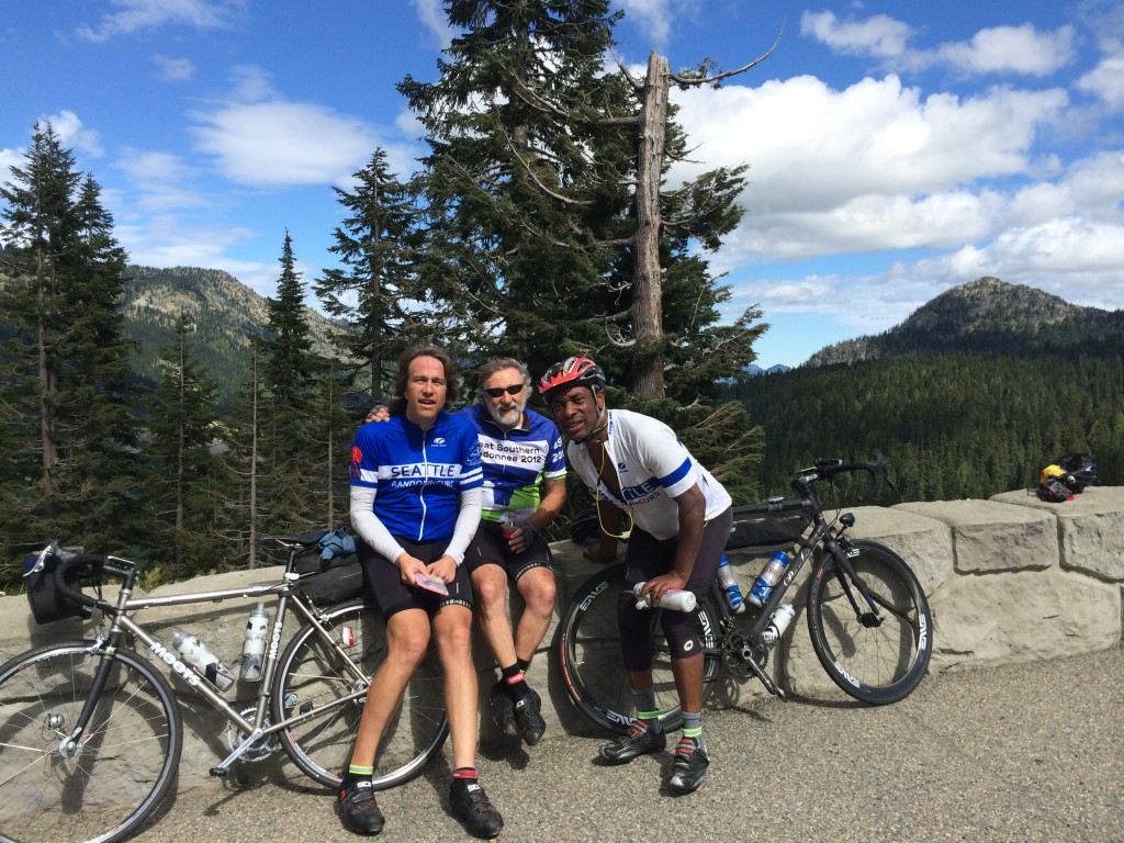
Rick Blacker, Vincent Muoneke, and I did a scouting ride of the 600k course this past Wednesday and Thursday. The ride is spectacular and challenging. I’ll try to give a bit of a preview of what to expect. Bear in mind that we rode on weekdays, not on a weekend, so there may be differences in traffic and services from what we encountered.
The warmup first 20k takes you to Black Diamond, but you’ll be there before the bakery opens, so no apple turnover temptation. The Green River gorge stands between you and the first information control in Cumberland. Be careful with the one lane bridge across the river. There may be an SIR volunteer to sign cards in Cumberland; if not, answer the question on the card.
Familiar roads will take you to Enumclaw (which you’ll skip by going around on Mud Mountain Road), Buckley, South Prairie, and Eatonville. In South Prairie, divert to the bike path, but be alert for the turn to rejoin the road. It’s an unmarked turn onto gravel street heading toward a red barn and just as the trail starts to diverge from the highway. We encountered truck traffic (but quite respectful) on the first part of Orville Road after South Prairie, but otherwise the first 100km was pretty calm.
At 100km, we had a wonderful breakfast stop at the Eatonville control at the Cottage Bakery Cafe (on right as you enter town) – pastries and nice breakfast sandwiches are available. If you get there before 8AM, the good news is that you’re killing it. The bad news is that you’ll have to head down to the convenience store for your control (the Shell station/market is on the left after the turn onto Center Street).
The climb up to WA-7 on the Alder Cutoff Road can be a bit unpleasant with traffic, so be careful. Be even more careful about the railroad tracks that you’ll encounter just before and just after Elbe. The tracks cross the road at a very sharp angle. Please be mindful of the vehicles behind, if any, as you manuever to cross them at a better angle. Elbe (120km) and Ashford (132km) provide the last opportunity for services before Packwood (174km). Elbe has nice public restrooms on left before at the entrance to the town. (I recall that Ashford does too at the Rainier Base Camp area on left, but we didn’t check that).
Skate Creek Road takes you to the first of the four major summits of the route. It’s a wonderful road and much of the elevation gain came along the way to Ashford, so the descent is way bigger than the climb. Which is nice. With the creek alongside, the descent to Packwood provides a great treat. But please be cautious about the pavement. Potholes and road subsidences appear suddenly when you are travelling at descending speed. Someone (RAMROD volunteer, perhaps) has highlighted many of the flaws with spray paint, but be alert everywhere. The last part of the descent to Packwood after you exit the forest is a wonderful thrill ride on good pavement.
The Shell at the corner of US-12 has a sandwich shop and lots of food options. The town offers other choices, but we used the Shell. After the control, head west to Randle on US-12. Some of our traditional opportunities to avoid the highway are no longer available. Davis Creek Road has been two dead-end spurs since a bridge washout a few years ago. But US-12 has a good shoulder except for a couple of bridges and traffic was light. After about 17km look for Silverbrook Road on the right, which will deliver you to Randle via a nice back road.
Randle has a convenience store (just before US-12) and a market and a cafe (on the other side of US-12). Fuel up and stock up here; the next store you’ll see is nearly 130 challenging kilometers away. We expect to have SIR support at the high point at Bear Meadows, but it’s a long way up to there.
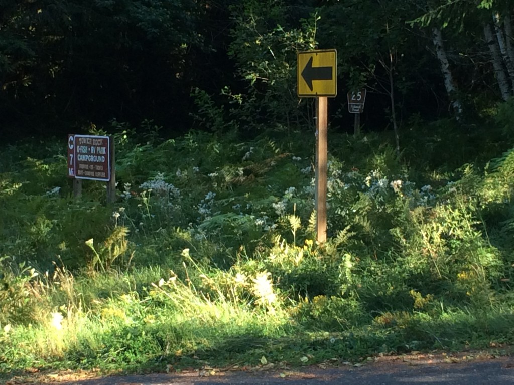
After Randle comes one of the key navigational challenges of the ride – finding Forest Road 26. Although you could get up the hill on Forest Road 25, you’d miss one of the nicest parts of the ride. When you head south from Randle, the route starts as WA-131, but changes to Forest Road 25 without fanfare as you enter the Gifford Pinchot National Forest. The turn to Forest Road 26 comes about 14km after Randle. I suggest being alert to the milepost markers on the right side of Road 25 and pay special attention after you pass MP7. Note also the signs on the bridges. After MP7 you’ll cross a bridge over the Cispus River. Just past that, the main road (25) bears left (a black on yellow arrow directs the Road 25 traffic to left; there is also a sign indicating that the Tower Rock RV Park and campground are 7 miles to the left – see photo). Forest Road 26 heads straight at this point. Don’t follow the arrow! If you look carefully in the weeds to the right, you can see a brown post with “26” on it. Also ahead there was a big sign that faces uphill, but on the downhill side that you can see, someone has painted an indication that you’ve found road 26.
I love this road. We saw fewer than ten vehicles on the entire stretch of road 26 and the scenery is wonderful. The climbing is gentle and fierce by turns. The road isn’t in great shape and includes patches of gravel. Not much of an issue when ascending, but be especially careful on any descents where you may be picking up speed. Near the top, after you start seeing the scarred blast zone trees from 34 years ago, you’ll get a pretty extended descent. I hit a stretch of gravel at a pretty good clip and exploded a tire beyond repair. Don’t do that. (I was glad I hadn’t dumped the spare tire to save weight on this ride).
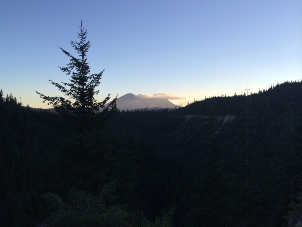
At the top of Forest Road 25 is the T-intersection with Forest Road 99. To the right is Windy Ridge; the route heads left towards Bear Meadows (the highest point of the second big bump on the elevation profile of the ride). Views of Mount Saint Helens and Mount Adams took my breath away. Look in the parking lot on the right at Bear Meadows for Bill Gobie (and bathrooms). (Of course, it’s possible that unforeseen circumstances prevent him from making it up there, but that’s the plan. If no SIR presence is possible, there will be no way to notify riders, but check our backup spot at the Wakepish Sno-Park on left just before the left turn onto Forest Road 25.)
A long descent awaits on Forest Road 25. This starts at about the 260km point of the ride. If you’ve managed to reach this point before nightfall, that’s great. The road surface is far from ideal here. By night, or by day, please be really careful and keep your speed in check. Have good lights, good tires, good alertness, and good reflexes.
Watch for the next turn carefully. I’m pretty sure that it came after MP9. In addition to the indications for NF-76, you should also see signs indicating the Cispus Center. (There may also be signs for the Tower Rock U-Fish, RV Park, and Campground, but I can’t recall seeing those. By the way, there may be water when you get to Tower Rock, but we didn’t investigate). Forest Road 76 and Cispus Road provided some wonderful quiet night riding in the forest along the Cispus River. With the earlier 4am start for the brevet (we started at 6am), some of you may do this in daylight, which is probably pretty cool as well. You’ll encounter few T-intersections along the way. The first, before Cispus Learning Center, is a right turn, the others are lefts. One is the location of the information control. After the last one, you’ll be heading west back towards Randle. Look carefully after another 12km or so for the right turn onto Cline Road. (If you miss it, you’ll fairly quickly arrive at where the road ends in a T-intersection with WA-131/NF-25 where you were before the climb. Head back a short way and look again for Cline Road.)
Cline Road and Bennett Road will keep you off US-12 until about 12km before Packwood. No control this time, but a stop for supplies before the climb up White Pass is a good idea. White Pass is a thousand meters above Packwood, so settle in for a long climb. We had a glorious starry night for our climb, with the occasional meteor for inspiration. Three of four of the big bumps done. A nice, possibly cold, descent (about 450 meters worth) takes you to Rimrock Lake. Look for the Silver Beach resort on the right for an SIR staffed control with food and beds.
After the break, the route continues east (and down) towards the junction with WA-410. Unless you’re desperate to visit Yakima, follow the route west (uphill and into the wind) towards Chinook Pass. The next 75km will take you up about 1150 meters. That’s only about 1.5% on average. Sounds easy. Partway up you’ll see evidence of the Nile Valley landslide that closed the highway five years ago. Not that you’ll really need a reminder of the power of gravity.
33 kilometers up is the Whistlin’ Jack resort on the left. (The info control is a sign on the right side of the road opposite the resort). Whistlin’ Jack’s has a convenience store as well as a restaurant with great breakfast offerings. For us, the breakfast break was wonderful; totally worth the time spent fortifying ourselves for the next 43km up to the summit. (If you run short of water on the way up, the Lodgepole Campground on the right about 12km from the summit has a water pump – right side of campground opposite campsite 23. The water is cold and likely good for the iron-deficient.)
Chinook Pass represents the highest elevation of the ride. Enjoy the triumph; we did. Ain’t over yet, though. Still another 100km to the finish. As always, be careful on the downhill. The steep section down to Cayuse Pass has some tight turns and tourist traffic. About 40km after Chinook, you’ll reach Greenwater. Given the likely headwind, the milkshakes at the deli on the left may provide the needed power for the last stretch home. We opted for beer and food at the Naches Tavern on the right. 21km after Greenwater, watch for the left turn to Mud Mountain Dam. Take the Mud Mountain Road all the way to 410 (west of Enumclaw) to find the last information control near the Boise Creek grocery store.
Just under 20km from the finish, the ride has a little sting left in its tail. “Enjoy” the climb up from the Green River valley on 218th Avenue. The finish is close!


