Author Archives: Mark Thomas

2017 Draft Calendar

Our calendar for 2017 ACP events has to be submitted by September 30th. Here’s a draft. Ideas welcome. Not all conflicts (with holidays, other rides, wedding anniversaries, etc) can be avoided, but let me know if there are some particularly bad problems. All rides dependent on finding willing volunteers to manage them.

Jan-Feb – Winter Training Series
Sat 3/11 – Spring Populaire

Sat 3/18 – Spring 200k
Sat 3/25 – Olympia 200k
Sat 4/8 – Spring 300k
Sat 4/15 – Olympia 300k

Fri 4/21 – Sun 4/23 – Fleche NW
Thu 5/11–Sun 5/14 – NW Crank
Sat 5/6–Sun 5/14 NWC Brevet Week (Sat 5/6 – 600k / 1000k; Tue 5/9 – 300k; Wed 5/10 – 400k; Sun 5/14 – 200k)

Sat 5/20 – Spring 400k
Sat 6/03 – Spring 600k
Fri 6/23 – Spring 1000k

Sat 7/8 – Summer Populaire
Sat 7/15 – Summer 200k
Sat 7/29 – Summer 300k
Sat 8/12 – Summer 400k
Sat 8/26 – Summer 600k
Fri 9/15 – Summer 1000k

Comments Off on 2017 Draft Calendar

Filed under Club Info, SIR Rides

Help wanted

[UPDATED 10/30: rides still in need of volunteers are in bold, below]

From Mark:

I hope to see many of you this Sunday at our annual meeting. It’ll be a fun opportunity to review a great year and to talk about next year.

We have a pretty ambitious schedule for 2015, designed to give us (1) multiple opportunities to qualify for Paris-Brest-Paris, (2) good training for PBP, and (3) great rides and challenges for those not going to PBP. All of this will only happen with a lot of your help. Please contact me before (or at) the meeting if you are willing to organize (or co-organize) any of our events for next year.

As a reminder, here’s the schedule of events:
(Additional RUSA events can be still be scheduled, but the ACP event schedule is set).

  • WTS – Ralph & Carol Nussbaum (Ray Whitlock & Noel Howes)
  • 03/07 Spring 100k populaire – Andy Speier / Dax & Michelle Soule / Jeff Loomis

ACP brevets (PBP qualifiers)

  • 03/14 200k – Mark Roberts
  • 03/28 300k – Gary Prince
  • 04/04 makeup 300k – Theo Roffe
  • 04/05 makeup 200k – Adam Glass

Fleche

  • 04/10-12 Fleche NW – Josh Morse / Theo Roffe

NW Crank / Brevet Week (PBP qualifiers)

  • 04/18-26 Brevet Week – Hugh Kimball
    • 04/18 NWC-BW ACP600k
    • 04/21 NWC-BW ACP300k
    • 04/22 NWC-BW ACP400k
    • 04/26 NWC-BW ACP200k
  • 04/23-26 NW Crank – Eric Vigoren / Maggie Williams / Hugh Kimball

ACP brevets (PBP qualifiers)

  • 05/02 400k – Adam Morley/Bob Brudvik/Mike McHale
  • 05/30 600k – Joe Llona

Additional PBP qualifiers

  • 06/13 Second chance 400k/600k – Jan Acuff / Susan Otcenas
  • 06/27 Last chance 400k/600k – Millison Fambles & Ian Shopland

PBP training rides

  • 07/16 Night start 400k (Theo Roffe) and 1000k (Ward Beebe) (with other options, likely permanents, for 18th and 19th)
  • 08/01 300k
  • 08/02 200k

Fall rides

  • 09/11 1000k – Robert Trombley
  • 09/19 200k – Ken and Karla Ward
  • 09/26 100k


Comments Off on Help wanted

Filed under Club Info

Thoughts for the new rider

By John Kydd
I’m a new rider.  I just did my first 300 and 400 so I am your guide to clueless riding.  I don’t have any Rando buddies save for the fact that my little sister rode many years ago.
 
Here are my “newbie” observations.
 
1.   These are good people.  They watch out for each other and you if you can keep with their pace.  Find a group that goes at a pace that is comfortable for you.  Introduce yourself and see if it’s reciprocated.  Then you’ve got some one to talk with.  Figure out what they eat at rest stops and buy stuff to share. 
 
2. Try to be quick at the stops ( I am not quick).  Do what you need to do and then you can relax and not slow the group down when they decide to leave.
 
3.  If you flat or something else just take it on and fix it.  Pick up the next group that comes by so you are not stuck out there alone.  Be sure to program in the brevet director’s phone number into your phone speed dial in case you can’t fix the problem.  If you are outside of cell reception then try to get to the next rest stop or wait for another rider. Be sure to pack a space blanket.  Hypothermia is no fun.
 
4.  Read the RUSA Handbook articles.  They are fantastic:  one hundred seventy four pages of wisdom and experience.  Skip around and sample the articles you like the most until you get to all of them..
 
5.  Consider joining the Seattle Randonnneurs mailing list at seattlerando@googlegroups.com – There is a ton of great information and you can meet the interesting writing personality of many of the riders.
 
6.  If you have not ridden in pace lines and such then try your best to hold your line.  Avoid sudden moves (particularly braking) until you alert the people behind you by shouting “slowing”  or “stopping” before you do so.  If I start to ride wobbily then I head to back of the group so I do not put anyone else at risk.
 
7.  Don’t worry about getting dropped by your group.  It happens.  It is not intentional as folks just ride their pace.   Slow down, fuel up and a another group will meet you or you can wait at the next rest stop.
 
8.  Garmin’s are not enough.  On the Crystal 300 I would have ended up in Tukwila if I followed my Garmin.  I later figured out that my Garmin confused the route out with the route back when the same road was used.  Go figure. Or maybe it was aliens.  I pulled out my cue cards and used them to find my way back to one of those wise riders (Hugh Kimball) who was kind enough to rescue me (from myself).
 
9.  If you have not ridden the route then study it.  I relied on my Garmin the first time: big mistake.  Highlight the controls and other important stops.
 
10.  Have fun.  Enjoy the beauty, the stories and all the mordant comments as the miles pile on,   Fun means not having to impress or win.  Fun also means safe.  If you are nodding off then it’s time for a quick nap.  No shame in that. Fun is not riding yourself senseless but listening to body instead of ego. Fun is taking good care of you so you make it home intact where that cold beer has been waiting for hours just to greet you.


Comments Off on Thoughts for the new rider

Filed under Rando How-Tos, SIR Members

Summer 600k – What a blast

The SIR Summer 600k may not be the ride for you . . .

. . . if you are looking for an easy flat ride (this one is difficult and has hills)

. . . if you need to update Facebook often (at least 400km of no cell coverage)

. . . if you require pristine pavement (lightly traveled forest roads are also lightly maintained)

. . . if you aren’t prepared for long stretches without services (it’s130km from Randle up into the forest and back to Packwood)

. . . if you don’t like seeing the mountains (we had jaw-dropping views of Mount Rainier, Mount St. Helens, and Mount Adams)

. . . if you don’t like the sights and sounds of rushing rivers and creeks (paralleling and crisscrossing the route)

Rick Blacker, Vincent Muoneke, and I did a scouting ride of the 600k course this past Wednesday and Thursday. The ride is spectacular and challenging. I’ll try to give a bit of a preview of what to expect. Bear in mind that we rode on weekdays, not on a weekend, so there may be differences in traffic and services from what we encountered.

Map

Elevation Profile

The warmup first 20k takes you to Black Diamond, but you’ll be there before the bakery opens, so no apple turnover temptation. The Green River gorge stands between you and the first information control in Cumberland. Be careful with the one lane bridge across the river. There may be an SIR volunteer to sign cards in Cumberland; if not, answer the question on the card.

Familiar roads will take you to Enumclaw (which you’ll skip by going around on Mud Mountain Road), Buckley, South Prairie, and Eatonville. In South Prairie, divert to the bike path, but be alert for the turn to rejoin the road. It’s an unmarked turn onto gravel street heading toward a red barn and just as the trail starts to diverge from the highway. We encountered truck traffic (but quite respectful) on the first part of Orville Road after South Prairie, but otherwise the first 100km was pretty calm.

At 100km, we had a wonderful breakfast stop at the Eatonville control at the Cottage Bakery Cafe (on right as you enter town) – pastries and nice breakfast sandwiches are available. If you get there before 8AM, the good news is that you’re killing it. The bad news is that you’ll have to head down to the convenience store for your control (the Shell station/market is on the left after the turn onto Center Street).

The climb up to WA-7 on the Alder Cutoff Road can be a bit unpleasant with traffic, so be careful. Be even more careful about the railroad tracks that you’ll encounter just before and just after Elbe. The tracks cross the road at a very sharp angle. Please be mindful of the vehicles behind, if any, as you manuever to cross them at a better angle. Elbe (120km) and Ashford (132km) provide the last opportunity for services before Packwood (174km). Elbe has nice public restrooms on left before at the entrance to the town. (I recall that Ashford does too at the Rainier Base Camp area on left, but we didn’t check that).

Skate Creek Road takes you to the first of the four major summits of the route. It’s a wonderful road and much of the elevation gain came along the way to Ashford, so the descent is way bigger than the climb. Which is nice. With the creek alongside, the descent to Packwood provides a great treat. But please be cautious about the pavement. Potholes and road subsidences appear suddenly when you are travelling at descending speed. Someone (RAMROD volunteer, perhaps) has highlighted many of the flaws with spray paint, but be alert everywhere. The last part of the descent to Packwood after you exit the forest is a wonderful thrill ride on good pavement.

The Shell at the corner of US-12 has a sandwich shop and lots of food options. The town offers other choices, but we used the Shell. After the control, head west to Randle on US-12. Some of our traditional opportunities to avoid the highway are no longer available. Davis Creek Road has been two dead-end spurs since a bridge washout a few years ago. But US-12 has a good shoulder except for a couple of bridges and traffic was light. After about 17km look for Silverbrook Road on the right, which will deliver you to Randle via a nice back road.

Randle has a convenience store (just before US-12) and a market and a cafe (on the other side of US-12). Fuel up and stock up here; the next store you’ll see is nearly 130 challenging kilometers away. We expect to have SIR support at the high point at Bear Meadows, but it’s a long way up to there.

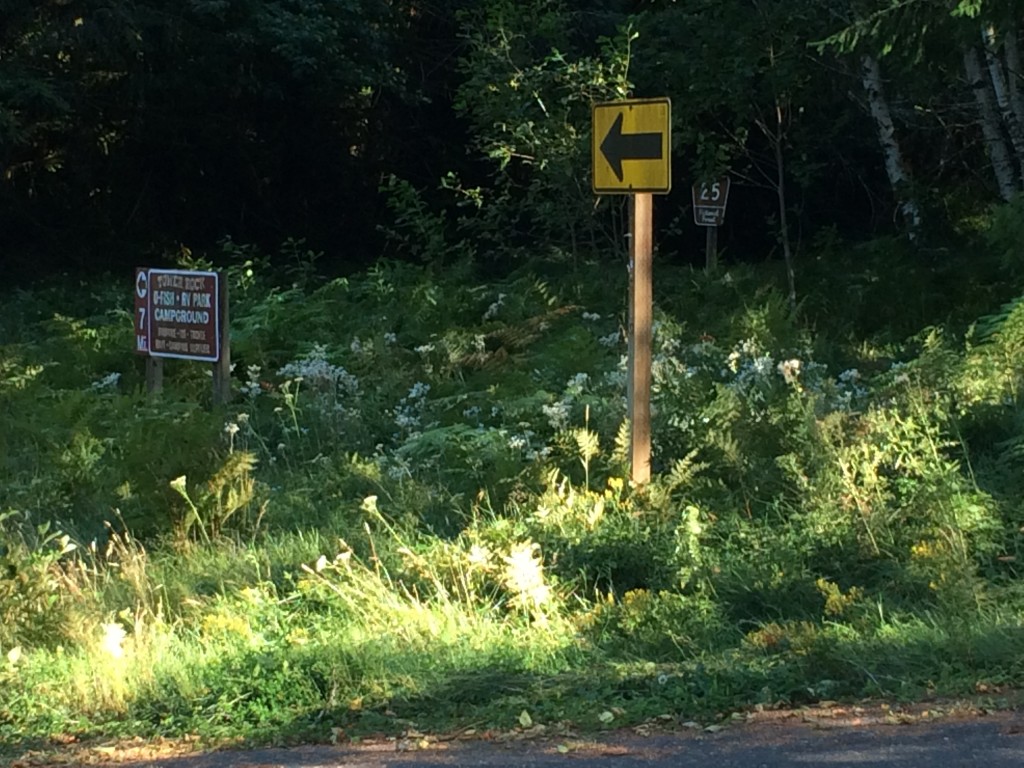
After Randle comes one of the key navigational challenges of the ride – finding Forest Road 26. Although you could get up the hill on Forest Road 25, you’d miss one of the nicest parts of the ride. When you head south from Randle, the route starts as WA-131, but changes to Forest Road 25 without fanfare as you enter the Gifford Pinchot National Forest. The turn to Forest Road 26 comes about 14km after Randle. I suggest being alert to the milepost markers on the right side of Road 25 and pay special attention after you pass MP7. Note also the signs on the bridges. After MP7 you’ll cross a bridge over the Cispus River. Just past that, the main road (25) bears left (a black on yellow arrow directs the Road 25 traffic to left; there is also a sign indicating that the Tower Rock RV Park and campground are 7 miles to the left – see photo). Forest Road 26 heads straight at this point. Don’t follow the arrow! If you look carefully in the weeds to the right, you can see a brown post with “26” on it. Also ahead there was a big sign that faces uphill, but on the downhill side that you can see, someone has painted an indication that you’ve found road 26.
NF26

I love this road. We saw fewer than ten vehicles on the entire stretch of road 26 and the scenery is wonderful. The climbing is gentle and fierce by turns. The road isn’t in great shape and includes patches of gravel. Not much of an issue when ascending, but be especially careful on any descents where you may be picking up speed. Near the top, after you start seeing the scarred blast zone trees from 34 years ago, you’ll get a pretty extended descent. I hit a stretch of gravel at a pretty good clip and exploded a tire beyond repair. Don’t do that. (I was glad I hadn’t dumped the spare tire to save weight on this ride).

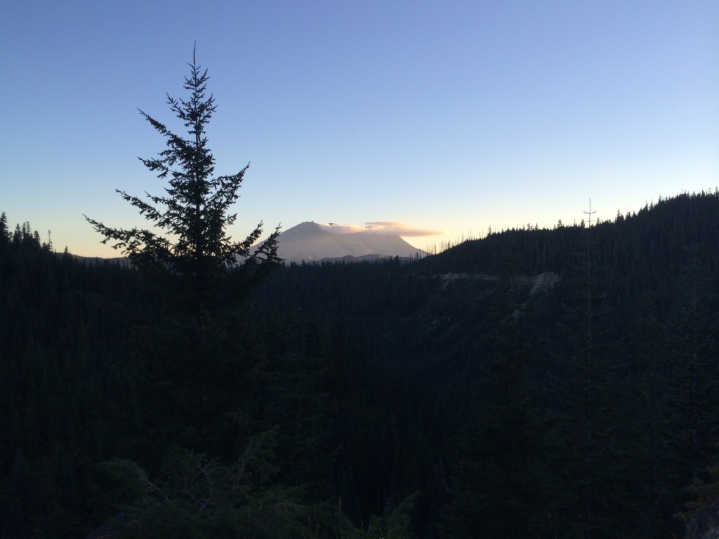
At the top of Forest Road 25 is the T-intersection with Forest Road 99. To the right is Windy Ridge; the route heads left towards Bear Meadows (the highest point of the second big bump on the elevation profile of the ride). Views of Mount Saint Helens and Mount Adams took my breath away. Look in the parking lot on the right at Bear Meadows for Bill Gobie (and bathrooms). (Of course, it’s possible that unforeseen circumstances prevent him from making it up there, but that’s the plan. If no SIR presence is possible, there will be no way to notify riders, but check our backup spot at the Wakepish Sno-Park on left just before the left turn onto Forest Road 25.)
Mountain

A long descent awaits on Forest Road 25. This starts at about the 260km point of the ride. If you’ve managed to reach this point before nightfall, that’s great. The road surface is far from ideal here. By night, or by day, please be really careful and keep your speed in check. Have good lights, good tires, good alertness, and good reflexes.

Watch for the next turn carefully. I’m pretty sure that it came after MP9. In addition to the indications for NF-76, you should also see signs indicating the Cispus Center. (There may also be signs for the Tower Rock U-Fish, RV Park, and Campground, but I can’t recall seeing those. By the way, there may be water when you get to Tower Rock, but we didn’t investigate). Forest Road 76 and Cispus Road provided some wonderful quiet night riding in the forest along the Cispus River. With the earlier 4am start for the brevet (we started at 6am), some of you may do this in daylight, which is probably pretty cool as well. You’ll encounter few T-intersections along the way. The first, before Cispus Learning Center, is a right turn, the others are lefts. One is the location of the information control. After the last one, you’ll be heading west back towards Randle. Look carefully after another 12km or so for the right turn onto Cline Road. (If you miss it, you’ll fairly quickly arrive at where the road ends in a T-intersection with WA-131/NF-25 where you were before the climb. Head back a short way and look again for Cline Road.)

Cline Road and Bennett Road will keep you off US-12 until about 12km before Packwood. No control this time, but a stop for supplies before the climb up White Pass is a good idea. White Pass is a thousand meters above Packwood, so settle in for a long climb. We had a glorious starry night for our climb, with the occasional meteor for inspiration. Three of four of the big bumps done. A nice, possibly cold, descent (about 450 meters worth) takes you to Rimrock Lake. Look for the Silver Beach resort on the right for an SIR staffed control with food and beds.

After the break, the route continues east (and down) towards the junction with WA-410. Unless you’re desperate to visit Yakima, follow the route west (uphill and into the wind) towards Chinook Pass. The next 75km will take you up about 1150 meters. That’s only about 1.5% on average. Sounds easy. Partway up you’ll see evidence of the Nile Valley landslide that closed the highway five years ago. Not that you’ll really need a reminder of the power of gravity.

33 kilometers up is the Whistlin’ Jack resort on the left. (The info control is a sign on the right side of the road opposite the resort). Whistlin’ Jack’s has a convenience store as well as a restaurant with great breakfast offerings. For us, the breakfast break was wonderful; totally worth the time spent fortifying ourselves for the next 43km up to the summit. (If you run short of water on the way up, the Lodgepole Campground on the right about 12km from the summit has a water pump – right side of campground opposite campsite 23. The water is cold and likely good for the iron-deficient.)
Chinook

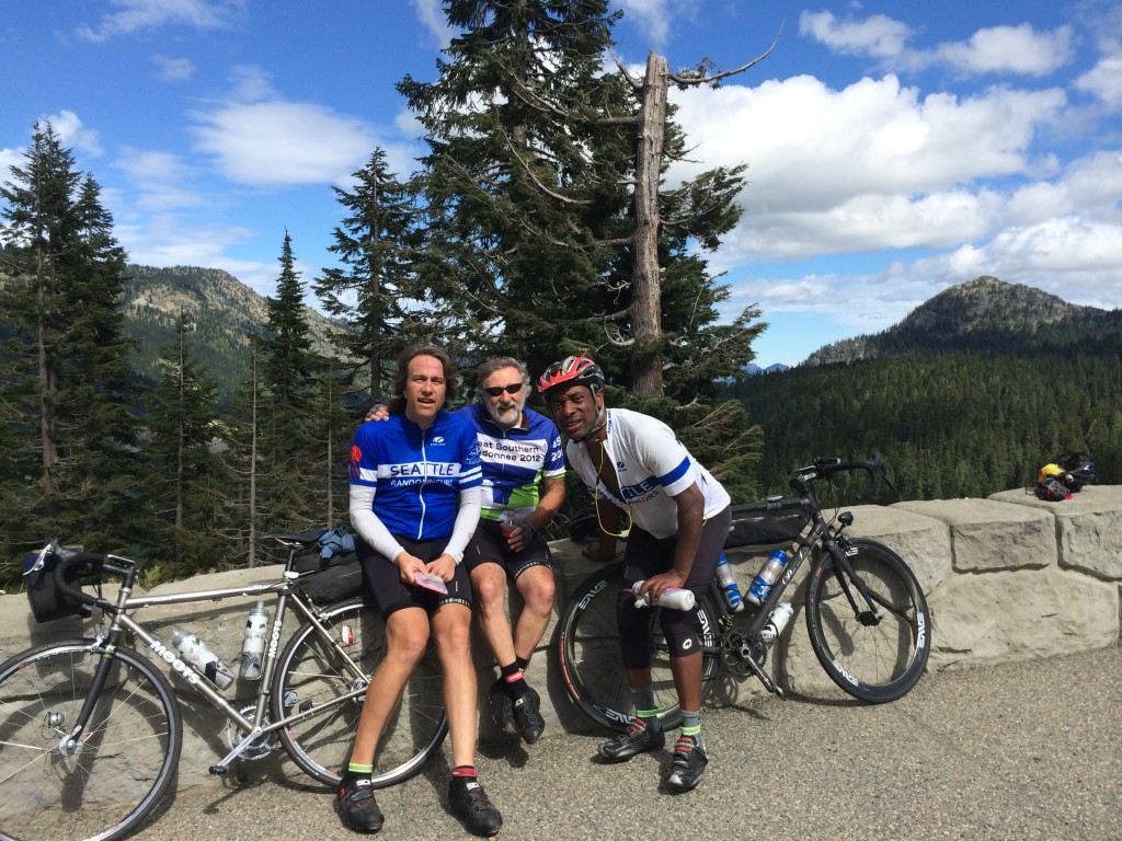
Chinook Pass represents the highest elevation of the ride. Enjoy the triumph; we did. Ain’t over yet, though. Still another 100km to the finish. As always, be careful on the downhill. The steep section down to Cayuse Pass has some tight turns and tourist traffic. About 40km after Chinook, you’ll reach Greenwater. Given the likely headwind, the milkshakes at the deli on the left may provide the needed power for the last stretch home. We opted for beer and food at the Naches Tavern on the right. 21km after Greenwater, watch for the left turn to Mud Mountain Dam. Take the Mud Mountain Road all the way to 410 (west of Enumclaw) to find the last information control near the Boise Creek grocery store.

Just under 20km from the finish, the ride has a little sting left in its tail. “Enjoy” the climb up from the Green River valley on 218th Avenue. The finish is close!

Comments Off on Summer 600k – What a blast

Filed under Pre Rides

2015 Draft Calendar

Here are some possible dates for the 2015 calendar.

Training rides
Jan-Feb – WTS
03/07 100k

ACP brevets (PBP qualifiers)
03/14 200k
03/28 300k
04/04 makeup 300k
04/05 makeup 200k

Fleche
04/10-12 Fleche NW

NW Crank / Brevet Week (PBP qualifiers)
04/18-26 Brevet Week
04/18 NWC-BW ACP600k
04/21 NWC-BW ACP300k
04/22 NWC-BW ACP400k
04/26 NWC-BW ACP200k
04/23-26 NW Crank

ACP brevets (PBP qualifiers)
05/02 400k
05/30 600k (changed from 5/23 to avoid Memorial Day weekend)

Additional PBP qualifiers
06/13 Second chance 400k/600k
06/27 Last chance 400k/600k

PBP training rides
07/16 Night start 400k and 1000k (with other options, likely permanents, for 18th and 19th)
08/01 300k
08/02 200k

Fall rides
09/11 1000k
09/19 200k
09/26 100k

4 Comments

Filed under Club Info, SIR Rides

Tsunami 600k Pre-Ride

Tsunami 600k Pre-Ride
By Vincent Muoneke

Vincent originally published this report on his blog, Spokesong.

photo

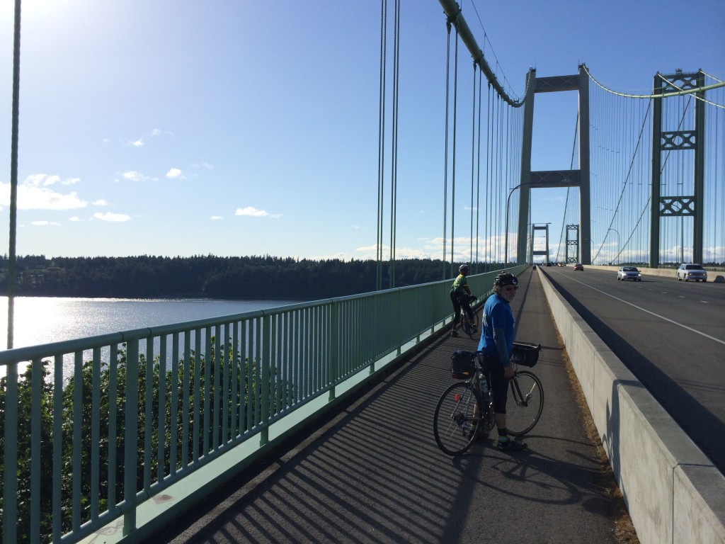
Looking back on the Narrows at Tacoma presented a photo op and Mark took it, after all it had only been raining since we left Tokeland after a good night’s sleep. I could not help but wonder if Tsunamis get named, hurricanes do, and the bridge that once stood here had one. That was before the climbing began, I decided that if this ride were a Tsunami, it’s name would be “Annie”. “Annie Tsunami” kinda has a ring to it.

We started 0715 at the Starbucks in Bremerton, Rick and I had arrived Via WA 3 and waited for Mark who arrived shortly by Ferry in time for the timely departure. We went down Burwell to WA 304 and to avoid the drama of getting to Gorst via WA 3, we made an early right on  Rodgers to climb a little and come down with a lower heart rate getting on Belfair Valley Rd.

The weather was good and Mark and Rick stopped repeatedly without as much as a glance at the watch to make copious notes to craft a reliable Cue Sheet. At Belfair we joined the WA 106, it’s a bit early but services are available. We did not run all the way to the Purdy Cutoff, but took an earlier left on Trails End Rd. just after the place with curios placed in front. This provides a more direct route to Shelton through Mason Lake. We signed our cards and refreshed at the control; The Airport Grocery and Deli and headed to Matlock.

We Ignored the store at Matlock, which will be there if you need it and continued straight towards Deckerville, turning right on Cougar Smith to tackle the the Gravel Climb. I had 28’s, 32’s would have been better. Now in the tracks of the “Watery 600k” our next stop was Humptulips, a control and a number of service options; a Grocery Store(the control) and a Gas Station. We leave the US 101 at the Gas Station, making a left onto Kirkpatrick that will bring you into the heart of the Tsunami Zone.

At the next control at Pacific beach there are a few options, We choose the restaurant and have a sit down meal, we inquire from the locals what the road is like between here and Ocean Shores, we get two opinions. “It is twisty, up and down”. “It is beautiful”.

They will be both correct, a fog is rolling in now from the Pacific now, so we get rear lights on. We have to find and answer 2 questions in Ocean Shores before returning to WA 115 then WA 109 that brings us to Arbedeen via Hoquiam. We prepare for the last leg of the day in the Aberdeen Safeway and then catch the WA 105 to Westport and Tokeland.

Morning in Tokeland, the sky is crying, the streets are full of tears, the rain will come down till we are close to Tacoma. We dash for Raymond for something to eat, The Chevron is 24hrs and the clerk is super cheerful that early, it is the control. We then tackle the 4 rollers of the 101 in the wet. We decide to stop for a real breakfast after the rollers at Artic, good breakfast, but we did bring a little Tsunami of rain water into the shop.

We pass Montesano, watch the first set of railroad tracks into Monte, they have a bad angle, we ignore services here and in Elma on our way to the control at Mcleary. We run parallel to US 12 and over the Satsop river on the way to Mcleary and it is possible that the bridge over the Satsop will be under construction. It will be straightforward to shunt that section by getting on US 12 and then returning to the service roads past the construction.

After refreshments at Mcleary we went up to WA 8 which we left to enter Old Olympic Hwy that brought us to Delphi Rd. which took us to Littlerock, control and refreshment here and we went down Littlerock Rd. to Tumwater where we caught the Yelm Hwy to Yelm. Another control at Yelm and from there towards Lacey to catch the Old Pac Hwy and a very short strip of 1-5 to Dupont, by now you are consistently seeing the Dan Henry’s for “Rhapsody”.

Dupont to Steilacoom, there’s also pretty bad rail tracks just past Steilacoom if you hit it wrong. From Chambers Creek, climb “snot nose hill” into the University area of Tacoma. 6th ave in Tacoma meets Jackson Ave on the steep side. Jackson is busy and to turn from Jackson into the trail (Scott Pierson) that crosses the Tacoma Narrows may be tricky. Use Caution here or consider using the side walk (on the wrong side of the road) on Jackson from 6th to get to the trail.

Across the Narrows we can smell Fritz’s in Bremerton, Beer and Brats. but hold unto your horses buckeroo, Annie is Bottom loaded, with climbing I mean. The Cushman Powerline trail which runs parallel to WA 16 gives a taste of this but it gets worse after Purdy, careful turning into Purdy Dr. just before Purdy, as it exits off one freeway to connect others and was quite busy on Friday of the Memorial Day weekend, should be better next weekend. Now in the Kitsap a few steep one’s before we are screaming down WA 3 to Gorst again and then up Burwell to the finish.
mt_600_finish

Annie is OK
Thanks Mark, Rick, and SIR


Comments Off on Tsunami 600k Pre-Ride

Filed under Pre Rides, SIR Rides

2014 Begins !

The winter training series starts tomorrow. See schedule here. Hope to see you there. The forecast calls for wind and rain. Perfect!

Weather

Comments Off on 2014 Begins !

Filed under SIR Rides

Navigation Aid

Cue sheets sometimes fail us, whether because of errors and omissions by the ride organizers or because our navigations skills let us down.

Many riders (including me) have started to use GPS units to supplement or replace their cue sheet navigation. They have their own issues, of course, including the need to keep them charged for an entire ride.

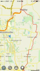
For what it’s worth, I’ve been experimenting with a smartphone-based backup for navigation. I use it as a fallback if both my GPS and my cue sheet fail me. For non-GPS owners it could just be a backup to their cue sheet navigation. Someone suggested that I post some details about it online, so here it is.

The idea is to combine off-line maps preloaded into the phone, a track of the route preloaded into the phone, and the GPS capabilities of the phone.

The value of having off-line maps is to provide street-level information when the phone has no access to cellular signal (or when cellular data is switched off to save money when traveling out of the country). I use an app called MapsWithMe on my iPhone. There is a free version, but I paid a few bucks for the full version. Versions are available for Android and Kindle as well, but I have no experience with them. A recent update to the iPhone app added the ability to import a KML file which helps with the second piece of the puzzle.

The next step is to load the track of the route into the application as well. My preferred method to do this is to use an online mapping application like BikeRouteToaster or RideWithGPS to create a track from the ride’s official cue sheet. Often the ride organizers will publish an unofficial GPS file, the pre-ride volunteers will offer one, or someone that I am willing to trust has created one. In those online applications can usually be found an option to download a GPX file that shows the track of the route. Once I have a GPX file, I go to a website that will convert the GPX to a KML file, viewable in the MapsWithMe application. The site I use is gpx2kml.com. Then you need to get the KML file into the phone. Dropbox or email does the trick with iPhone.

Now, if I find myself lost or doubting my navigation, I can open the app on the phone and locate myself on the map. If all has worked, I should be able to see my position (represented on the iPhone by a blue dot), the streets around me, and a line represented the course. If I’m off course, perhaps that’s enough to get me back on course. Or maybe enough to ask a kind stranger to help.

Hope that’s helpful. Questions, better ideas, other thoughts welcome in the comments.

Mark


screenshot

4 Comments

Filed under Rando How-Tos

2014 Ride Organizers (and organizers needed)

Thanks to all who stepped up to volunteer to organize SIR events in 2014. Bill has updated the SIR calendar, which can be found on the website here.

We are still looking for volunteers for the Spring 600km brevet on May 31st, the July Populaire on July 12th, the Crater Lake 1000k on August 14th, and the Summer 600k on September 6th. If you can help, please let me know.

The volunteer organizers could use help on many of these events. Please take a look a the list and see if you can help on one or more of these. Either contact the organizer directly or contact me to put you in touch with the organizer.

And of course if you spot any mistakes in the list, please let me know.

Mar 8 – Spring Populaire – Andy Speier
Mar 15 – Spring 200k – Mark Roberts
Mar 22 – Bellingham 200k – Dan Turner / Matt Dalton
Mar 29 – Spring 300k – Gary Prince
Apr 5 – Olympia 300k – Corey Thompson / Rick Blacker

Northwest Crank (Apr 17-20) – Hugh Kimball / Eric Vigoren
NWC Brevet Week (Apr 12-20) – Mark Roehrig

Fleche Northwest (May 3-5) – Josh Morse

May 17 – Spring 400k – Mike McHale
May 31 – Spring 600k –

Jun 21 – Cascade 1200/1000 – Don Jameson / Peter Beeson

Jul 12 – Summer Populaire – 
Jul 19 – Summer 200k – Robert Higdon / Chris Gay
Aug 8 – Summer 300k – Steve Davis / Joe Llona
Aug 14 – Crater Lake 1000k – 
Aug 23 – Summer 400k – Jeff Loomis
Sep 6 – Summer 600k – 
Sep 19 – Summer 1000k – Theo Roffe / Vincent Muoneke

Should be a great year!


Comments Off on 2014 Ride Organizers (and organizers needed)

Filed under Club Info, SIR Rides

SIR Blue Jersey/Vest order

Doug Migden reminds us that the Voler poly jersey, vest, and wind-jacket ordering deadline is November 11. This order is for blue items only.

For the first time we are including long sleeve  jerseys, wind-jackets and thermal jackets.

Information is on the SIR website here.

Comments Off on SIR Blue Jersey/Vest order

Filed under SIR Swag