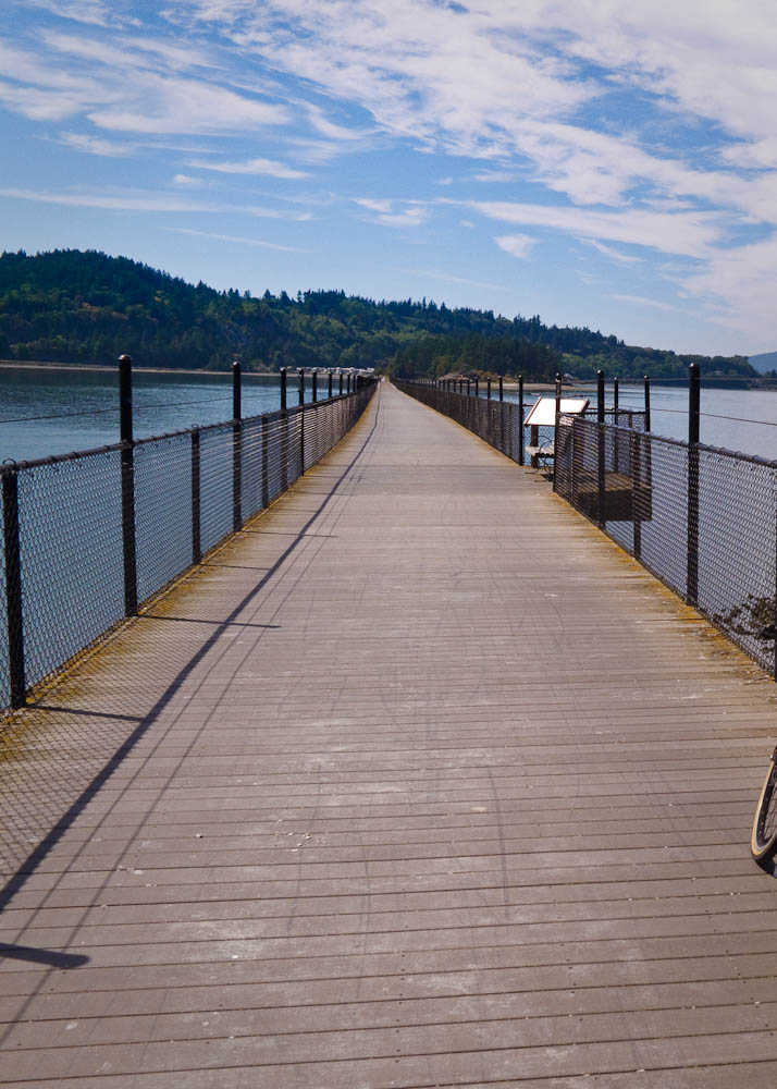
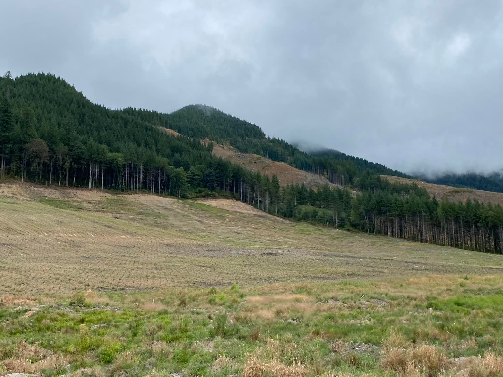
Last summer a portion of the trestle across Fidalgo Bay was burned. Reconstruction finished ahead of schedule last month. Three permanents were affected. They can be ridden now without detouring onto Hwy 20:
3040 San Juans Shuttle, 3043 Snohomish-Anacortes, 3044 Snohomish-Anacortes-Snohomish
I know you all missed chancing your tires on the broken oyster shells.
Thanks to Matt Kreger for alerting me to this news.
Comments Off on Tommy Thompson Trail Trestle Reopened
The Populaire starts at Tacoma’s War Memorial Park. There is ample parking at the park and adjacent Park & Ride lot. The park does not have restrooms. A number of fast food restaurants and a gas station are nearby.
The ride starts with the spectacular crossing of the Tacoma Narrows Bridge. The projected cold weather should discourage tourists, but as always, be careful around pedestrians and other cyclists. The descent to the bridge, climb to its middle, descent and then final climb on the west side set the tone for the route: Up, down, up and down, up and down…. Easily adjustable clothing for temperature regulation is highly recommended. For the most part the route is on relatively quiet roads with pleasant scenery.
After a short cruise on the Cushman Trail the route descends into Gig Harbor, where the traffic circle that was under construction all summer at Stinson Ave is finished. Expect slow traffic and oblivious pedestrians in the downtown area.
A long ascent ensues culminating in a thrilling plunge to Olalla. The store here is closed but does have a chemical toilet available.
Climbing out of Olalla we take the longer route through a little neighborhood while the cars go up the shorter way. This bit has the steepest climbing on the route. There is a scenic spot near the top where you can pretend to take in the view while catching your breath. Once you’ve winched your way to the top you’ve got the ride in the bag. Now about the remaining 100 kms….
Seriously, if you decide to walk the climb on Banner Rd, do use the left side where you will not be hemmed in by a guard rail.
Banner Rd continues north arrow straight. Eventually it begins a “climbing descent” where you can make up some time. Approaching Southworth we weave through a little neighborhood to stay away from any ferry traffic.
The Southworth info control is at the Southworth Grocery. From there the route offers water views as it continues through Manchester and around the point to the next info control at the Waterman Pier. This is a pleasant, speedy section of the route.
Port Orchard comes next where the cue sheet points out a 7-Eleven for resupply. There are numerous cafes and coffee shops if you need a higher-class calorie and caffeine boost. The steady climb on Port Orchard Blvd returns us to the undulating highlands of the Kitsap Peninsula.
After the Fire Station 15 info control comes a fast downhill on Pine Rd where you must be ready to get on your brakes for the turn to Spruce Rd. Warning cues have been added for this and several other turns that are easy to miss.
At Wauna we turn left onto Hwy 302. Traffic may be heavy, be patient with the left turn.
After crossing the little bridge on 302 turn into the 76 gas station. What looks like a parking lot is actually Tyee Dr.
Tyee Dr shortly merges with Purdy Dr. At this point Purdy Dr is functionally a shoulderless onramp for WA-16. At least there are two lanes and most drivers should give you room. Relief comes in a kilometer with the turn onto Burnham Dr.
The route wanders south and west to the last info control at Kopachuck State Park, which has restrooms. Next we swing by the Arletta store on our way back to the Narrows Bridge.
The entrance to the Narrows Bridge trail is via a left turn on a blind right hand curve. Please be cautious.
The finish is at the Starbucks on 6th Ave in Tacoma, a few blocks past War Memorial Park.
Comments Off on 2022 Turkey Populaire Pre-Ride Report
#04412 Redmond-Golden Gardens, 102.4 km, was contributed by Randy Oakley. Apart from the Missing Link in Ballard, it is entirely on the Burke-Gilman and Sammamish Valley Trails. At 47.8 km the route has a curious left turn onto the Burke-Gilman from Shilshole Ave that involves getting on the right-hand sidewalk along Shilshole. SDOT has done what it could to ensure cyclists make the turn under the protection of the traffic light. Please study the map and execute the turn as intended for your safety.
#4481 Packwood-Paradise-Packwood, 126 km, should be a spectacular route once the wildfires pass this year. Note Stevens Canyon Rd is only open Fri-Sun this year due to construction.
#4454 Southworth-Belfair-Keyport-Bainbridge, 104 km, is a scenic and rather strenuous route with 4200 ft of climbing. If you find this route unchallenging you can move on to:
#4518 Vashon Ramble, 102 km. Finally I worked out a route on Vashon! With 6500 ft of climbing don’t let the name lull you into taking it easy. Note Burma Rd is closed. The closure signs are on the side of road to allow local traffic to pass. Don’t mistake that for the road being passable. It is definitely cut.
Geoff Swarts has been busy constructing a loop around the Olympic Peninsula:
#2342 Four Pass Challenge, 605 km, was reactivated by request. This route climbs Stevens, Old Blewett, White, and Cayuse Passes in addition to traversing the Yakima River canyon.
#4180 Wet Side-Dry Side, 404 km, was updated for the closed trestle on the Issaquah-Preston trail.
Farther Afield
If you are feeling mildewed this winter consider my new routes in Death Valley:
Someone set the trestle on fire last week. Cascadia Daily News. This is the trestle that crosses Fidalgo Bay approaching Anacortes. Several routes use the trestle:
3040 San Juans Shuttle, 3043 Snohomish-Anacortes, 3044 Snohomish-Anacortes-Snohomish
The routes will remain active. Detouring on highway 20 is straightforward. Leaving Anacortes there are side roads and a bike trail accessible at S Fidalgo Bay Rd about half a mile before the traffic circle on 20. You cannot use this trail and roads going into Anacortes because of the median barrier on 20 at S Fidalgo Bay Rd!
Comments Off on Tommy Thompson Trail Trestle Closed
Our 3 intrepid explorers looking fresh, bright-eyed (mostly) and bushy-tailed at 5 am!
Heading out of town early in the morning, the route travels some normally busy roads. However, at 5:00 am, there should be lighter traffic than in the heat of rush hour. Before you know it, you’re out of town and almost feel like you’re in the wilderness already. The route travels along Mud Bay and Madrona Beach which are both gorgeous, but you probably won’t see the sights given that it will still be mostly dark during this part of the route.
The next section of the route travels 12 miles along Highway 101 which is a very busy road on a Friday, but there’s a wide shoulder. It will be noisy and annoying, but a necessary evil to get out to the gorgeous sights awaiting you. Your first opportunity for food and water may be the Dayton Store at approximately mile 28. As we rode past a little after 7 am, it appeared to be open even though Google Maps lists its opening time as 8 am. The first control is at the Matlock Store, 37 miles from the start, which again doesn’t officially open until 8 am, but I have shown up there as early as 7:45 am in the past and they let me in. If they’re not open, it may be worth waiting along with the old codgers’ coffee clutch hanging out in their vehicles as the next opportunity for water isn’t for another ~30 miles at Wynoochee Lake and your next opportunity for food isn’t for another ~70 miles at Lake Quinault.
The section from Matlock to Wynoochee is straightforward. There’s a slow 2.5-mile section of gravel at mile 49, but I rode it on tubeless 30’s and didn’t have any issues.
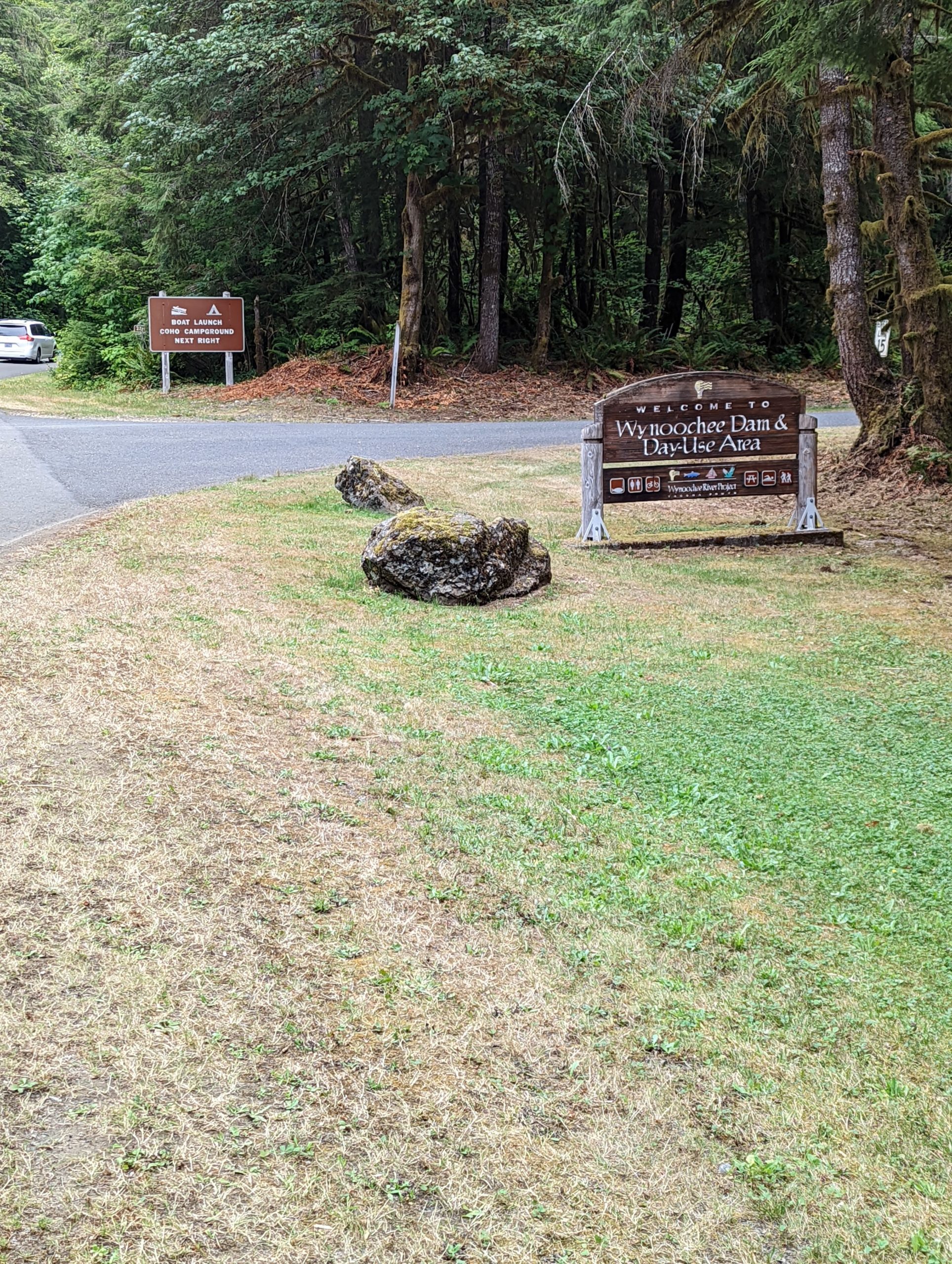
Turn right at mile 66.5 and you’ll have a nice descent on a beautifully paved road down to the Wynoochee Lake dam. Keep riding up the hill until you get to the signs indicating the campground and boat launch. Don’t turn at the “Day Use Area” sign, but instead turn right past the next sign that says, “Boat Launch Coho Campground”.
Stay left at the ICE sign at the campground hosts and take an immediate right. Don’t go into campground loops A or B. Look for a parking lot with boat trailers and go past them and down the hill to the launch. If you can’t find the boat launch, just go back and ask the campground hosts or ask someone who looks like they know where they’re going.
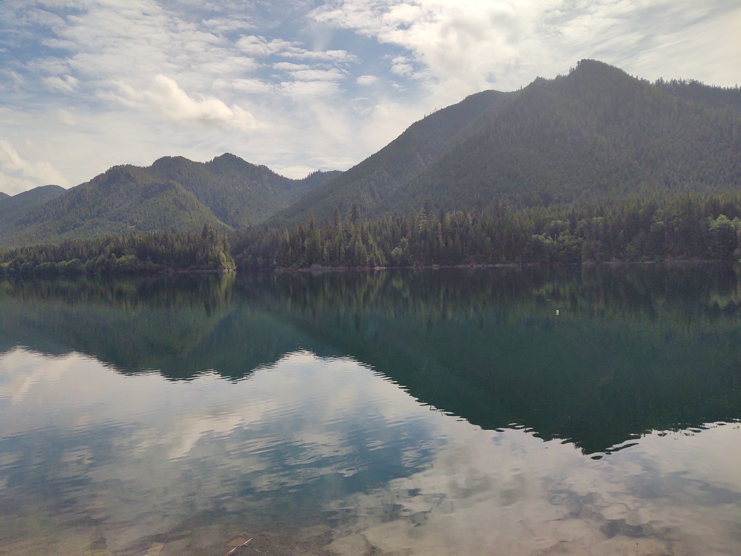
If the clouds aren’t too low over the hills, you’ll have an amazing view up the Wynoochee Valley. We may have a staffed control here, but if not fill up your water bottles in the spotless restrooms at the top of the hill you came down near the boat trailer parking lot.
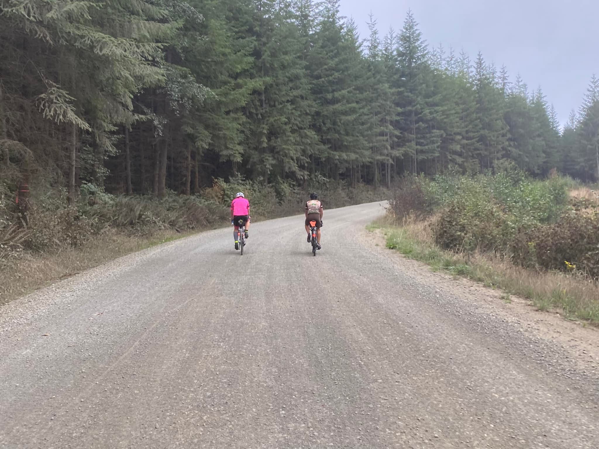
Retrace your steps to get out of Wynoochee and turn right onto Forest Service Road 22/Donkey Creek Road. The gravel begins almost immediately and doesn’t stop completely for 14 miles. There’s a long stretch of gravel followed by a long stretch of pavement and then gravel and pavement interspersed with each other frequently. There has been some new somewhat chunky gravel added this year so there will be a few loose sections along the way. We saw very little traffic on this road on a Friday, but did find ourselves riding on the wrong side of the road to find a good line. If you do this, beware that people camp along this road and you should expect vehicles. Stay alert, keep your headlight on and try not to ride on the left around blind corners. I rode on 30’s but you may be able to go faster and be happier if you ride on 32’s or larger. Also, there is no Verizon cell service (not sure about T-Mobile, ATT, etc.) from Wynoochee all the way to Highway 101 so it may be a good idea to have a Spot or InReach GPS tracker with you on this ride in case you need help in this area.
Once you turn onto Highway 101, it’s 13 miles along this busy road to your next turn. The shoulder comes and goes so the best bet would be to ride single file. The Lake Quinault area has 2 choices for food and beverages along the South Shore Road and 1 on the North Shore Road. It’s probably best to stock up as soon as you can, as by now, as it’s been a long haul since Matlock. The Quinault Mercantile is open every day 8 AM – 8 PM and has a lot of good choices, including sandwiches that you can warm up in the microwave at the rear of the store. Grab some food and plop down at the picnic tables across the street. The road along the south side of the road is nice pavement for about 8 miles until you hit gravel which fairly smooth but has some nasty potholes closer to your next turn.
Once you cross the bridge over the river and turn left, the road starts off as pavement but quickly turns to gravel. There are a couple tough climbs through here with some loose gravel.
I found that once I turned east onto the North Shore Road, both of my GPS devices were constantly alerting me that I was off route. Ignore the noise and keep riding. There’s only 1 road on this side of the lake so it would be difficult to be off route. Stop at the North Grocery (open 5 AM – 10 PM) and restock your supplies as it’s another 20 miles down to the Humptulips Grocery store which is open until 11 pm and has another selection of fine bio-engineered food and another microwave.
There’s nothing very exciting between here and the end of the ride, except for probably a lot of darkness. The next opportunities for food and drink are Montesano and Elma. The last control of the day, the End of Trail Shell closes at 11 pm. If you’re in need of supplies and aren’t going to make it there by 11, you may hit the jackpot at The Lucky Eagle Casino (closes at 4 am!) approximately 1 mile prior. After the last control, use extreme caution when turning left off Highway 12 and onto Moon Valley Road as although there’s a turn lane there, there’s no light and traffic is moving very fast along Highway 12! Enjoy a quick night’s sleep so you can get up and do it all over again Saturday morning.
Day 2:
Whereas Day 1 headed west to the Olympics, Day 2 takes us east to the Cascades and near Mt. Rainier. The day starts off heading south on less busier roads than days 1 or 3. Pay close attention to the cue sheet near the Home Depot at mile 1.6 in order to get onto the bike overpass that crosses over I-5. You’re out of town before you know it with plenty of services along the way as you’re generally paralleling the west side of I-5 all the way down to Chehalis. Don’t miss the turn at mile 22.7 like I did in 2021! You really do take the I-5 South on ramp, but you don’t get onto I-5 as the road splits beforehand.
There is a nice couple mile long stretch of trail that parallels the road between Centralia and Chehalis which is a nice relief from riding on the road. Make sure you stock up on food and water once you get to Chehalis as the next opportunity to do so isn’t for another 40 miles in Morton. Enjoy the flatness of the first 36 miles or so as once you turn off Jackson Highway and onto the Middle Fork Road, your legs will remind you that you already rode a double century + the day before. There will be more hills as you get closer to Morton.
In Morton, you can choose to continue ~37 miles to Packwood, eat at one of the cafes in town right on the route or head south off route for about ½ mile to get to services at the Morton Country Market. We felt the Market was well worth the effort as they have everything you need including a hot food bar and glamorous seating right outside the store.
From Morton, you’ll continue on a nice stretch of road until you eventually hit Highway 12 which is a busy road but has a nice wide shoulder. The next opportunity for food and water is in Randle where you turn south to get off the highway. Now you’re back on pleasant and peaceful country roads with little traffic, albeit with a few rollers along the way.
There are plenty of choices in Packwood for food and drink, but the 76 station at Skate Creek Road where the next info control is located, has plenty of choices. Stock up here because the next opportunity isn’t for another 25 miles in Ashford.
From there, it’s a beautiful ride up Skate Creek which is a 13-mile climb but it’s a nice, gradual incline coming from this side. Enjoy the shade and gurgling creeks if we’ve had any recent rain. If you get lucky on the descent, you’ll get this amazing view of Mt. Rainier.
Once you turn left onto Highway 706, the traffic increases and the shoulder width decreases. We were shocked at how much traffic was coming out of the park on a Saturday evening, but maybe since the official ride is scheduled after Labor Day and the kids are all back in school, the volume won’t be as heavy as it was on the pre-ride. It’s an easy 2.5 miles into Ashford with Suver’s General Store on the left which is open until 10 pm or a couple bars and another store a little further up the road. Beware of multiple sets of RR tracks on Highway 706 which are located at treacherous angles for bike tires!
The next opportunity for food and drinks is at the Elbe Bar and Grill which is open until 2 am on Saturdays. It’s on your right as you’re heading into town around the curve right across from the junction of Highway 7. You’ll probably hear it before you see it! Again, watch for another bad set of RR tracks just as you’re leaving Elbe! The next 10 miles of road on Highway 7 is very busy with little to no shoulders in places. We tried the Alder Cutoff Road on the pre-ride but decided Hwy 7 was the lesser of 2 evils. Stay single file with all your lights blazing and beware of blind corners on hills with no shoulders! Don’t forget the info control at Pack Forest on the right in order to decompress from the craziness you just rode through. Once you’ve made it to Eatonville there are a smattering of choices to choose from, including a couple restaurants and a grocery store. We ate at Cruiser Café on the left and enjoyed it immensely!
The route from Eatonville up to Kapowsin across to just south of Roy is a last-minute change that wasn’t ridden during the pre-ride. We rode the original route up Highway 161 and the Eatonville Cutoff Road and did not feel safe at all and have thus, decided to change the route. This section has been featured on other rides though and we will have more info about this section in the announcements the morning of the ride.
There seem to be plenty of markets, cafes and bars near Roy, McKenna and Yelm should you need them. You pick up the bike path in Yelm for the next 13 miles. Enjoy being off the road for a while – you earned it! If you’re making good time and it’s still light outside, stop and enjoy the very funky and cool Monarch Sculpture Park. By now, you’re practically home, but don’t miss the turn on to Bonniewood Drive out near the airport as I did!
Day 3:
Once again, we’re heading west, but this time out to the Pacific Ocean instead of the Olympic Mountains. The road out of town takes a slightly different route than Day 1 due to RUSA rules. Early on a Sunday morning, it should be no problem. On this day, you take Highway 8 to go west. Again, a busy road with a wide shoulder. The first opportunity to restock your food and drinks is at McCleary, approximately 22 miles from the La Quinta. You’ll soon be following familiar roads, except that things look all turned around because on Day 1 you were traveling some of these roads in the opposite direction.
Stock up in Montesano because it may be a while longer for any other opportunities depending upon what you’re able to find in Cosmopolis and along the highway to Twin Harbors. Heading out of Montesano there are some narrow bridges and hills along Highway 7 but a good shoulder to ride on otherwise.
As you pull in to Cosmopolis up Blue Slough Road, just past this view of the Pacific Northwest at its finest, make sure you take an immediate left onto 2nd to the left of the Cosmopolis sign as soon as you take a right onto Highway 101 (First Street). It comes up fast! Make your way to the trail adjacent to the yellow Lions Club building. There are restrooms with running water available there. Continue onto to the trail for about a mile and then take a left off the trail and onto South Evans Street and head south and west out of town.
You may get lucky and find some services open along Highway 105 on a tourist-filled Sunday afternoon. If not, enjoy the views of these lush forest and tidal landscapes. Just past the first Twin Harbors entrance on your left, you’ll find a Shell station with a Subway sandwich shop on the right. Otherwise, the next entrance to Twin Harbors where the control is located offers flush toilets and running water.
Once you enter Grayland (I’m starting to understand how it got its name), you get a nice reprieve from Highway 105 by turning onto some flat side roads through some very scenic cranberry bogs. Thank you, Ocean Spray! The next stop on this route offers some nice views of the ever-wild Pacific Ocean. If you hauled your surfboard with you, you may be able to carve some nice turns down there.
Further on up the road, the Tokeland 76 station is open until 9 pm and the casino across the road is open until 12 am. Make your way down the coast to Raymond which has a smattering of cafes and restaurants on route as you ride through town. Otherwise, the 76 station slightly off route at approximately mile 102 is open 24 hours. It may be a good idea to stock up in Raymond, as there’s a whole lot of nothing for the next 28 miles along Highway 6 to Pe Ell. Highway 6 has a decent shoulder and wasn’t too busy when we rode it on a Sunday evening.
At West 4th Avenue and Main in Pe Ell, you’ll find the Pe Ell Country Market and Liquor Store on your right and open until 10 pm. Directly across the street from the Market, you’ll find the Willapa Hills Trailhead, bathrooms and a control. It’s time to take a break from the road and ride the next 17 miles on gravel. There has been some gravel recently added in places along the trail so those areas may be a bit deep and loose. However, if you just ride really fast everything will be OK! If you ride the trail during the daylight, enjoy the beautiful sights. If you ride it in the dark, have your headlights blazing and keep an eye out for heffalumps and woozles.
You exit the trail in the booming metropolis of Adna with the only service there being the Adna Grocery Store which closes at 6 pm Sundays. There’s a 76 station out on Highway 6 and near the turn onto Scheuber Road but I don’t know their hours.
As you’re approaching the underpass of I-5 in Centralia, make sure you stay on the sidewalk to the right of the road to get under I-5 as the road is one-way coming toward you. The Chevron straight ahead of you may be the last chance for supplies so you should probably stock up now if you need it. There will probably also be a lot of entertaining people there late at night, so that alone, may be worth stopping for. The last 30 miles into Tumwater is nothing very exciting and should be straightforward.
Comments Off on Third Time’s a Charm 1000K Pre-Ride Report
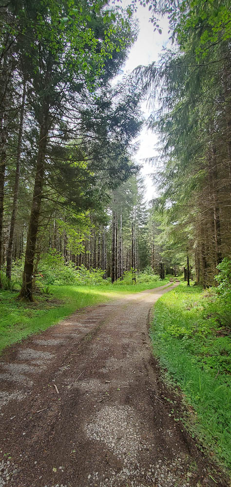
The Iron Horse Trail is always a pleasant refuge from car traffic and should not disappoint. After a couple of blocks in North Bend the route is entirely on gravel. There are several pit toilets and portable toilets along the trail. Water is only available at Hyak. No food or support is available on the route.
Wildflowers are still in bloom. Boxely Creek is running unusually high and noisy for this time of summer.
Most of the route west of the tunnel is protected from the sun, winding along the shaded south side of the valley above I-90. East of the tunnel there is very little cover. Expect full sun exposure for those 10 km. Typically a westerly wind builds throughout the day. You will probably get hit with headwinds in a few exposed spots on the way back.
The shaded area at the west tunnel portal is a good place to stop for a snack. On the east side you will be in full sun.
Expect all pedestrians to have ear pods screwed into their ears, and all dogs to be loose. The trail is popular with families so be cautious around small children. Many cyclists on the trail seem unfamiliar with passing conventions, such as ringing bells and calls of “On your left.” Be careful.
The trail is in very good shape, but being gravel you must always watch for holes and loose spots especially when descending. The east end of the tunnel is very rough.
Inconvenience at Hyak
If you have not been at Hyak recently (at the east end of the tunnel, 46 km into the ride), there is some irritating news: The water spigot on the restroom building has been removed. Water is only available in the restroom sinks, which is kind of gross. And the sinks do not fit larger water bottles! My 24-ounce bottles would not fit under the faucets. Bring a 16-oz bottle if you intend to refill at Hyak. I did the ride with three 24-oz bottles but would have liked another. Address complaints to the Washington State Parks Recreation Commissioners and Directors’ Office infocent@parks.wa.gov.
The Tunnel
A unique highlight of this route, the Snoqualmie Tunnel is over 3 km long. It has no artificial light. It is profoundly darker than any night riding you have done! Full night riding gear is required: good headlight, tail light, and reflective vest. A headlamp is recommended in case you have a mechanical inside the tunnel. Expect other tunnel users to have inadequate, inappropriate, or zero lights and reflective clothing. Ride cautiously, it is hard to judge distance inside the tunnel. Do not use a flashing tail light in the tunnel.
Riding into the tunnel can be disorienting. Stop for a minute and let your eyes and brain adjust to the darkness.
The tunnel is very cold! The air typically cools as it blows from the west to the east portal. Don a jacket before you enter the tunnel.
Time for Gravel!
RUSA recently implemented a new timing rule for gravel brevets and populaires. 20% additional time is allowed on unpaved segments over the time allowance for pavement. In other words, the minimum speed on gravel is 12 kph vs 15 kph on pavement. (Technically the rule is 1 minute additional per gravel kilometer.) Additionally, gravel distance will be logged as part of your RUSA record. The maximum speed remains unchanged from 34 kph (which inconveniences control workers with 20% longer hours).
The time allowance for this ride is 8 hours and 29 minutes. Which should not encourage you to slack off: I can tell you riding uphill for 50 km even on tame rail-trail gravel is a fair bit of work!
Gravel timing does not apply to ACP-sanctioned brevets.
Presently gravel timing does not apply to RUSA permanents. Because permanents are free-route there is concern a person could free-route on parallel paved roads while taking advantage of the relaxed gravel time limit. Email the RUSA board with your ideas for addressing this problem: board@rusa.org
Comments Off on Iron Horse Trail Populaire Pre-ride Report
Last Saturday (7/30), Mick set off on the Summer 400K pre-ride from the Best Western Arlington (3721 172nd St NE, Arlington). In short, this is a beautiful and challenging 400K (I know, all 400K’s are challenging), which will require planning to ensure riders have enough calories, electrolytes and water. Mick had two bottles and a camelback, and needed all of that capacity.
I’ll expand on this below, but here are the significant points where riders will have to opportunity to take on fluids and calories: Darrington (55K)- store, restaurant Marblemount (100K)- store, restaurant Newhalem (123K)- water, toilets at Info Ctr Colonial Creek (139K)- water, toilets in campground Canyon Creek Trailhead (156K)- water, toilets (SIR staffed) Washington Pass Overlook (191K)- water, toilets, snacks (SIR staffed) Colonial Creek (242K)- water, toilets in campground Newhalem (259K)- water, toilets at Info Ctr Marblemount (282K)- store, restaurant
Concrete (310K)- store (10pm), restaurant
Clear Lake (353K) Clear Lake Market (10:30pm), Evelyn’s Tavern (midnight)
Big Lake (362K) Big Lake Grocery (10:00pm)
The start takes us out on Smokey Pt. Blvd, and within 5K we’re on WA-530. There were wisps of fog still in the fields on our way to Oso and Darrington, and not much traffic at that hour. The store at the gas station in Darrington is at 55K, at the left turn to stay on WA-530, but some riders may choose to wait to refuel until Marblemount (100K, 100m off course).
It’s river grade climbing following the Skagit river to Newhalem, where everyone should stop to take on water for the climbing to follow. There will only be water available at the Info Ctr, the store there is closed.
After Newhalem, the climbing starts in earnest. Earlier in the day, much of the climb is shaded. Take advantage of the occasional waterfall close by the road to cool off! There will be water and toilets available at Colonial Creek Campground, 100m from entrance on either side of the road. We will also have water available at the Canyon Creek Trailhead, in a shaded gravel parking area.
The turnaround is at the Washington Pass Overlook. There are toilets, and it will be SIR- staffed with water and snacks. Mick arrived there with approximately 9 hours on the clock for his first half of the ride.
Riders should be able to make better time getting back to Marblemount, possibly stopping for water at Colonial Creek and/or Newhalem. All riders should find a couple choices for food and restaurants in Marblemount (282K) and Concrete (310K).
In Concrete, we’ll take Concrete- Sauk Valley Rd and S. Skagit Hwy, shadier and quieter alternatives to WA-20. Near Sedro Woolley, we’ll take WA-9 to the Nakashima Barn and the Centennial Trail back to Arlington. Note that most of the stores after Concrete close by 10 or 10:30.
The finish is back at the Best Western where cold beer and pizza will be waiting for you. I hope to see you at the 0500 start on 8/6! Registration is online here.
Preriders: Yonnel Gardes, Robert Giglio, Bill Gobie, Aaron Jones, Keith Moore
Crashers: Bill Gobie, Keith Moore
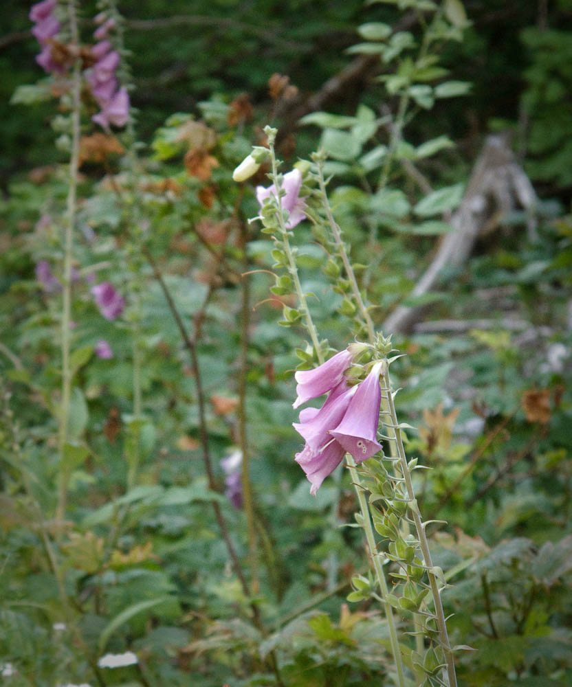
Tower Rock
From foxgloves to towering cedars to enormous volcanoes, scenery abounds at all scales on this route. Waterfalls, lakes, marshes and creeks tempt you to linger, but mosquitoes and biting flies will impel you onward! Pray you don’t get a flat!
Abundant also is climbing. Climbing, climbing, climbing! 14,000 feet of it in long alpine ascents plus the occasional vertical wall. Where climbing abounds so does descending. On some stretches you may reach 50 mph, on others you must brake the whole way down. In recognition of the challenge of reaching controls atop alpine climbs, time limits at the staffed controls at Takhlakh Lake and 240 km will not be enforced. That doesn’t mean you can take it easy! And note this route is 13 km longer than 300k. The minimum pace to finish is 15.7 kph.
Gravel
12% of the route or 37 km is gravel roads in four main segments, plus short patches of gravel in otherwise paved roads. Much is not tame gravel like the Iron Horse Trail or the better roads in local private forests. Potholes, soft patches, rocks, and slippery surfaces abound. Hazards are too numerous to enumerate in the cues. Only the most surprising hazards are noted in the cues. You must ride prudently within your abilities.
Tires at least 35 mm wide are recommended, and wider should be better. Moderately knobby tires might be desirable for better traction on gravel, but remember 88% of the route is pavement where knobbies might slow you down and impair high speed handling. As historical perspective, 12-15 years ago 32 mm was a wide tire and people were negotiating these roads.
Water
Hydration is imperative on this ride! You must remain well hydrated to tackle the climbs. Between the exertion and time spent climbing and dry air at higher altitudes, expect to consume a lot of water. Three bottles at minimum are recommended. Water is available at the six intermediate controls on this route. Most people should be able to reach the second intermediate control at Adams Fork Campground before needing water thanks to cool morning temperatures and only moderate climbing. From Adams Fork I recommend you leave each control with every bottle full.
Adams Fork Campground has a water pump located at the far end of the campground loop from the entrance. Pumping water works best with two people: One to pump, the other to fill bottles. Pull the button up to dispense water from the spigot under the pump. If you are alone, pump to fill the reservoir until water gushes out the overflow below the pump, then quickly fill bottles from the spigot.
Lift the button
Food
Apart from the staffed controls, food is available in Trout Lake at the cafe and the store. Eagle Cliff has a store which closes at 8 pm and pizzas available until 7 pm (roughly when a timed control would close).
Bail out
At Takhlakh Lake take stock of your condition. You will have finished the most difficult and highest climb on the route. Fatigue and dehydration will make the remaining two climbs equally if not more difficult. If you go forward from Takhlakh Lake DNFing will be extremely difficult unless you have a sag driver waiting. At Takhlakh Lake you can bail out relatively easily, returning toward Randle on NF-23. Note this is a gravel descent and carries most of the car traffic between Packwood and Trout Lake (which is why this version of the route does not use NF-23) and has not been scouted. Be sure to inform the control workers at Takhlakh and Packwood if you decide to DNF. Route: https://ridewithgps.com/routes/40258450. Load this on your gps (or print a cue sheet) before leaving home. There is no wireless service at Takhlakh Lake.
Safety
Ouch. Now I see the pothole.
Good lights and reflective gear for night riding are required. There will be a bike and equipment check. No shiney, no ridey.
Your brakes need to be in top shape. 14,000 feet of alpine climbing means 14,000 feet of alpine descending. Much of the gravel requires continuous braking. Speed control is imperative on the twisting descents, particularly NF-25 after Elk Pass. Brand new brake pads and good adjustment are highly recommended. Check that your rotors are within spec. I have manually-adjusted disc brakes and noticed significantly increased lever travel (pad wear) by the end.
I highly recommend pairing up with a buddy. Do not lose sight of each other. A 911 emergency response will take hours, and maybe overnight. County names have been added to the cues to help 911 route a call to the correct agency. Your best option is not to get injured, and if you do, make your way prudently to the nearest populated place (Trout Lake, Northwoods, Randle, Packwood).
This route may be the most remote in SIR’s inventory. Once you are out of sight of US-12 there is no cell service until Trout Lake. The Trout Lake store has wifi. At Eagle Cliff (Northwoods) Verizon customers will have roaming service. That is all! This ride is like traveling back in time when phones were wired and a fully-instrumented bike had an odometer, except you get to take your gps.
If you have any doubts about finishing you need to have a sag plan. Due to covid the volunteers will not pick up riders. You need to have your own driver and car. I suggest sag drivers wait at Trout Lake and then Northwoods (Eagle Cliff store), and only search for a rider who is significantly overdue or has sent a distress message via a tracker. Because of dust and congestion I request drivers not to drive the route unless actually searching for a rider. That will preserve the splendidly isolated and pristine experience for the riders.
Hotel Packwood is open after completing renovations. The entire hotel has been reserved for SIRs for July 22 & 23. Call and book a room directly. Say you are with SIR or Seattle Randonneurs. We will have use of a common room for storing bikes if we take all the rooms. Unused rooms have to be released on July 17. Their phone system may not be taking voicemails yet. Keep calling. Phone numbers:
Main hotel: 360-494-5431
Kate Bagwell personal phone (handles reservations): 360-801-5596
The route has been updated due to construction closure of road 23. The reroute adds 17 km of gravel, bringing the total to 53 km of gravel. The reroute is slightly longer than the bypassed section of road 23 which allowed cutting the route down to 300.3 km from 314. The route will be slightly slower for fast riders and more doable for slower riders.
The finish control has been moved to Hotel Packwood.
This is undoubtedly one of SIR’s most scenic routes. Even with the weekend’s damp forecast this should be a very enjoyable ride.
Susan Otcenas generously shared her Cascade 1400 pre-pre-ride intelligence, specifically regarding hazards.
The most dangerous spot on the course is at 327.9 km / 203.8 mi where you will find the Danger cue: “STOP FOR STOP SIGN.” This is on a downhill 7 miles from the overnight in Forks. The entire right side of the road is washed out. The washout is surrounded by concrete barricades. At night the glare from the stop sign may prevent you from seeing beyond the stop sign. If you blow past the stop sign you will crash headlong into the concrete barricade. Stop and orient yourself before proceeding!
The gravel portions of the route are in terrific shape. The surfaces are very hard with generally little loose gravel. They resemble rough pavement with a few potholes. The steep climbs on North Shore road may be slippery with the weekend’s rain, but they are short and quick to walk. I have never seen Cougar-Smith Road in such good shape. The large potholes that frequently lurk in the shade after the bridge at the beginning of the gravel section are filled. It is a good idea to slow down for the bridge regardless since the tall joints on the bridge could pinch-flat your tires.
Please familiarize yourself with the parking directions if you are joining the ride via the Fauntleroy (West Seattle) ferry. https://blog.seattlerando.org/?p=2100
The prehistoric glaciers that carved Pugetlandia’s topography did cyclists no favors, nor did the road engineers who built strait up and over every ridge. Don’t expect to make good time on the initial leg to Belfair. The first timed control is 340 km away in Forks, plenty of distance to build up time in the bank. At the left turn onto WA-3 before Belfair please wait for a safe break in traffic on highway 3.
After Belfair your speed should pick up as you roll along on WA-108 beside the Hood Canal. If the Canal’s cold saltwater makes you chilly, you should find relief on the stiff climb up Dalby and McCready Roads past the first info control at a gas station. After another climb on US-101 we turn west on rolling relatively flat roads past the Dayton store (no restroom) and onward to another info control at the Matlock store (good restroom).
From Matlock the roads undulate downwards through beautiful forest, finishing with a screaming descent to the bridge before the gravel section of Cougar-Smith Rd. Take it easy on the bridge. I can confirm Cougar-Smith’s climbing remains steep.
A road not taken along Cougar-Smith
After Cougar-Smith Rd we generally descend through Aberdeen Gardens and climb only slightly to Humptulips at 167 km. Gentle climbing continues until the route tips into the Quinault Valley and you zoom to the small resort settlement. For resupply skip the Chevron station, it has almost nothing. The Quinault Mercantile store is open although its restaurant is not. Slightly ahead the Rainforest Resort store is also open but with less selection.
The route continues up the Quinault Valley on South Shore Road. I believe this is the first time we have run a ride up the valley. This is one of the prettiest portions of the route in my opinion. After passing through open farm and pastureland you will cycle into dense forest where the ferns and moss suggest old growth. The trees are too small, however. The easy terrain probably allowed logging the original forest long ago. Nevertheless the regrown forest is marvelously lush. Watch and listen for Merriman Falls on the right.
Both my Wahoo and phone gps lost navigation lock in the narrow valley under the dense trees. If yours does too, carry on anyway. There is only one bridge across the Quinault River, and one road out on the other side. You will find them. From the bridge you can gaze upriver into the interior of the Olympic National Park.
Quinault River Bridge
North Shore Road feels more wild than South Shore. It is narrower and considerably steeper in places. Take care if the forecast rain makes it slippery.
North Shore Grocery at the intersection with US-101 is an important resupply point: It is the last supply for the remaining 100 km to Forks. The store closes at 10 PM. This is roughly the same time a person riding at the minimum pace would arrive, so it behooves you to beat this time. This is a good location to don your night riding gear if sunset is at hand.
Turning north on US-101, the shoulders are often poor or nonexistent. You should ensure you are highly visible for this portion.
At 266 km the route turns onto Clearwater Rd, becoming Hoh Mainline Rd. After passing through the bucolic hamlet of Clearwater, where you may sight elk in the fields, the road begins a relentless climb punctuated by small descents. There are four patches of gravel, 20-50 yards long, along here. They are noted in the cues. They may be difficult to see in the dark. After passing the brightly lit Olympic Corrections Center (don’t stop!) you will crest a second summit on Hoh Mainline and then speedily descend to US-101.
After crossing the Hoh River you have to climb out of its valley until cresting at about 324 km. On the descent beware of the dangerous barricade at the washout at 328 km. Finally some minor climbing that felt Everest-like will bring you to Forks and the overnight. Be sure to check in at the Forks Motel control even if you are not staying there. Fast riders may want to continue to the First Beach control, then return to their lodging in Forks for the night.
For many people the second day will begin with the plunge to sea level at scenic First Beach. From there the longest climb on the route takes you to the rim above Crescent Lake. Along the way the route turns onto a relatively new portion of the Olympic Discovery Trail at Mary Clark Rd. This quiet road and trail winding through dense forest also is one of the route’s gems.
Olympic Discovery Trail
The trail crosses US-101 and twists upward and then down through more forest on its way to the junction with the Spruce Railroad Trail. A long, easy descent ensues to the shore of scenic Lake Crescent.
The sojourn along Lake Crescent ends too soon and you have to climb a low pass over to Joyce, where a meal at the Blackberry Cafe is highly recommended.
After a run along WA-112 the route turns off to cross the Elwha River on a unique cycle bridge slung underneath the road bridge. Do not miss the turnoff for the bridge! The Olympic Discovery Trail resumes and you follow it into Port Angeles.
Once through Port Angeles, where there are numerous resupply and dining options, you leave town alongside salt water on the Olympic Discovery Trail, where you may get hit with salt spray if the weather is rough.
Next comes — can you guess — another climb, albeit short. The route gets on US-101 to avoid a hazardous, slippery portion of the ODT. A “Landmark” cue alerts you to the impending poorly signed left turn onto Old Olympic Highway. Avoiding construction on the ODT, we continue on roads all the way into Sequim, where there is a Safeway and numerous fast food options.
Once out of Sequim the route takes the ODT through Sequim Bay State Park, past Blyn, and almost all the way to Discovery Bay. For many riders this will be the first time on the very new portions of the ODT from Blyn to Discovery Bay.
There is little choice but to tolerate noisy, busy US-101 all the way to the Hood Canal Bridge. At least the shoulders are generally good. On the Hood Canal Bridge stay right on the solid panels on the grated bridge decks.
From the Hood Canal bridge turn left and pass through storybook-pretty Port Gamble. The Port Gamble General Store and Cafe is open until 6PM. Find it by turning left off-route where WA-104 makes a sharp right.
From there the route makes a beeline to the finish at the Quality Inn & Suites Bainbridge. To reach the ferry for Seattle continue south on Hildebrand Ln, continue on the walking path onto Erikson and finally turn left on Winslow Way E. The last ferry on Sunday sails at midnight.
Comments Off on 2022 Spring 600 km Brevet Pre-ride Report