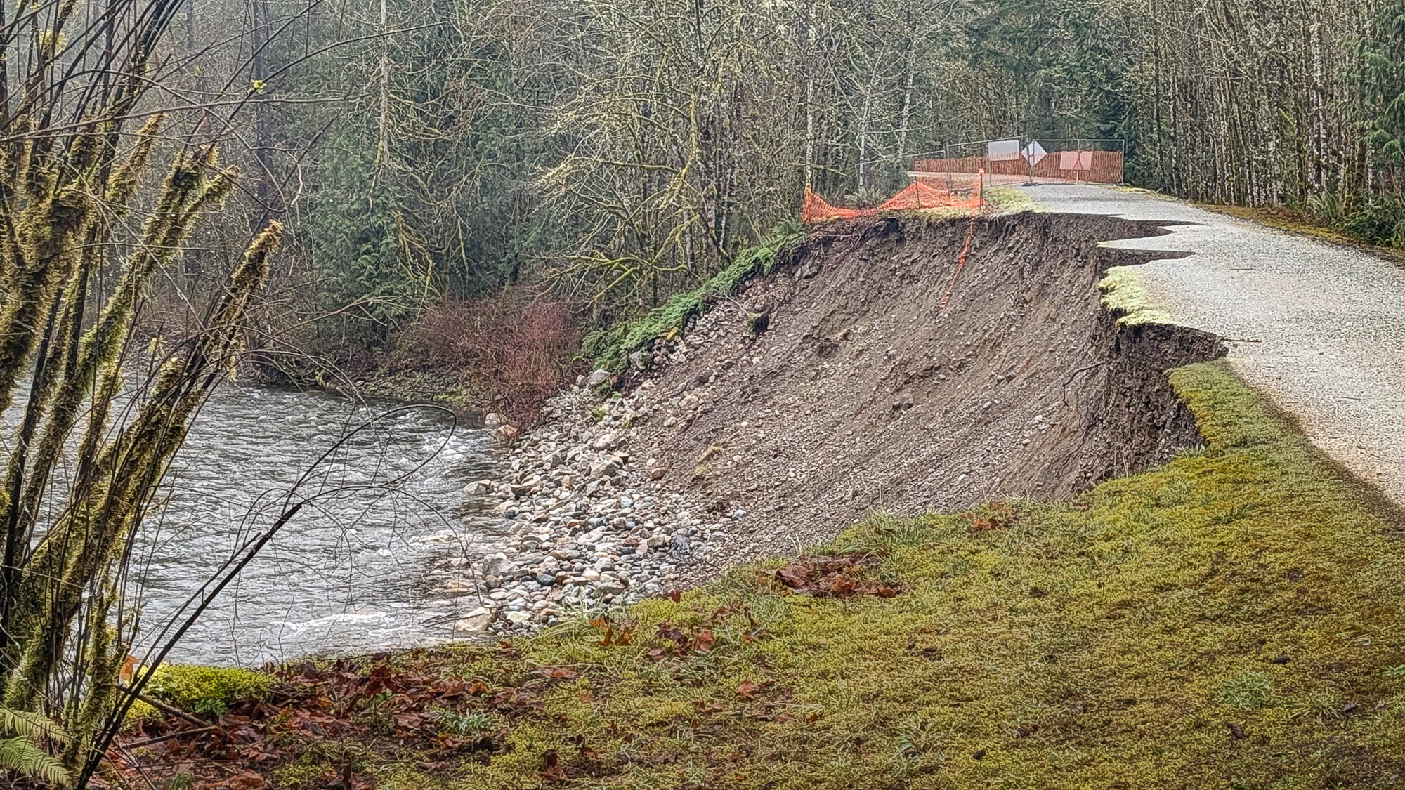
High river flow during the storms in December 2025 scoured and destabilized the embankment that carries the Cedar River Trail about three miles from the trail’s eastern end at Landsburg. The embankment and trail surface have eroded significantly in the last month. The trail will likely collapse soon. Crossing the closed section of the trail is far too dangerous, despite local residents continuing to walk and bike across it.
Most people were probably unaware the trail was so close to the river here.
King County has furnished no information about repairs. Given that the embankment is not a levee protecting a flood zone, repairing the trail probably has low priority. Fortunately the damaged section can be bypassed on residential streets:
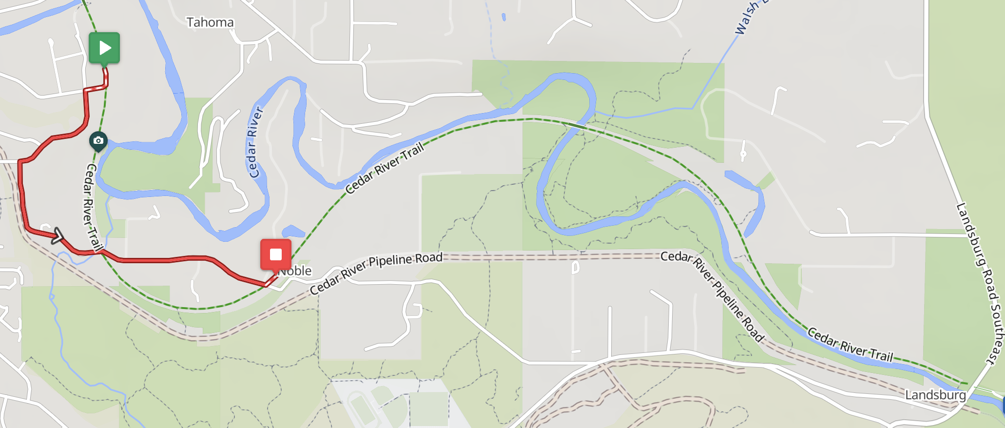
Four permanents have been rerouted. The routes are slightly shorter and lost some gravel credit, but gained a 15% surprise.
0401 Leschi-Auburn-Leschi
0848 Mercer Island-Selleck
1076 Southern Exposure
5709 Cedar River Wilderness Run