Author Archives: Theo Roffe

About Theo Roffe

SIR Newsletter/Blog Editor RUSA 5988

Brevet Week 2017 – May 6-14

It’s not too late to sign up for Brevet Week!  This year’s series offers a number of fantastic, previously-run Brevets in the Olympia area, all starting and finishing at the La Quinta in Tumwater.  The 600k and 400k follow same couse as the 1000K, with the 600k going clockwise around the Olympic Penninsula (that includes Sekiu, the Elwha River and the Dungeness).  The 400K goes to Kelso, Glenoma, and Kapowsin. The 200k and 300k primarily in Olympia and Centralia area, that are previously-run Brevets by Paul Johnson in 2011. Overnight for the 600k and 1000k is in Port Angeles  (and 2nd overnight for 1000k in Kelso) so be ready to be self-sufficient!  Hotel reservations are also on your own and there is no drop bag support.

Note: all of the brevets are self-supported. We will send you off with your control card and cue sheet, the rest is up to you!

Please register early and sign up for each individual Brevet you are interested.

Saturday May 6 600k and 1000k: http://seattlerando.org/index.php?option=com_content&view=article&id=612
Tuesday May 9 300k: http://seattlerando.org/index.php?option=com_content&view=article&id=613
Wednesday May 10 400K: http://seattlerando.org/index.php?option=com_content&view=article&id=614
Sunday May 14 200K: http://seattlerando.org/index.php?option=com_content&view=article&id=615

Comments Off on Brevet Week 2017 – May 6-14

Filed under SIR Rides

Pre Ride for 200/300K on April 15,2017

by Millison Fambles

The 200k and 300k rides will be run concurrently for the first 80 miles starting at Bertolino Coffee Bar 2421 S Union Tacoma 98405.

The ride starts along the Scott Pierson Trail. This trail has lots of turns and uses crosswalks and sidewalks as it follows along Hwy 16 to the Tacoma Narrows Bridge. The view from the bridge is spectacular and is a great photo opportunity.  Four miles later, you will be zooming down the hill into old town Gig Harbor. There is a bit of road construction along the water but it should not slow anyone down on a Saturday morning. The congestion and number of turns decreases once you have left Purdy, just in time for the Kitsap climbing to begin. Pine Rd starts the fun and it continues pretty much until WA-3.

The first control is in Belfair and there are a wide variety of food options: Safeway, McDonalds, Starbucks, etc. There is road construction for a short stretch through town. The route follows Hood Canal for a few miles before it makes a sharp and steep climb up E. Trails Rd to Mason Lake. Keep your eyes peeled through the clearcuts for glimpses of the Olympics and Mt Rainier. The next control is at the Airport Grocery outside of Shelton. Please be extra courteous and clean. We were scolded last year for leaving trash outside. If you are going to leave water for the following riders, please leave it neatly next to the trash can.

Follow US-101 south to Steamboat Island Rd. where we escape the business of the highway for the quiet lap along Madrona Beach.  Shortly after the climb up and out of the Delphi Valley, the route splits and the 200k cuts through south Olympia and the 300k continues south the explore the hills and valleys of the Doty Hills.

The 200:

Off Delphi, there are a few new roads to an info control. Congestion increases as the route goes through South Olympia and Tumwater. There are lots of services through this area. Cleveland Rd becomes Yelm Hwy and is busy but has a wide bike lane. Watch for merging and turning traffic. There is an info control then a fast descent into the Nisqually River Valley. Fort Lewis limits our road options for heading north so there will be a 1.5 mile stretch on I-5. Use caution if there are trucks merging to use the scales.  There are plenty of food options in Dupont and only 28k to go.  Continue past the Amazon fulfillment center, the Ft Lewis firing range, the Jack Nicklaus designed VA golf course and across Steilacoom Lake as you wind north through Lakewood. The final 10k follows city streets to the finish.

The 300:

Continues down the valley to Littlerock (services) and Mima Gate to the “End of the Trail” control in Rochester. Stock up on food and water here, there are no services for 50km. After a short stretch on US-12, the route turns into the hills and meanders through quiet, rural hills ending with a beautiful descent down the Lincoln Creek Valley. There is a control at Safeway in Centralia and then easy riding on 507 to Bucoda, Tenino and then on the trail to Rainier. Then, head north to East Olympia and then follow the 200k route to the finish.

Almost half of the elevation gain is in the first 50K, so the Belfair control is well timed for a break. The 200 route has services along the whole route. The 300 has a 50k gap from Rochester to Centralia without anything.

The weather forecast is looking good, but is has been and wet spring.

It helps if you preregister: http://seattlerando.org/index.php?option=com_content&view=article&id=608

See you Saturday morning at Bertolino’s.

Millison

Comments Off on Pre Ride for 200/300K on April 15,2017

Filed under Pre Rides, SIR Rides, Uncategorized

Permanent Change: The Arboretum Trail

by Bill Gobie

1801 Club Car Populaire

2596 Luck O’ the Drawbridges

The first portion of the UW Arboretum Trail opened in the last week of March. The trail parallels Lake Washington Blvd from E Madison St to Arboretum Drive. The two permanents listed above have been moved onto the trail. Southbound in particular, the trail allows riders to avoid the steep climb to E Madison St on Lake Washington Blvd. This location often carries heavy car traffic.

Currently the south end of the trail near E Madison St is not safely connected to Madison or Lake Washington Blvd. The maps below illustrate ways to access the trail. (Note the trail is not mapped yet in Google Maps.)

Accessing the trail when northbound on Lake Washington Blvd is relatively easy. Immediately after crossing E Madison St take the “soft right” onto 31st Ave E. Then turn left onto the trail. Be cautious of cars making the free right from Madison.

Southbound is a little more complicated. Turning left from 31st Ave E onto Lake Washington Blvd is difficult because of the free right from Madison and often heavy traffic on Lake Washington Blvd. The following method has been tested and works well:

From the trail cross 31st Ave E and go left through the gas station. Go to the farthest driveway. Turn right on E Madison St. To go south on Lake Washington Blvd immediately get into the left turn lane.

Comments Off on Permanent Change: The Arboretum Trail

Filed under Permanent Change

Olympia 200K – March 25, 2017 – Pre-ride Report


“On three, we’re going to stand, right foot first. One. Two. Three!” Corey and I (Theo) stood up and pedaled in synch, making short work of the hill. It was my first time as stoker (riding on the back seat) of a tandem, but my second time on the Top Rung 200K course. Most of the climbing is in the first half of the route, so don’t get discouraged if you’re going up slowly, or figuring out how to share a bike! There’s still the second half to make up time.

For the first several hours of our pre-ride, it rained heavily. We felt for our friends riding the Spring 200K brevet in the Snoqualmie Valley. They had the same rain forecast for the entire day. In Yelm, we stopped to eat… and ring out our socks. I bought a pair of dish gloves in a desperate bid for dry hands (they worked).

After our break, we resumed the rolling hills and lovely back roads past Harts Lake and Lake Lawrence. Corey captained the tandem around each turn with confidence and experience, but it’s a strange feeling to give up control and not steer the bike! As a few experienced stokers had suggested, I tried closing my eyes on the descents. But that was too much! It felt better to see the road ahead, trusting Corey’s skill, than to keep my eyes shut. And if you close your eyes, you’ll miss out on the natural beauty of this part of the ride.

We kept up a steady conversation, slowing our words only to pedal harder up the hills. The rain lightened up as we checked out the first three info controls and the sun started to come out. I hoped that the morning’s rain was enough to appease the fates and ensure good weather for brevet-day riders!

From Tenino to the course’s only timed control, in Oakville, navigation is fairly simple: Highway 12 to 183rd, back to Highway 12. It’s not my favorite set of roads in the area, but the shoulder is decent and navigation is easy. To be honest, I tuned out quite a bit of this stretch, looking down at my feet and watching the cranks turn. Corey attended to the road, and took the brunt of our headwind. I enjoyed my simple role as motor and turn signal!

The End of the Trail Shell station has plenty of snacking options, so don’t worry if you’re running low on fuel for the final 50k of the ride. Load up here and you’ll be fine. From the gas station, it’s only a short return on Highway 12 before getting onto more appealing roads: Moon, Mima Gate and Mima. Even their names are appealing! Down to the right of these winding roads, the Black River and Mima Creek overflowed their banks, swollen with heavy spring rain. The tiny trees of Weyerhaeuser’s Mima Nursery looked like a vast, green shag carpet as we rolled by. We passed by the famous Mima mounds. With the wind now mostly at our back, we sped along, making up time.

As we passed the failed logging town of Bordeaux, the sun began to descend towards Capitol State Forest in the west. Then we rode through Little Rock, where the post office and taco truck are the same size. It’s a straight shot from Little Rock to Tumwater. But the route’s zig-zags through Olympia will have you carefully watching your cue sheet all the way to the Woodland Trail. There, be sure to cross two bridges to get past I-5, but not the third bridge over Martin way. And take care when merging across Martin to the protected left turn lane. If traffic is heavy, you can skip the merge and stay right all the way to the intersection, using the crosswalks to get on Sleater Kinney Road. Shortly thereafter, Britton Parkway throws in a few more hills because you’ve got to earn those Top Rung beers at the finish!

This is a fun ride and last year’s edition saw a number of personal record finish times. If you, like many of us, have spent much of the winter off the bike, this route is a great opportunity to get riding again. It’s just hard enough to make you sore, but not so tough that you should doubt your ability to finish.

Please pre-register online. It helps the organizers a lot!

Comments Off on Olympia 200K – March 25, 2017 – Pre-ride Report

Filed under SIR Rides

Permanent Change: Portland

by Bill Gobie

[This is a new series of posts called Permanent Change which will describe significant changes to a permanent route. The first post in the series is about the popular, and reversible, route connecting Seattle, Olympia and Portland.]

0918 Seattle to Portland (reversible)

1124 Olympia to Portland (reversible)

The new route in Portland finishes near many places to control, eat and drink.

These permanent routes recently received a makeover at the Portland end. Susan Otcenas pointed out the old routes had several drawbacks: The numerous railroad crossings on NW Front Ave, and the unappealing atmosphere and lack of services at the terminus, Union Station (Amtrak). Susan suggested moving the terminus to somewhere in the Pearl District.

Portland’s Pearl District is infested with trolley tracks and confounded by one-way streets, making bicycle routing challenging, particularly remotely from Seattle! With input from Theo Roffe, the terminus has been moved to the Safeway at NW Lovejoy St & NW 13th Ave. Within one block of the Safeway there are several coffee shops, restaurants, and a brewpub, providing choices for riders wishing to take advantage of the open control. The Amtrak station is an easy 0.8 km from the Safeway on trolley-free streets. The route sheets are supplemented with directions to the station.

Also with Theo’s advice, a route to Highway 30 was laid out that avoids streets with parallel trolley tracks.

James Walsh rode revised the Portland to Olympia route in January 2017 and pronounced it great!
Theo rode the Seattle to Portland route in February 2017, so both directions have been checked.

Comments Off on Permanent Change: Portland

Filed under Permanent Change

Spring 200K – March 18, 2017

The 2017 Seattle Spring 200k is Saturday, March 18, starting at 07:00 am.

This is an early season ride starting at the Northshore Athletic Fields in Woodinville (14735 NE 145th St) and wandering around Lake Sammamish and Carnation before finishing up at the Redhook Brewery (14300 NE 145th St).

We ride south on the Sammamish river trail, down the east side of Lake Sammamish before climbing to the Issaquah Highlands. After a quick decent into the valley we go right by Sandy’s in Carnation on our way to Snohomish. From there we head north on the Centennial trail to the Bryant store, our northern most point. On the way back we go back through Snohomish before climbing Broadway on our way back to Woodinville and the finish at the Redhook Brewery.

Pre-registration and additional details on the SIR website.

Comments Off on Spring 200K – March 18, 2017

Filed under SIR Rides

Spring Populaire – March 11, 2017


Artwork by Alice Stribling, San Francisco Randonneuers www.alicestribling.com

Start the 2017 season with our 100 km Populaire Ride!

Bring your friends, wives, husbands, boyfriends, or girlfriends (or both).

Come ride with us (for free) and find out what randonneuring is about. Show up a bit early: we’ll answer your questions and give you a few pointers to help you use the route sheet, as well. The ride will start and end in Seattle. Unlike many of our routes this really is an easy route. [Editor’s note: You hear assurances like this a lot, but, in this case, it’s true.]


Date:        March 11, 2017

Location:           Woodland Park Tennis Courts Parking Lot

Green Lake Way N at N 52nd St, Seattle WA 98103

Time:               Register, sign waiver 0815-0900

Ride Start:        0900 (really)

Ride Ends:         Zeek’s Pizza, 6000 Phinney Ave N, Seattle WA 98103

(It’s a 5 minute ride back to the park and it’s all down hill)

Register:           Online at www.seattlerandonneur.org  until March 9

                              Pre-registration helps the ride organizers plan the logistics.

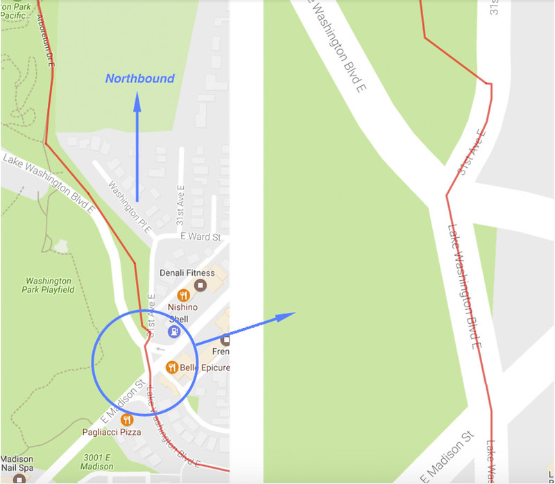
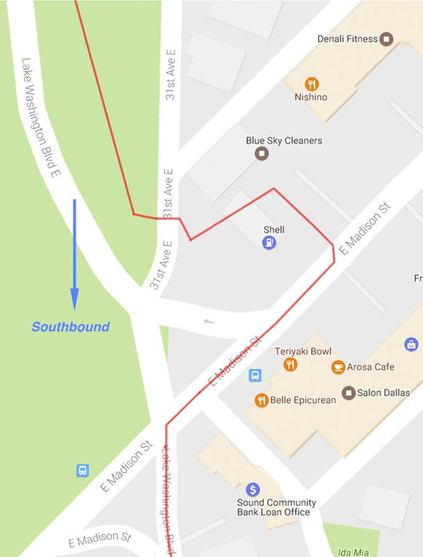
Route: https://ridewithgps.com/routes/19202557 (There may be changes after the pre-ride, so check back close to the ride date for the most current route)

Questions:  Andy Speier: andy @ peakrescue.org

Membership:       Not required!

Lights:              Not required! [Editor’s note: Feel free to bring your lights. Please use in solid mode front and rear.]

Fenders:           Not required, but you’ll make more friends if you have them. [Editor’s note: Buddy flap = bonus points]

Tools:               This is an unsupported ride. You are expected to be able to be self-sufficient in the event you get a flat tire or need to  perform a routine repair on your bicycle.

The Route:         This is a new route. We are trying to encourage and recruit new members, so we tried to bypass the truly nasty hills of previous years. We have removed the longer, confusing section of the Interurban Trail.  This is a fun ride! You will need to pay attention to the cue sheet. There are great views of the sound and the Olympic Mountains. You’ll ride west to Golden Gardens, follow a bit of the Interurban Trail North, enjoy a delightful descent down Perkins Way, zip along the Burke Gilman out to the Sammamish Trail to Redmond, and then head back to Seattle with the inevitable climb back up to the top of Phinney Ridge. Finish is at Zeeks Pizza.

Food:               We will provide coffee and snacks at the start of the ride. At the halfway point Control in Redmond there is a Peet’s Coffee, a Whole Foods and several other commercial food places in the shopping center.


Comments Off on Spring Populaire – March 11, 2017

Filed under SIR Rides

WTS # 8 – Carol’s Century 2/25/2017

Starting at 8 am on Saturday, Feb. 25, this is the final and longest ride in our eight-part Winter Training Series.

The Greater Seattle Century (GSC) was the first century (101 miles) ever ridden by Ralph & Carol in the mid-1990’s.  Designed by Carol (hence Carol’s Century), the route takes you on a wide clockwise circle around Seattle with a variety of terrain with many flat stretches interrupted by a few steep hills. We start by heading north along the Burke-Gilman Trail to Bothell, then along mostly quiet backcountry roads through Woodinville, Maltby, Carnation, Fall City, Issaquah and Maple Valley. The GSC then follows the Cedar River Trail to Renton and returns to Magnuson Park via Seward Park, Lake Washington Blvd. and the Burke Gilman Trail.

There is a total of approximately 3,400 feet elevation gain from beginning to end.

Please help out the Ride Leaders by Pre-Registering at: https://www.cascade.org/node/39538

Comments Off on WTS # 8 – Carol’s Century 2/25/2017

Filed under SIR Rides

WTS #7 Conway-Fairhaven-Chuckanut-Edison 2/18/17

Go North young men and women!

Winter training series # 7 Starts in Conway, parking along Dike Rd.  We start at 9:00 AM. Sign up on line on the Cascade website and I will check the box for you when you arrive. Print out your own personalized cue sheet from Ride With GPS: https://ridewithgps.com/routes/17840307

Same route as before, East to Hwy 9 then North and west across to Chuckanut and south through the farming towns of Bow and Edison.

So far 20% chance of showers.

Coffee and eating in Edison or Bow and then there is the Conway Pub and Eatery for acres ride dining.

-Noel Howes

Comments Off on WTS #7 Conway-Fairhaven-Chuckanut-Edison 2/18/17

Filed under SIR Rides

WTS 6: Kent-Dash & Brown Pts-Black Diamond – February 11, 2017

Hello Randonneurs!

All ready for some nicer weather? Looks like we may get some this Saturday, 2/11.

Come on down for our next training ride. No bothersome paperwork – just riding.

Remember that Soos Creek start won’t accommodate enough cars so we request you park at Kentridge School, 0.5 miles away.

Ralph has rerouted to avoid Green Valley Rd. Closure – his alternate route has an intriguing (on street view at least) climb that I have not done. He also calls out a fine looking espresso establishment in place of the BD Bakery.

RwGPS: https://ridewithgps.com/routes/18026610

Print out your own custom cue sheet – sign in on the Cascade site and I can just put a tick mark by your name when you arrive at the start: http://www.cascade.org/node/39536

Did I say “no paperwork”?

-Noel Howes

Comments Off on WTS 6: Kent-Dash & Brown Pts-Black Diamond – February 11, 2017

Filed under Other Rides, SIR Rides