Permanent Change: Good Scans make for Happy Volunteers, or, How to Avoid Doing It Again

The new Perminator relies heavily on users uploading scans of annual waivers and ride results (cards, receipts). Volunteers have to review these uploads, so we ask you to please do everything you can to make them legible and well organized!

We very much desire you to upload multipage scans as a single pdf! This greatly reduces the number of files the volunteers have to open to do their jobs. Sure, one person’s waiver in two uploads means opening just one extra file, but multiply that by the scores of active Permanents riders SIR has and one less mouse click per job really matters! This also helps prevent the digital equivalent of dropping a file of loose papers.

It is easiest to get good scans with an actual scanner. However, if you’re using a phone or tablet, you can use one of the native apps to scan multiple pages into a single PDF:

You can also take pictures and combine them into one pdf. But do this only if you know how to set your camera to its highest resolution and adjust the exposure for good legibility.

If you are using a phone or tablet, please place the documents in good light without shadows, and hold the device as level and square as possible over the documents. Review your images. If they are blurry or not turned the right way up, please correct the problem.

Please do not try to scan or photograph two letter-size pages in one image. Doing that compromises legibility.

Some phones and tablets may display a scan or photo the right way up, but include incorrect orientation data that causes the image to be displayed sideways or upside down on other devices. If you can, please download a test image to a computer to check for this problem before you upload scans to the Perminator.

Comments Off on Permanent Change: Good Scans make for Happy Volunteers, or, How to Avoid Doing It Again

Filed under Uncategorized

Permanent Change: Hail the new Perminator!; New waivers required

Return of the Perminator

Thanks to Adam Glass’ intense work and randonneur never quit spirit over the last several weeks, the new Perminator is available for online registration of SIR’s Permanents. We have to expect some glitches as everyone begins using it – please be patient and send bug reports to permanents@seattlerando.org.

Please note the new Perminator works differently in some important ways from the departed Perminator:

  • You will download ride materials from the site once the Perminator approves your registration. You will not receive an email.
  • You no longer snail-mail your card after your ride. You will enter your ride result (finish or dnf) yourself. You will upload scans of your card and receipts as proof.

All of this is detailed on the new Perminator’s home page.

Emailed paper registration remains available for a short time while all you eager k-hounds stress test the new Perminator.


New Annual Waivers Required

The annual waiver that you filed for 2019 didn’t account for the permanent owner change. Mark Roberts and Mitch Ishihara have produced an updated annual waiver form and it’s ready for you on Perminator. We’ve expired the previous 2019 waivers so you’ll need to fill out and upload this new form to register for permanents on the returned Perminator. Please  allow some time for annual waiver review/approval. Paper registration will continue to be available during this weekend with the expectation that we’ll return to Perminator-only registration next week.

Comments Off on Permanent Change: Hail the new Perminator!; New waivers required

Filed under Permanent Change, Permanents, Uncategorized

Permanent Change: Permanents have a new Owner

Permanents Change Owner

After many years as a Permanents owner, Geoff Swarts has handed ownership of his Permanents to Bill Gobie. While we speak of “SIR’s Permanents,” under RUSA rules Permanents are developed, administered, maintained – “owned” – by individuals. Geoff did an amazing job developing many of SIR’s Permanent routes himself, adding routes suggested by others to the inventory, administering the Permanents, and as the number of routes and volume of rides grew, supervising a team of volunteers who keep the system running. SIR’s collection of routes, numbering 370 and growing, is by far the largest under one owner and stimulated the development of the Perminator automated registration system. Thanks Geoff!


Comments Off on Permanent Change: Permanents have a new Owner

Filed under Permanent Change, Permanents

SIR Permanents Available via Emailed Registration

In light of the clamor to take advantage of the current good weather, and the willingness of several volunteers to process paper registrations, SIR’s Permanents are available via emailed registrations.

You can peruse SIR’s Permanent routes at: https://ridewithgps.com/organizations/29-seattle-international-randonneurs/routes

Download, fill out completely, sign, scan and return the ride registration. If you use your phone or tablet to photograph the registration set the camera to its highest resolution, take the picture under good light, and ensure it is focused, legible, and includes the entire document. The Permanents volunteers who review the registrations have final and unappealable authority to reject unsatisfactory registrations. We will make every reasonable effort to approve applications, but the volunteers lead real lives so please apply with as much lead time as possible. Quick processing is not guaranteed. Do not pester the volunteers with queries asking if your request was received. If you do not receive approval by your requested start time, you may of course exercise your free will to ride as you please, but you will not be riding under the auspices of the Permanents program and you will not receive credit for your ride.

Email your completed registrations to permanents@seattlerando.org . Include “Ride request” in the subject line. If approved, you will receive an email with the card and route sheet.

After your ride, snail mail your signed card and the original registration to: Millison Fambles, 3520 Sunset Beach Dr NW, Olympia WA 98502.

Comments Off on SIR Permanents Available via Emailed Registration

Filed under Permanents, Uncategorized

SIR Permanents Suspended; New Perminator Coming

We regret to announce SIR’s Permanents are suspended currently due to the Perminator’s infelicitous demise. Permanents will be reinstated when the new Perminator is available. In case the new Perminator is not running by next weekend, we are considering having several Permanents volunteers lead group Permanents requiring signed paper waivers. The Permanents volunteers are discussing whether to take on the workload involved in handling paper waivers.

From Adam Glass:

As some of you have likely noticed, Perminator is offline and has been for a bit. It suffered a serious failure related to changes in an external service. The data is accessible but Perminator can’t talk to it. Fixing the existing Perminator would require addressing a chain of breaking changes and EOLed components in its dependencies that have accumulated over it’s the 3+ years of operation. The result would likely still be brittle and require replacement soon. As the volunteer developer of Perminator, I need to balance the clear value of Perminator with the cost to maintain and run it.

I’ve been working on and off on a replacement for Perminator for a while. Recently I switched gears to Perminator v3, which was designed to be substantially more robust and easier to maintain for the long term. I made the judgement call after Perminator v1’s failure that the time spent temporarily fixing v1 would be better used completing v3. I consulted with SIR leadership on this decision and have been pursuing that path aggressively since—aided by the crappy weather, but constrained by some family issues and lack of access to good coffee or beer.

Perminator v3 is almost complete and is already being debugged by some alpha testers. We hope to make a public version of it available within the week. Beyond replacing Perminator v1, this new version is more maintainable, more robust, simpler to use and more powerful. In particular, it puts the pieces in place for near term introduction of alternate starts and EPP (Electronic Proof of Passage).

That said, despite my efforts, Perminator v3 will not be ready for this weekend.


Further comments are disabled. Please respond or post questions on Facebook or the SIR email list.

4 Comments

Filed under Permanents, Uncategorized

Important Closure: North Interuban Trail

Normally this notice would be titled “High Impact Closure,” but few people voluntarily ride the North Interurban and we only have two affected routes. Nevertheless, a some riders have been caught out by ongoing construction closures so here is some detour advice. Because there are no good all-hours options for the Maple & Ash Way detour, it is recommended to ride these detours only in the early morning if at all possible.

Affected routes: 1078, 1317

Maple & Ash Way

As of the date of writing, there are two closures. The longest-lasting is at Maple & Ash Way. The project webpage unhelpfully informs that the project will last “two construction seasons.” The closure will likely stretch into 2020. The recommended detour is taken from the 2018 Spring 400. This is likely to have light traffic only early on weekend mornings.

A shorter detour is possible by turning east on 164th St SW. You have to climb a multi-lane road busy with freeway-bound traffic.

52nd Ave W to 44th Ave W

This closure is supposed to last only through February 2019. It is possible to bypass the closure by riding north on 52nd W (which has a bike lane), east through Scriber Creek Park, and continuing east through the Lynnwood Transit Center to rejoin the trail at 44th Ave W. You have to climb a short stairway between the trail and transit center. About half the trail is a graveled path which has some boggy spots.

Comments Off on Important Closure: North Interuban Trail

Filed under Notable Detours, Permanents

Iron Horse Mountain Unpopulaire

Pre-ride Report

by Bill Gobie

Pre-Riders: Yogy Namara and Bill Gobie

The Unpopulaire is back! We are finishing the season with a Populaire with enough climbing to make it un-Populaire. But fear not, most of this Unpopulaire’s climbing is at the Iron Horse Trail’s gentle railroad grade. Which means the climbing goes on for a while. For pretty much the first half of the ride, in fact. The trail’s gravel surface adds an extra bit of resistance which will keep you warm in the weekend’s forecasted cool conditions.

The ride quickly leaves North Bend on the Snoqualmie Valley Trail. After passing under I-90 the trail settles into a steady, relatively steep railroad-grade climb to Rattlesnake Lake State Park. At the park we stay on the gravel trail and make a couple of sharp turns to reach the Iron Horse Trail. There is a short bit of steep climbing on the transition between trails.

Next, and it is a long next, the route heads up the Iron Horse Trail for almost 19 km to the Snoqualmie Tunnel. When you are crossing the high trestles imagine the experience when the trail was first opened and the trestles did not have railings! The surface of the trail was in excellent condition on the pre-ride, with just a few muddy spots. The conifers seemed happy from the recent rain. Deciduous foliage was displaying fall colors.

There are two climbing areas close together where you will probably encounter rock climbers on the trail. Watch for loose dogs.

At the tunnel entrance you may want to don a windshell or other warm clothing. It is always chilly inside the tunnel. The tunnel surface was very hard, with a few depressions where drips from the ceiling are eroding holes. Be happy the tunnel was relined a few years ago; previously one had to brave chilly waterfalls in the first 50 yards at each end.

Beware of pedestrians and other cyclists in the tunnel. Your MegaBriteUltra headlight may seem to light up the tunnel superbly, but pedestrians are surprisingly low-viz in the tunnel. Something about the tunnel makes it very difficult to judge distances to oncoming lights and reflective striping.

Emerging from the tunnel you will find yourself at the Hyak Trailhead. Water and restrooms are available in the building on the left. The water spigot is on the west side of the building (facing the tunnel).

The route continues a few miles on the trail past Hyak. There are a couple of gates to ride around. The turn-around point and info control is at an interpretive sign at a scenic spot on Lake Keechelus.

Retracing to the parking lot, we exit and make a couple of turns to head toward the ski area. The climbing on this road is rudely steep after the long cruise up the rail trail. IGNORE the Bike Detour sign! That will put you onto I-90. At the route’s summit we stop at the control at the Chevron Summit Deli. This control is untimed since it is at the top of a mountain, so don’t stress if you are short on time or a little behind the closing time.

The route passes under I-90 and then turns downhill on Forest Road 58. This was the original road to Snoqualmie Pass. If you miss this unsigned turn you will discover the road ends at the Alpental ski area.

Road 58 quickly steepens to a narrow and twisting 9% descent. Enjoy it but be mindful there could be cars driving uphill.

Road 58 continues swooping downhill through lovely dense forest.

After crossing I-90 (which is suddenly, shockingly, noisy) we glimpse a brief, “secret”, vista down the South Fork Snoqualmie River. It is hard to believe this coexists with the freeway just yards away.

The route continues under heavy tree cover on Road 55/Tinkham Rd. Tinkham Rd is a dirt road, with a generally very hard surface but frequent potholes. The potholes cluster in pothole minefields. Stay alert and watch your speed here.

Tinkham has two hazards noted on the route sheet: At around 46.4 miles there is a wooden bridge with a gap down the center, in the direction of travel. A bit farther at around 48.4 miles there is a huge drainage grate that runs all the way across the road. It resembles a diagonal cattle guard. The grate was dry when we encountered it. We rode across without a problem. It is a surprising thing to encounter without warning. Be very careful if it is wet.

All good things must come to an end: The route uses I-90 for about four miles after the end of Tinkham Rd. An advantage of riding the route in this direction is the freeway segment is downhill and over quickly. The shoulder is wide although it had a lot of debris. We got through without problems.

After I-90 we cruise for a couple of miles on paved Homestead Valley Rd. Next is a left for the Iron Horse Trail. This is marked by a sign for Ollalie State Park that you cannot read until you turn. But there are no other nearby candidate left turns, so this turn is not hard to find.

After going around a gate an 8% climb to gain the Iron Horse Trail is the final big effort of the ride. Then you have a serene cruise down to Rattlesnake Lake. The Cedar Falls sign cues you for the unmarked right turn to the Snoqualmie Valley Trail.

After leaving the state park you will find yourself making good time down the Snoqualmie Valley Trail – if you thought the trail was oddly difficult for a rail trail on the way up, you were right.

Back in North Bend, the finish is at Pour House, a few blocks past the start. An SIR volunteer will be there to collect your brevet card.


1 Comment

Filed under Uncategorized

2018 Summer 600K Pre-Ride Report

by Tom Beck

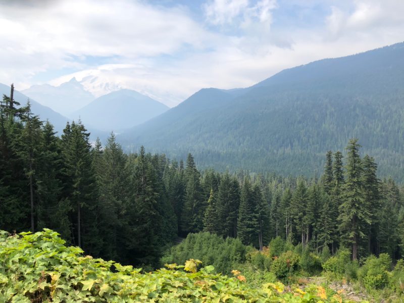
Mt. Rainier through clouds and haze.

Get ready for a challenging and scenic ride!  The Summer 600 km route starts at AAA Washington headquarters at 3605 132nd Avenue SE in Bellevue. Secure free parking is available to all participants. Bring a drop bag for the overnight control and, if you’d like, another one for the end of the ride. You will have access to rest rooms and showers (with towels).

Given the heat and smoke we have seen for the past several weeks, there was some concern about what we Tom Beck, Jim Ryan, and Eddie Bishop  would have to endure during the pre-ride this past weekend. While there was still some smoke in the air, it only obscured the views. The morning was cool and crisp, and more layers of clothing would have been a good idea because it took quite some time before the temperature warmed up. The first part of the ride takes you from Factoria (initially via bike path) to Coal Creek Parkway through Newcastle and Renton to the Cedar River Trail. Don’t forget to exit the Cedar River Trail before Testy Chef (mile 16.6) be careful of the loose gravel.

In Maple Valley, there’s a Starbucks on the left at mile 20.6 in case you need a shot of caffeine. There are also services in Black Diamond. The shoulder goes away on the Green River bridge deck (mile 26.7), so stay alert and take the lane. In Enumclaw, there is a QFC on the left and a park with Porta-Potty on the right. Use care making the left turn onto 410; you have a stop sign and cross traffic does not. Unfortunately for all you Egg McMuffin fans, the McDonalds in Enumclaw is currently closed for renovation. Plan accordingly.

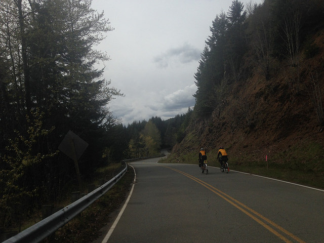
The road to Cayuse Pass.

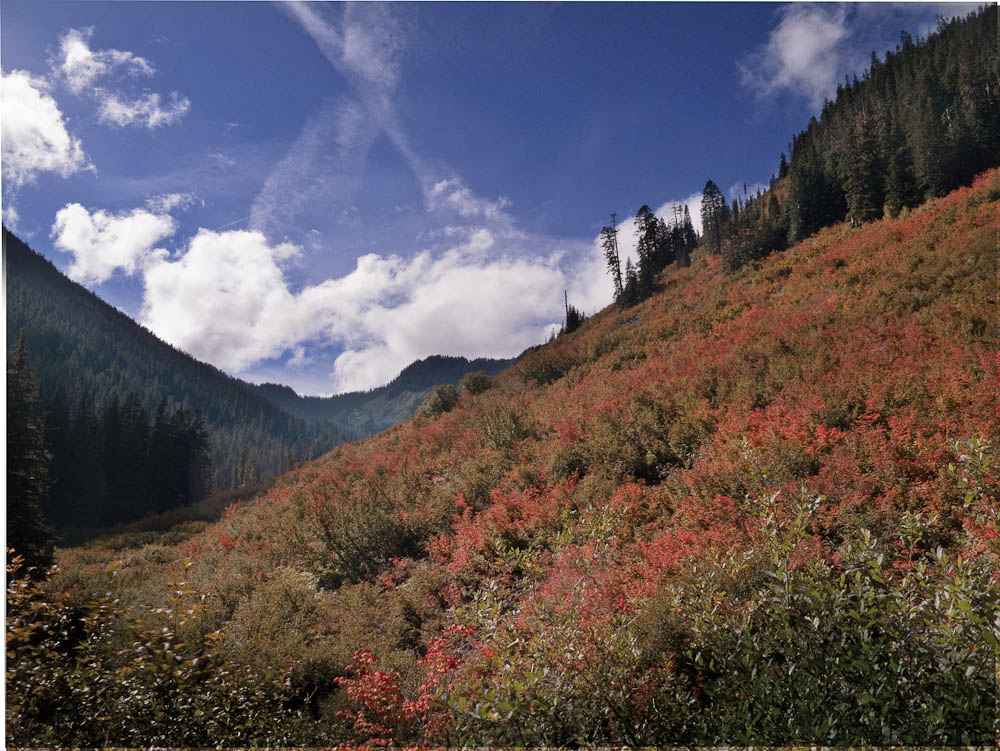
Top-up water bottles and snack packs at Greenwater because it’s a long climb to Cayuse Pass and a long ride down to next control in Packwood (47 miles and 3,500 ft of elevation gain). On the pre-ride, the Greenwater General Store was low on stock. If you can’t find what you’re looking for, there’s more to choose from about 100 yards farther up the road on the right. Enjoy some spectacular views of Mt. Rainier as you climb to Cayuse. Once you reach the pass, keep right at the huge Y to follow highway 123 toward Packwood. Do not follow 410 left up toward Naches.

In Packwood, there is a convenient convenience store, where you can get your card signed and enjoy the usual rando food. They also make great sandwiches to order  If you’re in need of water or a bathroom, Ohanapekosh Campground (mile 86) has restrooms and water. Expect headwinds between Packwood and Randle on highway 12 – winds are much less noticeable once you make the turn from Hwy 12 onto Silverbrook Road at mile 108.3. Leaving Randle, top-up again. You get about a mile of flat terrain before the climbing starts. There is an initial steep section, followed by miles of rolling terrain – some really great riding through here. The second half of the climb is more work for the legs; road conditions on the climb are good, and there are ample turn outs to pull off for pictures or a quick break. Be prepared for anything weather wise – and expect colder temperatures at the top.

If you make it to Elk Pass in daylight hours, you’ll have a couple of amazing scenic vistas of Mt. St. Helens, but you’re going to want to pay very close attention to the road surface to get there safely. The descent of Elk Pass has cracks, uneven pavement and slide damage, along with some smooth stuff. In the dark you will want to be especially careful. If you have a high intensity light setting, this would be the time to use it. The good news is it’s a lightly traveled road and traffic should be minimal.

Take a left turn at mile 160.4 to get to the Northwoods control (Eagle Cliff Store and campground). After you make the left, cross the bridge and start looking for an uphill gravel driveway on the left 1/2 mile after you made the turn – that’s your control. After checking in, head back the way you came – cross the bridge and turn left – at this point NFD 25 becomes Hwy 90. The store closes at 8:00 p.m., but this control will be staffed for all but the very fastest of riders. Eddie Bishop will be there by late afternoon. Restrooms are unlocked but unlit, so you might want your headlamp at night. There’s about 75 km to the overnight control and nothing in between, but it’s flat-ish and the air should be cool, so you may not need much.

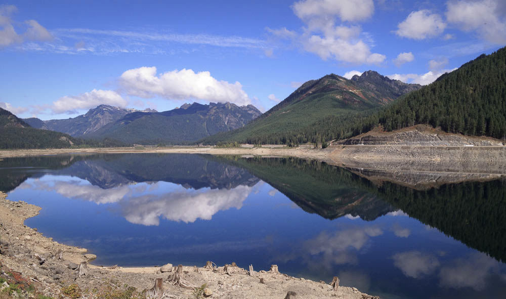
Hwy 90 during daylight. (Photo by Theo Roffe)

Hwy 90 is a fun road; it parallels several lakes first Swift Reservoir, then Yale Lake, then Lake Merwin, along with the Lewis River in places. Around mile 175, Hwy 90 changes to Hwy 503 you don’t even need to turn your handlebars. Hwys 90 and 503 have some climbs, some rollers, some great flat sections, and twists and turns. You’ll be riding in the dark, and the road has no shoulder; stay alert and make sure your taillights have ample power. The town of Cougar has services, but only if you get there early enough. The gas station on the left as you ride through town has a picnic table with umbrella if you need a place to sit and take a break.

The overnight control will be Best Western in Woodland. It’s close to, but not directly on, the road, nestled among some industrial-looking buildings. However, it was easy to find in the dark. There will be food available at the hotel. If you don’t care for what’s offered, there are several restaurants in close proximity.

After Woodland, you head to what may be the crown jewel of the pain cave Green Mountain Highway. Your legs will get about a 10-minute warm up. Is it a long grind like Cayuse Pass? No. Is it a combination of long climbs and shorter flat sections like Elk Pass? Well, no. It’s a couple of miles of graduated climbing ranging from 8% to 15%. Once you get to the top (however you choose to get there on foot, paperboy, full-gas straight line, or secret granny gears) you’ve got a few spots of tricky descending to do. At mile 211.8, while flying down the hill, you have a sharp, tight downhill turn to stay on Green Mountain Hwy. Again, around mile 213, you start down a steep grade and there is a 90-degree right-hander if you overshoot the turn you’ll ride into some guy’s living room. Bottom line: There are a lot of tricky sections descending Green Mountain that you’ll need to be alert about.

In the next section you’ll be riding parallel to I-5 with rollers, decent roads, and wide shoulders (watch for occasional glass and debris). There are services in Kalama and Kelso. These towns can have a lot of traffic even on a weekend especially Kelso around mile 230 (a popular I-5 exit for motorists seeking services). Be mindful and watch for inattentive drivers.

You’ll enjoy rollers after Kelso on Pacific Avenue, and later when it becomes Bond Rd. In a few places you’ll cross intersections with I-5 access – be watchful as we saw a lot of morning traffic at all of these. Your last I-5 intersection is around mile 249 by Peppers Truck Repair (truck stop across the street) – you’ll cross I-5 and then make a left onto Jackson Hwy South and head to Toledo.

At the control in Toledo, mile 255, you’ll find services including a mini-mart, IGA market, and some restaurants. This is where the pre-ride ended. The next 80 miles has all the climbing that is left: You’ll ascend and descend just over 4,000 feet as you ride through Mossyrock, Morton, Elbe, Eatonville, and Orting. These roads generally have good shoulders, but watch for holiday traffic given the proximity to Mount Rainier National Park and Mount St. Helens.

You’ll be greeted and congratulated finishing at AAA where you can get a little food and something hot or cold to drink. You are welcome to shower (towel provided) as well, so bring along something comfortable to change into and we’ll hang onto it until you get back.

The route is available on Ride With GPS: https://ridewithgps.com/routes/28231241

Please preregister for this ride.

Comments Off on 2018 Summer 600K Pre-Ride Report

Filed under Pre Rides, SIR Rides

High Impact Closure: Maxwell Road

Maxwell Rd will be closed for a culvert replacement from Aug 22 through Sept 5. Fortunately the detour should leave no one testy: continue on Cedar Grove Rd and turn left on the Maple Valley Trail.

King County Road Services link for the project

Affected routes include:

0341 Leschi – North Bend – Leschi
0541 MI-MV-Redmond-MI
0606 Redmond – North Bend – Leschi-Redmond
1234 WAYNES CHOICE
1315 Factoria-Maple Valley-Redmond
1801 Club Car Populaire Permanent
1904 Seattle-Mv-Mi
2013 Winter Solstice
2293 Testy Bumps
2297 Lakemont Testy and Bumpy
2436 MI-MtSH-Rimrocl
2525 Uncommonly Testy 100K
2575 Uncommonly Testy-Factoria Start
2795 Leschi-Hobart-Redmond Loop
2971 MI-Hobart
2981 MI-AUBURN-HOBART
3159 Kirkland Testy

Comments Off on High Impact Closure: Maxwell Road

Filed under Notable Detours, Permanent Change, Permanents

RUSA 20th Anniversary Populaire (8/18/2018): Pre-ride report

by Jeff Loomis

This populaire celebrates Randonneurs USA’s 20th anniversary. All finishers will receive a commemorative medal.


We met at the 65th Street Portage Bay Cafe.  It’s a good place to fuel up for the ride and is very near to the park-and-ride start.  If you would like to do the same, make a reservation because they are busy.  Bus Stop Espresso, Broadcast Coffee, Whole Foods, and Wayward Vegan Cafe are also in the vicinity.  The later than normal 11:00 a.m. start allows plenty of time for pre-ride eating and pushes the post-ride party into the evening hours.


Leaving the start, riders will make their way along Ravenna Blvd to the Burke Gilman Trail.  There is a bit of navigating to get over the Montlake Bridge to the 520 trail.  Make friends with any out-of-town riders to help them through this part.  Once on the 520, we didn’t see Mt. Rainier views due to the first cloudy day in months, but the event riders can hope for some nice views.


After the bridge we headed south through Medina near the homes of Bill Gates and other elites.  Nearing downtown Bellevue we passed through a waterfront neighborhood with some nice mid-century houses.  After downtown we grunted up the first serious climb of the ride, followed by some other older Bellevue neighborhoods on the way to the I-90 trail.  We mixed it up with some of the riders on the Obliteride charity ride and get some cheers from their supporters.


U-turn on the I-90 trail.


The loop around Mercer Island is always pleasant and we enjoyed the winding roads under the cool shade of the trees.  The less pleasant I-90 bridge trail was a good opportunity to push the tandem across in minimum time.

We leave the trail before the tunnel to make the fun descent to Lake Washington Blvd. and enjoy the views on the way to the Seward Park.  The park restrooms are convenient if you need to stop and there is water available at the fountain across the street.


Dave enjoys some blackberries.


Circling Seward Park.


We circle Seward Park and catch another info control.  Shortly after leaving the park is another steep climb up Orcas St. that was new to me.  We then have to connect the beautiful parts of the ride with a trip through the working industrial zone between Beacon Hill and West Seattle.  Watch for the Chili Dog stand to find the best route to the 1st Ave. Bridge bike path.


Editor’s note: this is not a chili dog.


West Seattle is reached by climbing Highland Park Way which is not the most bike friendly route but there aren’t really any nice ways to the top of the hill.  Fortunately weekend traffic isn’t that heavy.  Getting across West Seattle to the shoreline involves several more ups and downs where Dave starts questioning my route creation abilities.  Finally we drop down to Fauntleroy via a fun series of switchbacks.  It will be even more fun for those of you who don’t have a nervous stoker on the back of a tandem.  A traditional gas station control is a good place to grab a cold coke or maybe a $1.50 taco from the truck that is permanently stationed there.  Most of the climbing is done at this point so if you are close to the time limit you shouldn’t have a problem finishing.


The iconic Seattle views continue around Alki point with a control stop at the lighthouse.  On the day of the pre-ride, the road is closed for a Sub Pop event which will culminate with a Pearl Jam appearance later on.  We walk and shuffle through the crowds and then jump on the trail to reach the West Seattle Bridge.


Views from West Seattle


Cruise ship passengers and ferry arrivals keep us on our toes through the waterfront.  The route goes through Myrtle Edwards Park, but Dave points out that next weekend during the ride, Hemp Fest will be taking place.  It may be possible to walk your bike through the crowds of potheads and pick up some supplies if that’s your thing…  We scoped out a less scenic detour on Elliott Ave. until we can rejoin the trail at the Galer St. flyover.


We enjoy the quiet trails and ship canal views before crossing the bridge into Fremont, the Center of the Universe.  A gentle climb up Stone Way brings us to Green Lake and the final two uphill blocks to the finish.  There was no welcoming party for us, but the Populaire riders will find a party underway.

Please preregister for the ride so we can be sure to have enough food and drink for everyone!

Check out the route on Ride with GPS.

1 Comment

Filed under Pre Rides, SIR Rides