2019 Spring 600K Pre-Ride Report: Tahuya Hills

Gifford Pinchot National Forest, near Randle

Words by Andy Speier, photos by Kate Hotler

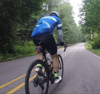
We left under a cloudy sky on Saturday morning. The Starbucks start location worked out well for us as they open at 0400. If you’re arriving early, please don’t pile your bikes out in front of the shop until they put the tables and chairs out. There is a wall available for leaning the bikes on the south side of the building. The challenge for starting a ride in SODO is travelling across there sets of active rail lines. We were lucky and no trains impeded our progress. [RBA’s note: If there is a train, please stop and wait. If it turns out to be very long, we’ll take an alternate route or correct the ride times to account for the delay.]

To set the mood for the ride and give you an insight into the hill climbing to come, we travel east up S Holgate street. Don’t get too into the climb or you will miss the left turn mid hill onto the Mountains to Sound Greenway Trail. On the trail, it’s the usual ride thru the tunnel and up Irving to Lake Washington Blvd. For you out of towners, be sure to shift into your low gear before you transition from the trail to Irving street.

Over the first 56 miles we rode on several trails which was a fun way to get out of the largest city in the state. Pay attention to the cue sheet instructions at mile 25.1 to change from the Cedar River Trail to the Green River/Lake Wilderness Trail up s short, steep gravel climb. A bit later, you will pass thru the edge of Black Diamond. There are services at the gas station on the left that you will pass. If you inhale deeply you may be able to smell the cinnamon rolls at the Black Diamond Bakery [ed’s note: the bakery is off route]. You’ll wind around on some nice country roads and then turn onto Highway 410. It’s a busy road, so after crossing the river and climbing a short hill you’ll turn off the road at the light onto Park Ave in Buckley. The route skips the commercial section of the highway to get you on quiet streets with an info control. There are restrooms in the park off N River Road and up the street on N River Road. For those looking to stock up on food, there is a sidewalk trail prior to Ryan Road that will take you back to Highway 410 where there is a Subway and a Chevron station.

From Buckley, the Foothills Trail is a treat. It has been recently re-surfaced and much of it is downhill. The turn onto SE 276th street at mile 28.9 is not signed. There is however pink/orange flagging on a post on the right side of the trail to alert you to the turn (if you are riding solely by the cue sheet). Nothing lasts forever and you are back on busier roads. Be mindful of the vehicles on Oroville Road E along Lake Kapowsin. Anxious fishermen seem to be speeding to and from somewhere. A left on WA 161 will take you up into the metropolis of Eatonville. The route will turn right onto Center St W to take you out of town. If you turn left on Center St E you will find a grocery store, subway and a Mexican restaurant. Do not leave town as you always do (for, say RAMROD) or you will find yourself off route and on the dreaded Alder Cut-Off Road. Turn right on Center St E to follow the route out of town thru La Grande (another town in western Washington that you can check off on your bucket list).

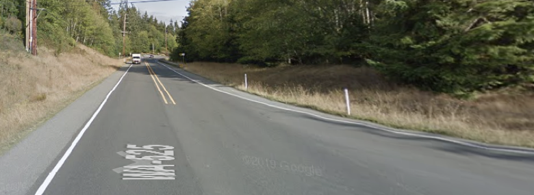
The RR Xing noted on your cue sheet as you enter and leave Elbe are worthy of your attention. On your left are WA State DOT restrooms. Heated with a great covered area to get out of the weather. There is no water, but the overhead cover is well worth it in poor weather conditions. There is also a store if you need to re-supply. The turn onto NF-52/Kernaham Road (which becomes Skate Creek Road) will take you off into the Gifford Pinchot on the backside of Mt Rainier National Park. There is a climb, but when you descend the other side, you will discover that you got the better end of the deal. The descent is windy and has some craters, so pay attention. The gravel sections have been repaired. You just have to look out for holes and an uneven surface along the edge of the road. As you enter Packwood look for Elk. There are many. The pre-riders encountered 40 degree temperatures and rain on this section. Hopefully you will have better weather. We bought out the hand warmers but there are a couple of wool toques and socks left if you need ’em. Best to pack your rain jacket!

You will leave Packwood on Hwy 12, but there is relief. You will turn onto Silverbrook Road for a while and then again onto Davis Lake Road. Davis Lake Road will take you into Morton by passing the commercial businesses on the highway. If don’t need any food, there are public restrooms as you cross the RR Xing and can continue out of town until the turnoff onto the Centralia Alpha Road. From Morton, it is nearly 40 miles to services in Centralia. If you want to find services in Morton turn left on 2nd street and ride for 6 blocks. You’ll find a grocery store Chevron station store. The ride up and down the Centralia Alpha Road will remind you Anciens of PBP—for the rest of you, it’s good preparation.

We fueled up on warm beverages and snacks back counting how many hours of sleep we would get if we headed out to after a quick pit stop. The rain had let up so our spirits were high. The terrain from Centralia to Elma is not challenging. It’s easy to make up a bit of time.

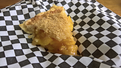
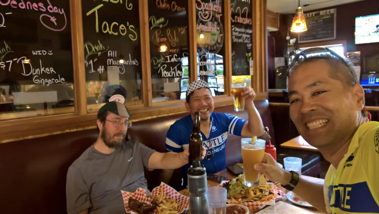
Dinner at the Rusty Tractor in Elma

The overnight control will be at the Stay Beyond Inn & Suite (formerly known as the Guesthouse Inn). For those of you riding thru we will have a warm meal for you (vegetarian or meat), beverages and a smile. For those looking to get a few hours of shut eye we have a plan in place to quickly get you to a room.

Leaving Elma you will bear left on the Coquallum Road. The RR Xing there is the real deal. Dark or daylight hours pay attention. In Skokomish the Twin Totems Store closes at midnight and opens at 0500. If you arrive prior to 0200 the casino is still open. The security guard can sign your card and may even invite you in for coffee. If you arrive past 0200 and prior to the 0500 of the opening of the Twin Totems Store than there will be an info control question. The route from Skokomish takes you thru the residential area of the reservation.

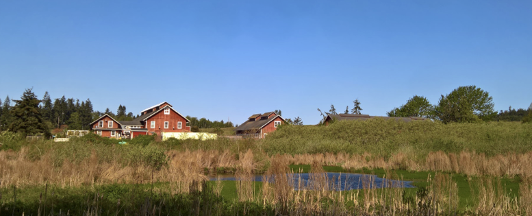
We (at least I was) excited about the thought of ice cream sandwiches at the Summertide Resort Control. For those that will arrive at the control prior to the store being open the control workers will have warm drinks, cup of noodles and other snacks. We took a few minutes to enjoy the sunshine, ice cream and soft drinks prior to the start of the Tahuya Hills. For those that will arrive while this control is SIR-staffed, there will be snacks and drinks. If you’re looking for a more substantial meal, you’d be better off stopping in Belfair about 16 miles earlier.

Dewatto Holly Road

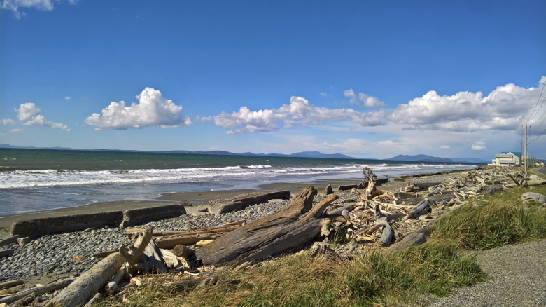
The hills of Dewatto Road—be sure to slow for the steep and sharp curves on Dewato Road shortly after the 3 mile marker (just past km 504/ mile 313)—and Seabeck Holly Road got our legs loosened up and ready for what was coming after Seabeck. The sun was out and the ride into Seabeck along the water was beautiful. The Seabeck Store is well stocked and there are fresh (at least that’s what the sign says) sandwiches in the cooler were labeled MEAT. There is a pizza place next door. [Ed’s note: The pizza is good, but not super fast.] The café is no longer in business. Behind the store there are picnic tables to sit at and enjoy the view. If you are cruising thru prior to the store opening then you will have an info control question. There is a toilet behind the Pizza place.

We left Seabeck under a beautiful sky and put on our game faces for the infamous Anderson Hill Road. It lives up to its reputation. When you think you have completed the climb and begin to let up, thinking to yourself “that wasn’t so bad,” you will find yourself heading down an impressive descent. Remember: “But wait, there’s more!” For each descent, you’ll return to the water and begin the next portion of your hill climbing adventure.

Dewatto Road

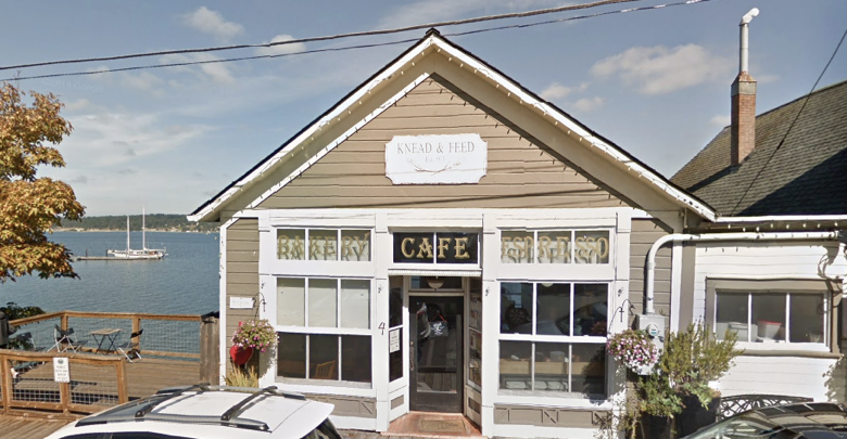
There are some roller hills on Highway 3 for a few miles before heading into the picture-perfect company town of Port Gamble. To save you time, there is an info control at the upscale bakery in the old gas station on the right. If you take a left at the large parking lot, you can ride over to the company general store that has snacks and a deli in the back. There are toilets in the post office building. At this point most you will be smelling the barn door and in the “get ’er done” mode.

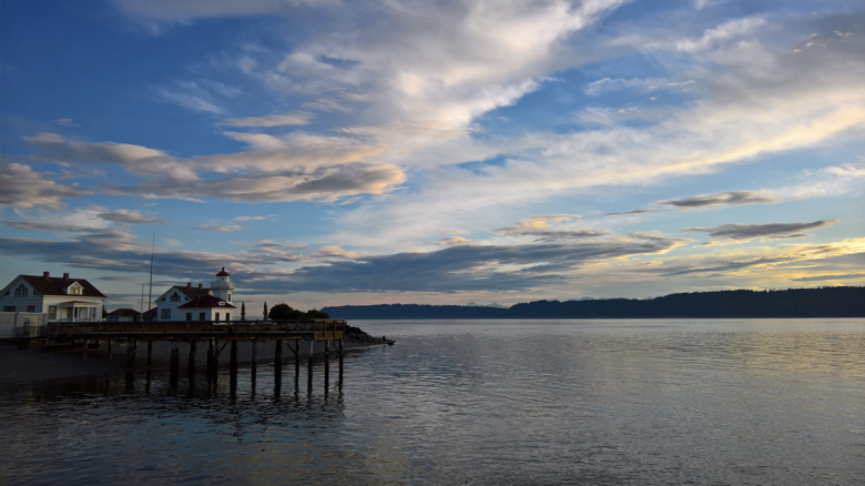
To keep you off the high weekend traffic roads, the route takes you to Suquamish the back way. It’s a beautiful route with a bit of climbing.

Highway 305 on Bainbridge Island is the final leg of the journey. You can (almost) see the barn doors. For those of you using this 600 as a PBP qualifier we will see you in (near) Paris.

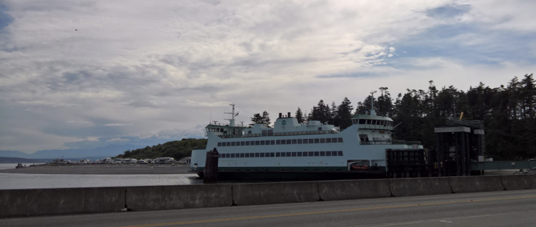
Headed home on the Bainbridge ferry

Route: https://ridewithgps.com/routes/29225332

Cue sheet: https://docs.google.com/spreadsheets/d/12vt6X4EvAzNnPwGCMS7fWkXe17ghmTC-0Tf9rl2k0G4/edit#gid=1670164969

Additional ride information: https://www.seattlerando.org/content.aspx?page_id=4002&club_id=928629&item_id=896679

Comments Off on 2019 Spring 600K Pre-Ride Report: Tahuya Hills

Filed under Pre Rides, SIR Rides

Pacific Beach 400 km Spring Brevet Pre-ride Report


By Bill Gobie

Pre-riders: Kate Hotler, Bill Gobie

Distance: 406 km

Climbing: 9300 ft (Ride with GPS); 9100 ft (Wahoo Elemnt Bolt)

Seattle ferry terminal: The vehicle entrance has changed due to construction. If you have not driven onto the ferry recently, read WSF’s directions! Google Maps’ directions are wrong! Don’t miss the boat! Driving to Bremerton takes an hour and a half!

The bicycle entrance is still at Yesler, although from the south left turns are not permitted – use the crosswalk. Read WSF’s directions (scroll down to bicycles).

From the start at the Bremerton ferry terminal Starbucks we ride three blocks north and turn left on 4th St. Taking 4th avoids the difficult hills and impatient drivers on our traditional route on Burwell. The route turns onto Burwell for the plunge to the left turn onto Callow.

In another break from our traditional departure from Bremerton, the route soon turns steeply uphill and works through the residential areas on the hillside. Thus we avoid the narrow debris-strewn shoulder on WA-3, which is a dangerous place to lose a water bottle or get a flat. Fear not: you will not have to ride these hills at the finish. The inbound side of WA-3 is much safer, although still debris-strewn.

Old Belfair Valley Rd sets the tone for the rest of the ride: rural, usually quiet, and hilly. In Belfair you can make a pit stop at the Shell convenience store.

These days Belfair is almost a pleasant place to ride a bike. Highway 3 has a bike lane!

Outside Belfair the route turns onto WA-108. 108 is not as peaceful as in former years. Expect a fair amount of traffic.

The first control comes in Union. Sadly the old Union Store is out of business. The control is across the street at Union City Market in the marina building. There are nice restrooms.

From the control make a U-turn, then find your lowest gear for the climb up McReavy Rd. This is a good foretaste of what you will face on PBP entering some of the medieval towns perched on hilltops, although without cobbles.

McCreavy lets us avoid the long noisy climb on 101. There is still a short stint on 101 before turning onto Dayton Airport Rd.

Most people should not need to stop at the Dayton Store, but it is an option if you miscalculated water or food. There are no restrooms.

You should load up on water and food at the Matlock Store, 57 mi / 91 km. The store has a nice restroom. The next supplies are 42 mi / 68 km away at Prairie Mart.

The next miles until turning onto US-101 at 152 km are some of the loveliest on the route, as we pass through deep forest, crossing from one river drainage to the next on steep and winding roads.  On paper this is the most challenging segment of the route. 

Early in this section we encounter Cougar Smith Rd with four kilometers of light gravel beginning after the bridge across the west fork of the Satsop River. The transition at the end of the bridge is rough; do mind the danger instruction! Cougar Smith has been recently graveled. The good news is all of the potholes we saw on our Fleche have been filled. The gravel is only deep off the sides. Traffic has swept most of the gravel off the road, leaving behind a sparse scattering that will annoy but not seriously impede those riding skinny tires. The grade reaches 12-16%. I walked the steep part. It was hardly slower than riding and gave my legs some relief.

Back on pavement, the highest elevation on the ride, 660 ft, is soon reached followed by a splendid downhill. Alas, starting from such modest altitude, visions of coasting to the coast are soon dashed and we must hump over innumerable humps to the next control at Humptulips. Fill up on supplies here. The store charges 45¢ to use a credit card.

The run to Copalis Crossing is a pleasantly zoomy, nearly steady downhill. You will encounter a couple of small bumps with noticeable grades on the way to Pacific Beach.

At 200 km, Pacific Beach is the halfway point. You & I Market has an Asian grill in back, which closes at 7:30 pm. The control is open. The Schooner Pub and Surf House Cafe are options if you want a sit-down meal. (Sitting at You & I meant sitting on the floor. Worked for us.) Seagate Restaurant and Lounge is a dive bar with pizza and bar food that was really nice to us on the fleche. It is off-route a bit more than a kilometer north on WA-109.

Leaving Pacific Beach you will cycle through scenic coastal forest that just may distract you from the crushing difficulty of the climbs as the road winds through deep ravines. Survive to Copalis Beach and you are rewarded with a pleasant flat run to the next control at the Chevron in Ocean Shores (postal address Hoquiam).

On the way to Hoquiam there are several bridges with raised curbs/sidewalks that appear abruptly in the shoulder. I found the curbs difficult to see at night. Be on the lookout as you approach bridges. These hazards are not noted on the route sheet.

Approaching Hoquiam we turn off the highway, visit an information control to keep everyone honest, and cruise through a residential area of Hoquiam.

From Hoquiam to Aberdeen to Cosmopolis we must cross two evil bridges. The Hoquiam bridge explicitly bans bicycles from the vehicle lanes. Trust me, you don’t want to be on the road! From 10th St turn onto the sidewalk on the far side of the road. The sidewalk/channel becomes pretty narrow. I chose to walk across. Please walk if you are at all nervous.

The Aberdeen-Cosmopolis bridge has a pedestrian ramp up to the bridge. Approaching, stay right on H St, do not go up the vehicle ramp. The ped ramp is right underneath the second overpass. The ramp has a very tight hairpin turn. Tandems and recumbents may need to dismount. I found the sidewalk on the bridge dicey. So again, walk if you are uncomfortable.

The control in Cosmopolis is a 7-Eleven. At night it did not have a good vibe. I am keeping it as the control since it is open 24 hours. The control is open; you may use the 76 station just before the 7-Eleven if you prefer.

From Cushing St in Cosmopolis you must find the bike trail on the right. The trail is not signed. It should be plenty obvious in daytime. At night, it is inconveniently located in deep shadow between two street lights.

The next supplies are available about 12 miles away at the Chevron in Montesano. This is a pleasant, clean, well-kept store! Stock up here for your passage through the Goose Prairie wilderness. The next certain supplies are at Twin Totems, 42 mi/ 67 km away. Faster riders will be able to resupply at the Dayton Store, which closes at 9 pm.

Just before dawn our GPS’s called for a right turn into a hillside. Our intended road was decommissioned, blocked by an enormous berm. I was too foggy to know what to do. In fact, I kept riding straight since no turn was possible. Then I realized Kate had turned around. She had sensibly consulted her Elemnt and saw there was a connection around the closed road. This defect in the route is now corrected.

Twin Totems is the penultimate control. For many, it will be the last supply stop before the finish – Belfair closes between midnight and 5 am.

From Twin Totems we return to Union and then substantially retrace the outbound route to the finish.

After the turn from Sam Christoferson Ave onto WA-3 stay in the left lane to go up the ramp to WA-3. The shoulder is filthy with debris; take care.

Entering Bremerton, there are two places on WA-304/Callow Ave where you must move left to avoid forced right turns.

Again departing from our traditional route on Burwell and its intemperate drivers, we cross Burwell and turn right on 6th St. Then we dodge onto 5th St and enjoy a relaxed (although not flat) run to the finish. After two right turns you will fetch up at the finish, the Fairfield Inn & Suites on 4th St.

If the hotel allows us, we will have an SIR Control sign out front with a note telling you which room to come to for the finish.

Comments Off on Pacific Beach 400 km Spring Brevet Pre-ride Report

Filed under SIR Rides

Permanent Change: Closure on the Interurban Trail in Kent

The Interurban Trail in Kent will be closed until late 2020 between a detour point south of S 212th St to James St. Theo Roffe has investigated the signed detour on 68th Ave S and does not recommend it. He recommends going one block farther west to 64th Ave S. This detour adds about 2 km to a 2 km long section of the trail.

According to the City of Kent, “There are times when the roadway at the trail crossing will not be affected by the construction for several weeks or months. During those periods of time, the trail will be open“.

Theo’s recommended detour

City of Kent blog post about the project

At least six of our Permanents are affected: #751, 978, 1076, 1132, 3066, 3592. As noted, detouring does not add much distance so no one should feel discouraged from riding these routes.

Comments Off on Permanent Change: Closure on the Interurban Trail in Kent

Filed under Notable Detours, Permanent Change, Permanents

Report for the 4/7/19 Olympia 200K

by Millison and Rick


The ride starts at the La Quinta in Tumwater. We head west, under the freeway, on familiar roads to Delphi Rd for an info control. From there, we climb a little from Waddell Creek, for info control #2, and skirt the east side of Capitol Forest to the timed control at The End of the Trail Shell in Oakville.

We take a little jaunt on Hwy 12, going into and out of the control. This first 24 miles (40k) was cold and foggy on the pre-ride. As we departed the control, we got just a hint of the sun.

Make sure you leave the control with enough supplies; it’s 30 miles until the next available services.

Leaving the control east on Hwy 12 for a mile, we turn south on some new roads and into Independence Valley and to Michigan Hill, the first of the climbs. Over the hill, we cruise along Lincoln Creek headed to the next climb up Ingalls road. Coming down, we head south toward Adna. Before the town, we take a left turn on the Willapa Hills Trail for a nice, quite, and flat respite before a short trip on Hwy 6. Hwy 6 is busy with fast traffic, use caution crossing it. Enjoy the twists and turns of Scheuber Rd to Centralia and the next control at the Chevron station. Use caution crossing under I-5 following the sidewalk. Use and obey the crosswalk signal. There is also a coffee shop/deli next door to the Chevron and a Subway across the parking lot. We weave through Centralia headed east, toward the new roads that Ian Shopland says should be interesting and make will make this a great ride.

Riding into Salzer Valley we found little traffic, good scenery and new roads—a rando’s dream. A short, steep pull will get you up Grimes Road where you’ll climb a little more up Seminary Hill as you head to the Steam Plant and another info control. Continue northeast on Tono Rd and with that, the Tono Hills, before services in Bucoda.

After the Tono Hills, the route will seem flat and fast. A mile and a half on WA-507, then a right turn on Skookumchuck Road, where we had a little tail wind, which leads to the next info control at Johnson Creek. From there, it’s time for the Yelm-Tenino Trail. Use caution as you cross WA-7, a very busy highway. Then, enjoy a pleasant cruise into Yelm and the last timed control. Return west on the trail to connect with the northbound Chehalis Western Trail to the last info control at Monarch Sculpture Park. Continue north on the trail for another 6 miles, before exiting on Fir Tree Rd, and making your way west to the finish.

For more information on this 300K brevet, head over to the Seattle Randonneurs website.

Comments Off on Report for the 4/7/19 Olympia 200K

Filed under Pre Rides

Olympia-Westport 300K Pre-Ride Report

by Vinny Muoneke


Started the ride in La Quinta in Tumwater at 6am as the riders will, went straight under the freeway and had a gentle warm up as I approached the first information control after passing the northern tip of Black Lake and going a little south on the west side of the lake to Delphi Road. I snapped a few photos and continued on Delphi. The first rays of sunlight revealed that there was some kind of work on the shoulder of Delphi almost for its whole length, but at this time on a Wednesday there was very little traffic to concern me and the ride became even more bucolic as I rode further on to begin the gentle climbing of the Coastal Range on Old Hwy 410 and Old Olympic Hwy.

This 300k is dumbbell shaped and I was thinking how dumb it was that I did not bring extra warm clothes as I was freezing. Sunlight revealed frosties everywhere and I distracted myself with views of the southern sound to the right as I climbed. I snapped to attention as I crossed WA-8, but again, at this time, traffic was not that heavy. The gentle climbing continued on WA-8 and I noticed the Summit Lake store was already open—on the right and convenient side of the highway. Nothing for me at this point, and I also ignored any chance for refueling as I exited to McCleary. You will also find services in Elma just before the timed control at Montesano.

WA-107 from Montesano will take you to the US-101 as you continue west towards the Pacific, dipping south on the 101 to Raymond. The bridge after Montesano was under some repair with flaggers, though they were gone on the return phase of this section. If you are in Party Mode, there is a restaurant in Arctic on the left side that’s open early and has saved my bacon on many a Flèche. The crossing of the coastal range continues on the 101, and, in this episode, I counted 5 significant rollers. The 5th one was a dwarf like the “planet” Pluto, but I counted it as it crested to a long descent into Raymond, and I know from experience that it is a bit of a whopper in the opposite direction. Watch the shoulders on the 101 here as mini-lahars may lead to some washing down of the road on the shoulder.

The timed control at Raymond is at the Chevron but there are a few places to refuel besides for something different than gas station fare. Retrace your steps for just a bit, head north and west along the scenic Willapa Bay, and pass through the little towns of Tokeland and Grayland with services. Ride past the cranberry beds on the way to the little fishing town of Westport, your information control and the turn-around point. More pictures snapped and I returned eastward.

By Grayland the clear sky was beginning to gray, but there were still good views of the snow-capped Olympics. And still great views of the mountains as I returned east, but shortly afterward, the sky went completely gray. I guess I should have listened to Captain Fambles who predicted better weather on Tuesday, but I needed recovery from a 400K on Saturday.

I don’t know why I expected tailwinds at this point, but what I got was cold rain almost till the end of the ride. So, hopefully the weather will be great Saturday for the brevet. I could barely stay warm with all my clothes on. I stopped at Aberdeen to warm up with a hot drink, and again at Cosmopolis where I got off the bike trail to find hot chocolate. The rollers on Blue Slough Road were welcome to warm the core.

Back on the handle of the dumbbell, heading east now, I ignored services at Montesano and Elma. At Elma, head south to go around the southern part of Capitol Forest with an informational control at Sharon Grange in Oakville to keep you honest. This grange may be easy to miss at dark, so watch out for it. After the penultimate control at the “End of Trail Shell” by the Chehalis Reservation, I did a short stint on the US-12. There is debris on the shoulder here; I took my eyes off the road to check my instruments as I was getting antsy for the finish and darn, flatted the 42mm rear tire on my Thompson 650B. I pulled a big screw out of the tire and put in a new tube, under rather conveniently placed street lights. All pumped and ready to finish, I rode a little further on US-12 and turned left, across oncoming highway traffic to more bucolic roads back to the finish.

For more information on this 300K brevet, head over to the Seattle Randonneurs website.

Comments Off on Olympia-Westport 300K Pre-Ride Report

Filed under Pre Rides, SIR Rides

Permanent Change: Restoring the Human Touch to Routes

By: a gang of beer-drinking randos sitting around a table after the Populaire

Online mapping tools like Ride with GPS have made randonneuring routes precise and accurate. Laborious work with paper maps that only provided approximate distances are a thing of the past. We no longer have to ride or drive a route to determine distances between instructions. And those distances were only as accurate as one’s bike computer or car odometer calibration. Complementing Ride with GPS, we frequently use a Google Script to create route sheets directly from a Ride with GPS route. Tedious spreadsheet work is avoided; no transcription errors due to hand-entering distances occurs. The result: Dependable routes unaffected by human foibles.

And yet, some feel such extensive use of technology has removed the human touch from route documents. To that end, we have developed the TrueRando script. TrueRando randomly inserts errors in the route sheet, flipping left turns to right turns, altering distances, and so on. Everything you fear and dread on the road in the dark at 3AM can be made to happen with TrueRando!

Wait, there’s more! Through the use of nerd knowledge the enhanced TrueRando+ script also injects different errors into the Ride with GPS route. Not only will the route sheet be unreliable. The GPS track will disagree with the route sheet at other locations! Truly, no better simulation of human weakness when handling details is available today.

TrueRando and TrueRando+ are available for a per-use fee of $1000 payable via anonymous wire transfer from your numbered Swiss bank account to permanentsteammallorcajunket.

Comments Off on Permanent Change: Restoring the Human Touch to Routes

Filed under Permanent Change, Permanents, Uncategorized

2019 Spring Populaire Pre-ride Report

Seattle International Randonneurs (SIR) superstition holds that the better the weather on the pre-ride, the worse the weather on the actual ride—and vice versa. Fortunately for those superstitious riders among us, we’ve devised a new tactic: We sent the organizers off to California to ride in poor weather while a group of volunteers stayed behind to suffer in sunny Seattle. That should balance things out.

The Spring Populaire conveniently begins from the Woodland Park soccer fields just south of Green Lake. This is close to the Greenlake Park and Ride and several bus lines, so should be fairly easy to get to. While the ride starts at a civilized 9 AM, please be sure to arrive early to get signed in. If this is your first ride with SIR, we recommend that you show up at 8:30 AM; we’ll help get you oriented and set to go with your cue sheet and control card. What’s a control card, you ask. It’s your passport, or manifest, for the ride and you’ll turn it in at the finish to serve as your proof of passage through the ride’s checkpoints.

From Woodland Park, you’ll roll out at a neutral pace, turning left from the parking lot to depart north on East Greenlake Way N. In just 3 kilometers, you get your first taste of a randonneuring control (a checkpoint) at Cowen Park. This is an info control, so check your card for the question and your surroundings for the answer. If SIR volunteers are present (hint, hint), they can sign your card in lieu of the answer. The route then goes through Cowen and Ravenna parks along a dirt and gravel path. Keep speed low and be courteous to pedestrian and canine visitors to the park—randonneuring isn’t a race, so there’s no need to zip through this section.

At the park’s southeasterly end, you’ll leave the path and get back on the roads briefly to connect with the Burke Gilman Trail, which will take you to Montlake Bridge and across the cut. Counterintuitively, you’ll ride a couple blocks on a wide sidewalk to make the connection to the 520 bike path and into Madison Valley (if you find yourself crossing the 520 bridge over Lake Washington, you’ve gone the wrong way). This zig-zagging route to Lake Washington will be familiar to many locals and there are way-finding signs for bikes, but your cue sheet or GPS unit is a helpful back-up if you don’t know the dance steps.

Zigs and zags now past, you’ll ride south along the edge of Lake Washington to Leschi and the I90 bridge. If our weather gambit paid off, you’ll get lovely views of downtown Bellevue and Mt Rainier in the distance. If it didn’t, put on your rain jackets and get low for the ride over the lake and across Mercer Island.

In Factoria, you’ll get to warm up with some nice climbing and then descend SE Newport Way. The shoulder is likely to be narrower than usual as it’s about halfway filled with sand and gravel, courtesy of snowpocalypse. There’s also a newish traffic circle toward the bottom (author’s note: I should have recorded its exact location, but it’s about kilometer 36), but if you continue along straight through it and stay on Newport, you’ll do just fine. The narrow shoulder conditions continue through Issaquah and on to Squak Valley Park, where you’ll pull off the road for another info control (answer the question on your card). This park does have a bathroom, but if you need more than a toilet at this point in the ride (~42km), just pedal along a bit farther to the Tiger Mountain Country Store about 4 km down the road. Well, up the road, as you’ll climb about 50 meters on your way there.

A couple more roads and you’ll reach the staffed control at the Cedar River Trail parking lot. Have your card ready for SIR volunteers to sign or stamp to indicate your passage. Then you can get back to it, riding the trail toward Renton. There isn’t really a ton to say about the trail, but three notes come to mind: First, take care at the road crossings as traffic can be fast and drivers may not be looking for you. Second, though it goes without saying, be courteous with other trail users and give notice and space when passing. Third, from Ron Regis Park (about kilometer 67) to the end of the trail, there’s a posted speed limit of 10 miles per hour. It’s tempting to ride faster, particularly if you’re getting behind on time, but there is a $101 fine for speeding on your bike through this section. Better to keep it mellow and make up time elsewhere. Depending on the weather, you’ll want to be attentive to ice/frost in this area, too.

Several turns through Renton and you’ll be back to Lake Washington, where you can put in a bit of speed stay ahead of the ride’s 3:40 PM cut-off time. Though if you get the same headwind we had on the pre-ride, that speed will be hard-earned. Nevertheless, take a moment to appreciate Lake Washington Boulevard, designed by the Olmsted Brothers and constructed beginning in 1904. With its many beautiful turns, hills, and views, it’s easy to see how this road made the National Register of Historic Places in 2017 and has been popular with cyclists for the past century. And if that’s not scenic enough for you, the route soon detours into the Washington Park Arboretum. Ride slowly and admire the trees—you’ll be sharing the path with walkers who are likely not expecting a large group of cyclists to join them on their dendrological stroll.

Then it’s back across the Montlake Bridge and onto the Burke, though you’ll go west rather than returning the way you came. In Fremont, you’ll leave the trail and start climbing: First on Stone Way, then on Fremont Avenue. The climb up to Phinney Ridge may feel steep and long, but it’s only 90 meters gain over 3 kilometers. OK, so maybe its steep. But there are stoplights along the way…. Ok, so maybe I’m not helping. But at the finish there’s beer, pizza, and good company, so it’s worth that last effort. Remember to turn your card in to the volunteers at the end, thank them for their work, and give yourself a high-five. You did it!

Get all the ride details here: https://www.seattlerando.org/content.aspx?page_id=4002&club_id=928629&item_id=896674

Comments Off on 2019 Spring Populaire Pre-ride Report

Filed under Pre Rides, SIR Rides

Permanent Change: Good Scans make for Happy Volunteers, or, How to Avoid Doing It Again

The new Perminator relies heavily on users uploading scans of annual waivers and ride results (cards, receipts). Volunteers have to review these uploads, so we ask you to please do everything you can to make them legible and well organized!

We very much desire you to upload multipage scans as a single pdf! This greatly reduces the number of files the volunteers have to open to do their jobs. Sure, one person’s waiver in two uploads means opening just one extra file, but multiply that by the scores of active Permanents riders SIR has and one less mouse click per job really matters! This also helps prevent the digital equivalent of dropping a file of loose papers.

It is easiest to get good scans with an actual scanner. However, if you’re using a phone or tablet, you can use one of the native apps to scan multiple pages into a single PDF:

You can also take pictures and combine them into one pdf. But do this only if you know how to set your camera to its highest resolution and adjust the exposure for good legibility.

If you are using a phone or tablet, please place the documents in good light without shadows, and hold the device as level and square as possible over the documents. Review your images. If they are blurry or not turned the right way up, please correct the problem.

Please do not try to scan or photograph two letter-size pages in one image. Doing that compromises legibility.

Some phones and tablets may display a scan or photo the right way up, but include incorrect orientation data that causes the image to be displayed sideways or upside down on other devices. If you can, please download a test image to a computer to check for this problem before you upload scans to the Perminator.

Comments Off on Permanent Change: Good Scans make for Happy Volunteers, or, How to Avoid Doing It Again

Filed under Uncategorized

Permanent Change: Hail the new Perminator!; New waivers required

Return of the Perminator

Thanks to Adam Glass’ intense work and randonneur never quit spirit over the last several weeks, the new Perminator is available for online registration of SIR’s Permanents. We have to expect some glitches as everyone begins using it – please be patient and send bug reports to permanents@seattlerando.org.

Please note the new Perminator works differently in some important ways from the departed Perminator:

  • You will download ride materials from the site once the Perminator approves your registration. You will not receive an email.
  • You no longer snail-mail your card after your ride. You will enter your ride result (finish or dnf) yourself. You will upload scans of your card and receipts as proof.

All of this is detailed on the new Perminator’s home page.

Emailed paper registration remains available for a short time while all you eager k-hounds stress test the new Perminator.


New Annual Waivers Required

The annual waiver that you filed for 2019 didn’t account for the permanent owner change. Mark Roberts and Mitch Ishihara have produced an updated annual waiver form and it’s ready for you on Perminator. We’ve expired the previous 2019 waivers so you’ll need to fill out and upload this new form to register for permanents on the returned Perminator. Please  allow some time for annual waiver review/approval. Paper registration will continue to be available during this weekend with the expectation that we’ll return to Perminator-only registration next week.

Comments Off on Permanent Change: Hail the new Perminator!; New waivers required

Filed under Permanent Change, Permanents, Uncategorized

Permanent Change: Permanents have a new Owner

Permanents Change Owner

After many years as a Permanents owner, Geoff Swarts has handed ownership of his Permanents to Bill Gobie. While we speak of “SIR’s Permanents,” under RUSA rules Permanents are developed, administered, maintained – “owned” – by individuals. Geoff did an amazing job developing many of SIR’s Permanent routes himself, adding routes suggested by others to the inventory, administering the Permanents, and as the number of routes and volume of rides grew, supervising a team of volunteers who keep the system running. SIR’s collection of routes, numbering 370 and growing, is by far the largest under one owner and stimulated the development of the Perminator automated registration system. Thanks Geoff!


Comments Off on Permanent Change: Permanents have a new Owner

Filed under Permanent Change, Permanents