Category Archives: Uncategorized

Permanent Change: Restoring the Human Touch to Routes

By: a gang of beer-drinking randos sitting around a table after the Populaire

Online mapping tools like Ride with GPS have made randonneuring routes precise and accurate. Laborious work with paper maps that only provided approximate distances are a thing of the past. We no longer have to ride or drive a route to determine distances between instructions. And those distances were only as accurate as one’s bike computer or car odometer calibration. Complementing Ride with GPS, we frequently use a Google Script to create route sheets directly from a Ride with GPS route. Tedious spreadsheet work is avoided; no transcription errors due to hand-entering distances occurs. The result: Dependable routes unaffected by human foibles.

And yet, some feel such extensive use of technology has removed the human touch from route documents. To that end, we have developed the TrueRando script. TrueRando randomly inserts errors in the route sheet, flipping left turns to right turns, altering distances, and so on. Everything you fear and dread on the road in the dark at 3AM can be made to happen with TrueRando!

Wait, there’s more! Through the use of nerd knowledge the enhanced TrueRando+ script also injects different errors into the Ride with GPS route. Not only will the route sheet be unreliable. The GPS track will disagree with the route sheet at other locations! Truly, no better simulation of human weakness when handling details is available today.

TrueRando and TrueRando+ are available for a per-use fee of $1000 payable via anonymous wire transfer from your numbered Swiss bank account to permanentsteammallorcajunket.

Comments Off on Permanent Change: Restoring the Human Touch to Routes

Filed under Permanent Change, Permanents, Uncategorized

Permanent Change: Good Scans make for Happy Volunteers, or, How to Avoid Doing It Again

The new Perminator relies heavily on users uploading scans of annual waivers and ride results (cards, receipts). Volunteers have to review these uploads, so we ask you to please do everything you can to make them legible and well organized!

We very much desire you to upload multipage scans as a single pdf! This greatly reduces the number of files the volunteers have to open to do their jobs. Sure, one person’s waiver in two uploads means opening just one extra file, but multiply that by the scores of active Permanents riders SIR has and one less mouse click per job really matters! This also helps prevent the digital equivalent of dropping a file of loose papers.

It is easiest to get good scans with an actual scanner. However, if you’re using a phone or tablet, you can use one of the native apps to scan multiple pages into a single PDF:

You can also take pictures and combine them into one pdf. But do this only if you know how to set your camera to its highest resolution and adjust the exposure for good legibility.

If you are using a phone or tablet, please place the documents in good light without shadows, and hold the device as level and square as possible over the documents. Review your images. If they are blurry or not turned the right way up, please correct the problem.

Please do not try to scan or photograph two letter-size pages in one image. Doing that compromises legibility.

Some phones and tablets may display a scan or photo the right way up, but include incorrect orientation data that causes the image to be displayed sideways or upside down on other devices. If you can, please download a test image to a computer to check for this problem before you upload scans to the Perminator.

Comments Off on Permanent Change: Good Scans make for Happy Volunteers, or, How to Avoid Doing It Again

Filed under Uncategorized

Permanent Change: Hail the new Perminator!; New waivers required

Return of the Perminator

Thanks to Adam Glass’ intense work and randonneur never quit spirit over the last several weeks, the new Perminator is available for online registration of SIR’s Permanents. We have to expect some glitches as everyone begins using it – please be patient and send bug reports to permanents@seattlerando.org.

Please note the new Perminator works differently in some important ways from the departed Perminator:

  • You will download ride materials from the site once the Perminator approves your registration. You will not receive an email.
  • You no longer snail-mail your card after your ride. You will enter your ride result (finish or dnf) yourself. You will upload scans of your card and receipts as proof.

All of this is detailed on the new Perminator’s home page.

Emailed paper registration remains available for a short time while all you eager k-hounds stress test the new Perminator.


New Annual Waivers Required

The annual waiver that you filed for 2019 didn’t account for the permanent owner change. Mark Roberts and Mitch Ishihara have produced an updated annual waiver form and it’s ready for you on Perminator. We’ve expired the previous 2019 waivers so you’ll need to fill out and upload this new form to register for permanents on the returned Perminator. Please  allow some time for annual waiver review/approval. Paper registration will continue to be available during this weekend with the expectation that we’ll return to Perminator-only registration next week.

Comments Off on Permanent Change: Hail the new Perminator!; New waivers required

Filed under Permanent Change, Permanents, Uncategorized

SIR Permanents Available via Emailed Registration

In light of the clamor to take advantage of the current good weather, and the willingness of several volunteers to process paper registrations, SIR’s Permanents are available via emailed registrations.

You can peruse SIR’s Permanent routes at: https://ridewithgps.com/organizations/29-seattle-international-randonneurs/routes

Download, fill out completely, sign, scan and return the ride registration. If you use your phone or tablet to photograph the registration set the camera to its highest resolution, take the picture under good light, and ensure it is focused, legible, and includes the entire document. The Permanents volunteers who review the registrations have final and unappealable authority to reject unsatisfactory registrations. We will make every reasonable effort to approve applications, but the volunteers lead real lives so please apply with as much lead time as possible. Quick processing is not guaranteed. Do not pester the volunteers with queries asking if your request was received. If you do not receive approval by your requested start time, you may of course exercise your free will to ride as you please, but you will not be riding under the auspices of the Permanents program and you will not receive credit for your ride.

Email your completed registrations to permanents@seattlerando.org . Include “Ride request” in the subject line. If approved, you will receive an email with the card and route sheet.

After your ride, snail mail your signed card and the original registration to: Millison Fambles, 3520 Sunset Beach Dr NW, Olympia WA 98502.

Comments Off on SIR Permanents Available via Emailed Registration

Filed under Permanents, Uncategorized

SIR Permanents Suspended; New Perminator Coming

We regret to announce SIR’s Permanents are suspended currently due to the Perminator’s infelicitous demise. Permanents will be reinstated when the new Perminator is available. In case the new Perminator is not running by next weekend, we are considering having several Permanents volunteers lead group Permanents requiring signed paper waivers. The Permanents volunteers are discussing whether to take on the workload involved in handling paper waivers.

From Adam Glass:

As some of you have likely noticed, Perminator is offline and has been for a bit. It suffered a serious failure related to changes in an external service. The data is accessible but Perminator can’t talk to it. Fixing the existing Perminator would require addressing a chain of breaking changes and EOLed components in its dependencies that have accumulated over it’s the 3+ years of operation. The result would likely still be brittle and require replacement soon. As the volunteer developer of Perminator, I need to balance the clear value of Perminator with the cost to maintain and run it.

I’ve been working on and off on a replacement for Perminator for a while. Recently I switched gears to Perminator v3, which was designed to be substantially more robust and easier to maintain for the long term. I made the judgement call after Perminator v1’s failure that the time spent temporarily fixing v1 would be better used completing v3. I consulted with SIR leadership on this decision and have been pursuing that path aggressively since—aided by the crappy weather, but constrained by some family issues and lack of access to good coffee or beer.

Perminator v3 is almost complete and is already being debugged by some alpha testers. We hope to make a public version of it available within the week. Beyond replacing Perminator v1, this new version is more maintainable, more robust, simpler to use and more powerful. In particular, it puts the pieces in place for near term introduction of alternate starts and EPP (Electronic Proof of Passage).

That said, despite my efforts, Perminator v3 will not be ready for this weekend.


Further comments are disabled. Please respond or post questions on Facebook or the SIR email list.

4 Comments

Filed under Permanents, Uncategorized

Iron Horse Mountain Unpopulaire

Pre-ride Report

by Bill Gobie

Pre-Riders: Yogy Namara and Bill Gobie

The Unpopulaire is back! We are finishing the season with a Populaire with enough climbing to make it un-Populaire. But fear not, most of this Unpopulaire’s climbing is at the Iron Horse Trail’s gentle railroad grade. Which means the climbing goes on for a while. For pretty much the first half of the ride, in fact. The trail’s gravel surface adds an extra bit of resistance which will keep you warm in the weekend’s forecasted cool conditions.

The ride quickly leaves North Bend on the Snoqualmie Valley Trail. After passing under I-90 the trail settles into a steady, relatively steep railroad-grade climb to Rattlesnake Lake State Park. At the park we stay on the gravel trail and make a couple of sharp turns to reach the Iron Horse Trail. There is a short bit of steep climbing on the transition between trails.

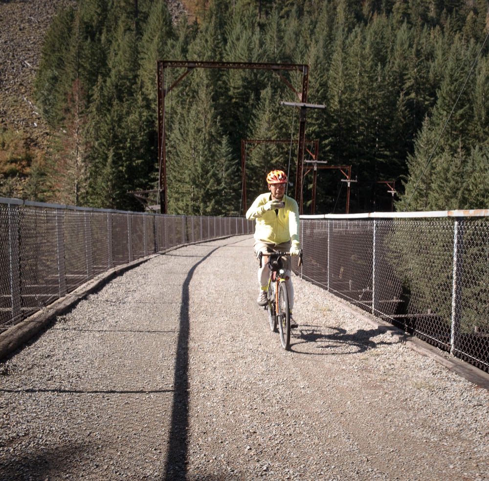
Next, and it is a long next, the route heads up the Iron Horse Trail for almost 19 km to the Snoqualmie Tunnel. When you are crossing the high trestles imagine the experience when the trail was first opened and the trestles did not have railings! The surface of the trail was in excellent condition on the pre-ride, with just a few muddy spots. The conifers seemed happy from the recent rain. Deciduous foliage was displaying fall colors.

There are two climbing areas close together where you will probably encounter rock climbers on the trail. Watch for loose dogs.

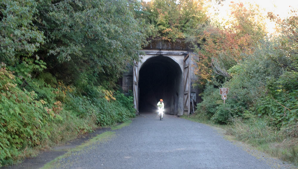
At the tunnel entrance you may want to don a windshell or other warm clothing. It is always chilly inside the tunnel. The tunnel surface was very hard, with a few depressions where drips from the ceiling are eroding holes. Be happy the tunnel was relined a few years ago; previously one had to brave chilly waterfalls in the first 50 yards at each end.

Beware of pedestrians and other cyclists in the tunnel. Your MegaBriteUltra headlight may seem to light up the tunnel superbly, but pedestrians are surprisingly low-viz in the tunnel. Something about the tunnel makes it very difficult to judge distances to oncoming lights and reflective striping.

Emerging from the tunnel you will find yourself at the Hyak Trailhead. Water and restrooms are available in the building on the left. The water spigot is on the west side of the building (facing the tunnel).

The route continues a few miles on the trail past Hyak. There are a couple of gates to ride around. The turn-around point and info control is at an interpretive sign at a scenic spot on Lake Keechelus.

Retracing to the parking lot, we exit and make a couple of turns to head toward the ski area. The climbing on this road is rudely steep after the long cruise up the rail trail. IGNORE the Bike Detour sign! That will put you onto I-90. At the route’s summit we stop at the control at the Chevron Summit Deli. This control is untimed since it is at the top of a mountain, so don’t stress if you are short on time or a little behind the closing time.

The route passes under I-90 and then turns downhill on Forest Road 58. This was the original road to Snoqualmie Pass. If you miss this unsigned turn you will discover the road ends at the Alpental ski area.

Road 58 quickly steepens to a narrow and twisting 9% descent. Enjoy it but be mindful there could be cars driving uphill.

Road 58 continues swooping downhill through lovely dense forest.

After crossing I-90 (which is suddenly, shockingly, noisy) we glimpse a brief, “secret”, vista down the South Fork Snoqualmie River. It is hard to believe this coexists with the freeway just yards away.

The route continues under heavy tree cover on Road 55/Tinkham Rd. Tinkham Rd is a dirt road, with a generally very hard surface but frequent potholes. The potholes cluster in pothole minefields. Stay alert and watch your speed here.

Tinkham has two hazards noted on the route sheet: At around 46.4 miles there is a wooden bridge with a gap down the center, in the direction of travel. A bit farther at around 48.4 miles there is a huge drainage grate that runs all the way across the road. It resembles a diagonal cattle guard. The grate was dry when we encountered it. We rode across without a problem. It is a surprising thing to encounter without warning. Be very careful if it is wet.

All good things must come to an end: The route uses I-90 for about four miles after the end of Tinkham Rd. An advantage of riding the route in this direction is the freeway segment is downhill and over quickly. The shoulder is wide although it had a lot of debris. We got through without problems.

After I-90 we cruise for a couple of miles on paved Homestead Valley Rd. Next is a left for the Iron Horse Trail. This is marked by a sign for Ollalie State Park that you cannot read until you turn. But there are no other nearby candidate left turns, so this turn is not hard to find.

After going around a gate an 8% climb to gain the Iron Horse Trail is the final big effort of the ride. Then you have a serene cruise down to Rattlesnake Lake. The Cedar Falls sign cues you for the unmarked right turn to the Snoqualmie Valley Trail.

After leaving the state park you will find yourself making good time down the Snoqualmie Valley Trail – if you thought the trail was oddly difficult for a rail trail on the way up, you were right.

Back in North Bend, the finish is at Pour House, a few blocks past the start. An SIR volunteer will be there to collect your brevet card.


1 Comment

Filed under Uncategorized

Crescent Beach Summer 300 km Brevet Pre-ride Report

by Bill Gobie, ride organizer

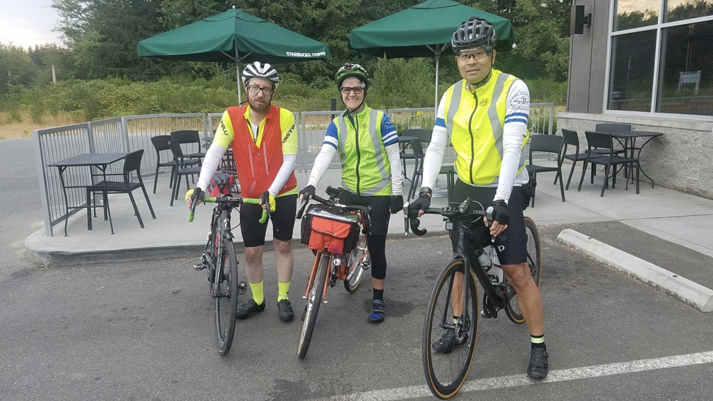
Pre-riders: Peg Winczewski, Mitch Ishihara, and Adam Glass

 — Important Notes —

The finish

The finish has been moved to the 24-hour AM/PM convenience store in Kingston. The AM/PM is virtually as convenient to the ferry as the previously planned finish at the Filling Station. The finish will not be SIR-staffed. Riders will be given a stamped, addressed envelope to mail their cards to the organizer (Bill).

Mitch & Adam discovered the Filling Station was in the process of shutting down at midnight. Peg found it was entirely closed up at 1:30 AM. Without an attractive finish venue that will definitely be open, it is too much to ask a volunteer to hang out for hours waiting for riders. We regret this departure from SIR tradition. Early finishers will probably find the Filling Station a nice place to wait for the ferry.

Potential delay at the Hood Canal Bridge when returning

WSDOT is conducting work on the bridge that can only be accomplished at slack water (minimum tidal flow). The bridge is closed to all traffic during this period. A slack will occur at approximately 11:30 PM Saturday night. WSDOT is vague as to whether work will actually occur on a given night. While WSDOT has posted a standing warning about the work, the pre-riders did not encounter a delay. You should be prepared for a delay of up to one hour in the window from 10 PM to midnight. A closure like this is part of the unpredictable conditions randonneurs are expected to overcome; no extra time will be given if the bridge is closed. You may want to pack some warm clothes in case you are forced to wait.

Weather

The weather forecast for the weekend calls for significantly cooler temperatures than we have recently endured. The pre-riders noted a cooling marine effect near the water, and much warmer temperatures after leaving Crescent Lake. Generally high humidity may make nighttime temperatures feel chilly.

Parking

There is ample parking in the Park & Ride lot on Hansville Rd NE, just north of the start location, if you elect to drive your car to the start. The SIR ride page discusses the issues of overnighting or catching the last ferries either to Edmonds or Seattle and why you may want your car.

The Olympic Discovery Trail

The route uses the ODT extensively. While the ODT is a marvelous facility, it is not a bicycle superhighway. It has poor sightlines preceeding sudden 90-degree turns and 15% pitches that can take you by surprise. Some road crossings are a little vague – the trail may resume a bit to the left or right vs straight across a crossroad. It is popular with walkers and families with small children; please ride cautiously and be respectful of all users. Portions are paved with rough, slow chip seal.

Support

There will be vanishingly little support. A volunteer might be available to assist with an emergency DNF until early evening. Phone coverage is spotty; do not count on assistance being available. Bus service is available on the Olympic Peninsula.

Cell coverage/roaming

Bill’s cell phone connected to a Canadian network in the vicinity of Crescent Beach. If you do not want to be hit with surprise roaming charges you might want to put your phone in airplane mode in this area.

— The Pre-Ride —

Our day began with a surprise rain shower in Edmonds. Dawn broke as the ferry reached Kingston. The pre-riders departed on schedule in pleasantly cool conditions.

  

The route begins with a ramble over to Big Valley Rd, then heads north on WA-3 and across the Hood Canal Bridge. We leave the main highway for the quieter, and steeper, parallel route on Larson Lake and Eaglemount Rds.

The first resupply opportunity comes at the Discovery Bay Village Store at 54 km. The store opens at 9 AM, 2 hours 15 min after the ride starts. Fast riders may arrive before the store opens. They should plan to resupply in Sequim, at 87 km. Water is available sooner, at 77 km in Sequim Bay State Park. The Longhouse Deli in Blyn is not recommended because reaching it requires crossing busy US-101.

After Discovery Bay the route uses Old Gardiner Rd. Old Gardiner Rd is remarkably tranquil for being so close to US-101.

In Blyn the route sheet directs your attention to the pedestrian tunnel under US-101. Riders navigating by route sheet should take note of the tunnel’s location. The return route uses the tunnel. Its entrance is difficult to see in the return direction.

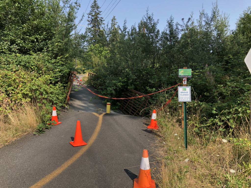
In Blyn the route picks up the Olympic Discovery Trail. The pre-riders discovered a wee problem with the trail. Fortunately detouring around the collapsed bridge is easy. The detour has been added to the route.
A few miles after passing through Sequim Bay State Park, the route leaves the trail to approach Sequim on Brownfield Rd, avoiding the strip mall congestion that the trail would lead you into. It is important to stop when turning off the trail because the road to the left is an uncontrolled exit ramp from 101. Traffic does not stop! An information control at this spot reinforces the need to stop.

In Sequim the route passes by the Safeway. Other food options are available off-route on Washington St.

Leaving Sequim you visit the salacious intersection of Woodcock and Kitchen Dick Rds. Proceeding west, the route eventually returns to the Olympic Discovery Trail, remaining on the trail all the way to Port Angeles. If the waves are high you may literally get a taste of salt water!

Port Angeles offers resupply opportunities. The route returns to the trail after leaving Port Angeles. At the Elwha River you cross the cool bike bridge suspended beneath the highway bridge.
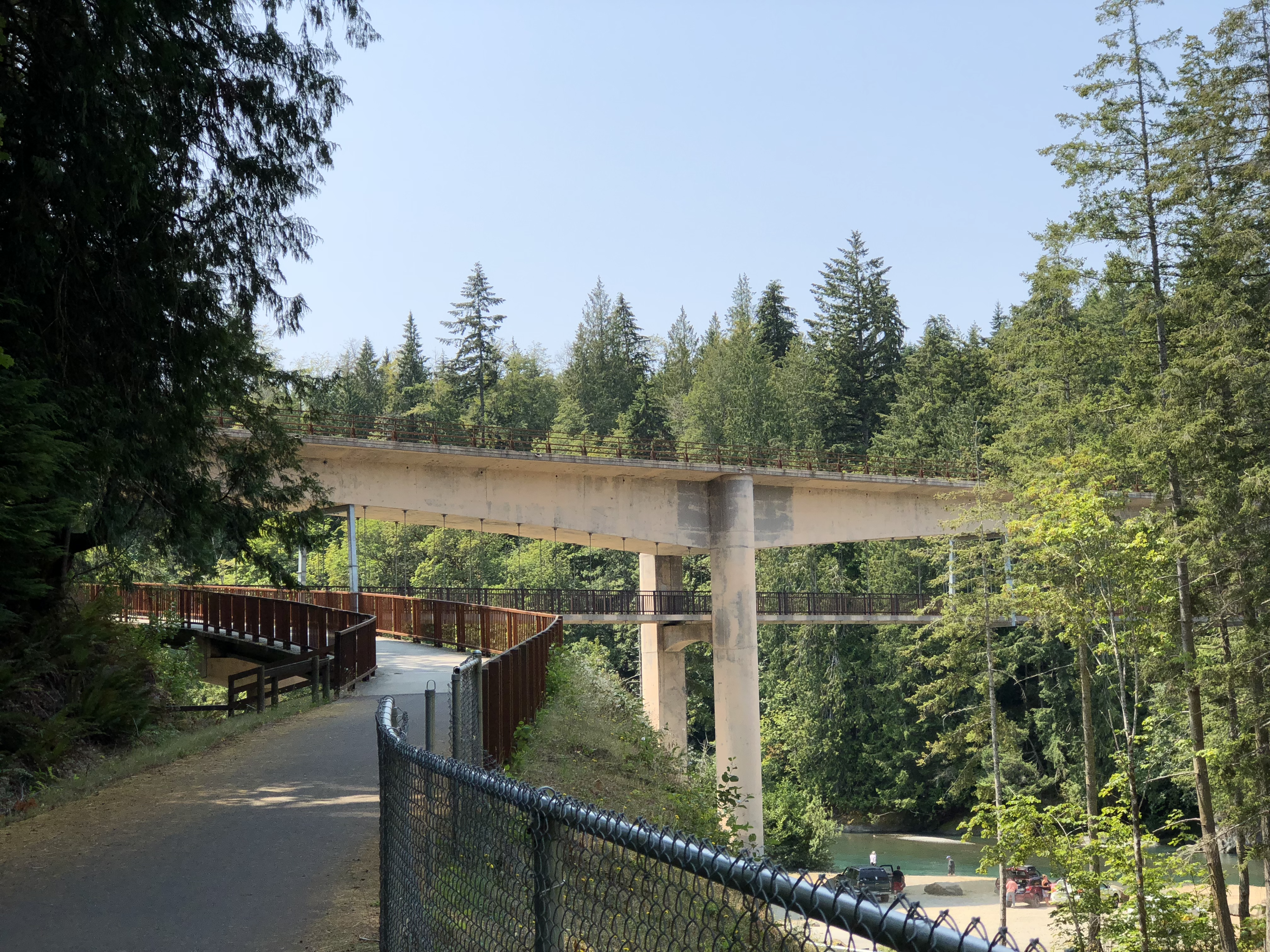
The route follows WA-112 for a few miles before turning for Crescent Beach. At Salt Creek Campground military history geeks can take a short off-route detour to see the casemates built shortly before World War II for two 16″ naval guns. Uniquely, the park road goes right through both emplacements.

Scenic Crescent Beach marks the westernmost point of the ride. After passing by the beach, the route climbs and turns inland on a narrow, forest-hemmed road heading for Crescent Lake. At the WA-112 crossing you can go a short distance off route left to the Blackberry Cafe in Joyce for a milkshake, pie, or something more substantial. But don’t get too stuffed; you still have to climb over the hill to Crescent Lake.
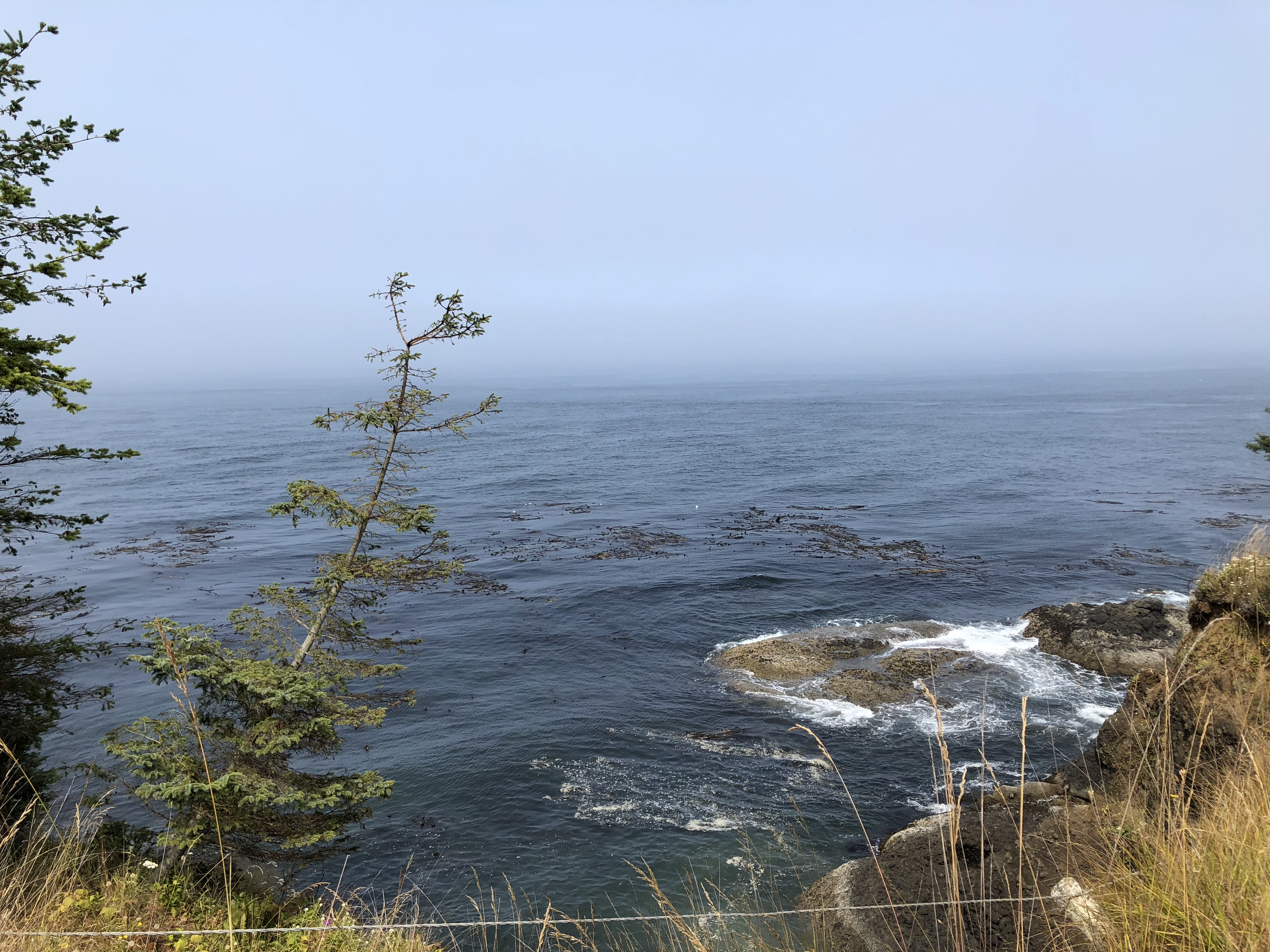
Alongside Crescent Lake, Beach Rd offers pretty views of the east end of the lake. After climbing out of the lake’s basin, the pre-riders suddenly encountered much hotter conditions on US-101. The control at Shadow Mountain General Store is a good place to prepare yourself for the challenge of Little River Rd. Be sure to leave with full bottles and good energy. The store’s ice cream is highly recommended!

After some noisy miles on US-101, you turn onto Olympic Hot Springs Rd then onto Little River Rd. Little River has the longest and steepest climbing on the route. The grade reaches 15% in places. About 4 km of this road is dirt. There is not much large gravel. Mitch & Adam rode 25 & 28 mm tires with no trouble, although there are places where you may have trouble resuming riding if you stop. The road heads uphill through a mix of forest and clearcuts. If the day is warm the clearcuts will be exposed and hot.
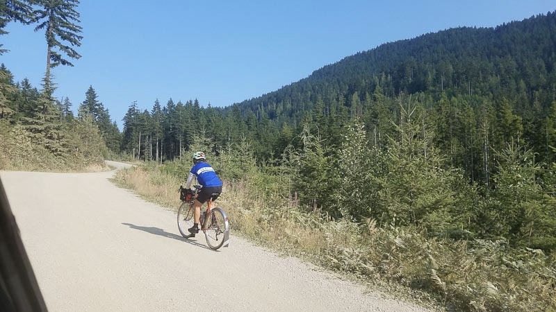
The route turns downhill on Hurricane Ridge Rd. The road is newly resurfaced and very smooth. However, it has some odd divots, so stay alert on this fast descent.

After passing through Port Angeles, with its resupply opportunities, the route largely retraces itself on the Olympic Discovery Trail. The Sequim Safeway or another restaurant is a good place for a substantial meal. For many riders this will be the last, best resupply opportunity. The 24-hour Longhouse Market at Blyn is a final option but requires crossing 101. The deli in the market may not be open much later than 6 PM.

In Blyn use the tunnel mentioned previously to cross safely under US-101. The route stays on 101 to Discovery Bay; using Old Gardiner Rd in this direction would require multiple left turns across 101.

Fast riders will be able to resupply at the Discovery Bay Village Store. The store closes at 8 PM.

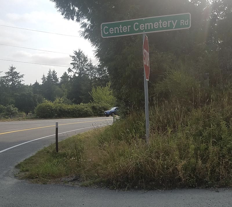
The route leaves 101 at Discovery Bay to again take the parallel route on Eaglemount and Larson Lake Rds. The final information control is at Center Cemetery Rd, just before the turn onto Larson Lake. The control asks a question about the stop sign on Center Cemetery Rd, not Larson Lake. Don’t mix them up.
With some luck you will not be delayed at the Hood Canal Bridge, and can cruise the last miles to Kingston.

As a special consideration for riders overnighting at The Point Casino Hotel, you may ride directly to the hotel and have your card signed there. This is a harder finish than going to Kingston! Mitch and Adam report that the food at the casino is better than a convenience store.

Comments Off on Crescent Beach Summer 300 km Brevet Pre-ride Report

Filed under Uncategorized

Time’s Up for the You’re-Out-of-Time Catch-22

New Closing-Time Rule for the First 60 km

The interaction of control closing time with the start control’s one-hour open window has been one of the endearing, or annoying, or nerve-wracking rules of US randonneuring. Ride starts are always open for one hour. You may miss the starting time by up to 60 minutes and still begin a ride. But prior to this rule change, if there were a nearby control you may have been out of luck:  The closing time for all other controls was calculated at a steady 15 kph pace* beginning at the official start time. For example, if the first control was at 15 km, it closed one hour after the start, at the same time the starting control closed! Besides challenging the perpetually tardy, this method severely penalized a random mechanical such as a puncture. This issue complicated course design when the early portion of a route might have required a control.

RUSA has adopted a modified closing-time rule for the first 60 km of a ride. The rule is:

Elapsed closing time = 1 hr + distance/20 kph

You now get the 1 hour start control window, plus the time it takes to ride to a control at 20 kph (about 12 mph). At 60 km the new closing time coincides with the old 15 kph rule. Beyond 60 km, 15 kph remains the minimum speed.*

Here are examples of the old and new rules. Times are elapsed time from the ride start.

Distance
(km)
Old
(h:min)
New
(h:min)
0 (start)
1:00
1:00
1
0:04
1:03
5
0:20
1:15
10
0:40
1:30
15
1:00
1:45
20
1:20
2:00
40
2:40
3:00
60
4:00
4:00


The new rule has been incorporated into the RUSA calculators, thanks to Lynne Fitzsimmons. The rule applies to ACP brevets, RUSA brevets, and RUSA permanents.

Control opening times are not affected.

Some of SIR’s permanent routes will need to be updated with new closing times for early controls. The new timing rule applies even if the route sheet and card have not been updated. If you find a route with obsolete times, let us know at permanents@seattlerando.org.

___________________________________________________________________________

*At long distances the minimum speed you must maintain decreases. For details see:

https://rusa.org/octime_perm.html

https://rusa.org/pages/acp-brevet-control-times-calculator

(the explanatory speed tables on these pages have not been updated with the new rule as of 3/21/18)


Comments Off on Time’s Up for the You’re-Out-of-Time Catch-22

Filed under Uncategorized

Permanent Change: Controlling 520

Controlling 520

By Bill Gobie


With the impending opening of the new bike trail across the 520 bridge, I reviewed our permanent routes to see which might need additional controls to prevent shortcutting across the bridge. Somewhat surprisingly, out of our 300+ routes, only ten are affected and each only needs one new control. The ten routes are:


757 Redmond to UW via Issaquah

758 UW-Issaquah

1015 Queen Anne-Everett-Sammamish

1514 Woodinville Trails

1801 Club Car Populaire

2795 Leschi-Hobart-Redmond Loop

2868 Common Trails

3065 Green Gold and Red

3226 Peddler Postdoc Redmond Start

3227 Postdoc Peddler Ballard Start


All of the routes are now fixed up with new controls. Some of these are popular routes. Some are ridden almost exclusively by one or two SIRs. If you are accustomed to riding any of these on autopilot, be on the lookout for the new control! Be sure you use the newest versions of the cards, route sheets, and gps files that the Perminator sends you.

Comments Off on Permanent Change: Controlling 520

Filed under Permanent Change, Permanents, Uncategorized

Pre Ride for 200/300K on April 15,2017

by Millison Fambles

The 200k and 300k rides will be run concurrently for the first 80 miles starting at Bertolino Coffee Bar 2421 S Union Tacoma 98405.

The ride starts along the Scott Pierson Trail. This trail has lots of turns and uses crosswalks and sidewalks as it follows along Hwy 16 to the Tacoma Narrows Bridge. The view from the bridge is spectacular and is a great photo opportunity.  Four miles later, you will be zooming down the hill into old town Gig Harbor. There is a bit of road construction along the water but it should not slow anyone down on a Saturday morning. The congestion and number of turns decreases once you have left Purdy, just in time for the Kitsap climbing to begin. Pine Rd starts the fun and it continues pretty much until WA-3.

The first control is in Belfair and there are a wide variety of food options: Safeway, McDonalds, Starbucks, etc. There is road construction for a short stretch through town. The route follows Hood Canal for a few miles before it makes a sharp and steep climb up E. Trails Rd to Mason Lake. Keep your eyes peeled through the clearcuts for glimpses of the Olympics and Mt Rainier. The next control is at the Airport Grocery outside of Shelton. Please be extra courteous and clean. We were scolded last year for leaving trash outside. If you are going to leave water for the following riders, please leave it neatly next to the trash can.

Follow US-101 south to Steamboat Island Rd. where we escape the business of the highway for the quiet lap along Madrona Beach.  Shortly after the climb up and out of the Delphi Valley, the route splits and the 200k cuts through south Olympia and the 300k continues south the explore the hills and valleys of the Doty Hills.

The 200:

Off Delphi, there are a few new roads to an info control. Congestion increases as the route goes through South Olympia and Tumwater. There are lots of services through this area. Cleveland Rd becomes Yelm Hwy and is busy but has a wide bike lane. Watch for merging and turning traffic. There is an info control then a fast descent into the Nisqually River Valley. Fort Lewis limits our road options for heading north so there will be a 1.5 mile stretch on I-5. Use caution if there are trucks merging to use the scales.  There are plenty of food options in Dupont and only 28k to go.  Continue past the Amazon fulfillment center, the Ft Lewis firing range, the Jack Nicklaus designed VA golf course and across Steilacoom Lake as you wind north through Lakewood. The final 10k follows city streets to the finish.

The 300:

Continues down the valley to Littlerock (services) and Mima Gate to the “End of the Trail” control in Rochester. Stock up on food and water here, there are no services for 50km. After a short stretch on US-12, the route turns into the hills and meanders through quiet, rural hills ending with a beautiful descent down the Lincoln Creek Valley. There is a control at Safeway in Centralia and then easy riding on 507 to Bucoda, Tenino and then on the trail to Rainier. Then, head north to East Olympia and then follow the 200k route to the finish.

Almost half of the elevation gain is in the first 50K, so the Belfair control is well timed for a break. The 200 route has services along the whole route. The 300 has a 50k gap from Rochester to Centralia without anything.

The weather forecast is looking good, but is has been and wet spring.

It helps if you preregister: http://seattlerando.org/index.php?option=com_content&view=article&id=608

See you Saturday morning at Bertolino’s.

Millison

Comments Off on Pre Ride for 200/300K on April 15,2017

Filed under Pre Rides, SIR Rides, Uncategorized