Author Archives: Theo Roffe

About Theo Roffe

SIR Newsletter/Blog Editor RUSA 5988

Spring 200K – Preride Report

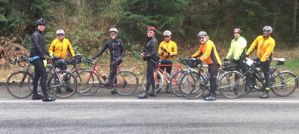
(L to R) Mark Thomas,   Doug Migden,   Bob Brudvik, Mark Roberts, Andy Speier, Rick Blacker, Mitch Ishihara, and Shan Perera. Not pictured: the camera-shy Tom Brett and the camera-wielding Lyn Gill).

(L to R) Mark Thomas, Doug Migden, Bob Brudvik, Mark Roberts, Andy Speier, Rick Blacker, Mitch Ishihara, and Shan Perera. Not pictured: the camera-shy Tom Brett and the camera-wielding Lyn Gill).

On Sunday, March 6th, an intrepid crew of volunteers braved the rainy forecast to scout the course for the upcoming 200k brevet (March 12th). With Mitch in charge of managing the micro-climate around us, however, we had almost no rain and a few glorious helping of blue skies. Flats were a different story as Ricky and Andy were cursed by the flat gods. The cue sheet was in pretty good shape, but the eagle eyes of Andy, Ricky, and Mark caught a few “opportunities for improvement.” (The RideWithGPS route has been updated and a revised cue sheet will be published shortly). All in all, it was a lovely day on the bike with good friends on a really nice route. Some notes about the route follow.

By and large, the route was on low-traffic roads. A couple of places to watch out:

(1) 1.5 miles of Woodinville-Duvall road early in the ride have a good shoulder, but please be cautious making the left onto 222nd Way noting that the road ahead is coming around a curve.

(2) Airport Way into Snohomish at the beginning and out of Snohomish near the end can be busy and it has no shoulder. (They can’t make a trail out of the train tracks from Snohomish to Woodinville soon enough for me. Maybe in my lifetime.)

(3) A half-mile on Machias Road after leaving the Centennial Trail outbound was a bit unpleasant.

(4) A little bit of uphill on Broadway after Snohomish on the way home can be unpleasant, but then the route turns left onto Connelly for a very nice back-road alternative to climbing the rest of Broadway.

(5) Caution also is advisable on the last part of Yew Way and the crossing of WA-522 near the end of the ride.

The route has a pretty decent amount of climbing – about 6000 feet of elevation gain. The route has a few steep pitches but no sustained double digit grades. We may have happened on the climb-iest way to get to Granite Falls on pavement, but the nice climb rewards you with views of Lake Bosworth before descending down towards Pilchuck Creek before Granite Falls. Save some of your climbing mojo for the end – more than 20% of the elevation gain in the ride comes in the last 17 miles. I’d say the climbing is all quite manageable unless you have Bob and Dr. Doug goading you into sprinting up all the hills. But we took one for the team and brought them with us on the pre-ride, so the regular ride should be quite ok.

Please note that there is nearly a mile of the route that is not paved (at mile 9). Two thirds of that is hard packed gravel, but there is about a quarter of a mile of dirt horse track. It was muddy and pocked with puddles on the pre-ride, but rideable on road bikes without issue. Be prepared, however, to walk some of it, depending on conditions, next Saturday. It’s a single file ride for all but the most skilled (and trusting) of randos.

Some notes on services:

(1) Don’t know if bathrooms will be open at the start. You are welcome to use the facilities at the house and then come down to start. Public restrooms (and bakeries) are available in Snohomish at 22 miles.

(2) There is a store at the Machias Road / OK Mill Road intersection (28 miles) before the climb up to Lake Bosworth.

(3) Mark’s Country Store (the Granite Falls control at mile 38) has good food options, tables, and nice people.

(4) The Bryant store where the Centennial Trail crosses WA-9 (mile 54 and again at mile 79) has the usual convenience store fare and offers growler fills if you happen to bring some along and need to take some beer home. A Mocha Death from the brewery that makes Irish Death looked quite interesting. But we forgot our growlers.

(5) We will have a manned control at a fire station near Big Lake (mile 68) with snacks and lunch-y sort of food. Andy has worked his fireman’s magic to get us access to the bathroom in the firehouse.

(6) The control at the Lake Stevens Mini-Mart (mile 98) does not have public restrooms. You can find facilities right afterwards – where you turn right onto the trail, look left instead and there is a sani-can in the trailhead parking lot. (The Machias Station on the trail three miles later has nice bathrooms. They were open when we came through, but no guarantees.) Also, this is an “open control” so feel free to stop at one of the other restaurants or markets near the Lake Stevens control for food or supplies and ask them to mark your card.

(7) The route follows 2nd Street through Snohomish (mile 106) to pass by two convenience stores (on left – Shell and 7-11). If you’d rather have a sit-down dinner, feel free to go down 1st Street instead and have a burger and beer with the weekend revelers.

(8) Convenience stores are also available at mile 117 and 121 if you need that one last Red Bull to get it done.

We will have food and drink at the house after the ride. It’s 2 miles downhill from the house to the start – https://goo.gl/maps/zp4QqzuEiaJ2 – you are welcome to leave your car in the neighborhood in the morning or drop off a bag of clothes at the house in the morning if you’d like to change after the ride. Or you can turn in your card and ride down and bring car back at the end. But please plan to spend some time after the ride. Tales of the day’s triumphs and old faded glories will be freely traded. Along with big talk about plans for the year.

Click here to register now for the ride on March 12th, starting at 7:30 AM. This will save you time at the start and helps the organizers stay organized.

Comments Off on Spring 200K – Preride Report

Filed under Pre Rides, SIR Rides

Sunny Spring Populaire Photos

The Spring 2016 Populaire went off beautifully, in no small part thanks to Lyn and Anita having arranged for summer weather. I can’t remember my last ride with short sleeves (PBP 2015?).


Here are a couple of photos from the start snapped by paparazzo Jeff Loomis:

Lyn, Populaire Organizer Extrordinaire

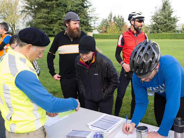
Getting Signed In

Click here to visit a photoset on Flickr of all photos with the tag 100KMar052016. If you’re on Flickr, add the tag to include your photos. If your computer isn’t allergic to Flash, you can see a slideshow of the entire photoset at the end of this post.

Cheers! Dan J and Narayan K. Photo by Lyn Gill.

Cheers! Dan J and Narayan K. Photo by Lyn Gill.

Did you write a ride report? Or share photos on another website? Please leave a comment with a link!

Comments Off on Sunny Spring Populaire Photos

Filed under SIR Rides

Island Views 300km Brevet – 3/26

Scenic Views

Organizers Adam Glass and Mitch Ishihara are inaugurating a new 300k route this year.  The Island Views 300 will take you from Snohomish, north to Fidalgo Island, across a trestle bridge to Anacortes, and then across Deception Pass onto Whidbey Island.

A Bridge

An SIR-manned stop will await you at Fort Ebey Park, followed by a return north via Oak Harbor,  La Conner and back to Snohomish.   The route features many pretty views and settings.  We think you’re going to like it!

A Park

The ride starts 3/26 at 06:00 in Downtown Snohomish (exact location TBA). It will help immensely if you pre-register (and prepay) before the day of ride to reduce the congestion at the start and to give us a sense of what supplies we need.  For more details and to register, click here.

Please remember that your bicycle should be equipped with a taillight and headlight and you should come to the start wearing your reflective gear. The days are still short in early March.

We hope to see you out there!

Click here for additional ride details and registration.
Preliminary route: https://ridewithgps.com/routes/12393704

Comments Off on Island Views 300km Brevet – 3/26

Filed under SIR Rides

Spring Populaire and 200K

The 2016 brevet series kicks off with the Spring Populaire on Saturday, March 5th, and a new 200km brevet on Saturday, March 12.  You can get more information, pre-register and view the courses on the SIR website, by clicking the links above, or read more below:

The Chateau St Michelle isn't in France, but we can pretend...

Woodinville’s Chateau St Michelle isn’t in France, but we can pretend…

Spring Populaire, March 5th

The Populaire begins by heading south around much of the perimeter of Mercer Island and turning onto the trail.  Before you know it you will be heading east going thru Newcastle and hooking onto May Valley Rd.  This will take you all the  way over to Issaquah-Hobart Rd. Heading south then west weaving your way over to the Cedar River Trail, where volunteers will be happily waiting to sign your cards.

From there you head into Renton, over to Seward Park, and loop around the scenic park.  Follow Seward Park Blvd. before meeting up with the bike path to go over the I-90 bridge to the finish at Roanoke Tavern, which is just past the parking lot you parked at the start (about ½ mile).  If you’ve never been to the historic Roanoke Tavern now is your chance.  Good burgers and beer.  Hope to see a great turn out. Shooting to beat Andy’s turn-out last year.  Let the games begin!

Pre-register for the Spring Populaire.

Spring 200K, March 12th

The 200K departs at 7:30 am from Sixty Acres Park in Woodinville. We’ve pushed back the start to 7:30am in order to enable riders from Seattle, if they choose, to take the first ST 545 bus to Redmond (arriving around 6:50AM) and ride up the trail to the start.

This year we finish at Mark and Chris Thomas’ house in Redmond (thanks for your hospitality, Mark and Chris).

As mentioned on the website, it will help immensely if you pre-register (and prepay) before the day of ride to reduce the congestion at the start and to give us a sense of what supplies we need.  If you are a returning randonneur, please try to submit and pay your RUSA and SIR memberships well before March 10.  SIR membership is not required, but is encouraged, and it does offer you a discount on all SIR brevets.  Membership in Randonneurs USA (RUSA) is also encouraged if you are not already a member (and is requirement for SIR membership).  We will have SIR and RUSA membership forms at the start for those new or renewing riders who need them.

Your bicycle should be equipped with a taillight and headlight, as the days are still short in early March.

Pre-register for the Spring 200K.

Comments Off on Spring Populaire and 200K

Filed under SIR Rides

2016 Cascade 1200K Volunteers and Registration News

Cascade 1200K

Great events don’t happen without great volunteers!

The 2016 Cascade 1200K is June 17-21, 2016 and we need help in ALL of the following areas:

  • 6/17 bike inspections (Mt. Vernon)
  • 6/18, 6/19/ & 6/20 overnight controls (Packwood, Moses Lake, Mazama)
  • 6/18, 6/19 & 6/20 daytime controls (locations TBD)
  • airport pick-ups and drop-offs (between SEA & Mt. Vernon)
  • Baggage truck driver(s)

If you think you can help (even if it’s tentative), please complete the form here.
We promise not to hold your first born children hostage if you have to withdraw your interest.

Registration for the 2016 Cascade 1200 opens on Saturday January 9th.

Complete registration details can be found here:http://seattlerando.org/C1200/registration/
(Additional details regarding hotel locations will be up shortly.)

Check out the FAQ page here: http://seattlerando.org/C1200/faq/

If you have any questions that are not answered by a review of those two pages, please feel free to post a question here or send an email to: cascade1200 @ seattlerandonneur . org

note: .

Note:  A *limited number* of volunteers making significant contributions during the event may be offered the opportunity to join the pre-ride.   Invitations to join the pre-ride are at the sole discretion of the organizers (Susan & Charlie) and will *not* be available to all volunteers.   Thank you in advance for your understanding.

Comments Off on 2016 Cascade 1200K Volunteers and Registration News

Filed under Cascade 1200, Club Info, SIR Rides

Call for 2016 Ride Organizers/Volunteers

The SIR Annual Meeting is this Saturday and it’s a great opportunity to meet up with your ride buddies and get a recap of 2015. It’s also where we look forward to the 2016 calendar and step up as ride organizers and volunteers.

If can organize, or help organize, any of our 2016 rides (see calendar below) please leave a comment or contact RBA Mark Thomas.

Update 10/14/15: Thanks to the many volunteers who have offered help! Rides that still need an organizer are in bold, below. (You can still help out with the other rides, of course.)

SIR Meeting in Issaquah

Sat 3/5 – Spring Populaire
Sat 3/12 – Spring 200k
Sat 3/19 – Olympia 200k – Corey T & Stephanie R
Sat 3/26 – Spring 300k – Adam G & Mitch I
Sat 4/2 – Olympia 300k – Millison F

Fri 4/15Sun 4/17 – Fleche NW – Theo R

Thu 4/28Sun 5/1 – NW Crank – Greg C & Rose P
Sun 4/23Sun 5/1 NWC Brevet Week (Sat 4/23 – 600k / 1000k; Tue 4/26 – 300k; Wed 4/27 – 400k; Sun 5/1 – 200k)

Fri 5/6 – Night start 100k – Dominique B

Sat 5/14 – Spring 400k
Sat 5/28 – Spring 600k

Sat 6/4 – “Dryside” RUSA 200k adventure brevet – Shiggy P

Sat 6/18 – Cascade 1200/1000 – Charlie W & Susan O

Sat 7/9 – Summer Populaire
Sat 7/16 – Summer 200k
Sat 7/31 – Summer 300k
Thu 8/11 – Summer 1000k
Sat 8/20 – Summer 400k
Sat 9/3 – Summer 600k

Fri 9/23 – Fall 1000k – Crater Lake? Bill G ?
TBA – Mountain Populaire


We’re also looking for blog contributors. Please let me know if you’d like to help out.  – Theo

Comments Off on Call for 2016 Ride Organizers/Volunteers

Filed under Club Info

PBP – Following Rider Progress

#parisbrestparis2015With PBP only 11 days away, some SIR riders have already headed to Europe, others are packing their bags and making final preparations. But how can you follow rider progress if you’re not riding?

Michal Young of the Oregon Randonneurs has set up a group tracking site for Pacific Northwest randos carrying SPOT trackers at PBP: http://enroute.saunter.us/track/nwrando.html
If you’d like to add your SPOT track to the group, please contact Michal (see his original post in the SIR group on Facebook).

There should also be tracking provided by the PBP organizers, here. (under construction at the time of this writing).

On Instagram, randonneurs from all over have been posting using #pbp2015 and #parisbrestparis2015

Know another way to follow along from home? Please share in the comments. Thanks!

Comments Off on PBP – Following Rider Progress

Filed under Other Rides, SIR Rides

Summer 400/600 6/27 Pre-Ride Report

by Ian Shopland

Millison and I completed the 400k pre-ride last Sunday. We didn’t find any gravel (surprise) but we did find a fierce hill. The start leaves Tumwater and immediately enters beautiful farm land. Usually this section was busy, but at 6am there was little to no traffic. The airport might see some congestion as it is the airshow this weekend. We were in Tenino in no time and then stopped for some coffee in Centralia. This is an open control. The route goes by Fuller Market Grocery, but there are other coffee shops and convenience stores on route. Scheuber Road rolls along and you will catch glimpses of Mt Rainier and Mt Saint Helens. The first info control is at the Claquato Church built in 1857 and is the oldest standing building in Washington. Just after the control, there is a 76 Station if you forgot anything in Centralia.

Where's Rickie????  Photo by Millison Fables

Where’s Rickie???? Photo by Millison Fables

Once you turn on 603, the route starts in on the rollers. It’s not that this ride has the most elevation, but that all of the climbing is steep. Berry and Tennessee will take you into Winlock. There are services to your left, off route by one block. It is important to note that the route diverges from the “normal” route out of Winlock. Please read your cue sheet carefully. We follow the STP trade route into Kelso/Longview. We will be using the Chevron just past the bridge but it is an open control. It is important to be efficient at this control because the serious climbs begin after this point in the ride.
There are two strange intersections just after the control where the ride skirts along I-5. At both intersections, it is easy to navigate if you don’t get on the freeway. There is only one road that isn’t an on or off ramp, but it isn’t well signed. A few bumps and you are in Kalama, your last services before the big climb. Make sure that you have enough water to get through this exposed climb. There are no services for 6 miles. The road curves inland and begins a puke-tastic climb that jumps over 15% and stays there for about a mile. Don’t forget to turn around and look over your shoulder, there are huge sweeping views of the lower Columbia. The climb continues, but the grade lessens (a bit) as you make your way up to 1,500ft above the river. ***Important*** the control is not at the top of the climb. Continue down the climb to Schmitz road for the info control. It is important to go straight at this point, and NOT follow the main road to the right. If you do, there will be more steep climbing ahead.
Use caution on the rest of the descent, the grade is steep and the curves are tight on this technical descent. Once you are back on flat land, you can get supplies at Woodland. There is an Arco station on the corner at the turn on CC street as well as many different services. The route follows the south side of the Lewis River to an 1876 mill and covered bridge. The bridge is at the bottom of a steep descent and the control is on the sign before you cross the bridge. Enjoy a short breather before you begin the series of climbs out of the Lewis River Valley.
The route brings you into Vancouver and passes lots of services. There is no timed control in this part of town, but we stopped at a McDonalds before the info control. Just after the McDonalds, the route cuts through a park on a short bike path that isn’t well marked. Just after the turn, you enter a parking lot and there are 3 different ways to get to the same trail on your left. Pick one and follow it up the short hill. The trail comes out on Reserve Street along Clark College. Follow this street south down the hill to the fort. We had beautiful views of Mt Hood towering over the historic fort. The info control is on the next corner. After the info control there are lots of food options at the many restaurants in downtown.
The timed control is a well stocked gas station on the west side of town. There is also a 24 hour gas station at mi 152. Soon you will be back in Woodland and just after, start up the other side of Green Mountain redux. The climb is shorter but not any less steep. Hopefully you saved some of those low gears for the grunt up to the top. Use caution on the descent, there is a well marked section (20 feet) of gravel through a construction area. This is the last of the major climbs on the ride.
Back in Kelso, we re-visited the 24 hour gas station for a control. There is hot coffee, sandwiches, etc to get stocked up for the end of the ride. The rest of the ride north was uneventful. We took shelter in the warm Toledo post office for a nap and then coffee in Centralia.
This is not any easy ride. Millison and I didn’t finish until 8am the following morning, but we ran into ‘pre-ride’ problems. We had a 9 mile detour and an additional steep (18%) climb that we removed. We also were held up a busy Safeway in Kelso. The repeated steep hills didn’t allow us to make up any time during the middle of the ride. The easiest parts of the ride are the sections before and after Kelso, so it is important to be efficient through these sections, especially in the morning. There are plenty of places to get services along the route so even in the heat, you should be able to stay well hydrated.
For those who are riding the 600k, we will have rooms at the Guesthouse Inn and standard overnight fare. The 200k section of the 600k is much easier than the previous 400k. It has 4000 feet of climbing and beautiful, quiet country roads.
We will see you in the parking lot at the Guesthouse at 6am.


Comments Off on Summer 400/600 6/27 Pre-Ride Report

Filed under Pre Rides, SIR Rides

Pre-Ride Report: 400/600K , June 13-14

by Susan Otcenas

The “Big Picture” summary of the ride is that while not an easy course by any measure, it is definitely doable even by randonneurs of modest ability.   The key to success is not pushing too hard on the first day, pacing yourself on all the climbing early in the ride, and exercising control efficiency to gain as much time in the bank as possible heading into the overnight.    While Day 2 is quite a bit easier than Day 1, I nonetheless recommend leaving the overnight with 30-45 minutes in the bank.  The hilliest bits come at the beginning and end of the day.

effyeah, Mt Rainier!

#effyeah #600k #MtRainier photo by Susan Otecenas

Keith Moore and I pre-rode the 600K on May 30/31.  Jan Acuff & Audunn Ludviksson pre-rode the 400K on June 6th.  Many thanks to the three of them for vetting my cuesheets, setting up info controls and providing feedback on the routing.

The 400K is substantially similar to the first loop of the 600K, with the “extra” miles need to bring it up to 400K accomplished on Hwy 12 west of Randle.  400K riders should read the 600K Day 1 summary for all of the relevant information.

Links for GPS data and Cue Sheets here:

(RWGPS 600K Day 1 )   (RWGPS 600K Day 2 )   (Cue Sheet 600K)
(RWGPS 400K)   (Cue Sheet 400K)

600K Day 1: 240 miles (386km).  10,500-11,500 feet of gain, depending upon your GPS.

Registration will be from 4:00 to 4:45am INSIDE the IHOP adjacent to the Motel 6 at 1885 15th Place NW in Issaquah.  Look for me and William Willaford inside.   Pre-ride instructions will be given in the parking lot outside the IHOP at 4:50am.  You may leave a small overnight bag with me for safe keeping in the control room. [See end of post for information about parking — ed. ]

Riders will depart at 5am, at which point the sky will already be surprisingly light.   You will spend several miles on the Cedar River Trail and the Cedar to Green River Trail.  The Cedar to Green River Trail is gravel.  Gravel generally makes me nervous, but I did just fine on 28mm tires.  Note that the gravel is a little looser at underpasses, so use caution.

Clever routing right past Sandys Espresso just in time for breakfast. You can thank me later. Photo by Susan Otcenas

Clever routing right past Sandys Espresso just in time for breakfast. You can thank me later. Photo by Susan Otcenas

It’s an easy ride to Enumclaw, your first control.   We used the expedient Chevron option.  Other than the Chevron, I think there is a coffee stand a few blocks later.   There are also a few restaurants at the corner of 410 at mile 29.5 if Chevron doesn’t tickle your fancy.

Over the next 40 miles you will climb about 4000 feet.  We highly recommend you carry three bottles. You’ll find services in Greenwater at mile 47, and there are some campgrounds beyond that which may have water (but we did not investigate).  We stopped at Greenwater to top off.   I had enough water in my bottles to make it to Packwood at mile 93, but Keith was running low between the summit and Packwood.

Cayuse Pass comes at mile 69, at which point you will have climbed roughly 5500 feet.  DO NOT PANIC if you are behind the clock a little.  You will make it up on the way into Packwood, which is 3500 feet below you.  (For reference, Keith & I had roughly 45 minutes “banked” at the top of Cayuse, and no one ever accused me of being a nimble climber.)

Don’t be fooled into thinking it’s ALL downhill from Cayuse Pass to Packwood.   There are a few smaller hills to climb after the first big drop.   We had a tailwind climbing to Cayuse and then a surprisingly stiff headwind for much of the descent and then into Packwood.  While the road surface is generally alright, some sections of the descent were surprisingly bumpy.

The expedient stop in Packwood is at the Shell on the right.   Departing Packwood, you will head west on Hwy 12 for 10 miles (we had a stiff headwind) and then get relief from the traffic by following Silverbrook the rest of the way to Randle.  600K riders will answer an info control question in Randle, while 400K riders will continue on west on Hwy 12 from Randle to an info control a few more miles down the road, and then back to Randle, to get the extra distance required to bring the day up to 400Km.  There are services in Randle.  600K riders may not need them, but 400K riders would be advised to fill up their water bottles as there are no services after Randle until returning to Packwood.

From Randle, you’ll ride Cispus Rd, then head east on the delightfully shady and delightfully traffic-free Cline Rd, where there’s another info control question to keep you honest.
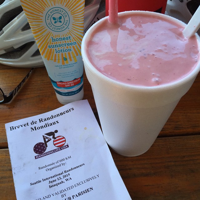
"2nd time through Packwood at mile 129. Big miles call for big shakes." Photo by Susan Otcenas

“2nd time through Packwood at mile 129. Big miles call for big shakes.” Photo by Susan Otcenas

Packwood is once again a control on the return.  If you are shy on time, you’ll probably want the Shell again.  Keith and I didn’t have oodles of time in the bank, but wanting something a little more solid, we opted for the burger and milkshake place on the right.   The milkshakes are handmade with fresh berries and plenty of ice cream.  That plus some salty fries to go in the handlebar bag made me a happy camper.    Keith came to regret his decision to eat a burger while climbing Skate Creek a short time later.  Let your stomach be your guide.

Skate Creek is a long climb, gaining 1500 feet, but it’s gently graded.   You’ll also find it blissfully shaded and extremely low traffic.    There are no services between Packwood and Ashford (grocery store on left) at mile 154 (163 for the 400K riders), so be sure you have enough water on board.  There are additional services in Elbe beyond that, though if you are a slower rider you might just find restaurants still open.  The store was closed when we arrived.

Please use caution and ride single file on Alder Cutoff Rd on the way to Eatonville.  It’s narrow and without much shoulder, which makes it somewhat stressful.  Audunn and Jan had several motorists yell at them on this stretch, though Jan did allow as one of those yelling motorists was making a complimentary statement about the shape of her derriere.  Audunn also had the novel experience of having a passenger attempt to pee on him from the window of a moving vehicle, so there’s that to add to your bucket list as well.

Continuing the Tour de Shell in Eatonville, we took time to put on our reflective and get ready for nightfall here.  It was still light for us, though slower riders may find themselves here after sunset.

20 miles after Eatonville, you will make the unsigned turn onto WA-162/Pioneer way.   There’s not much shoulder and there was more traffic than I was expecting at that hour (10pm ish).   Please use caution and ride single file!  Fortunately, you will only be on that road for 2.4 miles before the safety and serenity of the Foothills Trail.

Although not a control, you’ll likely want to stop, as we did, in Enumclaw, where you will find plenty of services on route.  At Hwy 410 there are several fast food options, and a 24 hour Safeway.   We brought our bikes into the Safeway and dined in great luxury while lounging on the mobility scooters.    After Enumclaw, there’s not much in the way of services until the overnight in Issaquah, though I recall an open Texaco somewhere along the line.

There is one last info control on Cumberland Kanasket Rd, and we made sure to create a question that would be easy to answer in the dark.

Look for the SIR control sign when you get back to the Motel 6.  I’ll post my room number on the sign.  Due to limited facilities (read: the mini fridge and microwave in my room) we will not be serving full-meal-worthy fare.   We will, however, have plenty of drinks, snacks, fruit, and enough pizza for you to feel satisfied.   If you have enough time banked, however, you may wish to avail yourself of the IHOP immediately next door.   Service is fast at oh-dark-thirty and they are open 24 hours on the weekends.  I also let them know we would be there, so with any luck they will have extra staff on hand.
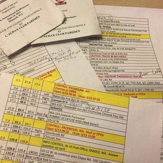
"One of the pleasures of doing a pre-ride is taking the time to annotate the cuesheet as you go so that the event's riders can have the best possible experience. This course is a beaut and I hope to see lots of riders in 2 weeks!” Susan Otcenas

“One of the pleasures of doing a pre-ride is taking the time to annotate the cuesheet as you go so that the event’s riders can have the best possible experience. This course is a beaut and I hope to see lots of riders!” Photo by Susan Otcenas


600K Day 2: 135 miles (217km).  3,000-4,000 feet of gain, depending upon your GPS.

We recommend you leave the overnight with 30-45 minutes in the bank if possible.

Within the first mile, you will curse my name.  Repeatedly and loudly.    There’s a stupidly steep hill to climb.   Just accept right now that you will walk it.   Jan said it’s OK to walk the hills; apparently all the cool kids are doing it, so you are absolved of any guilt.

Issaquah – Fall City Rd is undeniably bumpy but once you get over the early set of hills, you’ll drop down into the valley and have a pancake flat ride to Carnation.   The control is open, so use the (24 hr) Shell, or do what we did and head down the road a little further and have coffee and 2nd breakfast at Sandy’s Espresso (on right, open at 7am).  You can have 3rd breakfast during the next control at the Snohomish Bakery.  24 hour riders who come through Snohomish in the middle of the night may use the 24hr 7-11 a few blocks off-route at 2nd & D as a control.

After Snohomish, you will do a looooong out-n-back on the Centennial Trail.  Arlington is a good place to use the restrooms (public restrooms right on the trail) and fill your bottles in both directions.   There’s an info control at the North Centennial Trailhead turnaround.

There’s no control when you swing back through Snohomish, but we stopped anyway, to tank up before the hilly section to come up Broadway.  The milkshakes at the Pilchuck Drive-in in Snohomish are worth the stop.

You won’t likely enjoy the hills bits on Springhetti/Boadway/Bostian etc, but take heart in knowing that when you finish them you’ll be nearly done with the climbing for the day.   When you zoon down into Woodinville there are plenty of food options for the penultimate control.

Leaving Woodinville, you’ll spend quite a few serene miles on the Sammamish River Trail and the Marymoor Connector Trail.  After a short stretch on the East Lake Sammamish Trail, you will be forced to leave the trail where it’s closed due to a paving project. (I walked the hill to get back up to the roadway.  No shame, people, no shame.)

The final tricky instruction comes just 2 miles from the end at the traffic circle on E Lake Sammamish Parkway. Locals probably know this turn, but as an out-of-towner I think it’s easy to miss.   As you enter the traffic circle, follow the bike markings up on to the circle sidewalk.   This will lead you onto the bike/ped path that parallels the Parkway, which is high speed and has no shoulders on this stretch.

When you return to the Motel 6, come back to the same control room at the Motel 6.   We will be there to help you celebrate your successful completion of the ride!

If you have any questions, please don’t hesitate to ask.   See you soon!
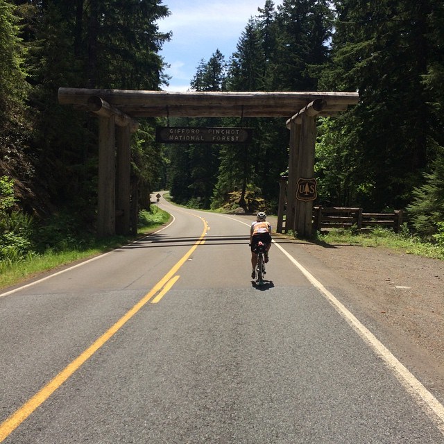
photo Keith Moore

Susan rides into the Gifford Pinchot National Forest. Photo Keith Moore


PARKING:

600K riders: Park at the Motel 6. At sign-in I will ask you for your license plate number, and will turn those in to the front desk. PRIORITY WILL BE GIVEN TO 600K RIDERS WHO PRE-REGISTER. If you turn up to ride the 600K but have not pre-registered, I can not guarantee you either a parking spot or a place to sleep. (The control room will NOT be available for you to sleep in/crash in. It’s a small room, has a hard uncarpeted floor, and the single bed will be used by the workers who are staying up all night to take care of riders coming and going). Pre-register here for the 600K.

400K riders: there are lots of towing signs in the Motel 6 parking lot. I have no idea if they enforce it, but I probably wouldn’t chance it. Instead, you might consider utilizing a space in the HUGE parking lots in front of Costco, Lowe’s etc just to the East of the motel. A scan of the area doesn’t indicate that there’s much in the way of on street parking in the area, but if you have a favorite spot, please share the information. Thanks! Pre-register here for the 400K.
Comments Off on Pre-Ride Report: 400/600K , June 13-14

Filed under Pre Rides, SIR Rides

Each Qualifying Brevet Has A Purpose

After riding a few of these solo with nothing else to do but contemplate the meaning of it all, I have come to the conclusion that each qualifying brevet has a purpose. Each distance has a lesson for the rider to learn or re-learn as necessary. Each distance is both an event and preparation for the next event.

Ron Himschoot

Ron Himschoot

The purpose of the 200K is to teach you the basics of how it all works. How to follow a route. How to get your card validated at controls. How to ride within time limits.

The purpose of the 300K it to teach you how to take care of yourself on a long ride. How to stay on top of your food and water consumption. How to keep going when you get tired without hurting yourself.

The purpose of the 400K is to teach you how to ride at night. How to equip your bike with lights that meet your needs. How to stay safe in the dark.

The purpose of the 600K is to teach you how to ride until you are exhausted, get some sleep, and get up and ride some more. Going to sleep when you are exhausted isn’t as easy as it sounds. Getting ready to ride again with your head in a fog and your muscles tightened up isn’t as easy as it sounds, either.

These are all lessons you need to learn if you want to be a Randonneur. Cut corners on your reflective clothing at your own peril. Neglect to equip your machine with with satisfactory lighting and you’ll regret it. You wont last long in this sport just meeting the minimum requirements. You spent a lot of money on your bike. You spent a lot of money for a wool jersey. You spend a lot of money on everything surrounding this sport. Go buy a decent reflective vest for crying out loud.

– Ron “The Club Curmudgeon” Himschoot


Editor’s Note: Ron Himschoot, RUSA 679, is a three time PBP ancien (1997, 2007, 2011) and has completed over 40,000 lifetime kilometers with RUSA. That’s a lot of contemplation. 😉

Thanks to Ron for sharing these lessons from the qualifying series. If you’re not yet prepared for night riding, you can buy a PBP-compliant vest and RUSA-required ankle bands from the RUSA store: http://rusa.org/cgi-bin/store_GF.pl

2 Comments

Filed under Rando How-Tos