Pre Ride Report – Olympia 300k
By Ian Shopland
This ride links some of the most scenic, quiet, least traveled roads in southwest Washington. Even in the pouring rain, I was amazed at the solitude and beauty. Here is my ride report.
Four riders: Theo, John P, Corey and myself huddled in the Starbucks and watched as the morning dawn never came. Black clouds billowed out of the south and blocked all but the most faint of morning light. The umbrella awning outside the door spun like a top in the wind and sprayed water over us like a rotary sprinkler. We hardened our resolve and pulled ourselves away from the pastries and coffee.
Within the first few blocks, the route kicks up and climbs over Tumwater Hill. It felt good to get blood pumping in the cold rain. Our brake pads squeegeed off water from our rims on the descent as we rode through sheets of water on the road. We snaked through the westside of town, taking the back roads to stay off the freeway as long as possible. Just before the gas station at Steamboat Island, we turned onto the 101 onramp and headed north to Shelton. This is the busiest section of the route but the shoulder is wide enough to ride two abreast. Be cautious when crossing the on/off ramps. Just north of Shelton we spotted some patches of blue sky and then decided they were actually just patches of less gray sky. Before too long we were at the first control and filled up with snacks and more coffee.
The instant we turned off 101, the sound of traffic disappeared behind us and we were left to our thoughts on the small roads though the woods. The next info control is not far off, but takes us through the quiet valley of Little Egypt. I believe this road is new to SIR. This info control is at a bridge between mile marker 1 and 2. Don’t forget to stop and read the sign on the left. After the control, the route circles the valley and the next turn isn’t signed. It turns up a short unmarked intersection that is a connector to the main road (Highland). If you miss it, just go down the 200m to the stop sign and take a left on Highland. It gets you to the same place.
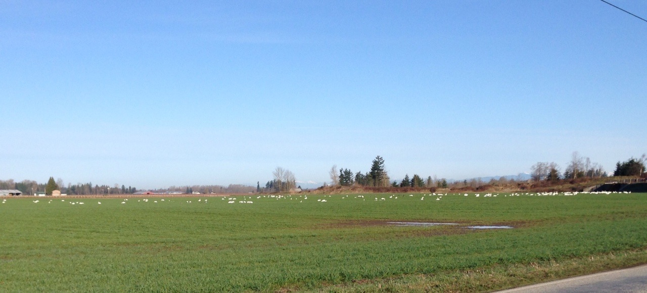
At this point, the rain had nearly stopped and we were able to look around and enjoy the scenery: green leaves slowly unfolding, rippling creeks full to their banks, and bright yellow odorous skunk cabbage blooming in the ditches. As the route turned south, the winds picked up and brought driving rain with them. This would be the weather rhythm of the day. Patches of dry/almost sunny and then the water faucet would reopen and we would be soaked for a few miles.
We arrived at the Montesano Thriftway dripping and were thrilled to see the deli was open. Hot chicken strips and hot clam chowder made the perfect lunch meal. The break was much needed, but we spent a long time there trying to work up the motivation to go back into the rain.
The stretch between Montesano and Artic went quickly. I was glad we didn’t have to go all the way down to Raymond on the “normal” route south. I’ve heard the cafe called “Clark’s” is very good and is located just before the turn, but we didn’t stop. The Fire station is just around the corner from the turn off on 101. The answer to the info question is on the west side of the building, (that would be the left side when looking at the doors).
Our first real sun came out at the perfect time. The trees and bushes were dripping with diamonds of raindrops as we followed the North River on the only paved road to the town of Brooklyn. The tavern here is a legacy of the logger bars of the yesteryear of the region. The wood floors are well worn and the walls are covered in old logging tools. We walked into a live duet of tuba and piano serenading the locals. The bartenders were happy and welcoming and there were drinks and hotdogs within a few minutes wait. It was hard to leave the warmth and entertainment of the bar but the most difficult sections of the ride were about to come.
In less than a mile the beautiful paved road turns to gravel and begins to climb. It continues for 3.8 miles and gains 800 ft with a max grade of 12-13%. The gravel quality is mostly very hard packed. The climb is long and hard but the views are incredible. If you can hear your heart pounding in your ears, just stop for a moment and regroup. Walk a bit and try again. The descent is also steep 11-12% and looses about the same elevation in about the same distance. Keep your bike under control and don’t overstep your skills. Make sure you are having fun. Before you know it, the pavement starts again and before you know it, there is another steep (paved) climb ahead of you.
The next stop was Adna and we warmed ourselves again and were ready for some food. I warmed a burrito in the microwave and John heated up some canned soup in a coffee mug. PLEASE pick up after yourself. The manager Jason wasn’t happy that some rando’s left garbage on his table and outside on another ride. Be courteous and clean up and remember thank yous.
Don’t eat too much in Adna or you might taste it again as you are going up Curtis Hill, just a few miles from the control. Darkness fell as we crested the hill and on the descent, we were again pelted by rain so hard it stung my face. The Curtis store is closed, but the answer to the info question is on the building to the left of the door. The route heads back the way you came, but don’t worry, we’re not going up Curtis Hill again. The route turns right on Lake Creek and heads down to King Road.
King Road was one of those roads that Rando’s have passed on many rides and I always asked myself, “I wonder where that goes?” It is a beautiful road that connects Curtis to Winlock. The pavement ends long before the climb. The climb itself is less than two miles but it is steep 11-12% and gains 600ft. This gravel is looser than on Brooklyn Road. Riders with 23mm tires will be challenged to maintain traction at times. The reason we started the ride an hour earlier was to get most of the riders through this section in the daylight. Our journey put us through this section in the pouring rain in the dark. It was a serious challenge. Most of the descent is paved, however. There is a short steep section of gravel (.6mi) and 8-9% max grade and 150 ft down.
You almost don’t have to pedal to get to Winlock. The usual bridge on Fir St is closed so there is a short detour south one block to the next bridge. After a re-supply on food, coffee, and dry air. We began the final section of climbs. The route backtracks a few blocks and zig zags through town to Tennessee and follows a few roller coaster hills before you hit Pleasant Valley. The only thing unpleasant about Pleasant Valley is leaving it, but before too long the Hillcrest Food Mart appears.
At this point, the hills were over, the wind was at our back but the rain still pounded the pavement. We headed north to home wet and tired.