Whidbey Island Views & Hills Pre-ride Report
By Mitch Ishihara, Adam Glass, and John Nguyen

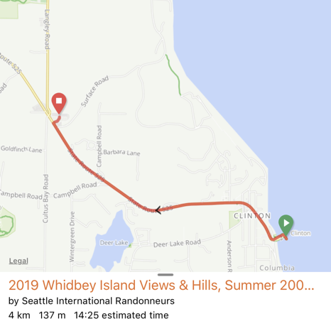
Reviving our islands and views theme from previous years1, we bring you scenic vistas on Whidbey Island with the added bonus of sufficiently steep and copious hills compressed into 202K (7900 feet elevation). Whidbey Island’s back roads also offer an escape from (un)civilization showcasing mouth watering baked goods, boutique coffee, plenty of real food options, and of course refreshing beer options at the finish. We reshaped SIR’s RUSA Permanent 998 Whidbey Coast, giving it a trim to down to 202 km and a detour away from the automobile-congested Deception Pass. For those who’ve never been to Whidbey Island, we think you’ll discover why tourists are attracted to it after a sampling on this ride.
Parking
Depending on if you intend to be on the island with a car or ride your bike onto the ferry instead, there are a few common options. Mukilteo has various park and ride locations located along I-5 which is a fair distance from the ferry terminal. Various signed 4-hour street parking spots are located near the ferry terminal up the hill along 3rd, 4th, and 5th Street. These are rumored to be unenforced on the weekend; use at your own risk. Your volunteers took a calculated risk. Also beware of automated speeding cameras on Mukilteo Speedway heading down to the ferry. Of course you can consider giving the city of Mukilteo a modest non-tax-deductible donation.
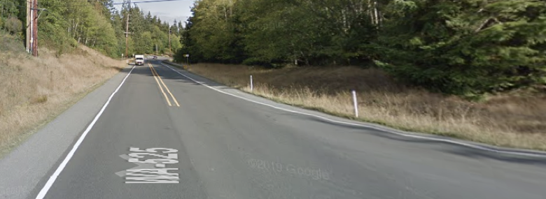
As for Clinton, it has a park and ride conveniently located near the finish: SR 525 at Clinton P&R.
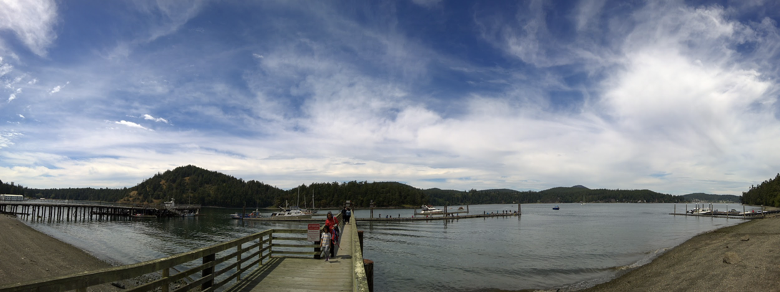
Departing Mukilteo
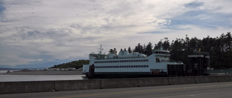
After paying the $6.10 fare each at the toll booth, John and Mitch proceeded ‘like regulars’ to the passenger loading zone on the left side of the ferry dock and waited. A morning chat with the friendly ferry attendant ensued as we described our upcoming bike ride on the island – a common destination for cyclists. We scanned our paper tickets and walked our bikes aboard the 7:00 AM ferry sailing. Once on the ferry, you’re allowed to ride the bike to the front to secure your bike to one of the many yellow ropes for bicycles. For those who happen to arrive at the ferry after the cars begin loading, you’ll be boarded last with your bikes at the back of the boat in addition to being last off the boat in Clinton. As an aside, there is an option to pre-purchase your ferry ticket but it is mostly used by folks with an automobile.

Arriving Clinton
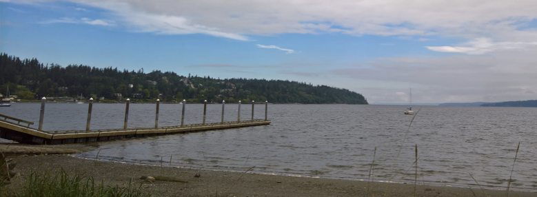
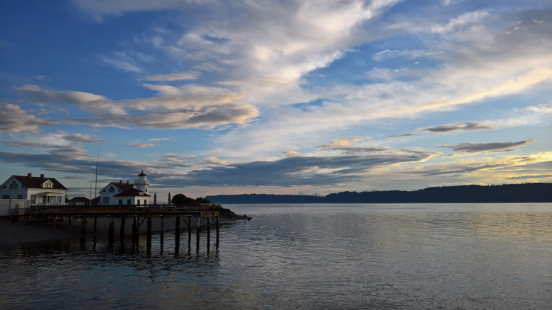
The crossing is a quick 15 minutes! Make use of the facilities expeditiously as there is limited restroom capacity at the start. After scouting out a location to process registration on the ferry, we decided we’ll be hanging out on the bow, port side of the ferry. Given the current weather forecast, you may be greeted with this welcoming view below. We disembarked the ferry around 7:15 AM.
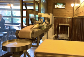
Whidbey Island Bagel Factory – Start Contrôle
Finding an open business early on Sunday morning for a manned start location proved a small challenge. A short 2.7 mile and 450 feet ride up WA-525 gets us to an open complex apparently popular with the locals. Barring a misfortune, this stretch should take about 15-20 minutes, in plenty of time for an 8:00 AM start. We arrived at 7:30 AM.
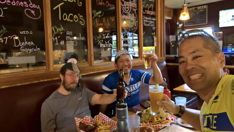
Of course, once Mitch found Whidbey Island Bagel Factory, it was on the list of candidates to verify for the pre-ride. The peanut gallery couldn’t resist commenting on bagels and how many a certain volunteer rider would consume that day. After taking a bite, the commentary shifted to, “these are pretty good bagels.” Good enough for a New Yorker!


We were a little disoriented leaving Ken’s Korner Shopping Center heading to the loading zone behind the complex. We’ll get you going in the right direction for the Brevet – head south near the Les Schwab Tire Center. We then turned left onto Surface Road which is a one mile descent down to Bob Galbreath Road.
The Views & Hills
Freeland Park @ mile 19
Freeland Park on the right offers public restrooms for those who need it. For those who don’t, you can enjoy the view while waiting for your riding buddies. Or you can zoom on by covering ground while the clock is ticking.
Honeymoon Bay Road @ mile 20.4
An eastern view of Holmes Harbor down Bercot Road on Honeymoon Bay Road with the Snohomish convergence zone (clouds) in the distance.

Resort Road @ mile 24
The hills, where do we start with this? They are relentless repeats oscillating somewhere between sea level and about 400 feet as the course hugs the coastline of Whidbey Island (hence the original Whidbey Coast permanent). One volunteer brought their fresh legs to this ride while another went all out the day before.
WA-525/WA-20
There are portions of this route which require traveling on WA-525 or WA-20 – the main highway down the middle of Whidbey Island. Ride well on the shoulder at all times on these stretches in single file.
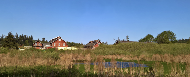
Greenbank Farm @ mile 27
Looking to your left around mile 27, Greenbank Farm shines in the morning sun. Unfortunately they do not open until 10 AM. You can only dream of eating scrumptious fresh baked pies from here for another time. Heads down, we continued on.
Houston Road @ mile 31.4
After you’ve scribbled your info control answer, take a peek at the Olympic Mountains in the distance.

Coupeville @ mile 41.5
About ⅓ of the ride done for the day, we arrived in Coupeville ready to gobble down a few fresh baked goods. We needed the calories later in the day for sure.
Knead & Feed Restaurant
4 Front St NW, Coupeville, WA 98239
https://goo.gl/maps/nXABiepHvuAM4Y4U8
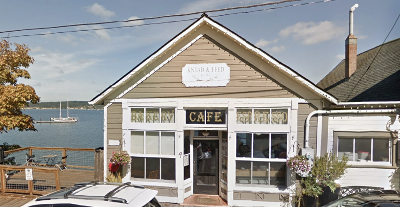
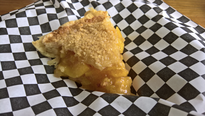
The peach pie features a perfectly flakey crust with an exterior crunch. The peaches are firm and sweet. You may see the volunteers hanging out here the day of the ride too! We promise to try to not eat all of the goods before you arrive.

Note that there are public restrooms on Alexander Street on the side of the Coupeville Chamber of Commerce building.

View of Penn Cove @ mile 45
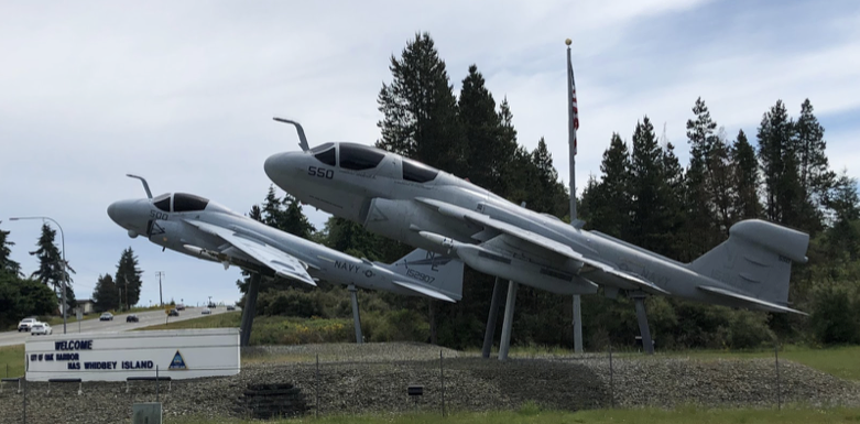
Oak Harbor @ mile 52
By the time we made it to Oak Harbor, the island life awakened with a hustle and bustle. We rode the permanent on April 27th, greeted by a parade and street fair on Pioneer Way. For the May 26th pre-ride, we encountered light traffic. There are plenty of services options in Oak Harbor, as well as Skagit Cycle Center (but it is closed on Sunday).
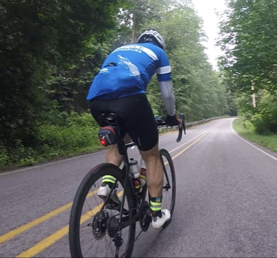
Descent down Monkey Hill Road @ mile 64.4
What goes up must come down. This is one of the many descents to enjoy on the island. Be safe!

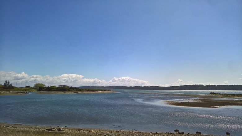
Cornet Bay @ mile 66.5
For the brevet, we rerouted to Cornet Bay instead of Deception Pass Bridge to avoid heavy automobile traffic near the bridge. Cornet Bay features panoramic views in an open setting. Boat tours of Deception Pass are available, though we didn’t take time to do the hour long tour while on the pre-ride.
For the Makeup 200 Brevet, we reserved the picnic shelter below for a SIR manned food stop and contrôle. There’s running water conveniently located nearby.

After finishing our scouting of the location, we left Cornet Bay with about an hour in the bank, returning on Cornet Bay Road back to WA-20. The route continues on WA-20 for 6 miles where we banked some time. The shoulders are wide.
Ault Field Road @ mile 74.1
Swantown @ mile 80
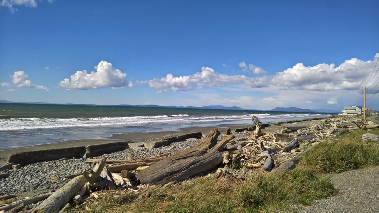
After scribbling down the info control answer we captured some photos on West Beach Road.

A bit further down the road on the right we stopped at West Beach County Park to enjoy the views of Puget Sound.
Callen’s in Coupeville (Fort Casey/Keystone) @ mile 93.6
At about the ¾ mark on the Brevet just past the Coupeville-Port Townsend ferry terminal, there’s a nice restaurant and market, Callen’s Restaurant and Co. The right side features the restaurant. The left side features a market with coffee, drinks, and water. Callen’s is open Sunday 8:00 AM – 8:00 PM. We stopped here for an early dinner.
Cozy’s Roadhouse Finish
We made it to the finish at 6:32 PM with 3 hours in the bank.
Heading back to Mukilteo
There are plenty of ferry sailings to return to Mukilteo departing approximately every half-hour until 12:30 AM.
Schedule: Mukilteo/Clinton

Summary
This is a pretty but hilly 202 km with about 8000 feet of climbing on mostly quiet roads to be completed in the 200K ACP Brevet maximum time of 13.5 hours. We’ve modified the brevet route slightly from the permanent route. Searching the SIR permanent inventory, 998 Whidbey Coast permanent is in the top 10 most climbing for a SIR 200K. The winner is of course 517 The Alps permanent at 9900 feet of climbing over 202 km.
Weather Forecast
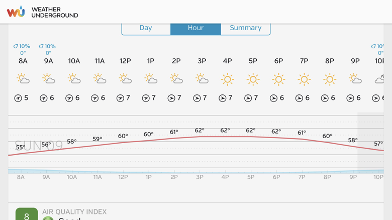
The weather forecast for Sunday June 9, 2019 is looking fantastic!
Pre-registrations
Help the organizers by pre-registering for this brevet here:
https://www.seattlerando.org/content.aspx?page_id=4002&club_id=928629&item_id=896680
- 2017 Chuckacamano Views 400K, 2016 Island Views 300K (Camano Island and north Whidbey Island), 2015 Bainbridge Island – Port Townsend Easter 200K
