This week #01233 Tacoma-Port Orchard-Tacoma was revised. The direction of the route was reversed to eliminate some unsafe left turns, and portions were moved to quieter parallel roads.
A control was added to #03387 U Village-Carnation in the Redmond-Kirkland area to provide a more convenient starting point for Eastside denizens.
In other news, reconstruction of the Spruce Railroad Trail portion of the Olympic Discovery Trail along the north side of Lake Crescent is almost complete. It should open to the public this month. This will provide a much safer and less stressful route around Lake Crescent than US-101 along the south side of the lake. https://www.peninsuladailynews.com/news/spruce-railroad-trail-refurbished/
With the growing number of revived permanent routes, it can be difficult to notice recently added routes on the overview maps. Since the last update one route has been added:
03387 U Village-Carnation 111 km. Formerly Gary Prince’s point-to-point commute training route, on the occasion of his retirement it has been changed to a loop which should make it more interesting to other riders.
Additionally, controls were added to 03505 Snoqualmie Valley Trail Run in Carnation and North Bend to provide alternate starting locations.
With the growing number of revived permanent routes, it can be difficult to notice recently added routes on the overview maps. Going forward I intend to publicize routes added in the preceding week or so.
Beginning October 1, RUSA will allow permanents up to 600 km. A link to an overview map of 300 km and longer routes has been added to the SIR Permanents page. Initially these local routes are available:
02576 Lake Forest Park-Big Lake. 300 km. This route was the most frequently ridden of SIR’s 300 km routes, with 26 completions, accounting for 27% of 300 km rides in the last four years of the old perms program.
00751 Bremerton-Elma-Rainier-Seattle. 300 km. This is likely the flattest 300 km route in SIR’s collection. Most of it is on pleasant low-traffic rural roads and bike trails. If you live on the Seattle side of the sound, riding it in the Bremerton to Seattle direction means you don’t risk missing the last ferry home.
00592 Bainbridge-Hurricane Ridge-Bainbridge. 306 km. This was formerly a sub-300 km route. Modernizing the route to use the Olympic Discovery Trail and avoid the frequently crowded section of Hurricane Ridge Rd below the entrance station pushed the distance up to 306 km. Cap your season with this route!
No 400 or 600 km routes are ready yet.
Comments Off on Longer Permanents Opening in October
I have tried to pull together everything you need to know about the revived Permanents program. On the SIR home page select the menu item Rides>Permanents.
Also, Yogy Namara has come up with better maps of Permanents, linked on the updated page. The maps on the SIR Ride with GPS home page announced in the previous blog post have been replaced with these maps. The advantage of these maps is they pull routes from the RUSA route library, rather than SIR’s. The new maps always display the official version of routes, rather than depending on SIR’s library being synchronized with RUSA’s.
If you have registered for a permanent since the new national system started up, you know searching for a route is a bit inconvenient.
If you want to find a route using a map, from the main RUSA page you can pick the Permanents drop down menu and choose Route Search. On the next page click Search for permanents on a map (created and supported by Jake Kassen). Jake’s search will show you routes that are currently available in the new program. Unfortunately it only plots start locations. It does not show where the routes go.
Until the national site displays maps of routes, the SIR team is using Ride with GPS’s Events facility to show you SIR’s routes. For technical reasons a few of the routes displayed may not be active yet in the national system.
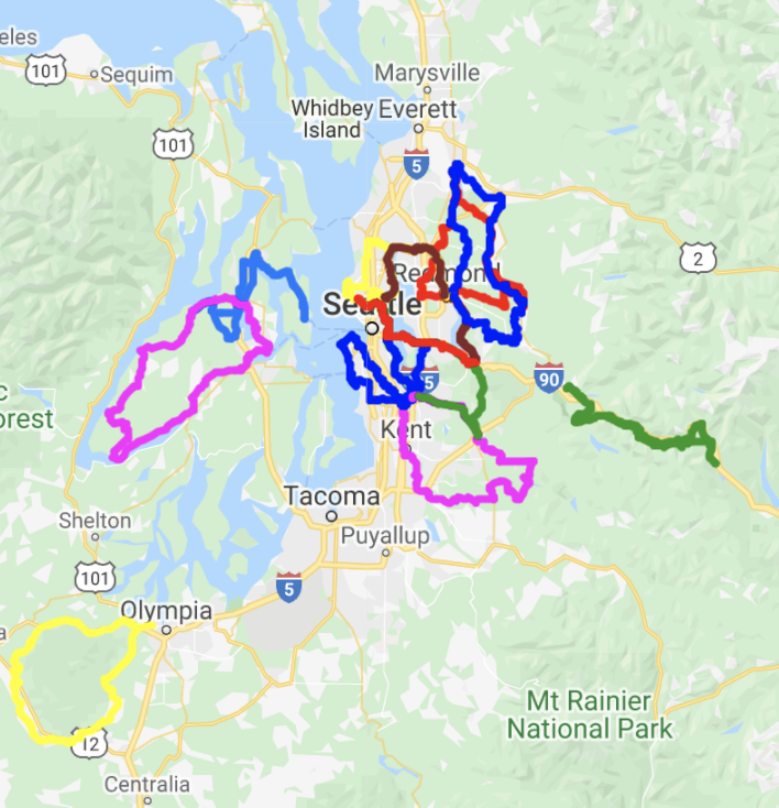
Go to SIR’s RwGPS Club page. Click on the Events tab. (You might want to bookmark the events page.) On the left we currently have three groups of Permanents to view: all of them, 100s, and 200s. Click on the set you want to view. It takes a few seconds for the set to load. In the future we might further subdivide the routes by region to keep this process from becoming too slow.
The routes are listed on the left. The selected route (green highlighting) is displayed on the map on the right. To see all the routes at once, click on Show all on map at the bottom of the list. You might have to scroll the list down when we have more routes available.
Now the map will display all the routes.
The various colors just distinguish the different routes. If you mouse over a route in the list, its trace on the map will highlight black.
Thanks to Yogy Namara for realizing Events could be used for this purpose, and keeping the lists of routes regularly updated.
Yes, that’s a bison, and it has nothing to do with the new program.
The new permanents program starts up August 1st. Changes from the old program include:
Administrative aspects
The program is run on a national basis.
Ride registration and result reporting is online.
Routes are no longer locally “owned.” Route contributors will likely stay engaged with their routes for maintenance, but they will have no administrative role – no longer processing ride registrations and results.
There will be an annual fee.
Changes for riders
Getting started
You need to create an account on the RUSA site. Use the link in the upper right corner. Once you have an account you will access Permanents through the My Account link.
There is a fee of $10 to cover the remainder of 2020. (Not live as of 7/29)
Registering for a ride and reporting results
Registration is online (not live yet as of 7/29).
The registration page will have methods of searching for routes.
You will report your ride result online (not live yet as of 7/29).
Ride results are self-verified – you will click a button to promise you are truthful.
Proof of passage materials should be retained for a year in the unlikely event of a RUSA audit.
Proof of passage options
You may choose to take photos at controls, record a gps track of your ride, or use a traditional brevet card. Information controls are eliminated.
Photos: Controls will have brief instructions specifying what to photograph. At a business photograph the front of the establishment if not otherwise directed. The time embedded in a photo’s metadata is adequate for establishing when you reached a control.
GPS track: Alternately you may record a gps track of your ride.
Brevet card: Or you may use a traditional brevet card, noting times of arrival yourself.
Only the overall elapsed time matters. Intermediate controls are no longer timed. For convenience the time limit is listed in the last cue of a route, and sometimes the first as well depending on the route contributor.
Route materials
The primary route document is a Ride with GPS file. If you want a paper route sheet, you will have to create your own using RwGPS’s printing options. (There are other methods, too, discussed below.)
Likewise, if you want to use a brevet card, you must create your own.
Start locations
A significant change (for SIRs) is a loop route may be started from any control and ridden in either direction. A point-to-point may be started at either end. Generally a RwGPS file for only one start and direction will be provided. Riders must create their own route materials for other start locations or direction of travel.
As a practical matter, most gps devices will begin following a route from any point on the route. When you reach the formal end of the route you will probably have to restart navigation and continue to the control where you began your ride.
Reversing a route is a less trivial matter because of one-way streets, curious road configurations, and the possibility of hazards existing only in one direction of travel. Be careful planning a reversed route.
Free routing
All routes are now free routes. The provided RwGPS routes are only suggested ways to get from control to control; riders are free to take alternate routes so long as they pass through the controls in the sequence defined by the suggested route, and as long as the route you ride is at least as long as the suggested route. You only receive credit for the distance of the suggested route, not for any additional distance you cover. While shorter routes between controls may exist, the RUSA rule requires: “The rider must ride at least the distance of the official route. If the rider’s route ends up being shorter than the official route, the rider must make up the distance at some point during the ride (e.g., at the finish).” RUSA allows omitting additional controls to force riding the suggested route if the shorter route is deemed too hazardous by the designer or bicycling on the shorter route is illegal.
At controls
If you are recording a gps trace of your ride, you do not need to stop.
If you are taking photos, the control cue will tell you what to photograph.
If you are using a brevet card, note the time you arrived.
A practical note regarding photo controls with gps navigation: Many gps devices will not adequately display the somewhat lengthy instruction of what to photograph at a control. You should have a backup method of reading control cues. Two options are:
Use the free Ride with GPS app on your phone. Even if you only have a free RwGPS account you can download routes for use without cell coverage and read the cue sheet.
Download the route sheet and edit it and print it to just show the controls.
The routes
Due to the Covid-19 crisis only 100 km and 200 km routes are available. (200 km means routes shorter than 300 km.) Initially only existing routes are being offered; new routes will be accepted at a later date. Since RwGPS files are now the primary route documents, and are required to contain all the information that a paper route sheet would have, many routes have required extensive overhauling. Route owners were also urged to update their routes to make them as current as possible. Volunteers at RUSA are reviewing updated routes to ensure they meet the new standards. Consequently only a limited selection of routes is available right now. New routes are added every few days.
Many SIR routes will be permanently retired. Examples are: All alternate start routes, since one may now start from any control; routes that have an improved “2.0” version; routes that are very unpleasant or are ill-advised due to road changes or increased traffic volume, such as riding I-90 or US-2 over the Cascade crest.
All routes using the Centennial Trail between Snohomish and Arlington are being held back until the sinkhole in the trail is repaired. After consulting with Centennial “frequent flyers,” it was decided rerouting on parallel backroads (such as Burn Rd) would change the nature of the routes too much.
The SIR Permanents team is endeavoring to add routes to the new program as rapidly as we can. Criteria for selecting routes are:
Popularity based on counts of rides in the last several years
Geographical diversity of start locations and terrain covered
Whim of the volunteer who is revising a route
The RUSA route library is here. To see available routes in Washington, enter “, WA” in the location field (note the comma and space). Don’t despair if your favorite route is not available; routes are being added as rapidly as they can be processed by the chain of volunteers.
Some of the routes have significant changes due to new bike trails or other opportunities for more pleasant routing. While free routing means you can still probably ride your “old familiar” by memory, we have tried to improve the routes where possible so please try the new versions. Some routes have one or two controls added to provide alternate start locations. Other routes have seen controls moved to locations more suitable for photos.
Replacement of the Bothell Landing pedestrian bridge will begin soon. The project is projected to finish in August of 2020. A portion of the Sammamish River Trail will be closed. A number of permanents will be affected, as well as commuters. Fortunately there is an easy detour.
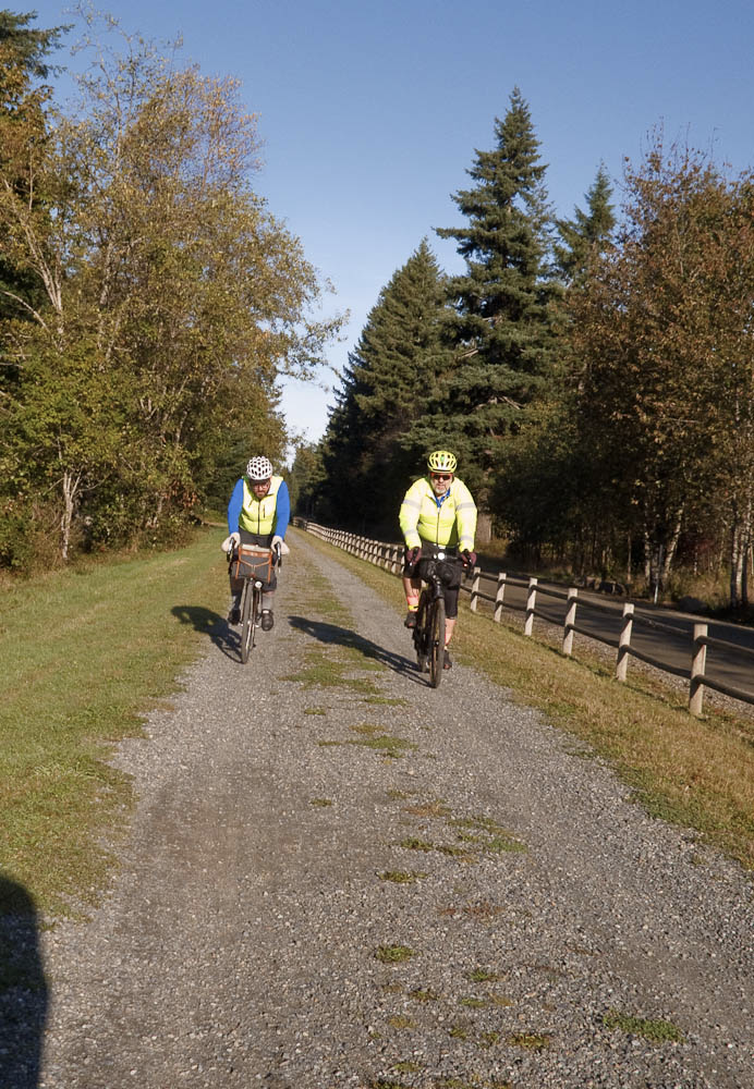
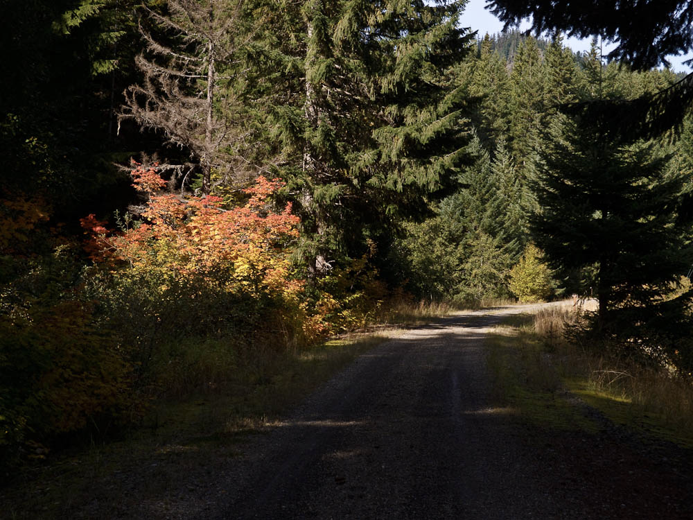
Bright morning sun and a half hour spent inside a warm bakery mislead yours truly into underdressing at the start. After a quick stop to add clothing the pre-ride got underway in earnest. The air was very cold, and continued to be cold all the way to the tunnel. While the Iron Horse Trail’s location on the shady north-facing side of the valley makes the trail very pleasant on a hot summer day, on a cold fall day the trail is cold, period.
At the start the course follows paved streets in North Bend for a few blocks, then turns on to gravel and remains on gravel for more than 50 km, all the way to Hyak. The return is on pavement, very hard dirt, and gravel. In all there is 76 km of gravel, 10 km of hard dirt, and the balance pavement.
We rolled up the trail without mishap, this dog with his prize stick notwithstanding.
The trail is used by horseback riders. If you encounter a horse, do not ring your bell! Bells can startle horses. Call out, ask the rider for permission to pass. Some riders will want to turn their horses to face you.
There were a fair number of people using the trail. If the weather is nice on the day of the ride, expect to encounter a goodly number of hikers taking advantage of the nice conditions. There may also be families with small children on bikes.
We got some welcome sunshine crossing the big trestles. The climbing areas near the trestles were lightly populated. Be aware people belaying climbers are paying full attention to their friends up on the rock. Give them lots of warning and pass slowly.
The portable toilets had been removed from the climbing areas. Three pit toilets are available on the trail, at Alice Creek Campground, Carter Creek Campground, and at the west end of the tunnel. On the east side of the tunnel Hyak has heated restrooms. These are all noted on the route sheet.
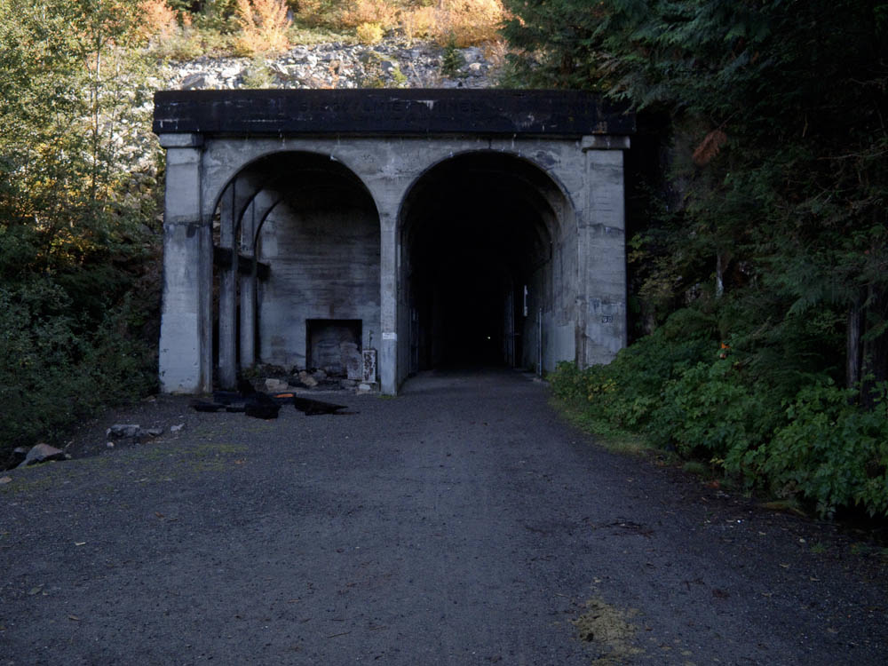
If you’ve not been to the Snoqualmie tunnel, it is a surprisingly long way up the trail. But eventually you arrive. Since the day was cold, we did not find the interior of the tunnel significantly colder. There were a few spots dripping water from the ceiling with small puddles beneath. The surface was generally very hard, although bumpy in a few places.
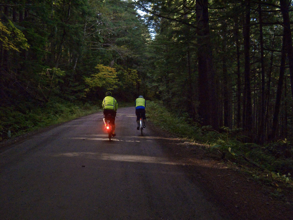
The tunnel is close to the parking area at Hyak. You will almost certainly encounter pedestrians in the tunnel. Most have lights, although somehow some people are able to make their way through without any lights. Virtually none wear reflective clothing nor do any have tail lights. Distance can be hard to judge, so approach pedestrians cautiously.
When we popped out of the tunnel on the Hyak side the air was significantly warmer and we had lots of nice sunshine. Hyak has a restroom building with heated restrooms. There is a water spigot on the west side of the building (nearest the tunnel).
Continuing on the trail we saw lots of foliage putting on its fall colors. Will the show last until the ride day? You will have to ride to find out!
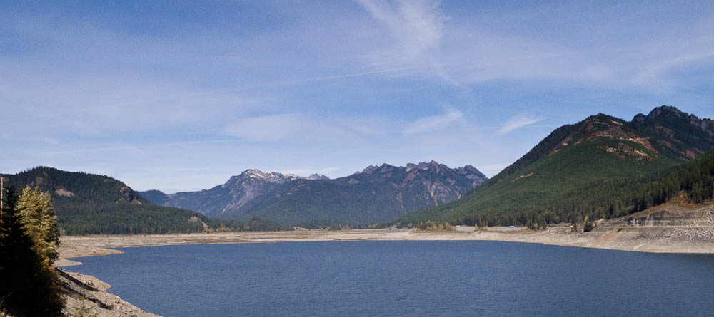
The turnaround point is at a large interpretive sign. The views are great from here (see picture at the top). We had a second look at the fall colors on the way back to Hyak.
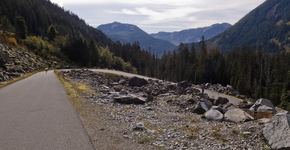
From Hyak the route takes the frontage road alongside I-90, passing the ski areas. The second-steepest climbing on the route occurs here. The control at the Summit Deli/Chevron marks the high point of the route. Since this control comes after nearly 60 km of unbroken climbing, it is untimed – you are not required to reach this point within four hours elapsed time. However, if you are over four hours, don’t dally here. You will be able to make up time on the descent, but you don’t want to have to be a daredevil.
A little way from the control the route turns left onto the original pass road, Forest Service Road 58, and begins a splendid descent. On a nice day the day-use areas along Road 58 will be busy. Be aware there may be uphill car traffic around every bend and curve. Around one hairpin I encountered a car making a three-point turn, entirely blocking the road. There are a few metal plates in the road. If it has rained within the last several days the shady portions of the road may still be wet. In some places we could see moss was beginning to regrow on the road.
The fast plunge through the forest eventually ends. The route crosses I-90 and turns onto Tinkham Rd. There is an enormous hole at this turn, 43.7 mi/70.1 km!
As usual, Tinkham Rd has numerous potholes. It will be a good idea for groups to spread out on Tinkham so everyone has a clear view of the pothole fields.
Tinkham has two fixed hazards, a wooden bridge with a gap down the center at 46.6 mi/75.0 km, and a large grate resembling a diagonal cattle guard spanning the entire road at 48.6 mi /78.2 km. These are noted on the route sheet.
After Tinkham there is a 2.4 mile noisy downhill run on I-90 to the next exit. The shoulder is wide but covered with debris. Ride carefully.
Exiting onto Homestead Valley Rd you will regain peace and quiet. From Homestead the route rejoins the Iron Horse Trail, but you have to work to do so! The steepest climbing on the route occurs on this short pitch. From there the rest of the ride is all downhill and then nearly level into North Bend.
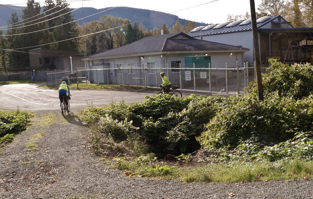
To find the exit from the trail look for a building with a chain link fence topped with barbed wire. At the start of the ride the cue sheet prompts you to look at this fence as you pass it. From there it’s a minute or two to the ride finish at The Pour House.
Comments Off on Iron Horse Unpopulaire Pre-ride Report