Category Archives: Pre Rides

Border to Border 1000K

by Theo Roffe and Rachel Wood

Complete route on RWGPS: https://ridewithgps.com/routes/27656925 
Cue sheets: https://docs.google.com/spreadsheets/d/1nmGcZ86ygDuhFXS0zd_5VuAZgG0SrGz-xAYvsSDB-I0/edit?usp=sharing

Day 1, Friday: Olympia to Bellingham

https://ridewithgps.com/routes/28158220

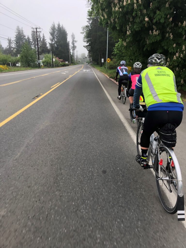
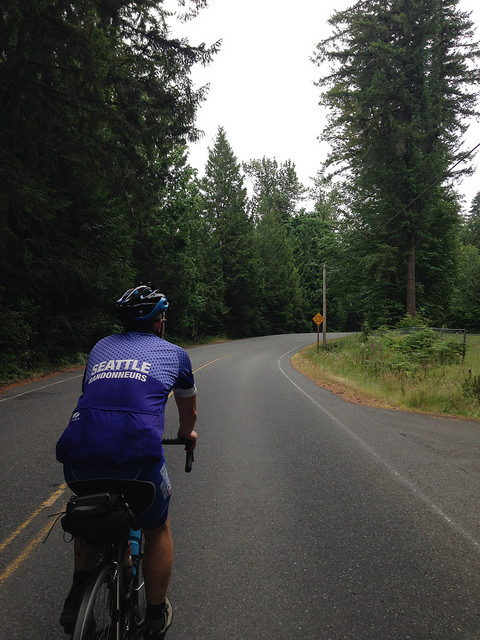
On Friday morning, in the chill air of the South Sound, we started our ride to the Canada border by heading south east. That felt a bit confusing, but the first control is in Rainier and, from there, the route backtracks along the Seattle-to-Portland route into Seattle. While this routing isn’t as scenic as sticking to the edge of the sound through Tacoma and Des Moines, it sure avoids a lot of climbing. And, despite what the cumulative elevation of 6713 m might suggest, avoiding big climbs was a goal for this route.

Riding the Interurban

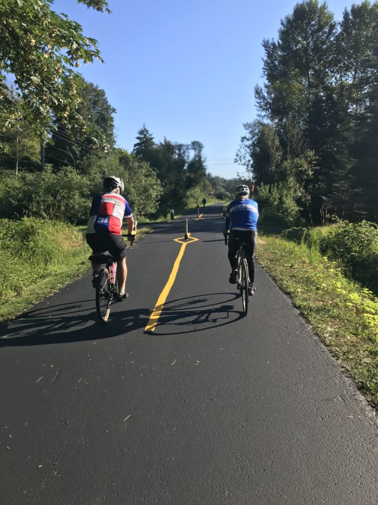
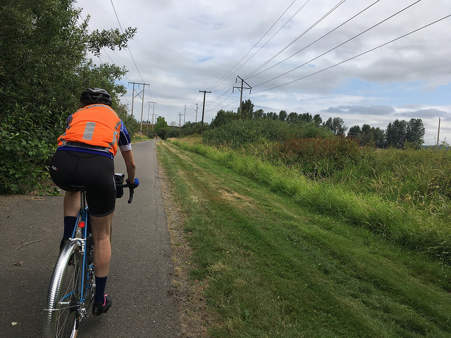
Beginning in Sumner, you’ll be on the Interurban trail. During the pre-ride, some sections were closed for a repaving project that should be completed in time for the ride. We were able to make it through with only minimal swerving around “Trail Closed” signs and riding through gravel. You’ll also want to watch out for railroad tracks along the trail – some were barely noticeable, but others were quite bumpy.

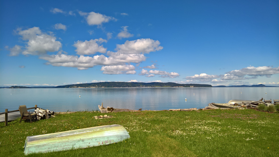
The Interurban trail drops you off in Renton, where you’ll find your way to the coast of Lake Washington for 40 km of watery views. Along this section, we stopped in Seward park to refill our water bottles, have a snack, and admire the lake with its variety of boats. After the lakeside riding, the route features a section of the Burke-Gilman and Lake Sammamish Trails. Even on a weekday afternoon, these are popular trails, so be attentive to other cyclists and pedestrians who may be moving more slowly.

Things get steep for a while through Woodinville and Maltby before descending into Snohomish County where broad plains offer bucolic views framed by the Cascade Mountains to the east. Marysville offers up some traffic and one of the route’s less pleasant roads, but the rolling hills from Tulalip Bay to Warm Beach are a great payoff. Due to a road closure just north of Warm Beach, you’ll trek back inland to Silvana before heading up through Stanwood and Conway to the Skagit Valley; however, the detour has a nice curvy descent into lovely farmland. Come back in the spring time for a wonderful display of Tulips in this area!

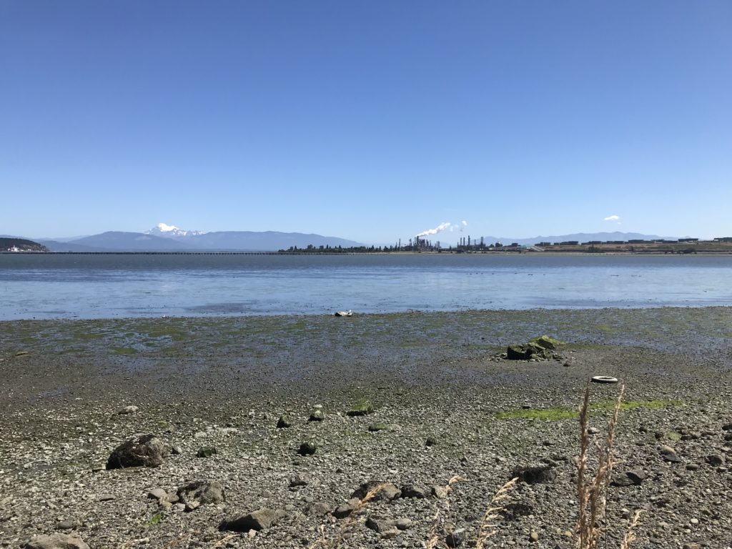
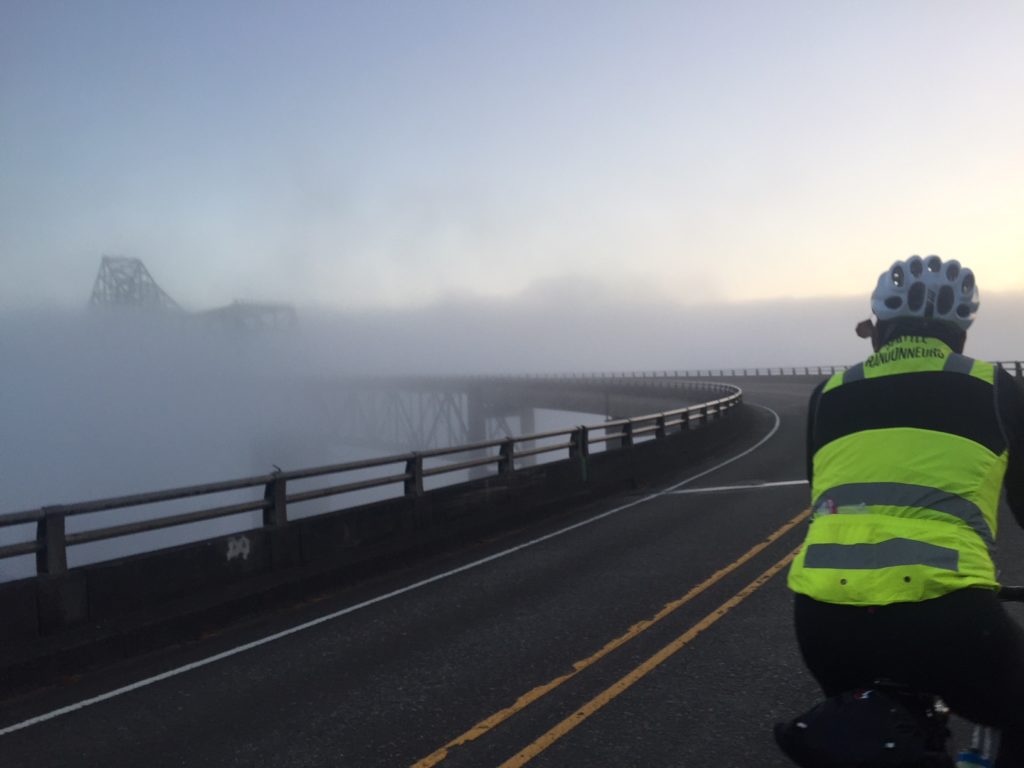
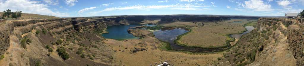
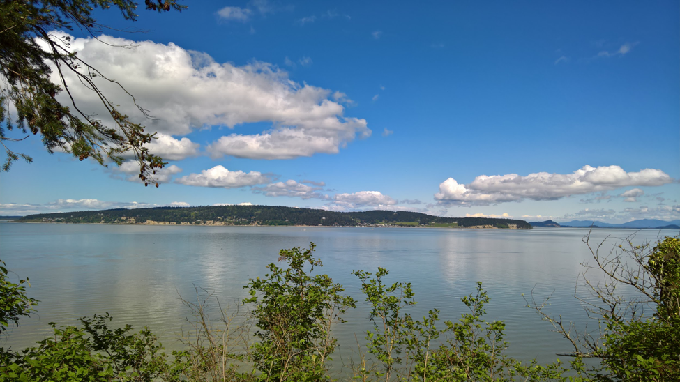
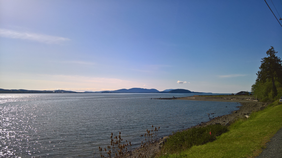
If you catch Bayview State park before 8 pm, there are bathrooms and nice views across Padilla Bay to Anacortes and Gumes Island. Chuckanut Drive, to the north, is a highlight of the route. Yes, it’s climby, but it sticks you right on the edge of Samish and Bellingham Bays where you can watch the sun set behind Lummi Island.

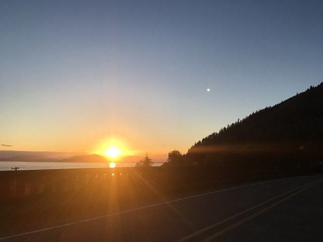
Sunset from Chuckanut, just before the climbing starts

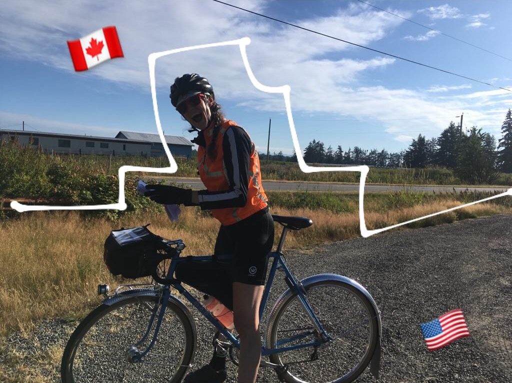
You’ll be able to get food in Fairhaven or Bellingham before the out-and-back to the Canada border. But don’t make the same mistake Rachel and I did and save that out-and-back for day 2! It’ll make for a very long, tough day – day 2 already has more climbing, it doesn’t need more distance. (Our splits for the pre-ride were 325 / 415 / 260 km. The official splits with the revised route are 405 / 338 / 264 km.)

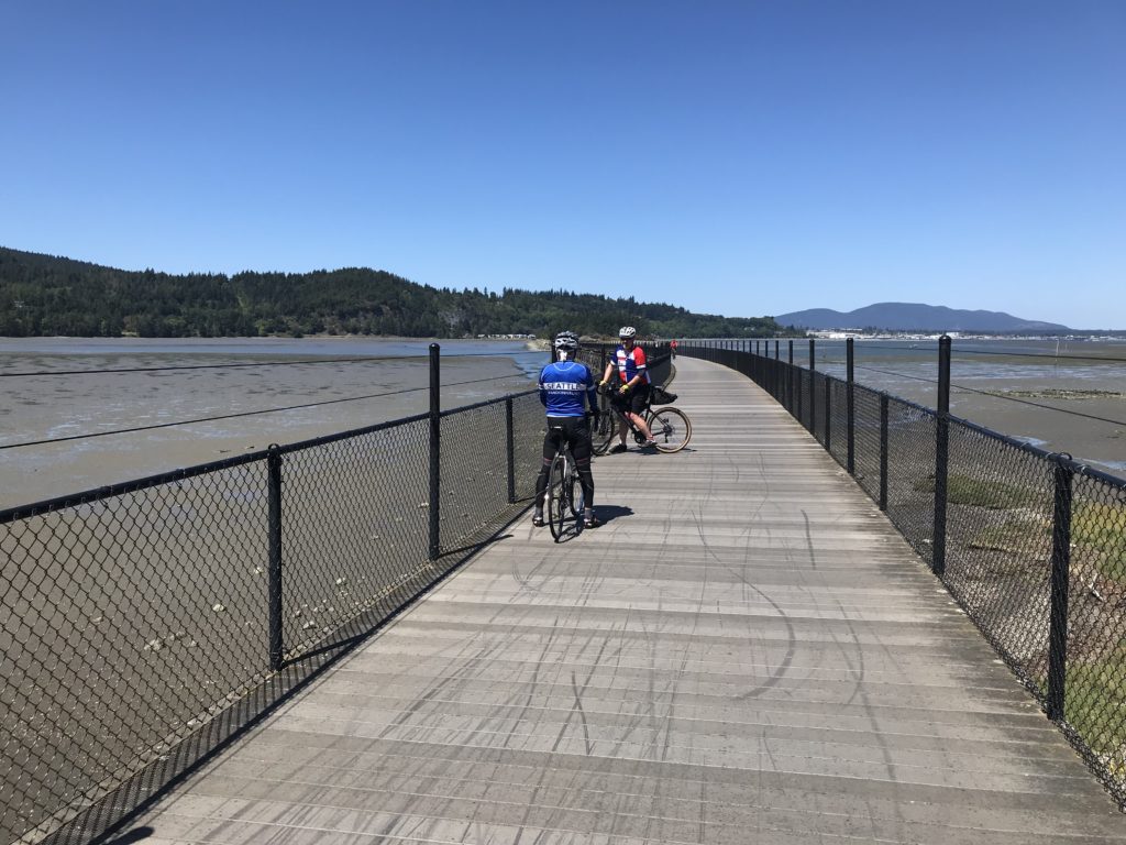
Anyway, the route from Fairhaven to Bellingham features a nice gravel trail that is totally rideable on a road bike with narrow tires. But if you can’t stand that kind of thing, feel free to stay on State Street into town. Keep in mind that Bellingham is a college town: Friday night downtown can be a bit of a party. We didn’t have any trouble, but you should keep both eyes open for young, dumb drivers and bar-hopping pedestrians.

If you’re fast, you might pass through Lynden in time for services, otherwise plan on packing what you need before leaving Bellingham. On the pre-ride, we had some trouble with a dog within 5 km of the border, but he’s likely to be locked up in his kennel at night. We just had the bad luck to come by as his people were opening his kennel and the gate! They came out to the street with his leash and treats and we squirted him with our water bottles until he finally went home. If you meet Duke, squirt him right in his face for us. Thanks! He hates that.

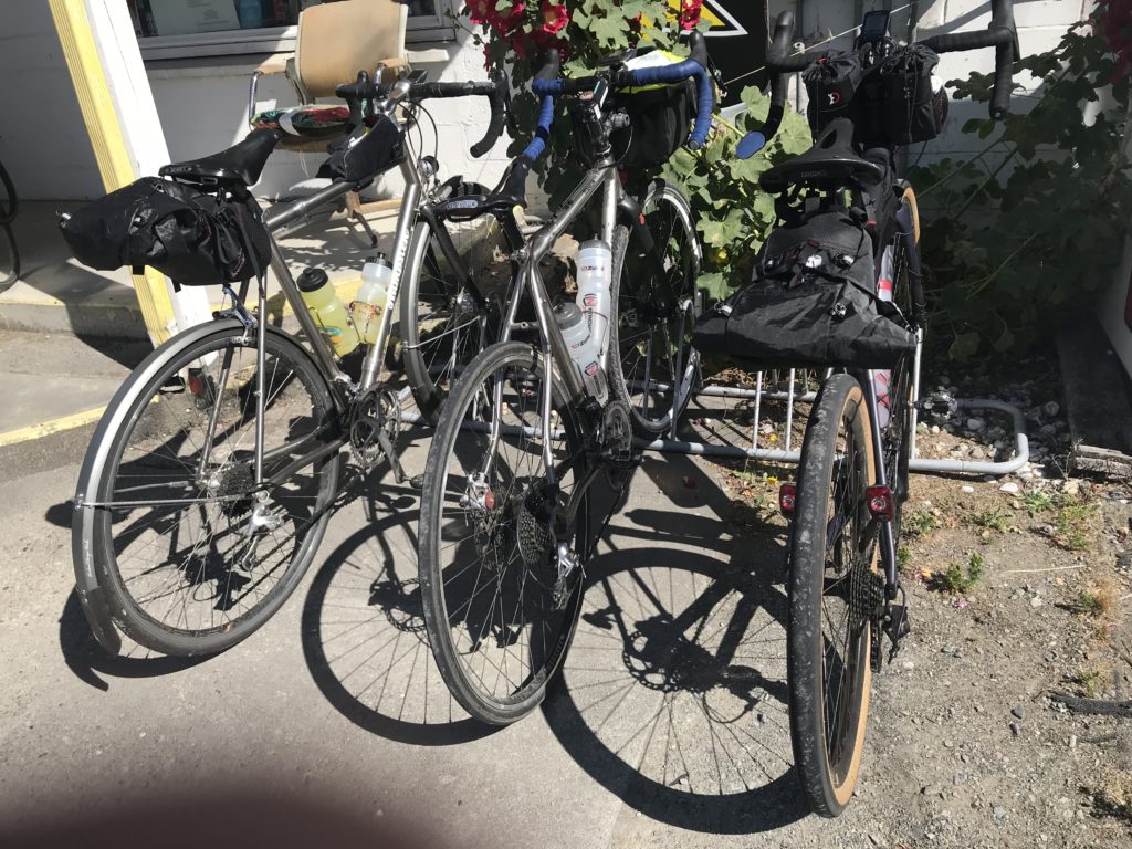
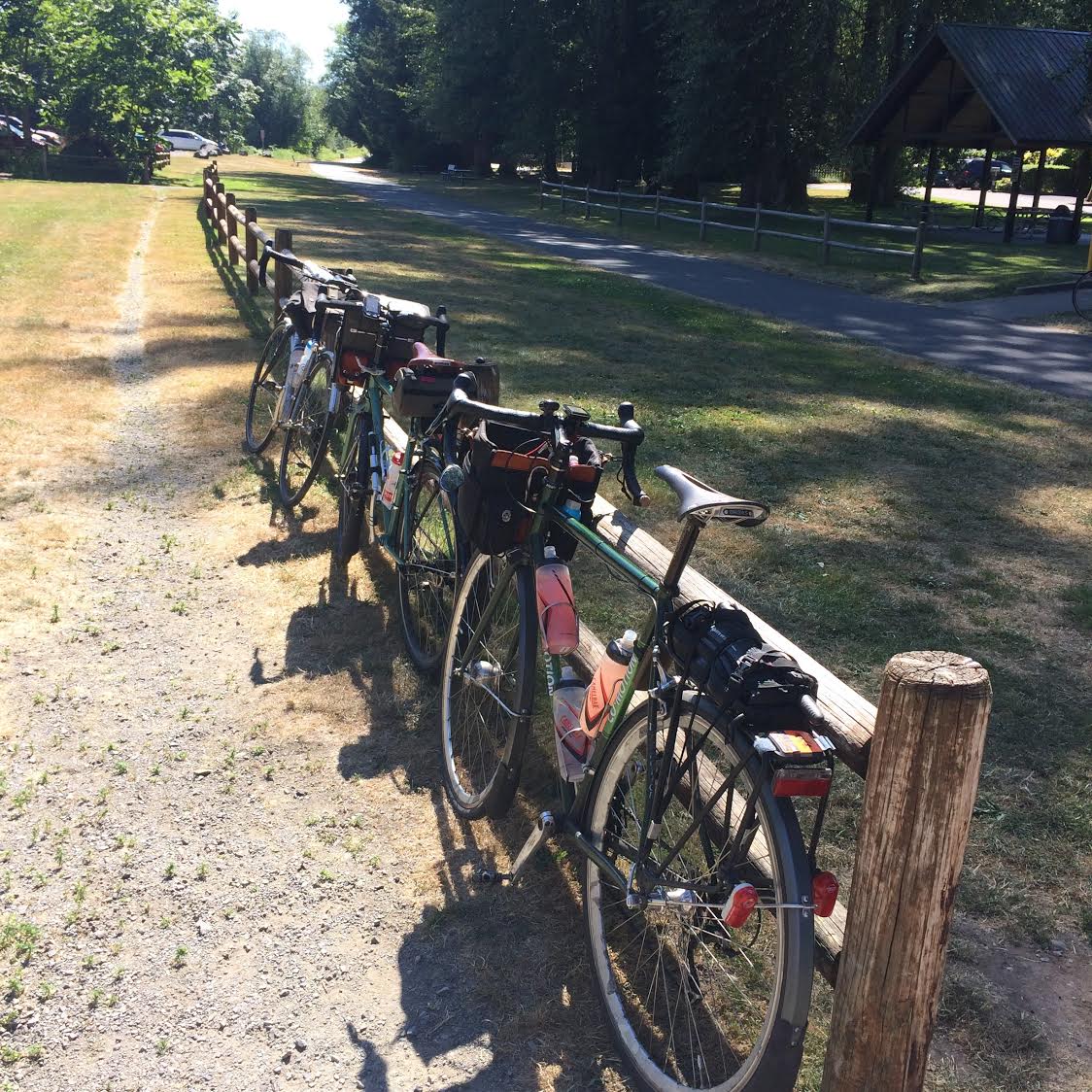
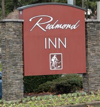
At the overnight control in Bellingham, we’ll have your drop-bags (if you choose to leave one at the start) and beds, but little else. For the pre-ride, we fit a change of clothes for day 2 in our bags. There’s a 24-hour Denny’s in the same parking lot where you can get dinner and breakfast regardless of your timing. We slept for 5 hours at this control. That was restful, but probably too much time by 1 or 2 hours; we were behind the clock all day Saturday.
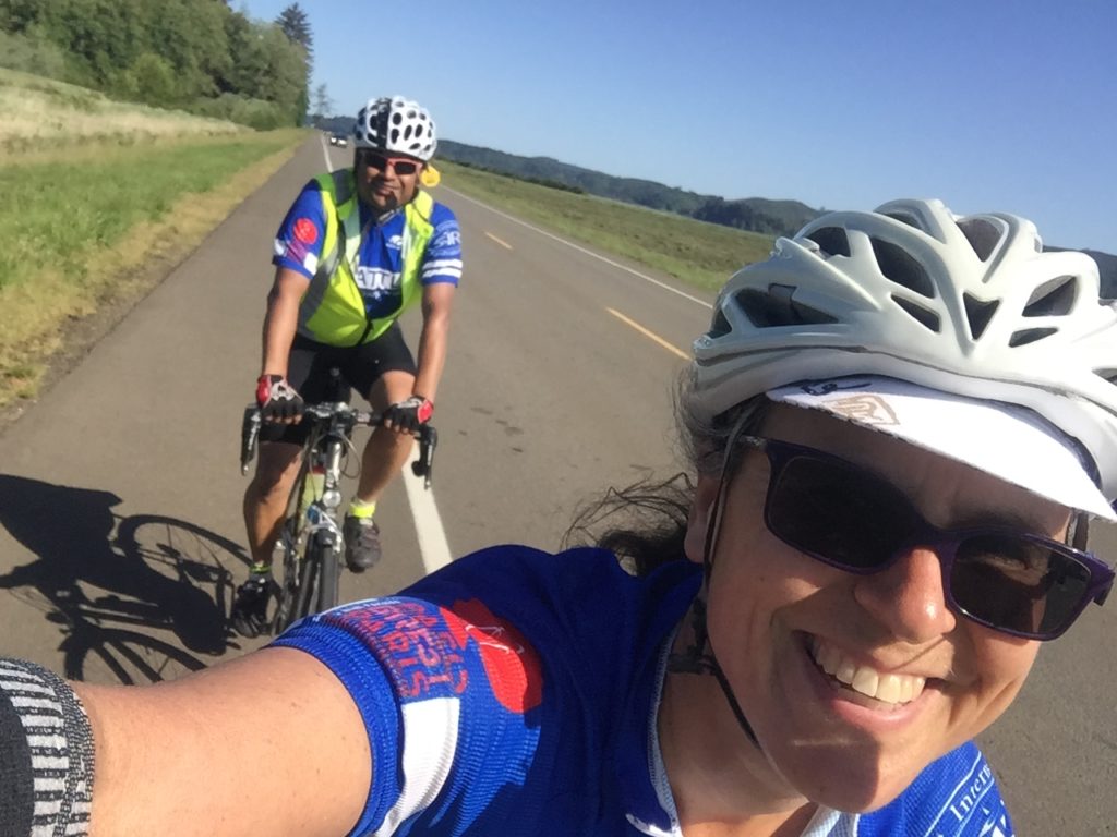
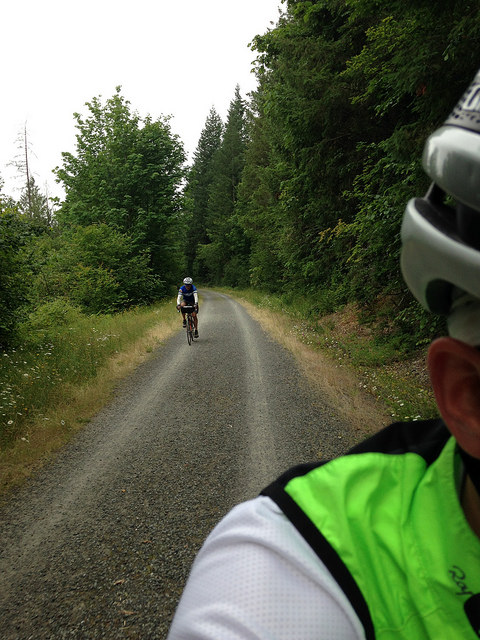
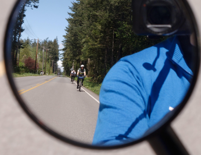
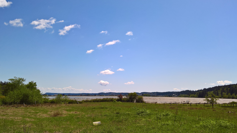
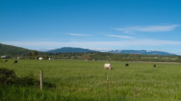
Snohomish Day 2

Day 2, Saturday: Bellingham to Olympia

https://ridewithgps.com/routes/28158228

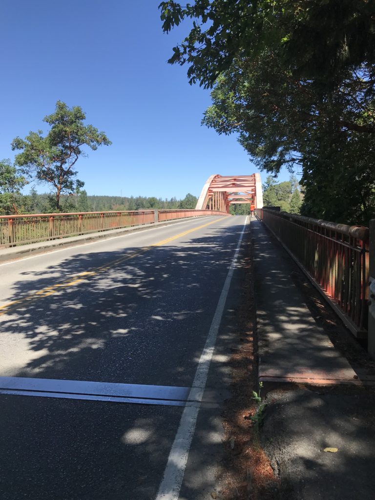
The route leaves Bellingham without passing many services, so be sure you have what you’ll need as there’s really very little over the next 50 km. There are some steep climbs to get out of town and wake you up, but the bright side is that they aren’t long, and they lead into a lovely descent on a quiet road along Lake Samish, followed by the similarly nice Old Highway 99. We had to avoid a road closure near turning off Old 99 (don’t let the signs scare you up Bow Hill Road! The route uses a much shorter, flatter detour) and headed into Burlington, which was terrible. Lucky for you, the route now skips Burlington and goes into downtown Mount Vernon. There is one section where you’ll have to rejoin main-road traffic to cross the Skagit River, but there is a bike lane on the bridge. In Mount Vernon, the Skagit Valley Co-op has everything, but we enjoyed a leisurely stop at the Calico Cupboard Café and Bakery. It’s an open control, so feel free to stop wherever you like to get your card signed.

The 200K riders were also at the Calico Cupboard Cafe! In Anacortes… 🙁

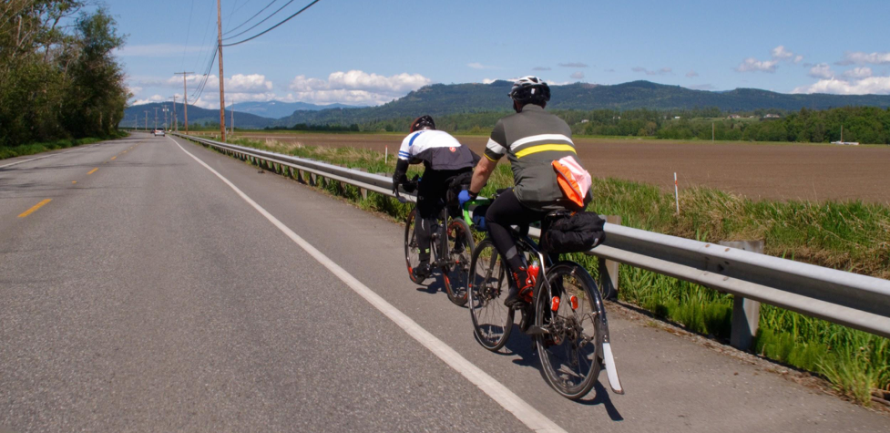
You’ll stick to frontage roads along I-5 returning nearly to Conway before heading east to Lake McMurray and the Centennial Trail. The trail is a popular place for slow cyclists and pedestrians, so please be cautious and attentive. You can keep a decent pace nonetheless, just ring your bell and pass with plenty of space. The Centennial Trail brings you back in Snohomish where you controlled on day 1. But leaving town you’ll head south east into the Snoqualmie River Valley to Carnation. This section offers mostly shaded, rolling roads with views of the Cascades and picturesque farms. Resupply in Carnation before the hill out of Fall City; there are a couple cafes in town, plus the grocery store where we went. As Rachel said on the pre-ride, that hill is no joke. Descending from the Issaquah Highlands you can pick up some good speed (we were going 40+ mph on our single bikes). Just be sure to get over to the left lane and avoid joining the freeway onramps!

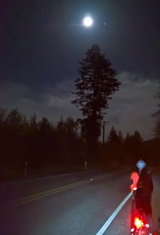
Control in Issaquah and then head out for more climbing: the highest elevation section of the route begins just as you leave Issaquah and ends 50 km later with a lovely descent into Orting on the Foothills trail. There was some road construction on the bridge between Enumclaw and Buckley which narrowed things down to one lane and stopped traffic in alternate directions. This seemed like a bad thing, but it resulted in making the left turn from 410 to Park Ave much easier than usual – there was only traffic coming from one direction by the time we finished the climb up from the bridge! From Orting, you’ll climb a steep ridge and work your way back to familiar roads: 507 to Yelm, the Yelm-Tenino trail to Rainier and Rainier Road back into Tumwater. We got here very late on the pre-ride and it was cold and slow going. Bring your layers for night riding!

After chasing the clock all day and riding extra distance to Eatonville (no longer on the route!), we arrived in Tumwater at 5:00 am. We slept ~3 hours (I really didn’t want to tackle day 3 on any less) and started Sunday behind the clock again. Fortunately, the clock slows down this far into a ride and we started picking up a buffer with each control.

Day 3, Sunday: Olympia to Longview and Back

https://ridewithgps.com/routes/28158231

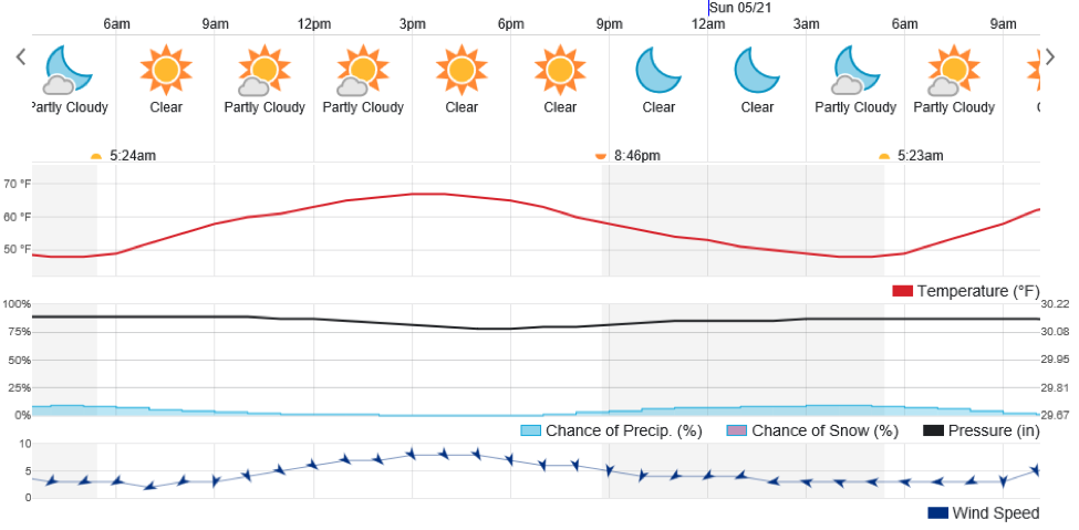
For the pre-ride, day 3 was forecasted to be the hottest, as it is for the event. We started relatively late in the day (9:40 a.m.) and thus missed out on the typically cool morning hours. Instead, we hit the beginning of the heat with a high temperature reportedly about 93°F. According to our cycling computers it was 105°F. Considering that official air temperatures are measured at a height of 2 meters above ground, while you’ll be riding just above the hot asphalt, it’s going to feel much more like 100°F than 90°F. And there’s less shade than you’d expect. That said, we had a strong tailwind for most of the morning and early afternoon.

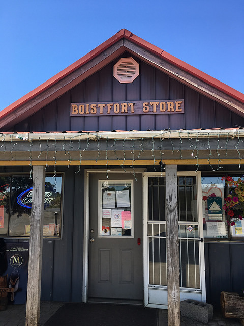
Curtis Hill Road will probably have you cursing us (blame Ian!), but the descent is fantastic and the roads on either side of the Boistfort Store are beautiful. You’ll get patches of shade here (though Rachel pointed out that all the climbs were sunny) and on the Westside Highway where the route heads south along the Cowlitz River to Longview. Longview has some big terrible roads, so we won’t go all the way to the Columbia river where the border is drawn between Oregon and Washington, but you’re very close. Instead, we’ll stick to lower traffic toads and then cross the Cowlitz into Kelso to join frontage roads along I5 where you’ll head north on the final leg of the journey. These frontage roads were shady and rolling – quite nice to ride!

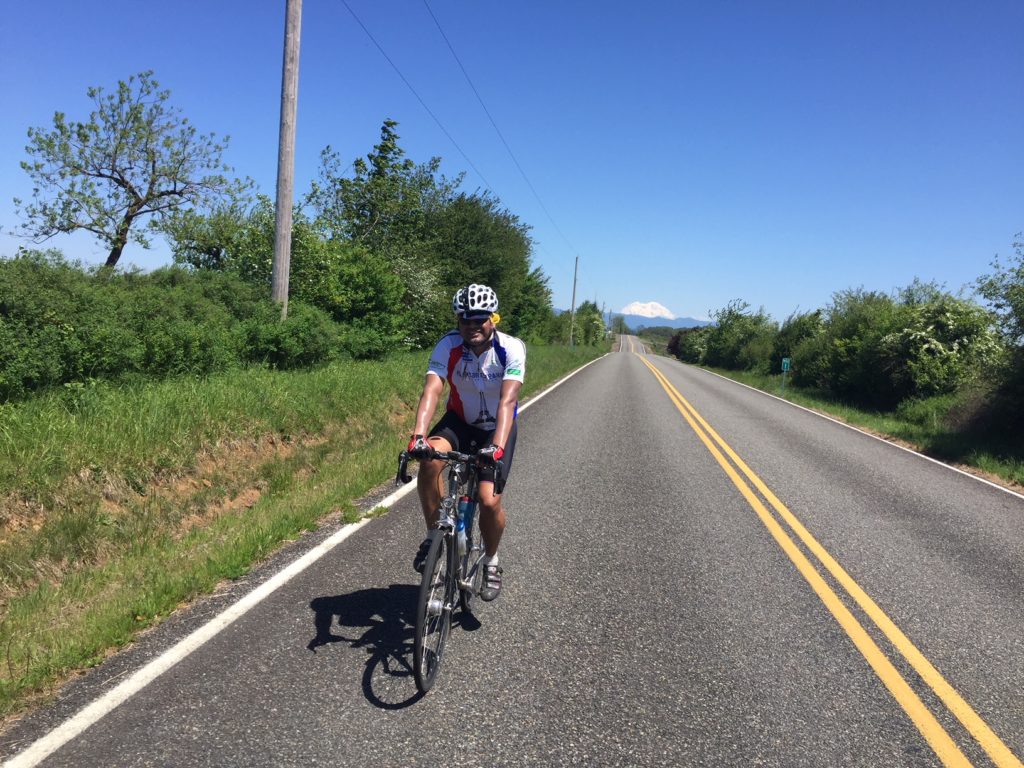
At the control in Toledo there’s a public bathroom at the boat launch just left after crossing the bridge into town. There’s also an IGA market (grocery store) open until 9 p.m. (they locked the door precisely on the hour!). The info control is at a gas station convenience store that’s open until 10 p.m. If you don’t want to stop, read the question in advance: you should be able to find the answer from your bike and remember it to write down later. Jackson Highway featured, for us, a beautiful sunset. If you’re earlier you’ll probably get great views of the valley, Mt St Helens, and Mt Rainier (we could just see both in the fading light). You’ll also get the last big climb through Lewis and Clark State Park at 939 km. But this means plenty of good descending into Chehalis and Centralia. Then you’ll go on through the valley with a few rollers to Bucoda and Tenino. Another info control at a gas station will leave your card with just one more slot to fill! Climb the last of the climbs out of town and (mostly) descend back to Tumwater. Of course, you can never believe “it’s all downhill from here,” but in this case, it mostly is.

We rolled into the finish at 1:30 a.m. for 68 hours elapsed (the pre-ride started 30 minutes later than the brevet will start. Also note that we rode 1032.9 km and your route will be 1007 km). Then we enjoyed a celebratory beer, a well-earned shower, and bed!

Strava users can look at our ride recording here: https://www.strava.com/activities/1721889143 (if you don’t log in, only high-level details are visible).

Comments Off on Border to Border 1000K

Filed under Pre Rides

2018 SIR Summer 200K Report: Snohomish–Anacortes–Snohomish

by Narayan Krishnamoorthy

NOTE CHANGE OF START and FINISH LOCATIONS

Ride start: 7 am
Registration start: 6 am
Ride start Location: Snohomish Library
Ride Finish: Trails End Brewery
Parking: Plenty of on-street parking along main drag and near the Library
Warning: Watch for road closures along Downtown Snohomish

Registration and additional details: http://seattlerando.org/content.aspx?page_id=87&club_id=928629&item_id=827535

As 200Ks go, this one is a fairly known commodity, but it combines elements from different types of routes in one rarely found package: low in traffic, high on trails, scenery, frequency of services, and quality of pavement.

We start early on Saturday from the Snohomish Public Library to avoid the hullabaloo of the Kla Ha Ya Days festival in Downtown Snohomish (and some possibly heavy headwinds later in the day); the early start allows us to enjoy cooler temperatures for longer, and the trail is less crowded (it promises to be a zoo once the 5K run starts at 8 am. Don’t be late). The first couple of miles are downhill – and feature very new smooth pavement – but the trail ventures gently uphill past the Machias store, and kicks up one more percent past Lake Stevens. You should have lovely views of the valley and the farms that line the sides of the trail. You’ll have a brief stretch of riding on Highway 9, but traffic volume should be low that time of day. You may begin to notice the first signs of a headwind or a crosswind here, but that bodes well for the return home.

The first control at Lake McMurray is a delight: it features a fabulous lake view and a very happy control volunteer eager to apply her bicycle stamp to your card, but only if you don’t block the gas pumps; if you do, you will get a bit of a talking to. Please make sure you clean up your garbage/recycling here (the store is a one person operation). This is a wonderful opportunity to refuel and to support the local economy. But fret not if you forget something: a brief and easy climb on Highway 534 leads you to Conway where even more services are available. Once you get past Conway, you will be blessed with lovely views of Mount Baker and, as an added bonus, will not see traffic until you hit the right turn onto Best Road. You’ll cross the Skagit River and find one more country store to refuel at (Rexville Grocery, can’t miss it on the right after you descend the Skagit River Bridge).

A short pedal brings you to lovely La Conner (a good coffee stop right as you enter town, should you feel the need) and our first possible hiccup: Maple Ave is easy to miss. Look for the Washington Federal Bank. Traffic was a bit higher than usual for the pre-riders because of Ragnar 2018, but you should have no traffic issues. The pre-riders found brief stretches of glass on Snee-Oosh Road, but the lovely water views more than made up for that risk. A brief battle with the headwind should bring you to one of the gems of the route: the Tommy Thompson trail that goes over Fidalgo Bay and brings you into Anacortes. On a hot day, the cool breeze off the bay will cool you right down and the water views will make you happy that you chose this ride. The trail does feature bollards, road crossings, and some weird chicanes, but it allows for a mostly stress-free ride into Anacortes.

The Calico Cupboard is lovely and has baked goodies and savoury foods that are sure to please your tired self. There is also a tavern across the street, but we found service slow on a previous ride. For quick service, get things to go at the bakery. A sit-down meal is recommended here as you are more than likely to be blessed with a tailwind on the way back. The route is an out and back, so you will have the luxury of retracing your steps with few complications.

The finish is at Trails End Taphouse, where eager volunteers will be on hand to shower you with kudos (and mooch free beers off of you).

1 Comment

Filed under Pre Rides, SIR Rides

2018 Spring 600K: Olympia–Astoria

by Narayan Krishnamoorthy

(Photo: Josh Morse)

How does that song go?!

Happiness comes double / After a little pain / If you want the rainbow / You must have the rain.

This is most certainly one of those kinds of rides. There are loads of beautiful sections featuring some lovely roads, and there is a small element of what I would call the ugly. But sometimes you have to keep plodding through the bad (Longview bridge, Longview anything really, Highway 30, Monte–Elma Road) to enjoy the awesome (Spencer Road, Apiary Road, Drew Prairie Road, Smith–Anderson Road, OR 202, Blue Slough Road, and on and on). And the awesome outnumbers the awful by a good margin, so, AWESOME is the overwhelming verdict.

Many thanks to Josh Morse, Dewey R. Blacker, Susan Otcenas, Eddie Bishop, and Saint Barbara for all of their efforts this weekend. Especially Saint Barbara.

Short report:

  • We had GREAT weather. Sorry if we soaked up all the good weather.
  • Three Water Bottle ride, if it’s hot.
  • STOCK UP: Grand Mound or Centralia, no services until Morton.
  • HAZARD: One lane Bridge on the road to Morton.
  • STOCK UP: Morton / Mossyrock / Saikum / Mayfield.
  • HAZARD: Take care as you navigate through West Kelso / Longview
  • HAZARD: Take care on Longview bridge.
  • HAZARD: Take care on the left turn across Hwy 30 traffic to Apiary Road. [Update: Route now goes up Old Rainier Road to avoid Hwy 30 and this hazardous left.]
  • STOCK UP: Vernonia. Nothing open until Astoria.
  • HAZARD: Cattle Guards, upon turning into Jewell Refuge.
  • Bundle up for the descent to Astoria
  • HAZARD: Recommend Taillights on Astoria Bridge.
  • Terrain gets a bit easier after North Cove.
  • FREE BUDDHISM CLASSES in Westport!
  • Save some match sticks for the hills in Olympia / Tumwater.
  • HAVE A WONDERFUL RIDE!

Long report:

We started off with a nice flat, fast warm-up to Grand Mound, and, a little south of Tumwater, we were treated to a Bald Eagle and her eaglets landing on the road to feast on roadkill—only to fly away at the sight of four marauding bicycles flying down the road. I hope riders on ride-day are as lucky as us! Keep an eye out for them when you pass Freightliner Northwest. At Grand Mound, you should stock up on supplies because there is nothing until you hit Morton; we found the Starbucks to be fast. The shoulder comes and goes after Grand Mound, so be prepared to move into traffic, and keep a watchful eye.

It only looks flat outside of Centralia (Photo: Susan)

Past Centralia, the climbing starts in earnest. It may not seem like much to those of you who finished the Ephrata 400, but it certainly isn’t nothing, either. And Centralia–Alpha road is there to remind you of that. The road was foggy and, though traffic was light, we switched our taillights on. The temperatures climbed as we hit the 508 turn to Morton, so we stopped to take off some layers. There is one little one-lane bridge, so please take care there. At Morton, Josh and Ricky hit the market, while Susan and I hit the convenience store for a quick 10-minute stop. Both locations have been informed of your arrival on ride day.

The author with Mt Rainier behind (Photo: Susan Otcenas)

The road out of Morton starts climbing, but it is of the gentle, endless variety and the shoulder is in excellent condition. There are services in Mossyrock, Mayfield, and Saikum (at the store), so take advantage and stock up / top up supplies. Spencer Road is a gem, and we were blessed with beautiful views of Mount Rainier (behind), and St Helens (to the left).

Mt Rainier from Spencer Road (Photo: Narayan)

Westside Highway had a nice tailwind, but lots of traffic. We stopped at the store in Castle Rock to top up on fluids and get some ice cream. At Longview, you hit one of the “rain” sections with city riding on a busy street that hopefully can be cut out of the actual ride. [Update: The route through Longview has been changed, but there are a few miles on a busy street that can’t be avoided.] And then, there is the Longview bridge (insert profanity here). The shoulder is dirty, filled with glass and lots of logging debris, and there is no line that you can take on that shoulder that will avoid the crap. Traffic will likely be high so please take care here. I climbed slowly and descended slower as the cars and trucks make a beeline for relaxation. Turning right on Highway 30 takes you on a long climb. I stopped at least two times to “admire the scenery” and Susan was so patient, waiting for me and encouraging me up the climb. [Update: Route now follows Hwy 30 East into Rainier, Oregon, avoiding this climb.]

The gang regrouped atop the summit to make a left turn onto Apiary Road. This left turn can be tricky as you have to cross two lanes of traffic, and sightlines are limited for cars coming around the bend. [Update: Route avoids this turn by going into Rainier, Oregon, and up Old Rainier Road. It’s a much more pleasant climb with less traffic.] We paused for a few minutes under a tree where I had one of my numerous “woe is me” moments, but only because I wasn’t aware of the rejuvenating stretch ahead that would remove all the unpleasantness of the last few miles from my brain. Apiary Road was lovely, low in traffic, and had a nice rhythm after the first little steep pitch. There is a false summit, but the climb to there, and the climb to the actual top are very gentle. If you toodle along in your lowest gear you will eventually get there.

We plummeted down to Vernonia and had a nice ice cream and Gatorade break. Riders may want to stock up here as there are NO services for the next 100K [editor’s note: seriously, there’s nothing]. After a 25-minute break, we left Vernonia and the “hurry up and relax” group threw a Starbucks bottle at us. Luckily their aim was as good as their driving. We stopped a bit after Birkenfeld to dork up for the night because temperatures were so warm that wearing a vest was not appealing. We saw very few cars on this gentle climb. We stopped at the Jewell Wildlife Refuge to use the bathrooms and add layers; watch out for the cattle guards immediately after you make the left turn into the refuge, particularly if it’s raining. I survived the guards, but suffered the disconcerting sight of Ricky doing bridges on the concrete sidewalk.

We left together and stayed together. The temperatures kept going lower and lower. A State Trooper kindly asked how many of us were on the road and sounded relieved when we said just the four of us! So look out for police presence on this climb. I didn’t carry long finger gloves (to save weight), and I didn’t want to waste the time putting on my leg warmers. So, I pretty much froze on the descent. The store in Olney was shut up tight. And the lights of Astoria were beautiful in the night. We made it to Astoria a little past midnight, which meant we rode in the dark only for 3 hours. Riders should actually have more daylight than we had, so this promises to be a low night-riding brevet.

Saint Barbara helped us get situated, had ordered food and drinks, and catered to our every need as we rested and prepared for bed. A warm shower, lots of pizza, some beer, and a nice FOUR-hour nap (sorry, Susan) all helped me wake up well rested. This is the most sleep I have ever had on a 600K. I hope everyone can get at least some shut eye during the brevet.

Crossing the Astoria–Meigler Bridge (Photo: Susan)

Back in Washington (Photo: Susan)

We had a nice breakfast of yogurt, coffee, and fruit (no warm food for us, but the hotel will do its best to have an early warm breakfast on the Sunday of the brevet), and set off with about 10 minutes to spare. The road was foggy—please switch on your taillights, even if you set off in the daylight. Any bit of visibility on the Astoria Bridge helps. The bridge is long, but the shoulder is adequate, the birds are plentiful, and traffic at that hour (5:45 a.m.) should be minimal. Maybe five cars passed us. The road to Naselle has lovely water views and the golden-hour-light of dawn coloured the trees a beautiful shade. The road gets climby after the right turn on to 101, and I was at my slowest here, but conversation with Susan and frequent breaks for this and that helped me recover a bit.

Susan and Narayan heading to Raymond.

The day warmed up considerably at Raymond, where we stopped for drinks and a bathroom break. Josh and Ricky opted for a sit-down meal (on Mother’s Day), and bled time as a result. I had another prolonged low and Susan pulled me down the road for miles to the North Cove Grill in Tokeland. There she bought me ice cream and a Starbucks Doubleshot, useful arrows to have in your quiver on a hot day, or if you have had minimal sleep. The road flattens out after North Cove Grill, and the riding gets even more pleasant thanks to a beautiful turn onto quiet Smith-Anderson road which puts you past a whole lot of cranberry farms.

Tumbledown house in the cranberry fields just south of Westport (Photo: Susan)

We found Heather Road unmarked. It is the first right turn after the road becomes Lindgren Road, eventually dumping you to an unmarked turn onto Highway 105. The control arrives shortly after (the Shell / Subway stop).

Here I was taught the finer points of Buddhism by a rather enthusiastic local riding a mountain bike, who may or may not have had all his marbles together, much to the amusement of my riding buddies. He mentioned something about the three colours in the talisman he was wearing, something about the paths, and the monk in Aberdeen… but I am afraid I am a poor student.

We left with about nine hours to do the last 72 miles or so and set a good pace as the terrain relented and winds became favourable again. We took the trail to Cosmopolis and then Blue Slough Road, which is now open after the landslides of the past years. We took an extended break in Montesano, the heat bothering us, and then a few more breaks as we made our way to McCleary. The pavement on Monte–Elma is as bad as ever!

There were some routing issues for us in terms of missing signs that will be fixed up on the final cue sheet, and we found our turn onto Highway 8. [Update: Street names have been updated on RWGPS and cue sheet to match the real world.] The shoulder on Highway 8 was better than we remembered from February and we worked our way through Mud Bay. I thought that was the last climb—ha! In true SIR fashion, there are some hills before the finish. But I have applied (read: whined) to the powers that be that better routing may be found to the finish. [Update: We couldn’t get rid of all the hills at the end, but we did adjust the route to the finish to avoid some of the busier roads on which the preriders suffered. Please think of them while enjoying a quiet ride along Decatur Street SW.]

The Whole Fam Damily at La Quinta

Eddie Bishop showed up at the finish with pizza, beer, and G&Ts to welcome us in, and so did Mrs Morse, Ian, and Sierra. It was an awesome end to a wonderful ride.

HAVE A SAFE AND WONDERFUL RIDE, ALL!

Ride details and registration on the SIR website.

1 Comment

Filed under Pre Rides, SIR Rides

2018 Spring 400: Ephrata, WA. May 5.

pre-ride report by RT

Well, this should be a challenging ride for all who signed up!

Unfortunately, due to getting pneumonia and being off the bike for some time, I had to pre-drive the course. So, I apologize that I’m not able to answer questions such as “What’s the chip seal like?” But my observations from that day indicate the roads are in good shape. Typical of Eastern Washington, shoulder space is limited, but traffic is low-volume and so riding is a pleasurable experience.

Ok, now to the ride.  You will leave the Ephrata Best Western at 6 a.m. on Saturday, May 5, and will head north along rolling roads toward Moses Coulee. Then you will then turn left onto SR-2 (wide shoulder) and make your way to an SIR manned control at Farmer (52km).

Once you’ve topped off your bottles and snacks, you will continue north towards the fast McNeil Canyon descent and back to the Columbia River for some stunning views of the area.  There is a water stop available at Beebee Bridge Park before you cross the Columbia River and continue on your journey north toward control number three in Pateros at the 124.5 km mark. This is a great opportunity to stretch, eat some food, and hydrate before the next segment of the ride.

After leaving Pateros, you will wind your way up WA-153 with a little side track along Gold Creek Loop Rd (152km) before heading towards the big climb of the day: Loup Loup Pass (4,020 ft).  But, before that, you will have an opportunity to refuel once again at the Carlton Store (162km) if you can make it before they close at 6pm; otherwise, your next chance for fuel will be Okanogan (220km).  After passing through Carlton, you will be presented with an info control (173km), climb up Loup Loup, and descend into Okanogan where there are 24-hour services at Chevron.  If you don’t want to stop there, continue on down the road to Omak for control number four (228km) at the 24-hour Conoco.  Once you depart from Omak, this will be the longest stretch without services (unless you can make it to the Colville Trading Post at 294 km by 8pm). The next opportunity to refuel is at the Coulee Dam Casino (316km) which is open 24 hours, or control number five at Coulee Gas in Grand Coulee (320km).

Dry Falls

Continuing south into Coulee City there is the Coulee City Community Park (365km) which has bathrooms and water and is open 24 hours a day.  This is the last opportunity to top off those bottles before heading back to Ephrata along WA-17 via Dry Falls and Soap Lake.

Congrats!!  You did it!!

Route on RWGPS: https://ridewithgps.com/routes/27355483

Ride details and preregistration: http://seattlerando.org/index.php?option=com_content&view=article&id=651:brevet&catid=62:2018-brevets-and-populaires

Summary of Controls and Water Stops

Location Distance (km) Service Hours
Start / Control #1: Ephrata Best Western 0
Control #2: Farmer, SIR Manned 52
Water: Beebee Bridge Park 93
Control #3: Pateros 124 Until 11 p.m.
Water: Carlton Store 162 Until 6 p.m.
Info Control 173
Water: Okanogan Chevron 220 Open 24 hrs.
Control #4: Omak Conoco 228
Water: Colville Trading Post 294 Until 8 p.m.
Water: Coulee Dam Casino 316 Open 24 hrs.
Control #5: Grand Coulee Gas 320 Open 24 hrs.
Water: Coulee City Community Park 366 Open 24 hrs.
Finish / Control #5: Ephrata Best Western 414

Safety Notes

This is a very challenging and remote ride. Please inspect your bike and lights thoroughly to ensure that everything is in working order. We will perform a safety check at the start to make sure everyone has primary and secondary front and rears lights, a reflective vest or sash, and reflective ankle bands. (Follow the RUSA reflectivity guidelines: https://rusa.org/reflectivity)

This ride also has a few very fast descents, McNeil Canyon and Loup Loup in particular. Exercise caution when descending these parts of the course.  There might be debris or sand build-up from the winter’s de-icing activities on the roadway.

When I was driving along WA-17 through Dry Falls, they were repaving the road.  Since it’s the weekend, they may not be repaving due to increased traffic along the section of the course. In any case, be attentive through this section.

RBA’s Note: With long distances between services, I suggest bringing three water bottles and plenty of food. Keep in mind that temperatures can vary widely in Eastern Washington; pack layers for hot and cold riding.

Ride Reports from the 2009 Edition

We won’t be climbing Disautel Pass this year, but otherwise these ride reports may be of interes.

Jason Karp: http://belgradebobcat.blogspot.com/2009/05/ephrata-washington-400k-brevet.html

Mark Thomas: http://rusa64.blogspot.com/2009/05/nice-road.html

Geoff Swarts: http://greenhornetrandoing.blogspot.com/2009/05/spring-2009-400k-pre-ride-report.html

Matt M: http://cyclinginseattle.blogspot.com/2009/05/big-commute-sir-400k-brevet-north-bend.html

1 Comment

Filed under Pre Rides, SIR Rides

2017 Summer 300K Pre-Ride Report – Four Volcanoes

Photo credit: Mitch Ishihara

By Bill Gobie

Pre-riders: Bill Gobie, Adam Glass, Mitch Ishihara

Support driver: Keith Moore


Important changes to the ride:

The start time is 0500.

The route has been shortened slightly and has less climbing: 306 km and 13,400 ft

Important highlights:

Expect hot conditions in the afternoon. Carry at least three water bottles and consume electrolytes. Staying hydrated is extremely important on this ride.

You must have night-riding equipment including: headlights and taillights; reflective clothing including ankle bands and a reflective vest or Sam Browne belt.

I strongly recommend running a tail light during the entire ride. From inside a car it is impossible to see into deep shade when the sun strikes a dirty windshield. During the day a blinking tail light is most effective. A tail light may alert a driver to  your presence.

Mountain weather can be very cold at night. Bring some warm clothes and a windbreaker. This will be important on the final descent from Elk Pass when the hour is late and you are tired. Bring raingear to Packwood; odds are you won’t need it but if the weather changes you will be glad you can bring it on the ride. I have descended from Elk Pass in heavy fog which my speed turned into rain.

Total distance on gravel is 47 km. Some is quite good, much is moderately challenging. A few hundred yards may inspire walking, depending on your ability and temperament. The pre-riders used 25, 28, and 40 mm tires.

Cell phone coverage is very limited. You will be out of communication on most of the route.

The Ride with GPS file has been revised. Its link is unchanged. The revised route sheet will be available soon.

Introduction

Trust me to create a route I could not finish! Turning my disappointment to your gain, the route has been made slightly easier by removing the furnace-like climb that DNF’d two of the pre-riders, and by selecting an easier gravel road for a small portion of the route without losing much scenery.

Getting to the start

This ride is a bit unusual by having the start at the Johnson Creek Sno-Park 16 km from the base/finish in Packwood. Being an ACP-sanctioned 300 km brevet, the time allowed is 20 hours, with no extra time allowed for any distance over 300 km. On an easier course an additional 16 km would not be a problem for most riders. On this course, you may need every minute. Therefore the start is at an easy-to-find location outside Packwood that brings the timed distance down to 306 km.

The route to the start is not easy! Removing its 1500 feet of climbing from the timed route was an additional factor in selecting the start location.

It took me 45 minutes to ride to the start location from Packwood. I advise allowing 30-60 minutes riding at moderate effort. This means you should leave Packwood between 0400 and 0430.

After turning off US-12, the gravel begins immediately on Forest Road 21. After a few pedal strokes you start a 2-mile-long granny gear climb with grades reaching 10%. After that, the climbing moderates, albeit with a few challenging pitches. The surface is generally hard. There is significant washboarding, generally on the uphill side of the road. It was usually possible to find a smooth line. The gravel roads on the course proper are similar.

Reducing vehicle traffic

We strongly want to reduce vehicle traffic on the gravel roads. When cars pass, dust can hang in the air for a long time. Some roads are one lane wide. General public traffic we cannot control. So we prefer that you ride to the start. If you feel you must drive, please leave Packwood at least an hour before the start for the safety and comfort of those who are riding to the start. The area is lonely and we can make no guarantees for your car’s safety. And you will have to retrieve it after the ride.

If you have a helper returning your car to Packwood, we insist the car stays at the start location until one hour after the start for the safety of any late riders.

Likewise if your helper is driving the course, we require that the car leaves at least fifteen minutes before the ride starts, or waits until two hours after the start. If the car is meeting you at the road 2329 control or Takhlakh Lake, we also require that it waits 30 minutes after the last rider passes.

Temperatures should be moderate for most of the gravel section of the course. SIR staff at the road 2329 and Takhlakh Lake controls can transport busted bikes and their riders back to Packwood. There is little reason for personal support on the gravel section of the ride. We recommend personal support vehicles meet riders much later on the course in Carson by driving via Randle and road 25.

The Ride

The route starts by crossing Johnson Creek on road 21, and immediately makes a four-mile-long granny gear climb. Then the road descends and you can make up a little time. 50°F temperatures made for pleasant climbing, but were a bit chilly on the descents. Climbing and descending alternate, so you have to pick layers for chilly downhills or roasting climbs and stick with it.

Mount Adams makes an early appearance above a straight segment of road 21. The volcano suddenly pops into sight at many other places on the route.

Photo credit: Mitch Ishihara and Bill Gobie

At the turn to road 2160 toward Walupt Lake, the surface switches to pavement. 2160 undulates along the valley floor, then climbs to the junction with road 56. The turn to road 56 is well signed. Gravel resumes. The pre-ride took road 56 only a short way to road 2329. The ride will stay on road 56. Road 56 is the preferred auto route, so it is anticipated to be in good condition, similar to road 21. (This variation was driven, but riding in a car is no substitute for assessing biking conditions.)

After about 11 km, the route turns onto road 5603 toward Orr Creek Sno-Park. After a flat trip across the valley floor, the road climbs steeply and becomes paved.

The turn to road 2329 is marked by a dilapidated sign. There will be an untimed SIR-staffed control here to help you find the turn and provide water. The control will remain open until an hour after a timed control would close. Road 2329 is gravel.

Road 2329 takes you through beautiful high country forest with the odd meadow here and there. The road was lined with fireweed and a few a Indian Paintbrush flowers. Mosquitoes are flourishing after the late, wet winter. They are not bothersome unless you stop. After Mitch hosed himself down with mosquito repellant, I found I was well protected if I stood in the plume emanating from him.

Photo credit: Bill Gobie

Larger wildlife exists in this area. A bear ran across road 2329 ahead of Adam and Mitch. Bears generally are afraid of humans and will run away if given a line of retreat. The significant exception is a mother bear protecting her cub. If you see a tiny bear stay the hell away from it, and do not cross the line it traveled until you know its mother’s location.

On road 2329 the morning sun cast dappled shadows that made it difficult to spot potholes and other hazards. Please ride conservatively. Stop when you take pictures.

Photo credit: Bill Gobie

The first summit, 4780 ft, occurs on road 2329 at Divide Camp. Sadly there are no views here, although there is a pretty meadow.

Photo credit: Bill Gobie

Immediately after the summit the road becomes hazardous enough to warrant a Danger instruction on the route sheet. The road plunges and becomes rocky and rutted. The road is rough all the way to Takhlakh Lake.

At Takhlakh Lake we will have a staffed control in the Day Use area, immediately on the left as you enter the campground. The control is untimed. It will remain open until 90 minutes after a timed control would close. There is a pit toilet here. Be sure to wander the few steps to the lake for the incredible view of Mt Adams, pictured below and at the top of this post.

Photo credit: Bill Gobie

After leaving the campground, the road is paved for a short distance until the junction with road 23. There is an enormous pothole at the junction, warranting another Danger instruction.

After a kilometer you reach Babyshoe Pass, marked by a small sign on the left adorned with baby shoes.

Most of the next six kilometers of gravel is a descent. Control your speed and ride safely.

At 53.1 km it is important to make the turn to stay on road 23 toward Trout Lake. This turn comes on a downhill and it could be easy to miss because the road going straight appears to be the mainline.

57.5 km marks the end of gravel for the route (except for a stretch too short to bother noting on the route sheet). After a short descent followed by a short climb, the road makes a 20 km alpine descent to Trout Lake. At times I reached 40 mph. Just before 59 km there is sharp right curve with a rut across the exit of the turn, noted with a Danger warning on the route sheet.

At roughly km 70 you will have a staggering view of Mt Adams. After merging onto Mt Adams Rd at the bottom of the descent, start looking back over your left shoulder. You will eventually be rewarded with another splendid view of Mt Adams.

In Trout Lake you can get a great meal, or just a milkshake, at the Bear Creek Cafe, regrettably staffed with inefficient teenagers. A quicker option is Trout Lake Grocery with pre-made sandwiches, a block off-route to the right on WA-141.

Conditions after Trout Lake will likely be hot and dry: have plenty of water on board for the run to Carson.

From Trout Lake you go south on WA-141 all the way to the Columbia River. This is a splendid downhill run; we averaged nearly 20 mph against a hot headwind. Mt Hood makes several appearances. En route at BZ Corner you will pass a Shell convenience store where you can pick up some more water. At the Columbia River there is a food truck or small restaurant where you should be able to replenish.

At the Columbia River the route goes west on WA-14. Traffic is heavy and shoulders are sometimes minimal. Please ride single file and be aware of approaching traffic. There will probably be a headwind.

The route originally went up Cook-Underhill Rd, renamed on the pre-ride Cooking Undertaker.  This forbidding furnace-like climb did in one of the pre-riders and materially contributed to the second abandon. The conditions drove the reluctant decision reroute onto highway 14, despite its heavy traffic.

On WA-14 we encountered a headwind all the way to Carson. While not strong, the wind was hot despite the proximity of the Columbia River. Traffic was heavy but surprisingly courteous.

Climbing into Carson you pass Carson Hot Springs Resort with its waterfall water feature tempting you drown yourself then and there. Carson is an open control. The Texaco convenience store is air-conditioned and has seating inside. There are several restaurant options for those with the time and stomach for a meal.

Cooked by the undertaker, I abandoned at Carson. Despite making a point of drinking copiously and taking electrolytes during the ride, two days later I am still dehydrated. I could tell I had little hope of riding the remaining climbing fast enough to finish in time. I was disappointed to miss the screaming descent from Elk Pass. I figured Mitch had a chance of making the finish if he did not wait for me. I wanted someone to finish to prove it could be done! After some consideration, Mitch accepted the challenge.

Photo credit: Bill Gobie

What followed was epic. After being cooked in 90ºF+ temps, Mitch rode the remaining 155 km with some 6000 ft of climbing in just over eight hours, finishing with eight minutes to spare.

From Carson, the route goes north on the Wind River Highway. Although temperatures moderated as the road climbed, the air was humid. After cresting Oldman Pass, don’t enjoy the descent too much, because you must watch for the left turn onto Curly Creek Rd. In a few more kilometers the route passes McClellan Overlook where we had a superb view of Mt St Helens silhouetted against the post-sunset sky.

At Northwoods, the Eagle Cliffs store was just closing when we arrived. The posted closing time is 8 pm, but Saturdays are busy so the owner keeps the store open until business drops off. If the store is closed when you arrive, riders have permission to get water from the spigot on the front of the laundromat/restroom building to the right of the store. Changing the start time to 0500 should help riders reach Northwoods while the store is open.

From Northwoods the route turns right onto road 25 toward Randle. Climb, climb, climb and you will reach the untimed SIR staffed support point before Elk Pass. In daylight you get a view of Mt St Helens. Our view of the Milky Way overhead was incredible while we waited for Mitch. The air was chilly; be prepared for cold conditions on the alpine descent from Elk Pass.

Photo credit: Bill Gobie

Between Carson and Elk Pass there are several campgrounds where we verified you can get water. These are noted on the route sheet.

From the support stop it is a few miles to the actual Elk Pass. After the pass the road immediately deteriorates, with sunken areas where the hillside is sloughing. The 35-kilometer descent has numerous sharp curves. Please ride with extreme caution, especially after dark.

After the fabulous descent, Mitch suddenly turned off on a tiny, rough dirt road. Mitch’s thoughts: “As I headed down, I thought this road was complete rubbish while pondering what Adam would say.” Fortunately we were in sight of him in Keith’s truck. We chased, and Mitch heeded Keith’s repeated honking and stopped. He was following the route! After some frantic map work we determined the route was in error and pointed Mitch back to road 25. This is why we pre-ride!

At Randle the route turns for Packwood on US-12. Late at night traffic is light and the road has easy grades. The shoulders are wide and clean. For most riders this should be a pleasant finish. Mitch had to keep the throttle open. Despite the climbing, heat, prudent descent from Elk Pass, and off-route misadventure, he finished within time in Packwood. That was an amazing ride to witness!

Photo credit: Bill Gobie

Communication

Cell phone service is sparse and highly dependant on provider. Verizon service was available at Trout Lake, Carson, and Packwood. AT&T coverage was very poor. In Trout Lake the cafe and grocery store have wifi.

Delorme InReach coverage and sat sms communication was predictably consistent on a 10-minute update interval.

SPOT tracking was surprisingly good. There was a notable dead zone south of Trout Lake on WA-141.

1 Comment

Filed under Pre Rides

2017 SIR Summer 200K Pre-Ride Report (7/15/17)

by Keith Moore

The 2017 SIR Summer 200K brevet features familiar roads and trails, as well as some roads rarely seen in SIR routes. This route is based largely on the 2015 “Great Lakes Hunt” 300K, without the super climby bits north of Arlington.

The pre-riders (Narayan Krishnamoorthy, Paul Murray, and myself) met at 6:30am at Peet’s Coffee in Redmond (near Whole Foods) for the traditional coffee, pastries, and paperwork. We departed at 7:00am sharp.

The first seven miles or so should be familiar to most SIR riders: an easy ride north on Avondale to Bear Creek, then to Mink and Woodinville-Duvall. Whereas most SIR routes turn west towards Paradise Lake, this route heads east. After a a couple of miles on Woo-Du, it turns into the quiet Aspenwood neighborhood. Way back in neighborhood is a little known dirt/gravel trail that connects Aspenwood to the Echo Lake area. Here we made our one and only navigational screw-up for the day.

Note: Follow the (updated/clarified) cuesheet instructions to stay on the trail and resist any temptation to divert left or right. In other words, go here:


NOT here:

The trail is well packed. I had no issues with my overloaded bike (and overloaded rider) on 28mm tires. After the trail we joined a gravel road for a few hundred yards. Again it was no problem on my 28mm tires.

After answering the info control question on Echo Lake Road we dropped down Welsh Road and joined High Bridge Road to Crescent Lake Road. A sublime ride through the Snoqualmie River Valley took us to WA-203 and Monroe. Numerous services are available in Monroe.

Crossing WA-2 we joined Old Owen Road then quickly turned onto Calhoun, the first notable climb of the day. It’s not long, but it does hit about 9.5% at one point, so it definitely gets your attention.

More quiet roads along sleepy farms took us to Lake Chaplain Road and (surprise!) Lake Chaplain. Unfortunately the lake is fenced off and not visible from the road. We answered the info control question, put on a fresh layer of sunscreen, and wondered what the people monitoring the security cameras thought of us.


Departing Lake Chaplain we doubled back then joined Old Pipeline Road to Bollenbaugh Hill Road, Woods Creek Road, and Lake Roesiger Road. Here again the route departs from SIR tradition — rather than riding north along the west side of Lake Roesiger, this route follows the east side of the lake. The east route is definitely “lumpier” than the west side, but it features a very nice park with real toilets, drinking water, picnic tables, and access to the lake for cooling overheated feet. Kasia & I will be manning this control on the day of the official ride, serving cold drinks, a few snacks, and control card signatures. About one mile north of the park is the Lake Roesiger Store if any additional supplies are needed.

Familiar roads continue to Granite Falls where numerous services and lunch opportunities abound.

The route departs Granite Falls on Jordan Road. Whereas most SIR routes take Jordan to Burns Road, this route continues on Jordan for about 13 miles or so to Arlington. Beware of broken glass on the shoulder.

In Arlington the route heads north briefly (~3 miles) on the Centennial Trail to the Bryant Coffee Co-Op. This is the one “merchant” control for the day. Cold drinks, ice cream, and snacks are available for purchase. Don’t forget to get your card signed! There’s no public restroom here, but there is a port-potty at the trailhead across the street, as well as “real” restrooms about 5 miles down the trail in town.

From Bryant the route doubles back on the Centennial Trail, then follows the trail all the way to Snohomish. Numerous services are available in Snohomish. Water and restrooms are available at Machias Station, about 5 miles north of Snohomish.

On ride day Snohomish will be celebrating their annual “Kla Ha Ya Days” summer festival. Expect a lot of traffic and other activity. Most importantly, expect 1st Street through town to be closed. Depart the trail on 2nd Street to D Avenue to continue heading south.

Traverse the lovely Snohomish valley to Springhetti Road and Broadway Ave, the last “big-ish” climb of the day. (It’s not that big of a climb, but it’s a bit of a grind, especially on a hot day.) Beware of glass on the shoulder.

After Broadway, the route crosses WA-522, joins Bostian Road and eventually reaches Woodinville-Duvall Road. Congratulations! The ride isn’t over yet, but it’s all downhill & flat for the remainder of the route.

Descend Woo-Du carefully — traffic can be heavy, and there are a number of drainage grates in the shoulder. The merge left at the traffic light (to stay on Woo-Du) is my least favorite part of the route. Be careful and keep an eye out for oblivious drivers. There is also a crosswalk available at the traffic light.

The route descends further into the town of Woodinville where many services are available. Turn left before the AM/PM (requiring another merge left across traffic), enter Wilmot-Gateway park and head south on the Sammamish River Trail.

The remainder is a piece-o-cake: just stay on the trail (be mindful of the cuesheet instructions for crossing over the bridge in Redmond), ride through Marymoor Park, and you’re practically to the finish.

Pop into Postdoc Brewing to get your card signed and have a beer if you’re so inclined. Soft drinks will also be available. The food truck scheduled for ride day is “Don Lucho’s Peruvian Sandwiches”. Vegetarian and carnivore options are available. See http://donluchosinseattle.com/#menu for details.

All in all I’d say it’s a fantastic route. Thanks to Narayan & Paul for a great pre-ride.

Please pre-register here.

Comments Off on 2017 SIR Summer 200K Pre-Ride Report (7/15/17)

Filed under Pre Rides

Summer Populaire (July 8, 2017) Pre-ride Report

The Summer Populaire (106 KM) kicks off the SIR Summer Series in style on July 8, 2017. It’s a lovely mix of familiar roads, trails, pavement, gravel, climbs, descents and even some flat stuff along the way. The ride starts in Columbia City at the Genessee Park and Playground and finishes at Super Six, part of theHawaiian-Korean fusion Marination empire. Cue sheet, map and pre-registration are all on the SIR website.

Organizers Ray Whitlock and Ben Rainbow gathered with pre-riders Hugh Kimball, BJ Moore, Fred Bladsel and Theo Roffe (that’s me) on July 1 to check the route and find questions for the several information controls.

The route avoids the I-90 bridge, passing instead through Renton on the south end of Lake Washington. This leads to a lovely descent (watch the rough pavement) into May Valley Park, past a dead end sign. At the bottom of the hill (where the many grates are), answer the info question and climb to the left. If you keep going straight, like I did, you’ll find a nice gravel trail that doesn’t go anywhere.

From May Valley Park it’s familiar roads with slightly higher traffic to Tiger Mountain Road and the biggest climb of the ride, just shy of 900 ft. It’s got a couple steep pitches, but it’s pretty scenic up there (see image at top of post). Answer the info question at the East Side Fire and Rescue, then enjoy the descent. But watch for cars from the left looking to park at the trailhead just before the T-intersection with Issaquah-Hobart Road.

The next phase of the ride is a bit gravely, but nothing very deep or technical. Just quiet sections of the Cedar River Trail, Cedar River Pipeline and Green River Trail. All of these provide a nice break from car traffic. Don’t get too distracted here, though, as we had to include a few more info controls. The last info is at mile 45, so you can stop messing with your brevet card from there until the finish.

From Maple Valley, it’s back to Renton where some construction interrupts our typical zig-zag back to Perimeter Road (around the airport). Be attentive to cars as construction always seems to make sharing more difficult. The route from Renton essentially backtracks to the start, but turns off on Genessee St (downshift!) and follows a backroads way to the finish.

It’s a fun route and the weather is looking to be most excellent this weekend! Hope to see you there.

And please remember to pre-register! It makes things a lot easier on the admin side.

Comments Off on Summer Populaire (July 8, 2017) Pre-ride Report

Filed under Pre Rides, SIR Rides

600 km Spring (June 3, 2017) Pre-ride Report

by Noel Howes

Bainbridge ferry arrival

“Ferry – Beach – Ferry” (Accent on second syllable in Ferry – Rhymes with Paree)

Jeff Loomis and I met on the glorious Saturday AM last for the 6:10 ferry to Bainbridge to set off on our adventure.

We moved the start to the Blackbird Bakery so you will ride to the light and turn left on main street – Winslow Way. Folks driving to start from Olympia or west of water can have coffee and treat before ride (they open at 6:30 and were not busy). A vehicle parked there will take your drop bag.

We set out on the back road and only reach 305 close to the Agate Pass Bridge – this left turn has traffic but hopefully less on Sunday [the ride starts on Saturday] AM. We made our way up to Poulsbo to the usual entrance to Big Valley road though it is marked with signs on Little Valley – “No through” etc. There is a poorly viewable crossing and cars do go fast over the hill coming from your left but we were cautious and got through. Big Valley is pretty, avoids the Port Gamble Road with its traffic, and small shoulder.

Cross the Hood Canal Bridge and take the left turn to Shine then down the Toandos Peninsula to the Community Center in Coyle (there will be water for you) – in the daylight! This is the beginnings of Tour de Industrial Forest but low traffic and some hills.

Jeff in Quilcene

Back out to Quilcene where we stopped for Milkshakes. This is at the 101 Brewery. There is also Olympic Grocery and another Grill and a coffee stand.

There will be an uneventful ride down 101 with services, except for hair-raising encounters with amateurs pulling enormous boats. The shoulder can be narrow at times but I wear a mirror for just this reason and blinkys on (helmet?) would be safer.

Turn at the usual route to get to Matlock store [which closes at 19:00. We will have…]that will have SIR support after it closes small food items and fluids. Out then into the Wynoochie wilderness with the requisite gravel and inclines to Humptulips and on to “Steve’s Hideaway” near Ocean City. This is a very long stretch with no services, water or food – real adventure for some.

Mr. DeGroot was wonderful to us with food, water, etc.  He has a trailer and a small bunkhouse. It is off the road in a gated area and Steve asks that you just lift you tires over the tire destroying teeth at the gate. One could take a catnap there and use a bathroom. Drop bags will be further, in Elma.

From here we went back to Hoquiam on some roads that avoid the past curves and traffic of the main highway. The main difficulty is getting over the Hoquiam East to West, this involves jumping on the sidewalk going against traffic then crossing at a marked crosswalk to sidewalk on other side until you can get back on a quieter road. We found parts of a trail leading to here but because we were running late and it was just getting light, there was little traffic, so we are routing you on the main road. From here it is smooth sailing to Elma via Blue Slough and Monte Elma road.

We slept very little because of my delays (more on this later) but you will have Andy Speier and his competent crew to welcome you with your drop bag. You will have less than 200 km to go!

Going through Shelton you will discover, if you do not already know, the reason for the road name North Cliff.  There is a sidewalk to the left if you are not too stubborn and want to stay out of traffic.

From Elma our first food stop was Subway in Belfair, much needed (there was food at our hour in Shelton). You then take the truly ugly two lane highway shoulder for a bit towards Tahuya which eases as it turns into North Shore road.

Olympic Mountains from Tahuya

Next come the walls of Tahuya. Please consider purchasing my forthcoming E book “ A Walkers Guide to the Tahuya – Seabeck Alps”. In summary, it is possible to walk the first hill, preliminary elevation of Holly and Anderson Hill and still finish the ride in time.

Press on to Seabeck Pizza or if you arrive before 8 PM you can go to the General store there as Jeff did. I actually arrived around 7:30 PM and had a slice of pizza made for me. The serveuse suggested one might call ahead to order but be aware they close at 8:30 and oven closes at 8. Ice Cream and pop available 8-8:30. (360) 830-4839

You will descend Trigger Ave under Highway 3 and turn left on the Clear Creek trail– do not get off on lesser trails but continue on the main trial to an unmarked blacktop then up to the trail sign. You will see Silverdale road and head to that. I had not realized that Silverdale Road is the massif that it is but it will take you up and over on painted bike lane to your turn at Lundvig and Poulsbo.

We will have the finish at the Bainbridge Best Western and the next ferry after control closing is midnight.

I did start a list for myself of new items not to break in a 600 km including shoes and lubed but unchecked drivetrain.  Jeff commented, kindly, that I have always been willing to try and learn new things. Needless to say, Hot Foot, bending derailleurs and lack of support except at Steve’s, cut my time and ability to climb severely.

I am told that parts of this ride are too hard. I did finish despite my stupidity, walking and searching for at least one new control and detailing others. I did meet my goal, though, of climbing an equivalent altitude to my next 1200 km ride goal for August.  I had a great weekend with my riding partner and stole any possibility of nice weather you might have.

Additional details and pre-registration on the SIR website, here.

Coming home from ferry through Fremont.

1 Comment

Filed under Pre Rides, SIR Rides

Chuckacamano Views 400k Pre-Ride Report

By Mitch Ishihara and Adam Glass

Continuing our islands and views theme from the past two years, we bring you more views from Camano Island, Chuckanut Drive, Bellingham, as well as other sensory infused opportunities from the northern interior of the Pacific Northwest.

Parking & Start

Ample parking at the start location awaits those wishing to get in a 400K.  Be advised though that there are no bathroom facilities.

Bear Creek Park & Ride
7760 178th Pl NE
Redmond, WA

The Pre-ride begins

Three opportunistic fair weather Randonneurs (Adam, Bill, and Mitch) set out to pre-ride the 5/20 Chuckacamano Views 400k route on an overcast and chilly 41°F morning.  All were bright eyed and bushy tails with smiles.  

Note: The start time on 5/20 will be 05:00 to make use of the increasing summer daylight hours.

The first 94K

After leaving the start at Bear Creek Park & Ride in Redmond, we headed north toward Paradise Lake.  Unfortunately, dense underbrush and trees block any views of the lake.  Apparently an artist decided carving wood sculptures from downed trees along Paradise Lake Road would do.

From Paradise Lake Road, we followed a common permanent route to Snohomish on Broadway Ave.  For the unfamiliar, lookout for the bad railroad track angle at the start of Broadway Ave.  After crossing the Snohomish River, the route headed west (left) on 1st Street to follow the river.  If you detour right on 1st, you find Snohomish downtown and a public bathroom on the right.

From Snohomish we took the same gently rolling hills and flatish route as last year’s Island Views 300K out to Marysville. By now, the dense marine cloud layer began to clear to blue skies for our randonneuring enjoyment. This year by popular request, we will take a slightly less traveled (slightly more hilly) route from Forty Five Road to McRae Road NW and Freestad Road south of Lake Ki before joining onto Lakewood Road for a glimpse of Lake Goodwin. As Lakewood Road begins to descend, stay alert for the right turn up onto Frank Waters Road.

In Stanwood there are numerous services, including an AM/PM before making the climb up the Stillaguamish River overpass.

Onto Camano Island

Once on the island, we left the busy HWY 532 on Good Road to take a scenic route along Utsalady Road.  This was recommended to us by our agents on the Island and well worth it.   Stunning views to the north (Skagit Bay).

Quiet roads…and more stunning views to the north (Skagit Bay and Whidbey Island).

A view from the Utsalady Point Park Info Control.

The views continued along Sunset Drive facing west as it dips down into the Sunset Beach neighborhood.  The terrain on Camano Island dips and climbs and repeats but lacks the duration of Whidbey.  At the south end of the Island(122.5 km), Elger Bay Grocery awaits to serve up some much needed calories and a control signature.

Continuing on with a few more dips and climbs, the route dips down with a view to the south (Triangle Cove).

Back on the flats

We eventually made our way off Camano Island to continue north along the flat farm lands with minimal trees.  As per usual there was a steady headwind from the North — use your energy wisely.

There’s an info control at the Shell station in Whitney before crossing HWY 20.  After finding the control answer however, we kept moving along capturing the scenery.

Barns, horses, farm land, …

More views along Bayview-Edison Road with abundant blue skies.  However, the sun was getting low now.

We parked our bikes with the others at Longhorn Saloon & Grill in Edison.  Longhorn allowed us to fill our bottles with water but wouldn’t do it for us.  Breadfarm (baked goods) is next door.

Note: that the Fairhaven control is only about +22.5 km from Edison — some more farmland and then Chuckanut Dr.

Let the Chuckanut adventure begin!

Of course paragliders were out and about enjoying the clear skies (and wind).

For those who desire a respite from possible car traffic on Chuckanut Drive, a stretch of compact dirt on the Whatcom County and Bellingham Interurban Trail parallels the road for 6.6 km.  Bill rode this on a recumbent highlighting the hard packed gravel and grade.  He did report two instances of sharp descents with loose gravel.

A bit beyond half way

We arrived in Fairhaven for the 215 km open control in time for a much needed dinner in hopes of surviving the second half through the cool night hours with enough energy reserves.

Fairhaven offers ample eating opportunities ranging from a Mambo Italiano, a pile of sandwich places, pizza, breweries, etc. You pass a grocery on the way in if you feel you can’t linger.  We strongly encourage you to stock up here on calories as the options beyond this point are limited and mostly of the gas station variety.

Into the night

As the sun set for the evening, so too did the photographers.  The temperature began to drop as the heat escaped into the clear night sky. We did manage to capture Jupiter next to the moon.  Other than this, there really isn’t much to see at night!  But brrr!

The Dodson’s IGA Market info control (243 km) in south Everson, WA marks the approximate northern most location on the route with services.  The folks at the Saloon next door seemed friendly enough as well.

The next services are at a Chevron in Deming at 249 km which lit up the dark sky off to the left of the route like the yard light in Poltergeist.

You know how there isn’t much to see at night?  Proceed with caution between 270 km and 280 km as HWY 9 has some pinch flat inducing potholes.  You can guess how we know.

Next services are at a friendly AM/PM in Sedro-Woolley at 286 km. They have some tasty hot chocolate out of a machine there.

The Safeway Arlington timed control is at 334 km.  Services in Snohomish begin at 368 km.  Woodinville AM/PM is at 389 km.  

The finish is at 407 km at the Redmond Inn.

Summary:

So that’s 407 km that you have to traverse in the 400K ACP Brevet maximum time of 27 hours along with 8000 feet of climbing.

The route can be thought of as four parts: 94 km of relative flatness out to Stanwood, 47 km of beautiful Camano Island views and a bunch of climbs and dips, 100 km of relative flatness north, and a cold return down the HWY 9 corridor.

Challenges:

  • It’s a 400k
  • It’ll be a cold night.  It’s also typically damp and foggy by the time you get to the Centennial.   Plan for mid-30°F at night.

Weather Forecast

The weather forecast for 5/20 is absolutely fantastic!  It is looking to be better than the pre-ride.

Pre-registrations

Help the organizers by pre-registering for this brevet here:
http://brevets.seattlerando.org/register_for_event/397


Comments Off on Chuckacamano Views 400k Pre-Ride Report

Filed under Pre Rides, SIR Rides

Pre Ride for 200/300K on April 15,2017

by Millison Fambles

The 200k and 300k rides will be run concurrently for the first 80 miles starting at Bertolino Coffee Bar 2421 S Union Tacoma 98405.

The ride starts along the Scott Pierson Trail. This trail has lots of turns and uses crosswalks and sidewalks as it follows along Hwy 16 to the Tacoma Narrows Bridge. The view from the bridge is spectacular and is a great photo opportunity.  Four miles later, you will be zooming down the hill into old town Gig Harbor. There is a bit of road construction along the water but it should not slow anyone down on a Saturday morning. The congestion and number of turns decreases once you have left Purdy, just in time for the Kitsap climbing to begin. Pine Rd starts the fun and it continues pretty much until WA-3.

The first control is in Belfair and there are a wide variety of food options: Safeway, McDonalds, Starbucks, etc. There is road construction for a short stretch through town. The route follows Hood Canal for a few miles before it makes a sharp and steep climb up E. Trails Rd to Mason Lake. Keep your eyes peeled through the clearcuts for glimpses of the Olympics and Mt Rainier. The next control is at the Airport Grocery outside of Shelton. Please be extra courteous and clean. We were scolded last year for leaving trash outside. If you are going to leave water for the following riders, please leave it neatly next to the trash can.

Follow US-101 south to Steamboat Island Rd. where we escape the business of the highway for the quiet lap along Madrona Beach.  Shortly after the climb up and out of the Delphi Valley, the route splits and the 200k cuts through south Olympia and the 300k continues south the explore the hills and valleys of the Doty Hills.

The 200:

Off Delphi, there are a few new roads to an info control. Congestion increases as the route goes through South Olympia and Tumwater. There are lots of services through this area. Cleveland Rd becomes Yelm Hwy and is busy but has a wide bike lane. Watch for merging and turning traffic. There is an info control then a fast descent into the Nisqually River Valley. Fort Lewis limits our road options for heading north so there will be a 1.5 mile stretch on I-5. Use caution if there are trucks merging to use the scales.  There are plenty of food options in Dupont and only 28k to go.  Continue past the Amazon fulfillment center, the Ft Lewis firing range, the Jack Nicklaus designed VA golf course and across Steilacoom Lake as you wind north through Lakewood. The final 10k follows city streets to the finish.

The 300:

Continues down the valley to Littlerock (services) and Mima Gate to the “End of the Trail” control in Rochester. Stock up on food and water here, there are no services for 50km. After a short stretch on US-12, the route turns into the hills and meanders through quiet, rural hills ending with a beautiful descent down the Lincoln Creek Valley. There is a control at Safeway in Centralia and then easy riding on 507 to Bucoda, Tenino and then on the trail to Rainier. Then, head north to East Olympia and then follow the 200k route to the finish.

Almost half of the elevation gain is in the first 50K, so the Belfair control is well timed for a break. The 200 route has services along the whole route. The 300 has a 50k gap from Rochester to Centralia without anything.

The weather forecast is looking good, but is has been and wet spring.

It helps if you preregister: http://seattlerando.org/index.php?option=com_content&view=article&id=608

See you Saturday morning at Bertolino’s.

Millison

Comments Off on Pre Ride for 200/300K on April 15,2017

Filed under Pre Rides, SIR Rides, Uncategorized